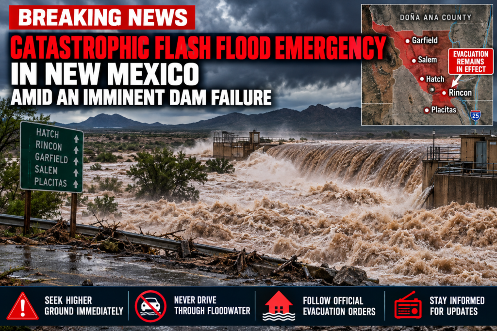

BREAKING: Catastrophic Flash Flood Emergency Hits New Mexico as Dam Threatens Failure
Updated: September 30, 2026
A dangerous flash-flood disaster unfolded across southern New Mexico Tuesday as torrential rainfall overwhelmed the Hatch Valley, threatened the failure of a dam and forced evacuations from several communities.
The National Weather Service issued a Flash Flood Emergency for northwestern Doña Ana County after operators and county officials reported the imminent failure of McLeod Dam, also known locally as Garfield Dam.
The NWS classified the event as a “particularly dangerous situation” and warned of life-threatening flooding downstream of the dam.
🚨 Latest Evacuation Status
The situation changed rapidly throughout Tuesday evening.
Doña Ana County initially ordered evacuations affecting Rincon, Garfield, Salem, Hatch and Placitas as flooding intensified and concerns grew about dams, levees and rapidly rising water.
As of the latest county update reported at approximately 10:46 p.m. Tuesday, evacuation orders had been lifted for Salem, Garfield, Hatch and Placitas.
🔴 RINCON: EVACUATION REMAINS IN EFFECT
Rincon remained under an evacuation order in the latest verified update.
Officials cautioned residents returning to other communities that floodwater, debris, damaged roads and other hazards could remain even after evacuation orders were lifted.
Residents should continue following instructions from Doña Ana County Emergency Management and the National Weather Service because conditions and evacuation zones can change rapidly.
🌊 Levee Breach Adds to the Emergency
The threat was not limited to McLeod Dam.
A separate levee breach near Rincon triggered another Flash Flood Emergency.
Officials reported that the Rincon Arroyo breached levees near the Rincon Water Treatment Plant, with floodwater threatening structures in Rincon. The development contributed to the continuing evacuation order for that community.
⚠️ McLeod Dam Reported Near Failure
At approximately 2:01 p.m. MDT Tuesday, dam operators and county officials reported the imminent failure of McLeod Dam.
The resulting National Weather Service warning identified potentially life-threatening flooding in rural areas between Garfield and Salem, including locations near Highways 187 and 390 and along the Garfield Drain, Garfield Canal and other irrigation and drainage channels.
People in low-lying areas below the dam were instructed to immediately move to higher ground.
The situation later expanded beyond the immediate dam area.
By Tuesday evening, Doña Ana County Emergency Management requested a Flash Flood Emergency for the wider Hatch Valley between the Sierra County line and Rincon.
Officials reported several retention dams near capacity while intense runoff poured through the region.
🌧️ Torrential Rain Overwhelms Hatch Valley
Exceptional rainfall rates helped create the emergency.
Earlier Tuesday, the National Weather Service warned that thunderstorms capable of producing rainfall rates of up to 3 inches per hour were moving into the Hatch and Rincon Valley.
Forecasters warned of serious flash flooding in arroyos, low-water crossings and poor-drainage areas, with rapid rises possible along Rincon Arroyo.
Low-water crossings along portions of Highway 185 were also expected to become impassable.
🌀 Tropical Moisture From Former Hurricane Polo
The flooding comes as deep tropical moisture associated with former Hurricane Polo spreads into the southwestern United States.
Polo moved inland across northwestern Mexico Tuesday after previously striking Baja California Sur. NOAA reported Tuesday afternoon that the weakening tropical cyclone was carrying strong winds and heavy rainfall northward toward southern New Mexico and far western Texas.
The remnants of Polo are helping produce a much broader heavy-rain and flash-flood threat across parts of the Southwest.
🚗 EVACUATION & FLASH-FLOOD SAFETY
Anyone still under an evacuation order should leave immediately rather than waiting for conditions to deteriorate.
Residents in threatened areas should:
🚨 Follow all evacuation orders from local emergency officials.
⛰️ Move to higher ground immediately if rapidly rising water approaches.
🚗 Use Interstate 25 as the primary evacuation route where authorities continue to recommend it.
💊 Take medications, identification, important documents and essential supplies.
🐕 Bring necessary supplies for pets and children.
📱 Keep phones charged and monitor official emergency alerts.
🌊 Never drive through a flooded roadway.
🚧 Do not drive around barricades.
⚡ Stay away from rapidly flowing arroyos, drainage channels and irrigation canals.
🏠 Residents returning to areas where evacuation orders have been lifted should watch for debris, washed-out roads, standing water and structural damage.
The National Weather Service emphasizes “Turn Around, Don’t Drown” because vehicles can quickly become trapped or swept away by moving floodwater.
🏠 Emergency Shelters
During the evacuations, authorities directed displaced residents toward:
Radium Springs Community Resource Center
12060 Lindbeck Road
Radium Springs, New Mexico
Doña Ana Community Resource Center
5745 Ledesma Drive
Las Cruces, New Mexico
The American Red Cross was also dispatched to assist evacuated residents.
Residents should verify that a shelter remains open before traveling there as the emergency response changes.
⚠️ Flood Danger Is Not Over When the Rain Stops
Flash-flood emergencies involving dams, levees and arroyos can remain dangerous after the heaviest rainfall ends.
Water stored behind retention structures can continue moving downstream, while saturated ground can produce additional runoff. Roads may also be undermined even when floodwater appears relatively shallow.
The National Weather Service had warned of a heightened flash-flood risk across New Mexico through Wednesday, with river flooding also possible into the latter part of the week.
🌎 Orbis Weather — Developing Story
The southern New Mexico flood emergency remains a developing situation.
The most important change overnight is that evacuation orders have been lifted for Hatch, Garfield, Salem and Placitas, while Rincon remained evacuated in the latest verified county update.
Residents throughout the Hatch Valley should continue monitoring National Weather Service warnings and Doña Ana County emergency communications. Never rely on an older evacuation map or social-media post when deciding whether it is safe to return home.
Orbis Weather will continue monitoring the New Mexico flooding, McLeod Dam, the Rincon levee breach and the remnants of former Hurricane Polo as additional information becomes available.

Nepal Hit by Deadly Floods, Landslides and Avalanche as Severe Weather Pounds Himalayan Nation
KATHMANDU, Nepal — September 28, 2026 — Nepal is facing another deadly natural-disaster emergency as days of intense rain, flooding, landslides and heavy mountain snowfall have killed dozens of people, destroyed homes and triggered a deadly avalanche high in the Himalayas.
The latest figures from Nepal’s disaster authorities show at least 21 people were killed and five remained missing in weather-related incidents across the country between Thursday and Sunday, with nearly 200 homes damaged.
At the same time, rescuers are battling dangerous high-altitude conditions following a major avalanche on Himlung Himal, a 7,126-meter (23,380-foot) mountain in north-central Nepal.
🏔️ Deadly Avalanche Strikes Himlung Himal
The avalanche struck Himlung Himal in Nepal’s Manang district on Sunday, September 27, as severe weather brought heavy rain to lower elevations and significant snowfall to the mountains.
By Monday, authorities reported that at least four people had died and 12 remained missing. Ten people were rescued from the mountain, while experienced mountain guides continued searching through snow and avalanche debris.
Those caught in the avalanche were Nepali workers preparing the base camp for foreign climbers ahead of the autumn climbing season.
Poor weather initially made rescue operations extremely difficult, but improving conditions Monday allowed search teams to return to the avalanche zone.
The casualty numbers have changed as rescuers reach the site, and additional revisions remain possible while the search continues.
🌧️ Floods and Landslides Sweep Across Nepal
The avalanche is only one part of a much larger weather emergency.
Persistent heavy rainfall has swollen rivers, triggered flash flooding and destabilized steep mountain slopes across Nepal.
Earlier reports showed authorities issuing flash-flood warnings across 49 of Nepal’s 77 districts, with more than half of the country facing elevated flood danger. Power and telecommunications networks have also been disrupted, and infrastructure — including a hydropower facility — has sustained damage.
Flooding and landslides have also affected Manang district, the same region where the Himlung Himal avalanche occurred.
The combination of saturated terrain, steep valleys and fast-moving rivers means additional landslides and localized flash floods can occur with little warning.
⚠️ Nepal Still Recovering From August Catastrophe
The latest disaster comes barely a month after catastrophic flooding devastated parts of Nepal in August.
Those floods swept through communities and river valleys, destroying settlements, roads and bridges. Current reports put the August death toll at more than 1,400 people, with thousands still listed as missing.
The new round of flooding, landslides and avalanches therefore arrives while many communities are still trying to recover from one of Nepal’s most devastating recent natural disasters.
🌊 Rivers Remain a Major Concern
Residents in vulnerable valleys should remain particularly cautious around swollen rivers, steep slopes and recently flooded areas.
Heavy rainfall can produce dangerous conditions far downstream from where the heaviest precipitation occurs. Landslides can also temporarily block rivers, creating natural dams that may suddenly fail and send a powerful surge of water downstream.
Road travel through mountainous areas can become especially dangerous because slopes weakened by prolonged rainfall can collapse without much warning.
❄️ Dangerous Conditions in the Himalayas
At higher elevations, the same storm pattern is producing a different hazard.
Heavy snowfall can rapidly increase the weight of the mountain snowpack. Combined with wind loading and unstable layers of older snow, this can sharply increase avalanche danger.
The Himlung Himal disaster illustrates how dramatically conditions can change during Nepal’s autumn climbing season.
Himlung Himal rises along Nepal’s northern Himalayan frontier and is a popular expedition destination. The mountain’s remote location and extreme altitude make rescue operations difficult even during good weather.
🚨 Search and Rescue Operations Continue
Rescue crews are continuing to search the avalanche zone while emergency teams elsewhere in Nepal respond to flooding, landslides and damaged communities.
The situation remains fluid, particularly in remote mountain districts where communications and transportation can be disrupted.
Orbis Weather Hazard Summary
🌧️ Heavy Rain: Ongoing flooding and landslide threat
🌊 Flash Floods: Elevated risk along rivers and mountain valleys
⛰️ Landslides: Saturated slopes remain unstable
❄️ Heavy Snow: Dangerous conditions at high elevations
🏔️ Avalanche: Deadly avalanche confirmed on Himlung Himal
🚁 Rescue Operations: Continuing in affected mountain regions
⚠️ Overall Threat: Serious — conditions remain hazardous in multiple parts of Nepal
Nepal’s latest emergency demonstrates the extraordinary range of hazards possible in the Himalayas, where intense rainfall can simultaneously produce destructive flooding in valleys, landslides along mountain slopes and dangerous accumulations of snow at high elevations.
Orbis Weather will continue monitoring Nepal’s flooding, landslide and avalanche emergency as search operations continue and new information becomes available.

🌊 Rare September Nor’easter Floods East Coast, Cancels Hundreds of Flights
September 26, 2026 — Orbis Weather
A powerful and unusually early September nor’easter is battering the U.S. East Coast, producing major coastal flooding, damaging winds, enormous waves, widespread power outages and major travel disruptions from the Mid-Atlantic into New England.
The slow-moving storm intensified offshore before pushing toward the coast, creating dangerous conditions from Washington, D.C., to Maine. More than 400 flights were canceled Saturday, while power outages topped 100,000 homes and businesses at one point, according to Reuters.
The National Weather Service warned that the nor’easter will continue producing coastal flooding, dangerous rip currents, strong wind gusts and heavy rain through the weekend.
🌊 New Jersey Hit Hard by Coastal Flooding
Some of the most dramatic impacts have occurred along the Jersey Shore, where ocean water pushed onto roads and into low-lying communities.
Flooding was reported in several coastal towns, including Surf City and Manasquan, while some vulnerable communities issued voluntary evacuation orders. New Jersey declared a state of emergency for eight counties as officials prepared for additional tidal flooding.
The National Weather Service warned of major coastal flooding along portions of the New Jersey and Delaware coasts, with repeated high-tide cycles capable of flooding roads and affecting homes and businesses.
Atlantic City beaches were closed Saturday as huge waves crashed along the shoreline. Waves could reach around 12 feet in some areas, according to regional forecasts.
💨 Wind Gust Hits 74 MPH
The storm has also generated exceptionally strong winds.
A weather station in Surf City, New Jersey, recorded a 74 mph gust late Friday, while several other Jersey Shore stations measured gusts of at least 60 mph.
Offshore buoys reported waves reaching 16 feet or higher near the Jersey Shore and southern New England.
High-wind warnings were issued along portions of the New Jersey and Delaware coastline, while strong winds extended northward into New York and New England.
Because trees across the Northeast are still carrying their leaves in late September, they can catch more wind than they would during a typical winter nor’easter. That increases the potential for falling trees, broken limbs and power-line damage.
⚡ More Than 100,000 Lose Power
The combination of saturated ground and strong winds brought down trees and power lines throughout the Northeast.
More than 100,000 customers lost electricity at one point Saturday, with significant outages reported across New Jersey, New York, Connecticut and Massachusetts.
Tens of thousands of New Jersey customers remained without power Saturday afternoon, with Ocean County among the hardest-hit areas.
✈️ Hundreds of Flights Canceled
The nor’easter is also creating a major air-travel headache.
Airlines canceled more than 400 flights Saturday, with disruptions affecting major airports across the Northeast.
Boston was particularly hard hit.
More than 200 flights to and from Boston Logan International Airport had been canceled by Saturday, while flights serving Nantucket and Martha’s Vineyard were also disrupted.
Because major Northeast airports are important connecting hubs, delays and cancellations can ripple across the national aviation system even in cities experiencing perfectly good weather.
🌧️ New York and New England Also in the Storm’s Path
Conditions deteriorated across Long Island, where downed trees, power outages, rough surf and coastal flooding were reported Saturday.
A tree reportedly fell through a home in East Patchogue, while another large tree blocked a road in Merrick.
Farther north, Massachusetts, Rhode Island and Connecticut faced strong winds, heavy rain and coastal flooding.
Forecasters said gusts could approach 60–65 mph around Cape Cod, Martha’s Vineyard and Nantucket, with slightly lower but still potentially damaging winds around Boston.
⚠️ Why This Nor’easter Is Unusual
Nor’easters themselves aren’t unusual along the East Coast.
What makes this storm noteworthy is its timing.
The most powerful nor’easters are normally associated with the colder months, particularly late fall through early spring. A significant coastal storm producing this combination of damaging wind, major tidal flooding and enormous surf in late September is considerably earlier than the classic nor’easter season.
The National Weather Service has described the system as an early-season nor’easter.
🌀 What Happens Next?
The storm is moving slowly, meaning coastal communities may experience several rounds of flooding rather than one brief surge.
The Weather Prediction Center expects the upper-level system to move northwestward into the Northeast and northern Mid-Atlantic while the associated surface low approaches the coast. The system should then gradually weaken heading into Sunday night.
For the Jersey Shore and surrounding areas, however, additional tidal flooding remains a serious concern through Sunday.
Dangerous surf and rip currents are also expected to persist along portions of the coastline.
🚨 Orbis Weather Safety Reminder
Residents and visitors along the affected coastline should avoid flooded roads and never attempt to drive through standing or moving water.
Stay away from beaches, jetties, seawalls and exposed coastal areas during periods of high surf. Falling trees and branches are another significant danger during strong wind gusts.
Anyone traveling through major Northeast airports should check their flight status before leaving for the airport, as additional delays and cancellations remain possible while the storm continues.
🌎 Orbis Weather Bottom Line
This is not a typical September rainstorm.
An unusually early and powerful nor’easter has brought major coastal flooding, hurricane-force-level wind gusts, massive waves, widespread power outages and hundreds of flight cancellations to the East Coast.
New Jersey and Delaware are experiencing some of the most serious coastal flooding, while strong winds and heavy rain extend through New York and into New England.
And because the storm is moving slowly, the danger isn’t over yet.
Orbis Weather will continue tracking the nor’easter as it moves through the Northeast and conditions gradually improve.
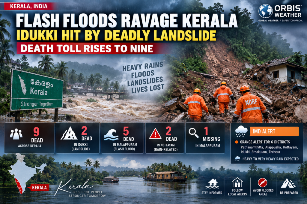
Flash Floods Ravage Kerala: Idukki Hit by Deadly Landslide as Death Toll Rises to Nine
September 21, 2026 — Kerala, India — Torrential monsoon rains have triggered deadly flash floods and landslides across Kerala, killing at least nine people in multiple districts and forcing evacuations as authorities warn that dangerous conditions could continue. (UNI)
The worst impacts have been reported in Malappuram, Idukki and Kottayam, where swollen rivers, saturated hillsides and sudden landslides have turned the latest burst of monsoon rainfall into a rapidly developing disaster.
Deadly Landslide Strikes Idukki
In the mountainous Idukki district, two siblings were killed after a rain-triggered landslide buried a temporary farm shed at Kottakamboor in Vattavada on Sunday.
The victims were identified as Balakrishnan, 47, and his sister Chinnu, 38. Balakrishnan’s wife, Mariyamma, was also caught in the landslide and taken to a hospital in Munnar.
The three had reportedly taken shelter inside the shed as heavy rainfall intensified when the hillside above them gave way. (The New Indian Express)
Heavy rain continued into Monday, with another landslide reported at Pazhampallichal in Adimali. Five families escaped shortly before debris and floodwater struck the area, while one house was destroyed. Authorities have moved families from vulnerable locations to a relief camp as a precaution. (WebIndia123 News)
Officials have also urged travelers to postpone trips to Idukki while the hazardous weather persists. (Public Tv English)
Flash Flood Sweeps Through Malappuram
A separate tragedy unfolded in Malappuram district, where a sudden flash flood struck the Kottapuzha River near TK Colony in the Nilambur area.
Heavy rainfall upstream caused the river to rise rapidly Sunday evening, sweeping people away before they could reach safety.
By Monday, five bodies had been recovered from the river and downstream areas. One person remained missing as rescue crews continued searching. (UNI)
Police, Fire and Rescue Services, disaster-management teams and local residents have been participating in the operation.
The speed of the flooding highlights one of the greatest dangers associated with intense rainfall in Kerala’s mountainous terrain: conditions at a riverbank can appear relatively calm even while extreme rainfall farther upstream sends a sudden surge downstream.
Nine Dead Across Kerala
As of September 21, the statewide rain-related death toll had climbed to nine:
🌊 Malappuram: Five deaths in the Kottapuzha flash flood
⛰️ Idukki: Two deaths in the Kottakamboor landslide
🌧️ Kottayam: Two deaths in separate rain-related incidents
🔍 Malappuram: One person remained missing
(UNI)
The toll could still change as search operations continue and authorities assess damage across affected communities.
More Heavy Rain Threatens Kerala
The India Meteorological Department (IMD) issued an orange alert for six districts — Pathanamthitta, Alappuzha, Kottayam, Idukki, Ernakulam and Thrissur — with heavy to very heavy rainfall and thunderstorms forecast.
Rainfall totals of approximately 115.6–204.4 mm (4.6–8 inches) within 24 hours were possible in areas under the orange alert, accompanied by winds reaching around 40 km/h (25 mph). (The Indian Express)
With soils already saturated, additional rainfall could trigger more flash flooding, landslides, falling trees and road disruptions, particularly across Kerala’s steep interior districts.
Emergency Monitoring Intensified
Kerala Chief Minister V. D. Satheesan has instructed disaster-management officials and district authorities to review conditions hourly.
Officials have been told to evacuate residents wherever necessary, while weather-related SMS alerts have been issued in Idukki and Kottayam. (WebIndia123 News)
For residents in mountainous or flood-prone areas, rapidly rising streams and rivers are particularly dangerous. People should avoid flooded roads, riverbanks, steep slopes and areas beneath unstable hillsides while heavy rain continues.
Orbis Weather Bottom Line
Kerala is facing a multi-hazard monsoon emergency, with flash flooding in Malappuram and deadly landslides in Idukki and Kottayam contributing to at least nine deaths.
The immediate concern is additional heavy rainfall falling onto already saturated terrain. With one person still missing and evacuations underway in vulnerable communities, the situation remains active and the casualty figures may change as rescue operations continue. (UNI)
Orbis Weather will continue monitoring the Kerala floods, landslides and rainfall alerts as conditions develop.

Deadly Floods Strike Việt Nam: 16,000 Homes Submerged, 4 Dead
September 20, 2026 | Orbis Weather
A major flooding disaster is unfolding across parts of northern and central Việt Nam, where days of torrential rain have submerged thousands of homes, triggered deadly landslides and left communities struggling with rising rivers, damaged roads and widespread agricultural losses.
At least four people have died, while more than 16,000 homes have been inundated, according to the latest reports from Vietnamese authorities. Even after the heaviest rain eased, large areas remained underwater, with highways, neighborhoods and farmland still flooded.
🌊 More Than 16,000 Homes Underwater
The scale of the flooding has become clearer as damage assessments come in from across the affected region.
As of September 17, authorities reported 16,310 homes inundated. Thanh Hóa Province suffered the largest number, with 8,419 homes flooded, followed by Ninh Bình with 4,787, Hà Nội with 2,204, Nghệ An with 749 and Phú Thọ with 151.
Several homes were also destroyed or damaged. Four houses collapsed in Thanh Hóa, while dozens of others sustained damage.
Floodwater has covered roads, surrounded residential neighborhoods and isolated rural communities, leaving some residents dependent on boats to move through inundated areas.
⚠️ Landslide Kills Three in Phú Thọ
One of the deadliest incidents occurred in Đà Bắc Commune, Phú Thọ Province, where prolonged rainfall triggered a landslide on September 17.
Approximately 40 cubic meters of soil and rock crashed into a home in Tú Lý Village, destroying two bedrooms and burying three people inside.
Emergency crews recovered all three victims from the debris.
A fourth death was subsequently reported in Hà Nội. According to the Associated Press, a university student who disappeared during the flooding was found dead after authorities discovered his motorcycle near a drainage-system entrance. Authorities suspect he was swept away by floodwater.
🏙️ Hà Nội Hit by Torrential Rain
The flooding also brought serious disruption to Hà Nội, where exceptionally heavy overnight rainfall turned streets into rivers.
Several monitoring locations recorded more than 150 millimeters (5.9 inches) of rainfall, while some locations received substantially more.
From Wednesday evening into early Thursday, rainfall totals reportedly reached 199 mm (7.8 inches) in Từ Liêm, 190 mm (7.5 inches) in Hai Bà Trưng and 182 mm (7.2 inches) in Cầu Giấy.
Floodwater reached approximately 30–50 centimeters (12–20 inches) on numerous streets, while some low-lying areas were submerged beneath nearly one meter (3.3 feet) of water.
Vehicles stalled, traffic backed up and some schools shifted to online classes as residents struggled to move through the flooded capital.
Images from the city showed residents using boats on flooded streets and attempting to keep water from pouring into homes.
🌊 Rivers Reach Dangerous Levels
The flooding wasn’t limited to urban areas.
Rivers across northern Việt Nam rose rapidly following the prolonged rainfall.
In Ninh Bình Province, the Hoàng Long River reached 4.42 meters, approximately 0.42 meters above the highest warning level, before slowly beginning to recede.
Other rivers remained elevated, keeping communities vulnerable to additional flooding.
Around Hà Nội, authorities stepped up emergency operations as the Tích and Bùi rivers reached the highest alert level.
Soldiers and emergency personnel were deployed to reinforce embankments and protect communities along vulnerable stretches of the rivers.
🌾 Nearly 25,000 Hectares of Agriculture Affected
The disaster is also taking a major toll on Việt Nam’s agricultural sector.
Government assessments reported that flooding affected nearly 25,000 hectares of crops and aquaculture, including rice fields and other agricultural land.
More than 1,100 hectares of aquaculture areas were also affected.
For farming communities already coping with extreme weather, the loss of crops, livestock and infrastructure could have economic consequences long after the water recedes.
🚧 Roads Cut Off and Communities Isolated
Transportation networks across several provinces have been disrupted by flooding and landslides.
In Nghệ An Province, heavy rain associated with the tropical system swollen streams, flooded roads and triggered landslides.
More than 3,000 residents in seven remote villages in Tam Thái Commune were cut off at one point, while landslides blocked access roads elsewhere in the province.
Flooding and landslides also affected national and provincial highways across Thanh Hóa, Quảng Trị and other areas.
🌀 Tropical Depression Helped Trigger the Disaster
The extreme rainfall followed a tropical depression that moved into central Việt Nam, bringing forecasts of widespread heavy rain, flooding and landslides.
Meteorologists had warned that the system could produce dangerous rainfall across a broad section of the country.
The combination of saturated ground, swollen rivers and steep mountainous terrain created particularly dangerous conditions for flash floods and landslides.
⚠️ Flood and Landslide Threat Has Not Completely Ended
Although conditions have improved in some of the hardest-hit locations, the regional threat remains.
On September 19, officials in Quảng Trị Province warned that additional heavy rain was causing rivers to rise rapidly again, creating renewed risks of river flooding, flash floods and landslides, particularly across mountainous and midland areas.
This means communities downstream and near unstable hillsides must continue monitoring local warnings even where rainfall has temporarily eased.
Flooding can remain dangerous long after a storm passes. Rivers may continue rising, saturated hillsides can fail without warning, and roads hidden beneath floodwater can be washed out or structurally damaged.
🌏 Another Major Southeast Asia Natural Disaster
The disaster highlights the extreme flood and landslide exposure faced by Việt Nam during periods of intense tropical rainfall.
Mountainous terrain increases the threat of flash flooding and landslides, while densely populated river valleys and low-lying urban areas can experience severe inundation when rainfall overwhelms drainage systems and rivers exceed their banks.
The latest disaster has demonstrated how quickly these hazards can combine: torrential rain, urban flooding, overflowing rivers and landslides have all occurred within the same weather event.
As floodwaters slowly recede, authorities face the next stage of the disaster — reaching isolated communities, clearing landslides, reopening roads, assessing damaged homes and farmland and watching for renewed flooding where rivers remain dangerously high.
For thousands of families across northern and central Việt Nam, however, the recovery is only beginning.
Orbis Weather will continue monitoring significant flooding, tropical weather, earthquakes, volcanic activity and other natural hazards across Việt Nam and Southeast Asia.

🇪🇸 Deadly Flash Floods Slam Spain as Torrential Rain Triggers Red Alert
Extreme rainfall turns streets into rivers across eastern Spain as one person dies, rescues unfold and authorities warn of dangerous flooding
September 17, 2026 — Orbis Weather
A violent outbreak of thunderstorms and torrential rainfall has triggered dangerous flash flooding across eastern and southeastern Spain, leaving at least one person dead, inundating roads and communities and causing widespread transportation disruption.
Some of the most severe conditions shifted into southeastern Spain on Thursday, where Spain’s national weather agency AEMET temporarily raised the warning to red — its highest level — for Campo de Cartagena and Mazarrón in the Murcia region.
Rainfall there exceeded 60 liters per square meter (60 mm / 2.36 inches) in just one hour, prompting warnings of extraordinary danger from flooding.
Although the red warning was subsequently downgraded as the most intense rainfall eased, authorities warned that flooding and additional thunderstorms remained a threat across parts of the region.
🚨 Driver Killed Near Barcelona
The storms have already turned deadly.
Emergency crews recovered the body of a man after his vehicle was swept away by a rapidly rising stream in Olivella, in Barcelona province.
Firefighters were alerted shortly after 11 p.m. Wednesday after a witness reported seeing a vehicle being carried away by floodwaters.
Crews later located the vehicle and found the driver’s body approximately 500 meters (1,640 feet) away.
The death is the first confirmed fatality associated with this episode of torrential rainfall.
🌧️ Extraordinary Rainfall Rates
The storms have produced remarkable rainfall rates across portions of Spain’s Mediterranean coast.
In Catalonia, Sant Pere de Ribes recorded 57.4 mm (2.26 inches) in only 30 minutes, while nearby Canyelles received 85.6 mm (3.37 inches) in three hours.
Farther south, the Valencia region was hammered by intense thunderstorms Wednesday evening.
Torrent recorded approximately 87.5 mm (3.44 inches) in one hour, while emergency officials dealt with hundreds of incidents involving flooded streets, stranded vehicles, water entering buildings and transportation problems.
The Valencian Emergency Coordination Center reported 774 weather-related incidents between Wednesday afternoon and Thursday morning, including 416 in Valencia city.
🔴 Cartagena Becomes Flooding Hotspot
By Thursday morning, the focus of the storm had shifted toward Murcia and Cartagena.
More than 60 mm of rain fell in Cartagena in roughly one hour, with nearly 80 mm reported in less than three hours in some locations.
Flooding developed across several sections of Cartagena, while emergency crews responded to people trapped in vehicles and other weather-related incidents.
The rainfall was accompanied in places by thunderstorms and hail.
A rain gauge at Los Patojos near Cartagena recorded 75.6 mm (2.98 inches) during the event.
Authorities suspended classes across numerous municipalities and issued emergency cellphone alerts telling residents to avoid unnecessary travel, stay away from flooded roads, streams and drainage channels, and seek higher ground where necessary.
✈️ Transportation Disrupted Across Eastern Spain
The flooding has also caused major travel problems.
Heavy rainfall affected roads, railways, metro systems and air travel around Barcelona and Valencia.
Metrovalencia was able to resume operations Thursday morning, although officials warned of delays and service disruptions while damage caused by the flooding was repaired.
The severe weather also forced the postponement of the Levante-Athletic Club La Liga match after torrential rainfall left the playing surface unusable.
🟠 Alicante, Murcia, Andalusia and Balearic Islands Also Threatened
The storm system has affected a broad portion of Spain’s Mediterranean region.
AEMET warnings Thursday included portions of the Valencian Community, Murcia, Andalusia, Castilla-La Mancha and the Balearic Islands.
Forecast rainfall totals in portions of Valencia could exceed 120 mm (4.7 inches) within two to three hours, while Ibiza and Formentera were placed under orange warnings for rainfall capable of reaching around 50 mm (2 inches) in one hour.
AEMET also warned of the possibility of very heavy showers and thunderstorms along the Valencia and Murcia coasts through Thursday.
Popular Mediterranean destinations therefore remain vulnerable to localized flooding, especially where thunderstorms repeatedly move across the same area.
⚠️ Why Flash Flooding Can Become So Dangerous
Mediterranean thunderstorms can produce extraordinary amounts of rain over a very small area in a short period.
That becomes especially dangerous in urban environments and mountainous coastal regions.
Dry riverbeds, ravines and drainage channels can transform into raging torrents within minutes, while paved surfaces in densely populated coastal cities allow rainwater to accumulate rapidly.
A road that appears passable can therefore become dangerous almost immediately.
Vehicles are particularly vulnerable because even relatively shallow moving water can push a car from a roadway.
🚗 Never Drive Through Floodwater
Authorities are urging residents and visitors in affected areas to follow official emergency instructions.
Anyone encountering flooding should:
🚫 Never attempt to drive through a flooded road.
🌊 Stay away from rivers, ravines, drainage channels and normally dry streambeds.
🚶 Avoid walking through moving floodwater.
🏠 Move to higher levels of buildings if water begins rising rapidly.
📱 Keep emergency alerts enabled on mobile devices.
⚡ Be prepared for lightning, hail and damaging wind gusts accompanying thunderstorms.
🚧 Respect road closures and instructions from emergency personnel.
Flash flooding is particularly dangerous at night, when the depth and speed of moving water can be difficult to judge.
🌍 Orbis Weather Outlook
The immediate focus remains on southeastern Spain and the Mediterranean coast, where additional thunderstorms could produce localized torrential rainfall even after the highest-level warning has been reduced.
The biggest danger will occur wherever thunderstorms repeatedly develop over the same locations.
Residents and the millions of tourists visiting Spain’s Mediterranean coast should continue monitoring official forecasts and emergency alerts until the storm system moves away.
Even after rainfall stops, flooded roads, swollen waterways, damaged infrastructure and unstable slopes can remain hazardous for hours.
Orbis Weather will continue monitoring the severe weather and flooding across Spain as the situation develops.
🇪🇸 Inundaciones mortales azotan España mientras lluvias torrenciales activan la alerta roja
Las lluvias extremas convierten las calles en ríos en el este de España, mientras una persona muere, se realizan rescates y las autoridades advierten de inundaciones peligrosas
17 de septiembre de 2026 — Orbis Weather
Un violento episodio de tormentas y lluvias torrenciales ha provocado peligrosas inundaciones repentinas en zonas del este y sureste de España, dejando al menos una persona muerta, carreteras y comunidades inundadas y graves problemas en el transporte.
Algunas de las condiciones más severas se desplazaron hacia el sureste de España el jueves, donde la Agencia Estatal de Meteorología (AEMET) elevó temporalmente el aviso a nivel rojo —el nivel más alto— en el Campo de Cartagena y Mazarrón, en la Región de Murcia.
En algunas zonas cayeron más de 60 litros por metro cuadrado (60 mm) en apenas una hora, lo que llevó a las autoridades a advertir de un peligro extraordinario por inundaciones.
Aunque posteriormente se rebajó el aviso rojo a medida que disminuía la intensidad de las precipitaciones, las autoridades advirtieron que las inundaciones y nuevas tormentas seguían representando un peligro en partes de la región.
🚨 Un conductor muere cerca de Barcelona
Las tormentas ya han causado al menos una víctima mortal.
Los servicios de emergencia recuperaron el cuerpo de un hombre después de que su vehículo fuera arrastrado por la fuerte corriente de una riera en Olivella, provincia de Barcelona.
Los bomberos recibieron el aviso poco después de las 11 de la noche del miércoles, después de que un testigo informara de que un vehículo estaba siendo arrastrado por las aguas.
Los equipos de emergencia localizaron posteriormente el automóvil y encontraron el cuerpo del conductor aproximadamente 500 metros más adelante.
Se trata de la primera víctima mortal confirmada relacionada con este episodio de lluvias torrenciales.
🌧️ Lluvias de intensidad extraordinaria
Las tormentas han producido acumulaciones e intensidades de lluvia excepcionales en algunos puntos de la costa mediterránea española.
En Cataluña, Sant Pere de Ribes registró 57,4 mm en apenas 30 minutos, mientras que la cercana localidad de Canyelles acumuló 85,6 mm en tres horas.
Más al sur, la Comunidad Valenciana sufrió fuertes tormentas durante la tarde y noche del miércoles.
En Torrent se registraron aproximadamente 87,5 mm en una hora, mientras los servicios de emergencia respondían a cientos de incidentes relacionados con calles inundadas, vehículos atrapados, entrada de agua en edificios y problemas de transporte.
El Centro de Coordinación de Emergencias de la Comunidad Valenciana informó de 774 incidentes relacionados con el temporal entre la tarde del miércoles y la mañana del jueves, incluidos 416 en la ciudad de Valencia.
🔴 Cartagena se convierte en uno de los principales focos de las inundaciones
Durante la mañana del jueves, el núcleo de las tormentas se desplazó hacia Murcia y Cartagena.
En Cartagena cayeron más de 60 mm de lluvia en aproximadamente una hora, mientras que algunos puntos se acercaron a los 80 mm en menos de tres horas.
Las inundaciones afectaron a numerosos sectores de Cartagena y los servicios de emergencia tuvieron que intervenir en incidentes relacionados con personas atrapadas en vehículos y otros problemas provocados por el temporal.
En algunos lugares, las lluvias estuvieron acompañadas por fuertes tormentas eléctricas y granizo.
Un pluviómetro situado en Los Patojos, cerca de Cartagena, registró 75,6 mm durante el episodio.
Las autoridades suspendieron las clases en numerosos municipios y enviaron alertas de emergencia a teléfonos móviles, pidiendo a la población que evitara desplazamientos innecesarios y se mantuviera alejada de carreteras inundadas, ramblas, ríos y cauces.
✈️ Graves problemas de transporte en el este de España
Las inundaciones también han provocado importantes problemas para viajeros y residentes.
Las fuertes precipitaciones afectaron a carreteras, ferrocarriles, redes de metro y vuelos en diferentes puntos del este de España.
Metrovalencia pudo reanudar sus operaciones durante la mañana del jueves, aunque se mantuvieron retrasos y problemas mientras continuaban las reparaciones y evaluaciones de los daños provocados por las inundaciones.
El temporal también obligó a aplazar el partido de LaLiga entre el Levante y el Athletic Club, después de que las lluvias torrenciales dejaran el terreno de juego en condiciones inadecuadas.
🟠 Alicante, Murcia, Andalucía y Baleares también bajo amenaza
El sistema de tormentas ha afectado a una extensa zona del Mediterráneo español.
Los avisos de AEMET durante el jueves incluyeron zonas de la Comunidad Valenciana, Murcia, Andalucía, Castilla-La Mancha y las Islas Baleares.
En algunas zonas de Valencia, las precipitaciones podrían superar los 120 mm en apenas dos o tres horas, mientras que Ibiza y Formentera estuvieron bajo aviso naranja ante la posibilidad de registrar aproximadamente 50 mm en una hora.
AEMET también advirtió de la posibilidad de chubascos muy fuertes y tormentas en las costas de Valencia y Murcia.
Esto significa que varias zonas turísticas del Mediterráneo continúan expuestas a inundaciones localizadas, especialmente allí donde las tormentas pasan repetidamente sobre las mismas áreas.
⚠️ Por qué estas inundaciones repentinas pueden ser tan peligrosas
Las tormentas mediterráneas pueden descargar cantidades extraordinarias de agua sobre áreas relativamente pequeñas en muy poco tiempo.
El riesgo aumenta especialmente en zonas urbanas y regiones costeras montañosas.
Las ramblas y cauces que normalmente permanecen secos pueden convertirse en torrentes violentos en cuestión de minutos, mientras que el asfalto y otras superficies impermeables de las ciudades impiden que el agua sea absorbida rápidamente por el suelo.
Como resultado, una carretera que parece transitable puede quedar completamente inundada pocos minutos después.
Los vehículos son especialmente vulnerables, ya que una corriente relativamente poco profunda puede ser suficiente para desplazar un automóvil.
🚗 Nunca atraviese una carretera inundada
Las autoridades piden a residentes y visitantes de las zonas afectadas que sigan las instrucciones oficiales de emergencia.
🚫 Nunca intente conducir por una carretera cubierta por agua.
🌊 Manténgase alejado de ríos, ramblas, barrancos y cauces normalmente secos.
🚶 No camine por zonas con agua en movimiento.
🏠 Si el agua comienza a subir rápidamente, diríjase a zonas elevadas o plantas superiores.
📱 Mantenga activadas las alertas de emergencia en su teléfono móvil.
⚡ Prepárese para rayos, granizo y fuertes ráfagas de viento asociados con las tormentas.
🚧 Respete los cierres de carreteras y las instrucciones de los servicios de emergencia.
Las inundaciones repentinas son especialmente peligrosas durante la noche, cuando resulta mucho más difícil determinar la profundidad y velocidad del agua.
🌍 Perspectiva de Orbis Weather
La atención continúa centrada en el sureste de España y la costa mediterránea, donde nuevas tormentas podrían producir lluvias torrenciales localizadas incluso después de que se haya rebajado el nivel máximo de alerta.
El mayor peligro se producirá en aquellos lugares donde varias tormentas descarguen repetidamente sobre las mismas zonas.
Los residentes y los millones de turistas que visitan la costa mediterránea española deberían continuar siguiendo los pronósticos oficiales y las alertas de emergencia hasta que el episodio de inestabilidad haya terminado.
Incluso después de que deje de llover, las carreteras inundadas, los cauces crecidos, los daños en infraestructuras y las laderas inestables pueden seguir representando un peligro durante horas.
Orbis Weather continuará vigilando las fuertes lluvias y las inundaciones en España a medida que evolucione la situación.

Deadly Monsoon Flooding Strikes the Southwest: 3 Killed as Tropical Moisture Engulfs Four Corners
September 16, 2026 | Orbis Weather
A dangerous surge of monsoonal moisture has unleashed torrential rainfall and flash flooding across the American Southwest, leaving three people dead in New Mexico and placing communities across the Four Corners region at risk of additional flooding.
Two adults and a juvenile died after being swept away by floodwaters early Wednesday near Newcomb, New Mexico, on the Navajo Nation, according to authorities.
The deaths come as an unusually moisture-rich weather pattern spreads heavy thunderstorms across Arizona, New Mexico, Utah and Colorado, producing a widespread threat of flash flooding that could continue into Thursday.
🌊 Three Killed in New Mexico Flooding
The Navajo Police Department’s Shiprock District received a report at approximately 12:30 a.m. Wednesday that people had been washed away in a flooded area.
Police officers, Navajo Nation Fire and Rescue crews from Newcomb and Shiprock, Navajo EMS and 4 Corners K-9 Search and Rescue responded.
Search crews subsequently located two adults and one juvenile, all of whom were pronounced dead. Authorities said the circumstances surrounding the incident remain under investigation.
Heavy rain had affected the Newcomb area Tuesday evening and continued intermittently toward midnight. Approximately 0.5 to 1 inch of rain was reported in the area, with much of it falling during a relatively short period.
The tragedy illustrates one of the greatest dangers of desert flash flooding: enormous amounts of rainfall are not always necessary to create life-threatening conditions.
Water can rapidly funnel through normally dry washes, arroyos, canyons and low-water crossings, sometimes affecting locations miles downstream from the heaviest rainfall.
⛈️ Monsoon Moisture Engulfs the Four Corners
The flooding is part of a broader outbreak of monsoon-driven thunderstorms affecting much of the Southwest.
Deep tropical and subtropical moisture has surged northward, providing thunderstorms with enough atmospheric moisture to produce exceptionally heavy rainfall.
The National Weather Service’s Weather Prediction Center placed portions of central and southern Arizona and New Mexico’s Sacramento Mountains under a Moderate Risk of excessive rainfall Wednesday.
Some thunderstorms were capable of producing rainfall rates of approximately 1 to 2.5 inches per hour, according to the Weather Prediction Center.
Repeated thunderstorms moving across the same locations — often called “training” — could dramatically increase local rainfall totals.
That is particularly concerning where soils have already become saturated from earlier storms.
🗺️ Arizona Faces Significant Flash-Flood Threat
Arizona is among the areas facing the greatest risk.
Heavy thunderstorms have been spreading across the state as tropical moisture interacts with the North American Monsoon circulation.
The combination could produce rapid flooding in:
Dry washes and normally dry riverbeds
Slot canyons
Urban drainage areas
Mountain valleys
Low-water crossings
Burn scars
Desert roads
Burn scars are particularly vulnerable because vegetation that would normally slow runoff has been removed by wildfire. Intense rainfall can quickly generate destructive debris flows carrying mud, rocks and vegetation downhill.
⚠️ Flood Watches Stretch Across the Southwest
The threat is not limited to Arizona and New Mexico.
Flood watches have extended into southern Utah and southwestern Colorado, covering a large portion of the Four Corners region.
In southwestern Colorado, the National Weather Service warned that multiple rounds of showers and thunderstorms could continue through early Thursday, threatening the Animas River Basin, San Juan River Basin, Four Corners/Upper Dolores River and San Juan Mountains.
Southern Utah also remained vulnerable, particularly around steep terrain, slot canyons and recreation areas.
Flood watches included locations around Canyonlands, Glen Canyon and Zion National Park, where normally dry canyons can become extremely dangerous during thunderstorms.
🌧️ Why This Monsoon Pattern Is So Dangerous
The North American Monsoon is a seasonal shift in atmospheric circulation that transports moisture into the southwestern United States and northwestern Mexico during summer and early fall.
It is an important source of rainfall for the desert Southwest.
But when exceptionally deep moisture combines with slow-moving thunderstorms, the monsoon can become dangerous.
Desert landscapes are especially susceptible to flash flooding because hard, dry or rocky surfaces often cannot absorb intense rainfall quickly enough.
Instead, water rushes downhill into drainage channels.
A seemingly harmless dry wash can become a powerful torrent within minutes.
🏜️ Slot Canyons Pose an Extreme Risk
Some of the most dangerous locations during Southwestern monsoon storms are slot canyons.
These narrow passages can collect runoff from thunderstorms occurring many miles away.
That means blue skies overhead do not necessarily mean a canyon is safe.
A thunderstorm upstream can send a wall of water through a canyon with little warning.
Hikers, campers and visitors throughout southern Utah and northern Arizona should pay close attention to weather forecasts and flash-flood warnings before entering canyon country.
🔥 Burn Scars Increase the Danger
Recent wildfire zones present another major concern.
Vegetation normally intercepts rainfall and helps stabilize soil. After an intense wildfire, the landscape can lose much of that protection.
Heavy rainfall can then race downhill, carrying ash, soil, boulders and burned vegetation.
The National Weather Service specifically warned that several burn scars and steep-terrain locations across New Mexico, Utah and Colorado could experience enhanced flooding or debris-flow risks during this week’s storms.
🚗 Never Drive Through Floodwater
Flash flooding is particularly dangerous for motorists.
Water crossing a road may be deeper or faster-moving than it appears, and floodwaters can undermine pavement beneath the surface.
Drivers encountering flooded roads should turn around and find another route.
People should also avoid walking into moving floodwater and stay away from normally dry washes, drainage channels and riverbanks during heavy thunderstorms.
🌎 Southwest Flood Threat Continues
Additional thunderstorms remain possible across portions of the Four Corners region into Thursday.
Southwestern Colorado remained under a Flood Watch through 6 a.m. MDT Thursday, while other flood watches covered parts of New Mexico, Arizona and Utah Wednesday.
Conditions should gradually improve as the deepest moisture shifts away, but localized flooding could continue wherever thunderstorms repeatedly develop.
For communities across the Southwest, Wednesday’s deaths are a tragic reminder of how quickly monsoon thunderstorms can turn deadly.
The North American Monsoon provides desperately needed rainfall to one of the driest regions of the United States — but when tropical moisture becomes concentrated over the desert landscape, the same weather pattern can transform normally dry washes and canyons into raging rivers in a matter of minutes.
Orbis Weather will continue monitoring the Southwest monsoon, flash-flood warnings and extreme rainfall across Arizona, New Mexico, Utah and Colorado.

Tourists Urged to Skip Kauai for Now as Island Recovers From Hurricane Lowell
KAUAI, Hawaii — September 11, 2026 — Travelers dreaming of Kauai’s beaches, waterfalls and dramatic coastal scenery are being asked to put those plans on hold while the island recovers from extensive damage caused by Hurricane Lowell.
The Hawaii Tourism Authority is encouraging visitors with upcoming Kauai trips to reschedule their stay or consider another Hawaiian island, rather than adding pressure to an island still dealing with widespread power outages, damaged roads and disrupted services. (Go Hawaii)
🌀 Hurricane Lowell Leaves Major Damage
Lowell battered Kauai earlier this week with destructive winds, heavy rain and powerful surf.
Oceanfront resorts sustained damage, some roads were torn apart, and large portions of the island lost electricity. Two deaths have also been reported in connection with the storm. (AP News)
Some of the worst impacts were reported around Poʻipū and other coastal communities, where storm surge and waves damaged roads and property.
Recovery crews are now working to clear debris, reopen transportation routes and restore electricity.
✈️ Visitors Asked to Give Kauai Time
Tourism officials say the message is temporary but important: Kauai needs time to recover.
Retired Hawaii tourism executive Mufi Hannemann said the island’s immediate priorities are food, electricity and fuel.
Unless travelers are visiting family or assisting with recovery efforts, he said this is simply not the best time to visit. (https://www.hawaiinewsnow.com)
Visitors already on Kauai are being encouraged to limit driving to essential trips so emergency vehicles, utility crews and cleanup teams can move freely. (Go Hawaii)
⚡ Power and Roads Remain Major Problems
The recovery is expected to take time.
Officials continue to report:
⚡ Widespread electricity outages
🌳 Fallen trees and debris
🚧 Damaged and closed roads
🏨 Disruptions at hotels and resorts
🌊 Dangerous coastal conditions in some areas
💧 Brown-water advisories along portions of the coastline
Travelers should also check directly with airlines, hotels and tour operators before changing or canceling reservations. (Go Hawaii)
🌴 Other Hawaiian Islands Still Welcoming Visitors
The travel warning is primarily focused on Kauai.
Tourism officials say visitors who still want to travel to Hawaii should consider Oahu, Maui, Lanai or Hawaii Island, where most major visitor areas experienced considerably less disruption. (Go Hawaii)
That approach could also help Hawaii’s broader tourism economy while reducing pressure on Kauai during its recovery.
🏝️ Tourism Is Crucial to Kauai
Asking visitors to stay away is not an easy decision.
Tourism provides roughly 40% of the island’s jobs, meaning an extended slowdown could cause significant economic pain for businesses and workers already coping with hurricane damage. (AP News)
But residents and officials say restoring basic services has to come first.
For now, Kauai’s beaches and resorts will have to wait.
The Garden Island is focused on something far more important: getting its communities back on their feet.
Orbis Weather will continue monitoring Hurricane Lowell recovery efforts and updated travel guidance for Kauai.

Severe Storms Leave 2 Dead, Trigger Flooding and Evacuations Across Italy, Slovenia and Croatia
September 11, 2026 — Orbis Weather
A powerful wave of severe weather has swept across northern Italy and pushed east toward Slovenia and Croatia, bringing torrential rain, flash flooding, destructive winds and dangerous travel conditions across parts of southern and central Europe.
At least two people have died in Italy, where thunderstorms produced widespread flooding, landslides and wind damage on Wednesday and Thursday. Italian authorities had placed multiple regions under orange weather alerts as an Atlantic disturbance moved across the country. (Protezione Civile)
🇮🇹 Two Dead as Floodwaters Hit Italy
One of the most serious incidents occurred in Latisana, northeastern Italy, where an elderly woman drowned after her vehicle became trapped in a flooded underpass. A Carabinieri officer entered the water in an attempt to rescue her but was unable to save her. (ANSA.it)
A second elderly woman was reported killed in Sinalunga, Tuscany, after severe winds associated with a tornado shattered a window, causing fatal injuries from flying glass. More than 63,000 lightning strikes were reported across Tuscany within 12 hours as the storm system crossed the region. (The Irish Sun)
Flooding was also reported across parts of Veneto, Friuli-Venezia Giulia, Lombardy and Tuscany.
In the province of Venice alone, firefighters received roughly 130 requests for assistance, including reports of flooded basements, garages, fallen trees and water-damaged buildings. (ANSA.it)
🌊 Rivers Overflow and Residents Evacuated
The Tagliamento River overflowed in northeastern Italy, flooding areas between San Michele al Tagliamento, Latisana and Lignano.
Firefighters carried out numerous rescues, including helping a pregnant woman trapped inside her vehicle. (Vigilfuoco)
Farther west in Val Masino, about 45 people were evacuated after a large landslide sent rock, trees and debris downhill near the community of Cataeggio. Schools were closed while engineers inspected the slope for further movement. (ANSA.it)
Trieste also experienced intense rainfall that left streets underwater, overwhelmed drains and caused scattered power outages. (ANSA.it)
🇸🇮 Storm System Moves Toward Slovenia
By early Friday, the most intense portion of the storm system was gradually shifting east toward Slovenia.
Officials in Friuli-Venezia Giulia said rainfall totals had reached around 50 millimeters in six hours in some coastal and lowland locations, while Bora winds produced gusts near 70 km/h (43 mph). (ANSA.it)
The same cold front responsible for Italy’s storms has been pushing warm, moisture-rich Mediterranean air upward, creating an environment favorable for intense thunderstorms and flash flooding across the northern Adriatic and Balkans. (The Guardian)
🇭🇷 Croatia Also Faces Heavy Rain Risk
As the disturbance continues eastward across the Adriatic and Balkan region, parts of Croatia and Slovenia remain vulnerable to additional heavy rain, localized flooding and landslides, particularly in mountainous terrain and areas with already saturated soil.
The system is expected to gradually weaken as it moves farther east, although scattered thunderstorms may continue across parts of the region into the weekend. (The Guardian)
⚠️ Flooding Remains the Main Danger
Even after the strongest thunderstorms move away, flooding can continue as rivers and streams respond to earlier rainfall. Authorities are warning residents to avoid flooded roads, underpasses and fast-moving water.
The storm system marks another significant episode of damaging weather across Europe during a period that has already featured repeated episodes of extreme rainfall, flash flooding and severe thunderstorms.
Orbis Weather will continue monitoring the storm system as it moves through Slovenia, Croatia and the Balkans.

🇮🇹 Severe Storms Trigger Deadly Flooding in Parts of Italy
September 10, 2026 — Orbis Weather
A powerful outbreak of severe thunderstorms has battered northern and central Italy, unleashing torrential rainfall, dangerous flash flooding, intense lightning and damaging winds, with at least one flooding-related death confirmed as authorities continue responding to emergencies across several regions.
One of the hardest-hit areas is Friuli-Venezia Giulia in northeastern Italy, where extraordinary rainfall overwhelmed roads and drainage systems around Latisana and Lignano Sabbiadoro.
🌊 Woman Dies After Car Becomes Trapped in Floodwater
The most serious incident occurred in Latisana, in the province of Udine, where a woman died after her vehicle became trapped in a flooded underpass.
According to ANSA, a Carabinieri officer responding to the emergency entered the water and managed to pull the woman from the vehicle, but rescuers were unable to save her. The officer was later taken to a hospital with injuries sustained during the rescue attempt.
The flooding was particularly severe between Latisana and Lignano Sabbiadoro, where streets, homes, campsites and underpasses were inundated.
Regional officials reported an extraordinary 203 mm (8 inches) of rain in 24 hours at Lignano Sabbiadoro, including about 135 mm (5.3 inches) in only three hours. Latisana recorded approximately 177 mm (7 inches).
Officials raised the alert level to orange as another disturbed weather front threatened coastal areas, Trieste and surrounding communities later Thursday.
⚡ More Than 63,000 Lightning Strikes in Tuscany
Farther south, Tuscany experienced an extraordinary night of thunderstorms.
More than 63,000 lightning strikes were detected across Tuscany in approximately 12 hours, according to ANSA. Heavy rainfall caused flooding around Grosseto, Livorno and other communities, while powerful wind gusts brought down trees and damaged property.
Floodwater entered apartments and basements, while several underpasses became dangerous as vehicles were caught by rising water.
River levels also increased, including the Salarco near Montepulciano and the Bruna near Gavorrano.
🌧️ Flooding and Storm Damage Across Central and Northern Italy
The severe-weather outbreak has affected a broad section of the country.
In the Marche region, firefighters carried out roughly 160 operations following heavy rainfall and powerful wind gusts, particularly around Ancona, Pesaro-Urbino and Macerata. Emergency crews responded to flooded areas, fallen trees and unstable structures.
Transportation was also disrupted in northeastern Italy.
Torrential rainfall and lightning interfered with railway infrastructure in Friuli-Venezia Giulia and connections with Veneto. Problems were reported around Trieste, Portogruaro and Monfalcone, while flooded underpasses were reported in Latisana, San Giorgio di Nogaro and Torviscosa.
Some trains experienced delays approaching an hour, and replacement buses were introduced on affected routes.
⛈️ Rome Hit by Powerful Thunderstorm
The storm system also reached Rome, where an intense downpour flooded several neighborhoods Thursday.
Trees and large branches were brought down across the Italian capital, while lightning reportedly struck a pine tree in the Aurelio district, setting it on fire.
Local police had responded to more than 100 incidents involving flooding, fallen trees, storm damage and traffic hazards by early Thursday afternoon.
🗺️ Why Is Italy Experiencing Such Severe Weather?
The storms are associated with a strong disturbance moving across Italy following a period of summer heat.
The system has produced widespread atmospheric instability, allowing thunderstorms capable of intense rainfall, frequent lightning and powerful wind gusts to develop.
Meteorologists reported that the unstable front was gradually shifting south and east across the country Thursday.
The combination of extremely heavy rainfall over short periods and urban drainage systems unable to handle the volume of water significantly increases the risk of flash flooding and flooded underpasses.
⚠️ Severe Weather Threat Continues
The immediate threat is not over.
Additional thunderstorms and heavy rainfall remain possible as the disturbance progresses through Italy. Conditions are expected to gradually improve across northern and parts of central Italy on Friday, while instability shifts farther south.
A more substantial improvement is forecast for much of Italy during the weekend, although scattered thunderstorms could linger in southern areas.
Residents and visitors in affected areas should avoid flooded roads and underpasses. Even relatively shallow moving water can make roads impassable, and water depth can be extremely difficult to judge at night or during heavy rainfall.
🌍 Orbis Weather — Developing Story
Emergency crews continue assessing flooding and storm damage across Italy. With additional thunderstorms possible, flooding, landslides, falling trees and transportation disruptions remain concerns in areas experiencing the heaviest rainfall.
Orbis Weather will continue monitoring this severe-weather outbreak as conditions evolve.
🇮🇹 Forti temporali provocano alluvioni mortali in alcune zone d’Italia
10 settembre 2026 — Orbis Weather
Una violenta ondata di maltempo ha colpito il Nord e il Centro Italia, portando piogge torrenziali, pericolose alluvioni improvvise, intensa attività elettrica e forti raffiche di vento. È stata confermata almeno una vittima legata alle inondazioni, mentre le autorità continuano a gestire numerose emergenze in diverse regioni.
Tra le aree più colpite c’è il Friuli-Venezia Giulia, nel nord-est del Paese, dove precipitazioni eccezionali hanno allagato strade e messo in difficoltà i sistemi di drenaggio, in particolare nelle zone di Latisana e Lignano Sabbiadoro.
🌊 Donna muore dopo essere rimasta intrappolata in auto
L’episodio più grave si è verificato a Latisana, in provincia di Udine, dove una donna ha perso la vita dopo che la sua automobile è rimasta intrappolata in un sottopasso allagato.
Secondo quanto riportato dall’ANSA, un carabiniere intervenuto durante l’emergenza è entrato nell’acqua ed è riuscito a estrarre la donna dal veicolo, ma i soccorritori non sono riusciti a salvarla. Il militare è stato successivamente trasportato in ospedale per le ferite riportate durante il tentativo di soccorso.
Le inondazioni sono state particolarmente gravi tra Latisana e Lignano Sabbiadoro, dove strade, abitazioni, campeggi e sottopassi sono stati invasi dall’acqua.
Le autorità regionali hanno riferito che a Lignano Sabbiadoro sono caduti 203 mm di pioggia in 24 ore, pari a circa 8 pollici, di cui circa 135 mm in sole tre ore. A Latisana sono stati registrati circa 177 mm di pioggia.
Il livello di allerta è stato innalzato ad arancione, mentre un’altra fase di maltempo minacciava le zone costiere, Trieste e le aree circostanti.
⚡ Oltre 63.000 fulmini in Toscana
Più a sud, anche la Toscana ha vissuto una notte caratterizzata da temporali eccezionalmente intensi.
Secondo l’ANSA, in circa 12 ore sono stati rilevati oltre 63.000 fulmini sulla regione. Le forti precipitazioni hanno provocato allagamenti nelle zone di Grosseto, Livorno e in altre località, mentre potenti raffiche di vento hanno abbattuto alberi e causato danni.
L’acqua ha invaso appartamenti, scantinati e strade, mentre diversi sottopassi sono diventati particolarmente pericolosi a causa del rapido innalzamento dell’acqua.
Sono aumentati anche i livelli di alcuni corsi d’acqua, tra cui il Salarco nei pressi di Montepulciano e il Bruna vicino a Gavorrano.
🌧️ Allagamenti e danni in diverse zone del Centro-Nord
L’ondata di maltempo ha interessato una vasta parte dell’Italia.
Nelle Marche, i Vigili del Fuoco hanno effettuato circa 160 interventi in seguito alle forti precipitazioni e alle raffiche di vento, soprattutto nelle province di Ancona, Pesaro-Urbino e Macerata.
Le squadre di emergenza sono intervenute per allagamenti, alberi caduti e strutture rese pericolanti dal maltempo.
Anche i trasporti hanno subito pesanti conseguenze nel nord-est del Paese.
Piogge torrenziali e fulmini hanno provocato problemi alle infrastrutture ferroviarie del Friuli-Venezia Giulia e ai collegamenti con il Veneto. Sono state segnalate criticità nelle zone di Trieste, Portogruaro e Monfalcone, mentre sottopassi allagati sono stati segnalati a Latisana, San Giorgio di Nogaro e Torviscosa.
Alcuni treni hanno accumulato ritardi vicini a un’ora e su alcune tratte sono stati introdotti autobus sostitutivi.
⛈️ Violento temporale colpisce Roma
Il sistema perturbato ha raggiunto anche Roma, dove un intenso temporale ha provocato allagamenti in diversi quartieri della capitale.
Alberi e grossi rami sono caduti in varie zone della città, mentre un fulmine avrebbe colpito un pino nel quartiere Aurelio, provocando un incendio.
Entro le prime ore del pomeriggio di giovedì, la Polizia Locale aveva già effettuato oltre 100 interventi legati ad allagamenti, alberi caduti, danni provocati dal temporale e problemi alla circolazione.
🗺️ Perché l’Italia sta vivendo un’ondata di maltempo così intensa?
I temporali sono associati a una forte perturbazione che sta attraversando l’Italia dopo un periodo caratterizzato dal caldo estivo.
Il sistema ha generato una forte instabilità atmosferica, favorendo lo sviluppo di temporali capaci di produrre precipitazioni estremamente intense, frequente attività elettrica e violente raffiche di vento.
I meteorologi hanno indicato che il fronte instabile si sta gradualmente spostando verso sud e verso est.
Quando grandi quantità di pioggia cadono in pochissimo tempo, i sistemi di drenaggio urbano possono essere rapidamente sopraffatti, aumentando notevolmente il rischio di alluvioni improvvise e sottopassi allagati.
⚠️ Il rischio di maltempo non è ancora terminato
La minaccia immediata non è completamente passata.
Ulteriori temporali e precipitazioni intense rimangono possibili mentre la perturbazione continua ad attraversare l’Italia.
Le condizioni dovrebbero gradualmente migliorare venerdì nel Nord e in alcune zone del Centro, mentre l’instabilità tenderà a spostarsi verso le regioni meridionali.
Un miglioramento più significativo è previsto durante il fine settimana in gran parte del Paese, anche se alcuni temporali potrebbero persistere nelle regioni del Sud.
Le autorità raccomandano di non attraversare strade, sottopassi o zone invase dall’acqua. Anche livelli d’acqua apparentemente modesti possono rendere una strada impraticabile, e durante forti piogge o nelle ore notturne può essere estremamente difficile valutare la reale profondità dell’acqua.
🌍 Orbis Weather — Notizia in aggiornamento
Le squadre di emergenza continuano a valutare i danni provocati dalle alluvioni e dai temporali in diverse zone d’Italia.
Con la possibilità di ulteriori fenomeni intensi, allagamenti, frane, caduta di alberi e interruzioni dei trasporti rimangono tra i principali rischi nelle aree interessate dalle precipitazioni più abbondanti.
Orbis Weather continuerà a monitorare questa grave ondata di maltempo e fornirà nuovi aggiornamenti con l’evolversi della situazione.

🌧️ One Dead, 11 Missing After Landslide in China Following Typhoon Saudel
JIANGXI, CHINA — September 5, 2026 — A deadly landslide has struck southeastern China following days of torrential rainfall associated with Typhoon Saudel, leaving at least one person dead and 11 others missing as emergency crews search through debris.
The landslide occurred early Saturday in Gaoping Town, Suichuan County, Jiangxi Province, after prolonged rainfall saturated mountainous terrain and triggered a sudden slope failure.
🚨 Homes Hit as Hillside Collapses
The disaster struck at approximately 4 a.m. local time, catching residents during the overnight hours.
According to initial reports, the landslide affected 12 homes and buried or trapped several people.
Rescue teams recovered one person who was later confirmed dead. Two people were rescued alive and were reported in stable condition, while 11 remained unaccounted for as search operations continued.
Emergency personnel have been deployed across the affected area, while residents considered vulnerable to additional landslides are being moved away from unstable slopes.
🌀 Typhoon Saudel Brings Days of Destructive Rain
The disaster comes amid widespread flooding and extreme rainfall associated with Typhoon Saudel, which has battered portions of eastern and southeastern China.
Saudel brought powerful winds and torrential rainfall during multiple landfalls, including another strike in Fujian Province on September 3.
Although tropical cyclones often receive the most attention for their winds, inland flooding and landslides can become equally dangerous — and sometimes continue after a storm weakens.
Across parts of Fujian, floodwaters have inundated communities, damaged buildings and forced widespread evacuations.
Hundreds of thousands of residents were reportedly moved from vulnerable areas as authorities responded to rising rivers, flash flooding and unstable terrain.
🌧️ Saturated Mountains Raise New Landslide Threat
The greatest concern now may be what happens after the rain.
Repeated rounds of heavy precipitation can soak deep into mountain slopes, increasing soil weight while reducing the ground’s ability to hold together. Eventually, entire sections of hillside can collapse with little warning.
That means additional landslides remain possible even where rainfall has begun to decrease.
⚠️ Major hazards across the region include:
Additional landslides and mudslides
Flash flooding
Rapidly rising rivers and streams
Falling rocks and debris
Road and bridge damage
Isolated communities
Further building collapses
Residents near steep terrain, river valleys and previously flooded areas should continue following evacuation instructions and warnings from local authorities.
🔎 Search for Missing Residents Continues
For rescue crews in Jiangxi, the immediate priority is locating the 11 people still missing.
Search teams face difficult conditions because unstable soil, debris and continued rainfall can make damaged areas dangerous for rescuers themselves.
The casualty count could change as crews reach additional sections of the landslide zone.
📊 Current Situation
Confirmed dead: 1
Missing: 11
Rescued alive: 2
Homes affected: 12
Location: Gaoping Town, Suichuan County, Jiangxi Province, China
Primary hazard: Landslide following extreme rainfall
Associated storm: Typhoon Saudel
Status: Search-and-rescue operations ongoing
🌎 Orbis Weather Hazard Watch
Typhoon Saudel demonstrates one of the most dangerous aspects of tropical cyclones: their impacts can continue long after the center of the storm has moved away or weakened.
In mountainous regions, enormous amounts of tropical rainfall can destabilize slopes and trigger deadly landslides hours or even days later.
With soils across portions of southeastern and eastern China already saturated, flooding and additional landslides will remain important hazards to monitor during the coming days.
Orbis Weather will continue monitoring Typhoon Saudel’s aftermath and significant weather-related disasters across China and the western Pacific.
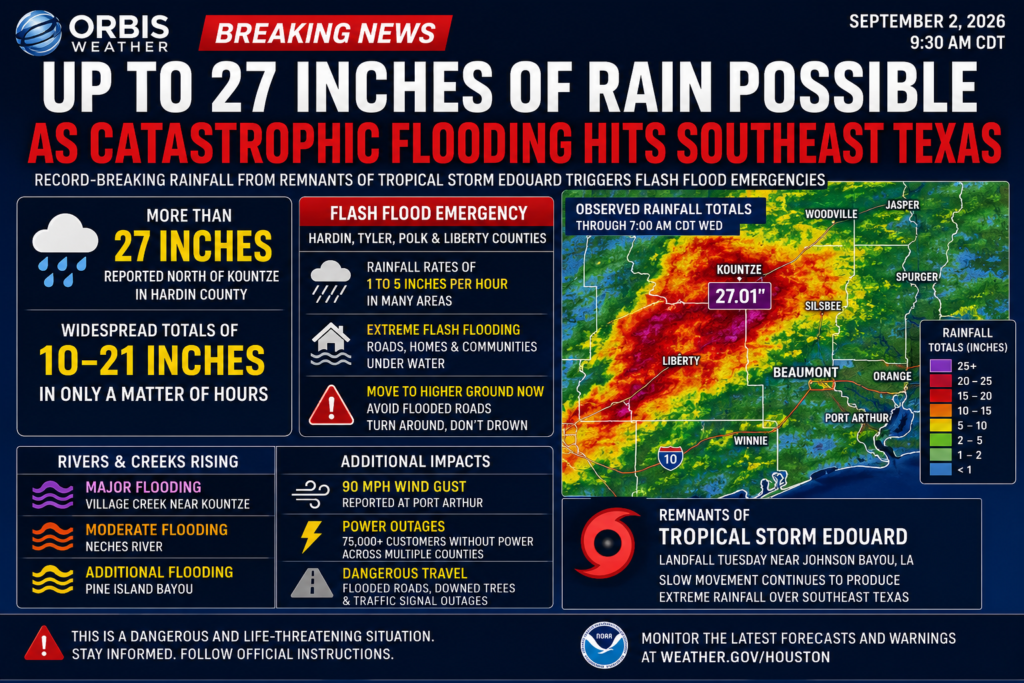
🌊 Up to 27 Inches of Rain Possible as Catastrophic Flooding Hits Southeast Texas
SEPTEMBER 2, 2026 | ORBIS WEATHER
A potentially historic flooding disaster is unfolding across Southeast Texas, where extreme tropical rainfall associated with the remnants of Tropical Storm Edouard has inundated communities, overwhelmed roads and sent rivers and creeks rapidly rising.
Some of the hardest-hit areas have experienced extraordinary rainfall, with more than two feet of water falling in localized areas and additional heavy rain threatening to worsen an already dangerous situation.
🚨 Flash flood emergencies have been issued as officials warn residents in affected communities to move to higher ground and avoid flooded roads.
🌧️ More Than Two Feet of Rain
The most extreme rainfall has focused across portions of Hardin County and surrounding Southeast Texas, including areas near Kountze and north of Beaumont.
Localized rainfall totals have approached or exceeded 20 inches, while the most intense bands have produced rainfall rates of several inches per hour.
Some locations could ultimately receive around 25 to 30 inches of rain where tropical rain bands repeatedly move across the same areas.
That is the equivalent of several months of normal rainfall falling in an extremely short period.
🚨 Catastrophic Flash Flooding
The combination of extreme rainfall rates, saturated ground and overwhelmed drainage systems has created a particularly dangerous flash-flood situation.
Communities across portions of Hardin, Tyler, Polk and Liberty counties are among those facing serious flooding concerns.
Roads have become submerged, smaller creeks have rapidly overflowed and water has entered low-lying areas.
Conditions can deteriorate extremely quickly during tropical flooding. Residents should not wait until water reaches their homes before moving to higher ground when authorities issue evacuation instructions.
🌀 Edouard’s Biggest Threat Is Now Rain
Although Tropical Storm Edouard has weakened since moving inland, the storm’s circulation continues to transport tremendous amounts of tropical moisture across Southeast Texas.
This highlights an important danger associated with landfalling tropical cyclones:
A storm does not have to be a hurricane to produce catastrophic impacts.
Wind speeds may decrease rapidly after landfall, but tropical rainfall can continue for hours—or even days—if a system moves slowly.
Edouard’s slow movement has allowed repeated thunderstorms to develop over many of the same locations, producing what meteorologists often call training rainfall.
🌊 Rivers and Creeks Continue to Rise
The flood emergency could continue long after the heaviest rainfall ends.
Enormous amounts of runoff are flowing into rivers, creeks and bayous throughout Southeast Texas.
Flooding concerns include areas along Village Creek, the Neches River and Pine Island Bayou, where water levels could continue rising as runoff moves downstream.
River flooding can sometimes peak many hours after rainfall has stopped.
Residents near waterways should therefore continue monitoring official warnings even if conditions temporarily improve.
💨 Powerful Winds Also Hit the Region
Edouard has produced more than flooding.
Strong winds accompanied the tropical system as it moved through the region, with gusts reportedly reaching around 90 mph near Port Arthur.
Trees and power lines have been knocked down in some communities, while tens of thousands of customers have experienced electricity outages.
Flooded roads combined with fallen trees and disabled traffic signals are making travel especially dangerous.
⚠️ Turn Around, Don’t Drown
Flash flooding remains one of the deadliest hazards associated with tropical systems.
Drivers should never attempt to cross a flooded roadway.
It is often impossible to determine the depth of floodwater or whether the road underneath has been washed away.
Even relatively shallow moving water can sweep a vehicle from the roadway.
🌊 Southeast Texas Flood Emergency — At a Glance
🌧️ Rainfall: Local totals exceeding 20 inches, with isolated amounts potentially approaching 25–30 inches
🚨 Flooding: Catastrophic flash flooding occurring in portions of Southeast Texas
🌀 System: Remnants of Tropical Storm Edouard
🌊 River Threat: Rivers, creeks and bayous continuing to rise
💨 Wind: Damaging tropical-storm-force winds and locally stronger gusts reported
⚡ Power: Widespread outages reported across affected communities
🚗 Travel: Numerous roads flooded or potentially impassable
⚠️ Primary Threat: Additional flash flooding and dangerous river flooding
🌎 ORBIS WEATHER WATCH
The Southeast Texas disaster is another reminder that water—not wind—is often the greatest threat from tropical cyclones.
Even after a tropical storm weakens over land, its moisture can produce devastating rainfall hundreds of miles from the coastline.
With some locations receiving rainfall measured in feet rather than inches, Southeast Texas could face significant flooding impacts well beyond Wednesday.
Residents throughout the affected region should continue monitoring National Weather Service warnings, local emergency management agencies and evacuation instructions.
ORBIS WEATHER will continue monitoring Edouard’s remnants, rainfall totals, river levels and flooding across Southeast Texas as the situation develops.
Orbis Weather — Tracking Earth’s weather, storms and natural hazards.
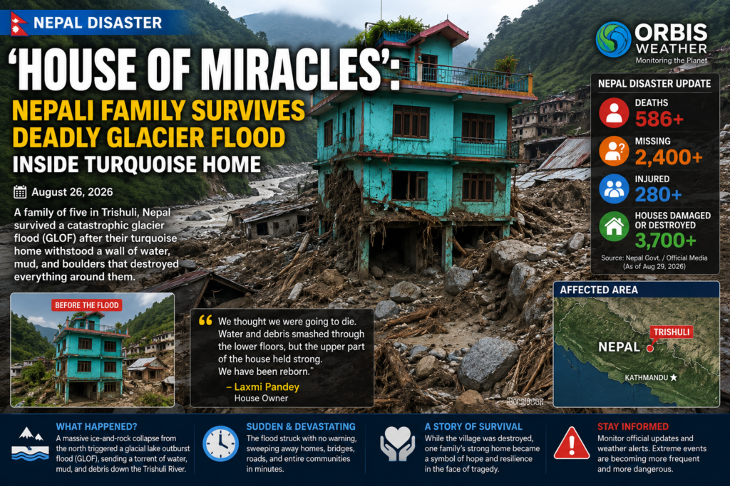

🇳🇵 ‘Miracle House’: Nepali Family Survives Deadly Glacier Flood Inside Turquoise Home
TRISHULI, Nepal — Amid the extraordinary destruction left behind by Nepal’s catastrophic August 26 glacier-triggered flood, one turquoise-colored house has emerged as an unlikely symbol of survival.
Videos that have spread around the world show the multi-story home standing in the middle of a raging torrent as muddy water, enormous rocks, trees and wreckage tear through the surrounding community.
Inside, members of the Pandey Pyakurel family feared they were witnessing the final moments of their lives.
Instead, the house remained standing — and the family survived.
🏠 A House Surrounded by Destruction
The turquoise home is located in the Trishuli Bazaar area of Nepal’s Nuwakot district.
When the catastrophic flood arrived on August 26, water and debris smashed into the lower portion of the building, ripping away doors and windows and destroying property stored inside.
But the reinforced-concrete frame remained standing while structures and vehicles around it were swept away.
Family members retreated to the highest levels of the house as the torrent battered the building from multiple directions.
Laxmi Pandey Pyakurel later described the terrifying ordeal, saying the family believed they might not survive.
The family remained trapped for roughly an hour to two hours before conditions improved enough for people nearby to reach them. Rescuers reportedly used a pipe and rope to help them escape from the building.
Everyone inside survived.
👨👩👧👦 Family Feared They Would Never Escape
The residents included Prakash Pandey Pyakurel, his wife Laxmi, their children and elderly family members.
One particularly frightening part of the ordeal involved the couple’s young son, who had left for school shortly before the disaster struck.
As floodwaters surrounded the home, the family did not know whether he was safe.
He was later found unharmed because his school was in a safer location.
Laxmi described the family’s survival as essentially receiving a second chance at life.
🌊 What Caused the Nepal Disaster?
The disaster was much more than an ordinary river flood.
Satellite analysis indicates that a huge section of glacier, ice and underlying bedrock collapsed high in the Himalayas near the Nepal-China border on August 26.
The enormous mass plunged into the valley below, producing an avalanche and debris flow that ultimately sent a devastating surge of water, mud, rocks and other material downstream.
Communities along the Bhote Koshi and Trishuli river systems were overwhelmed.
At one location along the Trishuli River, water reportedly rose by approximately 9 meters — nearly 30 feet — in only 30 minutes.
The fast-moving, sediment-heavy flood destroyed or damaged villages, bridges, highways, hydropower facilities and other infrastructure across the region.
🚨 Death Toll Surpasses 1,000
The scale of the wider disaster has continued to become clearer as rescuers reach previously isolated areas.
As of September 1, more than 1,000 people had been confirmed dead in Nepal, while approximately 3,916 remained missing, according to the latest reporting from the Associated Press.
China reported another 16 deaths and hundreds of people missing.
Nepalese authorities had rescued more than 11,800 people, while search teams continued looking through enormous deposits of mud and debris.
Hundreds of workers associated with damaged hydropower projects were among those still unaccounted for.
Because search and recovery operations remain underway, casualty figures could continue to change.
🛰️ Entire Landscape Transformed
Satellite imagery has revealed the extraordinary physical scale of the disaster.
The glacier and bedrock collapse sent debris through steep Himalayan valleys before the flood moved into populated areas downstream.
Sections of the Trishuli River dramatically widened, and normally greenish river water became thick with brown sediment.
Some communities were effectively buried beneath mud and debris. Roads disappeared, bridges collapsed and isolated settlements were left difficult to reach except by helicopter or on foot.
Even days after the disaster, rescue crews continued searching along riverbanks far downstream for victims and survivors.
🏔️ Growing Concern Over Himalayan Glacier Hazards
Scientists have warned for years that communities throughout the Himalayas face significant risks from unstable glaciers, glacial lakes, landslides and extreme flooding.
Warmer temperatures can contribute to glacier retreat and thawing permafrost, potentially destabilizing mountain slopes.
However, scientists caution against attributing any single glacier collapse exclusively to climate change without detailed analysis.
What is clear is that the combination of enormous quantities of ice, extremely steep terrain and densely populated river valleys can turn a high-altitude collapse into a disaster many miles downstream.
Researchers have also monitored lakes temporarily created when debris from the August 26 collapse blocked sections of the river system, adding concern about possible additional flooding.
💙 A Symbol of Survival
Against that grim backdrop, the turquoise house has become one of the defining images of the disaster.
The building did not escape undamaged. Its lower floors were battered, vehicles were swept away, belongings disappeared and the family’s business suffered extensive losses.
But its main structure survived.
Prakash has attributed some of the home’s resilience to its strong foundation and construction. The building is reportedly around 40 years old.
The family is now staying away from the devastated area while attempting to recover whatever belongings remain.
Their intention is eventually to rebuild their lives.
For thousands of other families across Nepal, that same process is only beginning.
The turquoise house standing above a landscape of mud and destruction is therefore more than an extraordinary photograph.
It has become a symbol of just how quickly a Himalayan disaster can destroy a community — and how, sometimes, survival can come down to a matter of minutes, location and the strength of the structure beneath your feet.
Orbis Weather will continue monitoring the Nepal disaster, ongoing rescue operations and potential additional glacier and flood hazards across the Himalayan region.
UNICEF: The United Nations organization that helps children in need, is accepting monetary donations to help children and victims of the flooding. Click here to learn more.
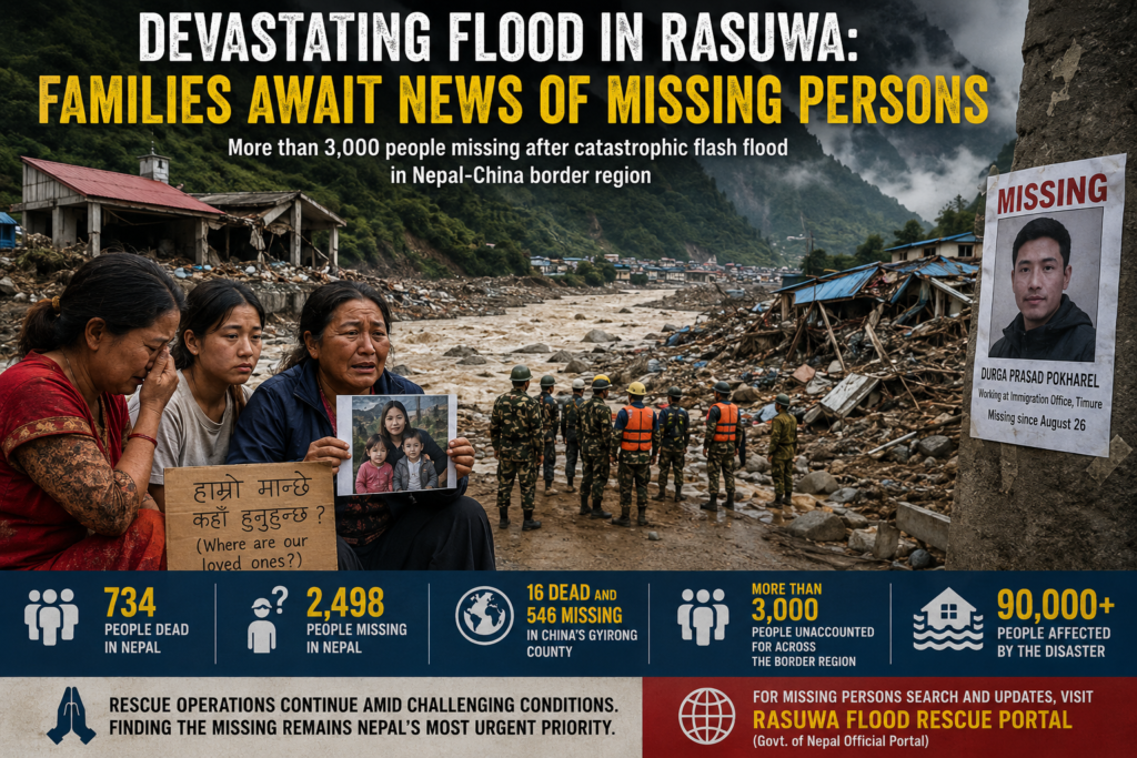
Devastating Flood in Rasuwa: Families Await News of Missing Persons
Families across Nepal are enduring an agonizing wait for news of loved ones still missing after the catastrophic flash flood that tore through Rasuwa district and the Bhote Koshi–Trishuli river system, leaving communities devastated and thousands of people unaccounted for.
The August 26 disaster was triggered when a glacier collapse unleashed an enormous torrent of ice, rock, mud and water through Himalayan valleys near the Nepal-China border. The flood struck with extraordinary speed, destroying settlements, roads, bridges, government facilities and hydropower infrastructure. (reuters.com)
💔 Families Search Hospitals, Police Stations and Riverbanks
For many families, the disaster has become a desperate search from one location to another.
Relatives carrying photographs of missing family members have been visiting hospitals, police offices, shelters and areas along the river in hopes of finding any information.
Among them is Bima Gole, whose sister Uma Gole and her children have been missing since the flood. According to Nepal’s public broadcaster, Bima last spoke with her sister at 9:14 a.m. on August 26. During the call, she heard people in the background shouting for everyone to run.
She has continued searching ever since. (radionepalonline.com)
Another missing person is Durga Prasad Pokharel, who was working at the immigration office in Timure when the flood struck. His family fears the sudden wall of water gave people inside the building almost no opportunity to escape. (english.ratopati.com)
🕯️ Thousands Still Missing
The scale of the disaster has continued to grow.
Nepal’s disaster authority reported Sunday that 734 people had died and 2,498 remained missing in Nepal, while another 16 people were confirmed dead and 546 missing in China’s Gyirong County. Taken together, more than 3,000 people remained unaccounted for across the border region. (reuters.com)
The numbers have changed rapidly as rescuers reach isolated areas and authorities reconcile lists of residents, workers, tourists and pilgrims.
More than 90,000 people may have been affected, according to the Red Cross. (reuters.com)
🚨 Workers May Still Be Trapped Underground
One of the most difficult rescue operations is unfolding at damaged hydropower facilities in Rasuwa.
At the Upper Trishuli-1 Hydropower Project, Ram Budha has repeatedly returned to a tunnel where his 20-year-old brother, Prabin, is believed to be trapped along with other workers.
Ram has gone inside and shouted his brother’s name, hoping to hear a response from somewhere in the darkness.
None has come.
Specialized assistance is now being used as authorities attempt to reach people believed trapped inside hydropower tunnels. Nepal has said it needs expertise in tunnel rescue operations as well as DNA testing, refrigerated storage and forensic identification. (reuters.com, kathmandupost.com)
⚠️ Identification Becomes Another Tragedy
Far downstream from Rasuwa, another grim consequence of the disaster is unfolding.
Bodies carried through the river system have been recovered as far away as Chitwan district, nearly 200 kilometers from the devastated valleys.
Authorities have begun temporarily burying unidentified victims because morgues have been overwhelmed and decomposition has made identification increasingly difficult. DNA samples, photographs and identifying information are being collected so remains can potentially be identified and returned to families later. (reuters.com)
For relatives still searching, that means the wait may continue even after victims have been recovered.
🌧️ Rescue Operations Remain Dangerous
The Himalayan terrain, damaged roads, unstable slopes and changing river conditions have repeatedly complicated rescue operations.
Fresh rainfall caused the Trishuli River to rise again, while landslides and temporary dams created by debris have raised fears of additional flooding. Rescue operations have already been temporarily suspended at times because conditions became too dangerous. (reuters.com)
Scientists say the disaster began with the collapse of glacier ice and rock high in the mountains. While experts caution against attributing a single glacier collapse solely to climate change, warming temperatures can destabilize high-altitude rock and ice by increasing melting and changing freeze-thaw conditions. (reuters.com)
🙏 Hope Amid the Devastation
There have also been extraordinary stories of survival.
Eight-year-old Zoyal Ghale escaped the flood by running from his school into a forest and climbing trees. He was eventually rescued with a broken leg and injuries to his face.
His mother had searched shelters and collection points and had begun believing both of her children were dead.
Days later, she learned Zoyal had survived. Mother and son were reunited at a Kathmandu hospital. (reuters.com)
For thousands of other families, however, there has been no such reunion.
They continue waiting beside hospitals, rescue centers, riverbanks and tunnel entrances—watching lists of survivors and recovered victims for the names they desperately want to find.
As search teams continue working through the wreckage, finding the missing remains Nepal’s most urgent priority.
People searching for relatives can also use the Nepal government’s official Rasuwa Flood Rescue Portal, which includes missing-and-found person searches, emergency contacts and rescue information.
Figures are current as of Sunday, August 30, 2026, and may change as search and recovery operations continue.
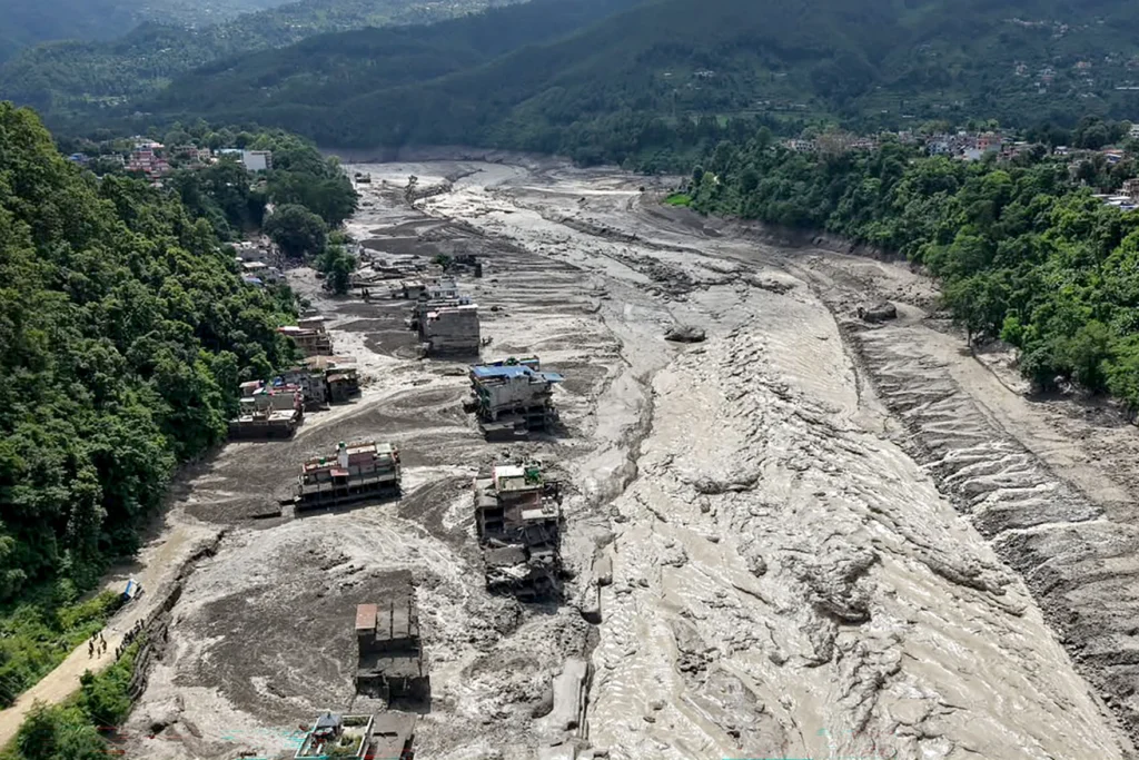
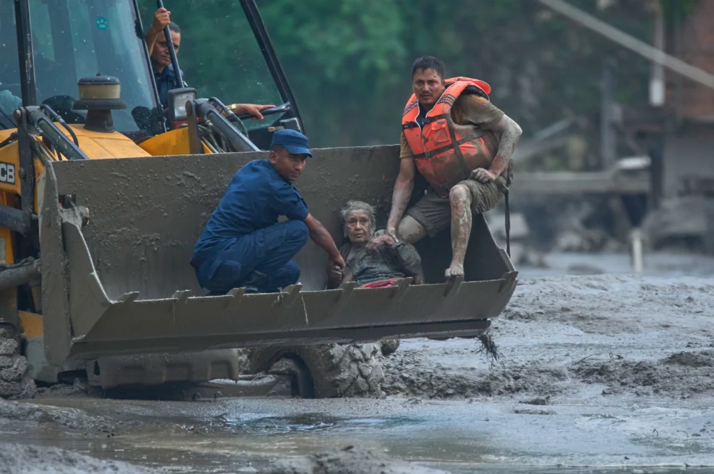
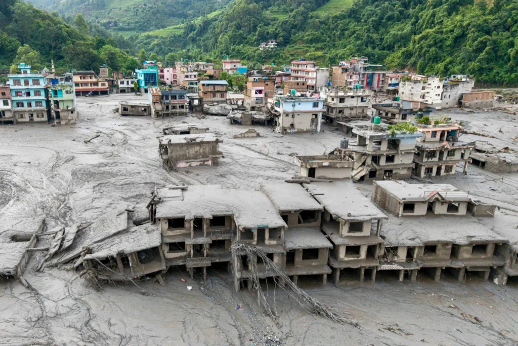
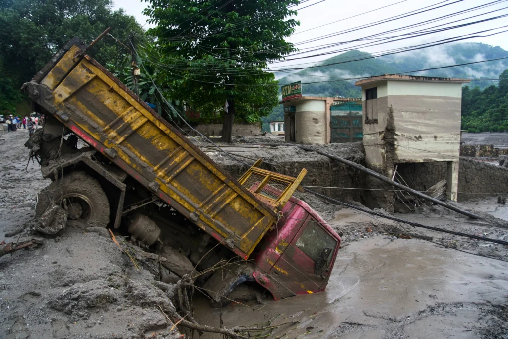
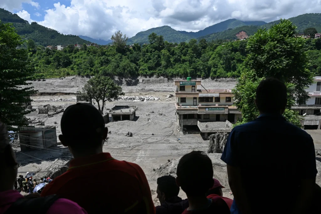

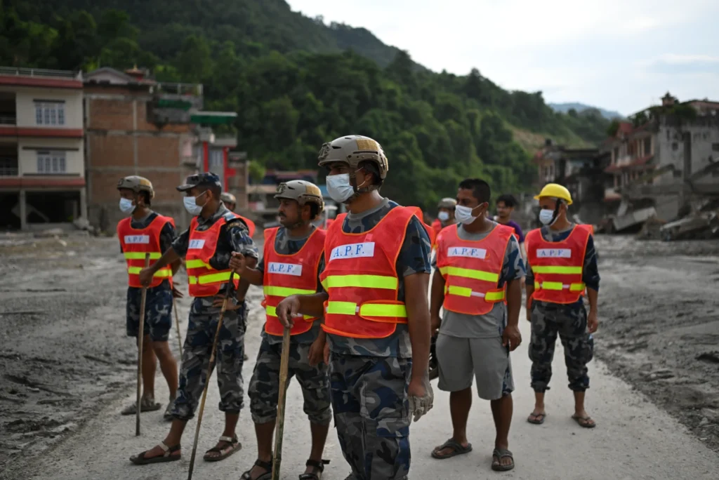
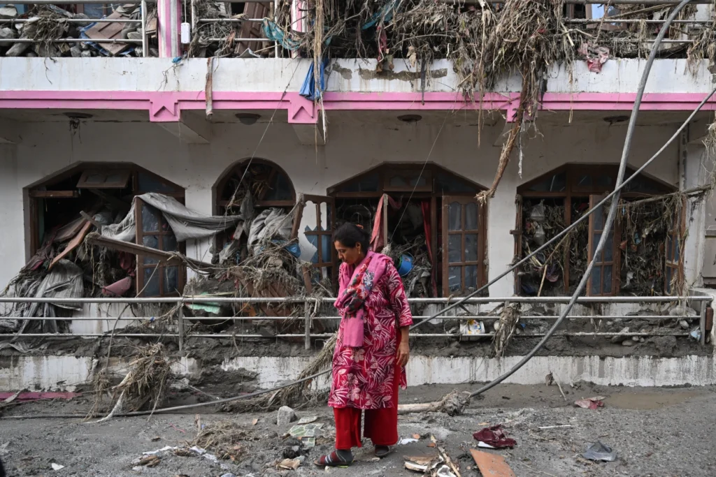

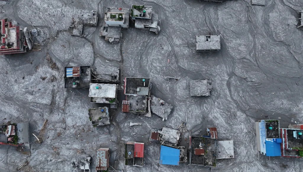


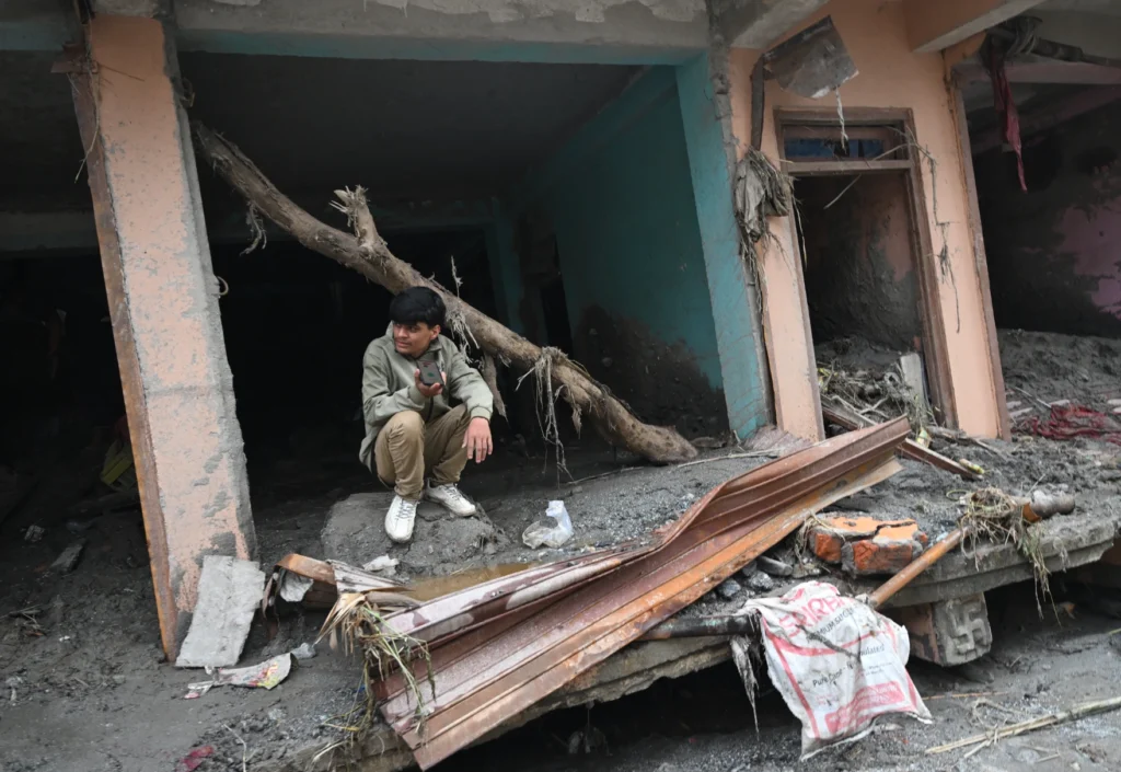
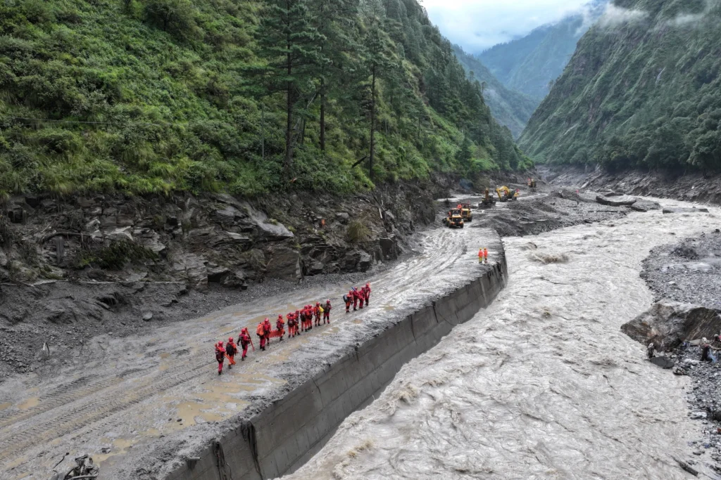

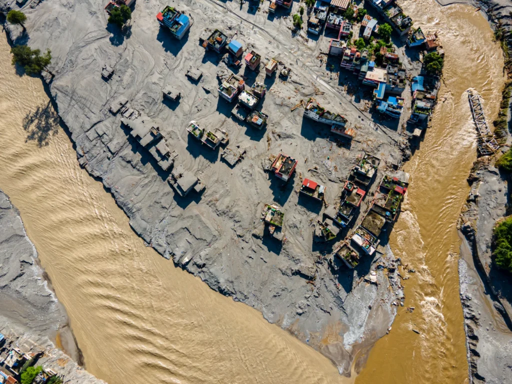
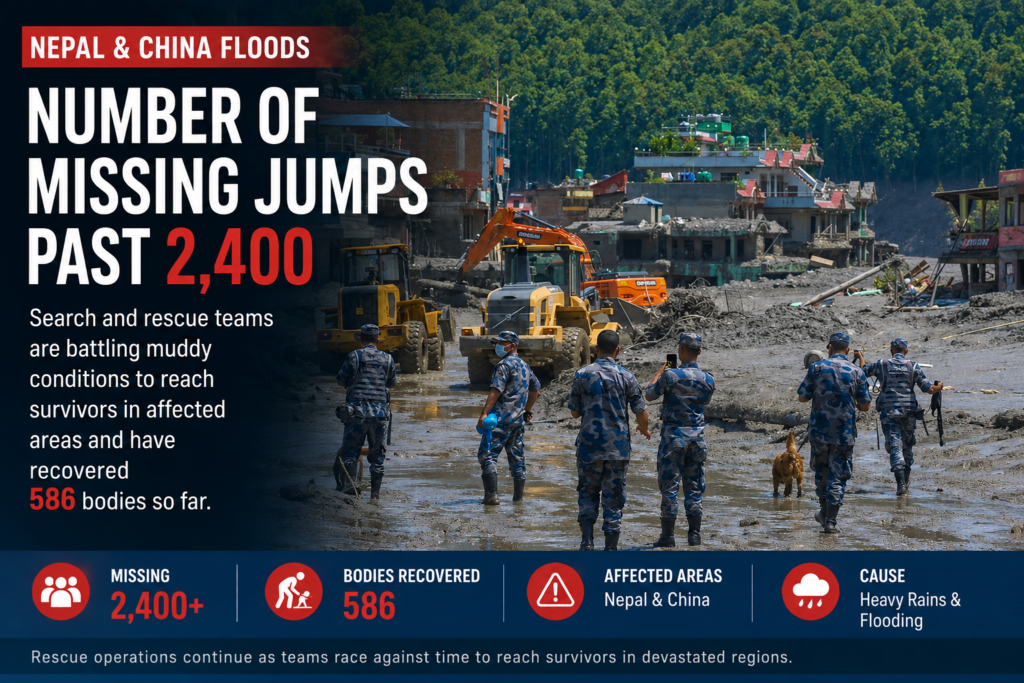
Latest
⚠️ Nepal Glacier Flood Watch — Risk Eases, Vigilance Continues
There is a meaningful change from the earlier warning: Nepal and China have resumed rescue operations after officials assessed the immediate danger from the overflowing barrier lake as manageable. Operations had been temporarily suspended when water levels rose and people were moved toward higher ground. (The Korea Times)
The threat has not been declared over. Two newly formed lakes remain under observation, and Nepalese authorities continue to warn people and rescue personnel along the Bhote Koshi–Trishuli corridor to stay away from riverbanks and other high-risk areas. The larger barrier lake contains millions of cubic meters of water, and erosion or failure of its debris dam could still produce another debris-laden flood. (Al Jazeera)
Current assessment: 🟠 Elevated risk, but lower than earlier Friday. No new catastrophic outburst has been reported in the latest credible reporting.
Latest detailed Nepal glacier-flood update
🚨 Nepal–China Flood Disaster: Missing Count Surges Past 2,400 as Search Intensifies
Friday, August 28, 2026
The scale of the deadly flooding affecting Nepal and China has grown dramatically, with the number of people reported missing now climbing past 2,400 as search-and-rescue crews continue working through devastated communities.
Authorities and rescue teams have recovered 586 bodies so far, while fears are growing that the death toll could rise significantly as crews reach areas that have been difficult or impossible to access.
🔴 What We Know
👥 More than 2,400 people are reported missing
⚫ 586 bodies have been recovered
🚨 Large-scale search-and-rescue operations remain underway
🚜 Heavy machinery is being used to clear enormous deposits of mud, rocks and debris
🌧️ Flooding and landslides have damaged communities and complicated access to some of the hardest-hit areas
🐕 Search teams and rescue dogs are being deployed where conditions permit
🚜 Mud and Debris Hamper Rescue Operations
Rescuers are battling deep mud, unstable ground, damaged roads and enormous debris fields as they attempt to locate survivors.
Excavators and other heavy equipment are being brought into devastated areas, but the sheer amount of material deposited by the flooding is making progress painfully slow.
Some communities have been left covered in thick layers of mud and rubble, while damaged transportation routes are making it difficult to move rescue personnel and supplies.
🔎 Race to Find the Missing
With more than 2,400 people still unaccounted for, locating survivors remains the immediate priority.
The enormous discrepancy between the number of confirmed deaths and those still listed as missing means officials face the difficult task of determining who may have survived, who has been displaced and who remains trapped or buried beneath debris.
The casualty figures should also be considered preliminary while authorities continue reconciling missing-person reports across affected areas.
⚠️ Death Toll Could Continue to Rise
With 586 bodies already recovered, the disaster has become one of the region’s most serious recent flooding emergencies.
Search operations are expected to continue as long as conditions allow, with rescuers racing against time while authorities assess damaged communities and attempt to restore access.
ORBIS WEATHER will continue monitoring the Nepal–China flood disaster as search teams reach additional areas and authorities release updated casualty and missing-person figures.
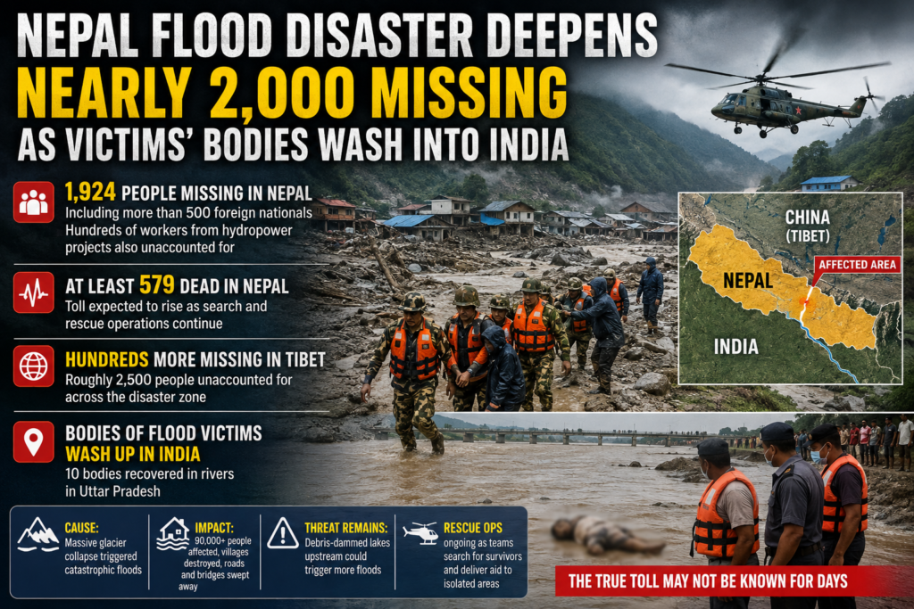
🌊 Nepal Flood Disaster Deepens: Nearly 2,000 Missing as Victims’ Bodies Wash Into India
ORBIS WEATHER — Friday, August 28, 2026
The scale of the catastrophic flooding in Nepal has grown dramatically, with authorities now reporting 1,924 people missing in Nepal alone as rescue crews continue searching devastated Himalayan valleys. At least 579 people have been confirmed dead in Nepal, and officials fear the toll could climb substantially as isolated communities are reached.
🚨 Missing-Count Nearly Doubles
Nepal’s National Disaster Risk Reduction and Management Authority says the number of people unaccounted for has risen to 1,924, including more than 500 foreign nationals. Hundreds of workers associated with hydropower projects along the affected rivers are also among those missing.
The disaster extends across the border into Tibet, where Chinese authorities have reported hundreds more missing. Taken together, the Nepal and Tibet figures indicate that roughly 2,500 people remain unaccounted for across the disaster zone.
🇮🇳 Bodies of Flood Victims Reach India
In a grim indication of the flood’s enormous power, victims have been carried far downstream through Nepal’s river system and across the border into India.
Police in the northern Indian state of Uttar Pradesh reported finding 10 bodies at three locations in rivers flowing out of Nepal. Authorities are working to determine the identities of those recovered.
Inside Nepal, bodies are also being recovered many miles from the hardest-hit mountain communities. Morgues in several districts are reaching or exceeding capacity as authorities attempt to identify victims through photographs, fingerprints and, when necessary, DNA testing.
🏔️ Glacier Collapse Unleashed Catastrophic Flood
The disaster began Wednesday when a massive collapse involving rock and glacial ice high in the Himalayas unleashed an enormous torrent of water, ice, rock, mud and debris through mountain river systems near the Nepal-Tibet border.
Entire settlements were overwhelmed. Roads, bridges, hydropower facilities and other infrastructure were destroyed as the flood raced downstream through narrow valleys.
More than 90,000 people are estimated to have been affected, according to the Red Cross.
⚠️ Threat of Another Flood Has Not Completely Passed
The emergency is not over.
Authorities are monitoring debris-dammed lakes upstream of the disaster area, where accumulated water could potentially trigger additional flooding if natural barriers fail. One immediate overflow threat eased Friday, allowing rescue operations to resume after a temporary suspension, but officials continue monitoring the lakes closely.
🚁 Search for Survivors Continues
Helicopters, soldiers, police and emergency crews are searching through enormous fields of mud and debris while delivering supplies to communities cut off by destroyed roads and bridges.
Rescuers are also working around damaged hydropower facilities and tunnels where workers were trapped when the flood struck.
Despite the rapidly rising casualty numbers, officials say the priority remains finding survivors.
With 1,924 people still missing in Nepal, hundreds more unaccounted for in Tibet and victims now being recovered as far downstream as India, the true human cost of the Himalayan flood disaster may not be known for days.
ORBIS WEATHER will continue monitoring this developing disaster as search-and-rescue operations continue.
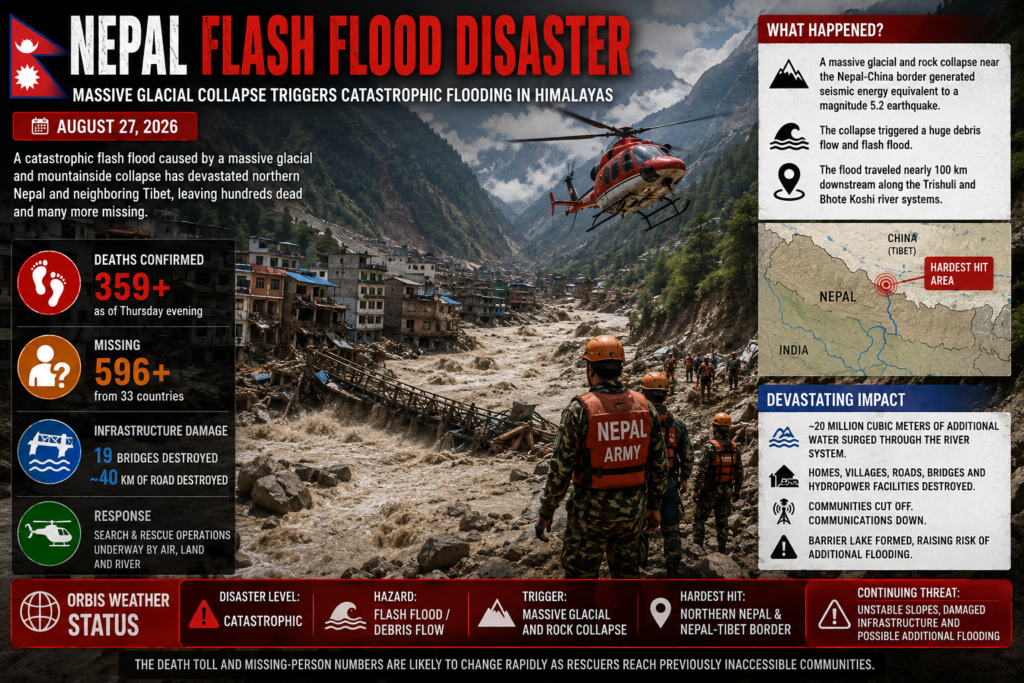
🇳🇵 Nepal Flash Flood Disaster: Hundreds Dead as Glacier Collapse Sends Wall of Water Through Himalayan Valleys
ORBIS WEATHER — August 27, 2026
A catastrophic flash flood has devastated parts of northern Nepal and neighboring Tibet after a massive collapse of glacial ice, rock and debris high in the Himalayas unleashed a violent torrent through mountain river valleys.
Nepal’s government reported Thursday evening that 359 bodies had been recovered, while hundreds of local residents and foreign visitors remained missing. Officials said 596 people from 33 countries were still unaccounted for in Nepal alone, though casualty and missing-person figures remain fluid as communications are restored and reports are verified. (aljazeera.com, mofa.gov.np)
🧊 What Triggered the Disaster?
The disaster began Wednesday morning, August 26, near the Nepal-China border. Early reports suggested an earthquake might have triggered the flood, but scientists now believe the seismic signal was actually generated by an enormous glacial and mountainside collapse.
The U.S. Geological Survey says a catastrophic debris flow and flood was likely triggered by a glacial collapse near the border. The debris flow and flooding ultimately traveled nearly 100 kilometers (62 miles) downstream along the Trishuli and Bhote Koshi river systems. (usgs.gov)
Scientists say the collapse generated seismic energy equivalent to roughly a magnitude 5.2 event. Ice, rock and debris plunged into the valley, creating a cascading flood that rapidly gained water, sediment and destructive power as it moved downstream. (abcnews.com)
🌊 A Wall of Water Races Downstream
The speed of the disaster left communities with almost no time to react. Water levels along parts of the river system reportedly rose dramatically within minutes.
The flood swept through the Bhote Koshi and Trishuli river valleys, destroying or damaging homes, villages, roads, bridges, hydropower facilities and other critical infrastructure. Nepal’s Flood Forecasting Division estimates the surge carried approximately 20 million cubic meters of additional water through the river system. (kathmandupost.com)
Satellite imagery shows entire areas buried beneath mud and debris. At least 19 bridges and roughly 40 kilometers (25 miles) of road have been destroyed, making it extremely difficult for rescuers to reach isolated communities. (aljazeera.com)
🚁 Massive Search-and-Rescue Operation
Nepalese authorities have mobilized security forces, disaster-response teams, medical personnel and helicopters. Aircraft are searching inaccessible valleys, evacuating survivors and delivering food, tents, medicine and emergency supplies to communities cut off by destroyed roads and bridges. (aljazeera.com, mofa.gov.np)
The situation remains dangerous. Authorities are monitoring river levels and unstable slopes, while a newly formed barrier lake near the disaster zone has raised concerns about additional flooding if the natural blockage fails. (aljazeera.com)
🌡️ Growing Himalayan Glacier Threat
Scientists are still investigating exactly why the glacier and mountainside failed. However, the disaster is highlighting the increasing danger posed by unstable glaciers, thawing permafrost and changing temperatures across the rapidly warming Himalayas.
Researchers caution that attributing this individual collapse specifically to climate change will require further study, but warming conditions are increasing glacier instability and the broader risk of avalanches, debris flows and sudden glacial flooding throughout the region. (apnews.com)
⚠️ ORBIS WEATHER STATUS
🔴 Disaster Level: Catastrophic
🌊 Hazard: Flash Flood / Debris Flow
🧊 Trigger: Massive glacial and rock collapse
📍 Hardest Hit: Northern Nepal and Nepal-Tibet border region
☠️ Nepal Death Toll: At least 359 confirmed as of Thursday evening
🔎 Missing: Hundreds, including foreign tourists and pilgrims
🚁 Response: Major search-and-rescue operation underway
⚠️ Continuing Threat: Unstable slopes, damaged infrastructure and possible additional flooding
The death toll and missing-person numbers are likely to change rapidly as rescuers reach previously inaccessible communities.
Highlights:









Live Lightning Map
Live U.S. Wildfire Tracker

Live Wildfire Smoke & Air Quality Tracker

Live Earthquake Map
Live Volcano Eruption Tracker