Earthquake Danger Zones: Most Earthquake-Prone Places on Earth
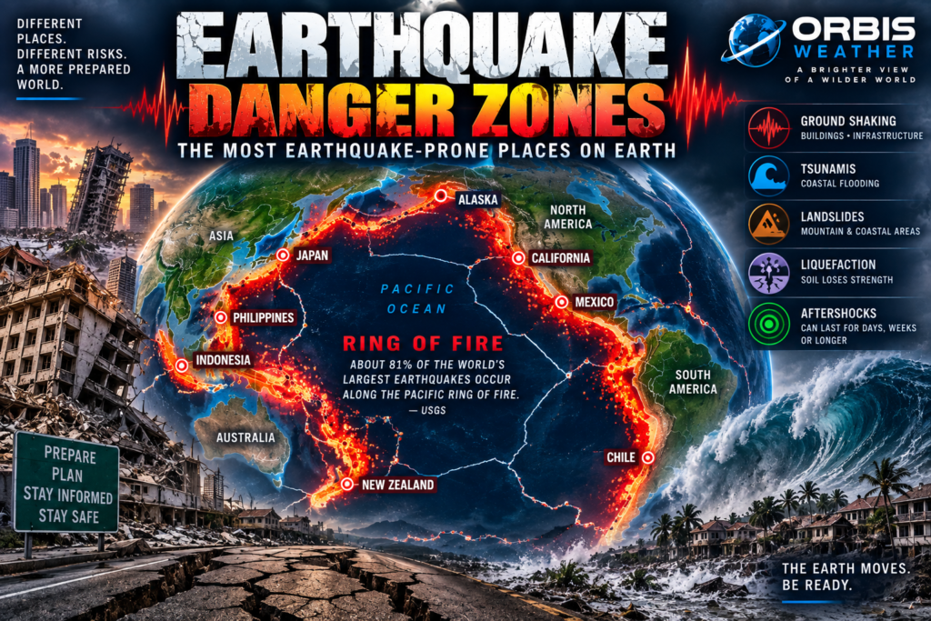

🌎 Earthquake Danger Zones: The Most Earthquake-Prone Places on Earth
The ground beneath our feet feels permanent.
It isn’t.
Earth’s outer shell is divided into enormous tectonic plates that are constantly moving — usually only centimeters each year.
Where those plates collide, pull apart or slide past one another, tremendous stress can accumulate within Earth’s crust.
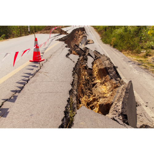
Eventually, rock breaks.
Energy races outward as seismic waves.
And within seconds, entire cities can begin shaking.
Earthquakes occur around the world, but they are far from evenly distributed.
Most follow enormous geological boundaries stretching thousands of miles across the planet.
And one region stands above all others:
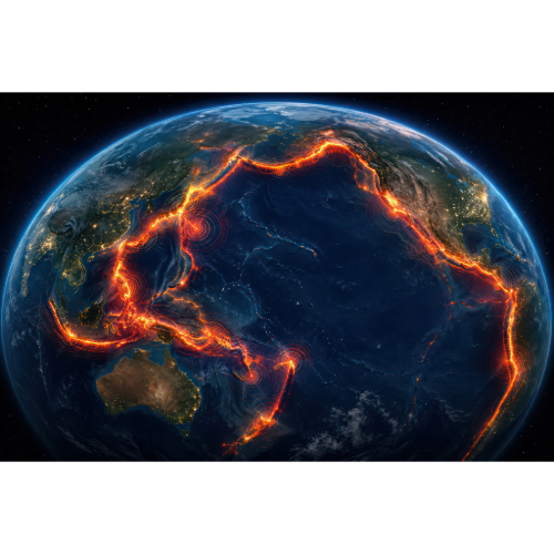
🔥 The Pacific Ring of Fire.
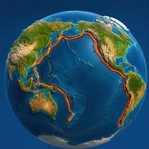
According to the U.S. Geological Survey, about 81% of the world’s largest earthquakes occur along the circum-Pacific seismic belt — the enormous earthquake zone surrounding much of the Pacific Ocean.
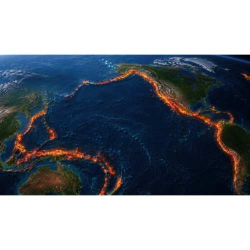
From Chile north through Mexico and California to Alaska, and then across the Pacific through Russia, Japan, the Philippines, Indonesia and toward New Zealand, this vast geological arc contains some of the most earthquake-prone places on Earth.
🔥 The Pacific Ring of Fire — Earth’s Great Earthquake Zone
The Ring of Fire isn’t a single fault.
It is an enormous system of tectonic plate boundaries surrounding much of the Pacific Ocean.
Here, the Pacific Plate and several neighboring plates interact.
In many locations, one tectonic plate is being forced beneath another in a process called subduction.
These subduction zones are capable of producing Earth’s largest earthquakes.
The Ring of Fire stretches through or near:
🇨🇱 Chile
🇵🇪 Peru
🇪🇨 Ecuador
🇲🇽 Mexico
🇺🇸 California and Alaska
🇨🇦 Western Canada
🇷🇺 Kamchatka
🇯🇵 Japan
🇵🇭 Philippines
🇮🇩 Indonesia
🇵🇬 Papua New Guinea
🇳🇿 New Zealand
Together they form an extraordinary horseshoe-shaped earthquake and volcanic zone around the Pacific.
🇯🇵 Japan — Living Where Tectonic Plates Meet
Few countries are more closely associated with earthquakes than Japan.
Japan sits near the boundaries of several tectonic plates.
Off its Pacific coast, oceanic plates descend beneath other plates along enormous subduction zones.
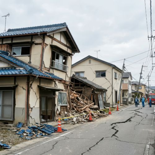
This geological setting produces frequent earthquakes ranging from barely noticeable tremors to catastrophic megathrust events.
On March 11, 2011, the magnitude 9.1 Tōhoku earthquake struck offshore northeastern Japan.
The earthquake generated a devastating tsunami that swept across portions of Japan’s Pacific coastline.
The disaster demonstrated one of the most important characteristics of earthquake danger zones:
The earthquake itself may only be the beginning.
Strong earthquakes can trigger:
🌊 Tsunamis
🪨 Landslides
🔥 Fires
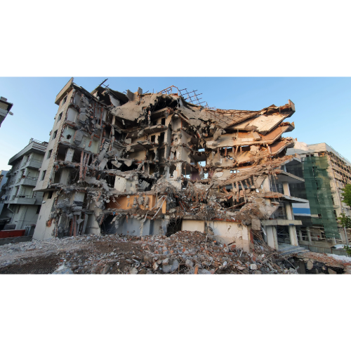
🏙️ Building collapses
🚧 Infrastructure failures
🌊 Liquefaction
Aftershocks can continue for days, weeks, months or even longer.
Japan has consequently developed some of the world’s most sophisticated earthquake monitoring, engineering and early-warning systems.
🇮🇩 Indonesia — Earthquakes, Volcanoes and Tsunamis
Indonesia lies along one of Earth’s most complex tectonic regions.
The country stretches across thousands of islands where several major tectonic plates interact.
South and west of Indonesia, oceanic crust is being forced beneath other plates along the Sunda subduction zone.
This geological system can generate enormous earthquakes.
On December 26, 2004, a magnitude 9.1 earthquake occurred off northern Sumatra.
The sudden movement of the seafloor generated a catastrophic Indian Ocean tsunami.
Waves spread across the ocean and struck coastlines far beyond Indonesia.
The disaster became one of the deadliest natural catastrophes of modern times.
Indonesia’s tectonic setting also explains its extraordinary concentration of active volcanoes.
Earthquakes and volcanoes here are two expressions of the same restless planet.
🇨🇱 Chile — Home of the Largest Earthquake Ever Recorded
Chile occupies one of Earth’s greatest earthquake zones.
Immediately offshore, the Nazca Plate is being forced beneath the South American Plate.
The collision created the Andes.
It also produces enormous earthquakes.
On May 22, 1960, southern Chile experienced the largest earthquake ever instrumentally recorded.
Magnitude:
9.5.
The Great Chilean — or Valdivia — earthquake ruptured an enormous portion of the plate boundary.
The earthquake generated a Pacific-wide tsunami.
Waves crossed the ocean and caused deaths as far away as Hawaii and Japan.
More than six decades later, no instrumentally recorded earthquake has exceeded it.
Chile remains one of Earth’s clearest examples of the extraordinary energy stored along subduction zones.
🇺🇸 Alaska — America’s Greatest Earthquake Zone
When Americans think about earthquakes, California usually comes first.
But the largest earthquake ever recorded in the United States happened in Alaska.
On March 27, 1964, a magnitude 9.2 earthquake struck Alaska’s Prince William Sound region.
It remains the second-largest instrumentally recorded earthquake in the world.
Alaska lies along the boundary where the Pacific Plate descends beneath the North American Plate.
This tectonic collision extends through the Aleutian Islands, creating a long arc of earthquakes and volcanoes.
Alaska experiences enormous numbers of earthquakes.
Many occur far from large population centers.
But its geological potential is extraordinary.
🇺🇸 California — The San Andreas Fault
California’s earthquake environment is different from Alaska’s.
The famous San Andreas Fault is a transform plate boundary.
Here, the Pacific Plate and North American Plate largely slide horizontally past one another.
Stress accumulates along sections of the fault until the rocks suddenly slip.
California contains many additional active faults beyond the San Andreas.
Major metropolitan areas including:
🏙️ Los Angeles
🌉 San Francisco Bay Area
🏙️ San Bernardino
🏙️ San Diego
contain substantial earthquake exposure.
Unlike hurricanes or tornadoes, earthquakes don’t provide days of meteorological warning.
Strong shaking can begin suddenly.
That makes earthquake-resistant construction and preparedness particularly important.
🇲🇽 Mexico — Where Subduction Meets Millions of People
Mexico sits along another important section of the Ring of Fire.
Along its Pacific coast, oceanic plates descend beneath the North American Plate.
Powerful earthquakes can occur offshore or beneath southern Mexico.
But earthquake damage isn’t determined by magnitude alone.
Mexico City demonstrates why geology matters.
The city sits partly atop sediments deposited within an ancient lake basin.
Those soft sediments can amplify seismic waves from distant earthquakes.
As a result, an earthquake occurring hundreds of kilometers away can sometimes produce intense shaking within portions of the capital.
Earthquake danger therefore depends not only on the fault.
It also depends on what lies beneath a city.
🇹🇷 Turkey — Beyond the Ring of Fire
Not all major earthquake zones surround the Pacific.
Another enormous seismic corridor stretches from the Mediterranean through Turkey, Iran and the Himalayas toward Southeast Asia.
USGS calls this the Alpide earthquake belt.
Turkey sits within an especially complex tectonic environment.
The Anatolian Plate is squeezed between surrounding tectonic plates.
Major faults including the North Anatolian Fault and East Anatolian Fault have produced destructive earthquakes.
Turkey demonstrates an important lesson:
The Ring of Fire may dominate global earthquake activity, but devastating earthquakes can occur far from the Pacific.
🇮🇷 Iran — Mountains Built by Collision
Iran lies within another major collision zone.
The Arabian Plate moves northward toward Eurasia.
Over geological time, this collision has helped create mountain ranges across the region.
It also creates earthquakes.
Numerous active faults cross Iran, and many communities have been damaged by destructive earthquakes throughout history.
Traditional buildings can be particularly vulnerable where earthquake-resistant construction is limited.
🏔️ The Himalayas — An Ongoing Continental Collision
The Himalayas exist because two enormous continental plates collided.
The Indian Plate continues pushing northward into the Eurasian Plate.
That collision is still happening.
The result is one of Earth’s greatest mountain ranges — and one of its major earthquake danger zones.
Countries exposed to Himalayan seismic activity include:
🇳🇵 Nepal
🇮🇳 India
🇵🇰 Pakistan
🇧🇹 Bhutan
🇨🇳 China
Major earthquakes can trigger devastating landslides throughout steep mountain valleys.
Roads can disappear.
Entire slopes can collapse.
Remote communities can become isolated.
In mountainous earthquake zones, the shaking itself may be only one part of the disaster.
🇳🇵 Nepal — Earthquakes Beneath the Himalayas
Nepal sits directly above the ongoing collision between India and Eurasia.
On April 25, 2015, a major earthquake struck Nepal.
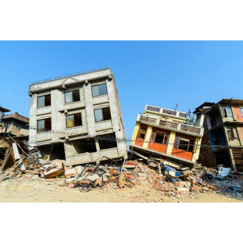
Kathmandu and surrounding areas experienced severe damage.
Mountain communities were devastated.
Landslides occurred throughout the Himalayas.
The earthquake also triggered enormous avalanches, including one on Mount Everest.
Nepal illustrates the compound nature of earthquake disasters:
Shaking → building collapse → landslides → avalanches → blocked roads → isolated communities.
🇳🇿 New Zealand — Earthquakes at the Bottom of the Ring of Fire
New Zealand sits along the boundary between the Pacific and Australian tectonic plates.
Its tectonic setting is extraordinarily complex.
Some regions experience subduction.
Others experience major strike-slip faulting.
The country’s mountains themselves are partly the product of tectonic forces.
Earthquakes are consequently a normal part of New Zealand’s geological environment.
The Alpine Fault on the South Island represents one of the country’s major active fault systems.
🇵🇭 Philippines — Islands Between Tectonic Plates
The Philippines doesn’t only face typhoons.
It also occupies an extremely active earthquake zone.
The archipelago lies between major tectonic systems along the western Pacific Ring of Fire.
Subduction zones occur on both sides of portions of the country.
Numerous active faults cross the islands.
That combination creates:
🌎 Earthquakes
🌋 Volcanoes
🌊 Tsunami potential
🪨 Landslides
The Philippines is therefore one of Earth’s major multi-hazard countries.
🌊 When Earthquakes Create Tsunamis
Some of Earth’s worst earthquake disasters occur underwater.
Large undersea earthquakes can suddenly move the seafloor.
That displacement can move an enormous volume of ocean water.
A tsunami is born.
In deep ocean water, tsunami waves may travel extremely fast while remaining relatively low.
As the waves enter shallower coastal waters, they slow and grow.
Coastlines can then experience destructive flooding.
The 2004 Indian Ocean earthquake and the 2011 Japan earthquake both demonstrated this danger.
Earthquake-prone coastlines near major subduction zones therefore frequently face two connected hazards:
🌎 Strong shaking
🌊 Tsunami
🏙️ Why Some Cities Shake More Than Others
Two cities equally distant from an earthquake can experience dramatically different shaking.
Local geology matters.
Hard rock generally behaves differently from loose sediments.
Soft soils and sedimentary basins can amplify seismic waves.
Some water-saturated soils can experience liquefaction.
During intense shaking, the soil temporarily loses strength and begins behaving more like a liquid.
Buildings can tilt.
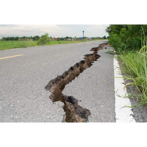
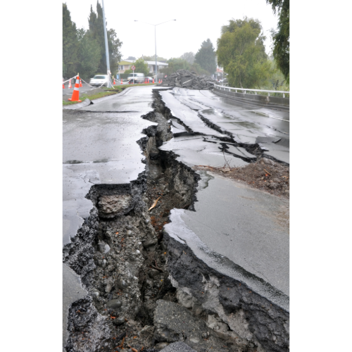
Roads can deform.
Pipelines can break.
Foundations can fail.
Earthquake danger maps therefore need more than fault locations.
They also need to consider the ground beneath our cities.
🏢 Buildings Determine Whether Earthquakes Become Disasters
Earthquakes themselves don’t necessarily kill people.
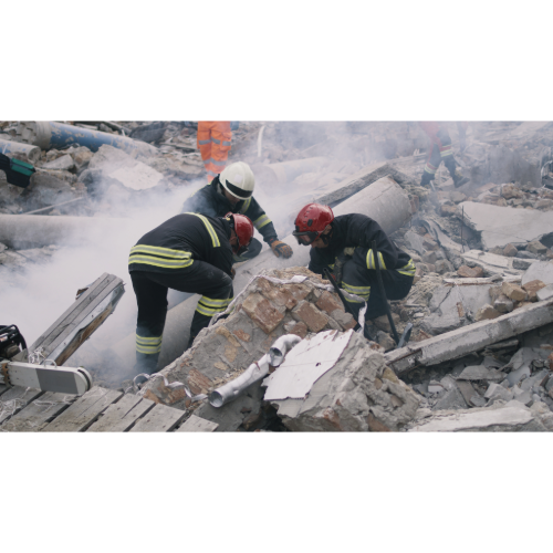
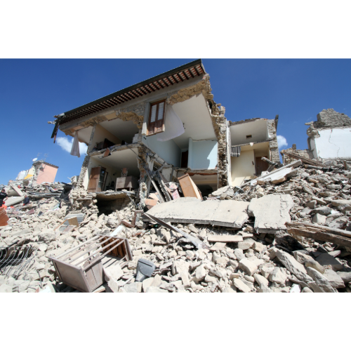
Collapsing buildings, falling objects, fires, landslides and tsunamis create much of the human toll.
That means two cities experiencing similar shaking can experience dramatically different outcomes.
Modern earthquake engineering can reduce the risk.
Buildings can be designed to flex.
Bridges can be strengthened.
Gas lines can automatically shut down.
Infrastructure can be reinforced.
Older buildings can be retrofitted.
Japan, Chile, California and New Zealand have all developed substantial earthquake engineering practices because of their seismic exposure.
📏 What Does Earthquake Magnitude Mean?
Earthquake magnitude describes the size of an earthquake at its source.
The scale is logarithmic.
That means the difference between magnitude 7 and magnitude 8 is much greater than the numbers might suggest.
But magnitude isn’t the same thing as local shaking intensity.
Damage depends on many factors:
📍 Distance from the earthquake
📏 Earthquake depth
🌎 Fault geometry
🏙️ Building construction
🪨 Local geology
👥 Population exposure
🌊 Whether a tsunami occurs
A relatively smaller shallow earthquake beneath a city can sometimes produce more local destruction than a larger earthquake far offshore.
⚠️ Can Scientists Predict Earthquakes?
Scientists can identify earthquake-prone faults.
They can estimate long-term probabilities.
They can measure tiny movements in Earth’s crust.
They can detect an earthquake within seconds after rupture begins.
But scientists currently cannot reliably predict the exact time, place and magnitude of a future major earthquake.
Earthquake early-warning systems are different.
They detect an earthquake after it begins and can sometimes provide seconds of warning before the strongest seismic waves arrive farther away.
Those seconds can still be valuable.
Trains can slow.
Machinery can stop.
People can take protective action.
But early warning is not earthquake prediction.
🌎 Earth’s Major Earthquake Danger Zones
Some of the planet’s most significant earthquake regions include:
🔥 Pacific Ring of Fire — Earth’s greatest seismic belt.
🇯🇵 Japan — Major subduction zones and tsunami exposure.
🇮🇩 Indonesia — Complex plate boundaries, megathrust earthquakes and tsunamis.
🇨🇱 Chile — One of Earth’s most powerful subduction zones.
🇺🇸 Alaska — America’s largest-earthquake environment.
🇺🇸 California — San Andreas and numerous other active faults.
🇲🇽 Mexico — Pacific subduction zone plus vulnerable major cities.
🇵🇭 Philippines — Multiple subduction zones and active faults.
🇳🇿 New Zealand — Pacific–Australian plate boundary.
🇹🇷 Turkey — Major strike-slip fault systems.
🇮🇷 Iran — Active continental collision zone.
🏔️ Himalayas — India–Eurasia continental collision.
🇳🇵 Nepal — Major Himalayan earthquake and landslide exposure.
🌎 The Three Great Earthquake Belts
Earthquakes form recognizable global patterns.
USGS identifies three principal earthquake zones.
🔥 1. Circum-Pacific Seismic Belt
Better known as the Ring of Fire, this is Earth’s dominant earthquake zone.
About 81% of the world’s largest earthquakes occur here.
It extends around much of the Pacific Ocean.
🏔️ 2. Alpide Earthquake Belt
This enormous zone extends from Indonesia through the Himalayas and Middle East toward the Mediterranean.
USGS says roughly 17% of the world’s largest earthquakes occur in this belt.
🌊 3. Mid-Ocean Ridge System
Earthquakes also occur where tectonic plates separate along underwater mountain chains.
The Mid-Atlantic Ridge is one example.
Many of these earthquakes occur far from major population centers.
🌍 Where Is Earth’s Greatest Earthquake Danger Zone?
There isn’t one single Earthquake Capital of the World.
Earthquake risk depends on the frequency and magnitude of earthquakes, local geology, population, building construction, tsunami exposure and many other factors.
But one global region clearly dominates:
🔥 The Pacific Ring of Fire.
USGS identifies the circum-Pacific seismic belt as the world’s greatest earthquake belt.
About 81% of Earth’s largest earthquakes occur around the Pacific rim.
The belt includes many of history’s greatest earthquakes.
The world’s largest instrumentally recorded earthquake — magnitude 9.5 — struck Chile in 1960.
The second largest — magnitude 9.2 — struck Alaska in 1964.
Other enormous earthquakes have occurred near Sumatra, Japan and Kamchatka.
Follow the Ring of Fire around the Pacific and you are effectively tracing one of the most powerful geological boundaries on Earth.
Chile → Central America → Mexico → California → Alaska → Russia → Japan → Philippines → Indonesia → New Zealand.
It is a nearly planet-spanning reminder that Earth’s surface is constantly moving.
Most of the time, we never notice.
Until suddenly we do.
❓ Earthquake Danger Zones — Frequently Asked Questions
Where do most large earthquakes occur?
Most of Earth’s largest earthquakes occur around the Pacific Ring of Fire, also known as the circum-Pacific seismic belt.
What percentage of the world’s largest earthquakes occur around the Ring of Fire?
According to USGS, approximately 81% of the world’s largest earthquakes occur along the circum-Pacific seismic belt.
What was the largest earthquake ever recorded?
The largest instrumentally recorded earthquake was the magnitude 9.5 Chile earthquake of May 22, 1960.
What was the largest U.S. earthquake?
The largest recorded U.S. earthquake was the magnitude 9.2 Alaska earthquake of 1964.
Does Japan have many earthquakes?
Yes. Japan lies near several active plate boundaries and subduction zones and experiences frequent earthquakes.
Why does Indonesia have so many earthquakes?
Indonesia lies within a complex tectonic region where several plates interact, including major subduction zones capable of producing very large earthquakes.
Does California have subduction-zone earthquakes?
Much of California’s famous earthquake activity is associated with transform faults such as the San Andreas. Farther north, the Cascadia Subduction Zone creates a different major earthquake hazard for northern California and the Pacific Northwest.
Can earthquakes cause tsunamis?
Yes. Large undersea earthquakes that significantly displace the seafloor can generate tsunamis.
Can scientists predict earthquakes?
Scientists cannot currently predict the exact time, location and magnitude of a future earthquake. They can identify hazardous faults, estimate probabilities and provide earthquake early warning after a rupture begins.
Where can I track earthquakes right now?
Use the Orbis Weather Real-Time Earthquake Map to follow earthquakes occurring around the world.