Tsunami Danger Zones: Most Tsunami-Prone Places on Earth
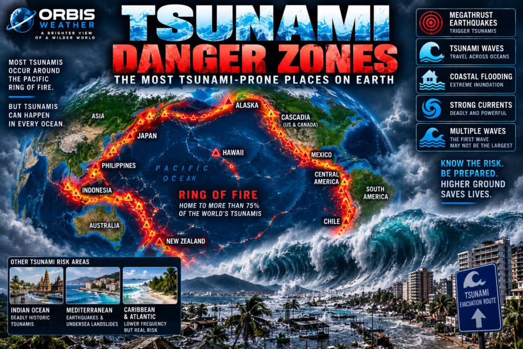

🌊 Tsunami Danger Zones: The Most Tsunami-Prone Places on Earth
The ocean can look perfectly calm.
Then the ground beneath it moves.
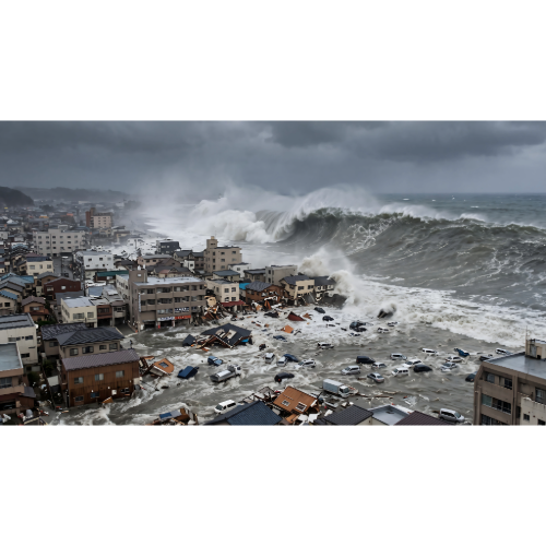
Within minutes, an enormous volume of seawater can be displaced, sending waves racing across an entire ocean.
A tsunami may cross thousands of miles of open water almost unnoticed.
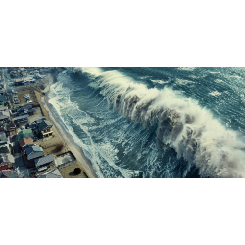
But when it reaches shallow coastal waters, everything changes.
The waves slow.
The water piles higher.
And a peaceful coastline can suddenly become one of the most dangerous places on Earth.
Tsunamis can occur in every ocean, but they are not distributed evenly.
One region dominates the historical record:
🔥 The Pacific Ring of Fire.
NOAA’s Global Historical Tsunami Database shows that approximately 78% of confirmed tsunami events between 1900 and 2015 occurred in the Pacific Ocean, particularly around the tectonically active Ring of Fire.
That creates an enormous tsunami danger corridor stretching from:
Japan → Philippines → Indonesia → Papua New Guinea → New Zealand → Chile → Peru → Mexico → California → Alaska → Aleutian Islands
But the Pacific isn’t the only danger zone.
The Indian Ocean, Mediterranean, Caribbean and northeastern Atlantic have all produced destructive tsunamis.
Understanding where they occur begins beneath the ocean floor.
🌎 What Causes a Tsunami?
Most tsunamis begin with an earthquake beneath or near the ocean.
But not every earthquake produces one.
For a major earthquake-generated tsunami to develop, there generally needs to be substantial displacement of the seafloor.
Large, shallow thrust earthquakes at subduction zones are particularly capable of doing this.
When part of the seafloor suddenly rises or falls, it pushes the enormous column of seawater above it.
That disturbance spreads outward.
A tsunami has begun.
But earthquakes aren’t the only cause.
Tsunamis can also be generated by:
🌎 Undersea earthquakes
🪨 Submarine landslides
⛰️ Coastal landslides
🌋 Volcanic eruptions or collapses
☄️ Extremely rare meteorite impacts
NOAA educational material indicates that earthquakes are responsible for the great majority of historical tsunamis, with landslides another significant source.
🔥 Pacific Ring of Fire — Earth’s Greatest Tsunami Zone
The Pacific Ocean is surrounded by enormous tectonic boundaries.
Many are subduction zones.
Here, one tectonic plate dives beneath another.
The boundary between them can become locked for decades or centuries while stress accumulates.
Eventually, the fault ruptures.
If a huge section of the seafloor moves vertically during that earthquake, an enormous tsunami can result.
USGS describes the Ring of Fire as the world’s most seismically and volcanically active zone.
The same geology that creates its earthquakes and volcanoes also explains its extraordinary tsunami history.
🇯🇵 Japan — One of Earth’s Great Tsunami Danger Zones
Few countries understand tsunami danger better than Japan.
Even the word tsunami comes from Japanese, meaning roughly “harbor wave.”
Japan sits beside enormous subduction zones capable of producing megathrust earthquakes.
On March 11, 2011, a magnitude 9.1 earthquake occurred offshore northeastern Japan.
The seafloor moved dramatically.
A massive tsunami followed.
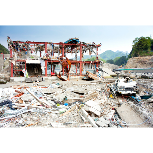
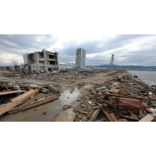
Water swept across portions of Japan’s northeastern coastline, destroying communities and infrastructure.
The disaster demonstrated how quickly a tsunami can follow a nearby earthquake.
In a local tsunami event, people near the source may have only minutes to reach safety.
That is why natural warning signs are so important.
If you are near the coast and experience strong or prolonged earthquake shaking, don’t wait to see a wave.
Move toward high ground.
🇮🇩 Indonesia — Where the 2004 Disaster Began
Indonesia occupies another of Earth’s greatest tsunami danger zones.
Off Sumatra, tectonic plates meet along the Sunda subduction zone.
On December 26, 2004, a magnitude 9.1 megathrust earthquake ruptured offshore northern Sumatra.
The movement displaced an enormous volume of ocean water.
A catastrophic tsunami spread across the Indian Ocean.
Indonesia was struck first.
But the waves continued outward.
Thailand was hit.
Sri Lanka was hit.
India was hit.
The Maldives were affected.
Waves eventually reached the coast of Africa.
More than 220,000 people were killed or remained missing across the affected region, making it one of the deadliest natural disasters of modern history.
The 2004 disaster changed the world’s understanding of tsunami risk.
It also accelerated development of tsunami warning systems across the Indian Ocean.
🌊 The Indian Ocean — A Danger Once Underestimated
Before 2004, much of the world’s tsunami preparedness infrastructure was concentrated around the Pacific.
The Indian Ocean disaster demonstrated why that wasn’t enough.
Subduction zones around Indonesia can generate enormous earthquakes capable of sending waves throughout the basin.
Countries facing Indian Ocean tsunami exposure include:
🇮🇩 Indonesia
🇹🇭 Thailand
🇱🇰 Sri Lanka
🇮🇳 India
🇲🇻 Maldives
🇲🇲 Myanmar
and portions of the East African coastline.
A tsunami generated near Indonesia can therefore become an international disaster within hours.
🇵🇭 Philippines — Surrounded by Tsunami Sources
The Philippines faces an extraordinary collection of natural hazards.
Typhoons arrive from the Pacific.
Volcanoes rise across the islands.
Earthquakes occur along numerous active faults and trenches.
And several of those offshore tectonic zones can generate tsunamis.
The country is surrounded by deep ocean trenches and complex plate boundaries.
Coastal communities can therefore face both local and distant tsunami threats.
A locally generated tsunami is particularly dangerous because warning times can be very short.
🇵🇬 Papua New Guinea and the Solomon Islands
The southwest Pacific contains another complicated network of active tectonic boundaries.
Papua New Guinea and the Solomon Islands experience frequent earthquakes.
Some generate tsunamis.
In 2007, a magnitude 8.1 earthquake along the Solomon Islands subduction zone generated a damaging tsunami.
USGS identifies this region as part of the broader Pacific Ring of Fire.
Steep coastal terrain also creates another danger:
landslide-generated tsunamis.
Earthquakes can destabilize underwater slopes or coastal mountains, producing additional waves.
🇳🇿 New Zealand — Tectonic Plates Beneath the Coast
New Zealand sits along the boundary between the Pacific and Australian tectonic plates.
That creates significant earthquake and tsunami exposure.
Several offshore fault systems can potentially generate local tsunamis.
The country can also receive distant tsunamis generated elsewhere around the Pacific.
This combination is important.
A distant tsunami may provide hours of warning.
A local tsunami may arrive far faster.
The closer the earthquake source is to the coastline, the less time people may have to evacuate.
🇨🇱 Chile — A Pacific Tsunami Generator
Across the Pacific lies another extraordinary tsunami zone.
Chile.
The Nazca Plate is being forced beneath the South American Plate along the country’s coastline.
This subduction zone has produced some of Earth’s greatest earthquakes.
On May 22, 1960, the magnitude 9.5 Great Chilean earthquake became the largest instrumentally recorded earthquake in history.
It generated a Pacific-wide tsunami.
The waves didn’t stop at Chile.
They crossed the ocean.
Hawaii was struck.
Japan was struck.
Other Pacific coastlines recorded the tsunami.
One earthquake had created an ocean-wide disaster.
🇵🇪 Peru and Ecuador — The Andean Tsunami Coast
The same subduction system continues north along western South America.
Peru and Ecuador have experienced major earthquakes and tsunamis throughout history.
Coastal cities along this region sit relatively close to offshore earthquake sources.
That can dramatically shorten evacuation time.
The lesson is similar to Japan:
If severe earthquake shaking occurs near a tsunami-prone coastline, the earthquake itself may be the warning.
🇺🇸 Alaska — America’s Greatest Tsunami Zone
Alaska contains some of the United States’ most significant tsunami hazards.
The Alaska-Aleutian subduction system is capable of producing enormous earthquakes.
On March 27, 1964, the magnitude 9.2 Great Alaska earthquake generated a Pacific-wide tsunami.
The tsunami caused damage and deaths not only in Alaska but also along portions of the U.S. West Coast.
USGS reports that the 1964 tsunami caused fatalities in Alaska, Oregon and California and produced damage across the Pacific.
But Alaska faces another remarkable tsunami hazard:
landslides.
🌊 Lituya Bay — The Giant Wave
In 1958, an earthquake triggered an enormous landslide into Lituya Bay, Alaska.
The sudden displacement of water produced an extraordinary local wave.
Evidence showed water reached approximately 1,720 feet above sea level on the opposite mountainside.
This wasn’t a typical ocean-wide tsunami.
It was an extreme local landslide-generated wave.
Lituya Bay demonstrates why tsunami generation isn’t limited to movement along giant offshore faults.
When enormous masses of rock collapse into confined bodies of water, the resulting displacement can be astonishing.
🇺🇸 Hawaii — In the Middle of the Pacific
Hawaii isn’t located directly beside one of the world’s largest subduction zones.
But its position in the center of the Pacific creates a different type of exposure.
Tsunamis generated around the Ring of Fire can cross the ocean and reach the Hawaiian Islands.
USGS records significant Hawaiian tsunamis generated by earthquakes in:
🇺🇸 Alaska and the Aleutians
🇨🇱 Chile
🇷🇺 Kamchatka
The devastating 1946 tsunami originated from an earthquake along the Aleutian subduction zone.
USGS says runup heights reached roughly 33–55 feet in Hawaii and 159 people were killed.
Hawaii demonstrates that a coastline doesn’t need to be beside the earthquake to face serious tsunami danger.
🇺🇸 Cascadia — The Pacific Northwest’s Sleeping Giant
Offshore northern California, Oregon, Washington and British Columbia lies one of North America’s most important tsunami sources:
The Cascadia Subduction Zone.
The fault stretches approximately 750 miles — about 1,200 kilometers — along the Pacific Northwest.
Geological evidence shows Cascadia has produced enormous earthquakes in the past.
Its most recent great rupture occurred in 1700.
That earthquake generated a tsunami that crossed the Pacific and was recorded in historical documents in Japan.
USGS research indicates Cascadia has produced magnitude 8–9 earthquakes in the geological past.
A future major Cascadia earthquake could create severe shaking and tsunami hazards along portions of the Pacific Northwest coastline.
🇺🇸 California — Local and Distant Tsunami Threats
California’s tsunami danger varies dramatically by location.
Much of the state’s famous earthquake hazard comes from strike-slip faults such as the San Andreas, which are generally less efficient tsunami generators than major offshore thrust faults.
But California can receive tsunamis generated elsewhere around the Pacific.
The 1964 Alaska tsunami caused particularly significant damage in Crescent City, California.
Northern California also lies near the southern end of the Cascadia Subduction Zone.
Coastal communities therefore need to consider both distant and local tsunami sources.
🇷🇺 Kamchatka and the Kuril Islands
Across the northern Pacific, Russia’s Kamchatka Peninsula and Kuril Islands sit beside another major subduction zone.
Large earthquakes here can generate Pacific-wide tsunamis.
Because the Pacific is so interconnected, a major earthquake near Russia can trigger alerts thousands of miles away.
Hawaii, Japan, Alaska and the U.S. West Coast may all monitor the same event.
🌊 The Mediterranean Has Tsunami Risk Too
Tsunamis aren’t just a Pacific problem.
The Mediterranean has a long history of earthquakes, volcanoes and tsunamis.
Potential source regions include parts of:
🇬🇷 Greece
🇮🇹 Italy
🇹🇷 Turkey
🇨🇾 Cyprus
and surrounding areas.
UNESCO’s Intergovernmental Oceanographic Commission warns that tsunami risk in the Mediterranean and northeastern Atlantic is real and actively supports regional warning and preparedness systems.
The region’s dense coastal population makes preparedness particularly important.
🇵🇹 Portugal — The 1755 Lisbon Disaster
On November 1, 1755, a massive earthquake struck near Portugal.
Lisbon experienced devastating shaking.
Fires followed.
Then a tsunami struck the coastline.
The disaster affected Portugal, Spain, Morocco and other Atlantic locations.
It remains one of Europe’s most famous natural catastrophes.
The 1755 event is also an important reminder:
The Atlantic can produce major tsunamis.
They are less frequent than in the Pacific, but they are not impossible.
🌴 The Caribbean — America’s Other Tsunami Zone
The Caribbean also contains active tectonic boundaries capable of producing tsunamis.
Puerto Rico and the U.S. Virgin Islands are particularly important.
USGS notes that the region has experienced damaging historical tsunamis.
A tsunami associated with an 1867 event near the Virgin Islands reportedly produced waves around 12 meters in some locations, while the 1918 Mona Passage earthquake generated a destructive tsunami affecting Puerto Rico.
The Caribbean therefore represents a genuine tsunami danger zone even though events are much less frequent than around the Pacific.
🌊 Why Tsunamis Become Dangerous Near Shore
A tsunami behaves very differently from an ordinary breaking wave.
In deep ocean water, tsunami energy can travel across enormous distances.
The wave may have relatively small height offshore.
But as it enters shallower water, it slows.
The wavelength shortens.
Water begins piling upward.
The result may not look like a giant surfing wave.
Sometimes the ocean rapidly rises and surges inland like an enormous flood.
Other times a wall of turbulent water approaches.
And there may be multiple waves.
The first wave isn’t necessarily the largest.
⚠️ Natural Tsunami Warning Signs
Technology is important.
But near the tsunami source, nature may provide the fastest warning.
Recognize three major signs:
🌎 FEEL — Strong or prolonged earthquake shaking
🌊 SEE — The ocean suddenly rises or retreats unusually far
👂 HEAR — A loud roar coming from the ocean
If any of these occur in a tsunami hazard zone:
Move inland and to high ground immediately.
Don’t wait for an official alert.
Don’t go toward the beach to watch.
Don’t return until authorities say the danger has passed.
🛰️ How Tsunami Warning Systems Work
Modern tsunami warning networks combine several technologies.
🌎 Seismometers detect earthquakes.
🌊 Sea-level gauges measure changes near coastlines.
📡 Deep-ocean instruments can detect pressure changes associated with passing tsunami waves.
🛰️ Satellites transmit observations.
💻 Computer models estimate arrival times and possible wave impacts.
Scientists can then issue tsunami watches, advisories or warnings.
For distant tsunamis, this system can provide valuable time.
For nearby tsunamis, natural warning signs may still be critical because waves can arrive before a detailed official forecast is available.
🌍 Major Tsunami Danger Zones
Some of Earth’s most important tsunami-prone regions include:
🇯🇵 Japan — Major subduction zones immediately offshore.
🇮🇩 Indonesia — Sunda megathrust and Indian Ocean exposure.
🇵🇭 Philippines — Numerous trenches and offshore earthquake sources.
🇵🇬 Papua New Guinea & Solomon Islands — Complex plate boundaries and landslide potential.
🇳🇿 New Zealand — Local and distant Pacific tsunami exposure.
🇨🇱 Chile — One of Earth’s most powerful subduction zones.
🇵🇪 Peru & 🇪🇨 Ecuador — Major Pacific subduction coastline.
🇺🇸 Alaska & Aleutians — Megathrust earthquakes and landslide tsunamis.
🇺🇸 Hawaii — Exposed to distant tsunamis from across the Pacific.
🇺🇸 Pacific Northwest — Cascadia Subduction Zone.
🇷🇺 Kamchatka & Kuril Islands — Major northern Pacific tsunami source.
🌊 Indian Ocean — Indonesia-to-South Asia tsunami corridor.
🌊 Mediterranean — Earthquake and volcanic tsunami sources.
🌴 Caribbean — Lower-frequency but genuine tsunami hazard.
🌎 Where Is Earth’s Greatest Tsunami Danger Zone?
There isn’t one single Tsunami Capital of the World.
Risk depends on earthquake sources, coastal geography, elevation, population, warning time and preparedness.
But the global historical record points overwhelmingly toward one ocean:
🌊 The Pacific.
NOAA data show approximately 78% of confirmed tsunamis between 1900 and 2015 occurred in the Pacific Ocean, especially around the Ring of Fire.
The reason is geological.
The Pacific is surrounded by enormous subduction zones capable of producing Earth’s largest earthquakes.
Those same earthquakes can displace the seafloor and launch tsunamis across entire ocean basins.
The great tsunami danger corridor therefore follows the same geological arc we’ve already seen in the Orbis Weather Earthquake Danger Zones and Volcano Danger Zones:
Chile → Peru → Mexico → Cascadia → Alaska → Kamchatka → Japan → Philippines → Indonesia → New Zealand.
But history also warns against ignoring the rest of the world.
The 2004 Indian Ocean disaster showed that devastating tsunamis can strike outside the Pacific.
The 1755 Lisbon disaster demonstrated the Atlantic’s potential.
The Mediterranean and Caribbean remain active tsunami regions.
Tsunamis may be rare at any individual coastline.
But when they occur, they can transform thousands of miles of coast in a matter of hours.
The most important warning may be the simplest:
If the ground shakes strongly near the coast, don’t wait to see what the ocean does next.
Go to high ground.
❓ Tsunami Danger Zones — Frequently Asked Questions
Where do most tsunamis occur?
The Pacific Ocean records the majority of historical tsunamis, especially around the tectonically active Ring of Fire.
What causes most tsunamis?
Most are generated by earthquakes beneath or near the ocean that significantly displace the seafloor.
Can volcanoes cause tsunamis?
Yes. Volcanic explosions, flank collapses and other volcanic processes can displace water and generate tsunamis.
Can landslides cause tsunamis?
Yes. Both underwater landslides and large landslides entering the ocean can generate destructive waves.
What was the deadliest modern tsunami?
The December 26, 2004 Indian Ocean tsunami was one of the deadliest natural disasters in modern history, killing or leaving missing more than 220,000 people across multiple countries.
Does the United States have tsunami danger zones?
Yes. Alaska, Hawaii, the Pacific Northwest, California, Puerto Rico and the U.S. Virgin Islands have significant tsunami hazards.
Can Florida get a tsunami?
Tsunami risk along Florida and the Gulf of Mexico is much lower than along the Pacific coast. USGS notes that historically recorded tsunami waves along the U.S. Gulf Coast have been small.
Can the Atlantic Ocean produce tsunamis?
Yes. The Atlantic has produced destructive tsunamis, including the famous 1755 Lisbon event and the 1929 Grand Banks tsunami near Newfoundland.
What should I do if I feel a strong earthquake at the coast?
Once the shaking stops enough to move safely, immediately head inland or toward high ground if you’re in a tsunami hazard zone. Don’t wait for an official warning if natural warning signs indicate a possible local tsunami.
Is the first tsunami wave always the largest?
No. Multiple waves can arrive over several hours, and later waves may be larger.
Where can I track earthquakes and tsunami threats?
Use the Orbis Weather Real-Time Earthquake Map and global natural-hazard coverage to monitor major earthquakes and developing tsunami threats.