Hurricane Danger Zones: Most Hurricane-Prone Places on Earth

🌀 Hurricane Danger Zones: The Most Hurricane-Prone Places on Earth
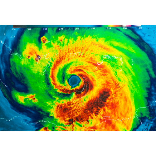
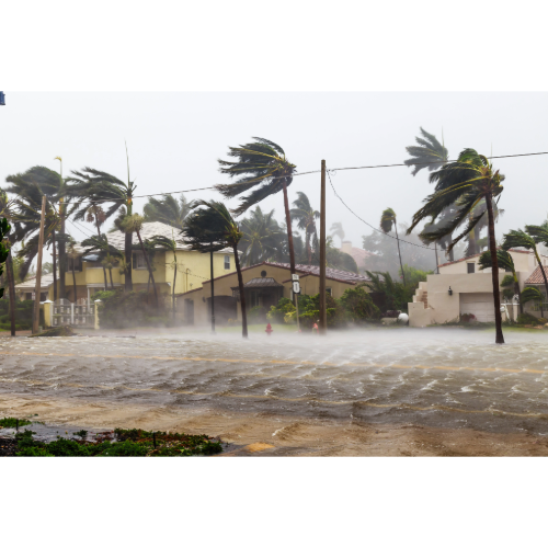
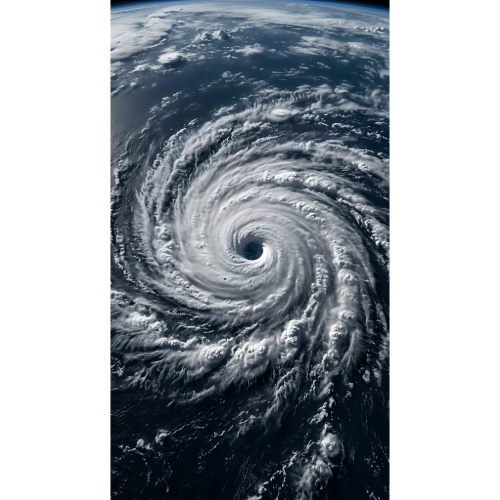
Hurricanes are among the most powerful weather systems on Earth. A single storm can generate destructive winds, push enormous amounts of seawater onto the coast, produce catastrophic rainfall and flooding, and even spawn tornadoes hundreds of miles from its center.
But hurricane danger isn’t spread evenly around the world.
Certain coastlines sit directly within well-established tropical cyclone corridors, placing them in the path of storms again and again.
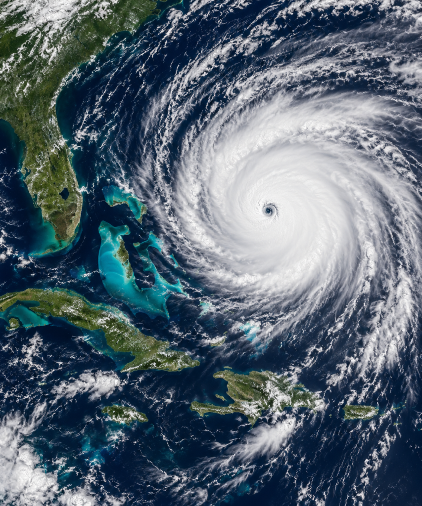
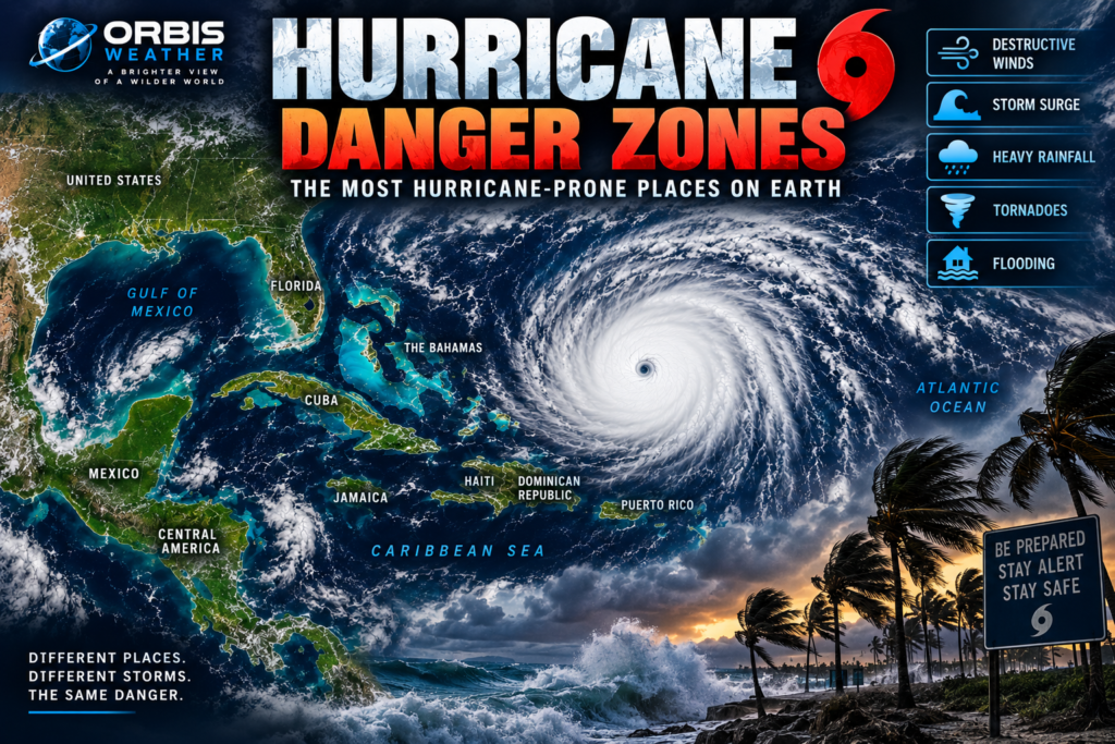
In the Atlantic, some of the greatest hurricane exposure is found across the Caribbean, Bahamas, Florida and Gulf of Mexico coastline.
There is no scientifically meaningful single “Hurricane Capital of the World.” The answer changes depending on whether we measure hurricane strikes, major hurricanes, storm surge, rainfall, population exposure or economic damage.
But history clearly reveals several extraordinary hurricane danger zones.
🏝️ The Caribbean — A Hurricane Crossroads
The Caribbean sits directly within one of Earth’s great tropical cyclone corridors.
Many Atlantic hurricanes begin as disturbances moving westward from Africa. As these systems cross the warm tropical Atlantic, some develop into tropical storms and hurricanes before reaching the Caribbean.
Other storms form closer to the Caribbean itself.
That places islands including Puerto Rico, Hispaniola, Jamaica, Cuba, the Cayman Islands and the Lesser Antilles within potential hurricane pathways.
A hurricane crossing the Caribbean can encounter exceptionally warm ocean water and favorable atmospheric conditions capable of supporting rapid strengthening.
Some storms then continue toward Mexico or Central America. Others turn toward Cuba, the Bahamas, Florida or the Gulf of Mexico.
This makes the Caribbean more than simply a hurricane-prone region.
It is one of the great crossroads of Atlantic hurricane activity.
🇧🇸 The Bahamas — Islands in the Hurricane Corridor
The Bahamas occupy a particularly exposed position between the tropical Atlantic, Florida and the Caribbean.
The archipelago extends across hundreds of miles of warm ocean.
Hurricanes approaching from the east or southeast can move directly through the islands before approaching Florida or turning north into the western Atlantic.
The Bahamas also demonstrate why hurricane category alone doesn’t determine hurricane danger.
Many islands are extremely low lying.
That makes storm surge and large waves particularly serious threats.
A powerful or slow-moving hurricane can push seawater across coastal communities while torrential rainfall adds additional flooding.
For small islands surrounded by ocean, there may be very little terrain available to escape the water.
🇺🇸 Florida — America’s Hurricane Hotspot
If one American state has become synonymous with hurricanes, it is Florida.
There is a very good reason.
Florida extends between the Atlantic Ocean and Gulf of Mexico, with the Caribbean immediately to its south.
NOAA’s Hurricane Research Division reports that approximately 40% of hurricanes directly hitting the United States have affected Florida in its historical database.
That extraordinary exposure results partly from geography.
Florida can be approached by hurricanes from several directions.
Storms can arrive through the Bahamas from the Atlantic.
They can move north from the Caribbean.
They can cross Cuba or the Florida Straits.
Others enter the Gulf of Mexico before turning toward Florida’s west coast or Panhandle.
Some hurricanes even cross the Florida peninsula and emerge over water again.
The result is a state where almost every coastline has some degree of hurricane history.
🌴 South Florida and the Florida Keys
South Florida occupies an especially exposed position.
The Florida Keys extend southwest between the Atlantic Ocean and Gulf of Mexico, while Miami and Florida’s southeastern coastline sit immediately west of the Bahamas.
Hurricanes moving through the Caribbean, Bahamas or Florida Straits can therefore approach this region from several directions.
Wind isn’t the only concern.
South Florida’s low elevation means storm surge and coastal flooding can become major hazards.
The Keys are particularly vulnerable because communities occupy narrow islands with water on both sides.
🌊 Southwest Florida
Southwest Florida represents another major hurricane danger zone.
Communities including Marco Island, Naples, Fort Myers and the Charlotte Harbor region face hurricanes approaching from the Caribbean and Gulf of Mexico.
Storm surge is one of the greatest concerns.
Strong hurricane winds can push Gulf water toward the coast, causing water levels to rise dramatically.
The precise impact can change enormously depending on a hurricane’s track.
A relatively small change in the position of the eye can determine whether winds push water toward the coastline or temporarily away from it.
Hurricane size, forward speed and angle of approach also matter.
That’s why people should never judge their hurricane danger simply by looking at the forecast line marking the projected center.
🌴 Tampa Bay and Florida’s West Coast
Florida’s west coast continues north toward another important hurricane exposure zone: Tampa Bay.
The shape of the coastline and the large population surrounding the bay make storm surge a major concern when hurricanes approach from the Gulf of Mexico.
But Tampa Bay illustrates another important lesson about hurricane risk.
A place does not need to experience frequent direct hits to have significant hurricane exposure.
NOAA notes that long quiet periods can occur between major hurricane strikes at individual cities. Historical averages therefore should never be interpreted as schedules for when the next hurricane will arrive.
🌊 Florida’s Atlantic Coast
Florida’s Atlantic coast faces a different hurricane pathway.
Storms moving through or north of the Bahamas can approach Miami, Fort Lauderdale, West Palm Beach, the Treasure Coast, Space Coast and northeastern Florida.
Some hurricanes continue northward parallel to the coastline, threatening Georgia and the Carolinas.
Others turn inland.
And hurricanes don’t need to make direct landfall for coastal communities to experience dangerous conditions.
Large storms can produce hurricane-force winds, storm surge and enormous waves far from the exact location of the eye.
🇺🇸 Louisiana — Hurricanes Meet a Vulnerable Coast
Louisiana is another major American hurricane danger zone.
The state’s southern coastline consists of extensive wetlands, bays, bayous and low-lying communities bordering the Gulf of Mexico.
NOAA’s historical statistics show Louisiana has repeatedly experienced major hurricane strikes.
Storm surge is particularly dangerous.
A large hurricane crossing the Gulf can push enormous amounts of seawater toward the northern Gulf Coast.
New Orleans presents an additional challenge because portions of the metropolitan region lie below sea level and depend on levees, floodwalls and pumps for flood protection.
Louisiana’s hurricane danger therefore combines wind, rainfall, coastal flooding and storm surge.
🇺🇸 Texas — The Western Gulf Hurricane Zone
Continue west along the Gulf Coast and another major hurricane zone appears.
Texas.
NOAA’s updated historical database lists 64 direct hurricane hits in Texas from 1851 through 2024, including 19 major hurricanes.
Texas has an enormous coastline stretching from Louisiana toward Mexico.
That means hurricane exposure varies considerably between the upper, central and southern Texas coast.
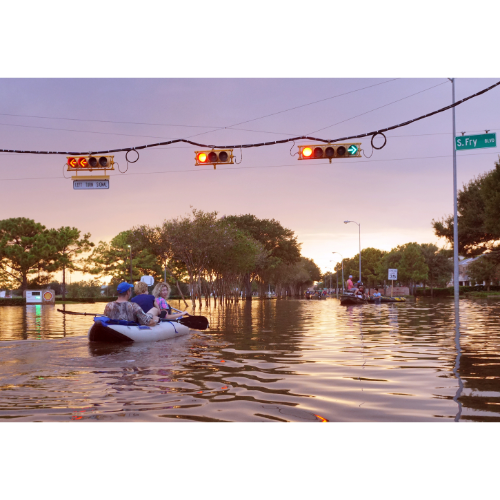
The region around Houston and Galveston also demonstrates why rainfall must be considered alongside wind and storm surge.
A tropical cyclone that slows after reaching the coast can produce extraordinary rainfall totals.
Water may continue rising long after the strongest winds have weakened.
Hurricanes can therefore become enormous inland flood disasters.
🇺🇸 North Carolina and the Outer Banks
The Gulf Coast isn’t America’s only major hurricane corridor.
North Carolina extends into the western Atlantic, placing the state in the path of hurricanes curving north from the Caribbean and Bahamas.
The Outer Banks are especially exposed.
These long, narrow barrier islands face the Atlantic Ocean directly.
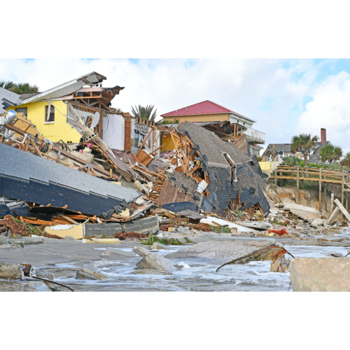
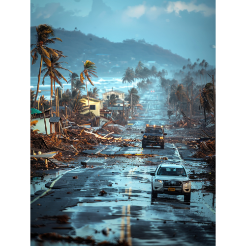
Hurricanes can produce powerful winds, huge waves, beach erosion, storm surge and ocean overwash capable of cutting roads and temporarily isolating communities.
Some storms never technically make landfall in North Carolina yet still produce serious coastal impacts as they pass offshore.
🇲🇽 Mexico — Hurricanes From Two Oceans
Mexico faces an unusual hurricane problem.
The country can experience tropical cyclones from two major hurricane basins.
The eastern side faces the Caribbean Sea and Gulf of Mexico.
The western coastline faces the eastern Pacific.
The Yucatán Peninsula lies directly in the path of some hurricanes crossing the western Caribbean.
After crossing the peninsula, storms can emerge into the Gulf of Mexico, where favorable conditions sometimes allow them to strengthen again.
Mexico’s Pacific coastline faces a separate population of eastern Pacific hurricanes.
Mountains add another hazard.
When hurricane moisture encounters steep terrain, enormous amounts of rain can fall over relatively small areas.
That can trigger devastating flash floods and landslides.
🌎 Central America — Where Hurricane Rain Becomes Dangerous
Parts of Belize, Honduras, Nicaragua, Guatemala and surrounding Central America are exposed to tropical systems moving through the Caribbean.
But hurricane wind isn’t necessarily the greatest threat.
Central America’s mountainous terrain can dramatically enhance rainfall.
Moist tropical air is forced upward along mountains, cooling and producing intense precipitation.
The result can be:
🌧️ Torrential rainfall
🌊 Flash flooding
🏞️ River flooding
🪨 Landslides
🚧 Washed-out roads and bridges
🏠 Isolated communities
A hurricane can therefore weaken rapidly after moving inland while its rainfall threat becomes even more dangerous.
🌊 Storm Surge — When the Ocean Moves Inland
Hurricane winds receive enormous attention, but storm surge can be one of the most dangerous hurricane hazards.
Storm surge occurs when powerful winds push ocean water toward the coastline.
Water can rise rapidly and move inland, flooding roads, buildings and entire communities.
The amount of surge doesn’t depend solely on hurricane category.
Several factors matter:
🌊 Hurricane size
🌀 Wind intensity
➡️ Direction of movement
⏱️ Forward speed
🗺️ Shape of the coastline
🌊 Depth of coastal waters
📍 Exact hurricane track
This is why two hurricanes with similar maximum wind speeds can produce dramatically different storm-surge impacts.
🌧️ Hurricane Rainfall — The Danger Can Travel Hundreds of Miles Inland
Hurricane danger does not end at the coastline.
Tropical cyclones contain enormous quantities of atmospheric moisture.
After landfall, that moisture can travel hundreds of miles inland.
If the storm slows down, rain may repeatedly fall over the same locations.
Rivers begin rising.
Roads disappear beneath floodwater.
Urban drainage systems become overwhelmed.
Mountain slopes can collapse.
Communities far from the ocean can experience devastating flooding even after the storm has weakened below hurricane strength.
A hurricane doesn’t need hurricane-force winds to remain dangerous.
🌪️ Hurricanes Can Produce Tornadoes
Hurricanes can also produce tornadoes.
These tornadoes often develop within outer rainbands where low-level wind shear and atmospheric rotation become favorable.
They may occur dozens or even hundreds of miles from the hurricane’s center.
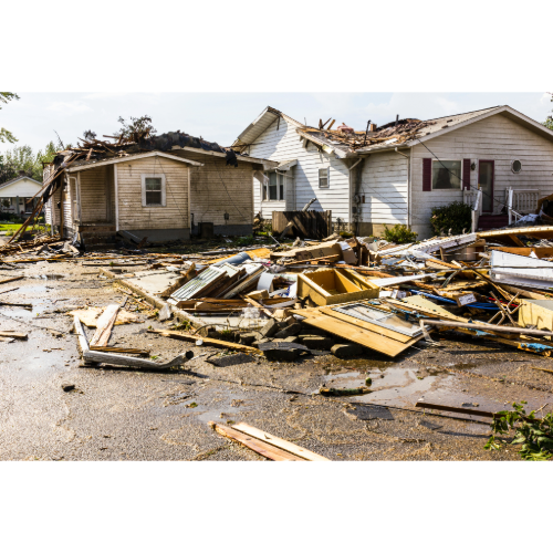
Although tropical-cyclone tornadoes are usually much smaller than the hurricane itself, they can create localized corridors of significant damage.
It is another reason hurricane warnings should be taken seriously even far from the projected eye.
🌀 Why Hurricane Category Doesn’t Tell the Whole Story
The familiar Category 1 through Category 5 hurricane scale describes one thing:
Maximum sustained wind speed.
It does not directly measure:
🌊 Storm surge
🌧️ Rainfall
🏞️ River flooding
🌪️ Tornadoes
📏 Hurricane size
⏱️ Storm duration
That distinction is extremely important.
A large, slow-moving hurricane can produce catastrophic flooding even if its maximum winds aren’t at the highest categories.
Likewise, a compact but extremely intense hurricane may produce devastating wind damage near its core.
Category matters — but category alone does not define hurricane danger.
🌍 Major Hurricane Danger Zones
Some of the Atlantic basin’s most significant hurricane danger zones include:
🇧🇸 Bahamas — Direct Atlantic hurricane exposure, storm surge, waves and wind.
🏝️ Caribbean Islands — Major hurricane corridors with wind, surge, flooding and landslide threats.
🇺🇸 Florida — Exposure from the Atlantic, Caribbean and Gulf of Mexico.
🇺🇸 Louisiana — Serious storm-surge exposure along the northern Gulf Coast.
🇺🇸 Texas — Hurricanes, storm surge and extreme rainfall along the western Gulf.
🇺🇸 North Carolina — Atlantic hurricanes, Outer Banks flooding and coastal erosion.
🇲🇽 Mexico — Hurricanes from both Atlantic and eastern Pacific basins.
🌎 Central America — Caribbean hurricanes combined with extreme rainfall, flooding and landslides.
🇨🇺 Cuba — Located directly within major Caribbean hurricane pathways.
🇵🇷 Puerto Rico — Exposed to hurricanes moving west and northwest through the tropical Atlantic and northeastern Caribbean.
NOAA’s Historical Hurricane Tracks database contains more than 13,000 tropical cyclone tracks, providing a striking visualization of how repeatedly storms have traveled through these regions.
🌀 Where Are Earth’s Greatest Hurricane Danger Zones?
There isn’t one single hurricane capital.
Instead, the Atlantic contains a broad hurricane danger corridor stretching through:
Caribbean → Bahamas → Florida → Gulf of Mexico → U.S. Gulf Coast
Florida stands out particularly strongly in the historical U.S. record. NOAA reports that about 40% of U.S. hurricane direct hits have affected Florida, while Florida and Texas together account for a large share of major-hurricane strikes.
But hurricane history also teaches an important lesson.
Past strikes tell us where hurricanes have occurred — not where the next hurricane will strike.
A coastline that hasn’t experienced a major hurricane for decades isn’t necessarily safer than one hit recently.
Every hurricane is different.
The track matters.
The size matters.
The speed matters.
The rainfall matters.
And along the coast, the direction of the wind can determine whether the ocean retreats or comes rushing inland.
That is why Orbis Weather tracks more than the center of a hurricane.
Wind, storm surge, rainfall, flooding and tornadoes all determine the true danger zone.
❓ Hurricane Danger Zones — Frequently Asked Questions
What is the most hurricane-prone U.S. state?
Florida has experienced more direct hurricane hits than any other U.S. state in NOAA’s historical statistics. NOAA says approximately 40% of U.S. hurricanes have affected Florida.
Why does Florida get so many hurricanes?
Florida sits between the Atlantic Ocean and Gulf of Mexico and immediately north of the Caribbean. Hurricanes can therefore approach the state from several directions.
What parts of Florida are vulnerable to hurricanes?
Virtually the entire Florida coastline has hurricane exposure. Particularly important areas include the Florida Keys, South Florida, Southwest Florida, Tampa Bay, the Panhandle and Atlantic coast.
Are the Bahamas hurricane-prone?
Yes. The Bahamas lie within a major Atlantic hurricane corridor between the tropical Atlantic, Caribbean and Florida.
Does Texas get many hurricanes?
Yes. NOAA’s historical database lists 64 Texas direct hurricane hits between 1851 and 2024, including 19 major hurricanes.
Can a Category 1 hurricane still be dangerous?
Yes. Hurricane category measures maximum sustained wind speed. A Category 1 hurricane can still produce dangerous storm surge, extreme rainfall, flooding, tornadoes and damaging waves.
Can hurricanes produce tornadoes?
Yes. Tornadoes can develop within hurricane rainbands, sometimes considerable distances from the storm’s center.
Is storm surge only dangerous near the eye?
No. Storm surge can extend far from the hurricane’s center, particularly with large storms. Local coastline shape and wind direction strongly influence which communities experience the highest water.
Can hurricanes cause flooding far inland?
Yes. Tropical moisture can travel hundreds of miles inland, producing flash flooding and river flooding long after a hurricane has moved away from the coastline.
Where can I track hurricanes?
Orbis Weather provides tropical tracking for the Atlantic, Pacific and Western Pacific, along with global storm maps and hurricane updates.