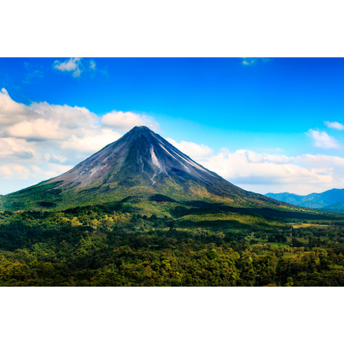
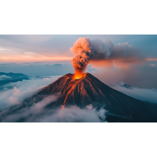
Volcano Danger Zones: Most Volcano-Prone Places on Earth
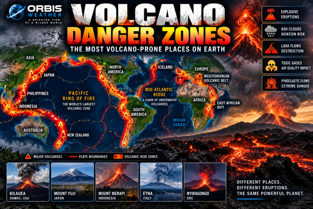

🌋 Volcano Danger Zones: The Most Volcano-Prone Places on Earth
Earth is not a quiet planet.
Far beneath our feet, tremendous heat drives geological processes that move tectonic plates, build mountains, open oceans and create volcanoes.
Most of the time, these forces operate almost invisibly.
Then a volcano awakens.
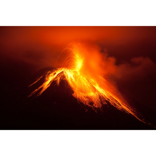
Magma rises toward the surface. Earthquakes shake the mountain. Gas escapes. Ash explodes into the atmosphere. Lava pours across the landscape.
And in the most dangerous eruptions, superheated clouds of ash, rock and gas can race down a volcano at extraordinary speed.
Volcanoes occur across much of the world, but they are not randomly distributed.
They cluster along tectonic plate boundaries and several enormous volcanic belts.
And the greatest of them all surrounds the Pacific Ocean:
🔥 The Pacific Ring of Fire.
More than half of the world’s active volcanoes above sea level encircle the Pacific, according to the U.S. Geological Survey.
From Indonesia and the Philippines through Japan and Russia, across Alaska and the Americas and south toward New Zealand, the Ring of Fire contains some of Earth’s most active and dangerous volcanic landscapes.
🔥 The Pacific Ring of Fire — Earth’s Great Volcanic Belt
Look at a global map of volcanoes and a remarkable pattern appears.
Thousands of miles of volcanoes trace the edges of the Pacific Ocean.
This enormous arc is commonly known as the Ring of Fire.
It passes through or near:
🇮🇩 Indonesia
🇵🇭 Philippines
🇯🇵 Japan
🇷🇺 Russia
🇺🇸 Alaska
🇺🇸 Western United States
🇲🇽 Mexico
🇬🇹 Guatemala
🇸🇻 El Salvador
🇳🇮 Nicaragua
🇨🇷 Costa Rica
🇨🇴 Colombia
🇪🇨 Ecuador
🇵🇪 Peru
🇨🇱 Chile
🇳🇿 New Zealand
Many of these volcanoes form above subduction zones.
Here, one tectonic plate is forced beneath another.
As geological processes associated with subduction generate magma, that magma can rise toward Earth’s surface.
Over millions of years, chains of volcanoes develop.
The result is one of the most spectacular — and hazardous — geological regions on Earth.
🇮🇩 Indonesia — One of Earth’s Great Volcano Countries
Few countries demonstrate the power of volcanism better than Indonesia.
The nation stretches across thousands of islands near the boundaries of several tectonic plates.
The Smithsonian Global Volcanism Program currently identifies 101 Indonesian volcanoes with Holocene activity, meaning evidence of eruption during roughly the past 12,000 years.
Even more remarkable, 71 have been active since 1800 and 55 since 1960, based on the Smithsonian database current through March 2026.
Volcanoes including:
🌋 Merapi
🌋 Semeru
🌋 Krakatau
🌋 Lewotobi
🌋 Lewotolok
🌋 Marapi
🌋 Dukono
🌋 Ibu
are part of Indonesia’s extraordinary volcanic landscape.
Some stand near densely populated communities.
That combination — frequent volcanic activity plus large populations — makes Indonesia one of the world’s most important volcano danger zones.
🌋 Mount Merapi — Living Beside an Active Volcano
Rising above central Java, Mount Merapi is one of Indonesia’s most closely watched volcanoes.
Millions of people live within the broader region surrounding the volcano.
Merapi can produce explosive eruptions, lava-dome collapses and dangerous pyroclastic flows.
Its activity demonstrates one of the central challenges of volcano risk.
Volcanic soils are often exceptionally fertile.
People farm them.
Cities develop nearby.
Communities can live beside volcanoes for generations.
For most of that time, the mountain may appear peaceful.
But eventually it can erupt again.
🇵🇭 Philippines — Volcanoes Among the Islands
The Philippines is already one of Earth’s great typhoon danger zones.
It is also highly volcanic.
The Smithsonian catalogs 23 Philippine volcanoes with Holocene activity, with 14 active since 1800.
Among the country’s best-known volcanoes are:
🌋 Mayon
🌋 Taal
🌋 Kanlaon
🌋 Pinatubo
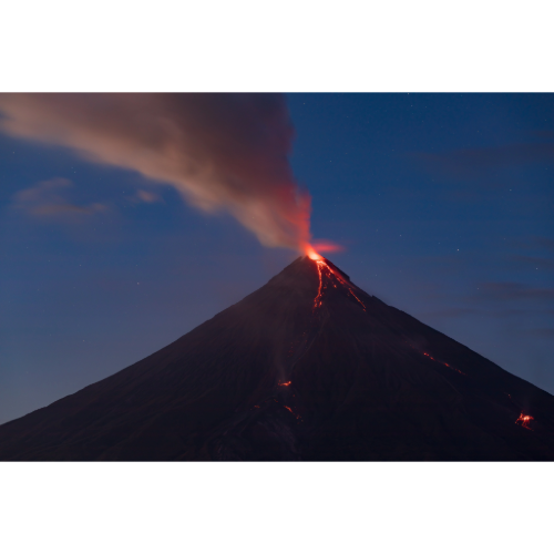
Mayon is famous for its remarkably symmetrical cone.
Taal sits within a complex volcanic system surrounded by heavily populated areas.
Pinatubo produced one of the largest eruptions of the 20th century in 1991.
Volcanic ash from major Philippine eruptions can disrupt aviation, damage agriculture, contaminate water supplies and affect communities far beyond the immediate volcano.
🇯🇵 Japan — Volcanoes Along the Ring of Fire
Japan’s spectacular mountains are another product of tectonic forces around the Pacific.
The Smithsonian Global Volcanism Program identifies 116 Japanese volcanoes with Holocene activity, one of the world’s largest national totals.
Japan’s famous volcanoes include:
🌋 Mount Fuji
🌋 Sakurajima / Aira
🌋 Suwanosejima
🌋 Asama
🌋 Aso
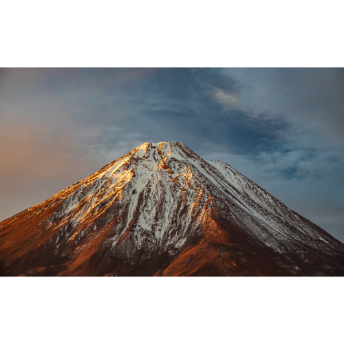
Mount Fuji has become an international symbol of Japan.
But it is also an active volcano.
Other Japanese volcanoes erupt considerably more frequently.
Japan’s extensive monitoring networks watch for earthquakes, deformation, gas emissions and other changes that could indicate increasing volcanic unrest.
🇷🇺 Kamchatka — A Wilderness of Volcanoes
Farther north lies one of Earth’s most spectacular volcanic regions:
Russia’s Kamchatka Peninsula.
Here, volcanoes rise dramatically above remote forests, tundra and snow-covered landscapes.
The Smithsonian catalogs more than 100 Holocene volcanoes across Russia, with many concentrated in Kamchatka and the Kuril Islands.
Some produce enormous ash plumes capable of reaching aircraft cruising altitudes.
That creates a hazard even when few people live near the volcano itself.
A remote eruption can still affect international aviation routes.
Volcano danger is not always measured by the number of buildings beside the crater.
🇺🇸 Alaska and the Aleutians — America’s Volcanic Frontier
The Ring of Fire continues eastward across the Aleutian Islands and Alaska.
The United States has an exceptionally large number of Holocene volcanoes, many located in Alaska.
The Smithsonian currently lists 165 U.S. volcanoes with Holocene activity, although that total includes volcanoes in U.S. states and territories under its database methodology.
Alaska’s volcanoes can produce explosive eruptions and high-altitude ash clouds.
Because major trans-Pacific aviation routes cross the region, volcanic ash represents an important aircraft hazard.
Jet engines and volcanic ash are a dangerous combination.
Ash can damage engines, windows and other aircraft systems.
🇺🇸 The Cascades — Volcanoes Above the Pacific Northwest
The Ring of Fire continues south through the Pacific Northwest.
The Cascade Range contains famous volcanoes including:
🌋 Mount St. Helens
🌋 Mount Rainier
🌋 Mount Hood
🌋 Mount Baker
🌋 Lassen Peak
Mount St. Helens demonstrated the region’s power with its catastrophic 1980 eruption.
But different Cascade volcanoes present different hazards.
At snow- and ice-covered volcanoes such as Mount Rainier, one major concern is lahars — fast-moving mixtures of water, mud, rock and volcanic debris.
These flows can travel through river valleys far beyond the volcano itself.
USGS specifically warns that valleys draining snow- and ice-covered volcanoes can be exposed to lahars.
🇲🇽 Mexico — Volcanoes Near Megacities
Mexico contains another major volcanic corridor.
One volcano is especially important:
🌋 Popocatépetl.
It rises southeast of Mexico City in one of the world’s most densely populated regions.
Popocatépetl has produced repeated periods of activity, including explosions and ash emissions.
Ash can affect communities many miles away depending on wind direction.
Mexico illustrates one of the most important principles of volcanic risk:
A volcano doesn’t need to produce a civilization-ending eruption to cause major disruption.
Even moderate ashfall can affect:
✈️ Airports
🚗 Transportation
💧 Water systems
🏫 Schools
🏠 Homes
🌾 Agriculture
🫁 Air quality
🇬🇹 Central America — A Chain of Volcanoes
Continue south and another remarkable volcanic chain appears.
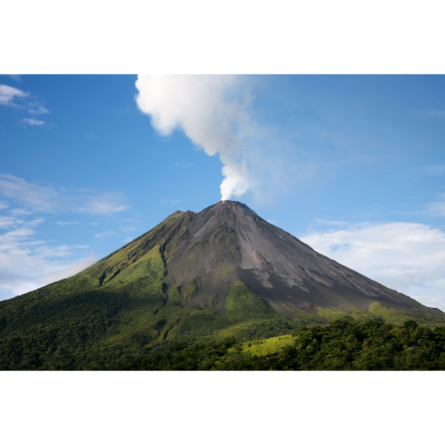
Guatemala, El Salvador, Nicaragua and Costa Rica contain numerous volcanoes associated with subduction along Central America’s Pacific coast.
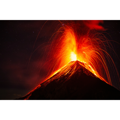
Guatemala’s Fuego is one of the region’s best-known active volcanoes.
The Smithsonian lists 20 Holocene volcanoes in Guatemala, including several with activity in recent decades.
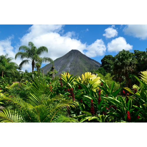
Volcanoes throughout Central America often rise above agricultural communities and major population centers.
The combination of steep terrain and tropical rainfall can also increase lahar and landslide hazards.
🇪🇨 Ecuador — Volcanoes of the Andes
South America’s Andes contain another extraordinary line of volcanoes.
In Ecuador, volcanic peaks tower above cities, valleys and high-altitude farmland.
Among the country’s best-known volcanoes are:
🌋 Cotopaxi
🌋 Reventador
🌋 Sangay
🌋 Tungurahua
Some are covered in snow and ice.
During eruptions, melting ice can contribute to lahars that rush down valleys.
The danger can extend far beyond the crater.
🇨🇱 Chile — Volcanoes Along the Andes
Chile is both an earthquake and volcano danger zone.
The Nazca Plate descends beneath South America offshore, helping generate the Andes and a long chain of volcanoes.
The Smithsonian catalogs 90 Chilean volcanoes with Holocene activity.
Volcanoes stretch for thousands of miles along the country.
Because some regions are remote, eruptions may threaten relatively few people directly.
Others occur closer to communities, transportation routes and infrastructure.
Large ash clouds can also cross international borders into Argentina.
Volcanic hazards do not respect national boundaries.
🇳🇿 New Zealand — At the Southern End of the Ring of Fire
New Zealand lies near the boundary between the Pacific and Australian tectonic plates.
Its North Island contains several major volcanic systems.
The country has experienced explosive eruptions, lava activity, hydrothermal explosions and enormous prehistoric eruptions.
Volcanic hazards include:
🌋 Ashfall
🔥 Pyroclastic flows
🌊 Lahars
☠️ Volcanic gases
💥 Explosions
New Zealand is also an excellent example of modern volcano monitoring and public hazard planning.
🇮🇸 Iceland — Where the Earth Pulls Apart
Not every major volcanic region is part of the Ring of Fire.
Iceland sits astride the Mid-Atlantic Ridge.
Here, tectonic plates are moving apart rather than colliding.
Magma rises into the opening created between the North American and Eurasian plates.
The result is an extraordinary volcanic landscape of:
🌋 Volcanoes
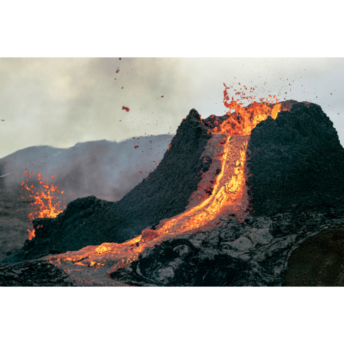
🔥 Lava fields
♨️ Geothermal areas
🧊 Glaciers
🌊 Rift zones
The Smithsonian catalogs 35 Icelandic volcanoes with Holocene activity.
Iceland demonstrates that volcanoes can form where plates separate, not only where they collide.
🇮🇹 Italy — Europe’s Famous Volcanoes
Italy contains some of the world’s most famous volcanoes.
🌋 Etna
🌋 Vesuvius
🌋 Stromboli
Etna in Sicily is one of Europe’s most active volcanic systems.
Stromboli has become famous for frequent explosive activity.
Vesuvius is known worldwide because of its catastrophic eruption in AD 79 that buried Pompeii and Herculaneum.
Today, the Naples region contains millions of residents living within a complex volcanic environment that also includes the Campi Flegrei caldera.
Italy proves that significant volcano danger exists well outside the Pacific Ring of Fire.
🌍 East African Rift — A Continent Slowly Splitting
Another remarkable volcanic zone crosses eastern Africa.
The East African Rift marks an area where Earth’s crust is gradually being pulled apart.
Volcanic systems occur through parts of:
🇪🇹 Ethiopia
🇰🇪 Kenya
🇹🇿 Tanzania
🇨🇩 Democratic Republic of the Congo
One particularly famous volcano is Nyiragongo in the Democratic Republic of the Congo.
Its highly fluid lava has historically posed a serious threat to nearby communities, including the city of Goma.
The East African Rift offers a glimpse of continental geology in motion.
Over immense geological timescales, rifting can eventually help create new ocean basins.
🔥 Lava — The Iconic Volcano Hazard
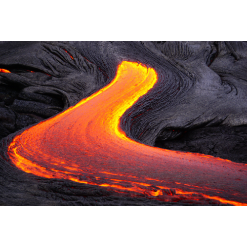
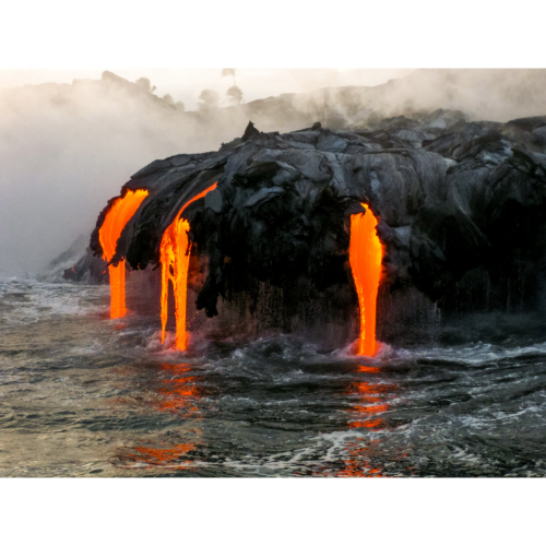
When most people imagine a volcanic eruption, they picture lava.
Lava can destroy almost everything directly in its path.
Roads disappear.
Homes burn or become buried.
Utilities are severed.
Entire landscapes can be transformed.
But lava is often relatively slow compared with some other volcanic hazards.
At many explosive volcanoes, lava isn’t the greatest immediate threat to human life.
☁️ Pyroclastic Flows — Among the Deadliest Volcanic Hazards
One of the most dangerous volcanic phenomena is the pyroclastic flow.
These are fast-moving mixtures of extremely hot gas, ash and volcanic material.
They can race down the sides of volcanoes and through valleys.
Unlike many lava flows, there may be little opportunity to escape once a pyroclastic flow is approaching.
This is why evacuation zones around explosive volcanoes are so important.
If scientists and authorities determine that an eruption could generate pyroclastic flows, leaving the danger zone before the eruption can be critical.
🌊 Lahars — Rivers of Volcanic Debris
Volcanoes can create destructive floods of mud and debris known as lahars.
They may form when:
🌧️ Heavy rain mixes with volcanic ash
🧊 An eruption melts snow or ice
🌊 Crater lakes release water
🌋 Loose volcanic material collapses into river valleys
Lahars can travel far downstream from a volcano.
USGS warns that river valleys draining volcanoes can become major hazard corridors.
This means people who cannot even see the volcano may still be exposed.
☁️ Volcanic Ash — A Hazard That Travels
Volcanic ash isn’t like soft fireplace ash.
It consists of tiny fragments of rock, minerals and volcanic glass.
Wind can carry it hundreds or even thousands of miles.
Heavy ashfall can:
🏠 Collapse roofs
✈️ Close airports
🚗 Reduce visibility
🌾 Damage crops
💧 Contaminate water
⚡ Damage electrical systems
🫁 Irritate lungs and eyes
Large explosive eruptions can send ash high into the atmosphere, disrupting aviation across entire regions.
☠️ Volcanic Gases
Volcanoes release gases including:
💨 Water vapor
☁️ Carbon dioxide
🧪 Sulfur dioxide
and other compounds.
Gas concentrations can become dangerous close to volcanic vents or in low-lying areas where gases accumulate.
Sulfur dioxide can also affect air quality far downwind.
Volcano monitoring therefore isn’t limited to watching lava.
Scientists measure gases because changes in gas emissions can provide clues about what is happening beneath a volcano.
🌋 How Scientists Monitor Volcanoes
Unlike earthquakes, volcanic eruptions can sometimes provide substantial warning signs.
Scientists monitor volcanoes using:
📈 Seismometers
🛰️ Satellites
📡 GPS instruments
🌋 Ground deformation measurements
☁️ Gas sensors
🌡️ Thermal cameras
📷 Visual observations
Rising magma may produce earthquakes.
The ground may swell.
Gas emissions may change.
Heat may increase.
But every volcano behaves differently.
Scientists cannot simply apply one universal countdown to an eruption.
Monitoring is about identifying changes and evaluating probabilities.
🌎 How Many Volcanoes Are Active Right Now?
The answer depends on what we mean by active.
The Smithsonian Global Volcanism Program says there are typically around 40–50 continuing eruptions worldwide, while roughly 20 volcanoes may be actively erupting on a particular day.
As of its March 31, 2026 database update, the Smithsonian listed 41 volcanoes with continuing eruptions and 47 volcanoes that had erupted at some point during 2026 by that date.
The numbers change as eruptions begin, pause and end.
The important point is that volcanic activity is not rare.
Somewhere on Earth, volcanoes are almost always erupting.
🌎 Major Volcano Danger Zones
Some of Earth’s most important volcanic regions include:
🔥 Pacific Ring of Fire — The planet’s dominant volcanic belt.
🇮🇩 Indonesia — Exceptional concentration of active volcanoes and large nearby populations.
🇯🇵 Japan — More than 100 Holocene volcanoes and extensive monitoring.
🇵🇭 Philippines — Active volcanic arcs and densely populated islands.
🇷🇺 Kamchatka — Numerous active volcanoes and major aviation ash hazards.
🇺🇸 Alaska & Aleutians — Large concentration of active volcanoes.
🇺🇸 Cascade Range — Explosive volcanoes and significant lahar hazards.
🇲🇽 Mexico — Active volcanoes near major population centers.
🌎 Central America — Long volcanic chain from Guatemala through Costa Rica.
🇪🇨 Ecuador & 🇨🇱 Chile — Andes volcanic zone.
🇳🇿 New Zealand — Active volcanic systems along a major plate boundary.
🇮🇸 Iceland — Mid-Atlantic Ridge volcanism.
🇮🇹 Italy — Etna, Stromboli, Vesuvius and Campi Flegrei.
🌍 East African Rift — Active continental rifting and volcanism.
🌍 Where Is Earth’s Greatest Volcano Danger Zone?
There isn’t one official Volcano Capital of the World.
Different measures produce different answers.
The United States has the largest number of Holocene volcanoes in the Smithsonian’s country database, with 165, followed by Japan with 116, Russia with 106 and Indonesia with 101.
But simple volcano counts don’t measure danger.
Population exposure, eruption style, frequency, ashfall, pyroclastic flows, lahars and evacuation challenges all matter.
Indonesia stands out because of the extraordinary combination of frequent activity, numerous volcanic systems and large populations living near volcanoes.
At the planetary scale, however, one region dominates the map:
🔥 The Pacific Ring of Fire.
More than half of Earth’s active volcanoes above sea level surround the Pacific.
Trace the belt around the ocean and you pass through many of the world’s great volcanic landscapes:
Indonesia → Philippines → Japan → Kamchatka → Alaska → Cascades → Mexico → Central America → Andes → New Zealand.
But the Ring of Fire isn’t the whole story.
Iceland shows what happens where tectonic plates pull apart.
Italy demonstrates Mediterranean volcanism.
East Africa reveals a continent slowly rifting.
And Hawaii demonstrates that volcanoes can even form far from plate boundaries above geological hotspots.
Earth’s volcanoes are windows into processes occurring deep beneath our feet.
Most remain quiet for long periods.
Some erupt almost continuously.
Others may sleep for centuries before awakening.
That uncertainty is exactly why understanding Volcano Danger Zones matters.
The mountain may look peaceful.
But the planet beneath it is still moving.
❓ Volcano Danger Zones — Frequently Asked Questions
Where are most volcanoes located?
Many of Earth’s active volcanoes are concentrated around the Pacific Ring of Fire, where tectonic plates collide and subduct.
What country has the most volcanoes?
Using the Smithsonian Global Volcanism Program’s count of volcanoes with Holocene activity, the United States has 165, followed by Japan, Russia and Indonesia. Counts vary depending on definitions and whether territories and maritime areas are included.
Why does Indonesia have so many volcanoes?
Indonesia lies along multiple tectonic boundaries and volcanic arcs where oceanic plates are being subducted beneath neighboring plates.
How many volcanoes are erupting right now?
The number changes constantly. Smithsonian data indicate there are typically 40–50 continuing eruptions worldwide, with roughly 20 volcanoes actively erupting on a particular day.
What is the Pacific Ring of Fire?
The Ring of Fire is a vast zone of volcanoes, earthquakes and tectonic plate boundaries surrounding much of the Pacific Ocean.
Is lava the most dangerous volcanic hazard?
Not necessarily. Pyroclastic flows, lahars, ashfall and volcanic gases can be extremely dangerous and may travel much farther or faster than many lava flows.
What is a pyroclastic flow?
It is a fast-moving, extremely hot mixture of volcanic gas, ash and rock traveling away from an eruption.
What is a lahar?
A lahar is a flow of water mixed with volcanic ash, rock and debris that can travel rapidly through valleys downstream from a volcano.
Can volcanic ash affect airplanes?
Yes. Volcanic ash can seriously damage aircraft engines and other systems, which is why large ash clouds can cause major aviation disruptions.
Can scientists predict volcanic eruptions?
Scientists can monitor earthquakes, ground deformation, gases, heat and other signs of unrest and sometimes forecast increased eruption likelihood. Exact eruption timing and size can remain uncertain.
Where can I track active volcanoes?
Use the Orbis Weather Live Volcano Eruption Tracker for global volcano activity, eruption reports and developing volcanic hazards.