Tornado Capital of the World: Most Tornado-Prone Places

🌪️ Tornado Capital of the World: The Most Tornado-Prone Places on Earth
Few weather phenomena are as violent, concentrated and unpredictable as a tornado.
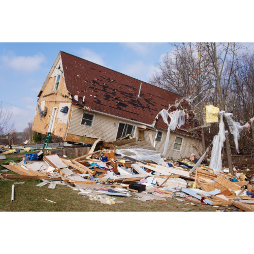
A powerful tornado can transform an ordinary thunderstorm into a devastating disaster within minutes, producing winds capable of destroying homes, overturning vehicles and throwing debris enormous distances.
Tornadoes occur on several continents.
But one country stands far above the rest:
🇺🇸 The United States.
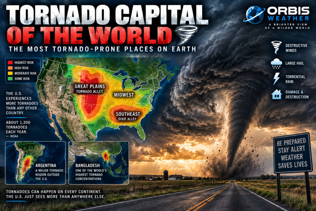
NOAA’s National Severe Storms Laboratory says the United States typically experiences about 1,200 tornadoes every year — more than anywhere else in the world.
The country’s unique geography creates an extraordinary meeting place for warm tropical moisture, dry continental air, cold northern air and powerful upper-level winds.
But America’s tornado geography is changing — or, more accurately, our understanding of it is becoming more complete.
The traditional Tornado Alley of Texas, Oklahoma, Kansas and Nebraska remains extremely important.
However, modern research shows substantial tornado activity extending eastward into the Midwest and Southeast, where nighttime tornadoes, forests, hills and vulnerable housing can create additional dangers.
There is no official meteorological title of “Tornado Capital of the World.”
But if we’re looking for the country where tornadoes are most frequent and where many of Earth’s strongest tornadoes occur, the answer is unmistakable:
The United States.
🇺🇸 Why Does America Get So Many Tornadoes?
The answer begins with geography.
North America has an unusual arrangement of mountains, plains and warm tropical waters.
To the west rise the Rocky Mountains.
To the south lies the warm Gulf of Mexico.
To the north stretch the cold interior regions of Canada.
Between them lies an enormous expanse of relatively open terrain.
That allows dramatically different air masses to collide.
Warm, humid air can surge northward from the Gulf of Mexico.
Hot, dry air can move east from the high terrain of Mexico and the Southwest.
Cold, dry air can descend from Canada and the northern United States.
When these air masses interact beneath strong winds changing speed and direction with height — known as wind shear — the atmosphere can become primed for rotating thunderstorms.
Under the right conditions, those thunderstorms can produce tornadoes.
NOAA identifies the Great Plains, Midwest and South as particularly susceptible regions.
🌪️ Tornado Alley — America’s Famous Tornado Zone
For decades, the phrase Tornado Alley has been associated with the Great Plains.
The traditional region generally includes parts of:
🇺🇸 Texas
🇺🇸 Oklahoma
🇺🇸 Kansas
🇺🇸 Nebraska
🇺🇸 South Dakota
and surrounding states.
The landscape seems almost designed for severe thunderstorms.
Warm, moisture-rich Gulf air can flow northward across the plains while dry air moves east from the Rockies and Southwest.
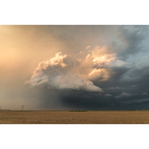
Powerful spring storm systems can then provide the lift and wind shear necessary for rotating supercell thunderstorms.
Some of those supercells produce tornadoes.
The wide-open plains also make tornadoes easier to see than in heavily forested regions.
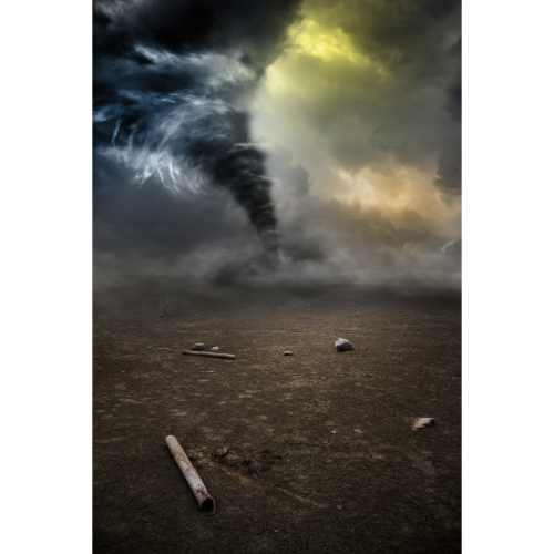
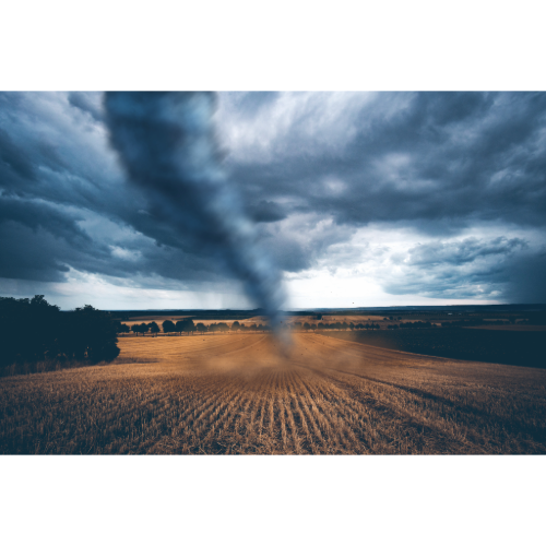
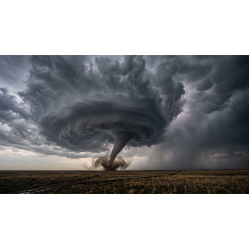
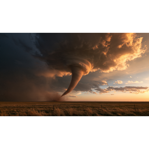
This landscape helped create the iconic American image of a dark tornado descending beneath a giant supercell over endless farmland.
But there is an important catch.
Tornado Alley doesn’t have scientifically fixed boundaries.
NOAA notes that different maps produce different versions depending on whether researchers examine all tornadoes, stronger tornadoes, tornado days or different periods of historical data.
Tornado Alley is useful as a general concept.
It should never be interpreted as America’s only tornado danger zone.
🌪️ Is Tornado Alley Moving East?
This is one of the most interesting developments in modern tornado research.
Recent studies have documented an eastward shift in significant tornado activity.
A 2024 analysis archived by NOAA examined F/EF1+ tornadoes during two 35-year periods: 1951–1985 and 1986–2020.
Researchers found tornado activity had shifted away from portions of the Great Plains and toward the Midwest and Southeast United States.
The researchers found that eastern U.S. tornado activity increased while western portions of the study region decreased.
That doesn’t mean tornadoes have disappeared from Kansas, Oklahoma or Texas.
Far from it.
The Great Plains remain an important severe-weather region.
But the familiar map of a narrow Tornado Alley through the central Plains no longer tells the entire story.
🌪️ Dixie Alley — America’s Other Tornado Danger Zone
East of the traditional Great Plains lies another dangerous tornado region commonly called Dixie Alley.
The term generally refers to parts of the southeastern United States, particularly areas including:
🇺🇸 Mississippi
🇺🇸 Alabama
🇺🇸 Tennessee
🇺🇸 Arkansas
🇺🇸 Louisiana
and neighboring states.
Tornadoes here present a different set of challenges.
The Southeast contains extensive forests, rolling hills and densely vegetated terrain.
That can make approaching tornadoes extremely difficult to see.
Storms can also move rapidly.
And unlike the traditional spring-focused image of Tornado Alley, significant tornado outbreaks can occur in the Southeast during the cooler months.
🌙 Nighttime Tornadoes — A Particularly Dangerous Threat
One characteristic makes tornadoes in the Southeast especially concerning:
They frequently occur at night.
NOAA’s VORTEX-USA research program has specifically studied the Southeast because tornadoes there can occur at night within fast-moving storms and in areas where visibility is poor.
Imagine trying to see an approaching tornado at 2 a.m.
There may be no visible funnel.
Rain could obscure the circulation.
Trees can block the horizon.
Most people are asleep.
That makes warning systems extraordinarily important.
NOAA researchers also note that housing vulnerability, including mobile and manufactured homes, contributes to tornado risk in parts of the Southeast.
🇺🇸 Texas — Enormous Tornado Numbers
Texas frequently records large numbers of tornadoes.
Part of the reason is straightforward:
Texas is enormous.
Its size means the state encompasses several different severe-weather environments.
North Texas can experience classic Great Plains supercells.
East Texas has greater humidity and vegetation.
The Texas Panhandle sits closer to the dry High Plains.
South Texas can even experience tornadoes associated with tropical cyclones.
Historical NOAA research covering 1991–2015 found Texas averaged roughly 147 tornadoes annually during that period — more than Kansas or Oklahoma.
But raw state totals can be misleading because states vary dramatically in geographical size.
Tornado density, strong-tornado frequency and population exposure tell different stories.
🌪️ Oklahoma — The Heart of Tornado Country
Few places are more closely associated with tornadoes than Oklahoma.
The state sits near the center of the classic Great Plains severe-weather environment.
Warm Gulf moisture can collide with dry air arriving from the Southwest while strong upper-level winds create substantial wind shear.
Oklahoma has experienced some of the most intensely studied tornadoes in meteorological history.
The region around Oklahoma City has also become important to tornado science because NOAA’s National Severe Storms Laboratory and other meteorological research institutions are located in Norman, Oklahoma.
Scientists continue studying how tornadoes form, strengthen and dissipate in an effort to improve warnings.
🌪️ Kansas — The Classic Tornado Landscape
Kansas occupies another central position in traditional Tornado Alley.
Its broad plains allow dramatically different air masses to interact during spring and early summer.
Powerful supercells can develop along drylines, cold fronts and other atmospheric boundaries.
Kansas is also home to one of the most famous tornado references in popular culture:
The Wizard of Oz.
But the real storms are considerably more complex than the fictional version.
Tornadoes vary enormously in size, duration and intensity.
Some remain over open countryside.
Others cross communities.
And even within the same thunderstorm, tornado intensity can change rapidly.
🌪️ Mississippi and Alabama — A Different Kind of Tornado Country
Mississippi and Alabama illustrate why tornado danger shouldn’t be measured simply by counting tornadoes.
The Southeast has several factors that can make tornadoes especially dangerous:
🌙 More nighttime events
🌲 Dense forests
⛰️ Rolling terrain
🏠 Vulnerable housing
🌧️ Rain-wrapped tornadoes
🚗 Fast-moving storms
👥 Significant population exposure
NOAA’s VORTEX research has found that the Southeast presents unique forecasting and public-safety challenges.
A tornado hidden behind trees and heavy rain at night can be dramatically harder to recognize than a highly visible Great Plains tornado crossing open farmland.
🌪️ What Creates a Tornado?
Not every thunderstorm can produce a tornado.
Many significant tornadoes develop from supercells — thunderstorms containing a persistent rotating updraft known as a mesocyclone.
Several atmospheric ingredients can contribute:
🌡️ Warm, unstable air
💧 Abundant moisture
💨 Strong wind shear
⬆️ Atmospheric lift
🔄 Rotating thunderstorms
But even when meteorologists observe these ingredients, determining exactly which storms will produce tornadoes remains difficult.
NOAA’s National Severe Storms Laboratory emphasizes that scientists still have important unanswered questions about tornado formation.
That is why tornado research continues.
🌪️ The Enhanced Fujita Scale
In the United States, tornadoes are rated using the Enhanced Fujita Scale, commonly called the EF Scale.
The ratings run from:
EF0 — Weakest
EF1
EF2
EF3
EF4
EF5 — Most severe damage category
But there is an important detail.
The EF rating isn’t simply a direct measurement of a tornado’s maximum wind speed.
Meteorologists survey damage after a tornado and use established damage indicators to estimate the wind speeds likely responsible.
That means a powerful tornado crossing open countryside may be difficult to rate at its true maximum intensity if it doesn’t strike structures or other suitable damage indicators.
🌎 Tornadoes Outside the United States
America may dominate global tornado statistics, but tornadoes are not exclusively American.
NOAA notes that tornadoes occur across parts of:
🌎 South America
🌍 Europe
🌍 Africa
🌏 Asia
🌏 Australia
🌏 New Zealand
In fact, NOAA identifies Argentina and Bangladesh as two areas with notable concentrations of tornadoes outside the United States.
🇦🇷 Argentina — South America’s Tornado Country
The plains of Argentina and surrounding portions of South America can produce powerful severe thunderstorms.
The region east of the Andes shares some atmospheric similarities with the central United States.
Moisture from tropical South America can interact with dry air descending from higher terrain while strong upper-level winds contribute to severe thunderstorm development.
Argentina, Uruguay, Paraguay and southern Brazil collectively form one of Earth’s significant severe-convective-storm regions.
These storms can produce:
🌪️ Tornadoes
🧊 Giant hail
💨 Destructive winds
⚡ Intense lightning
🌧️ Torrential rainfall
South America’s severe-weather environment receives less global attention than the United States, but it can be extraordinary.
🇧🇩 Bangladesh — Tornadoes in a Densely Populated Landscape
Bangladesh represents another significant tornado region.
NOAA identifies Bangladesh as one of the higher tornado concentrations outside the United States.
Here, tornado danger intersects with enormous population density.
Warm, humid air from the Bay of Bengal can interact with weather systems arriving from the northwest and north.
When severe thunderstorms develop over densely populated areas, even relatively narrow tornado paths can affect large numbers of people.
Historical tornadoes in Bangladesh have caused catastrophic loss of life.
🇨🇦 Canada — Tornadoes North of the Border
Canada also experiences tornadoes, particularly across southern portions of the country.
The Prairie provinces and southern Ontario can experience severe thunderstorms capable of producing tornadoes during the warmer months.
Some of the atmospheric systems producing severe weather over the northern United States continue directly into Canada.
Tornado season generally occurs later in northern regions because peak summertime heating arrives later than across the southern Plains.
🌍 Europe — Tornadoes Happen Here Too
Europe experiences tornadoes as well.
They are considerably less frequent than across the United States, but tornadoes have been documented in countries including:
🇬🇧 United Kingdom
🇩🇪 Germany
🇫🇷 France
🇮🇹 Italy
🇪🇸 Spain
🇳🇱 Netherlands
🇵🇱 Poland
and others.
Some European tornadoes can become damaging or occasionally intense.
The key lesson is simple:
Tornadoes are not limited to Tornado Alley.
⚠️ Tornadoes Can Happen in All 50 U.S. States
One of the most important tornado facts is also one of the easiest to forget.
NOAA says tornadoes have been reported in all 50 U.S. states.
Florida gets tornadoes.
California gets tornadoes.
New York gets tornadoes.
Even states far outside the traditional Tornado Alley can experience them.
The probability may differ dramatically from one region to another, but no U.S. state is completely tornado-free.
🏠 What Should You Do During a Tornado Warning?
If a tornado warning is issued for your location, move to shelter immediately.
The safest available location is generally a purpose-built tornado shelter or safe room.
Otherwise, move to the lowest floor of a sturdy building and choose a small interior room away from windows.
Put as many walls between yourself and the outside as possible.
Protect your head and neck.
People living in mobile or manufactured homes should have a plan to reach a more substantial shelter before severe weather arrives.
Do not depend on seeing the tornado.
In many cases, you won’t.
🌎 Major Tornado Danger Zones
Some of Earth’s most important tornado regions include:
🇺🇸 Great Plains — Traditional Tornado Alley and classic supercell country.
🇺🇸 Midwest — Significant severe-weather and tornado corridor.
🇺🇸 Southeast — Strong tornadoes, nighttime events and substantial population exposure.
🇺🇸 Texas — Large annual tornado totals and diverse severe-weather environments.
🇺🇸 Oklahoma & Kansas — Historic center of traditional Tornado Alley.
🇺🇸 Mississippi & Alabama — Important Southeast tornado corridor.
🇦🇷 Argentina / Uruguay / Paraguay / southern Brazil — Major South American severe-thunderstorm region.
🇧🇩 Bangladesh — Significant tornado hazard combined with dense population.
🇨🇦 Southern Canada — Tornadoes associated with summertime severe thunderstorms.
🇪🇺 Europe — Lower overall frequency but recurring tornado occurrence across numerous countries.
🌎 So Where Is the Tornado Capital of the World?
There is no official meteorological “Tornado Capital of the World.”
But at the country level, the United States clearly stands apart.
NOAA says approximately 1,200 tornadoes occur in the United States annually, and the country typically experiences more tornadoes than anywhere else.
America’s unusual geography helps explain why.
The Rocky Mountains rise to the west.
The warm Gulf of Mexico lies to the south.
Cold continental air can arrive from the north.
And between them stretch the enormous central and eastern United States.
The traditional Great Plains remain important tornado country.
But modern research shows tornado activity has shifted toward — and remains a serious hazard across — parts of the Midwest and Southeast, making America’s tornado landscape considerably larger and more complicated than the classic Tornado Alley map suggests.
Outside America, Argentina and Bangladesh are among the world’s other notable tornado regions.
Tornadoes can happen almost anywhere when atmospheric conditions come together correctly.
But nowhere on Earth experiences them quite like the United States.
❓ Tornado Capital of the World — Frequently Asked Questions
What is the Tornado Capital of the World?
There is no official Tornado Capital of the World. At the country level, however, the United States experiences more tornadoes than anywhere else, according to NOAA.
How many tornadoes occur in the United States each year?
NOAA’s National Severe Storms Laboratory says approximately 1,200 tornadoes hit the United States annually, although the total varies considerably from year to year.
Where is Tornado Alley?
Tornado Alley generally refers to portions of the central Great Plains, traditionally including Texas, Oklahoma, Kansas and Nebraska. However, NOAA emphasizes that it has no fixed scientific boundary.
Is Tornado Alley moving?
Research has documented a long-term shift in tornado activity away from portions of the Great Plains toward the Midwest and Southeast, particularly when examining significant tornadoes and tornado days.
What is Dixie Alley?
Dixie Alley is an informal name for a tornado-prone region of the southeastern United States that includes parts of Mississippi, Alabama, Tennessee, Arkansas, Louisiana and neighboring states.
Why are nighttime tornadoes dangerous?
People may be sleeping, tornadoes are difficult to see, and darkness, rain, trees and hills can obscure approaching storms. NOAA tornado research has identified nighttime tornadoes as a particular concern in the Southeast.
Which country gets the most tornadoes?
The United States typically records more tornadoes than any other country.
Do tornadoes happen outside America?
Yes. Tornadoes occur on several continents. NOAA specifically identifies Argentina and Bangladesh as two notable tornado concentrations outside the United States.
Can tornadoes happen in Florida?
Yes. Tornadoes have been recorded in every U.S. state, including Florida. Tropical cyclones can also produce tornadoes.
What is the strongest tornado rating?
The highest rating on the U.S. Enhanced Fujita Scale is EF5.
Where can I track tornadoes and severe thunderstorms?
Follow Orbis Weather Severe Weather coverage and live weather maps for developing thunderstorms, tornado watches, warnings and severe-weather outbreaks.