Flood Capital of the World: Most Flood-Prone Places on Earth
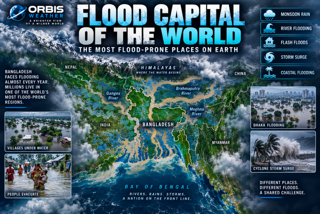

🌊 Flood Capital of the World: The Most Flood-Prone Places on Earth
Water gives life to civilizations.
But in some parts of the world, water also represents one of nature’s greatest recurring threats.
Rivers overflow. Monsoon rains overwhelm entire regions. Tropical cyclones drive seawater inland. Mountain valleys experience catastrophic flash floods. Cities disappear beneath water when drainage systems cannot keep pace with extreme rainfall.
Flooding is Earth’s most geographically widespread natural hazard.
But if one country could be described as the “Flood Capital of the World,” Bangladesh would be one of the strongest candidates.
🇧🇩 Bangladesh sits at the downstream end of three enormous river systems — the Ganges, Brahmaputra and Meghna.
Much of the country consists of low-lying floodplain and delta terrain.
During the South Asian monsoon, enormous volumes of water travel through these rivers toward the Bay of Bengal.
At the same time, heavy rain can fall directly across Bangladesh.
And along the coast, tropical cyclones can push storm surge inland.
Few countries face such a powerful combination of river flooding, monsoon flooding, flash flooding and coastal flooding.
🇧🇩 Bangladesh — Where Three Great Rivers Meet
To understand Bangladesh’s extraordinary flood exposure, look at a map of South Asia.
Three giant river systems converge near the country.
🌊 The Ganges
🌊 The Brahmaputra
🌊 The Meghna
Together they drain an enormous portion of the Himalayas and South Asia before reaching the Bay of Bengal.
Bangladesh sits near the end of that journey.
WMO notes that almost 93% of the combined Ganges-Brahmaputra-Meghna catchment lies outside Bangladesh, meaning rainfall hundreds or even thousands of miles upstream can eventually influence water levels inside the country.
Bangladesh therefore doesn’t need to receive all the rain itself.
Water falling across parts of India, Nepal, Bhutan and the Tibetan Plateau can ultimately flow toward Bangladesh.
That makes the country part of one of Earth’s greatest hydrological funnels.
🌧️ The Monsoon — When the Rivers Rise
South Asia’s monsoon dramatically transforms the landscape every year.
From roughly June through September, enormous amounts of moisture arrive across the region.
Rivers swell.
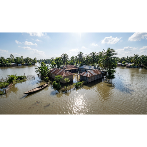
Floodplains fill.
Wetlands expand.
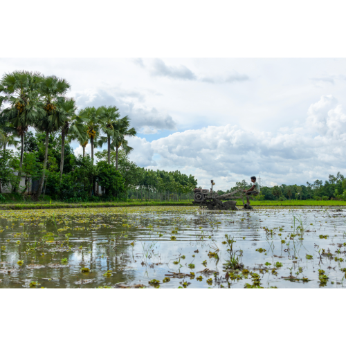
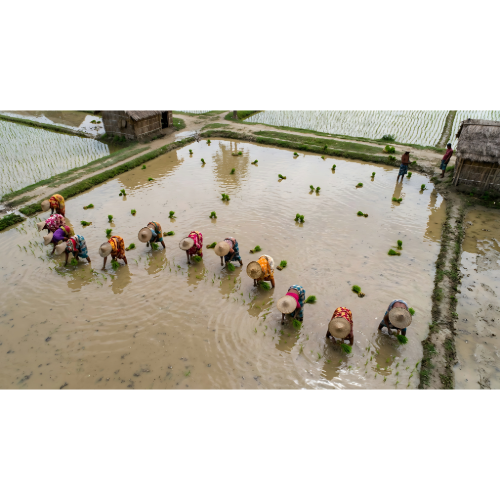
Fields become covered with water.
Some flooding is entirely natural.
In fact, seasonal flooding has helped build and fertilize the enormous delta for thousands of years.
But there is a tremendous difference between normal seasonal flooding and a catastrophic flood.
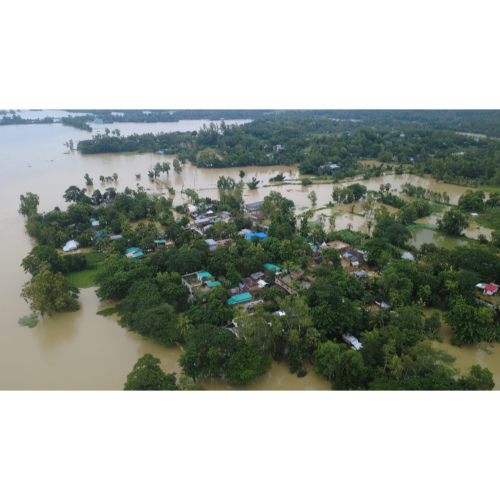
When intense monsoon rainfall combines with high river levels throughout the Ganges-Brahmaputra-Meghna basin, huge areas can become inundated.
WMO says heavy monsoon rainfall is the principal cause of flooding in Bangladesh and flooding occurs almost every year.
🌊 How Much of Bangladesh Floods?
The numbers can be extraordinary.
World Bank analysis using Bangladesh Flood Forecasting and Warning Centre data found that during a 68-year period, approximately 20% of Bangladesh flooded during an average year.
Major floods affecting more than 30% of the country’s area occurred repeatedly.
During particularly extreme years, inundation became enormous.
The historic 1988 flood affected about 61% of Bangladesh.
The catastrophic 1998 flood affected approximately 68%.
Imagine more than half of an entire country experiencing flooding during a single disaster.
That illustrates why Bangladesh occupies such an extraordinary position in the global geography of floods.
🌊 The World’s Great Delta
Bangladesh occupies much of the Ganges-Brahmaputra-Meghna Delta, one of Earth’s great river landscapes.
The rivers carry enormous quantities of water and sediment from the Himalayas toward the Bay of Bengal.
Over thousands of years, those sediments created vast areas of fertile land.
Millions of people depend on this landscape.
Agriculture thrives because of its water and nutrient-rich soils.
Cities developed along its rivers.
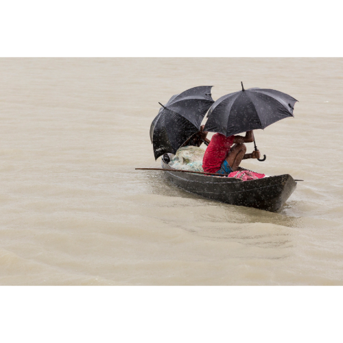
Fishing communities depend on its waterways.
But the same geography that supports life also creates flood exposure.
Large areas are naturally low.
Rivers constantly shift.
Banks erode.
Channels change.
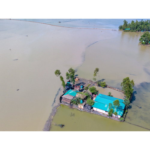
Floodwaters spread across enormous floodplains.
Bangladesh is therefore a remarkable example of humanity living alongside — and adapting to — one of Earth’s most powerful river systems.
🏔️ The Himalayas — Where the Water Begins
Some of Bangladesh’s floodwater begins its journey far away.
The Himalayas feed many of South Asia’s largest rivers.
Snowmelt, rainfall and mountain tributaries eventually flow into the great river systems downstream.
During the monsoon, intense rainfall across mountainous terrain can send huge quantities of water into rivers.
Flood waves then travel downstream.
This means Bangladesh’s flood risk cannot be understood by looking only at Bangladesh.
It is part of a vast interconnected watershed stretching across several countries.
What happens upstream can eventually affect communities hundreds of miles downstream.
⚡ Flash Floods — Water Arriving Fast
Not every flood develops slowly.
Parts of Bangladesh can experience flash flooding.
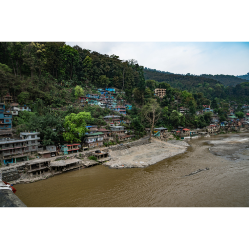
This is particularly important in northeastern areas, where intense rainfall in nearby hills and mountains can rapidly send water downstream.
Flash floods can arrive much faster than broad river flooding.
Fields can disappear beneath water.
Roads can become impassable.
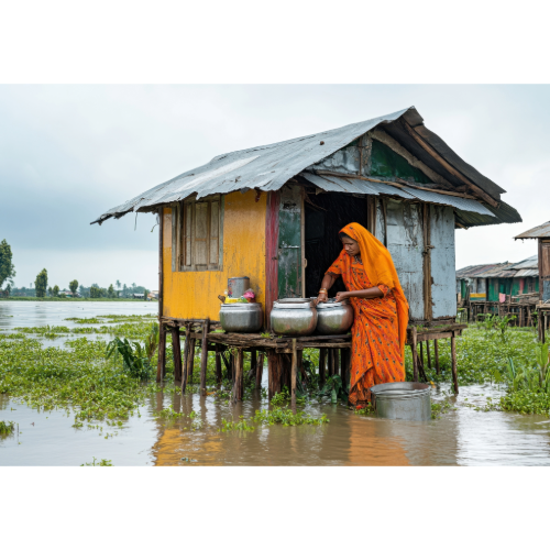
Homes can be surrounded.
Crops approaching harvest can be destroyed within hours.
The speed of the water can make flash floods especially dangerous.
🌊 Riverbank Erosion — When the River Takes the Land
Flooding isn’t the only threat created by Bangladesh’s rivers.
The rivers themselves move.
Large channels can migrate across their floodplains, eroding one bank while depositing sediment elsewhere.
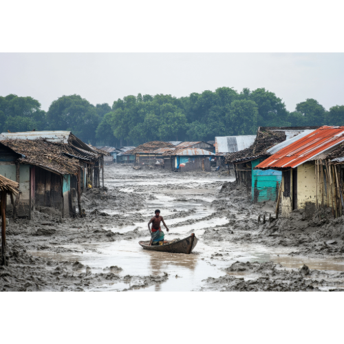
Homes, farmland and entire communities can be threatened by riverbank erosion.
An area that appears safely inland one year may find the river dramatically closer years later.
For families living beside these enormous waterways, the danger isn’t simply that water temporarily covers the land.
Sometimes the river permanently takes it.
🌀 Cyclones Add Another Kind of Flood
Bangladesh also faces flooding from the sea.
The country’s coastline borders the Bay of Bengal, where tropical cyclones can produce major storm surges.
Strong cyclone winds push seawater toward the coast.
The shallow waters and shape of the northern Bay of Bengal can amplify coastal inundation.
When storm surge arrives at the same time as high tides or elevated river levels, the effects can compound.
WMO notes that Bangladesh’s coastal region can experience flooding from high tides, tropical cyclones and river discharge — sometimes simultaneously.
That creates one of Earth’s most complicated flood environments.
🌊 Storm Surge — When the Bay of Bengal Moves Inland
Storm surge is different from ordinary rainfall flooding.
A tropical cyclone can physically push ocean water onto land.
Low-lying coastal communities may suddenly find themselves beneath rapidly rising seawater.
Bangladesh has suffered some of history’s deadliest tropical cyclone disasters partly because of this geography.
Over decades, the country has invested heavily in cyclone shelters, forecasting, warning systems, coastal defenses and evacuation programs.
Those measures have saved many lives.
Bangladesh is therefore not only a story about flood vulnerability.
It is also a story about adaptation and resilience.
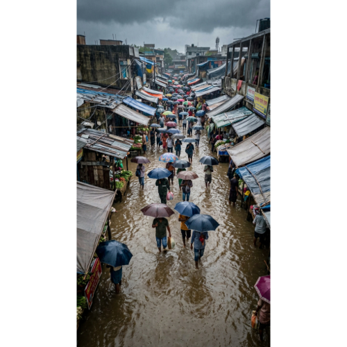
🏙️ Dhaka — Urban Flooding in a Megacity
Flooding isn’t limited to rural floodplains.
Bangladesh’s capital, Dhaka, faces another problem:
urban flooding and waterlogging.
Intense tropical rainfall can overwhelm drainage systems.
Rapid urban development can make the problem worse when wetlands, canals and natural drainage areas disappear beneath roads and buildings.
Water that once had somewhere to go suddenly has nowhere to go.
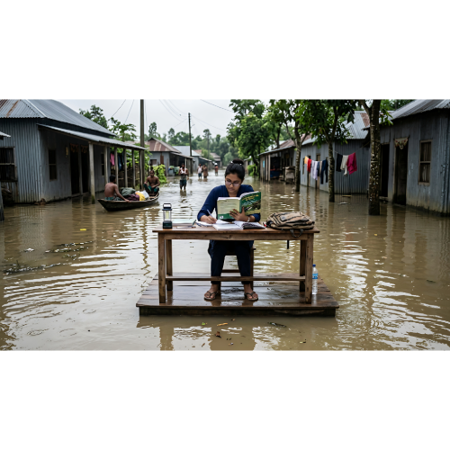
Streets become rivers.
Traffic stops.
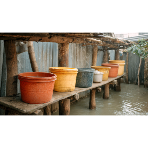
Homes and businesses flood.
Dhaka illustrates a rapidly growing global problem:
As cities expand, extreme rainfall can become increasingly difficult to manage.
🌎 Flooding Is a Global Hazard
Bangladesh may represent one of Earth’s greatest concentrations of flood risk, but catastrophic flooding occurs around the world.
Different regions face different kinds of floods.
Some are dominated by giant rivers.
Others by monsoons.
Some face tropical cyclone rainfall.
Others face flash floods, storm surge or urban drainage failures.
And many locations face several simultaneously.
🇮🇳 India — Monsoon Flood Country
India experiences flooding across an enormous geographical area.
The Ganges and Brahmaputra river systems can produce widespread flooding during the monsoon.
States including Assam, Bihar, Uttar Pradesh and West Bengal experience recurring flood threats.
Cities can also experience extreme urban flooding when intense monsoon rainfall overwhelms drainage.
Because India has such a large population, major floods can affect millions of people.
🇵🇰 Pakistan — When Monsoon Rains Become Catastrophic
Pakistan has experienced some of the most dramatic flood disasters of the modern era.
The Indus River forms the backbone of the country’s hydrology.
When exceptional monsoon rainfall occurs across the watershed, flooding can spread over enormous areas.
Mountain valleys also face flash floods caused by intense rainfall and rapidly rising rivers.
Flooding here demonstrates how extreme rainfall can transform normally dry landscapes.
🇨🇳 China — Great Rivers, Enormous Floodplains
China has battled major floods for thousands of years.
The Yangtze River and Yellow River have supported enormous civilizations while also producing devastating floods.
Today, dams, levees, reservoirs and flood-control systems manage much of the risk.
But extreme rainfall can still produce major river flooding, flash floods and urban inundation.
China’s rapidly growing cities also face increasing challenges from intense rainfall.
🇮🇩 Indonesia — Tropical Rain and Flash Floods
Indonesia experiences a different flood environment.
The country consists of thousands of mountainous tropical islands.
Intense rainfall can quickly flow down steep terrain.
Urban areas such as Jakarta face recurring flood problems caused by a combination of heavy rainfall, rivers, dense development, drainage limitations and land subsidence.
Flooding can occur rapidly and affect densely populated neighborhoods.
🇻🇳 Vietnam and the Mekong Delta
The Mekong River creates another of Earth’s great delta landscapes.
Southern Vietnam contains extensive low-lying terrain where rivers, tides and tropical rainfall interact.
Seasonal flooding is part of the natural ecosystem.
But extreme floods can damage homes, agriculture and infrastructure.
Typhoons and tropical storms can add enormous rainfall farther north and central Vietnam.
🇳🇱 The Netherlands — Living Below the Water
Not every flood-prone country experiences constant disasters.
The Netherlands demonstrates what extraordinary engineering can accomplish.
Large areas of the country lie at or below sea level.
Historically, catastrophic North Sea floods shaped Dutch society.
Today, an enormous system of:
🌊 Dikes
🚪 Storm-surge barriers
🏞️ Flood-control landscapes
🚰 Pumps
🌊 Coastal defenses
protects much of the country.
The Dutch experience proves an important point:
Flood exposure does not automatically mean flood catastrophe.
Preparation, infrastructure, forecasting and planning can dramatically change outcomes.
🇺🇸 Flooding in the United States
The United States faces nearly every major type of flooding.
🌧️ Flash floods
🏞️ River floods
🌀 Hurricane rainfall
🌊 Storm surge
🏙️ Urban flooding
🌨️ Snowmelt flooding
The Mississippi River system can produce enormous river floods.
Hurricanes can generate catastrophic rainfall along the Gulf of Mexico and Atlantic coasts.
Mountain and desert regions can experience violent flash flooding.
Flooding can occur far from the center of a tropical cyclone.
In some hurricanes, rainfall ultimately becomes more destructive than wind.
⚡ Flash Floods — One of Nature’s Fastest Disasters
River flooding may develop over days.
Flash flooding can develop within minutes or hours.
Extreme rainfall can overwhelm small streams and drainage systems almost immediately.
Mountain valleys, slot canyons and urban areas can be particularly dangerous.
Water can move with tremendous force.
Vehicles can be swept away.
Roads can disappear.
Buildings can be damaged or destroyed.
And because the flooding develops so quickly, people may have little time to react.
🏙️ The Growing Urban Flood Problem
Some of the world’s most serious future flood challenges may occur in cities.
Concrete and asphalt prevent rainfall from soaking naturally into the ground.
Storm drains can handle only limited amounts of water.
When extreme rainfall exceeds drainage capacity, streets become temporary rivers.
Rapid urban development can make the problem worse.
Natural wetlands disappear.
Streams are confined.
Floodplains are developed.
More people and infrastructure become exposed.
Cities including Dhaka, Jakarta, Mumbai, Bangkok, Houston and others demonstrate different versions of this global challenge.
🌡️ A Warmer Atmosphere and Extreme Rainfall
A warmer atmosphere can hold more water vapor.
That doesn’t mean every place will become wetter or every flood will be caused by climate change.
Flooding depends on many factors, including:
🌧️ Rainfall intensity
🏞️ River conditions
🌊 Ocean levels
🏙️ Urban development
🌲 Land use
🚧 Drainage systems
🧱 Flood defenses
But increases in extreme precipitation can increase flood hazards in some regions.
At the same time, sea-level rise increases the baseline from which coastal flooding and storm surge occur.
Flood risk therefore involves both natural weather variability and long-term changes in climate, land use and population exposure.
🌎 Major Flood Danger Zones
Some of Earth’s most important flood-prone regions include:
🇧🇩 Bangladesh — Ganges-Brahmaputra-Meghna rivers, monsoon rainfall and cyclone storm surge.
🇮🇳 India — Monsoon floods across several major river basins.
🇵🇰 Pakistan — Indus River flooding, extreme monsoon rainfall and mountain flash floods.
🇨🇳 China — Major rivers, intense rainfall and densely populated floodplains.
🇮🇩 Indonesia — Tropical rainfall, steep terrain and severe urban flooding.
🇻🇳 Vietnam — Mekong Delta flooding plus tropical cyclone rainfall.
🇵🇭 Philippines — Typhoon rainfall, flash floods and landslides.
🇹🇭 Thailand — Monsoon and river flooding across low-lying plains.
🇺🇸 United States — River flooding, flash floods, hurricanes and storm surge.
🇳🇱 Netherlands — Exceptional exposure managed through world-leading flood defenses.
🌊 So Where Is the Flood Capital of the World?
There is no official meteorological “Flood Capital of the World.”
Flood risk can also be measured in many ways — frequency, area flooded, population exposed, economic losses or mortality.
But Bangladesh stands out as one of Earth’s most remarkable flood-prone countries.
It sits downstream from the enormous Ganges-Brahmaputra-Meghna watershed.
Much of the country occupies low-lying delta and floodplain terrain.
Monsoon rains swell rivers every year.
Flash floods descend from nearby highlands.
Cyclones push water inland from the Bay of Bengal.
And millions of people live alongside the rivers and floodplains that make the country fertile and productive.
Flooding isn’t simply an occasional disaster here.
Water is part of the landscape itself.
Bangladesh has consequently become one of the world’s most important laboratories for flood forecasting, cyclone preparedness, shelters, resilient infrastructure and adaptation.
The same water that creates danger also supports farms, fisheries, transportation and millions of livelihoods.
That makes Bangladesh’s relationship with flooding more complicated than a simple disaster story.
It is the story of a nation built within one of Earth’s greatest river deltas — learning continuously how to live with water.
❓ Flood Capital of the World — Frequently Asked Questions
What is the Flood Capital of the World?
There is no official Flood Capital of the World. However, Bangladesh is one of the strongest candidates because of its extraordinary exposure to river flooding, monsoon rainfall, flash floods and coastal storm surge.
Why does Bangladesh flood so often?
Bangladesh lies downstream from the Ganges, Brahmaputra and Meghna rivers, receives intense monsoon rainfall and contains extensive low-lying floodplain and delta terrain.
How much of Bangladesh floods each year?
Historical World Bank analysis using Bangladesh flood data indicates that roughly 20% of the country flooded annually on average over a 68-year period, although the amount varies dramatically from year to year.
What was one of Bangladesh’s largest floods?
The 1998 flood inundated approximately 68% of Bangladesh, according to data cited in World Bank analysis.
Is all flooding in Bangladesh bad?
No. Normal seasonal flooding is part of the natural delta ecosystem and can replenish soil, wetlands and water supplies. Extreme flooding is what produces major disasters.
What are the main types of flooding?
Major types include river flooding, flash flooding, coastal flooding, storm surge and urban flooding.
Can tropical cyclones cause flooding?
Yes. Tropical cyclones can produce both extreme rainfall and coastal storm surge, sometimes creating flooding far from the storm’s center.
What countries are especially flood-prone?
Bangladesh, India, Pakistan, China, Indonesia, Vietnam and the Philippines are among countries with substantial flood exposure, although risk differs greatly by region and flood type.
Does the United States have major flood risk?
Yes. The United States experiences river floods, flash floods, hurricane rainfall, storm surge, urban flooding and snowmelt flooding.
Where can I track major floods?
Follow Orbis Weather global natural-hazard coverage and live weather maps for major floods, tropical cyclones, extreme rainfall and developing disasters around the world.