🔥 Latest Wildfire News & Active Fire Updates
By Paul Harrison | Founder & Publisher, Orbis Weather
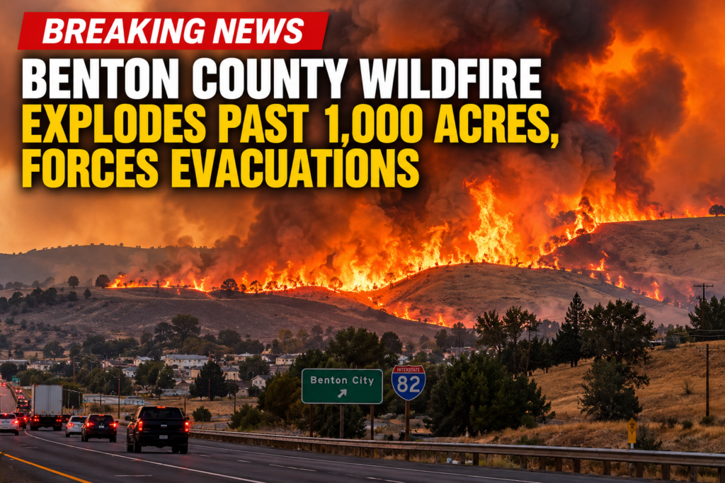

🔥 Benton County Wildfire Explodes Past 1,000 Acres, Forces Level 3 Evacuations in Washington
BENTON COUNTY, Washington — September 25, 2026 — A fast-moving wildfire erupted near Benton City on Friday afternoon, racing across more than 1,000 acres and prompting urgent Level 3 “GO NOW” evacuation orders as flames threatened homes and infrastructure.
The wildfire, identified as the Second Street Fire, was reported at approximately 2:40 p.m. Friday and spread rapidly through dry grass, brush and wooded terrain.
By 5:46 p.m., WildCAD information cited by local media placed the fire at approximately 1,149 acres, following earlier estimates ranging from 800 to 1,000 acres.
🚨 Level 3 Evacuations Ordered
The rapidly advancing fire forced authorities to issue the highest evacuation level for several areas.
Level 3 means “GO NOW.” Residents under this order should leave immediately rather than wait for conditions to deteriorate further.
Areas reported under Level 3 evacuation orders included the subdivision accessed by Pear Drive and North Valley Drive Way, as well as the Kiona Village Mobile Home Park.
Additional evacuation zones could change as firefighters assess the fire’s movement and weather conditions.
Residents anywhere near the wildfire should rely on Benton County emergency officials for their specific evacuation status and should not enter closed or evacuated areas.
🏠 Homes and Infrastructure Threatened
The Second Street Fire is burning close enough to populated areas to threaten homes and other infrastructure, turning what began as a vegetation fire into a significant wildfire emergency within hours.
A temporary evacuation shelter operated with assistance from the American Red Cross was established at Kiona-Benton City High School for people displaced by the fire.
🚒 Washington Mobilizes Additional Firefighters
The seriousness of the situation prompted Washington officials to authorize state fire mobilization at approximately 4:30 p.m. Friday.
State mobilization allows additional firefighting personnel and equipment to reinforce local agencies when a wildfire exceeds or threatens to exceed local resources.
Six wildland strike teams were requested to help battle the blaze.
Firefighters were working Friday evening to protect structures, slow the fire’s advance and establish containment lines around the rapidly expanding perimeter.
🛣️ Roads Impacted by the Fire
The wildfire also created transportation problems around Benton City.
Reported impacts included areas around:
Interstate 82
State Route 224
Kennedy Road
Keene Road
Drivers should expect rapidly changing closures and avoid traveling toward the fire area.
Smoke may also reduce visibility well beyond the active flames, particularly as winds carry the smoke plume across the region.
💨 Dry Vegetation Helping Fire Spread
Eastern Washington’s grasslands and shrub-covered terrain can allow wildfire to move extremely quickly when vegetation is dry and winds increase.
Grass fires are particularly dangerous because flames can race across open terrain much faster than people might expect. Wind-blown embers can also ignite new spot fires ahead of the primary fire front.
That makes conditions especially dangerous when wildfire approaches neighborhoods and transportation corridors.
Residents outside mandatory evacuation areas should still be prepared to leave quickly if evacuation levels increase.
🔥 Cause Remains Under Investigation
Officials had not announced a confirmed cause of the Second Street Fire Friday evening.
The cause remains under investigation.
There were also no confirmed reports available in the initial updates establishing the full extent of structural damage.
Those numbers may change significantly once firefighters can safely assess areas affected by the blaze.
⚠️ What Residents Should Do
Anyone living near the Second Street Fire should keep phones charged, monitor official emergency alerts and have medications, identification, pets and essential belongings ready to go.
Residents receiving a Level 3 evacuation notice should leave immediately.
Do not attempt to drive into an evacuation zone to photograph or watch the wildfire. Additional traffic can interfere with fire engines and residents trying to evacuate.
🌎 Orbis Weather Wildfire Watch
The Second Street Fire is now one of Washington’s significant active wildfire incidents of September 25, demonstrating how quickly a late-season grass and brush fire can become a major emergency.
The situation remains fluid Friday night.
Current reported size: approximately 1,149 acres
Location: Benton City area, Benton County, Washington
Evacuations: Level 3 “GO NOW” orders in affected areas
Structures: Homes and infrastructure threatened
State response: Washington state fire mobilization authorized
Cause: Under investigation
Orbis Weather will continue tracking the Second Street Fire as updated acreage, containment, evacuation and damage information becomes available.
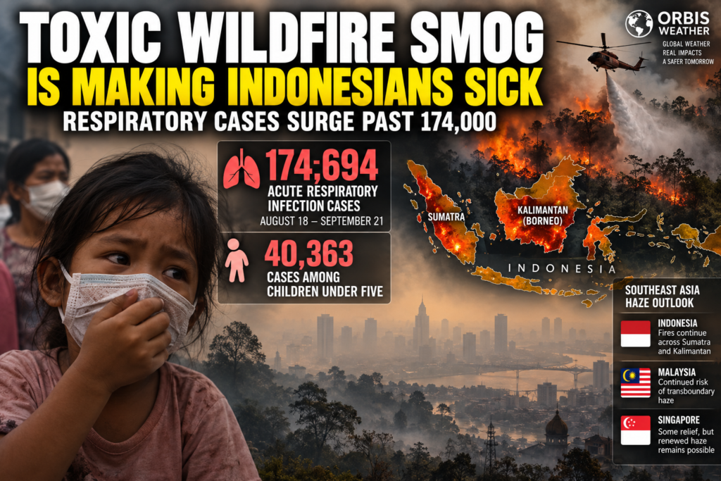
☣️ Toxic Wildfire Smog Is Making Indonesians Sick as Respiratory Cases Surge Past 174,000
September 23, 2026 — Orbis Weather
A worsening wildfire and peatland fire crisis across Indonesia has evolved into a major public-health emergency, with thick smoke blanketing communities, degrading air quality and sending tens of thousands of people — including young children — to health facilities with respiratory illness.
Indonesia’s Ministry of Health says 174,694 cases of acute respiratory infection (ARI) were recorded in wildfire-affected areas between August 18 and September 21. Of those cases, 40,363 involved children under five years old. Officials said 4,533 cases remained active in the latest reporting, with the remainder having recovered.
The illnesses are being reported across 63 districts in six provinces affected by forest and land fires.
😷 Smoke Becomes a Public-Health Crisis
The danger from Indonesia’s fires isn’t limited to the flames.
Smoke from burning forests and peatlands contains fine particulate pollution, including PM2.5, which can penetrate deep into the lungs. Prolonged exposure can aggravate asthma and other respiratory illnesses and is particularly concerning for children, older adults, pregnant women and people with existing heart or lung conditions.
Across smoke-affected communities, residents have reported coughing, sore throats, irritated eyes and breathing difficulties as haze repeatedly settles over cities and villages.
The Indonesian government says health facilities in affected regions have been placed on alert, including local health centers and referral hospitals, while authorities continue monitoring illnesses associated with smoke exposure.
The scale of the disruption has extended well beyond hospitals. Earlier in the crisis, roughly 1.4 million students across six Indonesian provinces shifted to remote learning because of poor air quality from the fires.
🔥 Sumatra and Kalimantan Remain Major Fire Zones
Some of the most serious fire and smoke conditions continue across Sumatra and Kalimantan, the Indonesian portion of Borneo.
Indonesia’s government reported that approximately 72,089 hectares — about 178,000 acres — had burned across six priority provinces as of September. Air quality in some parts of Kalimantan had reached hazardous levels, while areas of Sumatra experienced very unhealthy or unhealthy air.
The fire situation can change dramatically from one day to the next.
Indonesia’s Forestry Ministry detected 1,532 high-confidence hotspots nationwide on September 20, an increase of 209 from the previous day.
By September 21, however, that number had fallen sharply to 688 high-confidence hotspots, a decrease of 844 in 24 hours.
Central Kalimantan still accounted for 228 hotspots, although that was dramatically lower than the 968 recorded a day earlier. South Kalimantan increased to 71 hotspots from 39.
The decline is encouraging, but it does not mean the wildfire crisis is over.
Hotspot counts fluctuate with weather, firefighting activity, satellite coverage and cloud or smoke obscuration. Fires burning in peat can also persist below the surface and re-emerge even after flames appear to have been extinguished.
🚁 Indonesia Mounts Massive Firefighting Operation
Indonesia has mobilized a major national response.
As of September 21, authorities said 64 aircraft had been deployed to support firefighting operations, alongside more than 54,000 personnel involved in fire prevention and suppression efforts.
Operations include:
🚁 Aerial water bombing
🌧️ Weather-modification and cloud-seeding operations
🚒 Ground firefighting teams
💧 Peatland soaking and rewetting
✈️ Aerial patrols
🔥 Hotspot monitoring and rapid-response teams
The government has been particularly focused on Central Kalimantan and South Sumatra, where ground operations, water bombing and weather-modification efforts have continued.
🌫️ Why Peat Fires Are So Difficult to Stop
Indonesia’s vast peatlands make this fire crisis especially challenging.
When peat becomes extremely dry, fire can penetrate beneath the surface and continue smoldering underground. These fires can survive for long periods, producing enormous quantities of smoke even when relatively little open flame is visible.
Rain may temporarily suppress the fires without completely extinguishing them.
That is one reason Indonesia’s haze episodes can continue for weeks — and why substantial rainfall is often needed before conditions improve significantly.
🛰️ Thick Smoke Still Covering Parts of Southeast Asia
Satellite and ground observations on September 23 show that the haze problem remains significant.
Regional monitoring indicates that several air-quality stations across Borneo and Sumatra are reporting Unhealthy to Hazardous conditions.
Cloud cover and dense smoke have also prevented satellites from determining the full extent of some hotspot areas.
The ASEAN Specialised Meteorological Centre reported scattered to widespread hotspots over Kalimantan and Sumatra, with moderate to dense smoke affecting portions of Kalimantan, southern Sumatra and northern Borneo.
That means the Indonesian wildfire emergency has become a regional air-quality problem.
🇲🇾 Malaysia Remains in the Smoke Corridor
Malaysia — particularly Sarawak on Borneo — remains vulnerable to smoke transported from Indonesian fires.
Earlier this month, hazardous haze affected Malaysian Borneo as smoke crossed international borders, contributing to worsening respiratory conditions there as well.
Wind direction will continue to determine which communities receive the worst smoke on any particular day.
With fires still burning across Kalimantan and Sumatra, additional episodes of transboundary haze remain possible.
🇸🇬 Singapore Gets Some Relief — But Haze Threat Isn’t Over
Conditions in Singapore were somewhat better on September 23.
At 7 p.m. local time, Singapore’s 24-hour Pollutant Standards Index ranged from 58 to 67, placing the country in the Moderate range. Western Singapore recorded the highest PSI reading of 67.
That’s an improvement from several days earlier.
On September 20, Singapore’s 24-hour PSI ranged from 71 to 102, reaching the Unhealthy category in some areas as smoke from Sumatra drifted toward the island.
Rain is helping temporarily clean the atmosphere, but Singapore is not necessarily out of danger.
🌏 Southeast Asia Haze Outlook
The latest regional forecast issued September 23 indicates that dry conditions are expected across much of southern Southeast Asia over the coming days.
Some showers are forecast across northern and central Sumatra, Peninsular Malaysia and portions of Borneo. Those showers could temporarily reduce hotspots and smoke.
However, areas experiencing prolonged dry weather may continue seeing elevated fire activity.
Most importantly, forecasters say there remains a continued risk of transboundary haze as winds across southern Southeast Asia blow generally from the southeast to southwest.
🔴 El Niño Could Keep the Fire Danger Elevated
The longer-term outlook remains concerning.
The ASEAN Specialised Meteorological Centre says El Niño conditions are present and expected to remain strong during September through November 2026.
Below-normal rainfall is forecast across much of the Maritime Continent, while temperatures are expected to run above normal across much of Southeast Asia.
Those conditions increase the likelihood of prolonged dry periods capable of sustaining vegetation and peat fires.
Regional forecasters therefore expect an elevated risk of hotspots, smoke and transboundary haze during the coming weeks.
There is some potential relief ahead.
As Southeast Asia transitions from the Southwest Monsoon into the inter-monsoon period around October, increasing shower activity near the equator could gradually help suppress fires and improve air quality.
But until widespread rainfall arrives, the region remains vulnerable.
⚠️ What Happens Next?
Indonesia’s wildfire crisis has now become one of Southeast Asia’s most significant environmental emergencies of 2026.
The sharp decline in detected hotspots this week is encouraging, but hundreds of fires remain detectable, smoke continues to blanket parts of Sumatra and Borneo, and respiratory illnesses have climbed to nearly 175,000 cases.
The biggest concern is what happens if another prolonged stretch of dry weather develops.
With strong El Niño conditions, below-normal rainfall and extensive dry peatlands, fires that have been suppressed could flare again — potentially sending another surge of smoke across Indonesia, Malaysia, Singapore and surrounding areas.
🌎 Orbis Weather Outlook
Current threat: 🔴 HIGH
🔥 Wildfire Risk: High across vulnerable areas of Sumatra and Kalimantan
🌫️ Haze Risk: High locally, with Unhealthy to Hazardous air still occurring
🇲🇾 Malaysia: Continued risk of intermittent transboundary haze
🇸🇬 Singapore: Improved September 23, but renewed haze remains possible
😷 Health Impact: 174,694 reported acute respiratory infections in affected Indonesian areas
👶 Children Under Five: 40,363 reported cases
🌧️ Best Chance for Improvement: More persistent rainfall during the approaching inter-monsoon transition
For millions of people across Indonesia, the most dangerous part of these wildfires may not be the flames they can see.
It’s the smoke they’re breathing.
Orbis Weather will continue monitoring Indonesia’s wildfires, regional air quality, satellite-detected hotspots and the movement of transboundary haze across Southeast Asia.

Two Dead After Helicopter Crash During Yosemite Dome Fire Response
YOSEMITE NATIONAL PARK, Calif. — September 21, 2026 — Two people have been killed after a helicopter involved in firefighting operations on the Dome Fire in Yosemite National Park crashed over the weekend.
Federal officials confirmed that the helicopter was supporting the response to the Dome Fire when it went down in Mariposa County. Two people were aboard the aircraft, and both were killed.
The aircraft was associated with Precision, an aviation company involved in wildfire operations. The company confirmed the loss of two members of its team and asked for privacy for their families and colleagues. The victims had not been publicly identified in the initial reports Monday.
🚁 Helicopter Supporting Dome Fire Operations
Helicopters have played a major role in the battle against the Dome Fire because much of the wildfire is burning across steep and rugged terrain where access by ground crews is difficult.
Before the crash, the National Park Service reported that helicopters assigned to the incident were transporting firefighters and supplies while also conducting water drops.
The National Transportation Safety Board and Federal Aviation Administration are investigating the crash. The cause has not yet been determined.
🔥 Dome Fire Continues Burning in Yosemite
The Dome Fire started on September 15 north of Wawona Dome in Yosemite National Park.
By Sunday morning, September 20, the National Park Service reported the wildfire at 2,667 acres and 15% contained, with approximately 525 personnel assigned to the incident. Firefighters were dealing with spot fires, heavy fuels and difficult terrain as the fire continued moving into portions of the footprint left by the 2017 Empire Fire.
The fire has been burning through red fir and other heavy timber, creating conditions capable of producing embers and spot fires ahead of the main fire perimeter.
⚠️ Yosemite Remains Open
There were no evacuation orders or warnings in effect in the National Park Service’s Sunday update, and officials said there was no immediate threat to developed areas or infrastructure.
Yosemite National Park remains open, although an expanded fire safety closure is in effect around the Dome Fire. Hazards within the closed area include falling trees and limbs, burning logs, hot ash, smoke and poor visibility.
Investigation Underway
The helicopter crash adds a tragic loss to an already difficult wildfire response.
Investigators are expected to examine the aircraft, flight operations, weather conditions and other available evidence as they work to determine what caused the helicopter to go down.
Orbis Weather will update this story as additional information about the victims, aircraft and investigation is released.
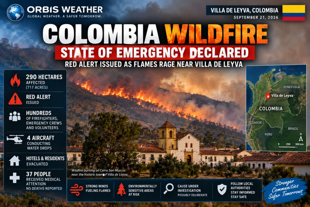
Colombia Wildfire Emergency: Red Alert Issued as Flames Rage Near Villa de Leyva
VILLA DE LEYVA, Colombia — September 21, 2026 — A major wildfire burning through the mountains surrounding the historic Colombian town of Villa de Leyva has prompted authorities to declare an emergency as flames threaten homes, hotels and environmentally sensitive areas.
The wildfire began Saturday, September 19, on Cerro San Marcos in Boyacá Department and continued burning Monday after more than 30 hours of firefighting operations. Strong winds, dry vegetation, steep terrain and heavy smoke have complicated efforts to contain the blaze. (Reuters Connect)
🔥 Nearly 300 Hectares Burned
Authorities reported Monday morning that approximately 290 hectares (717 acres) of vegetation had been affected. Boyacá Governor Carlos Amaya said crews had brought roughly 50% of the wildfire under control, but warned that strong winds could quickly cause conditions to deteriorate again. (El Heraldo)
The emergency response has grown substantially, with hundreds of firefighters, emergency personnel, residents and volunteers involved. Four aircraft have also been conducting water drops, although smoke and wind have periodically restricted aerial operations. (Noticias Caracol)
🚨 Red Alert and Public Calamity Declared
Authorities declared a red alert, while Villa de Leyva declared a public calamity, allowing officials to mobilize additional resources and coordinate the emergency response.
Schools in the municipality were closed Monday as officials attempted to reduce traffic and keep residents away from firefighting operations. A municipal coliseum has also been prepared as an emergency assistance and shelter location. (www.eluniversal.com.co)
🏨 Hotels and Residents Evacuated
The advancing flames forced precautionary evacuations from areas near the fire.
Among the locations affected were Hotel El Duruelo and Hotel Suites Arcoíris. Authorities reported that 29 people were evacuated from Suites Arcoíris as flames approached the area. Nearby residents have also been moved away from threatened neighborhoods. (infobae)
At least 37 people have received medical attention, according to reports cited by Colombian media. Most were members of emergency crews involved in fighting the fire, and authorities had reported no deaths or serious injuries as of Monday morning. (El Heraldo)
🌬️ Strong Winds Remain the Biggest Threat
One of the greatest challenges remains the weather.
Powerful wind gusts have pushed flames through dry vegetation and generated new fire fronts, while thick smoke has occasionally made helicopter operations difficult.
Authorities are particularly concerned about the fire spreading toward populated areas and the environmentally important Iguaque sanctuary. (Noticias RCN)
Colombia was already experiencing elevated wildfire danger before the Villa de Leyva fire. On September 14, the country’s IDEAM weather and environmental agency reported 279 municipalities under some level of wildfire alert, including 36 under red alert, with Boyacá among the departments containing numerous municipalities at risk. (IdeaM)
🔎 Cause Under Investigation
The cause of the Villa de Leyva wildfire has not been officially established.
Colombia’s environment minister said preliminary information indicated the blaze may have been deliberately started, but authorities were still investigating. Boyacá officials have reportedly offered a 45-million Colombian peso reward for information that helps determine responsibility for the fire. (infobae)
🌎 Orbis Weather — What Happens Next
Firefighters are expected to continue attacking remaining hotspots from the ground while aircraft make water drops whenever wind and visibility allow.
Even with approximately half of the fire reportedly controlled, the emergency is not over. Strong winds could reactivate burning areas or push flames beyond existing containment lines.
Residents and visitors around Villa de Leyva should follow instructions from Colombian emergency authorities, stay away from active firefighting zones and be prepared to evacuate if additional orders are issued.
Orbis Weather will continue monitoring the Villa de Leyva wildfire as crews work to bring one of Colombia’s latest major wildfire emergencies under control.
Incendio forestal en Colombia: declaran estado de emergencia y alerta roja mientras avanzan las llamas cerca de Villa de Leyva
VILLA DE LEYVA, Colombia — 21 de septiembre de 2026 — Un importante incendio forestal que afecta las montañas que rodean la histórica localidad colombiana de Villa de Leyva ha llevado a las autoridades a declarar una emergencia, mientras las llamas amenazan viviendas, hoteles y zonas ambientalmente sensibles.
El incendio comenzó el sábado 19 de septiembre en el Cerro San Marcos, en el departamento de Boyacá, y continuaba activo el lunes después de más de 30 horas de operaciones de extinción.
Los fuertes vientos, la vegetación seca, el terreno montañoso y el intenso humo han complicado considerablemente los esfuerzos para controlar el fuego.
🔥 Cerca de 300 hectáreas afectadas
Las autoridades informaron el lunes por la mañana que aproximadamente 290 hectáreas (717 acres) de vegetación habían sido afectadas.
El gobernador de Boyacá, Carlos Amaya, indicó que los equipos de emergencia habían logrado controlar aproximadamente el 50 % del incendio, aunque advirtió que los fuertes vientos podrían provocar una rápida reactivación o expansión de las llamas.
La respuesta de emergencia ha aumentado considerablemente, con cientos de bomberos, miembros de organismos de socorro, residentes y voluntarios participando en las labores.
Además, cuatro aeronaves han realizado descargas de agua sobre las zonas afectadas, aunque el humo y los fuertes vientos han limitado periódicamente las operaciones aéreas.
🚨 Alerta roja y calamidad pública
Las autoridades declararon una alerta roja, mientras que Villa de Leyva declaró una situación de calamidad pública, lo que permite movilizar recursos adicionales y mejorar la coordinación de la respuesta de emergencia.
Las clases fueron suspendidas el lunes en el municipio con el objetivo de reducir el tráfico y mantener a residentes y visitantes alejados de las operaciones de extinción.
También se preparó un coliseo municipal como centro de asistencia y posible refugio para las personas afectadas.
🏨 Evacuación de hoteles y residentes
El avance de las llamas obligó a realizar evacuaciones preventivas en sectores cercanos al incendio.
Entre los establecimientos afectados se encuentran el Hotel El Duruelo y el Hotel Suites Arcoíris. Las autoridades informaron que 29 personas fueron evacuadas del Suites Arcoíris cuando el fuego comenzó a acercarse a la zona.
También se evacuó preventivamente a residentes de sectores amenazados.
Al menos 37 personas recibieron atención médica, según reportes de medios colombianos. La mayoría eran integrantes de los equipos de emergencia que participaban en las labores contra el incendio.
Hasta el lunes por la mañana, no se habían reportado muertes ni lesiones graves.
🌬️ Los fuertes vientos siguen siendo una de las mayores amenazas
Las condiciones meteorológicas continúan siendo uno de los principales desafíos para los bomberos.
Las fuertes ráfagas de viento han empujado las llamas a través de la vegetación seca y han contribuido a la formación de nuevos frentes de fuego. Al mismo tiempo, el espeso humo ha dificultado en algunos momentos las operaciones de helicópteros y otras aeronaves.
Las autoridades están especialmente preocupadas por la posibilidad de que el incendio avance hacia áreas pobladas y hacia zonas de gran importancia ambiental, incluido el Santuario de Fauna y Flora Iguaque.
Colombia ya registraba un elevado riesgo de incendios forestales antes de que comenzara la emergencia en Villa de Leyva.
El 14 de septiembre, el IDEAM informó que 279 municipios del país se encontraban bajo algún nivel de alerta por incendios forestales, incluidos 36 municipios bajo alerta roja.
Boyacá figuraba entre los departamentos con numerosos municipios bajo riesgo.
🔎 La causa del incendio está bajo investigación
La causa del incendio forestal de Villa de Leyva todavía no ha sido determinada oficialmente.
La ministra de Ambiente de Colombia indicó que la información preliminar sugería que el incendio podría haber sido provocado intencionalmente, aunque las autoridades continúan investigando y todavía no se ha establecido una causa definitiva.
Funcionarios de Boyacá también habrían ofrecido una recompensa de 45 millones de pesos colombianos por información que permita determinar quién o qué provocó el incendio.
🌎 Orbis Weather — Qué ocurrirá ahora
Se espera que los bomberos continúen atacando los focos activos desde tierra mientras las aeronaves realizan descargas de agua cuando las condiciones de viento, humo y visibilidad lo permitan.
Aunque aproximadamente la mitad del incendio habría sido controlada, la emergencia aún no ha terminado.
Los fuertes vientos podrían reactivar zonas que ya habían sido parcialmente controladas o empujar las llamas más allá de las líneas de contención.
Se recomienda a residentes y visitantes de Villa de Leyva seguir las instrucciones de las autoridades colombianas, mantenerse alejados de las zonas donde trabajan los equipos de emergencia y estar preparados para evacuar si se emiten nuevas órdenes.
Orbis Weather continuará monitoreando el incendio forestal de Villa de Leyva mientras los equipos de emergencia trabajan para controlar una de las emergencias por incendios forestales más importantes que enfrenta actualmente Colombia.
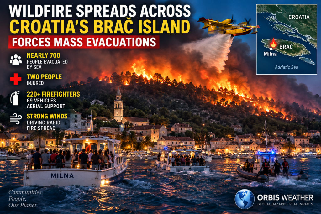
Wildfire Spreads Across Croatia’s Brač Island, Forces Mass Evacuations
BRAČ, Croatia — September 14, 2026 — A massive wildfire has swept across Croatia’s popular Adriatic island of Brač, forcing hundreds of residents and tourists to flee as strong winds pushed flames toward coastal communities.
The fire, which began near the village of Ložišća on September 10, spread rapidly across dry vegetation and difficult terrain before threatening communities including Milna on the western side of the island.
🔥 Nearly 700 Evacuated by Sea
The most dramatic phase of the emergency unfolded Saturday night into Sunday morning as flames advanced toward Milna and nearby tourist areas.
A major maritime evacuation was launched at approximately 9:56 p.m. Saturday, with rescue boats, tourist vessels, police craft, Croatian Coast Guard vessels and private boats helping move people away from the threatened coastline.
By early Sunday, reports indicated that around 700 people had been evacuated by sea.
Children, elderly residents and other vulnerable people were among those caught in potentially dangerous areas as smoke and flames approached the coastline.
🚨 Two People Injured
At least two people were injured during the emergency.
One elderly woman reportedly fell from a boat during the evacuation and nearly drowned. She was subsequently reported to be in stable condition.
Another person suffered injuries associated with smoke inhalation.
Despite the intensity of the wildfire, firefighters succeeded in defending many homes and preventing the flames from overrunning the town of Milna.
🚒 Hundreds of Firefighters Battle the Blaze
Croatia mounted a major firefighting operation as conditions deteriorated.
More than 220 firefighters and 69 firefighting vehicles were deployed, while four Canadair water-bombing aircraftattacked the flames from the air.
Crews worked through the night as powerful bora winds repeatedly pushed the fire across the island’s dry landscape.
Firefighters described an extremely difficult battle around Milna, where crews were forced to concentrate resources on protecting houses and tourist facilities.
🌬️ Strong Winds Drive Rapid Fire Spread
Wind has been one of the biggest challenges.
Strong bora winds helped drive the wildfire across scrubland, pine forest and other vegetation while making aerial and ground firefighting operations more difficult.
Satellite observations indicated that the burn scar expanded substantially as the fire moved toward western and southern portions of Brač.
Some estimates have placed the affected area at several thousand hectares, although estimates have varied as authorities and satellite analysts continue assessing the fire.
The scale makes it one of the most significant wildfire emergencies to affect the region this year.
🏠 Milna Defended
Milna became one of the main defensive lines for firefighters after the blaze moved dangerously close to the community.
Crews spent hours protecting buildings and preventing flames from entering populated areas.
The effort appears to have worked.
By September 14, conditions had improved significantly, with Croatian firefighting officials reporting that the fire had not experienced a major overnight resurgence, despite continued winds.
Firefighting forces could begin to be reduced if favorable conditions continue, although crews remain alert for hotspots and renewed flare-ups.
🛰️ European Emergency Mapping Activated
The scale of the wildfire also prompted activation of the Copernicus Emergency Management Service Rapid Mapping system.
Satellite mapping is being used to estimate the extent of the fire and assess damage across the island.
Brač covers roughly 395 square kilometers and is one of Croatia’s best-known Adriatic destinations, attracting large numbers of tourists during the summer season.
⚠️ Danger Not Completely Over
Although the situation has improved, wildfire crews still face the possibility of flare-ups.
Burning vegetation, steep terrain and shifting winds can allow apparently controlled sections of a wildfire to reignite.
Authorities have urged residents and visitors to stay away from affected roads and firefighting zones and to follow instructions from emergency services.
🌍 Orbis Weather — Wildfire Watch
Location: Brač Island, Croatia
Fire began: September 10, 2026
Major threatened area: Milna and western Brač
Evacuations: Around 700 people reported evacuated by sea
Firefighting response: 220+ firefighters, 69 vehicles and aerial firefighting aircraft
Primary hazard: Strong winds driving fire through dry vegetation
Current trend: Improving, but firefighting and monitoring continue
The Brač wildfire demonstrates how quickly a wind-driven Mediterranean wildfire can change from a remote vegetation fire into a major evacuation emergency.
For hundreds of people along the island’s coastline, the sea became the safest escape route as firefighters fought through the night to keep the flames away from homes.
Požar se širi hrvatskim otokom Bračem i prisiljava stotine ljudi na evakuaciju
BRAČ, Hrvatska — 14. rujna 2026. — Veliki šumski požar zahvatio je popularni hrvatski jadranski otok Brač, prisilivši stotine stanovnika i turista na evakuaciju dok je snažan vjetar potiskivao vatru prema obalnim naseljima.
Požar, koji je izbio 10. rujna u blizini Ložišća, brzo se proširio kroz suhu vegetaciju i teško pristupačan teren te ugrozio naselja, uključujući Milnu na zapadnom dijelu otoka.
🔥 Gotovo 700 ljudi evakuirano morem
Najdramatičnija faza izvanredne situacije odvijala se tijekom noći sa subote na nedjelju, kada se vatra približila Milni i okolnim turističkim područjima.
Oko 21:56 sati u subotu pokrenuta je velika pomorska evakuacija. U akciji su sudjelovali spasilački i turistički brodovi, policijska plovila, brodovi Hrvatske obalne straže te privatna plovila koja su pomagala u premještanju ljudi s ugrožene obale.
Do ranih nedjeljnih sati izvješća su navodila da je oko 700 ljudi evakuirano morem.
Među ljudima koji su se našli u potencijalno opasnim područjima dok su se dim i vatra približavali obali bili su djeca, starije osobe i druge ranjive skupine.
🚨 Dvije osobe ozlijeđene
Najmanje dvije osobe ozlijeđene su tijekom izvanredne situacije.
Prema izvješćima, jedna starija žena pala je s broda tijekom evakuacije i zamalo se utopila. Naknadno je objavljeno da je u stabilnom stanju.
Druga osoba zadobila je zdravstvene probleme povezane s udisanjem dima.
Unatoč intenzitetu požara, vatrogasci su uspjeli obraniti brojne kuće i spriječiti da plamen zahvati naseljeni dio Milne.
🚒 Stotine vatrogasaca u borbi s vatrom
Hrvatska je pokrenula veliku vatrogasnu operaciju nakon što su se uvjeti na terenu pogoršali.
Na požarište je raspoređeno više od 220 vatrogasaca i 69 vatrogasnih vozila, dok su četiri Canadaira iz zraka sudjelovala u gašenju požara.
Vatrogasne ekipe radile su tijekom cijele noći dok je snažna bura iznova širila vatru preko suhog krajolika otoka.
Posebno teška borba vodila se oko Milne, gdje su vatrogasci morali koncentrirati svoje snage na obranu kuća i turističkih objekata.
🌬️ Snažan vjetar ubrzao širenje požara
Vjetar je bio jedan od najvećih izazova za vatrogasce.
Snažna bura pomogla je širenju požara kroz makiju, borovu šumu i drugu vegetaciju, istodobno otežavajući gašenje iz zraka i s tla.
Satelitska opažanja pokazala su značajno povećanje opožarenog područja dok se požar širio prema zapadnim i južnim dijelovima Brača.
Prema pojedinim procjenama, zahvaćeno je nekoliko tisuća hektara, iako se procjene razlikuju dok nadležne službe i satelitski analitičari nastavljaju procjenjivati stvarne razmjere požara.
Zbog svoje veličine riječ je o jednom od značajnijih požara koji su ove godine pogodili ovu regiju.
🏠 Vatrogasci obranili Milnu
Milna je postala jedna od ključnih obrambenih točaka nakon što se požar opasno približio naselju.
Vatrogasci su satima štitili zgrade i pokušavali spriječiti ulazak vatre u naseljena područja.
Njihovi napori pokazali su se uspješnima.
Do 14. rujna situacija se znatno poboljšala, a hrvatske vatrogasne službe izvijestile su da tijekom noći nije došlo do većeg ponovnog razbuktavanja požara, unatoč vjetru.
Ako se povoljni uvjeti nastave, broj vatrogasnih snaga na terenu mogao bi se postupno smanjivati. Međutim, ekipe i dalje nadziru požarište zbog mogućih skrivenih žarišta i ponovnog širenja vatre.
🛰️ Aktivirano europsko satelitsko kartiranje
Razmjeri požara doveli su i do aktiviranja sustava Copernicus Emergency Management Service Rapid Mapping.
Satelitsko kartiranje koristi se za određivanje veličine opožarenog područja i procjenu štete diljem otoka.
Brač ima površinu od približno 395 četvornih kilometara i jedan je od najpoznatijih hrvatskih jadranskih otoka, koji tijekom ljetne turističke sezone privlači velik broj posjetitelja.
⚠️ Opasnost još nije potpuno prošla
Iako se situacija poboljšala, vatrogasci se i dalje suočavaju s mogućnošću ponovnog aktiviranja požara.
Goruća vegetacija, nepristupačan teren i promjene smjera vjetra mogu uzrokovati ponovno rasplamsavanje dijelova požarišta za koje se činilo da su pod kontrolom.
Nadležne službe pozvale su stanovnike i posjetitelje da se drže podalje od zahvaćenih cesta i područja u kojima djeluju vatrogasne ekipe te da slijede upute hitnih službi.
🌍 Orbis Weather — Praćenje požara
Lokacija: otok Brač, Hrvatska
Početak požara: 10. rujna 2026.
Glavno ugroženo područje: Milna i zapadni dio Brača
Evakuacije: oko 700 ljudi evakuirano morem
Vatrogasne snage: više od 220 vatrogasaca, 69 vozila i zračne snage
Glavna opasnost: snažan vjetar koji ubrzava širenje požara kroz suhu vegetaciju
Trenutačna situacija: stanje se poboljšava, ali gašenje i nadzor požarišta se nastavljaju
Požar na Braču pokazuje koliko se brzo požar potaknut snažnim vjetrom u mediteranskom području može pretvoriti iz požara otvorenog prostora u veliku izvanrednu situaciju koja zahtijeva masovnu evakuaciju.
Za stotine ljudi uz obalu otoka more je postalo najsigurniji put za bijeg, dok su se vatrogasci tijekom cijele noći borili kako bi spriječili da plamen zahvati njihove domove.
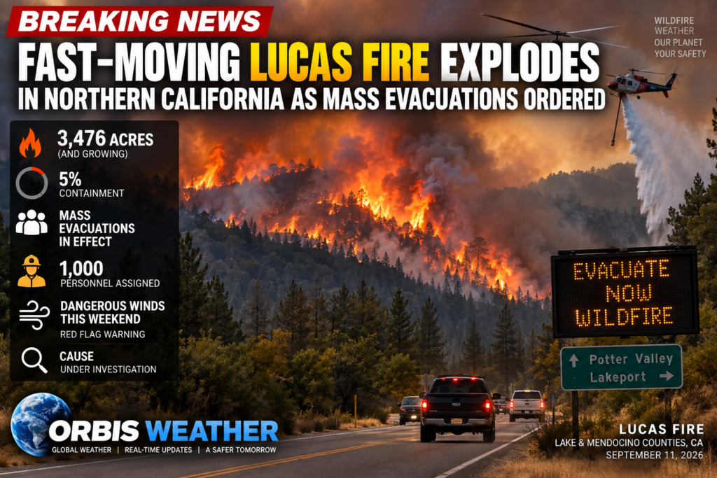
🔥 Fast-Moving Lucas Fire Explodes in Northern California as Mass Evacuations Ordered
LAKE & MENDOCINO COUNTIES, California — September 11, 2026 — A fast-moving wildfire burning across rugged terrain in Northern California exploded in size Friday, forcing widespread evacuations as firefighters race to gain control before another round of dangerous fire weather arrives.
The Lucas Fire, burning near Potter Valley along the Lake–Mendocino county line, has grown to approximately 3,476 acres and is just 5% contained, according to a Friday afternoon update from CAL FIRE.
That represents a dramatic increase from approximately 1,099 acres Friday morning, underscoring how rapidly the fire is spreading through the region.
🔥 Fire Explodes Across Rugged Terrain
The Lucas Fire began at approximately 9:18 a.m. Thursday, September 10, near Potter Valley. Early reports placed the fire at only about 10 acres.
Within hours, however, conditions deteriorated.
By Thursday afternoon, the fire had reached roughly 400 acres. By Thursday night, it had surpassed 1,000 acres, and by Friday afternoon it had more than tripled again to 3,476 acres.
Firefighters are dealing with steep, remote terrain that has complicated access to portions of the fire.
CAL FIRE has deployed a major response to the incident, with approximately 1,000 personnel assigned as of Friday morning. Numerous firefighting air tankers have also been conducting suppression missions when conditions permit.
🚨 Evacuation Orders Expand
Multiple communities and rural areas are now under mandatory evacuation orders.
In Lake County, evacuation orders include zones:
MNF-E016, MNF-E018, MNF-E019, UPP-E023, UPP-E025, UPP-E026, UPP-E027 and UPP-E030.
Additional evacuation warnings cover several Lake County zones, while warnings have also been issued for MEN-2POT08 and MEN-2UKV28 in Mendocino County.
Residents under an evacuation order should leave immediately rather than waiting for conditions to worsen.
A temporary evacuation point has been established at the Lake County Fairgrounds, Baldwin Pavilion, 401 Martin Street in Lakeport. The location is also being used for animal evacuations.
🚧 Roads Closed as Firefight Intensifies
Several roads have been closed as emergency crews work around the expanding fire.
Closures reported by CAL FIRE include intersections along Highway 20 at Bachelor Valley Road, Witter Springs Road and Saratoga Springs Road.
Conditions can change rapidly near an active wildfire, and additional closures are possible.
💨 Dangerous Fire Weather Arrives Saturday
Perhaps the biggest concern now is what happens next.
The National Weather Service has issued a Red Flag Warning for Lake County from 10 a.m. Saturday until 2 a.m. Sunday.
Forecasters expect northwest winds with gusts generally between 20 and 30 mph, with gusts potentially reaching 40 mph along higher ridges. Relative humidity could fall into the 20% to 30% range.
Those conditions could make an already difficult firefight significantly more dangerous.
The National Weather Service warns that fires already burning under these conditions may spread rapidly.
Eastern Mendocino County could also experience elevated fire danger as stronger winds develop Saturday.
🌫️ Smoke Spreads Beyond the Fire Zone
Smoke from Northern California wildfires is already affecting areas far from the flames.
Hazy skies have been reported across portions of the Truckee Meadows and Lake Tahoe region, with the Lucas Fire and other regional wildfires believed to be contributing to the smoke.
Smoke conditions can shift quickly depending on wind direction, and residents with respiratory problems should monitor local air-quality information.
🧑🚒 Firefighters Face a Critical 24 Hours
The next 24 to 36 hours could prove crucial.
Fire crews will attempt to strengthen containment lines before stronger winds arrive Saturday. Aircraft are supporting crews on the ground, while firefighters continue working in steep and difficult terrain.
The fire has already demonstrated its ability to expand rapidly, jumping from roughly 10 acres Thursday morning to more than 3,400 acres by Friday afternoon.
With Red Flag conditions approaching, even relatively small breaches of containment lines could allow flames to make another significant run.
❓ What Started the Lucas Fire?
The cause of the Lucas Fire remains under investigation, according to CAL FIRE.
As of the latest official incident update, CAL FIRE had not reported civilian or firefighter fatalities associated with the fire.
⚠️ Orbis Weather Wildfire Watch
The Lucas Fire remains an active and potentially dangerous wildfire.
Current status:
🔥 Fire: Lucas Fire
📍 Location: Lake–Mendocino county line near Potter Valley
🔥 Size: 3,476 acres
🚒 Containment: 5%
🚨 Evacuations: Multiple orders and warnings active
✈️ Response: Approximately 1,000 personnel and aerial firefighting resources
💨 Major concern: Stronger winds and low humidity Saturday
⚠️ Red Flag Warning: Lake County Saturday into early Sunday
🔍 Cause: Under investigation
Residents anywhere near the evacuation zones should remain prepared to leave quickly and follow instructions from local emergency officials.
With strong winds approaching and thousands of acres still burning uncontrolled, the Lucas Fire could remain one of Northern California’s most significant wildfire threats through the weekend.
This is a developing story. Acreage, containment, evacuation zones and road closures may change rapidly as firefighters assess the Lucas Fire overnight.
Orbis Weather will continue monitoring the Lucas Fire and Northern California fire conditions as new information becomes available.
About the Author
Paul Harrison — Founder & Publisher, Orbis Weather
Paul Harrison founded Orbis Weather in 2026 to make global weather and natural-hazard information easier to find, follow and understand. His coverage includes tropical cyclones, severe weather, extreme temperatures, earthquakes, volcanoes, wildfires, flooding and significant natural disasters worldwide.
View all articles by Paul Harrison → | Editorial Standards →









Live Lightning Map
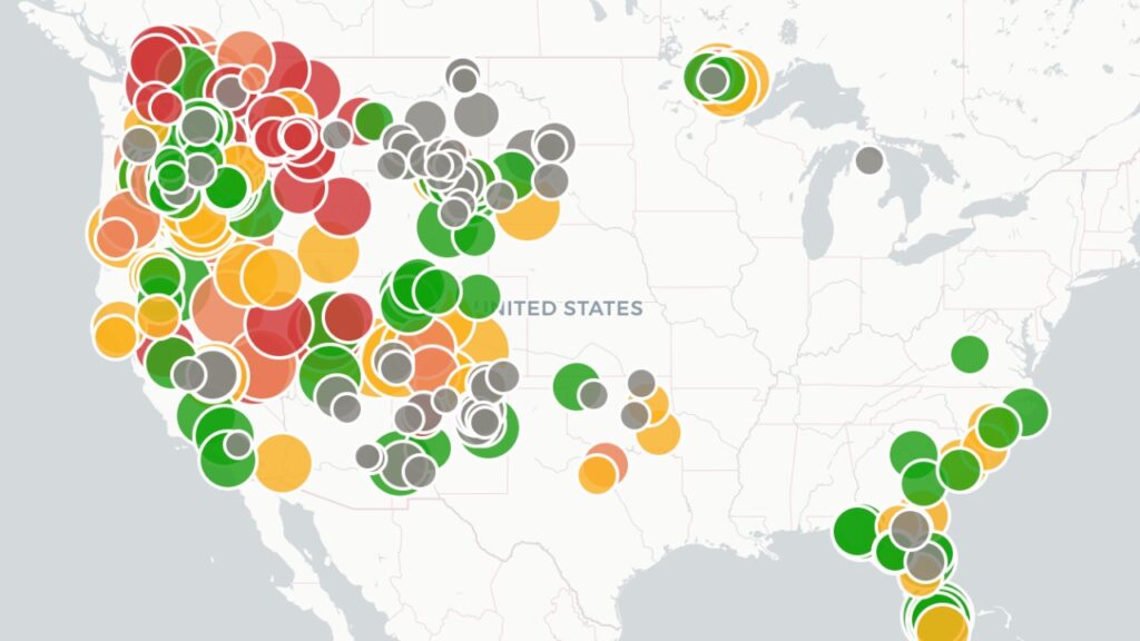
Live U.S. Wildfire Tracker

Live Wildfire Smoke & Air Quality Tracker

Live Earthquake Map
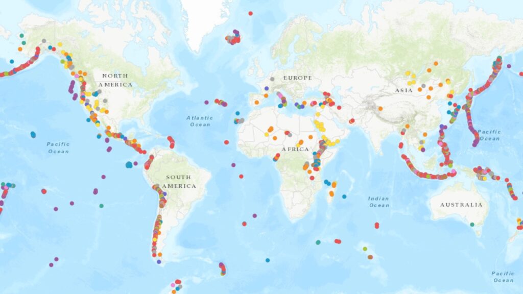
Live Volcano Eruption Tracker