
By Paul Harrison | Founder & Publisher, Orbis Weather
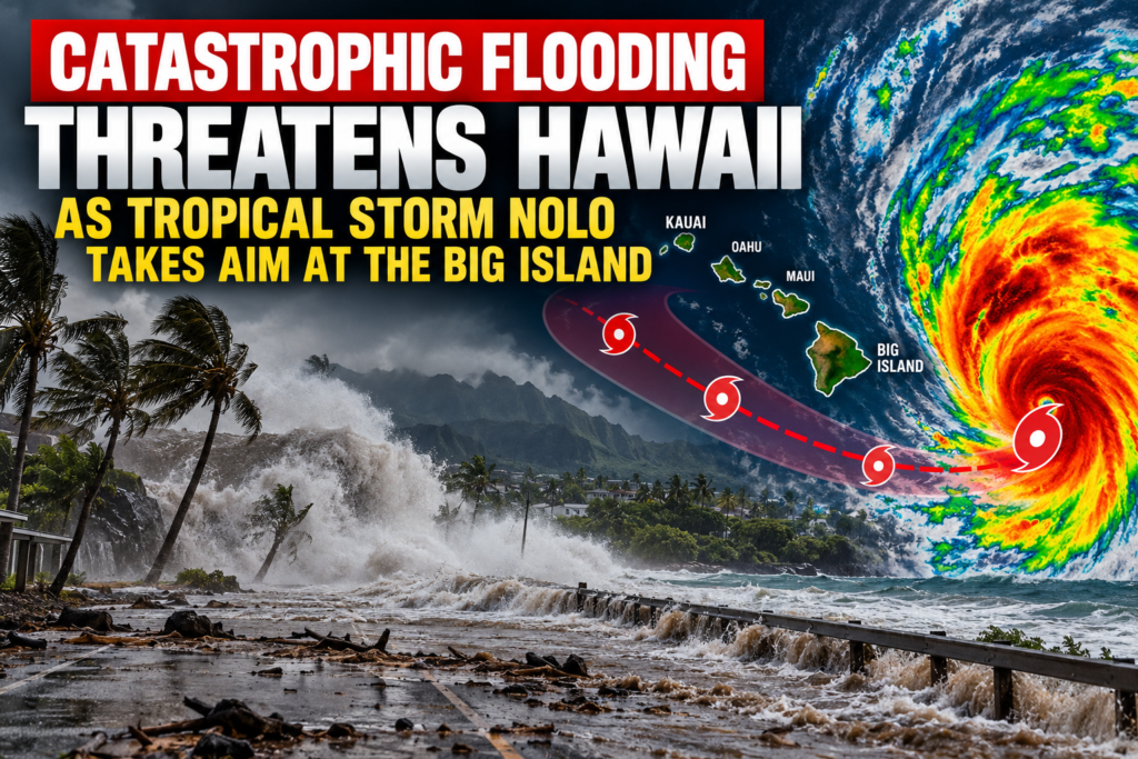

🌊 Catastrophic Flooding Threatens Hawaii as Tropical Storm Nolo Takes Aim at the Big Island
HAWAII — September 23, 2026 — Hawaii is preparing for a potentially dangerous tropical cyclone as Tropical Storm Nolo strengthens south of the islands, threatening the Big Island with extreme rainfall, destructive flooding, landslides and potentially hurricane-force winds.
The National Hurricane Center said Nolo had maximum sustained winds of 40 mph (65 km/h) at 11 a.m. HST Wednesday. The center was about 310 miles (500 km) south of South Point, Hawaii, moving west-northwest at approximately 6 mph. A Hurricane Watch is now in effect for Hawaii County, meaning hurricane conditions are possible within the next 48 hours.
Nolo is expected to strengthen as it approaches the Hawaiian Islands, potentially becoming a hurricane before making its closest approach to the Big Island. Forecasters say atmospheric and ocean conditions could support significant intensification, although the exact track and strength remain uncertain.
🌧️ Flooding Could Become the Biggest Threat
While damaging winds are a major concern, Nolo’s rainfall may prove even more dangerous.
National Weather Service forecasts indicate the windward and southeastern portions of the Big Island face the greatest risk as deep tropical moisture interacts with Hawaii’s steep terrain. Flood Watches have been issued for the Big Island and Maui County.
Some forecasts indicate extreme rainfall totals approaching 2 feet or more in the hardest-hit areas, with even greater localized amounts possible depending on Nolo’s eventual track.
That amount of tropical rainfall falling over mountainous terrain could produce rapidly rising streams, overflowing rivers, flash floods and potentially deadly landslides.
⚠️ The threat includes:
Life-threatening flash flooding
Landslides and rockslides
Roads and bridges becoming impassable
Floodwater entering homes and businesses
Washed-out roads and isolated communities
Rapidly rising streams and rivers
Dangerous conditions in valleys and near steep terrain
The National Weather Service warns that significant heavy rain is likely over windward and southeastern portions of the Big Island, while other parts of Maui County are also at risk.
🌀 Nolo Could Strengthen Rapidly
Nolo only recently regained tropical-storm status, but satellite imagery Wednesday showed the cyclone becoming increasingly organized.
Forecasters noted tighter curved rainbands developing around the circulation, while satellite intensity estimates continued to increase.
Nolo’s relatively slow movement is another concern.
A slow-moving tropical cyclone can expose the same areas to repeated bands of torrential rainfall for hours — or even days — dramatically increasing the potential for catastrophic flooding.
🏝️ Big Island Faces the Greatest Danger
The Big Island is currently at the center of the threat.
A Hurricane Watch covers Hawaii County, including communities along the island’s eastern and southeastern sides. Areas including Hilo, Pahoa, Volcano, Naalehu and Pahala could experience significant impacts depending on Nolo’s eventual track.
Even if the center of Nolo does not make landfall, the storm’s enormous moisture supply means dangerous weather could extend far from its circulation.
Mountainous terrain can dramatically enhance rainfall on the windward side of the island as moisture-laden tropical air is forced upward.
That makes communities near streams, valleys, steep slopes and historically flood-prone areas particularly vulnerable.
🌧️ Maui Also Faces Serious Flooding Risk
The danger is not limited to the Big Island.
A Flood Watch is also in effect across Maui County, including portions of Maui, Molokai, Lanai and Kahoolawe. Heavy tropical rain is expected to spread northwestward as Nolo approaches.
Windward Maui and the slopes of Haleakala could experience particularly heavy rainfall as Nolo’s moisture interacts with the island’s mountains.
Residents and visitors should not assume they are safe simply because Nolo’s center remains closer to the Big Island.
🌊 Dangerous Surf and Coastal Flooding
Nolo will also generate increasingly dangerous ocean conditions.
Large swells could produce high surf, powerful rip currents, coastal erosion and localized coastal flooding along exposed shores.
For portions of the Big Island, forecasters are also monitoring the possibility of localized storm-surge flooding as Nolo passes nearby.
Boaters, swimmers and surfers should closely monitor official marine warnings as conditions deteriorate.
🚨 Hawaii Residents Urged to Prepare Now
Officials are urging residents to use the remaining time before conditions worsen to prepare.
People in vulnerable locations should know whether they live near a flood zone, stream, steep hillside or evacuation route. Emergency supplies should include drinking water, food, medications, flashlights, batteries and charging equipment.
Vehicles should be fueled or charged, and residents should avoid waiting until heavy rainfall begins before making preparations.
Most importantly, never attempt to drive through floodwater.
Even relatively shallow moving water can sweep a vehicle from a roadway, and tropical rainfall can transform normally quiet streams into violent torrents in minutes.
📍 Nolo’s Track Remains Critical
There is still meaningful uncertainty over exactly how close Nolo’s center will come to the Big Island.
A relatively small shift in the track could dramatically change which communities receive the strongest winds and heaviest rainfall.
But residents should not focus solely on the forecast center line.
Nolo’s rain shield will cover a much larger area than its eye or center, meaning severe flooding could occur well away from the storm’s eventual track.
🔴 Orbis Weather Outlook
Tropical Storm Nolo is becoming a potentially high-impact weather event for Hawaii.
The combination of strengthening winds, extremely moisture-rich tropical air, Hawaii’s steep terrain and the possibility of prolonged rainfall creates a serious risk of flash flooding, landslides and infrastructure damage, especially across the Big Island.
The National Weather Service has already placed vulnerable areas under flood watches, while the Hurricane Watch for Hawaii County underscores the possibility of substantially worsening conditions during the next several days.
The most dangerous period appears likely to develop Friday into the weekend, but heavy rainfall can begin well before Nolo makes its closest approach.
Residents and visitors across the Big Island and Maui should closely follow updates from the National Hurricane Center, National Weather Service Honolulu and local emergency-management officials.
Orbis Weather will continue tracking Tropical Storm Nolo as it approaches Hawaii.
Forecast information can change rapidly with tropical cyclones. Always follow official evacuation orders, Flash Flood Warnings and emergency instructions issued by local authorities.
About the Author
Paul Harrison — Founder & Publisher, Orbis Weather
Paul Harrison founded Orbis Weather in 2026 to make global weather and natural-hazard information easier to find, follow and understand. His coverage includes tropical cyclones, severe weather, extreme temperatures, earthquakes, volcanoes, wildfires, flooding and significant natural disasters worldwide.
View all articles by Paul Harrison → | Editorial Standards →