
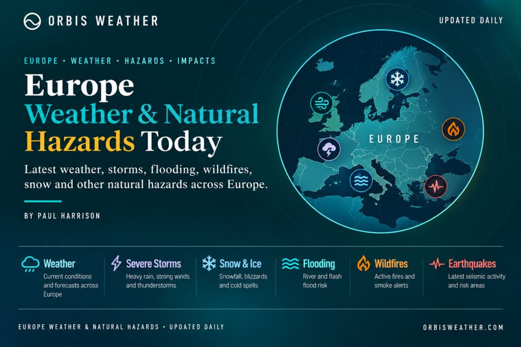
🌍 Europe Weather & Natural Hazards Today
By Paul Harrison | Founder & Publisher, Orbis Weather

- Southwest Indian Ocean Tropical Weather Update – November 5, 2026 8:59 PM
- Australian Region Tropical Weather Update — Thursday, November 5, 2026 8:43 PM
- Europe Weather & Natural Hazards Today — Thursday, November 5, 2026 7:25 PM
- Southeast Asia Weather & Natural Hazards Today: Thursday, November 5, 2026 7:03 PM
- Singapore Monsoon & Flood This Week: Thursday, November 5, 2026 6:53 PM
- Africa Weather & Natural Hazards Today — Thursday, November 5, 2026 6:08 PM
- Sydney Battered by Storms 5:15 PM
- Middle East Weather & Natural Hazards Today — Thursday, November 5, 2026 4:29 PM
- Earth’s Cold Spots This Week Nov 4, 2026 3:05 PM
- Catastrophic Flooding Forces Florida Schools to Remain Closed as Communities Struggle to Recover 12:23 PM
- Australia, New Zealand & Oceania Weather & Natural Hazards Today — Thursday, November 5, 2026 12:05 PM
- South America Weather & Natural Hazards Today — November 4, 2026 8:14 AM
- Central America Weather & Natural Hazards Today: Heavy Rain, Dangerous Flooding and Landslide Threats Increase Across the Region 8:05 AM
- North America Weather & Natural Hazards Today: Heavy Mountain Snow, Flash Flood Risks and Atlantic Tropical Development 7:53 AM
- Daily Earthquakes, Storms, Fires & Floods Report — November 4, 2026 7:41 AM
- Weekly Earth’s Extreme Weather Report — Wednesday, November 4, 2026 7:34 AM
- Tropical Atlantic Daily Report: Wednesday, November 4, 2026 7:26 AM
- Eastern & Central Pacific Tropical Weather Update: Wednesday, November 4, 2026 7:11 AM
- WESTERN PACIFIC Tropical Weather Update: Typhoon In-Fa Remains Active as Storm Turns North 6:58 AM





🌍 Europe Weather & Natural Hazards Today — Thursday, November 5, 2026
ORBIS WEATHER | EUROPE DAILY WEATHER & NATURAL HAZARDS REPORT
By Paul Harrison | Founder & Publisher, Orbis Weather
Published: Thursday, November 5, 2026 — European local date
Coverage: United Kingdom, Ireland, France, Spain, Portugal, Germany, Central Europe, Scandinavia, Italy, Greece, the Balkans and Eastern Europe.
Reporting focus: Heavy rainfall, flooding, thunderstorms, damaging winds, frost, snow, coastal hazards, earthquakes and volcanic activity.
🌦️ Europe Weather Overview — November 5, 2026
Europe enters Thursday with several contrasting weather patterns, as unsettled conditions develop across parts of southwestern Europe and the Mediterranean while much of northern and western Europe experiences a mixture of cloud, cool temperatures and relatively quieter weather.
The most important developing weather story is the potential for heavy rainfall and thunderstorms across parts of southern France, Spain and the Mediterranean region, where low-pressure systems may produce localized flooding and difficult travel conditions.
Southern France faces another period of rainfall, particularly around Languedoc and the Mediterranean coastline. Showers may extend toward the Alps and Pyrenees, with thunderstorms possible along the coast.
Italy is also monitoring a developing rainfall pattern, with showers forecast across Piedmont, the Aosta Valley, Sardinia and Sicily.
Meanwhile, the United Kingdom is expected to experience variable cloud, occasional drizzle and near-seasonal temperatures. Clearer overnight periods could produce localized frost and fog.
Across northern and central Europe, the arrival of November brings increasing concern about freezing temperatures, reduced visibility and hazardous conditions on mountain roads.
These regional developments are supported by forecasts published November 4 by the UK Met Office and contemporary forecasts for France and Italy.
🚨 Europe’s Main Weather Hazards Today
Hazard | Areas to monitor | Main concern |
|---|---|---|
🌧️ Heavy rainfall | Southern France, Spain, Mediterranean | Localized flooding |
⛈️ Thunderstorms | Mediterranean France, Iberian Peninsula | Lightning and intense rainfall |
🌊 Coastal conditions | Mediterranean and Atlantic coasts | Rough seas and strong winds |
🌫️ Fog | UK, Central Europe | Reduced visibility |
🧊 Frost | Northern and Central Europe | Slippery roads |
❄️ Mountain snow | Alps, Scandinavia | High-elevation travel hazards |
🌍 Earthquakes | Greece, Italy, Balkans, Iceland | Seismic monitoring |
🌋 Volcanoes | Iceland and Italy | Volcanic monitoring |
Important: This table combines forecast weather concerns with routine natural-hazard monitoring. It does not indicate that every hazard is active or that every region is under an official warning.
🇬🇧 United Kingdom — Cloud, Drizzle and Chilly Conditions
The United Kingdom enters Thursday with a relatively subdued weather pattern compared with the more unsettled conditions developing around the Mediterranean.
According to the UK Met Office forecast issued Wednesday afternoon, November 4, much of the country can expect variable cloud with occasional brighter intervals.
Drizzly showers are expected, particularly toward northeastern areas, while eastern coastal communities may experience cooler conditions because of onshore winds.
🌡️ Weather outlook
England: Variable cloud, occasional brighter periods and scattered drizzle.
Scotland: Cool conditions, with localized frost or fog possible after overnight clear spells.
Wales: Mostly cloudy periods with occasional brighter intervals.
Northern Ireland: Cloud and occasional brighter weather, with local fog possible in sheltered areas.
Eastern coasts: Breezy conditions making temperatures feel cooler.
Temperatures should generally remain close to the seasonal average.
🌫️ Main hazards
Fog may reduce visibility on rural roads and in sheltered valleys, particularly during the morning.
Where skies clear overnight, frost could create slippery surfaces on untreated roads and pavements.
📅 Looking ahead
Friday is expected to bring another largely cloudy day, with showers focused mainly toward southwestern areas.
More changeable weather may develop during the weekend as Atlantic weather systems begin influencing parts of the country.
Orbis Weather assessment: No widespread severe-weather emergency is established by the reviewed UK national forecast for Thursday, although local conditions and warnings should continue to be monitored.
🇮🇪 Ireland — Atlantic Weather and Coastal Monitoring
Ireland remains exposed to rapidly changing Atlantic weather during November.
Although no specific nationwide severe-weather event for Thursday has been independently established in the information reviewed, several seasonal hazards deserve attention.
🌧️ Conditions to monitor
Atlantic showers and changing cloud cover.
Stronger winds along exposed western and northern coastlines.
Wet roads during periods of rainfall.
Localized fog in sheltered inland areas.
Rough seas where Atlantic winds strengthen.
Coastal communities, fishing vessels and ferry operators should consult the latest marine forecasts before departure.
Official forecast: Met Éireann
🇫🇷 France — Heavy Rain and Mediterranean Thunderstorm Risk
Southern France is one of the principal areas to monitor during Thursday’s European weather outlook.
Rain is forecast to continue across parts of the Languedoc region, potentially extending toward the Alps, Pyrenees and central France.
Thunderstorms could develop near the Mediterranean coastline, where intense rainfall may create localized flooding.
The precise intensity and distribution of thunderstorms remain uncertain.
⚠️ Areas of concern
Languedoc and Mediterranean France: Persistent rainfall and possible thunderstorms.
Provence and southeastern France: Showers and changing coastal conditions.
Alps and Pyrenees: Rain at lower elevations, with colder conditions at higher altitudes.
Northern and eastern France: Chilly conditions, with some areas forecast to reach only 7–10°C (45–50°F).
Brittany: Afternoon temperatures around 11–13°C (52–55°F).
Southeastern France: Some locations could reach approximately 17°C (63°F), despite unsettled conditions.
🌊 Flooding concerns
Mediterranean rainfall events can intensify rapidly when moist air is forced upward over coastal mountains.
Where heavy downpours persist, streams and drainage systems can respond quickly.
Residents should avoid flooded roads and monitor local rainfall warnings.
Orbis Weather assessment: Southern France warrants close monitoring Thursday, particularly for heavy rainfall and possible coastal thunderstorms. The reviewed forecast does not establish widespread destructive flooding as an ongoing event.
🇪🇸 🇵🇹 Spain and Portugal — Atlantic Low Pressure and Rainfall Concerns
The Iberian Peninsula remains an important monitoring area as low-pressure activity influences southwestern Europe.
Spain’s national meteorological agency, AEMET, maintains a warning system covering heavy rain, thunderstorms, coastal hazards and other dangerous weather.
🌧️ Main hazards to monitor
Spain: Rainfall and thunderstorm developments, particularly where Atlantic and Mediterranean weather systems interact.
Portugal: Atlantic coastal winds, showers and changing marine conditions.
Mountain regions: Colder weather and possible wintry precipitation at higher elevations.
Coastal communities: Rough seas and hazardous surf where strong winds develop.
Heavy rainfall can cause localized flash flooding, particularly in steep terrain, dry riverbeds and urban areas with limited drainage.
The precise locations and validity periods of Thursday’s warnings should be checked directly with the national weather agencies rather than inferred from the broader regional forecast.
Official warnings: AEMET Spain weather warnings
🇮🇹 Italy — Rain Returns to Piedmont, Sardinia and Sicily
Italy faces a developing period of unsettled weather as an Iberian low-pressure system influences parts of the country.
Forecasts published November 4 indicate increasing cloud and scattered rainfall across western northern Italy and the major Mediterranean islands on Thursday.
🌧️ Regional forecast
Region | Forecast conditions |
|---|---|
Piedmont and Aosta Valley | Scattered rain, approximately 5–15 mm |
Eastern Sardinia | Rainfall around 10–20 mm |
Eastern and southern Sicily | Rainfall around 10–20 mm |
Northeastern Italy | Largely dry with brighter conditions |
Central Italy | Variable cloud, generally limited rainfall |
Western coastal areas | Southerly winds, locally gusting 40–50 km/h |
The rainfall totals are forecasts for approximately 24 hours, not confirmed observations.
🌊 Coastal and marine conditions
Seas along some western coastal areas may become rough to very rough, with forecast wave heights around 1.3–1.8 metres.
Travelers using smaller vessels should check local marine warnings.
❄️ Alpine conditions
At higher elevations, colder temperatures may support wintry precipitation. Mountain travelers should monitor forecasts for changing snow levels and road conditions.
Orbis Weather assessment: The main Italian concerns Thursday are localized rainfall, coastal winds and higher-elevation conditions rather than a confirmed nationwide severe-weather emergency.
🇩🇪 Germany — Frost, Fog and Early Winter Hazards
Germany enters November with increasing potential for cold mornings, fog and localized frost.
High-pressure conditions can allow temperatures to fall rapidly overnight, particularly where skies clear and winds remain light.
🧊 Main weather concerns
Northern Germany: Low cloud, fog and cool conditions.
Central Germany: Frost risk in sheltered valleys and rural areas.
Southern Germany: Colder conditions near the Alps, particularly at higher elevations.
Major cities: Reduced visibility during early-morning travel where fog develops.
Drivers should watch for icy patches on bridges and untreated roads when temperatures approach freezing.
These are seasonal monitoring priorities; the information reviewed does not confirm a nationwide German ice or snow warning for November 5.
Official information: Deutscher Wetterdienst (DWD)
🇨🇭 🇦🇹 🇵🇱 🇨🇿 Central Europe — Fog, Frost and Mountain Conditions
Switzerland, Austria, Poland, Czechia, Slovakia and Hungary are entering a period when overnight temperatures and mountain weather become increasingly important.
🏔️ Alpine regions
The Alps can experience rapidly changing conditions during November, including snowfall at higher elevations, freezing temperatures and reduced visibility.
Snow-covered mountain passes may become difficult to navigate when temperatures fall below freezing.
🌫️ Lowland regions
Fog and low cloud can develop in valleys and river basins during stable weather.
These conditions may persist into the morning, particularly where cold air becomes trapped beneath warmer air.
⚠️ Hazards to monitor
Overnight frost and icy surfaces.
Fog affecting roads and airports.
Snow and ice at higher elevations.
Rapid changes in mountain visibility.
Localized rainfall and river-level fluctuations.
No widespread severe-weather emergency across Central Europe has been independently confirmed for Thursday in the sources reviewed.
🇳🇴 🇸🇪 🇫🇮 Scandinavia — Cold Weather and Increasing Winter Risks
Northern Europe continues its seasonal transition toward winter.
Norway, Sweden and Finland face increasingly short daylight hours, colder nights and the potential for snow and ice, especially across northern and elevated regions.
❄️ Northern Scandinavia
Snowfall and freezing temperatures become increasingly important for road transport and outdoor activities at this time of year.
🌊 Norwegian coastline
Coastal communities should monitor wind and wave forecasts, particularly where weather systems move across the Norwegian Sea.
🧊 Finland and Sweden
Freezing conditions can create hazardous driving surfaces, especially during early-morning and nighttime travel.
Orbis Weather assessment: Winter travel conditions are a growing concern across northern Scandinavia, but specific snow totals and active warning levels for November 5 have not been independently verified.
Official sources: Norwegian Meteorological Institute and Finnish Meteorological Institute.
🇬🇷 Greece and the Balkans — Monitoring Conditions After Mediterranean Storms
Greece and parts of southeastern Europe remain important areas for weather monitoring following unsettled conditions earlier in the week.
Heavy rainfall and thunderstorms affected parts of the eastern Mediterranean during the preceding days.
However, earlier warnings should not automatically be treated as active on Thursday.
🌧️ Greece
Areas to monitor include western Greece, the Aegean islands and northeastern regions where heavy rainfall may create localized drainage problems.
🇭🇷 Croatia and the Adriatic
Strong coastal winds can create dangerous conditions for small vessels and ferry operations.
🇧🇬 Bulgaria and southeastern Europe
Rainfall and river conditions require monitoring where unsettled weather persists.
A Meteoalarm-based warning snapshot published November 4 listed a red rain warning for Bulgaria, alongside other European warnings. That snapshot is not sufficient to establish the warning’s validity throughout November 5; residents should verify the current affected districts and expiry times.
⚠️ Main concerns
Localized flooding, slippery roads, thunderstorms and hazardous marine conditions remain the principal hazards to monitor where rainfall continues.
🇷🇴 🇺🇦 🇵🇱 Eastern Europe — Falling Temperatures and Seasonal Hazards
Eastern Europe is moving further into the colder part of the year, with growing potential for frost, fog and wintry weather.
🌡️ Regional considerations
Romania: Fog and cold conditions in valleys, with possible wintry weather in the Carpathians.
Ukraine: Falling nighttime temperatures and the potential for frost or freezing conditions.
Eastern Poland: Cold mornings, fog and occasional icy surfaces.
Baltic countries: Increasing risk of frost, freezing precipitation and winter travel difficulties as November progresses.
These are seasonal hazards rather than verified countrywide warnings for Thursday.
Travelers should consult national forecasts for the latest local conditions.
🌍 Earthquake Monitoring — Europe
Europe remains seismically active, particularly around the Mediterranean, the Balkans and Iceland.
Earthquakes cannot be reliably predicted by date, and routine seismic monitoring does not mean that a damaging earthquake is imminent.
Areas of ongoing seismic monitoring
Region | Geological concern |
|---|---|
🇬🇷 Greece | Active fault systems and regional earthquakes |
🇮🇹 Italy | Apennine seismic activity |
🇷🇴 Romania | Vrancea intermediate-depth earthquakes |
🇮🇸 Iceland | Volcanic and tectonic earthquakes |
🇹🇷 Türkiye | North Anatolian and other active fault systems |
🇭🇷 Balkans | Regional fault activity |
🔎 Earthquake status for November 5
A verified list of significant earthquakes occurring specifically on November 5 was not available from the sources reviewed.
Therefore, Orbis Weather is not reporting unverified earthquake magnitudes, casualties or damage.
For updated earthquake locations, magnitudes and depths, consult the European-Mediterranean Seismological Centre (EMSC) or USGS Earthquake Map.
🌋 Volcano Monitoring — Iceland and Italy
Europe contains several active volcanic systems requiring continuous scientific monitoring.
🇮🇸 Iceland
The Reykjanes Peninsula remains an important volcanic monitoring region because of its recent history of magma intrusions and eruptions.
Monitoring focuses on ground deformation, earthquake swarms, gas emissions and magma movement.
An earthquake swarm alone does not establish that an eruption is imminent.
🇮🇹 Mount Etna
Mount Etna in Sicily is one of Europe’s most active volcanoes.
Scientists monitor seismic activity, gas emissions, thermal anomalies and changes in volcanic behavior.
🇮🇹 Stromboli
Stromboli is known for frequent explosive volcanic activity, although the intensity and frequency can change.
⚠️ Current status
No new eruption beginning specifically on November 5 has been independently confirmed in the information reviewed.
Official volcanic monitoring: Icelandic Meteorological Office and Italy’s National Institute of Geophysics and Volcanology (INGV).
🌊 European Flooding and Coastal Hazards
Flooding remains one of Europe’s most important natural hazards during autumn.
Atlantic storms, Mediterranean low-pressure systems and persistent rainfall can produce different types of flooding.
🌧️ Flash flooding
Rapid flooding may occur when intense thunderstorms overwhelm drainage systems, particularly in urban areas and steep valleys.
🏞️ River flooding
Prolonged rainfall can cause rivers to rise over several days, sometimes after the heaviest rain has ended.
🌊 Coastal flooding
Strong onshore winds and elevated sea levels can create coastal flooding, particularly when high tides coincide with storm-driven waves.
Regions to monitor Thursday
Southern France and parts of the Mediterranean deserve particular attention because of the forecast rainfall and possible thunderstorms.
Residents should follow official warnings and avoid entering flooded roads, even when water appears shallow.
🌡️ Europe Temperature Outlook — Thursday, November 5
The following figures are selected forecast examples, not a comprehensive European temperature observation table.
Location or region | Forecast temperature |
|---|---|
🇫🇷 Brittany | 11–13°C (52–55°F) |
🇫🇷 Northern and eastern France | 7–10°C (45–50°F) |
🇫🇷 Southeastern France | Up to 17°C (63°F) |
🇮🇹 Central Italy | Around 18–19°C (64–66°F) |
🇮🇹 Cagliari, Sardinia | Up to 21°C (70°F) |
The figures are drawn from forecasts issued ahead of Thursday and may change as weather systems evolve.
📅 Europe Weather Outlook — November 5–8, 2026
Date | Expected developments |
|---|---|
Thursday, Nov. 5 | Southern France faces rainfall and possible storms; parts of Italy turn wetter; UK mostly cloudy with drizzle |
Friday, Nov. 6 | Rain may persist around the Mediterranean; UK showers focused mainly in the southwest |
Saturday, Nov. 7 | More changeable conditions in the UK; scattered showers possible across parts of Italy |
Sunday, Nov. 8 | Brighter conditions expected across much of Italy; UK sunshine more likely in southern areas |
This outlook summarizes available regional forecast trends rather than providing a verified forecast for every European country.
🚨 European Weather Safety Advice
During periods of unsettled autumn weather, residents and travelers should remain alert to changing conditions.
🌧️ Heavy rain: Avoid flooded roads, underpasses and rapidly rising streams.
⛈️ Thunderstorms: Move indoors when thunder is heard and avoid exposed locations.
💨 Strong winds: Secure loose outdoor objects and avoid exposed coastal areas during warnings.
❄️ Snow and ice: Check mountain routes and carry suitable winter equipment.
🌫️ Fog: Reduce driving speed and increase following distances.
🌊 Rough seas: Check marine forecasts before boating or swimming.
🌍 Earthquakes: Follow local civil protection instructions and know how to Drop, Cover and Hold On.
🌋 Volcanic activity: Follow official exclusion zones and volcanic observatory updates.
📡 Official European Weather and Natural Hazard Sources
Orbis Weather recommends the following authoritative agencies for current forecasts, alerts and scientific monitoring.
Organization | Information provided |
|---|---|
European severe-weather warnings | |
Numerical weather prediction and forecast analysis | |
United Kingdom forecasts and warnings | |
Ireland forecasts and warnings | |
France forecasts and warnings | |
Spain forecasts and warnings | |
Germany forecasts and warnings | |
European earthquake monitoring | |
Italian earthquakes and volcanoes | |
Icelandic weather, earthquakes and volcanoes | |
European environmental and Earth observation information |
📰 Orbis Weather Editorial Methodology and Accuracy Statement
Prepared by Paul Harrison | Orbis Weather
This report provides a regional overview of European weather conditions, forecasts and natural hazards for Thursday, November 5, 2026.
The article draws on publicly available meteorological forecasts, official warning services, geological monitoring resources and relevant weather reporting.
How this report is prepared
Weather forecasts are assessed using available national meteorological information and supporting reporting. Significant hazards are discussed in their geographical context, with attention to forecast uncertainty and the difference between a potential threat and a confirmed event.
Forecasts versus observations
Forecast rainfall, wind speeds, temperatures and weather developments are not presented as confirmed observations unless independently verified.
Where current earthquake or volcanic event information cannot be established, this is stated rather than inventing event details.
Important limitations
Europe covers a large geographical area with substantial local weather variation. Conditions may change rapidly, and some national warnings may be issued, revised or cancelled after publication.
This report is a regional editorial briefing and does not replace official, location-specific emergency warnings.
Corrections and updates
Orbis Weather aims to correct material factual errors and update significant developments as reliable information becomes available.
Readers should always consult their national meteorological agency and local emergency management authorities when severe weather threatens.
🌍 Final Outlook — Europe, November 5, 2026
Europe’s principal weather concern Thursday is the developing rainfall pattern across southwestern Europe and the Mediterranean.
Southern France faces the possibility of heavy rain and thunderstorms, while parts of Italy are forecast to experience renewed showers and stronger coastal winds.
The United Kingdom should see generally quieter weather, although drizzle, fog and localized frost remain possible.
Across northern and central Europe, the transition toward winter continues to increase the importance of frost, snow and reduced visibility.
Earthquake and volcanic monitoring remains essential across Europe’s geologically active regions, but no specific new major geological disaster has been established by the sources reviewed for this report.
Orbis Weather will continue monitoring Europe’s changing weather patterns, severe-weather warnings and natural hazards.
Sometimes the most dangerous weather is not the biggest storm on the map, but the localized event that develops with little warning.
Paul Harrison
Founder & Publisher — Orbis Weather
Independent weather reporting, natural hazard monitoring and global environmental coverage.
About the Author
Paul Harrison — Founder & Publisher, Orbis Weather
Paul Harrison founded Orbis Weather in 2026 to make global weather and natural-hazard information easier to find, follow and understand. His coverage includes tropical cyclones, severe weather, extreme temperatures, earthquakes, volcanoes, wildfires, flooding and significant natural disasters worldwide.
View all articles by Paul Harrison → | Editorial Standards →
Global Weather Tracker Hub
Explore weather maps, tropical systems, storms and natural hazards around the world.
No matching trackers found.