
South America Weather & Natural Hazards Today
By Paul Harrison | Founder & Publisher, Orbis Weather
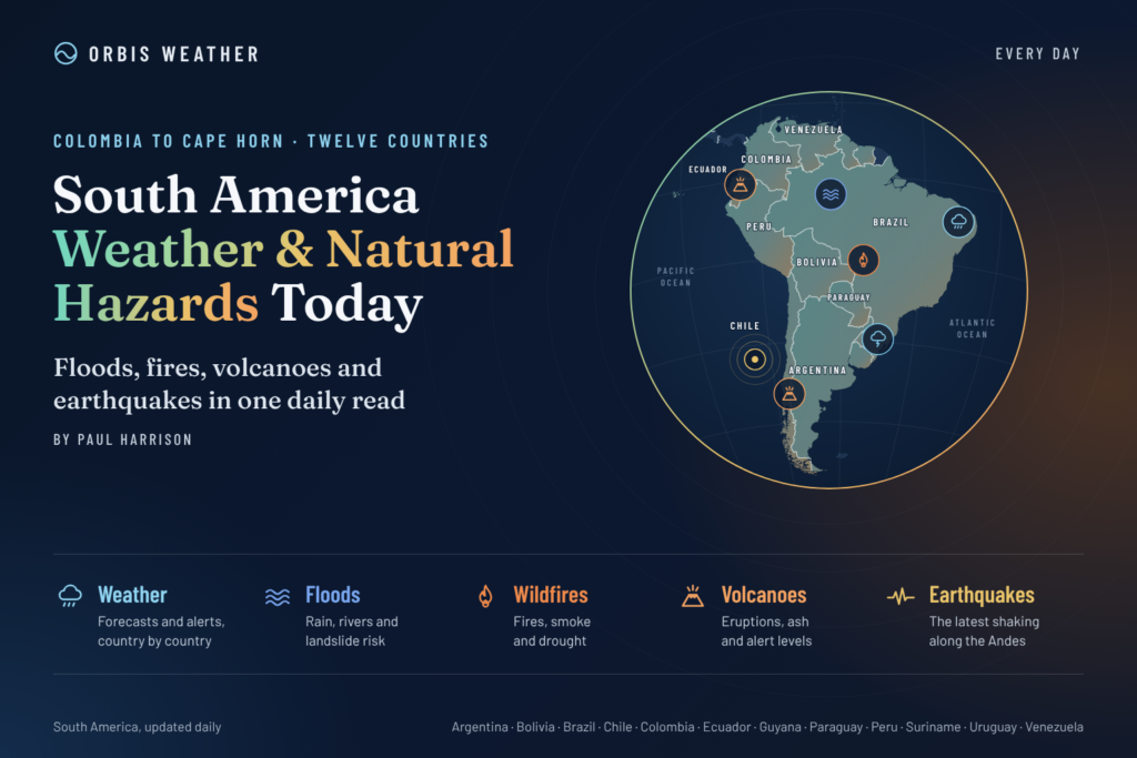

- South America Weather & Natural Hazards Today — November 4, 2026 8:14 AM
- Central America Weather & Natural Hazards Today: Heavy Rain, Dangerous Flooding and Landslide Threats Increase Across the Region 8:05 AM
- North America Weather & Natural Hazards Today: Heavy Mountain Snow, Flash Flood Risks and Atlantic Tropical Development 7:53 AM
- Daily Earthquakes, Storms, Fires & Floods Report — November 4, 2026 7:41 AM
- Weekly Earth’s Extreme Weather Report — Wednesday, November 4, 2026 7:34 AM
- Tropical Atlantic Daily Report: Wednesday, November 4, 2026 7:26 AM
- Eastern & Central Pacific Tropical Weather Update: Wednesday, November 4, 2026 7:11 AM
- WESTERN PACIFIC Tropical Weather Update: Typhoon In-Fa Remains Active as Storm Turns North 6:58 AM





South America Weather & Natural Hazards Today — November 4, 2026
By Paul Harrison | Founder & Publisher, Orbis Weather
Wednesday, November 4, 2026 | Regional Weather Report & Natural Hazards Outlook
Severe storms threaten southern Brazil, Ecuador braces for heavy rainfall, and major flooding remains a concern in Colombia and northeastern Argentina as South America enters another day of potentially dangerous weather.
🌎 South America Weather Overview
South America is facing several distinct weather threats today, from potentially destructive thunderstorms in Brazil to river flooding in Argentina and Colombia.
The most significant newly confirmed severe-weather alert comes from Brazil, where the National Institute of Meteorology (INMET) has issued its highest-level storm warning for parts of the country’s southern region.
Meanwhile, Ecuador’s meteorological agency is warning of heavy rainfall and thunderstorms through November 7, raising concerns about flash flooding and landslides.
The broader regional picture is complicated by the developing effects of the 2026–2027 El Niño, which can influence rainfall distribution across South America but does not determine the outcome of individual storms.
🚨 Today’s Major Weather and Natural Hazard Alerts
Country / Region | Main concern | Outlook |
|---|---|---|
🇧🇷 Southern Brazil | Severe storms, damaging winds, hail and flooding | Red warning |
🇪🇨 Ecuador | Heavy rainfall, thunderstorms and localized flooding | Official rainfall alert |
🇨🇴 Colombia | Existing flooding and saturated river basins | Ongoing flood concern |
🇦🇷 Northeastern Argentina | Paraná River flooding and evacuations | Ongoing river-flood concern |
🇵🇪 Peru | Mountain rainfall and landslide vulnerability | Monitor local bulletins |
🇨🇱 Chile | Seasonal rainfall variability and mountain conditions | Monitor regional forecasts |
🇧🇴 Bolivia | Localized thunderstorms and changing rainfall patterns | Regional monitoring |
🇵🇾 Paraguay / 🇺🇾 Uruguay | Possible regional storm development | Check national warnings |
Alert classifications above distinguish verified official warnings from ongoing hazards and general monitoring. They are not a uniform continent-wide risk scale.
🇧🇷 Brazil — Highest-Level Storm Warning for the South
Brazil faces one of South America’s most significant confirmed weather threats today.
INMET has issued a red warning, its highest severe-weather category, covering areas of Rio Grande do Sul, Santa Catarina and Paraná.
The warning runs from midnight through 11:59 p.m. local time on November 4.
⛈️ Forecast storm hazards
INMET identifies the potential for:
Rainfall exceeding 60 mm (2.4 inches) in an hour or 100 mm (3.9 inches) over a day.
Wind gusts exceeding 100 km/h (62 mph).
Damaging hail and fallen trees.
Flash flooding, power interruptions and damage to buildings and crops.
The affected warning areas include portions of the Porto Alegre, Florianópolis and Curitiba metropolitan regions, along with several inland districts.
These figures describe the potential severity of storms within the warning area, not rainfall or wind already observed at every location.
⚠️ What residents should watch
Heavy rain can overwhelm urban drainage systems, while strong winds and hail threaten vehicles, power infrastructure and agricultural operations.
Residents should avoid unnecessary travel during severe thunderstorms, stay away from fallen electrical lines and follow instructions from local Civil Defense authorities.
Brazilian emergency contacts include Civil Defense at 199 and the Fire Department at 193.
Orbis Weather assessment: Southern Brazil is the highest-priority confirmed severe-weather area in this edition because of the official red warning and its potential for multiple damaging hazards.
🇪🇨 Ecuador — Heavy Rain and Thunderstorms Through November 7
Ecuador’s National Institute of Meteorology and Hydrology (INAMHI) has issued Meteorological Alert No. 86 for heavy to very heavy rainfall and thunderstorms.
The alert begins at 10 a.m. on November 4 and remains in effect until 10 a.m. on November 7.
Areas identified in the forecast include Esmeraldas, Santo Domingo, Guayas, Manabí, Santa Elena, Los Ríos and El Oro.
🌧️ Principal hazards
Intense downpours could cause rapid water accumulation on roads, flooding in low-lying communities and dangerous conditions near streams.
Mountainous and steep terrain presents additional landslide concerns, particularly where heavy rainfall saturates the ground.
People traveling between coastal communities and inland mountain areas should check local road conditions before departure.
Outlook: Ecuador’s heavy-rainfall threat extends beyond today, making November 5–7 important dates for continued monitoring.
🇨🇴 Colombia — Flood Recovery and Continued River Concerns
Colombia continues to face serious consequences from recent flooding, particularly in northern areas including Córdoba.
Earlier reporting documented extensive flooding, damage to agricultural land, disruption to transportation and large numbers of affected residents.
The broader emergency has involved concerns about contaminated water, damaged infrastructure and communities isolated by high water.
As detailed in Orbis Weather’s November 3 flood report, more than 156,000 people were reported affected during the earlier Córdoba emergency. This is a historical impact figure, not a newly verified November 4 displacement count.
🌊 Why flooding can persist after rainfall
Flooding is not always confined to the period of heaviest precipitation.
Water moving downstream from elevated watersheds can cause rivers to rise after storms have ended. Saturated ground also increases runoff from subsequent rainfall.
The main concerns include renewed river rises, landslides on unstable slopes, damaged roads and reduced access to essential services.
Outlook: Communities in previously flooded areas should continue monitoring IDEAM bulletins and local disaster-management instructions. No new nationwide flood-warning level has been independently confirmed for this report.
🇦🇷 Argentina — Paraná River Flooding Remains a Major Concern
Northeastern Argentina continues to deal with the consequences of elevated river levels and widespread flooding along the Paraná basin.
Recent flooding has affected parts of Corrientes, Chaco and Misiones, forcing evacuations and disrupting rural communities.
An October 27 regional health situation report cited in Orbis Weather’s earlier coverage documented evacuations across all three provinces.
High river levels near Corrientes and Barranqueras have been particularly concerning, with earlier measurements exceeding local evacuation thresholds.
🌊 Main risks
Further inundation of low-lying riverfront communities.
Disruption to river transport and road access.
Agricultural and livestock losses.
Additional evacuations if water levels rise again.
River flooding can remain dangerous even when local weather becomes relatively calm, because rainfall elsewhere in the basin influences downstream water levels.
📅 Outlook into late 2026
El Niño can increase the likelihood of above-normal rainfall in parts of the Paraná basin, particularly during the Southern Hemisphere’s warmer months.
However, that does not mean continuous flooding is inevitable. Future conditions will depend on actual rainfall, upstream river flows and local flood-control measures.
Orbis Weather assessment: Northeastern Argentina remains an important area for continued hydrological monitoring, although today’s exact river levels and evacuation totals require confirmation from Argentine authorities.
🇵🇪 Peru — Red Rainfall Alert for Northern Coastal Regions
Peru has become another major area of concern today, with the National Meteorology and Hydrology Service (SENAMHI) forecasting heavy to potentially extreme rainfall along parts of the northern coast.
Tumbes is particularly vulnerable, while Piura and sections of the Andean highlands also face unsettled conditions.
The agency has issued a red warning for November 4–5, followed by an orange warning for November 6.
🌧️ Expected rainfall
Region | Forecast daily rainfall |
|---|---|
Northern coast | 5–55 mm (0.2–2.2 in) |
Northern highlands | 8–29 mm (0.3–1.1 in) |
Central highlands | 6–17 mm (0.2–0.7 in) |
Southern highlands | Around 11 mm (0.4 in) |
Thunderstorms could produce wind gusts near 40 km/h (25 mph), with hail possible above approximately 2,800 meters (9,186 feet) in the northern mountains.
The warning covers 13 departments, including Tumbes, Piura, Lambayeque, Cajamarca, La Libertad and several central and southern regions.
⚠️ Flooding and landslide potential
The greatest concern is rapid flooding in vulnerable coastal communities and landslides along mountain roads.
Residents should avoid dry riverbeds and drainage channels during heavy rainfall, as flash floods can develop rapidly.
Orbis Weather assessment: Northern Peru joins southern Brazil among today’s most serious officially warned weather areas.
🇨🇱 Chile — Spring Weather and Mountain Hazards
Chile is moving deeper into the Southern Hemisphere’s spring, bringing changing conditions from the Atacama Desert to Patagonia.
Northern Chile generally remains relatively dry, although occasional mountain thunderstorms and unusual precipitation can create hazards in exposed areas.
Central Chile is entering a transitional period when frontal systems, mountain weather and temperature changes can influence travel and outdoor activities.
Farther south, strong winds, rainfall and rapidly changing temperatures remain important considerations for Patagonia.
🌦️ El Niño influence
Research examining strong El Niño events identifies an increased tendency toward wetter conditions in portions of central Chile during October and November.
That seasonal tendency does not establish that any particular Chilean city will receive heavy rainfall today.
Outlook: Travelers should consult Chile’s Dirección Meteorológica and SENAPRED for current warnings, especially when crossing mountain passes or visiting remote southern regions.
🇧🇴 Bolivia — Mountain Storms and Rainfall Variability
Bolivia’s geography creates substantial differences between the Amazon lowlands, high Andean plateau and eastern agricultural regions.
During November, developing seasonal rainfall can bring thunderstorms to some lowland and mountain areas.
The principal hazards to monitor include localized flash flooding, lightning, reduced visibility on mountain roads and landslides where soils become saturated.
🌡️ Longer-term climate concern
El Niño has historically been associated with reduced summer rainfall across portions of the Altiplano, particularly during December through March.
Seasonal climate-model research also indicates an elevated probability of drier-than-normal conditions across parts of the high plateau during the approaching summer.
Outlook: No specific nationwide November 4 severe-weather warning was independently established in the sources reviewed. Bolivia’s SENAMHI remains the authority for local forecasts and alerts.
🇵🇾 Paraguay and 🇺🇾 Uruguay — Storm Monitoring Across the Southern Plains
Paraguay and Uruguay sit within a region where warm, moist air and passing weather systems can support strong thunderstorms during the warmer months.
Heavy rainfall, lightning, gusty winds and hail are important seasonal hazards.
⛈️ Paraguay
Eastern Paraguay is part of the wider Paraná basin, where upstream rainfall can influence river conditions beyond national borders.
Additional heavy rain would be particularly concerning for vulnerable floodplain communities.
🌧️ Uruguay
Uruguay is entering a period when spring and early-summer weather can bring rapidly changing temperatures and organized thunderstorms.
Research on strong El Niño events suggests an increased likelihood of above-normal seasonal rainfall across Uruguay and neighboring areas of southeastern South America.
Outlook: These are regional monitoring considerations, not confirmation of active nationwide storm warnings today.
🇻🇪 Venezuela, 🇬🇾 Guyana, 🇸🇷 Suriname and French Guiana — Tropical Rainfall and Flood Awareness
Northern South America remains exposed to tropical rainfall, localized thunderstorms and occasional flooding.
In Venezuela, mountainous areas and densely populated valleys can be vulnerable to rapid runoff during intense rain.
Across Guyana, Suriname and French Guiana, heavy tropical showers can create drainage problems in coastal settlements and flooding along rivers.
🌿 Amazon and northern South America drought outlook
One of the more important longer-term developments is the potential for reduced rainfall associated with El Niño.
Historical research indicates that strong El Niño events frequently produce drier conditions across northern South America during December through February.
The Amazon basin also has a well-established tendency toward rainfall deficits during strong El Niño episodes.
These are seasonal probabilities rather than verified drought conditions in every country today.
🌋 Earthquakes and Volcanoes — Andes Monitoring
South America’s Pacific margin remains one of the world’s most seismically active regions.
The Nazca tectonic plate moves beneath the South American plate, generating earthquakes and contributing to volcanic activity along the Andes.
🌎 Earthquake monitoring
Areas requiring ongoing seismic awareness include coastal Peru, Ecuador, Chile and the Andean regions of Colombia.
Earthquakes cannot currently be predicted reliably by date, location and magnitude. Residents should rely on official earthquake monitoring and tsunami-warning agencies.
The November 4 Orbis Weather global earthquake report did not identify a major damaging mainland South American earthquake among its highlighted events. This does not mean the continent experienced no smaller earthquakes.
🌋 Volcano monitoring
Volcanic systems requiring routine observation include:
Colombia: Nevado del Ruiz and Galeras.
Ecuador: Cotopaxi and Reventador.
Peru: Sabancaya and Ubinas.
Chile: Villarrica and Láscar.
These are examples of monitored volcanic systems, not a list of confirmed eruptions today.
Residents should consult national geological services for current volcanic alert levels, ashfall forecasts and exclusion zones.
🔥 Wildfires, Drought and Air Quality
As South America approaches summer, wildfire concerns vary considerably between the tropical forests, central Brazil, the southern plains and Chile.
Dry vegetation, strong winds and human ignition sources can combine to produce dangerous fire conditions.
🌳 Amazon Basin
El Niño increases the probability of drought across portions of the Amazon, potentially reducing vegetation moisture and increasing fire susceptibility.
However, wildfire activity depends on several factors, including land clearing, human ignition, rainfall deficits and fire-management practices.
🌬️ Smoke and health impacts
Wildfire smoke can contain fine particulate matter, known as PM2.5, which may affect air quality far beyond the immediate fire area.
People with respiratory or cardiovascular conditions, older adults and children can be particularly vulnerable.
No continent-wide real-time wildfire count or PM2.5 reading has been verified for this edition.
🌊 Coastal and Marine Hazards
South America’s extensive coastline faces different hazards along the Pacific, Atlantic and Caribbean waters.
Pacific coast: Peru, Ecuador and Chile should monitor high surf, strong currents and official tsunami advisories following significant offshore earthquakes.
Atlantic coast: Brazil, Uruguay and Argentina can experience hazardous coastal conditions from strong winds, passing weather systems and large ocean swells.
Caribbean coast: Northern Colombia and Venezuela can experience thunderstorms, rough seas and dangerous marine conditions.
Marine conditions vary substantially by location. Mariners should consult national maritime agencies for current wave heights, wind forecasts and coastal warnings before departure.
🌡️ El Niño 2026–2027 — Why South America’s Weather Risks Are Changing
El Niño is a recurring climate pattern involving unusually warm ocean temperatures in the central and eastern equatorial Pacific.
It can alter atmospheric circulation and rainfall across large parts of the world.
For South America, the effects differ considerably by region.
Region | Typical strong El Niño influence |
|---|---|
Amazon Basin | Greater probability of drought |
Northern Colombia and Venezuela | Increased seasonal dryness |
Coastal Ecuador and northern Peru | Greater potential for unusually heavy seasonal rainfall |
Southern Brazil | Increased likelihood of above-normal rainfall |
Northeastern Argentina | Increased rainfall and river-flooding potential |
Uruguay and Paraguay | Tendency toward wetter seasonal conditions |
Altiplano | Increased probability of summer rainfall deficits |
Central Chile | Potential for wetter late-spring conditions |
These relationships are supported by historical observations and seasonal climate research, but they are not guarantees.
A critical point is that El Niño does not cause every flood, drought or severe thunderstorm. Individual events also depend on regional atmospheric systems, moisture availability, geography and land conditions.
📅 South America Weather Outlook — November 5–7, 2026
THU
5
NOV
Southern Brazil, Peru and Ecuador
Continued monitoring of severe storms in southern Brazil is necessary following Wednesday’s red warning, although that warning’s confirmed validity ends November 4. Peru’s red rainfall warning continues, and Ecuador’s multiday rainfall alert remains active.
FRI
6
NOV
Peru and Ecuador
Peru’s rainfall warning drops to orange, although flooding remains possible. Ecuador’s heavy-rainfall warning continues. River conditions in Argentina and Colombia should be monitored separately from short-term storm forecasts.
SAT
7
NOV
Ecuador and regional river basins
Ecuador’s current rainfall alert is scheduled to expire at 10 a.m. local time, unless extended or replaced. Continued flood recovery and hydrological monitoring remain important elsewhere.
This outlook summarizes confirmed warning validity periods and continuing hazards; it is not a newly generated numerical weather forecast.
🛟 Weather Safety — What Residents Should Know
When heavy rain or severe thunderstorms threaten, a few practical precautions can substantially reduce exposure to danger.
🌊 Flooding: Never drive or walk through moving floodwater. Road surfaces may be damaged or missing beneath it.
⛈️ Lightning: Seek shelter inside a substantial building or enclosed vehicle when thunder is heard.
🌪️ Damaging winds: Stay away from windows, trees and unsecured outdoor structures.
⛰️ Landslides: Watch for cracks in the ground, unusual water flow, leaning trees or falling rocks.
🌋 Volcanic ash: Follow evacuation and respiratory-protection guidance from local authorities.
🌎 Earthquakes: Drop, cover and hold on during shaking. In coastal areas, follow tsunami evacuation guidance when appropriate.
❓ South America Weather — Frequently Asked Questions
Which country faces the most serious confirmed storm threat today?
Brazil has issued a highest-level red storm warning for southern states on November 4. Peru also has a red rainfall warning affecting northern coastal areas.
Is Ecuador expecting flooding?
Ecuador’s INAMHI has issued a heavy-rainfall and thunderstorm alert through November 7. Flooding is a potential consequence, particularly in vulnerable low-lying areas, but it is not guaranteed everywhere.
Is Argentina still experiencing river flooding?
Recent reports confirm significant flooding and evacuations in northeastern Argentina. Exact November 4 river levels should be checked against the latest official hydrological observations.
Will El Niño make South America’s weather more extreme?
El Niño changes the probability of certain weather patterns. It can increase rainfall in some regions while contributing to drought in others, but local impacts vary.
Are there any major earthquakes or volcanic eruptions today?
The sources reviewed did not establish a new major damaging mainland South American earthquake or a newly confirmed major eruption for November 4. That is not equivalent to a complete real-time seismic or volcanic all-clear.
🔗 Official Weather and Natural Hazard Sources
Orbis Weather recommends these official monitoring agencies for location-specific forecasts and emergency alerts.
Country / Region | Official agency |
|---|---|
Brazil | |
Argentina | |
Colombia | |
Ecuador | |
Peru | |
Chile | |
Bolivia | |
Paraguay | |
Uruguay | |
Venezuela | |
Earthquakes worldwide | |
Volcanoes worldwide | |
International disaster alerts | |
Global climate monitoring |
📰 Orbis Weather — Final Assessment
South America’s weather picture on November 4 is dominated by three newly verified warning situations: dangerous thunderstorms in southern Brazil, potentially extreme rainfall in northern Peru and several days of heavy rain and thunderstorms forecast for Ecuador.
At the same time, the consequences of earlier flooding remain significant in Colombia and northeastern Argentina.
The next several days will be particularly important for communities exposed to heavy rainfall, unstable hillsides and elevated rivers.
Beyond the immediate hazards, El Niño remains a major climate-monitoring concern as the continent approaches the Southern Hemisphere summer.
The most important message today: follow official warnings, monitor changing conditions and never assume that the danger ends when the rain stops.
About the Author
Paul Harrison — Founder & Publisher, Orbis Weather
Paul Harrison founded Orbis Weather in 2026 to make global weather and natural-hazard information easier to find, follow and understand. His coverage includes tropical cyclones, severe weather, extreme temperatures, earthquakes, volcanoes, wildfires, flooding and significant natural disasters worldwide.
View all articles by Paul Harrison → | Editorial Standards →
Global Weather Tracker Hub
Explore weather maps, tropical systems, storms and natural hazards around the world.
No matching trackers found.