
By Paul Harrison | Founder & Publisher, Orbis Weather

- South America Weather & Natural Hazards Today — November 4, 2026 8:14 AM
- Central America Weather & Natural Hazards Today: Heavy Rain, Dangerous Flooding and Landslide Threats Increase Across the Region 8:05 AM
- North America Weather & Natural Hazards Today: Heavy Mountain Snow, Flash Flood Risks and Atlantic Tropical Development 7:53 AM
- Daily Earthquakes, Storms, Fires & Floods Report — November 4, 2026 7:41 AM
- Weekly Earth’s Extreme Weather Report — Wednesday, November 4, 2026 7:34 AM
- Tropical Atlantic Daily Report: Wednesday, November 4, 2026 7:26 AM
- Eastern & Central Pacific Tropical Weather Update: Wednesday, November 4, 2026 7:11 AM
- WESTERN PACIFIC Tropical Weather Update: Typhoon In-Fa Remains Active as Storm Turns North 6:58 AM





🌪️ WESTERN PACIFIC Tropical Weather Update: Typhoon In-Fa Remains Active as Storm Turns North
Orbis Weather | Wednesday, November 4, 2026
By Paul Harrison | Orbis Weather
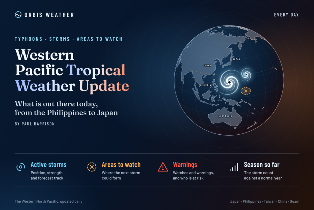
🌏 WESTERN PACIFIC — Typhoon In-Fa remains the main tropical weather threat across the Western North Pacific today, November 4, 2026, as the powerful storm moves northward over the open Pacific, east of the Philippines and south of Japan.
The Japan Meteorological Agency (JMA) continues to classify In-Fa as a typhoon, while the Joint Typhoon Warning Center (JTWC) reports that the storm is encountering increasing wind shear, which is beginning to disrupt its structure.
Although the storm is currently far from the major population centers of the Philippines, Taiwan and mainland Japan, dangerous seas remain a concern around the cyclone. Forecasters expect In-Fa to accelerate northeastward and eventually transition into an extratropical low.
Elsewhere across the Western Pacific, the latest basin-wide JTWC tropical weather advisory identifies no additional tropical cyclones or tropical disturbances.
This report examines the latest storm information, forecast track, regional weather conditions, marine hazards and developments to monitor over the coming days.
🌀 1. Typhoon In-Fa — Latest Storm Information
Storm status
| International name | In-Fa |
| JTWC designation | 30W |
| JMA designation | T2631 |
| Position | 24.5°N, 138.5°E |
| Maximum sustained winds (JMA) | 120 km/h (75 mph) |
| Maximum gusts | 180 km/h (112 mph) |
| Central pressure | 970 hPa |
| Movement | Northward, slowly |
| Advisory time | 12:00 JST, November 4 |
JMA’s November 4 analysis places In-Fa over the Philippine Sea, with the center tracking northward. The storm remains well organized enough to retain typhoon classification, although satellite analysis indicates deterioration in its inner structure.
JTWC’s later November 4 analysis estimated maximum one-minute sustained winds of 80 knots, approximately 148 km/h (92 mph). This is higher than JMA’s ten-minute sustained wind estimate because the agencies use different averaging periods and analysis techniques.
JTWC also reported significant wave heights near 30 feet (9.1 meters), highlighting the substantial marine danger associated with the cyclone.
🧭 2. Where Is Typhoon In-Fa Heading?
The latest JMA forecast indicates that In-Fa will continue northward before turning northeast and accelerating over the northwestern Pacific.
Date | Forecast position | Expected status |
|---|---|---|
Nov. 4 | 24.5°N, 138.5°E | Typhoon |
Nov. 5, 00:00 JST | 26.4°N, 138.6°E | Typhoon |
Nov. 5, 12:00 JST | 28.9°N, 140.3°E | Severe tropical storm |
Nov. 6, 09:00 JST | 37.0°N, 150.4°E | Typhoon |
Nov. 7, 09:00 JST | 48.7°N, 167.6°E | Extratropical low |
Forecast positions and classifications from JMA’s November 4 advisory. Forecasts are subject to change.
The predicted northeastward turn should carry the storm away from the Philippines and toward higher latitudes east of Japan.
However, weakening does not necessarily mean that marine conditions will become safe. As In-Fa interacts with stronger midlatitude winds, its wind field could expand, potentially generating dangerous waves across a much broader area.
The forecast transition into an extratropical system is particularly important for shipping operations across the northwestern Pacific.
🌊 3. Philippines — Typhoon Outside Philippine Area of Responsibility
PAGASA reported early Wednesday that Typhoon In-Fa was approximately 1,770 kilometers east-northeast of extreme northern Luzon, outside the Philippine Area of Responsibility.
At that time, PAGASA estimated sustained winds of 130 km/h and gusts reaching 160 km/h, with the system moving north-northwestward at approximately 10 km/h.
The typhoon’s projected track does not currently indicate a direct Philippine landfall.
Nevertheless, weather hazards remain possible in several parts of the country from systems unrelated to In-Fa.
🌧️ Rainfall and thunderstorms
PAGASA’s November 4 forecast identifies:
Quezon, Camarines Norte, Camarines Sur and Catanduanes: Scattered rain and thunderstorms associated with easterly winds, with localized flash flooding or landslides possible.
Northern Luzon: The northeast monsoon is producing isolated light rainfall across the Ilocos Region, Cordillera Administrative Region and Cagayan Valley.
Metro Manila, Visayas and remaining parts of Luzon: Isolated showers and thunderstorms, with locally heavy rainfall possible.
Mindanao: Localized thunderstorms that could produce brief heavy downpours and flash flooding.
Residents should distinguish between the offshore typhoon and locally occurring rainstorms. Heavy rainfall does not necessarily mean that a tropical cyclone is approaching.
For official Philippine weather warnings, visit PAGASA.
🇯🇵 4. Japan and the Ogasawara Islands — Marine Conditions Under Watch
Typhoon In-Fa is moving through waters south of Japan, in the broader vicinity of the Ogasawara island chain.
The storm’s current and projected positions make offshore marine conditions the principal concern.
🌬️ Potential impacts
Strong winds: Areas near the cyclone’s circulation may experience damaging winds, particularly over exposed waters.
High waves: Large swells may spread beyond the immediate storm center, creating hazardous conditions for fishing vessels and commercial shipping.
Heavy rainfall: Rainbands associated with In-Fa could produce locally intense precipitation if they affect island communities.
Changing storm track: As the cyclone accelerates northeastward, the location of the strongest winds and highest waves will shift.
The current JMA forecast keeps the cyclone’s center offshore as it moves into higher latitudes. However, a track that avoids landfall can still produce dangerous marine conditions.
Travelers and vessel operators should consult the latest JMA marine warnings and local advisories before making decisions.
🌏 5. Taiwan, China and the South China Sea
🇹🇼 Taiwan
Typhoon In-Fa is not currently forecast to make landfall in Taiwan.
Its position east of the Philippines and projected north-to-northeastward movement reduce the likelihood of direct tropical-cyclone conditions affecting the island.
However, local weather conditions, coastal winds and marine warnings should continue to be monitored independently of the typhoon.
🇨🇳 Coastal China
The current forecast does not indicate a direct threat from In-Fa to mainland China’s coastline.
Residents and maritime operators should continue monitoring official forecasts, particularly for any changes in the broader regional pressure pattern.
🌊 South China Sea
The JTWC’s November 4 basin-wide discussion did not identify an additional tropical cyclone or tropical disturbance in the Western North Pacific monitoring region, which includes the South China Sea.
This does not rule out locally heavy thunderstorms, rough seas or the later development of tropical disturbances.
Weather conditions across the South China Sea can change rapidly, particularly where monsoonal winds and tropical moisture interact.
🇬🇺 6. Guam, Northern Mariana Islands and Micronesia
Typhoon In-Fa has moved well north and west of Guam and the Northern Mariana Islands.
An earlier National Weather Service Guam advisory reported that In-Fa was moving away from the Mariana Islands, with no tropical cyclone watches or warnings listed in that advisory.
The storm’s present position and forecast movement indicate that its center will continue away from the Mariana Islands.
However, this does not provide an all-clear for every marine or local weather hazard.
Across Guam, Saipan, Tinian, Rota and the wider Micronesian region, residents should monitor local forecasts for:
🌧️ Heavy tropical showers and thunderstorms.
🌬️ Strong gusts associated with isolated squalls.
🌊 Hazardous surf and rip currents.
⛵ Changes in small-craft and offshore marine conditions.
The National Weather Service Guam remains the appropriate source for local warnings and advisories.
🛰️ 7. Western Pacific Tropical Development Outlook — Next Five Days
Forecast period: November 4–9, 2026
Region | Current assessment |
|---|---|
Philippine Sea | Active Typhoon In-Fa moving north |
South China Sea | No additional JTWC disturbance identified |
East of Taiwan | Monitor In-Fa’s northeastward turn |
South of Japan | Active typhoon and hazardous offshore seas |
Mariana Islands | In-Fa moving away; monitor local weather |
Western Pacific near the equator | No additional JTWC disturbance identified |
The latest JTWC basin-wide advisory lists In-Fa as the only active tropical cyclone and identifies no additional tropical disturbances.
Important: This is a current disturbance assessment, not a numerical five-day formation-probability forecast. The absence of a monitored disturbance does not guarantee that another system cannot form during the next five days.
What could influence new tropical development?
Several atmospheric and oceanic factors will help determine whether additional tropical systems organize during November.
🌡️ Sea-surface temperatures: Warm ocean waters provide the energy needed for tropical cyclones, but warm water alone does not guarantee development.
💨 Vertical wind shear: Strong changes in wind speed or direction with altitude can disrupt developing thunderstorms and tropical circulations.
🌧️ Tropical moisture: Deep atmospheric moisture can support sustained thunderstorm development, particularly when combined with low-level convergence.
🌀 Low-pressure circulation: A developing disturbance needs sufficient organization and rotation before it can strengthen into a tropical depression.
🌏 Large-scale atmospheric patterns: Monsoon troughs, subtropical high-pressure systems and passing atmospheric waves can influence both development and storm movement.
Orbis Weather will continue monitoring these factors as the basin progresses through November.
📅 8. Western Pacific Typhoon Season — Why November Still Matters
Unlike the Atlantic hurricane season, the Western North Pacific does not have a fixed official tropical cyclone season.
Tropical cyclones can develop at any time of year, although activity is generally greatest during the warmer months.
November remains an important month because warm tropical waters can still support significant storms.
Late-season cyclones may also interact with stronger midlatitude weather systems as they move northward.
This interaction can result in rapid changes in storm speed, structure and intensity.
Typhoon In-Fa provides an example of this process, with its forecast track carrying it northeastward toward cooler waters and eventual extratropical transition.
An extratropical cyclone is not necessarily harmless. Such systems can retain powerful winds and generate large ocean waves even after losing their tropical characteristics.
⚠️ 9. Marine Safety and Coastal Preparedness
Although In-Fa is currently over open water, marine hazards can extend far beyond the storm’s center.
Mariners should pay particular attention to forecast wind fields, significant wave heights and the timing of the storm’s northeastward acceleration.
Recommended precautions
🚢 Commercial vessels should review official marine forecasts and consider alternative routes around hazardous waters.
🎣 Fishing crews should avoid operating near the typhoon’s circulation and monitor changing sea conditions.
🏖️ Coastal visitors should obey local beach closures, surf warnings and rip-current advisories.
📱 Residents of exposed islands should keep access to official warning services and emergency information.
🧭 Travelers should confirm ferry and flight schedules directly with operators when adverse weather is expected.
Never use the forecast position of a cyclone’s center as the sole measure of danger. Tropical-storm-force winds, dangerous swells and heavy rain can occur well away from the center.
🔍 10. What Orbis Weather Is Watching Next
The most important developments during the next 24–72 hours are In-Fa’s track, intensity and transition toward a larger midlatitude weather system.
Track and acceleration
Whether In-Fa follows the forecast northeastward turn and how quickly it moves into the open North Pacific.
Changes in storm intensity
Whether increasing wind shear continues to weaken the tropical core or the storm briefly strengthens during its transition.
Ocean wave conditions
Whether dangerous swells and gale-force winds expand across shipping routes east of Japan.
Additional tropical disturbances
Whether new areas of organized convection emerge across the Philippine Sea, South China Sea or tropical Western Pacific.
🌐 11. Official Tropical Weather Sources
Orbis Weather uses information from recognized meteorological agencies to help readers understand tropical cyclone activity.
Agency | Information provided |
|---|---|
Official Japanese cyclone analysis and forecasts | |
Tropical cyclone warnings and forecast reasoning | |
Philippine weather bulletins and cyclone warnings | |
Tropical cyclone and marine advisories for Guam and Micronesia | |
Regional tropical cyclone and marine information | |
Satellite monitoring of cloud and storm development |
These agencies may report different wind speeds because of varying wind averaging periods, observation methods and advisory times.
Readers should always use the official warning agency responsible for their location when making safety decisions.
📝 12. Orbis Weather Editorial Methodology and Disclaimer
Report date: November 4, 2026.
Reporting basis: Publicly available tropical cyclone analyses, forecast advisories and regional weather information from JMA, JTWC, PAGASA and the National Weather Service.
Forecast interpretation: Orbis Weather combines agency information with explanatory reporting to help readers understand storm behavior, regional risks and forecast uncertainty.
Data limitations: Tropical cyclone positions, intensities, forecast tracks and warning areas may change between official updates. Regional weather discussions are not substitutes for location-specific forecasts.
Editorial independence: Orbis Weather provides independent weather reporting and does not issue official tropical cyclone warnings, evacuation orders or emergency instructions.
Corrections and updates: Material factual errors should be corrected when identified. New official advisories may supersede information published in this report.
For emergency decisions, readers must consult their national meteorological agency and local emergency management authorities.
🌪️ Western Pacific Tropical Weather — Final Outlook
Typhoon In-Fa remains the dominant tropical weather system across the Western North Pacific on November 4, 2026.
The cyclone is forecast to move northward, accelerate northeastward and transition into an extratropical system over the coming days.
While a direct landfall in the Philippines, Taiwan or mainland Japan is not indicated by the current track, hazardous marine conditions remain a concern across waters south and east of Japan.
Elsewhere, the latest JTWC basin-wide assessment has not identified another active tropical cyclone or tropical disturbance.
The key message: In-Fa is expected to move away from densely populated tropical regions, but its evolution into a powerful North Pacific weather system still requires careful monitoring, especially for shipping and offshore operations.
Orbis Weather will continue tracking tropical cyclone activity, developing disturbances and significant weather hazards throughout the Western Pacific.
Paul Harrison
Orbis Weather — Global Weather, Tropical Cyclones & Natural Hazards
About the Author
Paul Harrison — Founder & Publisher, Orbis Weather
Paul Harrison founded Orbis Weather in 2026 to make global weather and natural-hazard information easier to find, follow and understand. His coverage includes tropical cyclones, severe weather, extreme temperatures, earthquakes, volcanoes, wildfires, flooding and significant natural disasters worldwide.
View all articles by Paul Harrison → | Editorial Standards →
🌀 Western Pacific Basin
Live typhoon tracking, tropical cyclone activity, satellite imagery, weather, sea-surface temperatures and waves across the Western North Pacific, including Japan, the Philippines, Taiwan, Guam and Micronesia.
⚠️ Western Pacific Tropics Right Now
Live basin status🌀 Western Pacific Storm Tracker
Live tropical cyclones · click a storm for track/cone🌀 Western Pacific Storm Tracker
Live tropical cyclones across the Western Pacific. Drag to pan, Ctrl/⌘+scroll to zoom, and click a storm to show its track and cone.