
South America Weather & Natural Hazards Today
By Paul Harrison | Founder & Publisher, Orbis Weather

- Severe Thunderstorms Threaten North Texas Monday Night Into Tuesday Morning 11:00 AM
- South America Weather & Natural Hazards Today — November 2, 2026 8:22 AM
- Central America Weather & Natural Hazards Today: Tropical Wave Raises Heavy Rain and Flooding Concerns 8:12 AM
- North America Weather & Natural Hazards Today Nov 2 8:02 AM
- Weekly Global Weather Watch: Weekly Analysis, November 2, 2026 7:43 AM
- Daily Earthquakes, Storms, Fires & Floods Report: November 2, 2026 7:36 AM
- Tropical Atlantic Daily Report: Monday, November 2, 2026 7:17 AM
- Eastern & Central Pacific Tropical Weather Update: Monday, November 2, 2026 7:08 AM
- WESTERN PACIFIC Tropical Weather Update – Monday, November 2, 2026 6:52 AM





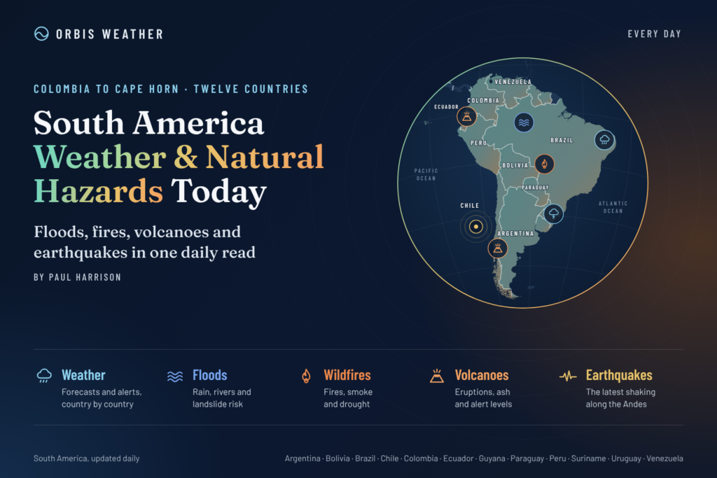
🌎 South America Weather & Natural Hazards Today — November 2, 2026
By Paul Harrison | Founder & Publisher, Orbis Weather
Monday, November 2, 2026 | South America Weather, Flooding, Severe Storms, Earthquakes, Volcanoes & Climate Monitoring
⛈️ Severe thunderstorms, flooding concerns and landslide risks remain important across parts of South America as November begins. Argentina and Paraguay are monitoring the aftermath of weekend storms, Brazil faces an unsettled early-November weather pattern, and Ecuador and Colombia remain vulnerable to flooding and unstable hillsides.
Meanwhile, the developing 2026–27 El Niño event could influence rainfall, drought and temperature patterns across the continent in the coming months.
From the tropical Amazon rainforest to the snow-covered Andes and the agricultural plains of Argentina, South America’s geography creates dramatically different weather conditions.
Today’s Orbis Weather report examines the latest documented hazards, explains the risks and identifies the official services residents should consult for current warnings.
Verification note: This report incorporates official alerts and reporting available through November 1, together with longer-term climate information. Not every November 2 warning could be independently confirmed. Expired alerts are identified as historical, and potential hazards must not be interpreted as active emergency warnings.
🚨 1. South America Natural Hazards at a Glance
Country / Region | Main hazard | November 2 assessment |
|---|---|---|
🇦🇷 Argentina | ⛈️ Severe storms, hail, flooding | Monitor following November 1 alerts |
🇵🇾 Paraguay | ⛈️ Thunderstorms, river flooding | Storm potential into Monday |
🇧🇷 Brazil | 🌧️ Heavy rain, thunderstorms | Early-November storm monitoring |
🇪🇨 Ecuador | 🌊 Flooding, landslides | Reassess after November 1 alerts |
🇨🇴 Colombia | ⛰️ Landslides, river levels | Continuing regional monitoring |
🇵🇪 Peru | 🌧️ Coastal flooding, mountain rainfall | Seasonal and local monitoring |
🇨🇱 Chile | 🏔️ Mountain weather, earthquakes | Routine hazard monitoring |
🇧🇴 Bolivia | ⛈️ Thunderstorms, river conditions | Seasonal monitoring |
🇻🇪 Venezuela | 🌦️ Tropical rainfall, flood risk | Local monitoring |
🇺🇾 Uruguay | 💨 Wind, thunderstorms | Monitor regional forecasts |
🇬🇾 Guyana | 🌧️ Heavy tropical rainfall | Seasonal monitoring |
🇸🇷 Suriname | 🌧️ Rainfall, localized flooding | Seasonal monitoring |
🌳 Amazon Basin | 🌦️ Storms, rivers, wildfires | Regional monitoring |
🌋 Andes | 🌎 Earthquakes, volcanoes | Continuous geological monitoring |
These assessments describe hazards to watch rather than a continent-wide official alert scale. Monitoring does not establish that a warning is currently active.
🇦🇷 2. Argentina: Severe Thunderstorms and Flooding Concerns
Argentina enters Monday following a period of potentially dangerous thunderstorms.
The country’s National Meteorological Service (SMN) issued orange and yellow warnings for Sunday, November 1, affecting several central and northern provinces.
Orange-level alerts included portions of Buenos Aires province, La Pampa, San Luis and Santa Fe.
The November 1 forecast identified the potential for:
⛈️ Strong to severe thunderstorms.
🌧️ Rainfall accumulations of 50–90 mm (2–3.5 inches) in orange-alert areas, locally higher.
💨 Wind gusts potentially exceeding 90 km/h (56 mph).
🧊 Hail and frequent lightning.
🌊 Flash flooding in low-lying and poorly drained areas.
Those figures refer to Sunday’s forecast, not measured rainfall or a newly confirmed Monday warning.
What happens after the storms?
Even when thunderstorms weaken or move away, accumulated rainfall can continue flowing into rivers, drainage channels and agricultural land.
Floodwater may persist where drainage is limited, while saturated soil can complicate transportation and farming operations.
Northern Argentina, particularly areas connected to the Paraná and Paraguay river systems, should continue monitoring official hydrological information.
Orbis Weather assessment: Monday’s priority is determining where weekend storms produced significant rainfall and whether further warnings have been issued.
Official alerts: Argentina National Meteorological Service
🇵🇾 3. Paraguay: Thunderstorms and River Flooding Remain Concerns
Paraguay is another important country to monitor as the new week begins.
The national meteorological service issued a thunderstorm alert on Sunday affecting central Presidente Hayes, with possible impacts around Asunción.
The weather system was expected to have the potential to continue overnight into Monday, November 2.
⛈️ Principal weather hazards
Strong thunderstorms can produce intense short-duration rainfall, damaging wind gusts, hail and lightning.
These conditions can cause localized street flooding, fallen trees and transportation disruption.
🌊 Paraná River flooding
Paraguay has also experienced significant river flooding during recent weeks.
Reporting from October 22 indicated that approximately 4,200 families had been affected by rising Paraná River waters.
That figure is historical and should not be treated as the current number of affected families.
River flooding can remain dangerous after the rainfall responsible for the original rise has ended. Upstream runoff may continue entering the river system, delaying recovery.
Orbis Weather assessment: Monitor both short-term thunderstorms and longer-lasting river conditions, particularly in vulnerable riverside communities.
Official information: Paraguay Directorate of Meteorology and Hydrology
🇧🇷 4. Brazil: Heavy Rain, Lightning and Storm Development
Brazil faces a varied early-November weather pattern, with thunderstorms and heavy rainfall among the principal concerns.
Recent INMET warnings have included areas of Paraná, Santa Catarina, São Paulo, Mato Grosso do Sul, Minas Gerais, Rio Grande do Sul, Rio de Janeiro and Goiás.
Alert coverage and expiration times vary, and not all of those locations necessarily remain under warnings on November 2.
⛈️ Southern Brazil
Southern Brazil can experience organized thunderstorms as warm, humid air interacts with passing frontal systems.
Potential hazards include heavy downpours, lightning, hail and strong wind gusts.
🌧️ Southeastern Brazil
In densely populated areas around São Paulo, Rio de Janeiro and Minas Gerais, short periods of intense rainfall can overwhelm urban drainage.
Low-lying streets, underpasses and communities near steep slopes are particularly vulnerable.
🌳 Central Brazil and the Amazon
Across the central-western and northern regions, high humidity and daytime heating frequently support afternoon and evening thunderstorms.
Rainfall can vary considerably over short distances.
Why Brazil’s rainfall is important
Brazil’s size means one part of the country can experience flooding while another faces drought or wildfire concerns.
This contrast is particularly important during El Niño, when changes in tropical Pacific temperatures can influence regional atmospheric circulation.
Orbis Weather assessment: Thunderstorms and localized flooding remain important monitoring priorities. Residents should consult INMET for active municipal-level alerts.
Official source: INMET Weather Alerts
🇪🇨 5. Ecuador: Flooding and Landslide Risks After Extreme Rainfall Alerts
Ecuador was among the most important weather-warning areas at the beginning of November.
The National Institute of Meteorology and Hydrology (INAMHI) listed six active warnings on November 1, including two classified as extreme severity.
Areas covered included Esmeraldas, portions of Pichincha and Imbabura, Los Ríos, Guayas and El Oro.
Those alerts were scheduled to expire at 11:00 p.m. Ecuador time on November 1. Their continuation into November 2 has not been verified.
🌊 Why the risk can persist
After prolonged or intense rainfall, several hazards may remain:
Rivers can continue rising after rainfall ends.
Saturated mountain slopes may become unstable.
Roads and bridges may remain damaged or flooded.
Debris flows can occur in steep drainage channels.
Standing water can obstruct transportation.
The western slopes of the Andes are particularly susceptible to landslides during heavy rainfall.
🏝️ Galápagos Islands
The Galápagos Islands were also included in recent severe-rainfall monitoring.
Island communities should consult local authorities for any remaining flooding, road or marine restrictions rather than assuming mainland conditions apply.
Orbis Weather assessment: The principal question for Monday is whether rainfall has eased sufficiently to reduce river and landslide risks. Expired warnings do not automatically mean that all secondary hazards have ended.
Official source: Ecuador INAMHI
🇨🇴 6. Colombia: Landslide Threats in Mountainous Regions
Colombia remains vulnerable to rainfall-related natural hazards because of its mountainous terrain, major river systems and tropical climate.
IDEAM alerts issued on October 31 identified landslide concerns in numerous municipalities in Antioquia.
The current validity of individual municipal warnings requires confirmation.
⛰️ Landslide-prone areas
Mountainous regions of Antioquia and other Andean departments can experience slope instability when rainfall saturates the ground.
Potential warning signs include cracks in roads or buildings, leaning trees, unusual seepage from hillsides and sudden changes in stream levels.
🌧️ Pacific coastal rainfall
Colombia’s Pacific coastal region is among the wettest inhabited areas of the world.
Persistent tropical rainfall can create river flooding and transportation problems, particularly in isolated communities.
🔥 Contrasting wildfire conditions
Colombia can also experience dry-weather wildfire risks in some municipalities while other areas receive heavy rain.
A countrywide assessment should therefore distinguish between individual departments and local conditions.
Orbis Weather assessment: Landslides and river conditions remain important concerns, especially where recent rainfall has left slopes saturated.
Official source: Colombia IDEAM
🇵🇪 7. Peru: Coastal Hazards, Andes Rainfall and El Niño Monitoring
Peru is especially sensitive to changes in Pacific Ocean temperatures.
The developing El Niño event is important because unusually warm eastern Pacific waters can influence rainfall along portions of Peru’s coast.
However, El Niño does not guarantee flooding in every coastal region or on every date.
🌊 Northern coastal Peru
Northern coastal communities can become vulnerable to intense rainfall, overflowing drainage channels and river flooding when atmospheric conditions favor prolonged precipitation.
⛰️ Andes Mountains
In the Andes, heavy rainfall can trigger landslides and debris flows known locally as huaicos.
These events can damage mountain roads, disrupt transport and threaten settlements near steep valleys.
🌊 Pacific coastal waters
High surf and strong swells can threaten fishing activities, ports and exposed coastal infrastructure even when inland weather is relatively calm.
Orbis Weather assessment: Peru’s most important monitoring priorities are local rainfall warnings, coastal conditions, river levels and the evolving El Niño pattern. No new nationwide November 2 emergency has been independently established here.
Official source: Peru SENAMHI
🇨🇱 8. Chile: Mountain Weather, Wind and Geological Hazards
Chile’s extraordinary north-to-south geography creates major differences in weather and natural hazards.
Northern Chile is dominated by extremely dry landscapes, central Chile has a Mediterranean-influenced climate, and southern Chile is exposed to cooler, wetter weather systems.
🏔️ Andean mountain conditions
As Southern Hemisphere spring advances, mountain weather can change rapidly.
Snowmelt, precipitation and fluctuating temperatures may influence streams, slope stability and travel conditions.
💨 Southern Chile
Southern regions can experience strong winds and unsettled weather associated with systems moving across the South Pacific.
Travelers should monitor local forecasts, particularly when using exposed mountain roads or marine routes.
🌎 Earthquake preparedness
Chile lies along the boundary where the Nazca Plate subducts beneath the South American Plate.
This tectonic setting produces frequent earthquakes and supports volcanic activity.
Earthquakes cannot be predicted reliably by date, location and magnitude.
Orbis Weather assessment: Monitor regional weather warnings and official earthquake or volcano bulletins. No specific new major November 2 Chilean disaster has been independently confirmed for this report.
Official sources: Chile SENAPRED and Chile Meteorological Directorate
🇧🇴 9. Bolivia: Seasonal Thunderstorms and Mountain Hazards
Bolivia is moving further into its warmer, wetter part of the year.
The country’s weather varies greatly between the high-altitude Altiplano, Andean valleys and tropical lowlands.
🌦️ Main regional concerns
In eastern Bolivia, warm and humid conditions can support thunderstorms.
Mountain valleys can experience rapid runoff when intense rainfall develops over steep terrain.
Communities near rivers should monitor rainfall upstream, as flooding can occur even where local precipitation is limited.
Orbis Weather assessment: Seasonal thunderstorms, river levels and mountain-road conditions deserve attention. This is a regional risk overview, not confirmation of an active nationwide warning.
Official source: Bolivia SENAMHI
🇻🇪 10. Venezuela, Guyana and Suriname: Tropical Rainfall Monitoring
Northern South America remains exposed to tropical rainfall and localized flooding.
🇻🇪 Venezuela
Heavy showers and thunderstorms can develop in tropical lowlands and mountainous regions.
Flooding and landslides are particular concerns where intense rainfall affects steep terrain or poorly drained communities.
🇬🇾 Guyana
Coastal Guyana contains extensive low-lying areas where intense rainfall can create drainage problems.
River levels and tidal conditions can influence the severity of coastal flooding.
🇸🇷 Suriname
Suriname’s tropical climate supports heavy showers and thunderstorms, with rainfall patterns varying seasonally.
Localized flooding may occur during intense downpours.
Orbis Weather assessment: Localized heavy rainfall and river conditions are the main hazards to monitor. No new countrywide emergency is verified here for November 2.
🇺🇾 11. Uruguay: Spring Storms and Changing Weather
Uruguay’s spring weather can be highly variable.
Warm, humid air moving southward can interact with approaching frontal systems, occasionally supporting thunderstorms, strong winds and heavy rainfall.
Agricultural communities and coastal areas may be affected differently depending on storm tracks.
Orbis Weather assessment: Monitor official short-term forecasts for thunderstorms, wind advisories and rainfall accumulation. No new nationwide severe-weather warning has been independently confirmed for today.
Official source: Uruguay INUMET
🌳 12. Amazon Basin: Rainfall, River Levels, Drought and Wildfires
The Amazon Basin covers enormous areas of Brazil, Peru, Colombia, Bolivia, Ecuador, Venezuela and neighboring territories.
Conditions can vary dramatically across this vast region.
🌧️ Tropical thunderstorms
Warm temperatures, atmospheric moisture and daytime heating frequently support thunderstorms.
Heavy rainfall may occur in localized areas, while other locations remain relatively dry.
🌊 River flooding
The Amazon River system responds to rainfall across a vast drainage network.
Water falling hundreds or thousands of kilometers upstream can eventually influence downstream river levels.
This means that river flooding may persist well after local rainfall ends.
🔥 Wildfire and smoke concerns
Drought and land-use activities can increase wildfire risk, especially in disturbed or cleared forest areas.
Smoke may travel long distances and reduce air quality.
No specific new Amazon-wide wildfire emergency has been independently confirmed for November 2.
Why El Niño matters
El Niño can contribute to reduced rainfall in portions of the northern Amazon, increasing drought and wildfire vulnerability.
However, the impact varies geographically and depends on other atmospheric conditions.
🌎 13. Earthquakes Across South America
Western South America forms part of the Pacific Ring of Fire, a region characterized by frequent earthquakes and volcanic activity.
The interaction of tectonic plates creates significant geological hazards along the Andes.
Areas requiring routine earthquake monitoring
Country | Principal geological concern |
|---|---|
🇨🇱 Chile | Large subduction-zone earthquakes and tsunamis |
🇵🇪 Peru | Offshore earthquakes and Andean seismic activity |
🇪🇨 Ecuador | Coastal and Andean earthquakes |
🇨🇴 Colombia | Complex tectonic fault systems |
🇧🇴 Bolivia | Deep and intermediate-depth earthquakes |
🇦🇷 Argentina | Western Andean seismic activity |
🇻🇪 Venezuela | Active fault systems in northern Venezuela |
🌊 Tsunami preparedness
A powerful undersea earthquake can generate a tsunami, although not every offshore earthquake does so.
Residents near vulnerable Pacific coastlines should follow official tsunami guidance.
After strong or prolonged coastal shaking, moving promptly to higher ground or inland may be necessary without waiting for a formal warning.
Earthquake status: No specific November 2 magnitude, location or casualty figure is presented because a current event catalog was not independently verified.
Official monitoring: USGS Real-Time Earthquake Map
🌋 14. South America Volcano Monitoring
The Andes contain numerous active volcanic systems.
Volcanoes can produce ash emissions, lava flows, explosive eruptions and volcanic mudflows known as lahars.
Country | Volcano | Potential hazards |
|---|---|---|
🇪🇨 Ecuador | Reventador | Ash, explosions, lava |
🇪🇨 Ecuador | Sangay | Ash, lava, debris flows |
🇨🇴 Colombia | Nevado del Ruiz | Ash, lahars, volcanic unrest |
🇵🇪 Peru | Sabancaya | Explosive activity, ash |
🇨🇱 Chile | Villarrica | Lava, ash, lahars |
🇨🇱 Chile | Láscar | Explosions, ash emissions |
🇦🇷 Argentina / 🇨🇱 Chile | Copahue | Gas, ash, volcanic unrest |
These are volcanoes requiring scientific monitoring, not a list of eruptions confirmed to be occurring on November 2.
✈️ Why volcanic ash matters
Volcanic ash can damage aircraft engines, reduce visibility and disrupt aviation.
Ashfall may also affect drinking-water supplies, roads and respiratory health.
Residents should follow local volcanic observatories and civil-protection authorities.
Official sources: Smithsonian Global Volcanism Program and Ecuador Geophysical Institute
🌡️ 15. El Niño 2026–27: A Major Climate Concern for South America
One of the most significant developments influencing South America’s longer-term weather outlook is the 2026–27 El Niño event.
El Niño occurs when unusually warm sea-surface temperatures develop across the central and eastern equatorial Pacific.
These temperature changes influence atmospheric circulation and can shift rainfall patterns across large parts of the world.
The current event began in June 2026, and climate-model projections have indicated the possibility of exceptionally strong conditions extending into 2027. Its ultimate peak strength remains uncertain.
How El Niño may influence South America
Region | Potential seasonal influence |
|---|---|
Ecuador and northern Peru | Increased heavy-rainfall and flood potential |
Southern Brazil | Wetter periods and flooding |
Northern Argentina | Increased heavy-rainfall potential |
Paraguay | Rainfall variability and river flooding |
Colombia | Drier conditions in some regions |
Venezuela | Increased dryness in some areas |
Northern Brazil | Drought and wildfire potential |
Chile | Shifts in precipitation patterns |
These are broad climate tendencies, not forecasts of specific storms.
Is climate change making the situation worse?
Climate change is increasing the atmosphere’s capacity to hold water vapor and can intensify heavy rainfall under favorable conditions.
Higher temperatures can also increase evaporation and worsen drought conditions.
El Niño and human-caused climate change are different processes, although their effects can interact.
Scientists continue studying how global warming may influence the frequency and intensity of future El Niño events.
A single flood, storm or drought cannot automatically be attributed to either El Niño or climate change without detailed scientific analysis.
📅 16. South America Weather & Natural Hazards Outlook: November 2–6
The following outlook identifies regional monitoring priorities rather than a verified five-day forecast for every country.
Region | What to watch |
|---|---|
🇦🇷 Argentina | Storm aftermath, additional thunderstorms and local flooding |
🇵🇾 Paraguay | Monday storm potential and Paraná River conditions |
🇧🇷 Brazil | Thunderstorms and localized heavy rainfall |
🇪🇨 Ecuador | Updated alerts, river levels and saturated slopes |
🇨🇴 Colombia | Landslide monitoring and rainfall |
🇵🇪 Peru | Coastal conditions and mountain rainfall |
🇨🇱 Chile | Mountain weather and regional warnings |
🇧🇴 Bolivia | Seasonal thunderstorms |
🇻🇪 Venezuela | Tropical rainfall and localized flooding |
🌳 Amazon Basin | Rainfall distribution, rivers and wildfire conditions |
🌋 Andes | Routine earthquake and volcano monitoring |
For exact daily forecasts, rainfall totals, wind speeds and warning expiration times, consult the relevant national meteorological agency.
🛡️ 17. Natural Hazard Safety Advice
Flooding: Never drive or walk through moving floodwater. Roads and bridges may be damaged beneath the surface.
Landslides: Avoid unstable slopes and follow evacuation orders. Watch for ground cracks and unusual water movement.
Thunderstorms: Seek shelter inside a substantial building when thunder is heard. Avoid open fields and isolated trees.
Strong winds: Secure loose outdoor objects and stay away from damaged electrical lines.
Wildfires: Follow local evacuation instructions and minimize exposure to heavy smoke.
Earthquakes: Drop, cover and hold on during shaking. Follow coastal tsunami evacuation guidance where appropriate.
Volcanic ash: Follow official instructions regarding evacuation, respiratory protection and water safety.
📡 18. Official Weather and Natural Hazard Information Sources
Orbis Weather uses national meteorological agencies, geological monitoring organizations and established scientific sources to explain regional hazards.
Organization | Coverage |
|---|---|
Weather forecasts and alerts | |
Severe-weather warnings | |
Rainfall and flood warnings | |
Weather, rivers and landslides | |
Weather and climate | |
Weather alerts | |
Weather forecasts | |
Emergency information | |
Weather warnings | |
Earthquake information | |
Volcanic activity | |
Global weather and climate |
Editorial methodology and verification
Orbis Weather distinguishes between four types of information:
Confirmed observations: Events supported by dated measurements, official reports or reliable documentation.
Official warnings: Alerts issued by responsible agencies, with geographic coverage and validity periods where available.
Forecast hazards: Conditions that may develop, rather than confirmed events.
Background risks: Seasonal, geographical and geological vulnerabilities that may exist without an active warning.
Weather warnings can change rapidly. Where a warning cannot be verified for the publication date, this report identifies the latest known information rather than assuming it remains active.
Orbis Weather does not issue official weather warnings or replace government emergency services. Readers should use the linked national authorities for immediate decisions.
🌎 19. Final Outlook: South America Begins the Week with Multiple Hazards to Monitor
South America’s weather picture for Monday, November 2, is dominated by several different concerns.
Argentina and Paraguay need to monitor the effects of recent severe thunderstorms, including any continuing flooding or river rises.
Brazil remains susceptible to heavy showers and thunderstorms in several regions as November begins.
Ecuador faces the possibility of lingering river and slope hazards following its recent extreme-rainfall warnings, while Colombia continues monitoring landslide-prone terrain.
Across Peru, Chile and the wider Andes, geological hazards remain a constant part of regional preparedness.
Looking further ahead, the developing El Niño event could become an increasingly important influence on rainfall, drought and temperature patterns.
The central message is that South America does not experience one uniform weather pattern. Severe rainfall in one region can occur alongside dry conditions or wildfire risks elsewhere.
For residents and travelers, the most important information is the latest local warning—not a continent-wide generalization.
Orbis Weather will continue following significant weather events, climate developments and natural hazards across South America.
About the Author
Paul Harrison — Founder & Publisher, Orbis Weather
Paul Harrison founded Orbis Weather in 2026 to make global weather and natural-hazard information easier to find, follow and understand. His coverage includes tropical cyclones, severe weather, extreme temperatures, earthquakes, volcanoes, wildfires, flooding and significant natural disasters worldwide.
View all articles by Paul Harrison → | Editorial Standards →
Global Weather Tracker Hub
Explore weather maps, tropical systems, storms and natural hazards around the world.
No matching trackers found.