
⚠️ Severe Thunderstorms Threaten North Texas Monday Night Into Tuesday Morning
By Paul Harrison | Founder & Publisher, Orbis Weather

- Australia, New Zealand & Oceania Weather & Natural Hazards Today — Tuesday, November 3, 2026 11:27 AM
- Severe Thunderstorms Threaten North Texas Monday Night Into Tuesday Morning 11:00 AM
- South America Weather & Natural Hazards Today — November 2, 2026 8:22 AM
- Central America Weather & Natural Hazards Today: Tropical Wave Raises Heavy Rain and Flooding Concerns 8:12 AM
- North America Weather & Natural Hazards Today Nov 2 8:02 AM
- Weekly Global Weather Watch: Weekly Analysis, November 2, 2026 7:43 AM
- Daily Earthquakes, Storms, Fires & Floods Report: November 2, 2026 7:36 AM
- Tropical Atlantic Daily Report: Monday, November 2, 2026 7:17 AM
- Eastern & Central Pacific Tropical Weather Update: Monday, November 2, 2026 7:08 AM
- WESTERN PACIFIC Tropical Weather Update – Monday, November 2, 2026 6:52 AM





⚠️ Severe Thunderstorms Threaten North Texas Monday Night Into Tuesday Morning
Orbis Weather | November 2, 2026 | Weather Alert
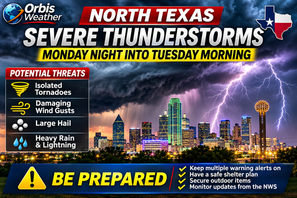
NORTH TEXAS — Millions of residents across North Texas, including the Dallas–Fort Worth metropolitan area, are being urged to prepare for potentially strong to severe thunderstorms Monday night, November 2, continuing into the early hours of Tuesday, November 3.
The National Weather Service (NWS) in Fort Worth warns that a powerful approaching weather system could produce damaging wind gusts, large hail, frequent lightning and isolated tornadoes as thunderstorms organize into a line and move eastward across the region.
⛈️ What to Expect
The greatest severe-weather concern is along and north of Interstate 20, although thunderstorms are expected across a wider area of North and Central Texas.
-
💨 Damaging winds: The primary threat, particularly as storms develop into a fast-moving line.
-
🧊 Large hail: Possible with thunderstorms developing during the late afternoon and evening.
-
🌪️ Isolated tornadoes: A brief tornado or two cannot be ruled out, particularly within rotating sections of the storm line.
-
🌧️ Heavy rainfall: Localized flooding is possible, although the storms’ rapid movement should limit the overall flash-flood threat.
-
⚡ Frequent lightning: Dangerous lightning could accompany thunderstorms overnight.
🕒 When Will the Storms Arrive?
Based on the NWS Fort Worth forecast issued early Monday morning, November 2:
|
Time (Central Standard Time) |
Expected development |
|---|---|
|
Monday, 3–6 PM |
Isolated thunderstorms possible northwest of Dallas–Fort Worth |
|
Monday evening |
Thunderstorms increase and organize into clusters or a broken line |
|
Around 11 PM |
Main storm line approaches the Interstate 35 corridor |
|
Overnight into Tuesday |
Storms continue east across North and Central Texas |
|
By approximately 8 AM Tuesday |
Main storm line expected to exit the forecast region |
🌪️ Why Meteorologists Are Concerned
A strengthening upper-level weather disturbance moving out of the Desert Southwest will interact with warm, unstable air across Texas.
Strong wind shear — changes in wind speed and direction with altitude — could help thunderstorms become organized and potentially rotate.
The initial storms may develop as individual supercells, which can produce large hail, damaging winds and tornadoes.
As the evening progresses, forecasters expect thunderstorms to consolidate into a broken line, increasing the potential for damaging straight-line winds.
🌤️ Cooler Weather Follows Tuesday
Once the cold front moves through, conditions should improve considerably.
Tuesday afternoon is expected to bring clearing skies, northwest winds gusting near 25 mph (40 km/h), and temperatures generally in the lower to middle 70s°F (21–24°C).
By Wednesday morning, temperatures could fall into the 40s and lower 50s°F (approximately 4–11°C), followed by pleasant fall weather.
🚨 Overnight Storm Safety
Because the strongest thunderstorms could arrive while many residents are sleeping, the NWS recommends keeping multiple methods of receiving weather warnings available.
Residents should ensure emergency alerts are enabled on their phones, charge essential devices, secure loose outdoor items and identify an interior room on the lowest floor where they can shelter if a tornado warning is issued.
The bottom line: North Texas faces a genuine overnight severe-weather threat, with damaging winds the primary concern and isolated tornadoes possible. Residents should monitor forecast updates throughout Monday evening.
About the Author
Paul Harrison — Founder & Publisher, Orbis Weather
Paul Harrison founded Orbis Weather in 2026 to make global weather and natural-hazard information easier to find, follow and understand. His coverage includes tropical cyclones, severe weather, extreme temperatures, earthquakes, volcanoes, wildfires, flooding and significant natural disasters worldwide.
View all articles by Paul Harrison → | Editorial Standards →
Global Weather Tracker Hub
Explore weather maps, tropical systems, storms and natural hazards around the world.
No matching trackers found.