
‘Potentially Catastrophic’ Flooding Threatens Three Colorado Counties as Historic River Levels Trigger Evacuations
By Paul Harrison | Founder & Publisher, Orbis Weather

- South America Weather & Natural Hazards Today — November 2, 2026 8:22 AM
- Central America Weather & Natural Hazards Today: Tropical Wave Raises Heavy Rain and Flooding Concerns 8:12 AM
- North America Weather & Natural Hazards Today Nov 2 8:02 AM
- Weekly Global Weather Watch: Weekly Analysis, November 2, 2026 7:43 AM
- Daily Earthquakes, Storms, Fires & Floods Report: November 2, 2026 7:36 AM
- Tropical Atlantic Daily Report: Monday, November 2, 2026 7:17 AM
- Eastern & Central Pacific Tropical Weather Update: Monday, November 2, 2026 7:08 AM
- WESTERN PACIFIC Tropical Weather Update – Monday, November 2, 2026 6:52 AM





‘Potentially Catastrophic’ Flooding Threatens Three Colorado Counties as Historic River Levels Trigger Evacuations
Orbis Weather | United States Weather & Natural Hazards
By Paul Harrison | November 1, 2026
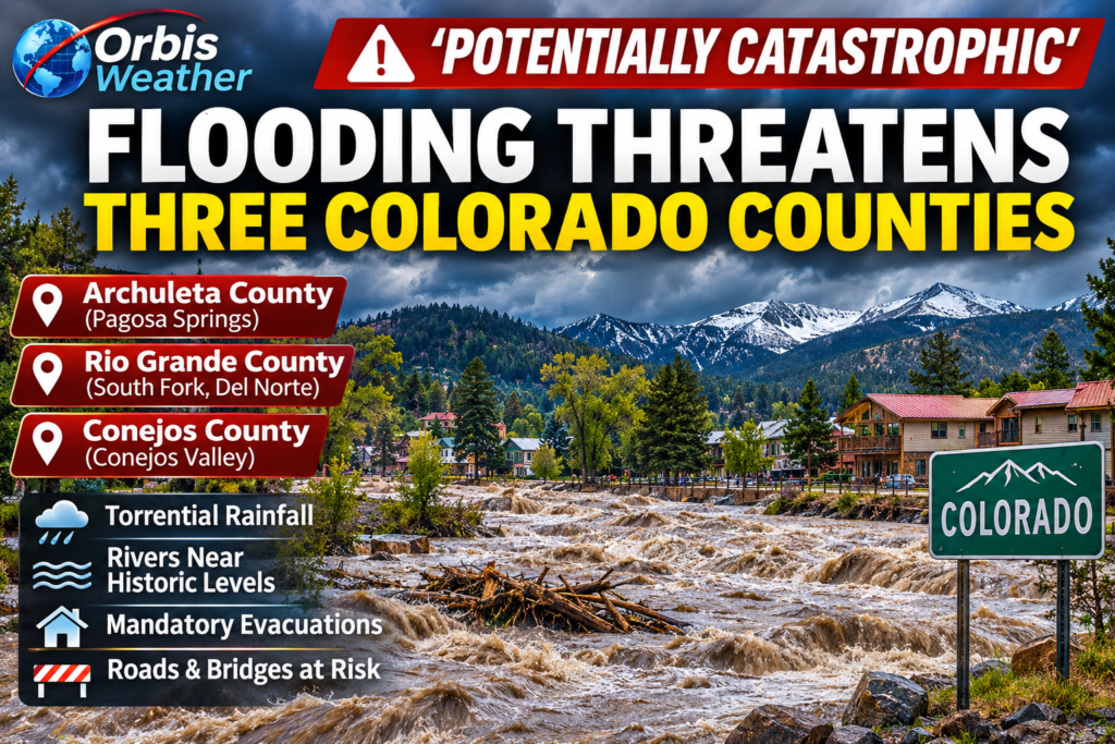
SOUTHWEST COLORADO — A potentially catastrophic flooding emergency is unfolding across southwestern Colorado, with mandatory evacuations ordered in three counties as torrential rainfall threatens to push rivers beyond historic flood levels.
Authorities in Archuleta, Rio Grande and Conejos counties are urging residents in vulnerable communities to evacuate immediately, warning that rising rivers, damaged roads and dangerous currents could leave entire neighborhoods isolated.
The situation is particularly alarming in Pagosa Springs, where the San Juan River is forecast to exceed levels recorded during the devastating flood of 1911.
🌊 Three Counties Facing Major Flooding
Archuleta County — Pagosa Springs
Pagosa Springs is at the center of the emergency. Local officials warned that the San Juan River could reach approximately 19.71 feet late Sunday, November 1.
For comparison, the historic 1911 flood reached approximately 17.8 feet and destroyed much of the town as it existed at the time.
Mandatory evacuations affect low-lying communities along the San Juan, Rio Blanco, Navajo and Piedra rivers.
Rio Grande County — South Fork and Del Norte
Mandatory evacuations have also been ordered in vulnerable areas around South Fork and Del Norte.
Flooding threatens homes, roads and properties near the Rio Grande and its tributaries. Emergency shelters have been established as communities prepare for additional rainfall.
Conejos County — Conejos River Valley
Residents from Platoro through the Conejos River Canyon toward Fox Creek and Mogote have been instructed to evacuate.
Authorities are also monitoring bridges and transportation routes, including the Tixier Ramirez Bridge near Antonito, amid concerns about structural damage from rapidly rising water.
🌧️ Why Is Colorado Experiencing Such Severe Flooding?
A succession of moisture-rich Pacific storm systems has brought heavy precipitation to the southwestern United States.
The latest rainfall is falling on ground already saturated by previous storms, substantially increasing runoff into rivers and streams.
The National Weather Service warned that some locations across the wider Southwest could receive up to 4 inches (102 mm) of rainfall during this latest episode.
Rainfall, snowmelt and runoff from higher elevations are combining to produce dangerous river conditions.
⚠️ National Weather Service Issues Particularly Dangerous Warning
The National Weather Service office in Grand Junction described the flooding across southwestern Colorado and southeastern Utah as significant and historic.
Its November 1 warning reported that roads had already become impassable, with some washed away or collapsed entirely.
Forecasters warned that major flooding would continue through Monday, November 2, and classified the situation as particularly dangerous.
🚨 Evacuations, Road Closures and Emergency Response
Colorado emergency management officials have urged residents not to wait until floodwaters reach their homes.
Emergency crews face several challenges, including flooded highways, damaged bridges, inaccessible communities and weather conditions that may restrict helicopter operations.
Colorado National Guard resources and search-and-rescue teams have been positioned to assist affected communities.
Highway 160 access into Pagosa Springs has been restricted, while other roads across the region are experiencing flooding and closures.
The state had already declared a flooding disaster emergency across 12 southwestern Colorado counties following severe flooding in late October.
📍 Where Residents Can Find Emergency Information
Residents should follow county emergency management instructions and avoid traveling through flood-affected areas.
For Pagosa Springs and Archuleta County, the town has identified Open Door Church, 110 Trinity Lane, as an evacuation shelter.
Official information is available through:
Never attempt to drive through floodwater. Roads may be undermined even where the water appears shallow.
🔎 What Happens Next?
The most dangerous period is expected overnight Sunday into Monday as heavy rainfall continues and rivers respond to runoff from mountain watersheds.
Even after rainfall decreases, river flooding may continue downstream. Floodwaters can also weaken bridges, undermine roads and leave communities inaccessible.
The full extent of the damage will not be known until water levels recede and emergency crews can safely assess affected areas.
🌎 Orbis Weather Outlook
The Colorado flooding emergency highlights the danger of successive heavy rainfall events in mountainous regions, where runoff can rapidly overwhelm river systems.
For southwestern Colorado, the immediate priorities remain evacuation, emergency shelter and avoiding flooded roads.
Orbis Weather will continue monitoring the Colorado flooding emergency, river conditions and official National Weather Service warnings.
About the Author
Paul Harrison — Founder & Publisher, Orbis Weather
Paul Harrison founded Orbis Weather in 2026 to make global weather and natural-hazard information easier to find, follow and understand. His coverage includes tropical cyclones, severe weather, extreme temperatures, earthquakes, volcanoes, wildfires, flooding and significant natural disasters worldwide.
View all articles by Paul Harrison → | Editorial Standards →
Global Weather Tracker Hub
Explore weather maps, tropical systems, storms and natural hazards around the world.
No matching trackers found.