
🌍 Australia, New Zealand & Oceania Weather & Natural Hazards Today
By Paul Harrison | Founder & Publisher, Orbis Weather
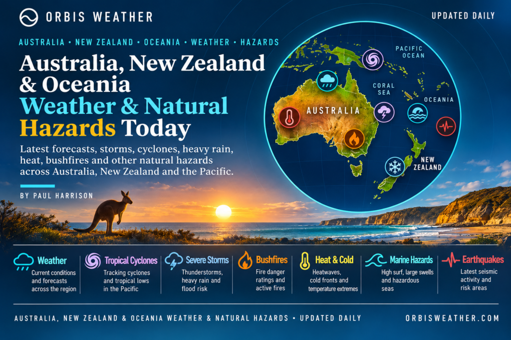

- Australia, New Zealand & Oceania Weather & Natural Hazards Today — Tuesday, November 3, 2026 11:27 AM
- Severe Thunderstorms Threaten North Texas Monday Night Into Tuesday Morning 11:00 AM
- South America Weather & Natural Hazards Today — November 2, 2026 8:22 AM
- Central America Weather & Natural Hazards Today: Tropical Wave Raises Heavy Rain and Flooding Concerns 8:12 AM
- North America Weather & Natural Hazards Today Nov 2 8:02 AM
- Weekly Global Weather Watch: Weekly Analysis, November 2, 2026 7:43 AM
- Daily Earthquakes, Storms, Fires & Floods Report: November 2, 2026 7:36 AM
- Tropical Atlantic Daily Report: Monday, November 2, 2026 7:17 AM
- Eastern & Central Pacific Tropical Weather Update: Monday, November 2, 2026 7:08 AM
- WESTERN PACIFIC Tropical Weather Update – Monday, November 2, 2026 6:52 AM





Australia, New Zealand & Oceania Weather & Natural Hazards Today — Tuesday, November 3, 2026
By Paul Harrison | Orbis Weather
Regional Weather Report | Tuesday, November 3, 2026 (local time)
🌏 Regional Overview: Severe Storms Threaten Eastern Australia as New Zealand Faces Heavy Rain
Severe thunderstorms, damaging winds, large hail, heavy rainfall and potential flash flooding are the main weather concerns across Australia, New Zealand and parts of Oceania as the region moves into Tuesday, November 3, 2026.
Eastern Australia faces the most significant thunderstorm threat, with Queensland and New South Wales particularly exposed to potentially destructive storms. Australia’s Bureau of Meteorology (BoM) has highlighted the possibility of giant hail, destructive wind gusts and intense rainfall in parts of southeast Queensland.
Meanwhile, New Zealand is dealing with a significant heavy-rain event across parts of the South Island, where swollen rivers, landslides and difficult driving conditions are concerns.
Across the tropical Pacific, attention is focused on developing rainfall patterns, coastal marine conditions and the influence of a strong El Niño on regional weather and climate.
The main developments are:
🔴 Australia: Severe thunderstorms threaten Queensland and New South Wales, with giant hail and destructive winds possible in some areas.
🟠 New Zealand: Heavy rainfall and flooding concerns across the South Island, particularly Westland and the Southern Alps.
🟡 Vanuatu: Heavy-rain potential and hazardous northern coastal waters.
🟢 Solomon Islands: Scattered showers and isolated thunderstorms, with no general warning in the latest bulletin reviewed.
🌊 Pacific Islands: Strong El Niño raises longer-term concerns about rainfall, drought, ocean temperatures and tropical cyclone activity.
These assessments draw on official meteorological bulletins issued November 2 for the November 3 reporting period, supplemented by regional climate information.
🇦🇺 Australia Weather Today
⛈️ Queensland — Severe Thunderstorm Threat
Queensland is one of the principal areas of concern on Tuesday.
The Bureau of Meteorology expects severe thunderstorms across a broad area extending from southeast Queensland through Wide Bay and into the Central Highlands and Coalfields.
Areas requiring particular attention include Brisbane, Ipswich, Toowoomba, the Gold Coast, Sunshine Coast, Gympie, Kingaroy and surrounding districts.
Potential hazards include damaging wind gusts, large hail, intense rainfall, localised flash flooding and dangerous lightning.
Of particular concern is a corridor extending from Brisbane’s western suburbs toward Ipswich, Toowoomba, Warwick and Kingaroy. The Bureau has identified the potential for exceptionally severe thunderstorms capable of producing:
Giant hail measuring 5 cm (approximately 2 inches) or larger.
Destructive wind gusts of 125 km/h (78 mph) or greater.
Localised intense rainfall and flash flooding.
These are potential storm intensities, not observed conditions or a forecast that every location will experience them.
Brisbane’s forecast high is approximately 28°C (82°F), with thunderstorms possible from late morning into the afternoon and evening.
⛈️ New South Wales — Large Hail and Damaging Winds Possible
A broad trough is expected to produce showers and thunderstorms across eastern New South Wales.
The most significant severe-storm risk is concentrated in northeastern districts, including the Northern Rivers, Northern Tablelands and parts of the Mid North Coast.
Sydney could also experience thunderstorms, some potentially severe.
The main hazards are damaging winds, large hail, heavy downpours, lightning and localised flooding.
Sydney forecast: Around 26°C (79°F), with showers and thunderstorms.
Canberra forecast: Around 25°C (77°F), with showers and thunderstorms, some potentially severe.
Western New South Wales should generally experience drier and calmer conditions behind the trough.
🌦️ Victoria — Showers and Thunderstorms
Victoria remains under the influence of the broader weather system moving through southeastern Australia.
Showers and thunderstorms are possible, especially across eastern districts, while the earlier severe-storm threat focused on northwestern Victoria during Monday.
Residents should continue checking forecasts and warnings as the system progresses eastward.
🌤️ Western Australia — Generally Calmer Conditions
A high-pressure system near Western Australia is expected to support relatively cooler and calmer weather across much of western and southern Australia.
However, the Kimberley may experience showers and thunderstorms associated with tropical moisture and instability.
The principal hazards in northern areas are lightning, locally heavy showers and rapidly changing conditions near thunderstorms.
🌦️ Northern Territory — Tropical Thunderstorms
Thunderstorms are possible across northern parts of the Northern Territory as the region progresses toward its wetter summer season.
Localised heavy rain, lightning and gusty winds may accompany stronger storms.
People travelling through remote areas should monitor road conditions and avoid flooded crossings.
🌤️ South Australia and Tasmania
High pressure is expected to contribute to more settled conditions across much of southern Australia, although local variations and passing weather systems remain possible.
No specific widespread severe-weather event for these areas was established in the official forecast material reviewed for this report.
Australia official warnings: Australian Bureau of Meteorology
🇳🇿 New Zealand Weather Today
🌧️ South Island — Heavy Rain, Flooding and Landslide Concerns
New Zealand’s South Island is experiencing a substantial rainfall event, with the Westland District and headwaters of Canterbury lakes and rivers among the most affected locations.
MetService issued Orange Heavy Rain Warnings covering these regions, with the latest available warning-feed information showing substantial rainfall accumulations and warnings extending into Tuesday.
In the Westland ranges, forecast additional rainfall totals reached 300–350 mm (11.8–13.8 inches) in the updated bulletin. For the Canterbury headwaters south of Arthur’s Pass, 220–280 mm (8.7–11 inches) was forecast about the main divide.
These figures relate to specified warning periods and are not daily totals for all of Tuesday.
Potential consequences include rapidly rising streams and rivers, surface flooding, landslides, debris on roads and difficult travel conditions.
Rainfall is expected to ease as the weather system progresses, but rivers may remain elevated after the heaviest rain has passed.
🌬️ Strong Winds Across Southern Regions
Northwesterly winds have also affected parts of the South Island, including exposed high-country locations.
Strong winds can make travel hazardous, particularly for high-sided vehicles, and may create difficult conditions in mountain passes.
🌦️ North Island — Changeable Spring Weather
The North Island faces more variable spring conditions, with changing cloud cover, periods of rain and wind depending on location.
Looking beyond Tuesday, MetService has identified a developing humid north-to-northwest flow and possible heavy rainfall later in the week.
There is low confidence of warning-level rainfall in the eastern Bay of Plenty ranges on Saturday, November 7. This is an outlook rather than an active heavy-rain warning.
New Zealand official warnings: MetService Weather Warnings
🌴 Fiji Weather Today
🌦️ Showers, Gusty Trade Winds and Rough Seas
Fiji is expected to experience a mixture of sunshine, cloud and passing showers on Tuesday.
The Fiji Meteorological Service reports that high pressure well south of the country is directing moderate to fresh southeasterly winds across the islands.
Cloudy periods and brief showers are expected around Suva, Nausori, Taveuni, Kadavu, the Lau and Lomaiviti groups, and parts of Vanua Levu.
Western districts, including Nadi, Lautoka and the Mamanuca and Yasawa islands, should generally experience more sunshine, although isolated showers remain possible.
Forecast temperatures include:
Location | Tuesday high | Conditions |
|---|---|---|
Suva / Nausori | 29°C (84°F) | Cloudy, brief showers |
Nadi / Lautoka | 31°C (88°F) | Mostly fine, isolated showers |
Labasa | 31°C (88°F) | Mainly fine |
Taveuni | 29°C (84°F) | Cloudy, brief showers |
Kadavu | 29°C (84°F) | Cloudy, brief showers |
Marine conditions deserve particular attention, with moderate to rough seas and southeasterly winds generally around 15–20 knots in the national marine outlook.
Small vessels should check local marine forecasts before departure.
Official source: Fiji Meteorological Service
🇵🇬 Papua New Guinea Weather & Natural Hazards
☀️ Dry Conditions Intensify Water and Agricultural Concerns
Papua New Guinea faces one of the region’s most serious longer-term environmental emergencies, with El Niño-related drought affecting water supplies, agriculture and rural communities.
Recent reporting indicates that some areas have received less than a quarter of their normal rainfall since August. Water shortages have damaged food gardens, reduced river flows and affected electricity generation.
An estimated eight million people are affected by the drought, according to reporting published October 30. The impacts vary considerably by province and community.
Port Moresby Forecast
Tuesday is expected to be predominantly sunny, with temperatures reaching approximately 31°C (88°F) and a low near 22°C (72°F), according to the UK Met Office forecast.
High ultraviolet radiation remains a concern for people working outdoors.
Key Hazards
Water shortages, agricultural losses, food insecurity and reduced hydroelectric power generation remain important concerns.
Rainfall in isolated areas would not necessarily provide immediate relief from the wider drought.
Communities should follow official water-management advice and avoid unnecessary consumption where restrictions apply.
🇻🇺 Vanuatu Weather & Natural Hazards
🌧️ Heavy Rain Potential and Hazardous Northern Waters
Vanuatu’s Meteorology and Geo-Hazards Department has identified a moderate likelihood of rainfall reaching 100 mm (3.9 inches) or more within 24 hours during the first two days of its November 2 outlook.
The department also assessed a moderate-to-high likelihood of coastal winds reaching at least 25 knots in parts of northern waters.
These forecasts indicate potential hazards, not confirmation that the thresholds will be reached everywhere.
The main concerns are localised flooding, difficult marine conditions, reduced visibility during heavy showers and dangerous conditions for smaller boats.
Residents and maritime operators should monitor updated national bulletins.
Official source: Vanuatu Meteorology and Geo-Hazards Department
🇸🇧 Solomon Islands Weather Today
🌦️ Scattered Showers and Isolated Thunderstorms
The Solomon Islands Meteorological Service forecast issued Monday evening indicates that a trough lies northeast of the country, with southeast trade winds prevailing to its south.
Choiseul and Western Province may experience scattered showers and isolated thunderstorms, while other areas should see a mixture of fine periods and showers.
The national bulletin reviewed reported no general weather warning in force at issuance.
Nevertheless, isolated thunderstorms can still produce lightning, heavy rain and temporary reductions in visibility.
Coastal communities and small-boat operators should check the latest local forecast before travelling.
Official source: Solomon Islands Meteorological Service
🌺 Tonga, Samoa, Cook Islands and French Polynesia
Across the central and eastern South Pacific, changing trade winds, passing showers and tropical moisture remain important features of the regional weather pattern.
Conditions can differ substantially between island groups, even over relatively short distances.
🇹🇴 Tonga
Residents should monitor local forecasts for changes in wind strength, rainfall and coastal sea conditions as the South Pacific cyclone season approaches.
🇼🇸 Samoa and American Samoa
Warm tropical conditions can support passing showers and occasional thunderstorms. Heavy rainfall may produce rapid runoff in steep terrain.
🇨🇰 Cook Islands
Marine conditions, passing showers and trade-wind variations are important considerations for inter-island travel and fishing.
🇵🇫 French Polynesia
Island groups spread across a vast ocean area can experience very different weather simultaneously. Local rainfall and marine forecasts are essential.
Verification note: Current November 3 national warnings and detailed forecasts for these island groups were not independently established during preparation of this report. The descriptions above are general seasonal considerations, not verified active alerts.
🌀 South Pacific Tropical Cyclone Outlook
November marks the beginning of the principal tropical cyclone season across much of the southwest Pacific.
The season generally extends through April, although tropical cyclones can occasionally develop outside those months.
Early-season monitoring focuses on the Coral Sea, waters surrounding Vanuatu and Fiji, and the wider southwest Pacific.
A tropical disturbance can develop into a tropical depression and, under favourable conditions, strengthen into a tropical cyclone.
Important environmental factors include warm ocean temperatures, atmospheric moisture, low-level circulation and vertical wind shear.
No specific active cyclone affecting the region has been independently confirmed in the sources reviewed for this edition.This should not be interpreted as an official all-clear across the entire Pacific basin.
For current tropical cyclone advisories, consult the Regional Specialized Meteorological Centre in Nadi and the Australian Bureau of Meteorology.
🌋 Earthquakes, Volcanoes and Tsunami Risk
Oceania lies along several active tectonic boundaries, particularly around Papua New Guinea, the Solomon Islands, Vanuatu, Tonga and New Zealand.
These regions experience frequent earthquakes because of movement between major tectonic plates.
🌋 Volcano Monitoring
Volcanic hazards across the region include ash emissions, gas releases, lava activity, landslides and disruption to aviation.
Important monitoring areas include Papua New Guinea, Vanuatu and New Zealand’s volcanic zones.
Volcanic ash can pose a serious danger to aircraft even when eruptions occur far from populated communities.
🌎 Earthquake Monitoring
Strong or shallow earthquakes can cause structural damage and landslides. Under certain conditions, underwater earthquakes may also generate tsunamis.
No specific earthquake magnitude, new eruption or active tsunami warning is being reported here without a verified event bulletin.
For current observations and alerts, use:
Residents in coastal earthquake zones should remember that strong or prolonged shaking can be a natural tsunami warning. Move to higher ground or inland immediately where appropriate, without waiting for an official message.
🌊 Ocean Conditions, Coastal Flooding and Marine Hazards
Marine conditions are especially important across Oceania because many communities depend on fishing, shipping and inter-island transport.
Three hazards deserve attention during the current reporting period.
Rough seas and strong winds: Fiji is forecasting moderate to rough seas, while northern Vanuatu waters face a heightened risk of strong coastal winds.
Heavy rainfall and runoff: Localised intense rain can create dangerous conditions near river mouths, harbours and low-lying coastal settlements.
Ocean swell and changing tides: Even when inland weather is relatively calm, long-period swell can create dangerous surf and strong currents.
Mariners should use official coastal and high-seas forecasts rather than relying solely on general land forecasts.
🌡️ El Niño and the Pacific Climate Outlook
A strong El Niño is influencing weather and climate across the Pacific, with implications extending into 2027.
At a regional climate forum in Port Moresby in late October, Pacific climate specialists discussed the possibility of exceptionally strong El Niño conditions and their potential effects on rainfall, temperatures, ocean conditions and tropical cyclones.
El Niño does not affect every island in the same way. Some areas can experience substantial rainfall deficits while others face wetter conditions.
Potential regional consequences include drought, agricultural stress, water shortages, warmer ocean temperatures and changes in tropical cyclone activity.
Papua New Guinea’s ongoing drought demonstrates why seasonal climate developments can be as consequential as short-lived storms.
Climate outlooks describe broad probabilities over weeks or months. They cannot determine whether an individual town will experience severe weather on a particular day.
📊 Regional Weather and Hazard Summary
Tuesday, November 3, 2026 — Based on the latest verified bulletins reviewed. These are editorial hazard priorities, not official alert classifications.
Region | Main concern | Editorial priority |
|---|---|---|
Queensland | Severe thunderstorms, giant hail, destructive winds | 🔴 High |
New South Wales | Severe storms, heavy rain, hail | 🔴 High |
Victoria | Showers and thunderstorms | 🟡 Monitor |
Western Australia | Generally calmer; northern storms | 🟢 Lower |
Northern Territory | Local thunderstorms | 🟡 Monitor |
New Zealand South Island | Heavy rain, flooding, landslides | 🔴 High |
New Zealand North Island | Changeable conditions | 🟡 Monitor |
Fiji | Showers, gusty winds, rough seas | 🟡 Monitor |
Papua New Guinea | Ongoing drought and water shortages | 🔴 High |
Vanuatu | Heavy-rain potential, coastal winds | 🟠 Elevated |
Solomon Islands | Scattered showers and thunderstorms | 🟢 Lower |
Other Pacific islands | Local weather and marine conditions | ⚪ Not assessed |
These categories reflect the potential seriousness of the hazards discussed, not a uniform region-wide warning system. An absence of verified warnings does not establish that conditions are safe.
🔭 Weather Outlook: November 4–7, 2026
Australia
The movement of the eastern Australian trough will remain an important forecasting consideration following Tuesday’s severe thunderstorm threat.
Areas affected by severe storms should continue monitoring official forecasts for any subsequent rainfall, flooding or wind warnings.
New Zealand
MetService expects humid north-to-northwest conditions to influence the country later in the week.
Further rain is possible across northern and western regions, with a low-confidence heavy-rain signal for the Westland ranges on Wednesday and Thursday.
Another trough may bring rain to central and northern New Zealand toward Friday and Saturday.
Fiji and the Southwest Pacific
Fiji’s forecast indicates continued moderate to rough marine conditions into the following days, with showers affecting windward areas.
Across the wider Pacific, seasonal monitoring will focus on tropical disturbances, rainfall patterns and developing cyclone risks.
Papua New Guinea
Drought remains the major longer-term concern. Even where scattered showers occur, sustained rainfall would be needed to substantially improve depleted water supplies and agricultural conditions.
🛟 Weather Safety Advice
People in eastern Australia should secure loose outdoor items, protect vehicles where practical and avoid unnecessary travel during severe thunderstorms. Never drive through floodwater.
In New Zealand, avoid swollen rivers, unstable slopes and roads affected by slips or debris. Check road closures before travelling through mountainous areas.
Across the Pacific islands, small-vessel operators should check marine warnings and avoid sailing when dangerous winds or seas are forecast.
During thunderstorms, seek shelter in a substantial building or enclosed vehicle. Avoid exposed beaches, open water and isolated trees.
📰 Orbis Weather Analysis
Tuesday’s weather illustrates the enormous diversity of natural hazards across Australia, New Zealand and Oceania.
In eastern Australia, the immediate concern is severe convection — powerful thunderstorms capable of producing damaging winds, large hail and dangerous rainfall.
Across New Zealand’s South Island, prolonged heavy rain creates a different set of hazards, particularly where steep terrain increases the risk of rapid runoff and landslides.
Further north, Papua New Guinea faces a slower-developing but potentially devastating environmental problem as prolonged drought threatens water security and food production.
For the Pacific islands, marine conditions and seasonal tropical cyclone monitoring remain essential as the region enters November.
The broader lesson is that natural hazards are not limited to dramatic storms. Drought, flooding, rough seas and geological activity can all threaten communities, infrastructure and livelihoods.
The priority for November 3 is clear: monitor severe thunderstorms across eastern Australia, ongoing rainfall impacts in New Zealand, and the developing seasonal hazards across the Pacific.
📚 Weather Data Sources and Editorial Methodology
This report has been prepared by Orbis Weather using official meteorological information, regional hazard monitoring resources and independently published reporting.
Primary weather and hazard sources
Organisation | Coverage |
|---|---|
Australian forecasts, storms and warnings | |
New Zealand weather forecasts and warnings | |
New Zealand earthquakes and volcanoes | |
Fiji weather and South Pacific cyclone monitoring | |
Vanuatu weather and geological hazards | |
Solomon Islands forecasts | |
Earthquake monitoring | |
Tsunami advisories | |
Regional climate and environmental information |
How this report is produced
Orbis Weather reviews available national meteorological forecasts, severe-weather outlooks and relevant hazard information, then combines the findings into a regional news report.
Official forecasts are distinguished from broader climate assessments and general safety information.
Forecast rainfall, wind speeds and temperatures are predictions, not observed measurements, unless explicitly described otherwise.
Not all national services publish data simultaneously. This means some warnings may change between the preparation of this report and the time it is read.
The report does not independently measure weather conditions or issue official meteorological warnings.
Publication timing
This edition is dated Tuesday, November 3, 2026, reflecting the local calendar date across Australia, New Zealand and the principal Pacific island regions covered.
Source bulletins were reviewed on Monday, November 2, and include forecasts extending into Tuesday. Some Pacific islands cross the International Date Line, so readers should always use their local official warning times.
About the Author
Paul Harrison — Founder & Publisher, Orbis Weather
Paul Harrison founded Orbis Weather in 2026 to make global weather and natural-hazard information easier to find, follow and understand. His coverage includes tropical cyclones, severe weather, extreme temperatures, earthquakes, volcanoes, wildfires, flooding and significant natural disasters worldwide.
View all articles by Paul Harrison → | Editorial Standards →
Global Weather Tracker Hub
Explore weather maps, tropical systems, storms and natural hazards around the world.
No matching trackers found.