
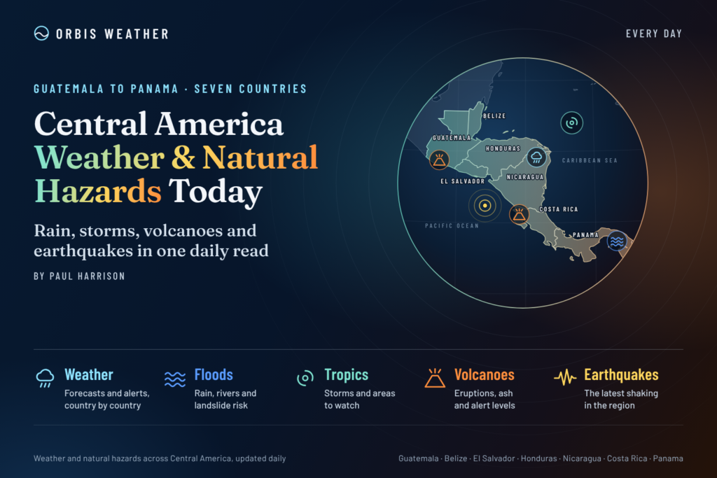
Central America Weather & Natural Hazards Today
By Paul Harrison | Founder & Publisher, Orbis Weather

- Australia, New Zealand & Oceania Weather & Natural Hazards Today — Tuesday, November 3, 2026 11:27 AM
- Severe Thunderstorms Threaten North Texas Monday Night Into Tuesday Morning 11:00 AM
- South America Weather & Natural Hazards Today — November 2, 2026 8:22 AM
- Central America Weather & Natural Hazards Today: Tropical Wave Raises Heavy Rain and Flooding Concerns 8:12 AM
- North America Weather & Natural Hazards Today Nov 2 8:02 AM
- Weekly Global Weather Watch: Weekly Analysis, November 2, 2026 7:43 AM
- Daily Earthquakes, Storms, Fires & Floods Report: November 2, 2026 7:36 AM
- Tropical Atlantic Daily Report: Monday, November 2, 2026 7:17 AM
- Eastern & Central Pacific Tropical Weather Update: Monday, November 2, 2026 7:08 AM
- WESTERN PACIFIC Tropical Weather Update – Monday, November 2, 2026 6:52 AM





Central America Weather & Natural Hazards Today: Tropical Wave Raises Heavy Rain and Flooding Concerns
By Paul Harrison | Orbis Weather
Monday, November 2, 2026
Heavy tropical rainfall, thunderstorms and the possibility of localized flooding are among the principal weather concerns across Central America today, with particular attention focused on Costa Rica as a tropical wave interacts with an increasingly active rain-producing weather pattern.
Costa Rica’s National Meteorological Institute (IMN) forecasts increased rainfall as Tropical Wave No. 52 moves across the country, with showers potentially continuing into Tuesday. The Caribbean and northern regions are expected to experience rain throughout Monday, while wetter conditions spread toward the central and southern Pacific regions later in the day.
Elsewhere, the region remains exposed to familiar November hazards, including localized thunderstorms, rapid river rises, landslides on saturated hillsides and dangerous conditions along exposed coastlines.
The Atlantic and eastern Pacific basins currently have no active tropical cyclones, according to the National Hurricane Center’s November 2 update. However, the absence of a named storm does not eliminate the risk of heavy rainfall.
Today’s Regional Weather and Hazard Overview
Country | Weather focus | Main hazard to monitor |
|---|---|---|
Belize | Caribbean moisture and passing showers | Localized heavy rain |
Guatemala | Mountain and Pacific-slope thunderstorms | Flash flooding and landslides |
Honduras | Caribbean rainfall and inland showers | River flooding |
El Salvador | Afternoon showers and thunderstorms | Urban flooding |
Nicaragua | Humid tropical conditions and scattered storms | Heavy downpours |
Costa Rica | Tropical Wave No. 52 and active convergence zone | Heavy rain, flooding and landslides |
Panama | Tropical moisture and thunderstorms | Flash flooding and slope instability |
This table provides a regional hazard-monitoring outlook, not a list of confirmed active warnings. Costa Rica’s rainfall forecast is supported by its national meteorological service; conditions in the other countries require verification against their latest national forecasts.
1. Costa Rica: Tropical Wave Increases Rainfall Risk
Costa Rica is the clearest area of immediate concern in today’s regional assessment.
The IMN reports that Tropical Wave No. 52 is moving across the country on Monday, bringing additional moisture and instability. The disturbance is expected to interact with the Intertropical Convergence Zone (ITCZ), a broad belt of converging winds and rising air that frequently produces heavy tropical rainfall.
The combination may strengthen rainfall activity and prolong unsettled conditions into Tuesday, November 3.
Areas to monitor
Caribbean region: Rainfall is expected during the day, with locally persistent showers possible.
Northern region: Additional rainfall may affect rivers, roads and low-lying communities.
Central Pacific: Rain chances increase toward the end of Monday.
Southern Pacific: Increasing moisture may support heavier showers and thunderstorms.
Central Valley: Residents should monitor updated local forecasts as the disturbance crosses the country.
The primary concern is rainfall accumulation rather than damaging winds associated with an organized tropical cyclone.
Communities near steep hillsides, rivers and drainage channels should remain alert to rapidly changing conditions, particularly after dark.
2. Panama: Thunderstorms and Localized Flooding Potential
Panama remains vulnerable to heavy tropical rainfall during November, particularly where moisture from the Pacific and Caribbean combines with daytime heating.
The Pacific-facing provinces of Chiriquí, Veraguas, Coclé and Darién are important areas for monitoring thunderstorms and rainfall accumulation.
In Panama City and other urban areas, intense short-duration rainfall can overwhelm drainage infrastructure, producing localized flooding even without a tropical storm.
Mountain roads and communities near steep terrain should remain alert to landslide hazards during prolonged wet periods.
Current assessment: Localized rainfall and thunderstorms are potential hazards, but a specific nationwide severe-weather warning for November 2 has not been independently confirmed for this report.
3. Nicaragua: Tropical Moisture and Heavy Showers
Nicaragua’s weather is strongly influenced by Caribbean trade winds, tropical moisture and local atmospheric instability.
The eastern Caribbean lowlands generally receive substantial rainfall, while western areas can experience afternoon and evening thunderstorms when conditions are favorable.
Areas requiring routine monitoring include Managua, León, Granada, Bluefields and the Río San Juan region.
Heavy showers can create hazardous driving conditions, localized flooding and sudden rises in smaller waterways.
The main concern is the intensity and duration of individual rainstorms, rather than the mere presence of scattered showers.
No specific November 2 rainfall totals or active flood alerts have been verified for Nicaragua in this update.
4. Honduras: Caribbean Rainfall and Mountain Flood Risks
Honduras is especially vulnerable to flooding when moist Caribbean air interacts with mountainous terrain.
The northern coastline, including the San Pedro Sula metropolitan area and communities around La Ceiba, can experience prolonged rainfall during periods of strong onshore moisture flow.
Inland communities face additional risks from steep terrain, where heavy rainfall may trigger landslides or washouts.
Residents should monitor conditions near rivers and mountain roads, particularly if repeated thunderstorms affect the same area.
The threat is highly dependent on local rainfall intensity and previous ground saturation. This report does not establish that widespread flooding is occurring in Honduras today.
5. Guatemala: Thunderstorms, Mountain Rainfall and Landslide Exposure
Guatemala’s mountainous landscape creates considerable variation in weather conditions over relatively short distances.
Moisture moving inland from the Pacific or Caribbean can generate thunderstorms, while elevated terrain enhances rainfall in some locations.
Potentially vulnerable areas include the western highlands, Pacific coastal departments and mountainous roads surrounding Guatemala City.
During heavy rainfall, steep slopes and unstable ground can produce landslides, while urban areas may experience sudden surface-water flooding.
Travelers should pay particular attention to official road closures and emergency bulletins rather than relying exclusively on broad regional weather forecasts.
6. El Salvador: Localized Thunderstorms and Urban Flooding
El Salvador can experience intense tropical downpours even when neighboring areas remain relatively dry.
San Salvador and surrounding urban communities are particularly sensitive to short-duration heavy rainfall because of paved surfaces, steep drainage channels and densely developed neighborhoods.
Elsewhere, mountainous areas may experience landslide hazards when persistent rain weakens hillsides.
Residents should remain cautious around low-water crossings, drainage channels and flood-prone roads.
No specific nationwide emergency warning has been independently verified for November 2.
7. Belize: Caribbean Showers and Coastal Conditions
Belize’s weather is closely connected to conditions over the western Caribbean Sea.
Passing moisture, showers and isolated thunderstorms can affect coastal districts and inland areas, particularly when tropical disturbances move through the region.
Belize City, Dangriga, Placencia and Punta Gorda are among the locations where coastal weather and marine conditions deserve attention.
Small-boat operators should check the latest wind, wave and thunderstorm forecasts before departure.
Although the Atlantic basin currently has no active tropical cyclones, localized heavy rainfall and marine hazards remain possible.
8. Tropical Weather Outlook: Caribbean Sea and Eastern Pacific
The National Hurricane Center’s latest available bulletin indicates no active tropical cyclones in either basin as of the early hours of November 2.
This is encouraging for communities across Central America, but hurricane season is not yet over.
The Atlantic hurricane season officially continues through November 30, while the eastern North Pacific’s regular season extends through November 30.
November tropical cyclones are less common than those occurring during the climatological peak, but development remains possible.
Importantly, a tropical wave does not need to become a tropical depression or named storm to produce damaging rainfall.
Orbis Weather assessment: The most immediate confirmed weather development in this report is the tropical wave affecting Costa Rica, rather than an organized hurricane or tropical storm.
For updated official outlooks, consult the National Hurricane Center.
9. Flooding and Landslide Risk: Why Rainfall Accumulation Matters
One of Central America’s most significant natural hazards is the combination of intense rainfall and steep terrain.
A short but powerful thunderstorm can generate rapid flooding in communities located near rivers, streams and drainage channels.
Where soils are already saturated, additional rainfall can destabilize slopes and increase the likelihood of landslides.
This concern is particularly relevant in southern Costa Rica, where reports based on IMN information indicate soil saturation exceeding 95% in some locations. The IMN has also warned that isolated thunderstorm gusts could reach 80 km/h (50 mph).
Flooding risks depend on several factors, including rainfall intensity, duration, topography, drainage capacity and antecedent soil moisture.
A regional forecast cannot establish the safety of an individual road, river crossing or neighborhood.
10. Earthquake and Volcanic Hazards
Central America lies along an active tectonic boundary where the Cocos Plate moves beneath portions of the Caribbean Plate and neighboring crustal blocks.
This geological setting contributes to frequent earthquakes and volcanic activity, especially along the Pacific side of the region.
Earthquake monitoring
Guatemala, El Salvador, Nicaragua, Costa Rica and Panama all have areas exposed to significant seismic hazards.
Earthquakes can occur without warning, and their effects depend on magnitude, depth, distance from populated areas and local ground conditions.
No specific significant earthquake occurring on November 2 has been independently verified for inclusion in this report.
Readers can monitor the latest events through the USGS Real-Time Earthquake Map.
Volcano monitoring
Important volcanoes across Central America include Fuego and Pacaya in Guatemala, Santa Ana in El Salvador, Masaya in Nicaragua, and Poás, Turrialba and Rincón de la Vieja in Costa Rica.
Potential hazards include volcanic ash, gas emissions, explosive activity and rain-triggered volcanic mudflows known as lahars.
Mentioning a volcano in this report does not indicate that a new eruption has occurred today.
For current monitoring information, consult the Smithsonian Global Volcanism Program and the relevant national geological agencies.
11. Marine Conditions and Coastal Hazards
Central America has extensive coastlines facing both the Caribbean Sea and the Pacific Ocean.
Conditions can vary considerably between the two coasts.
Along the Caribbean, stronger trade winds may produce choppy seas and hazardous conditions for smaller vessels.
On the Pacific coast, distant swells can create powerful breaking waves and dangerous rip currents even when the weather on land appears relatively calm.
Heavy rainfall can also reduce visibility, while thunderstorms create additional hazards for fishing vessels and recreational boaters.
No region-wide wave-height or rip-current warning has been verified for today’s report. Mariners should consult the latest local forecasts before traveling.
12. Weather Outlook: November 3–5
TUESDAY THROUGH THURSDAY | PLANNING OUTLOOK
Date | Regional outlook |
|---|---|
Tuesday, November 3 | Rainy conditions may persist across Costa Rica as tropical moisture and the ITCZ remain influential |
Wednesday, November 4 | Continued monitoring of rainfall, rivers and saturated slopes is warranted, particularly in southern Central America |
Thursday, November 5 | Updated national forecasts will be needed to determine whether instability is weakening or additional rainfall threats are developing |
Costa Rica’s meteorological service has indicated that unsettled conditions could continue beyond Monday. However, precise rainfall timing and location for November 4–5 remain uncertain.
13. Public Safety and Preparedness
Residents and travelers across Central America should remain alert during periods of heavy tropical rainfall.
Avoid driving or walking through flooded roads and river crossings.
Stay away from steep slopes showing cracks, unusual water seepage or falling debris.
Seek shelter inside a substantial building when thunderstorms approach.
Monitor official rainfall warnings, river levels and emergency evacuation instructions.
Check marine forecasts before boating, fishing or swimming.
Keep essential supplies available in communities exposed to flooding or landslides.
During severe weather, local emergency management agencies and national meteorological services should always take precedence over general regional reporting.
14. Official Weather and Natural Hazard Sources
Orbis Weather encourages readers to consult the following primary information providers.
Agency | Coverage |
|---|---|
Caribbean and eastern Pacific tropical cyclones | |
Costa Rica forecasts and weather warnings | |
Guatemala weather, earthquakes and volcanoes | |
Weather and geological monitoring | |
National meteorological information | |
Meteorology, earthquakes and volcanoes | |
Belize weather and marine forecasts | |
Panama weather and hydrological monitoring | |
Earthquake information | |
Global volcanic activity |
15. Orbis Weather Analysis: The Bigger Picture
Central America’s geography makes the region especially sensitive to tropical rainfall.
Mountain ranges, narrow coastal plains, densely populated valleys and numerous river systems can turn localized thunderstorms into serious natural hazards.
The most important verified development today is Tropical Wave No. 52 crossing Costa Rica and interacting with the Intertropical Convergence Zone.
Although the Atlantic and eastern Pacific have no active tropical cyclones in the latest checked advisory, the region’s rainfall risks remain important.
For residents of southern Costa Rica in particular, the combination of additional rainfall and already saturated soils deserves attention.
The broader lesson is that tropical weather does not have to reach hurricane strength to become dangerous.
Orbis Weather will continue monitoring developments across Belize, Guatemala, Honduras, El Salvador, Nicaragua, Costa Rica and Panama as conditions evolve.
About the Author
Paul Harrison — Founder & Publisher, Orbis Weather
Paul Harrison founded Orbis Weather in 2026 to make global weather and natural-hazard information easier to find, follow and understand. His coverage includes tropical cyclones, severe weather, extreme temperatures, earthquakes, volcanoes, wildfires, flooding and significant natural disasters worldwide.
View all articles by Paul Harrison → | Editorial Standards →
Global Weather Tracker Hub
Explore weather maps, tropical systems, storms and natural hazards around the world.
No matching trackers found.