
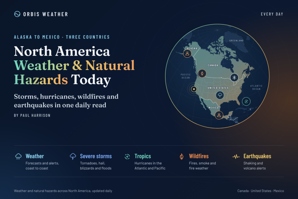
North America Weather & Natural Hazards Today
By Paul Harrison | Founder & Publisher, Orbis Weather

- Thailand Warns Eight Provinces of Possible Flooding as High Tides Threaten Bangkok and Coastal Communities 10:55 AM
- South America Weather & Natural Hazards Today — November 1, 2026 10:15 AM
- Central America Weather & Natural Hazards Today — Sunday, November 1, 2026 10:03 AM
- North America Weather & Natural Hazards Today Nov 1 9:46 AM
- Indonesia Forest Fire Haze Linked to More Than 3,500 Deaths in September as Air Pollution Crisis Deepens 8:37 AM
- Weekly Earth Watch: Volcanoes, Earthquakes & Natural Hazards – Week ending November 1, 2026 7:57 AM
- Daily Earthquakes, Storms, Fires & Floods Report — November 1, 2026 7:48 AM
- WESTERN PACIFIC Tropical Weather Update – November 1, 2026 7:34 AM
- Eastern & Central Pacific Tropical Weather Update: Sunday, November 1, 2026 7:27 AM
- Tropical Atlantic Daily Report: Sunday, November 1, 2026 7:20 AM
- Galápagos Islands Flood Disaster: One Dead, Two Missing as Torrential Rain Forces Families From Homes 5:26 AM
- Powerful Pacific Storm Could Bring Tornadoes, Damaging Winds and Widespread Rain Across the United States 5:07 AM





🌎 North America Weather & Natural Hazards Today: Major Pacific Storm Brings Flooding, Mountain Snow and Tornado Threat
By Paul Harrison | Founder & Publisher, Orbis Weather
Sunday, November 1, 2026 | United States, Canada, Mexico, Central America and the Caribbean
A powerful Pacific storm system is emerging as North America’s most significant weather story today, bringing a dangerous combination of heavy rainfall, flash flooding, mountain snow and the potential for severe thunderstorms across the United States.
The immediate concern is flooding across parts of the Southwest and Four Corners region. By Monday, November 2, attention will shift toward Texas, Oklahoma and Kansas, where damaging winds and a few tornadoes are possible.
Meanwhile, the Atlantic hurricane season continues into November without an active tropical cyclone, although coastal flooding, rough seas and changing marine conditions remain important hazards to monitor.
This Orbis Weather report examines the major threats, the science behind them, the areas most exposed and what residents should watch over the next 24–72 hours.
🚨 Today’s North America Hazard Overview
🌧️ Southwest U.S. flash flooding
Heavy rain and rapid runoff, particularly around the Four Corners region
🌪️ Southern Plains severe storms
Tornado and damaging-wind potential across Oklahoma, northern Texas and Kansas
❄️ Rocky Mountain snow
Heavy mountain snow and difficult travel at higher elevations
🌀 Atlantic tropical cyclones
No active Atlantic tropical cyclones reported by the National Hurricane Center this morning
Hazard classifications are Orbis Weather editorial descriptions, not official warning categories. They summarize information available on November 1, 2026.
🌧️ 1. United States: Flash Flood Threat Across the Southwest
The Southwest is facing a potentially dangerous period of heavy rainfall as a large Pacific weather system moves inland.
Parts of Arizona, Utah, Colorado and New Mexico are especially vulnerable where intense rainfall intersects with steep terrain, dry washes and areas already saturated by earlier storms.
NOAA’s Weather Prediction Center identifies a Moderate Risk of excessive rainfall for Sunday, November 1. This is Level 3 of 4 on its excessive rainfall scale and indicates an elevated risk of significant flash flooding within the designated area.
Flash flooding can develop rapidly in mountainous terrain and desert landscapes. Water may travel considerable distances through drainage channels before reaching roads and communities that have experienced little rainfall themselves.
Principal hazards include:
🌊 Rapidly rising creeks, streams and normally dry washes.
🚗 Dangerous water crossings on rural highways and low-water roads.
⛰️ Mudslides, rockfalls and debris flows in steep terrain.
🏕️ Flooding in campgrounds, canyons and recreational areas.
⚡ Thunderstorms producing intense rainfall over short periods.
Residents and travelers should pay particular attention to flash flood warnings and avoid driving through flooded roads.
The latest official rainfall outlook is available from the NOAA Weather Prediction Center.
🌪️ 2. Texas, Oklahoma and Kansas: Severe Weather Threat Monday
One of the most concerning developments is the potential for severe thunderstorms across the central and southern Plains on Monday, November 2.
The NOAA Storm Prediction Center has issued a Slight Risk — Level 2 of 5 for much of Oklahoma, northern Texas, and south-central and eastern Kansas.
This does not mean tornadoes are certain. It indicates that the atmospheric environment is expected to support scattered severe thunderstorms.
Forecasters identify damaging wind gusts and a few tornadoes as the main threats, with storms expected to develop late Monday afternoon and continue into the evening.
Why could tornadoes develop?
A strengthening low-pressure system moving east of the Rockies will interact with warm, moisture-rich air moving northward from the Gulf of Mexico.
Several atmospheric ingredients may come together:
Wind shear: Changes in wind speed and direction with height can support rotating thunderstorms.
Atmospheric instability: Warm, humid air near the surface beneath cooler air aloft can fuel powerful updrafts.
A dryline: A boundary between dry and moist air can help initiate thunderstorms.
A cold front: Advancing cooler air can organize thunderstorms into a line capable of producing damaging winds.
The Storm Prediction Center notes that some early storms could become supercells before evolving into a more organized line during the evening.
An isolated strong tornado is possible if atmospheric conditions become sufficiently favorable, but the exact locations remain uncertain.
Residents should review their tornado shelter plans before Monday afternoon, particularly in mobile homes and other vulnerable structures.
Official forecasts: NOAA Storm Prediction Center.
❄️ 3. Rocky Mountains: Heavy Snow and Difficult Travel
Higher elevations of the Rockies are facing a very different side of the same storm.
As moist Pacific air rises over mountain terrain, temperatures are expected to support significant snowfall in some areas.
The San Juan Mountains of southwestern Colorado are among the regions highlighted for heavy precipitation, with forecasts indicating the possibility of 12–15 inches (30–38 cm) of snow in favored higher-elevation locations by Monday.
Lower elevations may experience rain while mountain passes receive accumulating snow.
The principal concerns are reduced visibility, snow-covered roads, icy mountain passes and rapidly changing conditions.
The Weather Prediction Center indicates a high probability of heavy snow in some areas on both Sunday and Monday, although that designation does not apply uniformly across the Rockies.
Travelers should check state transportation advisories before entering mountain routes.
🇲🇽 4. Mexico: Cold Front Brings Heavy Rain, Strong Winds and Falling Temperatures
Mexico is also experiencing potentially hazardous weather as Cold Front No. 4 enters the northwest of the country.
According to forecasts attributed to Mexico’s National Meteorological Service (SMN), rainfall is expected across 21 states on Sunday, with the greatest concern focused on Baja California and Sonora.
🌧️ Baja California
75–150 mm
🌧️ Sonora
50–75 mm
💨 Baja California and Sonora
60–80 km/h
Temperatures could fall to between 23°F and 32°F (-5°C to 0°C) in mountainous parts of Baja California, Chihuahua and Durango.
Meanwhile, some lower-elevation regions of Mexico could remain hot, with daytime temperatures reaching 95–104°F (35–40°C).
This contrast illustrates how a single country can experience near-freezing mountain conditions, heavy rain and significant heat simultaneously.
The combination of heavy rain and strong winds could cause flooding, fallen trees and transportation disruption. Coastal areas of Baja California may also experience rough seas.
Residents should follow official guidance from Mexico’s National Meteorological Service.
🇨🇦 5. Canada: Fog, Showers and Unusually Mild Conditions in Ontario
Parts of northwestern Ontario are beginning November with relatively mild conditions, low cloud, fog and periods of rain.
Forecasts for November 1–3 indicate that communities including Thunder Bay, Kenora, Red Lake and Fort Frances could experience reduced visibility and intermittent showers.
Temperatures in Fort Frances may approach 61°F (16°C), unusually mild for the beginning of November.
Although these conditions are less dramatic than the developing severe weather threat in the United States, fog can create significant transportation hazards, particularly on rural highways.
Drivers should watch for sudden reductions in visibility during the morning and overnight hours.
Elsewhere in Canada, the seasonal transition toward winter means residents should remain prepared for freezing temperatures, snow, icy roads and rapidly changing conditions.
This report does not establish a verified nationwide Canadian warning count. Current alerts should be checked through Environment and Climate Change Canada.
🌀 6. Atlantic, Caribbean and Gulf of Mexico: No Active Tropical Cyclones
There is encouraging news across the Atlantic hurricane basin this morning.
The National Hurricane Center reported no active tropical cyclones in the Atlantic, Caribbean Sea or Gulf of Mexico in its early November 1 update.
The eastern and central North Pacific also had no active tropical cyclones at the time of the update.
However, the absence of a named tropical storm does not eliminate marine hazards.
Strong winds, rough seas, coastal flooding and dangerous rip currents can develop from ordinary weather systems, particularly as cold fronts begin moving farther south during autumn.
The Atlantic hurricane season officially continues through November 30, and tropical development remains possible late in the season.
Residents of Florida, the Caribbean, the Gulf Coast and coastal Mexico should continue monitoring official tropical and marine forecasts.
Official updates: NOAA National Hurricane Center.
🔥 7. Wildfires, Drought and Air Quality
While heavy rainfall dominates the immediate weather headlines, drought and wildfire conditions remain important longer-term hazards across North America.
Dry vegetation, low humidity and strong winds can create conditions favorable for rapid wildfire spread, especially in areas that have received little recent rainfall.
NOAA’s winter 2026–27 outlook indicates that drought improvement or removal is favored in parts of the Southwest, Southern Great Plains, Southeast and East Coast.
However, drought development or worsening is favored in parts of the northern Rockies, northeastern Oregon and eastern Washington.
These are seasonal probabilities rather than predictions of individual wildfire events.
For current wildfire and air-quality conditions, readers can use:
No specific new wildfire incident, evacuation order or unhealthy AQI reading is confirmed in this edition.
🌎 8. Earthquakes, Volcanoes and Geological Hazards
North America is exposed to geological hazards along several major tectonic boundaries.
The Pacific coast of Mexico, California, Alaska and western Canada lies near active plate boundaries capable of producing significant earthquakes.
Volcanic hazards are also present in Alaska, the Cascade Range, Mexico and parts of Central America.
Unlike major storm systems, earthquakes generally cannot be forecast with reliable dates, locations and magnitudes.
Volcano observatories can, however, monitor changes in seismic activity, ground deformation and gas emissions that may indicate changing volcanic conditions.
Where to monitor current activity
Hazard | Official monitoring source |
|---|---|
🌎 Earthquakes | |
🌋 U.S. volcanoes | |
🇲🇽 Mexican earthquakes | |
🇨🇦 Canadian earthquakes | |
🌊 Tsunami warnings |
Important: This section identifies ongoing geological exposure and monitoring resources. It does not claim that a significant earthquake, volcanic eruption or tsunami warning occurred today.
📅 9. North America Weather Outlook: Next 72 Hours
Date | Main developments to monitor |
|---|---|
Sunday, Nov. 1 | Southwest flooding risk, heavy Rocky Mountain precipitation, mountain snow and heavy rain in northwestern Mexico |
Monday, Nov. 2 | Severe thunderstorms across Texas, Oklahoma and Kansas; damaging winds and a few tornadoes possible |
Tuesday, Nov. 3 | Storm system progresses eastward, with additional rainfall and thunderstorms possible across the central United States |
Wednesday, Nov. 4 | Monitor the eastern United States for the system’s subsequent impacts as forecasts become clearer |
This outlook describes expected developments, not guaranteed outcomes. Timing, rainfall totals and severe weather coverage can change as new forecast data becomes available.
🛑 10. Weather Safety: What Residents Should Do
Severe weather preparation should reflect the hazards expected in each region.
For flash flooding, avoid low-water crossings, never drive into floodwater and move to higher ground when officials issue a flash flood warning.
For tornadoes, identify a sturdy shelter in advance. During a tornado warning, move to a basement or a small interior room on the lowest floor, away from windows.
For mountain snow, check road conditions before traveling, carry emergency supplies and allow additional travel time.
For strong winds, secure outdoor objects and stay clear of fallen power lines.
For coastal hazards, check marine forecasts, rip-current statements and local beach warnings before entering the water.
A watch means hazardous conditions are possible. A warning means hazardous weather is occurring, imminent or expected based on official warning criteria.
🔬 11. Why This Weather Pattern Matters
The developing Pacific storm illustrates the complex interaction between the jet stream, atmospheric moisture, temperature contrasts and North America’s mountain ranges.
The Rockies can intensify the development of low-pressure systems as upper-level disturbances move into the Plains.
At the same time, moisture moving north from the Gulf of Mexico provides fuel for thunderstorms.
When sufficient atmospheric instability, wind shear and a triggering boundary overlap, ordinary thunderstorms can organize into damaging severe storms.
Farther west, mountain lifting can turn Pacific moisture into intense rainfall or heavy snow.
These different hazards are linked to the same broader weather system, but their local impacts depend on geography, temperature and atmospheric conditions.
❓ 12. Frequently Asked Questions
Is a tornado outbreak expected in the United States?
The Storm Prediction Center forecasts scattered severe thunderstorms and a few tornadoes on Monday across parts of Texas, Oklahoma and Kansas. An outbreak is not established by the current outlook.
Which region faces the greatest flooding concern today?
Parts of the southwestern United States, particularly the Four Corners region, face an elevated flash flood threat. Northwestern Mexico also has a significant heavy-rain forecast.
Is there an active hurricane threatening North America?
No active Atlantic, eastern North Pacific or central North Pacific tropical cyclones were reported by the National Hurricane Center in the early November 1 update.
Could the storm bring beneficial rainfall?
Yes. Rainfall could help alleviate dry conditions in some areas. However, excessive rainfall over a short period can produce flooding even in regions experiencing drought.
Does Orbis Weather issue official warnings?
No. Orbis Weather provides independent weather and natural-hazard reporting. Official watches, warnings, emergency instructions and evacuation orders are issued by authorized meteorological and emergency-management agencies.
🌎 Orbis Weather Final Outlook
North America enters November with a developing storm system capable of producing multiple weather hazards across a large geographical area.
The most immediate concern is heavy rainfall and flash flooding in the Southwest, followed by the potential for damaging thunderstorms and tornadoes across the central and southern Plains on Monday.
Mexico faces its own significant rainfall and wind threat as a cold front crosses the northwest, while parts of Canada experience comparatively mild and damp early-November conditions.
The absence of active Atlantic tropical cyclones is welcome news, but it does not remove the risks associated with powerful autumn storms.
The next 24–48 hours will be particularly important for residents of the Southwest, Texas, Oklahoma and Kansas.
📚 Sources, Methodology and Editorial Transparency
This report was prepared using publicly available meteorological forecasts, hazard outlooks and weather reporting reviewed on November 1, 2026.
Primary sources include the NOAA Storm Prediction Center, NOAA Weather Prediction Center, National Hurricane Center and Mexico’s National Meteorological Service. Canadian regional reporting was also reviewed.
Orbis Weather distinguishes between confirmed observations, official forecasts, longer-range outlooks and general hazard information. Where current incident information could not be verified, no specific event or warning has been asserted.
Forecasts are subject to change, and official weather agencies remain the authoritative sources for emergency decisions.
Editorial policy: Orbis Weather does not issue official weather warnings, does not represent itself as a government forecasting agency and does not guarantee forecast accuracy. Corrections should be made transparently when verified information changes.
Primary official resources:
About the Author
Paul Harrison — Founder & Publisher, Orbis Weather
Paul Harrison founded Orbis Weather in 2026 to make global weather and natural-hazard information easier to find, follow and understand. His coverage includes tropical cyclones, severe weather, extreme temperatures, earthquakes, volcanoes, wildfires, flooding and significant natural disasters worldwide.
View all articles by Paul Harrison → | Editorial Standards →
Global Weather Tracker Hub
Explore weather maps, tropical systems, storms and natural hazards around the world.
No matching trackers found.