
🌀 Southwest Indian Ocean Tropical Weather Update
By Paul Harrison | Founder & Publisher, Orbis Weather

- Middle East Weather & Natural Hazards Today — Friday, November 6, 2026 4:47 PM
- Africa Weather & Natural Hazards Today — Friday, November 6, 2026 4:44 PM
- America’s Hot Spots This Week November 5, 2026 2:44 PM
- Southwest Indian Ocean Tropical Weather Update – November 6, 2026 12:48 PM
- Australian Region Tropical Weather Update — Friday, November 6, 2026 12:37 PM
- El Niño Heats Up the Pacific as Relentless Typhoons Batter East Asia 11:42 AM
- Australia, New Zealand & Oceania Weather & Natural Hazards Today Nov 6, 2026 10:59 AM
- Ocoee River Crests at Record Level in Copperhill, Triggering Catastrophic Flooding Across Tennessee and Georgia 10:12 AM
- North America Weather & Natural Hazards Today – November 5, 2026 8:31 AM
- Central America Weather & Natural Hazards Today – November 5, 2026 8:21 AM
- South America Weather & Natural Hazards Today – November 5, 2026 8:12 AM
- Daily Earthquakes, Storms, Fires & Floods Report – November 5, 2026 7:39 AM
- Weekly Global Climate Pulse: Thursday, November 5, 2026 7:31 AM
- Tropical Atlantic Daily Report: Thursday, November 5, 2026 7:17 AM
- Eastern & Central Pacific Tropical Weather Update: Thursday, November 5, 2026 7:06 AM
- Western Pacific Tropical Update: In-Fa & Invest 99W 6:53 AM





🌀 Southwest Indian Ocean Tropical Weather Update – November 6, 2026
By Paul Harrison | Orbis Weather
Friday, November 6, 2026 | Regional Weather & Tropical Cyclone Outlook
Coverage: Madagascar, Mauritius, Réunion, Seychelles, Mayotte, Comoros, Mozambique, Agalega and the surrounding Southwest Indian Ocean.
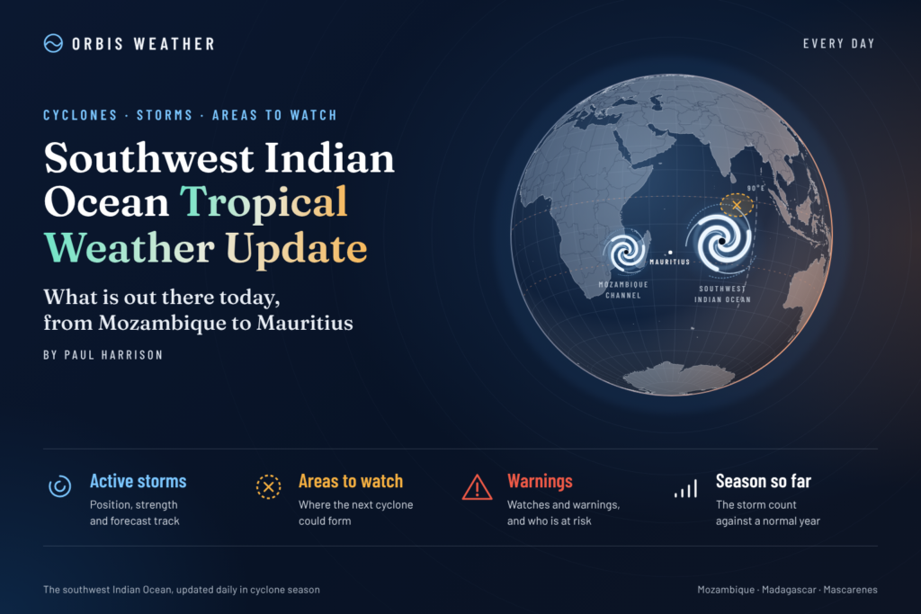
🌍 Tropical Disturbance Northeast of Agalega Could Strengthen as Cyclone Season Begins
The Southwest Indian Ocean is showing early signs of increasing tropical activity as the 2026–2027 cyclone season gets underway, with meteorologists closely monitoring a developing tropical disturbance northeast of Agalega.
The system has become the basin’s main area of interest, with the Regional Specialized Meteorological Centre (RSMC) in La Réunion identifying the potential for tropical storm development from Friday, November 6.
According to regional reporting published November 5, the disturbance was approximately 1,135 kilometres (705 miles) north-northeast of Réunion, moving southwestward at around 19 km/h (12 mph).
Estimated sustained winds were approximately 45 km/h (28 mph), with gusts reaching 65 km/h (40 mph).
At that stage, no direct effects were expected in Réunion or Mayotte during the following five days.
Important timing note: This report is dated November 6 to reflect the local calendar in the Southwest Indian Ocean. The latest independently verified cyclone information available for this article is from November 4–5. A November 6 official bulletin has not yet been verified, so the disturbance’s classification and position should not be treated as live November 6 observations.
📊 1. Southwest Indian Ocean Tropical Status
Indicator | Latest verified assessment |
|---|---|
🌀 Main area of interest | Northeast of Agalega |
🌧️ System status | Tropical disturbance under monitoring |
📈 Development potential | Moderate from November 6 |
🧭 Reported movement | Southwest at approximately 19 km/h |
💨 Reported sustained winds | 45 km/h (28 mph) |
🌬️ Reported gusts | Up to 65 km/h (40 mph) |
📍 Reported distance from Réunion | Approximately 1,135 km (705 miles) |
🗓️ Outlook period | November 6–10 |
⚠️ Direct land impacts | Not established |
Wind and movement estimates are from November 5 regional reporting. They are not current November 6 measurements.
🌀 2. Agalega Tropical Disturbance: Main System to Watch
The developing area of disturbed weather northeast of Agalega is the principal tropical weather concern across the basin.
The November 4 official Météo-France bulletin indicated that the disturbance would move slowly southwestward, with a moderate probability of becoming a tropical storm beginning November 6.
More recent regional reporting on November 5 suggested that strengthening into a moderate tropical storm was possible over the following days.
What could happen next?
Several atmospheric and oceanic factors will determine whether the disturbance strengthens.
🌡️ Warm ocean waters: Sufficiently warm sea-surface temperatures can provide energy for tropical development.
🌬️ Wind shear: Strong winds at different atmospheric levels may interfere with storm organization.
⛈️ Thunderstorm development: Persistent thunderstorms near the circulation centre can support intensification.
🌀 Low-pressure organization: A better-defined circulation would increase the likelihood of tropical storm classification.
🧭 Steering winds: Surrounding pressure systems will influence the disturbance’s future movement.
Although conditions may support development, the system’s ultimate strength, exact track and potential impacts remain uncertain.
A forecast of moderate formation potential does not mean that tropical storm formation is guaranteed.
🌍 3. Regional Tropical Weather Outlook
🇲🇬 Madagascar
Madagascar remains one of the most vulnerable countries in the Southwest Indian Ocean during tropical cyclone season.
The eastern and northeastern coastlines are particularly exposed to storms approaching from the Indian Ocean.
For November 6, the principal concern is monitoring the disturbance northeast of Agalega rather than anticipating a confirmed landfall.
There is currently insufficient verified information to predict that the system will reach Madagascar.
Hazards to monitor as the season progresses: Heavy rainfall, flash flooding, river flooding, damaging winds, landslides and dangerous coastal seas.
🇲🇺 Mauritius and Agalega
Agalega is geographically closer to the monitored disturbance than the main island of Mauritius and deserves particular attention as the system evolves.
Residents and marine operators should follow updated meteorological bulletins for possible changes in wind, rainfall and sea conditions.
For the main island of Mauritius, the available information does not establish a direct cyclone threat.
The future track remains important because a southwestward-moving disturbance can change direction as surrounding atmospheric conditions evolve.
🇷🇪 Réunion
Réunion is entering its principal cyclone monitoring period as the disturbance develops well to the north-northeast.
Regional reporting on November 5 indicated that no direct effects from the developing disturbance were expected on Réunion during the following five days.
However, this does not rule out ordinary showers, thunderstorms or locally hazardous marine conditions unrelated to the system.
Réunion’s mountainous terrain can amplify rainfall impacts, particularly where heavy showers affect steep valleys and drainage channels.
Residents should continue following Météo-France for local weather warnings and updated tropical cyclone assessments.
🇸🇨 Seychelles
The Seychelles lie within the broader northern Indian Ocean tropical weather environment.
Although the main disturbance is being monitored near Agalega, its eventual development does not automatically imply a threat to the Seychelles.
Thunderstorms and locally heavy rainfall can occur independently of named tropical systems.
Marine operators should monitor local forecasts, particularly when travelling between islands.
🇾🇹 Mayotte and 🇰🇲 Comoros
Mayotte and the Comoros are approaching a period of increasing seasonal tropical rainfall and cyclone exposure.
According to November 5 regional reporting, the developing disturbance was not expected to directly affect Mayotte during the following five days.
However, communities should continue preparing for seasonal hazards, including flash flooding, strong winds, dangerous seas and landslides.
The region’s mountainous islands can experience significant rainfall impacts even from systems that remain offshore.
🇲🇿 Mozambique
Mozambique’s northern and central coastal regions remain important areas for seasonal cyclone preparedness.
At present, the available information does not support forecasting a Mozambique landfall from the disturbance northeast of Agalega.
Communities should nevertheless monitor regional cyclone activity as the Southern Hemisphere summer progresses.
Flood preparedness is particularly important for low-lying coastal communities and river basins.
📅 4. Five-Day Tropical Development Outlook: November 6–10
Date | Tropical outlook |
|---|---|
Fri, Nov 6 | Period of moderate tropical storm formation potential begins in the latest verified official outlook |
Sat, Nov 7 | Further organization is possible; classification requires updated confirmation |
Sun, Nov 8 | Track and intensity uncertainty remain significant |
Mon, Nov 9 | Continue monitoring possible southwestward development |
Tue, Nov 10 | Beyond the latest verified official five-day outlook; updated guidance required |
Forecast confidence: Moderate that the Agalega disturbance warrants continued monitoring, but limited regarding its eventual intensity, precise track and any land impacts.
These entries are monitoring guidance rather than daily predictions that a cyclone will form or strengthen on a particular date.
📉 5. Southwest Indian Ocean Cyclone Season Forecast: 2026–2027
Météo-France’s seasonal outlook indicates that the Southwest Indian Ocean may experience below-normal tropical cyclone activity during the 2026–2027 season.
The forecast is influenced by the developing El Niño climate pattern and changing atmospheric and oceanic conditions across the region.
Expected tropical storms or systems
6–10
Expected tropical cyclones
3–5
The outlook includes Tropical Storm Agueda, which has already been monitored during the season.
Météo-France also anticipates the possibility of somewhat greater cyclone activity north and northeast of the Mascarene Islands, with some systems potentially following more southerly or southeasterly tracks.
The agency’s seasonal assessment suggests reduced relative impact risk for Madagascar and Mozambique, while the risk for Mauritius, Rodrigues and Réunion remains closer to normal.
An important distinction: A forecast for fewer cyclones does not mean that damaging storms cannot occur. One cyclone striking a vulnerable coastal community can produce devastating consequences regardless of overall seasonal activity.
🌡️ 6. El Niño and Its Potential Influence on Cyclone Activity
El Niño is an important influence on global atmospheric circulation and tropical cyclone patterns.
During El Niño episodes, changes in tropical Pacific sea-surface temperatures can affect wind patterns, atmospheric circulation and rainfall across distant regions, including the Indian Ocean.
For the Southwest Indian Ocean, the potential consequences include changes in:
🌀 Tropical storm formation frequency.
🧭 Preferred cyclone tracks and movement.
🌬️ Upper-level winds and vertical wind shear.
🌧️ Regional rainfall distribution.
🌊 Oceanic and atmospheric conditions supporting cyclone intensification.
The 2026–2027 seasonal outlook highlights the possibility of fewer tropical systems overall, alongside a geographical redistribution of cyclone activity.
However, El Niño cannot reliably determine the path of any individual cyclone weeks or months in advance.
Every developing system requires independent monitoring using satellite observations, atmospheric measurements and numerical forecast guidance.
🌊 7. Marine and Coastal Hazards
Even before a tropical disturbance becomes a named storm, it may produce hazardous weather across surrounding waters.
Mariners and coastal communities should remain aware of several potential hazards.
Hazard | Potential consequences |
|---|---|
🌊 Rough seas | Dangerous conditions for small vessels |
💨 Strong squalls | Sudden wind gusts and reduced visibility |
⛈️ Thunderstorms | Lightning, intense rainfall and gusty winds |
🌧️ Heavy rain | Localized flooding and poor visibility |
🌀 Developing circulation | Rapid changes in offshore weather conditions |
🌊 Long-period swell | Hazardous surf and coastal currents |
These are general hazards associated with tropical disturbances. They are not confirmed warnings for every location in the basin on November 6.
Fishermen, commercial shipping operators and recreational boaters should consult official marine forecasts before departure.
🛰️ 8. How Tropical Cyclones Are Monitored
The Southwest Indian Ocean is monitored using a combination of satellite imagery, weather observations, atmospheric analysis and computer forecast models.
The principal regional cyclone forecasting authority is Météo-France La Réunion, which operates the Regional Specialized Meteorological Centre for tropical cyclones in this basin.
What forecasters look for
Satellite imagery: Meteorologists examine cloud structures, thunderstorm activity and developing circulation patterns.
Sea-surface temperatures: Warm ocean waters provide energy for tropical cyclone development.
Atmospheric pressure: Falling pressure near a developing circulation can indicate increasing organization.
Wind shear: Strong vertical wind shear can weaken or disrupt a developing tropical system.
Forecast models: Computer simulations help assess potential storm tracks and intensification, although individual model runs can differ substantially.
A forecast model displaying a cyclone does not mean that the cyclone will necessarily form.
Official forecasts combine multiple observations, model guidance and expert meteorological analysis.
🚨 9. Tropical Cyclone Preparedness
The beginning of cyclone season provides an opportunity for communities across the region to review emergency preparations.
Residents should:
🏠 Inspect roofs, drainage systems and outdoor structures.
🔦 Check emergency lighting, batteries and essential supplies.
💧 Maintain access to safe drinking water.
📱 Identify official emergency information channels.
📄 Protect important documents from flooding.
🚗 Review evacuation routes and emergency shelter arrangements.
🌊 Avoid unnecessary marine travel when warnings are issued.
Residents of flood-prone coastal areas, river valleys and mountainous communities should pay particular attention to heavy rainfall hazards.
Flooding and landslides can be dangerous even when tropical cyclone winds remain below destructive levels.
❓ 10. Frequently Asked Questions
Is there a tropical cyclone in the Southwest Indian Ocean on November 6?
The latest verified official bulletin reviewed for this report did not identify a classified tropical depression or cyclone on November 4. A developing disturbance was subsequently reported northeast of Agalega on November 5. Its classification for November 6 requires confirmation from a newer official bulletin.
Could the disturbance become a tropical storm?
Yes. Météo-France identified moderate formation potential beginning November 6, and regional reporting indicated that strengthening into a moderate tropical storm was possible.
Is Mauritius in danger?
The reviewed information does not establish a direct cyclone threat to the main island of Mauritius. Agalega and surrounding marine areas should continue monitoring the developing system.
Will Réunion be affected?
November 5 regional reporting indicated no direct effects were expected from the disturbance during the following five days. Updated forecasts should be checked for any changes.
When is cyclone season in the Southwest Indian Ocean?
The main season generally runs from November through April, although tropical systems can develop outside this period.
Does a below-normal seasonal forecast mean fewer dangerous storms?
Not necessarily. Seasonal forecasts estimate overall activity and cannot guarantee that populated islands or coastal areas will avoid destructive cyclones.
🔎 11. Official Weather Sources and Further Information
Orbis Weather recommends consulting the following meteorological organizations for official forecasts, warnings and cyclone information.
Organization | Official source |
|---|---|
Météo-France La Réunion | |
Mauritius Meteorological Services | |
Madagascar Meteorological Service | |
Seychelles Meteorological Authority | |
Mozambique National Institute of Meteorology | |
Joint Typhoon Warning Center |
Additional reporting reviewed:
Official national meteorological services and emergency-management authorities remain the primary sources for operational warnings and public safety instructions.
📝 12. Orbis Weather Editorial Methodology and Accuracy Policy
This article was prepared by Paul Harrison for Orbis Weather using meteorological information and regional reporting available during editorial review on November 5, 2026, corresponding to November 6 in parts of the Southwest Indian Ocean.
Data sources
The principal reference is Météo-France La Réunion, supplemented by regional reporting and official seasonal forecast information.
Forecast interpretation
Orbis Weather distinguishes between observed conditions, official forecasts, forecast probabilities and general seasonal risk information.
Storm classifications, movement and intensity can change as new observations become available.
Accuracy and limitations
This report does not claim to provide continuous real-time cyclone monitoring. Any information requiring a newer official bulletin is identified as unconfirmed.
No speculative cyclone names, landfall locations, storm categories or future wind speeds have been assigned.
Corrections policy
Orbis Weather aims to correct material factual errors promptly when identified. Significant corrections should be clearly explained, particularly when they concern storm locations, intensities, warning statuses or potential impacts.
Independent reporting
Orbis Weather is an independent weather information and educational publisher. It is not a national meteorological agency and does not issue official cyclone warnings.
Readers should always follow official emergency instructions in their location.
🌍 13. Final Southwest Indian Ocean Tropical Outlook
The Southwest Indian Ocean is entering its 2026–2027 cyclone season with a developing disturbance northeast of Agalega attracting increasing attention.
The most important development for Friday, November 6, is whether this disturbance becomes sufficiently organized to reach tropical storm intensity.
While regional reporting indicates that strengthening is possible, the eventual track, intensity and land impacts remain uncertain.
The broader seasonal outlook suggests below-normal cyclone activity, but the potential for significant individual storms remains.
For Madagascar, Mauritius, Réunion, Seychelles, Mayotte, Comoros and Mozambique, the priority is continued monitoring, early preparedness and reliance on official meteorological guidance.
Orbis Weather will continue following tropical developments across the Southwest Indian Ocean, including storm formation, forecast tracks, intensification, rainfall threats and coastal hazards.
About the Author
Paul Harrison — Founder & Publisher, Orbis Weather
Paul Harrison founded Orbis Weather in 2026 to make global weather and natural-hazard information easier to find, follow and understand. His coverage includes tropical cyclones, severe weather, extreme temperatures, earthquakes, volcanoes, wildfires, flooding and significant natural disasters worldwide.
View all articles by Paul Harrison → | Editorial Standards →
Global Weather Tracker Hub
Explore weather maps, tropical systems, storms and natural hazards around the world.
No matching trackers found.