
El Niño Heats Up the Pacific as Relentless Typhoons Batter East Asia
By Paul Harrison | Founder & Publisher, Orbis Weather

- America’s Hot Spots This Week November 5, 2026 2:44 PM
- Southwest Indian Ocean Tropical Weather Update – November 6, 2026 12:48 PM
- Australian Region Tropical Weather Update — Friday, November 6, 2026 12:37 PM
- El Niño Heats Up the Pacific as Relentless Typhoons Batter East Asia 11:42 AM
- Australia, New Zealand & Oceania Weather & Natural Hazards Today Nov 6, 2026 10:59 AM
- Ocoee River Crests at Record Level in Copperhill, Triggering Catastrophic Flooding Across Tennessee and Georgia 10:12 AM
- North America Weather & Natural Hazards Today – November 5, 2026 8:31 AM
- Central America Weather & Natural Hazards Today – November 5, 2026 8:21 AM
- South America Weather & Natural Hazards Today – November 5, 2026 8:12 AM
- Daily Earthquakes, Storms, Fires & Floods Report – November 5, 2026 7:39 AM
- Weekly Global Climate Pulse: Thursday, November 5, 2026 7:31 AM
- Tropical Atlantic Daily Report: Thursday, November 5, 2026 7:17 AM
- Eastern & Central Pacific Tropical Weather Update: Thursday, November 5, 2026 7:06 AM
- Western Pacific Tropical Update: In-Fa & Invest 99W 6:53 AM





El Niño Heats Up the Pacific as Relentless Typhoons Batter East Asia
By Paul Harrison, Orbis Weather ·
An El Niño that could rank among the strongest on record is still building in the tropical Pacific, and East Asia is in the middle of an unusually busy typhoon season. Japan’s weather agency has numbered 31 tropical storms in the western Pacific so far in 2026, already above the full-year average of 25.5.
The latest, Typhoon In-fa, is moving northeast over open water south of Japan this week. It follows Typhoon Champi, which reached the top of the intensity scale in October and shut down much of Taiwan. Australia’s Bureau of Meteorology said on October 27 that a key El Niño index had reached a record weekly value. Forecasters expect the warming to peak around November or December.
In the Philippines, which typically sees about 20 tropical storms a year, the head of climatology at the state weather bureau warned in September that the overheated Pacific “can go into convulsions soon,” BBC News reported.
How strong is this El Niño?
The major forecasting agencies agree that El Niño is strong and still strengthening, and some measures are already at record levels.
Agency | Date | What it reported |
|---|---|---|
Oct 8 | El Niño Advisory in effect. Niño-3.4 index at +2.1°C (+3.8°F); sea surface temperatures more than 4.0°C (7.2°F) above normal in parts of the eastern equatorial Pacific. A strong-to-very strong El Niño is likely through January–March 2027, with a greater than 83% chance | |
Oct 27 | Weekly relative Niño3.4 index reached a record +2.88°C (+5.2°F) for the week ending Oct 25, the highest in its weekly dataset, which begins in 2008. All models forecast a peak around November or December | |
PAGASA (Philippines), via RNA Media | Nov 4 | A very strong El Niño is established, could peak toward the end of 2026 and could last into the first half of 2027 |
NOAA said chances remain high for a “historic event” that would exceed the strength of all El Niño events since 1950. The Bureau of Meteorology added a caution: on its longer monthly dataset, used for historical comparisons, values are still below previous records. The two agencies calculate their indices differently, so their numbers should not be compared directly.
Other signals point the same way. The bureau reported a strongly negative Southern Oscillation Index of −16.6 for the 30 days to October 25, a sign that the atmosphere is responding to the warm ocean. A positive Indian Ocean Dipole is also under way. NOAA’s next update is scheduled for November 12.
A punishing typhoon season
The 2026 season has produced powerful storms from the Mariana Islands to southern China, and it started early. Typhoon Champi was the season’s 30th named storm and 13th typhoon. Tropical Storm Risk had forecast 28 named storms for the full year in August, against a 1991–2020 average of 25.5, according to the season summary on Wikipedia.
Storm | When | Peak strength | Where it hit | Toll |
|---|---|---|---|---|
April | 215 km/h (134 mph) 10-minute winds, 905 hPa (JMA) | Saipan and Tinian, Guam, Micronesia | 17 dead, 1 missing; more than $1.55 billion in damage | |
Mekkhala and Higos | June | Mekkhala: 185 km/h (115 mph), 925 hPa (JMA) | Approached Japan’s east coast together | About 1 million people evacuated (BBC) |
Bavi | Late June to mid-July | 205 km/h (127 mph), 910 hPa (JMA) | Rota; Zhejiang, China; heavy rain in the Philippines | 23 dead, 18 missing in the Philippines |
Maysak | Early July | Severe tropical storm | Hainan, Guangxi and northern Vietnam | 171 dead, 159 of them in Guangxi |
Dolphin | August | Super typhoon | Eastern China after 16 days at sea | “Dozens of casualties” (BBC) |
October | 215 km/h (134 mph), 900 hPa (JMA); 295 km/h (183 mph) 1-minute winds (JTWC) | Passed near Guam; brushed Taiwan, the Philippines’ Batanes islands and Okinawa | 1 dead in Taiwan; about 500 injured (Reuters, via RNA Media) or more than 616 (Wikipedia) | |
In-fa | Late October to November | 940 hPa at peak on Oct 29 (JMA) | Open Pacific south of Japan | None reported |
Tolls for Sinlaku, Bavi and Maysak are from the Wikipedia season and storm articles, which draw on national agencies; official totals may differ.
Champi showed how much disruption a storm can cause without a direct hit. Nearly all of Taiwan shut down even though the typhoon did not make landfall, and hundreds of flights were cancelled across Hong Kong, Taiwan and Japan, BBC News reported. About 15,000 homes lost power in Okinawa.
In-fa is now heading away from land. At 03:45 UTC on November 4, the Japan Meteorological Agency (JMA) measured it at 970 hPa with 120 km/h (75 mph) sustained winds, Weathernews reported. JMA expects it to become an extratropical low by November 7. The Hong Kong Observatory expects it to lose its tropical characteristics by Friday, November 6, according to RNA Media.
What links El Niño and typhoons?
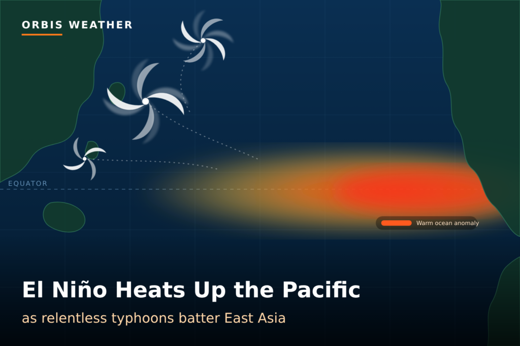
El Niño does not create typhoons, but it changes where they form and how much warm water they can feed on. In El Niño years, warm water spreads east across the tropical Pacific. Storms tend to form farther east, closer to the open ocean, which gives them more time over warm water to strengthen before they reach land.
That pattern fits this season. Several of 2026’s strongest storms, including Sinlaku and Champi, formed far to the east near Micronesia and the Mariana Islands. Super Typhoon Dolphin spent 16 days crossing the Pacific before striking China, BBC News reported. The BBC also cited a forecast that accumulated cyclone energy, a measure of how strong and long-lived storms are over a season, would be nearly double the 30-year average for Southeast and East Asia.
El Niño is still only one influence among several. Typhoon activity varies widely from year to year, and long-term ocean warming adds to the picture. Manila-based climatologist Rafaela Jane Delfino told the BBC that simulations of past Philippine typhoons in a warmer climate raised their rainfall by 26%.
What comes next
The typhoon season is winding down, but El Niño has months left to run. The Bureau of Meteorology expects the warming to stay above El Niño thresholds into the southern autumn of 2027, which runs from March to May. The UK Met Office has forecast it to be the strongest in living memory and likely to last until February or March, BBC News reported.
That has consequences far beyond East Asia. NOAA’s outlook keeps a strong-to-very strong El Niño in place through the Northern Hemisphere winter, when its influence on weather patterns across the Americas is usually greatest. The United Nations Development Programme’s Asia-Pacific office has warned that the window to prepare is “closing,” according to the BBC.
Three updates to watch:
- NOAA’s ENSO discussion on November 12: the next official read on El Niño’s strength and how long it will last.
- The Bureau of Meteorology’s next climate driver update: whether the record weekly index climbs further.
- JMA and the Joint Typhoon Warning Center: any late-season storms, as warm water lingers in the western Pacific.
Frequently asked questions
What is El Niño? El Niño is a periodic warming of the surface waters of the central and eastern tropical Pacific. It shifts rainfall and wind patterns around the world and usually peaks in the Northern Hemisphere winter.
Is this the strongest El Niño ever recorded? Not yet by the standard historical measure. Australia’s Bureau of Meteorology recorded a record weekly index value, but its longer monthly record, used for historical comparisons, is still below past peaks. NOAA says a record-breaking event remains likely.
Did El Niño cause this year’s typhoons? Not on its own. El Niño tends to push storm formation farther east, giving storms more time to strengthen over warm water, but each season also depends on other factors.
Is Typhoon In-fa a threat to Japan? Forecasters expect it to stay over open water. Weathernews, citing JMA, said its track does not approach the Japanese mainland, and it is expected to lose its tropical character by November 6 or 7.
Sources
- NOAA Climate Prediction Center: ENSO Diagnostic Discussion, Oct 8, 2026
- Australian Bureau of Meteorology: ENSO monitoring, Oct 27, 2026
- BBC News (via Yahoo): Typhoons batter East Asia as El Niño makes Pacific “burn with fever”
- RNA Media: El Niño fuels East Asia’s typhoon season
- Weathernews: Typhoon No. 31 (In-fa)
- Wikipedia: 2026 Pacific typhoon season
- Wikipedia: Typhoon Champi (2026)
- Wikipedia: Typhoon Sinlaku (2026)
About the Author
Paul Harrison — Founder & Publisher, Orbis Weather
Paul Harrison founded Orbis Weather in 2026 to make global weather and natural-hazard information easier to find, follow and understand. His coverage includes tropical cyclones, severe weather, extreme temperatures, earthquakes, volcanoes, wildfires, flooding and significant natural disasters worldwide.
View all articles by Paul Harrison → | Editorial Standards →
Global Weather Tracker Hub
Explore weather maps, tropical systems, storms and natural hazards around the world.
No matching trackers found.