
By Paul Harrison | Founder & Publisher, Orbis Weather

- America’s Hot Spots This Week November 5, 2026 2:44 PM
- Southwest Indian Ocean Tropical Weather Update – November 6, 2026 12:48 PM
- Australian Region Tropical Weather Update — Friday, November 6, 2026 12:37 PM
- El Niño Heats Up the Pacific as Relentless Typhoons Batter East Asia 11:42 AM
- Australia, New Zealand & Oceania Weather & Natural Hazards Today Nov 6, 2026 10:59 AM
- Ocoee River Crests at Record Level in Copperhill, Triggering Catastrophic Flooding Across Tennessee and Georgia 10:12 AM
- North America Weather & Natural Hazards Today – November 5, 2026 8:31 AM
- Central America Weather & Natural Hazards Today – November 5, 2026 8:21 AM
- South America Weather & Natural Hazards Today – November 5, 2026 8:12 AM
- Daily Earthquakes, Storms, Fires & Floods Report – November 5, 2026 7:39 AM
- Weekly Global Climate Pulse: Thursday, November 5, 2026 7:31 AM
- Tropical Atlantic Daily Report: Thursday, November 5, 2026 7:17 AM
- Eastern & Central Pacific Tropical Weather Update: Thursday, November 5, 2026 7:06 AM
- Western Pacific Tropical Update: In-Fa & Invest 99W 6:53 AM





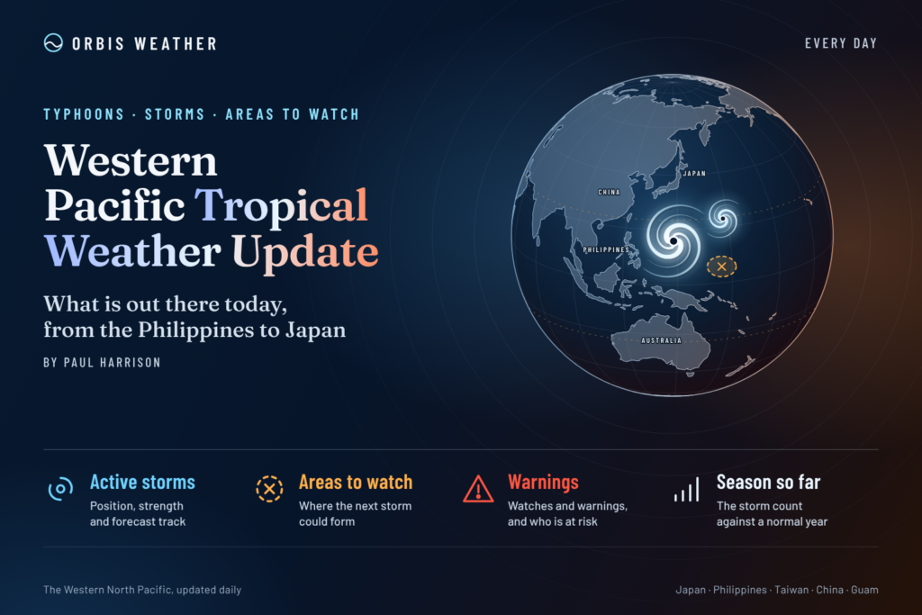
Western Pacific Tropical Weather Update: Typhoon In-Fa Heads Northeast as New Disturbance Develops Near Guam
Thursday, November 5, 2026 | By Paul Harrison | Orbis Weather
Typhoon In-Fa remains active over the Western Pacific, moving northeast toward the open waters east of Japan, while a separate tropical disturbance, Invest 99W, is being monitored east-northeast of Guam.
The latest Joint Typhoon Warning Center (JTWC) advisory identifies one active tropical cyclone in the Western North Pacific, with another area of disturbed weather showing limited potential for development over the next 24 hours.
Although In-Fa is expected to transition into an extratropical system, dangerous marine conditions remain a concern. Meanwhile, forecasters are watching whether Invest 99W can become better organized as it travels westward across the tropical Pacific.
1. Typhoon In-Fa (30W): Moving Away From Japan’s Southern Islands
Typhoon In-Fa is tracking northeast over the Western Pacific, well away from the Philippine archipelago.
According to the JTWC advisory valid at 00:00 UTC on November 5, In-Fa was centered near 28.1°N, 140.0°E, approximately 131 nautical miles west-northwest of Chichi Jima.
Latest storm information
Category | Details |
|---|---|
Storm name | Typhoon In-Fa (30W) |
Position | 28.1°N, 140.0°E |
Maximum sustained winds | 75 knots (139 km/h / 86 mph) |
Peak gusts | 90 knots (167 km/h / 104 mph) |
Central pressure | 979 hPa |
Movement | Northeast at 17 knots (31 km/h / 20 mph) |
Maximum significant wave height | 31 feet (9.4 meters) |
Advisory time | November 5, 00:00 UTC |
What happens next?
In-Fa is forecast to accelerate northeastward, moving farther into the open Pacific east of Japan.
JTWC forecasts indicate that the system will undergo extratropical transition by November 6, as it interacts with the mid-latitude weather pattern.
During this transition, the storm may lose some of its tropical characteristics while maintaining an extensive wind field capable of producing hazardous marine conditions.
By 00:00 UTC on November 6, the JTWC forecast places the system near 38.2°N, 152.1°E, with sustained winds near 65 knots.
This forecast represents a substantial northeastward movement over 24 hours.
Potential impacts
The main concerns include:
Dangerous seas and large waves across portions of the northwestern Pacific.
Strong winds affecting shipping routes east and southeast of Japan.
Hazardous marine conditions around the Izu and Ogasawara island waters.
Continued rough seas as the storm accelerates and transitions into a powerful extratropical low.
The current forecast does not indicate a direct landfall on mainland Japan. However, marine interests should monitor updated JMA forecasts and warnings.
2. Invest 99W: Tropical Disturbance East-Northeast of Guam
While In-Fa moves into the northern Pacific, forecasters are also monitoring Invest 99W, a tropical disturbance situated east-northeast of Guam.
The JTWC’s November 5 advisory places the disturbance near 15.6°N, 157.2°E, approximately 738 nautical miles (1,367 km / 849 miles) east-northeast of Guam.
Satellite observations indicate that the system remains poorly organized, with an exposed wave structure and scattered thunderstorms concentrated north and east of its axis.
Current conditions
Indicator | Latest analysis |
|---|---|
Designation | Invest 99W |
Position | 15.6°N, 157.2°E |
Estimated winds | 15–23 knots (28–43 km/h) |
Estimated pressure | 1010 hPa |
Sea surface temperatures | 28–29°C (82–84°F) |
Vertical wind shear | 5–10 knots |
General movement | Westward |
24-hour development potential | Low |
Could Invest 99W become a tropical depression?
Environmental conditions are marginally favorable for gradual development.
Warm ocean temperatures and relatively low vertical wind shear could support additional thunderstorm organization. However, weak upper-level outflow and the disturbance’s poorly defined circulation remain limiting factors.
Forecast models suggest slow consolidation may occur during the next 48 hours as the system moves westward.
At present, the JTWC assesses the probability of significant tropical cyclone development within 24 hours as low.
This does not rule out later development, and the system will require continued monitoring as it approaches the broader Mariana Islands region.
3. Philippines: No Active Tropical Cyclone Within the PAR
The Philippine Atmospheric, Geophysical and Astronomical Services Administration (PAGASA) currently lists no active tropical cyclone within the Philippine Area of Responsibility (PAR) on its tropical cyclone bulletin page.
Typhoon In-Fa is located well to the northeast of the Philippines, outside the PAR.
Invest 99W is also outside the PAR and remains a tropical disturbance rather than a classified tropical cyclone.
PAGASA has published a tropical cyclone threat potential outlook covering November 5–18, 2026, which provides additional guidance on possible cyclone activity over the coming two weeks.
What residents should watch
Even without an active cyclone inside the PAR, local weather hazards can still occur.
The northeast monsoon, locally known as Amihan, can contribute to stronger winds, rough seas and changing weather conditions across parts of the Philippines during this time of year.
PAGASA announced the onset of the northeast monsoon on October 27, 2026.
Residents and maritime operators should continue checking official forecasts for rainfall, thunderstorms, coastal winds and sea conditions.
4. Japan, Taiwan, China and the Mariana Islands: Regional Tropical Outlook
Japan
Typhoon In-Fa remains the primary tropical weather system of interest.
The storm’s northeastward movement should take its center farther away from Japan’s southern island chain. However, strong winds and dangerous offshore seas remain possible along its path.
The transition into an extratropical cyclone is particularly important for marine forecasting because the wind field can expand even as the storm’s tropical structure weakens.
Taiwan and Eastern China
The latest JTWC basin-wide advisory does not identify an active tropical cyclone approaching Taiwan or mainland China.
No additional suspect development areas were listed beyond Invest 99W.
This assessment relates specifically to tropical cyclones and does not exclude locally hazardous weather.
Guam and the Northern Mariana Islands
Invest 99W is the main system to monitor over the coming days.
Although immediate tropical cyclone development potential remains low, its westward movement could eventually bring the disturbance closer to the Mariana Islands.
The eventual track, organization and intensity remain uncertain. Residents should follow updates from the National Weather Service in Guam.
South China Sea
No separate organized tropical cyclone was identified over the South China Sea in the JTWC’s November 5 basin-wide advisory.
Nevertheless, seasonal monsoon conditions and localized thunderstorms can produce hazardous weather independently of tropical cyclone activity.
5. Western Pacific Tropical Outlook: Next 24–72 Hours
Period | Forecast developments |
|---|---|
Next 24 hours | In-Fa accelerates northeast and begins or continues extratropical transition; Invest 99W has low development potential |
24–48 hours | In-Fa completes its forecast transition; Invest 99W may slowly consolidate |
48–72 hours | Further evolution of Invest 99W remains uncertain; updated advisories will determine whether its development risk increases |
These are forecast expectations, not guaranteed outcomes. Tropical cyclone development probabilities and forecast tracks can change substantially as new satellite observations become available.
6. Understanding Tropical Cyclone Development in November
November remains part of the Western North Pacific’s tropical cyclone season.
Unlike the Atlantic hurricane season, which officially runs from June 1 through November 30, tropical cyclones can develop in the Western North Pacific at any time of year.
Warm ocean temperatures provide energy for tropical disturbances, but sea surface temperatures alone do not determine whether a storm will form.
Other important factors include atmospheric moisture, vertical wind shear, upper-level ventilation and the organization of the low-level circulation.
Invest 99W illustrates this relationship. Although ocean temperatures are sufficiently warm to support tropical development, the disturbance has not yet established the organized circulation required for tropical cyclone classification.
In-Fa illustrates a different process. As it moves northward into cooler waters and stronger upper-level winds, it is losing the tropical characteristics that helped sustain it earlier in its life cycle.
7. What Orbis Weather Is Monitoring
The most important developments during the next several days will be the completion of In-Fa’s extratropical transition and the organization of Invest 99W.
For In-Fa, attention will focus on its expanding wind field, wave conditions and movement into the North Pacific.
For Invest 99W, forecasters will examine whether satellite imagery shows persistent thunderstorm activity developing around a better-defined circulation center.
A stronger, more organized circulation could increase the likelihood of tropical depression formation. Conversely, continued disorganization or unfavorable atmospheric conditions could prevent significant development.
At present, there is insufficient evidence to assign Invest 99W a reliable landfall location or predict that it will become a named storm.
8. Official Tropical Weather Sources
Orbis Weather uses established meteorological agencies and publicly available forecasting products to provide regional tropical weather reporting.
Readers can access the original information through these official sources:
Joint Typhoon Warning Center (JTWC) — Tropical cyclone warnings, forecast tracks and development assessments.
Japan Meteorological Agency (JMA) — Official tropical cyclone information and forecasts for the Western North Pacific.
PAGASA Tropical Cyclone Bulletins — Philippine tropical cyclone warnings and bulletins.
National Weather Service Guam — Forecasts, watches and warnings for Guam and the Mariana Islands.
Hong Kong Observatory — Tropical cyclone tracking and regional storm information.
9. Orbis Weather Editorial Methodology and Forecast Disclaimer
How this report was prepared
This Western Pacific Tropical Weather Update was prepared by Orbis Weather using published meteorological information, tropical cyclone advisories and publicly available forecast guidance.
Storm positions, wind estimates, central pressures and development assessments are attributed to their issuing agencies. The article adds independent explanatory reporting to help readers understand the significance of these forecasts.
JTWC generally reports maximum sustained winds averaged over one minute, while JMA uses a ten-minute averaging period. These measurements are not directly interchangeable and may produce different reported storm intensities.
Forecast limitations
Tropical cyclone forecasts contain uncertainty. Changes in atmospheric steering currents, wind shear, ocean temperatures and storm structure may alter predicted tracks or intensities.
The information in this article is accurate to the cited advisory times and should not be interpreted as a continuously updated warning service.
Orbis Weather does not issue official tropical cyclone warnings, evacuation orders or marine safety notices.
Corrections and updates
Orbis Weather aims to provide accurate, clearly sourced weather reporting. Material factual errors should be corrected when identified, with significant changes explained to readers.
For emergency decisions, always consult the responsible national meteorological agency and local emergency management authorities.
10. Final Outlook: In-Fa Weakening, Invest 99W Worth Watching
The Western Pacific currently presents two distinct tropical weather developments.
Typhoon In-Fa is moving rapidly northeastward, with an extratropical transition expected as it travels into the open North Pacific. Although the storm is weakening, dangerous marine conditions remain a significant concern.
Farther south, Invest 99W continues westward across warm tropical waters east-northeast of Guam. Its development potential remains low in the immediate term, but gradual organization is possible.
For the Philippines, PAGASA currently reports no active tropical cyclone inside the Philippine Area of Responsibility.
Orbis Weather will continue monitoring official tropical cyclone advisories and reporting significant changes across the Western Pacific.
By Paul Harrison — Orbis Weather
Sometimes the biggest tropical weather story isn’t where a storm is today, but what it might become tomorrow.
About the Author
Paul Harrison — Founder & Publisher, Orbis Weather
Paul Harrison founded Orbis Weather in 2026 to make global weather and natural-hazard information easier to find, follow and understand. His coverage includes tropical cyclones, severe weather, extreme temperatures, earthquakes, volcanoes, wildfires, flooding and significant natural disasters worldwide.
View all articles by Paul Harrison → | Editorial Standards →
🌀 Western Pacific Basin
Live typhoon tracking, tropical cyclone activity, satellite imagery, weather, sea-surface temperatures and waves across the Western North Pacific, including Japan, the Philippines, Taiwan, Guam and Micronesia.
⚠️ Western Pacific Tropics Right Now
Live basin status🌀 Western Pacific Storm Tracker
Live tropical cyclones · click a storm for track/cone🌀 Western Pacific Storm Tracker
Live tropical cyclones across the Western Pacific. Drag to pan, Ctrl/⌘+scroll to zoom, and click a storm to show its track and cone.