
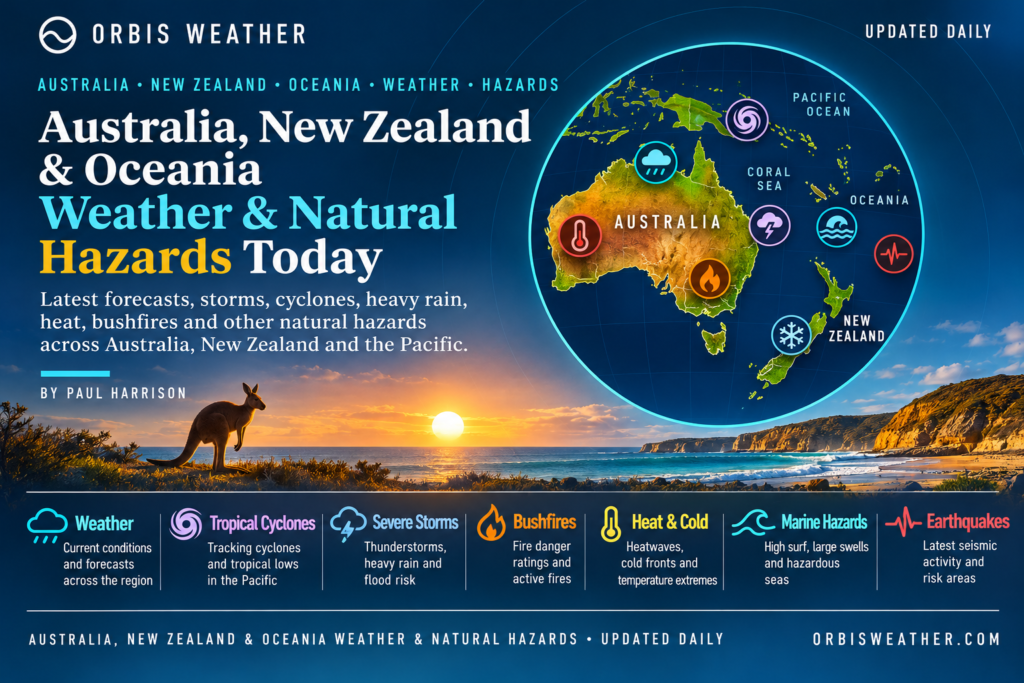
🌍 Australia, New Zealand & Oceania Weather & Natural Hazards Today
By Paul Harrison | Founder & Publisher, Orbis Weather

- America’s Hot Spots This Week November 5, 2026 2:44 PM
- Southwest Indian Ocean Tropical Weather Update – November 6, 2026 12:48 PM
- Australian Region Tropical Weather Update — Friday, November 6, 2026 12:37 PM
- El Niño Heats Up the Pacific as Relentless Typhoons Batter East Asia 11:42 AM
- Australia, New Zealand & Oceania Weather & Natural Hazards Today Nov 6, 2026 10:59 AM
- Ocoee River Crests at Record Level in Copperhill, Triggering Catastrophic Flooding Across Tennessee and Georgia 10:12 AM
- North America Weather & Natural Hazards Today – November 5, 2026 8:31 AM
- Central America Weather & Natural Hazards Today – November 5, 2026 8:21 AM
- South America Weather & Natural Hazards Today – November 5, 2026 8:12 AM
- Daily Earthquakes, Storms, Fires & Floods Report – November 5, 2026 7:39 AM
- Weekly Global Climate Pulse: Thursday, November 5, 2026 7:31 AM
- Tropical Atlantic Daily Report: Thursday, November 5, 2026 7:17 AM
- Eastern & Central Pacific Tropical Weather Update: Thursday, November 5, 2026 7:06 AM
- Western Pacific Tropical Update: In-Fa & Invest 99W 6:53 AM





🌏 Australia, New Zealand & Oceania Weather & Natural Hazards Today
Friday, November 6, 2026 | Orbis Weather
By Paul Harrison | Orbis Weather
Regional weather intelligence covering Australia, New Zealand, Papua New Guinea, Fiji, Vanuatu, the Solomon Islands, New Caledonia, Samoa, Tonga and the wider Pacific.
🌦️ Regional Weather Overview
Australia, New Zealand and the Pacific Islands enter Friday, November 6, with several seasonal weather hazards demanding attention, including severe thunderstorms, heavy rainfall, flash flooding, dangerous surf, tropical disturbances and geological activity.
Across Australia, November marks an important transition toward the southern summer. Rising temperatures, increasing atmospheric moisture and changing wind patterns can create favorable conditions for thunderstorms, particularly across eastern and northern regions.
New Zealand faces a different combination of hazards, with rapidly changing spring weather, strong winds, heavy rainfall and mountain snow remaining possible.
Across the tropical Pacific, the approaching Southern Hemisphere cyclone season brings renewed attention to tropical disturbances, intense rainfall and coastal flooding.
Today’s principal monitoring priorities are:
⛈️ Australia: Severe thunderstorms, damaging winds, hail and localized flash flooding.
🌧️ New Zealand: Heavy rain, strong winds and rapidly changing alpine conditions.
🌀 South Pacific: Tropical cyclone development potential as the season approaches.
🌊 Pacific Islands: Coastal inundation, dangerous surf and heavy tropical showers.
🌋 Melanesia: Volcanic activity and earthquake hazards, particularly around Papua New Guinea and Vanuatu.
🔥 Australia: Bushfire weather and heat exposure in areas experiencing hot, dry and windy conditions.
These are regional hazards to monitor, not a declaration that every listed event is occurring or that official warnings are active throughout the region.
🇦🇺 Australia Weather & Natural Hazards Today
🌡️ Northern Australia — Severe Heatwave Conditions Continue
The Australian Bureau of Meteorology forecasts a striking weather contrast on Friday: dangerous heat across northern Australia while a cold front moves into the southeast.
Severe heatwave conditions are expected to persist across parts of northern Queensland and the Northern Territory.
In northern Queensland, temperatures are forecast to climb into the low-to-mid 30s Celsius, while inland western districts may reach around 40°C (104°F).
Heat exhaustion, dehydration and heatstroke are important concerns, particularly for outdoor workers, older residents and people without reliable cooling.
The Bureau also expects thunderstorms in far western Queensland, although much of the state’s eastern coastline should experience drier conditions.
☀️ Queensland — Sunshine Returns to the Southeast
Following recent severe thunderstorms, Friday’s forecast offers some welcome improvement for Brisbane and southeastern Queensland.
The Bureau expects predominantly sunny conditions across much of southern and eastern Queensland, with southeasterly winds bringing cooler temperatures to Brisbane.
Location | Forecast high |
|---|---|
Brisbane | 82°F / 28°C |
Townsville | 91°F / 33°C |
Cairns | 91°F / 33°C |
Western inland Queensland | Locally around 104°F / 40°C |
Central and northern Queensland are expected to remain warmer than average.
Hazards to monitor: Extreme heat in northern and western districts, isolated inland thunderstorms and lightning.
Residents cleaning up after earlier storms should continue checking local road conditions and electricity restoration information.
☀️ New South Wales & Australian Capital Territory — Mostly Sunny Friday
Sydney, Canberra and much of New South Wales are expected to enjoy relatively settled conditions on Friday.
The Bureau forecasts widespread sunshine, with some morning fog possible around the ranges.
Location | Forecast high |
|---|---|
Sydney | 75°F / 24°C |
Canberra | 73°F / 23°C |
These conditions represent an improvement from the severe thunderstorm activity that affected parts of eastern Australia earlier in the week.
However, residents should remain aware that damaged trees, saturated ground and infrastructure problems can persist after severe weather has ended.
🌬️ Victoria — Cold Front Approaching
Victoria faces an approaching cold front that is expected to bring increasing showers, gusty conditions and a significant temperature change.
Friday should begin relatively mild in many areas, with temperatures around 20°C (68°F) in southern districts.
Mildura could reach approximately 29°C (84°F).
Showers are expected to develop across southwestern Victoria before extending toward Melbourne and Gippsland later Friday.
The more significant change arrives Saturday, when colder air is forecast to produce alpine snow as low as approximately 800 meters (2,625 feet).
Hazards to monitor: Strong winds, wet roads, falling temperatures and alpine snow.
🌧️ Tasmania — Rain, Cold Winds and Mountain Snow
Tasmania is among the areas most directly affected by Friday’s approaching cold front.
Rain and showers are forecast across the island, with the possibility of colder conditions and small hail behind the front.
Hobart is forecast to reach approximately 18°C (64°F).
Snow levels may fall to around 800 meters (2,625 feet) in western highland areas late Friday.
Motorists traveling through elevated terrain should be prepared for deteriorating visibility, slippery roads and rapidly changing conditions.
🌤️ South Australia — Mostly Dry Before the Change
Much of South Australia is expected to remain dry and sunny on Friday, although a cold front will approach southeastern districts later in the day.
Adelaide is forecast to reach approximately 23°C (73°F), with increasing winds and a possible late shower.
Mount Gambier is expected to reach around 20°C (68°F).
Northern South Australia will remain warmer, while southern coastal districts experience milder conditions.
⛈️ Western Australia — Inland Thunderstorms and Damaging Wind Potential
Western Australia faces a mixture of heat, sunshine and thunderstorms.
Perth is forecast to reach approximately 31°C (88°F), while a heat trough supports showers and thunderstorms across the Pilbara and interior.
The Bureau identifies the possibility of severe thunderstorms with damaging winds across inland Pilbara districts and parts of the interior on Friday afternoon and evening.
Travelers in remote areas should remain particularly cautious, as sudden thunderstorms can create dangerous driving conditions and localized flooding.
🌡️ Northern Territory — Heatwave and Tropical Build-Up
Darwin is forecast to reach approximately 35°C (95°F), with a shower or thunderstorm possible.
Severe heatwave conditions remain a concern across the Top End and parts of the Northern Territory.
As the tropical build-up progresses, high humidity and afternoon thunderstorms may increase discomfort and create additional lightning hazards.
The Bureau’s November 5 national forecast is the primary source for the Australian regional forecasts above.
🇳🇿 New Zealand Weather & Natural Hazards Today
⛈️ Northland & Auckland — Severe Thunderstorm Watch
New Zealand’s North Island faces an important weather threat on Friday, with a severe thunderstorm watch covering Northland and Auckland.
According to the MetService warning feed, thunderstorms could become severe during Friday afternoon and evening, particularly across southwestern Northland and Auckland.
The warning highlights the potential for localized rainfall rates of 25–40 mm per hour (approximately 1–1.6 inches per hour).
Rainfall of this intensity could produce flash flooding, surface flooding and landslides, especially around streams, narrow valleys and low-lying roads.
The watch is listed as valid until 9 p.m. Friday, November 6, New Zealand time, subject to updates or cancellation.
🌧️ Auckland, Waikato & Bay of Plenty — Weekend Rainfall Concerns
A complex low-pressure system moving eastward from the Tasman Sea is expected to bring showers and periods of rain to several parts of New Zealand.
MetService’s November 4 outlook indicated a relatively limited severe-weather risk on Friday, but identified the possibility of heavier rainfall during Saturday.
Areas requiring attention include Northland, eastern Auckland, Waikato, the Coromandel Peninsula and Bay of Plenty.
The outlook assigned low confidence to rainfall reaching warning thresholds in those areas. This means significant rainfall remains possible, not certain.
The later thunderstorm watch for Friday is a separate, more immediate concern.
🌦️ Wellington & Central New Zealand
Wellington and central North Island communities should prepare for changeable conditions as the broader low-pressure system influences the country.
Showers, gusty winds and reduced visibility may affect exposed routes depending on the movement of rain bands.
No specific severe-weather warning for Wellington was independently confirmed in the sources reviewed for this report.
🌧️ South Island — West Coast Showers and Thunderstorm Potential
A front moving across New Zealand may produce showers and isolated thunderstorms around the western South Island.
The November 5 thunderstorm outlook identified a low thunderstorm risk along the West Coast from around Hokitika northward before dawn Friday.
Travelers through mountainous areas should check road conditions, particularly where rainfall could affect visibility and steep terrain.
🏔️ Alpine Weather and Mountain Safety
Spring weather in New Zealand’s Southern Alps can change quickly.
Even when lowland communities experience relatively mild conditions, mountain travelers may encounter colder temperatures, strong winds and poor visibility.
Hikers, climbers and motorists using alpine passes should consult current forecasts before departure.
🌀 South Pacific Tropical Cyclone Outlook
Fiji, Vanuatu, Tonga, Samoa and New Caledonia
The South Pacific is entering its main tropical cyclone monitoring season, which generally runs from November through April.
The Fiji Meteorological Service, through the Regional Specialized Meteorological Centre in Nadi, monitors tropical cyclone development across much of the southwest Pacific.
Its tropical disturbance summary issued November 4 reported no significant tropical disturbance analyzed or forecastwithin its monitoring area, extending from the equator to 25°S and 160°E to 120°W.
A newer five-day tropical cyclone outlook was dated November 5, but its detailed forecast was not available for independent verification during preparation of this report. Therefore, the November 4 summary should not be interpreted as confirmation that the basin remains disturbance-free throughout Friday.
Tropical cyclone formation is only one part of the region’s weather risk. Heavy rain, thunderstorms, dangerous surf and coastal flooding can occur without a named cyclone.
Residents across Fiji, Vanuatu, Tonga, Samoa and New Caledonia should continue following their national meteorological agencies for updated warnings.
🏝️ Pacific Islands Weather & Natural Hazards
🇫🇯 Fiji — Tropical Rainfall and Coastal Conditions
Fiji’s main seasonal concerns include heavy tropical showers, thunderstorms, flash flooding and hazardous marine conditions.
The islands of Viti Levu and Vanua Levu can experience considerable differences in rainfall because of their mountainous terrain.
For Friday, no island-specific rainfall totals or active flood warnings were independently verified for this report.
Residents and visitors should monitor the Fiji Meteorological Service for updated local forecasts and marine advisories.
🇵🇬 Papua New Guinea — Heavy Rain and Geological Hazards
Papua New Guinea remains vulnerable to a combination of tropical rainfall, flooding, landslides, earthquakes and volcanic activity.
Mountainous terrain increases the danger of landslides when prolonged rainfall saturates hillsides.
Communities along steep valleys and river systems should pay particular attention to official rainfall and river-level warnings.
The country also lies within the Pacific Ring of Fire, where tectonic activity creates an ongoing earthquake and volcanic hazard.
No new major volcanic eruption was independently confirmed for Friday in the sources reviewed.
🇻🇺 Vanuatu — Earthquake Monitoring Remains Important
Vanuatu continues to experience seismic activity associated with the complex plate boundaries of the southwest Pacific.
The Vanuatu Meteorology and Geo-Hazards Department listed several recent regional earthquakes, including:
Date | Location | Magnitude |
|---|---|---|
November 5 | Vanuatu Islands | 4.2 |
November 5 | Vanuatu Islands | 4.4 |
November 4 | Loyalty Islands | 4.3 |
November 4 | Kermadec Islands region | 5.6 |
These are recorded earthquakes, not forecasts of future events.
The USGS catalog also records a magnitude 6.0 earthquake northwest of Port-Olry, Vanuatu, on November 1, following a series of significant regional earthquakes in late October.
Earthquakes cannot currently be predicted reliably. A strong or prolonged earthquake near the coast should prompt residents to follow local tsunami evacuation guidance immediately.
🇸🇧 Solomon Islands — Rainfall, Flooding and Earthquake Risk
The Solomon Islands face recurring hazards from tropical rainfall, coastal conditions and earthquakes.
Flash flooding can develop rapidly where heavy rainfall affects steep catchments and settlements near rivers.
No new significant earthquake, tsunami warning or nationwide severe-weather alert was independently confirmed for November 6.
Residents should continue checking official meteorological and disaster-management information.
🇳🇨 New Caledonia — Marine and Seismic Hazards
New Caledonia’s principal regional hazards include tropical rainfall, coastal flooding, dangerous surf and earthquakes associated with nearby plate boundaries.
Marine conditions can change considerably between sheltered lagoons and exposed coastlines.
Small-vessel operators should check locally issued wind, swell and marine warnings before departure.
🇼🇸 Samoa, 🇹🇴 Tonga & the Wider Pacific
Samoa, Tonga, Tuvalu, Kiribati and other Pacific Island communities face varying combinations of tropical rainfall, coastal inundation, marine hazards and seasonal cyclone risk.
Low-lying islands and atolls are particularly sensitive to the combination of high tides, elevated sea levels and large ocean swells.
However, these vulnerabilities should not be confused with a confirmed coastal flooding warning for Friday.
Local conditions and active advisories should always be verified through national weather services.
🌋 Earthquakes, Volcanoes & Tsunami Monitoring
The southwest Pacific forms part of the Pacific Ring of Fire, one of Earth’s most geologically active regions.
Tectonic plate movement produces frequent earthquakes, while volcanic systems in Papua New Guinea, Vanuatu, Tonga and nearby island chains require ongoing monitoring.
Recent significant regional earthquakes
The USGS earthquake catalog identifies several noteworthy recent events:
Date | Location | Magnitude |
|---|---|---|
November 1 | Northwest of Port-Olry, Vanuatu | 6.0 |
October 29 | East-southeast of Port-Olry, Vanuatu | 6.2 |
October 29 | Southeast of Easter Island | 6.4 |
October 24 | West-northwest of Port-Olry, Vanuatu | 6.9 |
These earthquakes illustrate the region’s recent seismic activity but do not establish that another large earthquake is imminent.
🌊 Tsunami Safety
Not every earthquake generates a tsunami.
Tsunami generation depends on factors including earthquake location, depth, magnitude and displacement of the seafloor.
People near the coast should treat strong or prolonged shaking, sudden unusual sea-level changes or a loud roar from the ocean as natural tsunami warning signs.
Move immediately to high ground or inland where appropriate. Do not wait for an official notification when natural warning signs are present.
No basin-wide active tsunami warning was independently verified for this report.
🔥 Australia Bushfire & Heat Risk
Australia’s approach to summer brings increased attention to bushfire conditions, particularly where dry vegetation, high temperatures, low humidity and strong winds coincide.
Northern Australia is experiencing significant heatwave conditions, while parts of Western Australia face thunderstorms capable of producing lightning and damaging winds.
However, high temperatures alone do not establish an extreme fire danger rating.
Fire danger depends on several factors, including fuel dryness, wind, humidity and local conditions.
For current incidents and evacuation advice, residents should consult the emergency services responsible for their state or territory.
🌊 Marine, Coastal & Ocean Hazards
Marine conditions remain an important consideration across Australia, New Zealand and Oceania.
The most significant general risks include strong winds, large swells, dangerous currents, coastal flooding and reduced visibility during heavy rain.
Eastern Australia: Check local surf forecasts and beach hazard notices, especially where recent storms have affected coastal conditions.
Tasmania and southern Australia: Friday’s cold front may bring changing winds and deteriorating marine conditions.
New Zealand: Rain bands and changing winds may affect coastal and inter-island travel.
Pacific Islands: Tropical showers, localized squalls and swell conditions should be assessed through national marine forecasts.
No specific wave-height forecast is provided because current location-specific measurements were not independently verified.
📊 Regional Hazard Summary — November 6, 2026
Region | Main concern | Assessment |
|---|---|---|
Northern Queensland | Severe heatwave | Elevated risk |
Southeast Queensland | Mostly sunny, cooler | Improving |
NSW and ACT | Mostly settled weather | Lower weather risk |
Victoria | Approaching cold front | Changing conditions |
Tasmania | Rain and colder weather | Elevated weather risk |
Inland Western Australia | Severe thunderstorm potential | Elevated risk |
Northern Territory | Severe heatwave | Elevated risk |
Auckland and Northland | Severe thunderstorm watch | Active watch |
Rest of New Zealand | Low-pressure system and showers | Monitor |
Fiji and South Pacific | Tropical disturbances | Seasonal monitoring |
Vanuatu | Recent earthquake activity | Ongoing seismic hazard |
Papua New Guinea | Rainfall and geological hazards | Ongoing monitoring |
Assessments are editorial summaries of available forecasts, recent observations and seasonal hazards. They are not official warning classifications. Conditions may change after publication.
📅 What to Watch Over the Next 48–72 Hours
Saturday, November 7
Australia: Colder air is forecast to spread across Victoria and Tasmania, with alpine snow possible around 800 meters. Northern heatwave conditions remain an important concern.
New Zealand: Rainfall associated with the complex low-pressure system may become more significant across parts of the upper and central North Island. Northland, Auckland, Coromandel and Bay of Plenty require particular attention.
South Pacific: Continue monitoring tropical cyclone outlooks and localized marine warnings.
Sunday, November 8
Australia: Monitor the progression of the southeastern cold outbreak and updated northern heatwave warnings.
New Zealand: Earlier MetService guidance indicated the low-pressure trough should move eastward, with a weak ridge developing and showers possible in inland areas.
Oceania: Continue monitoring local rainfall, coastal hazards and regional seismic activity.
These are outlooks rather than confirmed future impacts.
🛡️ Weather Safety Advice
Residents and visitors should take precautions appropriate to local conditions.
⛈️ Thunderstorms: Seek shelter indoors when thunder is heard. Avoid trees, exposed beaches and open fields.
🌊 Flooding: Never drive through floodwater. Water depth, currents and road damage may be difficult to assess.
🌡️ Heatwaves: Drink water regularly, limit strenuous outdoor activity and check on vulnerable people.
🌬️ Strong winds: Secure loose outdoor objects and avoid damaged trees or fallen power lines.
🌋 Earthquakes: Drop, cover and hold on during shaking. Follow local evacuation guidance afterward.
🌀 Tropical cyclones: Prepare emergency supplies and monitor official warnings throughout the cyclone season.
🔥 Bushfires: Know local evacuation routes and follow emergency-service instructions.
🔗 Official Weather & Natural Hazard Sources
Orbis Weather recommends the following primary sources for current observations, warnings and emergency information.
Country or region | Official source |
|---|---|
Australia | |
New Zealand | |
Fiji and Southwest Pacific | |
Papua New Guinea | |
Vanuatu | |
Global earthquakes | |
Pacific tsunami warnings | |
Global volcanic activity | |
Australian bushfires |
📝 Orbis Weather Editorial Methodology & Data Transparency
Report date: Friday, November 6, 2026, using regional local dates.
Prepared by: Paul Harrison, Orbis Weather.
How this report is prepared
This regional weather and natural hazards report combines publicly available meteorological forecasts, official warning information, earthquake records and independent editorial analysis.
The report distinguishes between:
Confirmed observations: Events documented in official earthquake catalogs or meteorological observations.
Forecast conditions: Weather expected to occur based on published meteorological guidance.
Active watches and warnings: Alerts issued by authorized agencies, identified where verified.
Seasonal hazards: Known regional risks that may exist without an active warning.
Where current local observations or official warnings cannot be independently confirmed, the report identifies that limitation rather than presenting estimates as established facts.
Forecast information may be updated, amended or canceled after publication.
Forecast limitations
Weather forecasting contains uncertainty, particularly when predicting localized thunderstorms, tropical cyclone formation, rainfall intensity and flash flooding.
Earthquake and volcanic hazards are monitored using scientific observations, but the precise time and location of future earthquakes cannot currently be predicted reliably.
This article is intended for public weather awareness and general information. It is not a substitute for official emergency warnings or evacuation instructions.
Corrections and updates
Orbis Weather aims to maintain accurate, clearly sourced and understandable reporting. Material errors should be corrected when identified, and significant changes to published information should be clearly communicated.
Readers should consult official meteorological and emergency-management agencies before making safety-critical decisions.
🌏 Final Outlook — Australia, New Zealand & Oceania
Friday, November 6, presents a contrasting weather picture across the region.
Australia faces a significant divide between persistent northern heat and a developing southeastern cold outbreak. Western Australia’s interior also has the potential for severe thunderstorms, while much of New South Wales and southern Queensland can expect more settled weather.
New Zealand’s most immediate verified concern is the severe thunderstorm watch affecting Auckland and Northland, with intense localized rainfall and flash flooding possible. Additional rainfall concerns extend into the weekend.
Across the Pacific Islands, tropical cyclone preparedness remains important as the Southern Hemisphere season begins. Vanuatu’s recent earthquake activity also reinforces the importance of continued seismic monitoring.
The key message for Friday: Monitor official warnings, prepare for rapidly changing local conditions and do not underestimate the dangers of extreme heat, flash flooding or severe thunderstorms.
Orbis Weather — Tracking the World’s Weather, Natural Hazards and Changing Planet
About the Author
Paul Harrison — Founder & Publisher, Orbis Weather
Paul Harrison founded Orbis Weather in 2026 to make global weather and natural-hazard information easier to find, follow and understand. His coverage includes tropical cyclones, severe weather, extreme temperatures, earthquakes, volcanoes, wildfires, flooding and significant natural disasters worldwide.
View all articles by Paul Harrison → | Editorial Standards →
Global Weather Tracker Hub
Explore weather maps, tropical systems, storms and natural hazards around the world.
No matching trackers found.