
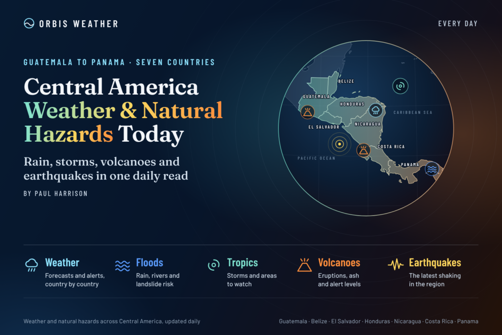
Central America Weather & Natural Hazards Today
By Paul Harrison | Founder & Publisher, Orbis Weather

- Middle East Weather & Natural Hazards Today — Friday, November 6, 2026 4:47 PM
- Africa Weather & Natural Hazards Today — Friday, November 6, 2026 4:44 PM
- America’s Hot Spots This Week November 5, 2026 2:44 PM
- Southwest Indian Ocean Tropical Weather Update – November 6, 2026 12:48 PM
- Australian Region Tropical Weather Update — Friday, November 6, 2026 12:37 PM
- El Niño Heats Up the Pacific as Relentless Typhoons Batter East Asia 11:42 AM
- Australia, New Zealand & Oceania Weather & Natural Hazards Today Nov 6, 2026 10:59 AM
- Ocoee River Crests at Record Level in Copperhill, Triggering Catastrophic Flooding Across Tennessee and Georgia 10:12 AM
- North America Weather & Natural Hazards Today – November 5, 2026 8:31 AM
- Central America Weather & Natural Hazards Today – November 5, 2026 8:21 AM
- South America Weather & Natural Hazards Today – November 5, 2026 8:12 AM
- Daily Earthquakes, Storms, Fires & Floods Report – November 5, 2026 7:39 AM
- Weekly Global Climate Pulse: Thursday, November 5, 2026 7:31 AM
- Tropical Atlantic Daily Report: Thursday, November 5, 2026 7:17 AM
- Eastern & Central Pacific Tropical Weather Update: Thursday, November 5, 2026 7:06 AM
- Western Pacific Tropical Update: In-Fa & Invest 99W 6:53 AM





Central America Weather & Natural Hazards Today – November 5, 2026
By Paul Harrison, Orbis Weather ·
At a glance
A developing low-pressure area off the Pacific coast is the main hazard for Central America in the 24 hours to Thursday morning, November 5, with heavy rain possible into the weekend.
- Tropical outlook: the NHC gives the low a 40% chance of becoming a tropical depression in 48 hours and 60% in seven days.
- Rain: Panama has rain notices in force through Thursday night, Costa Rica is on a nationwide green alert, and El Salvador expects more rain on the coast and in the east. No deaths or major floods were reported.
- Earthquakes: quiet, with one magnitude 4.5 deep under western Nicaragua.
- Volcanoes: no major new eruption; Fuego and Santiaguito continue long-running activity in Guatemala.
National weather services and civil protection agencies issue the official warnings; follow them first.
Tropical outlook
A broad low-pressure area over the Pacific off Central America could become a tropical depression by the weekend, and forecasters warn it may bring heavy rain whether or not it develops.
Agency | Issued | Chance of formation, 48 hours | Chance of formation, 7 days |
|---|---|---|---|
10 p.m. PST Nov 4 (06:00 UTC Nov 5) | 40% | 60% | |
Evening Nov 4 | 30% | 50% |
The NHC said the low “is producing a large area of disorganized cloudiness and showers” and that “a tropical depression could form by this weekend while the low drifts northward.” It added: “Regardless of development, this system could bring areas of heavy rain to portions of Central America through this weekend.”
MARN expects the low to approach El Salvador’s coast, with the heaviest rain most likely between the weekend and Monday, November 9, mainly on the coast and in the east. It has not given rainfall totals or a confirmed track. The two agencies’ figures differ slightly; the newest outlook from either replaces those above.
No tropical cyclone is active in the Atlantic, Caribbean or Eastern Pacific.
Rain, floods and landslides
Panama faces the region’s heaviest forecast rain, with up to 280 mm (11 in) possible through Thursday night, while alerts are in place from Costa Rica to El Salvador. No deaths, evacuations or major floods were reported in the latest agency updates.
Country | Agency and alert | Forecast and threats | Source |
|---|---|---|---|
Panama | IMHPA watch and SINAPROC prevention notice, 7 p.m. Nov 3 to 11:59 p.m. Nov 5 | 201–280 mm (7.9–11.0 in) in southern Chiriquí, central and southern Veraguas and the Azuero highlands; 120–200 mm (4.7–7.9 in) in much of the rest of the country. River rises, flash floods and landslides possible | |
Costa Rica | National Emergency Commission (CNE) green alert nationwide since Nov 3 | Unstable weather through the week, with significant totals in the Central and South Pacific; high waves on the Pacific coast. Soils were already saturated after mid-October floods | |
El Salvador | MARN daily forecast for Nov 5 | Rain and storms mainly in the east, on the coast and along the volcanic range, with lightning and gusts above 30 km/h (19 mph) | |
Honduras | No national alert in the sources reviewed | Choluteca recorded up to 13.6 mm (0.5 in) on Wednesday; rain is expected to continue through the week, according to climate specialist César Quintanilla |
Costa Rica’s green alert is the first, preventive stage of its alert system. The CNE linked it to the remains of a tropical wave, a trough over the isthmus and the Intertropical Convergence Zone. Panama’s civil protection agency urged people not to cross rivers, streams or flooded streets and to stay away from slopes.
Earthquakes
It was a quiet day for earthquakes. The US Geological Survey (USGS) catalog lists one event of magnitude 2.5 or greater from southern Mexico to Panama in the 24 hours to 13:16 UTC (7:16 a.m. Central America time) on November 5.
Time (UTC) | Magnitude | Location | Depth |
|---|---|---|---|
Nov 4, 19:55 | 4.5 | 99 mi (159 km) |
At that depth, shaking at the surface is usually limited, and USGS listed no felt reports or tsunami. USGS catalog search, run at 13:16 UTC.
Guatemala’s seismic institute, INSIVUMEH, recorded a cluster of small quakes in Santa Rosa department on Wednesday, the largest a magnitude 3.6 at 6:13 a.m. local time, Prensa Libre reported. It was felt in San Rafael Las Flores and San Carlos Alzatate. A magnitude 3.2 followed at 3:48 p.m., with no injuries or damage reported, according to Publinews.
Volcanoes
No major new eruption was reported in Central America on November 4 or 5. Guatemala’s Fuego and Santiaguito continue their long-running eruptions. The table shows activity in the most recent Smithsonian/USGS Weekly Volcanic Activity Report in its public feed, which covers October 8–14.
Volcano | Country | Activity (Oct 8–14) |
|---|---|---|
Fuego | Guatemala | 2 to 8 explosions per hour; ash plumes up to 1.1 km (3,600 ft) above the summit; ashfall in Yepocapa and nearby villages; lahars on Oct 7 |
Santa María (Santiaguito dome) | Guatemala | Up to 3 explosions per hour; plumes up to 1.1 km above the dome; ashfall in villages to the south |
Masaya | Nicaragua | Ash plumes to 1.2–1.5 km (3,900–4,900 ft) above sea level on Oct 9 |
Popocatépetl | Mexico | Alert Yellow, Phase Two; 19 to 42 low-level emission events a day; plumes to 6.1–7.3 km (20,000–24,000 ft) above sea level on Oct 12–14; public kept 12 km (7.5 mi) from the crater |
In mid-October, INSIVUMEH said it had seen no relevant change at Fuego after a social media video claimed a new fissure, and it warned that false or older information circulates, La Hora reported. Current alert levels come from INSIVUMEH in Guatemala, Nicaragua’s INETER and Mexico’s CENAPRED, and their latest bulletins replace the figures above.
What to watch next
- The Pacific low: whether it becomes a tropical depression by the weekend. The NHC updates its Tropical Weather Outlook several times a day.
- El Salvador, weekend to Monday, November 9: MARN expects rain to increase on the coast and in the east as the low approaches.
- Panama, through Thursday night: the IMHPA and SINAPROC rain notices run until 11:59 p.m. on November 5 and may be extended.
- Costa Rica: the CNE green alert remains in force; the national weather institute (IMN) issues updates.
- Guatemala’s volcanoes: INSIVUMEH publishes daily bulletins on Fuego and Santiaguito.
About this report
This report covers weather and natural hazards from southern Mexico to Panama in the 24 hours to about 7:15 a.m. Central America time (13:15 UTC) on Thursday, November 5, 2026, with forecasts for the days ahead. It draws on the NHC, national weather and civil protection agencies, the USGS earthquake catalog, the Smithsonian Global Volcanism Program and news reports. Agency figures are preliminary and change as updates arrive. National weather services and civil protection agencies issue the official warnings; follow them first.
Glossary
- Tropical depression: the weakest stage of a tropical cyclone, with sustained winds below 39 mph (63 km/h).
- Tropical wave: a band of low pressure moving westward across the tropics that brings showers and storms.
- Intertropical Convergence Zone: a belt near the equator where trade winds meet and storms form often.
- Lahar: a fast-moving flow of volcanic debris and water, often set off by heavy rain on a volcano’s slopes.
Frequently asked questions
Will a tropical storm hit Central America this weekend? Not necessarily. The NHC gives the low a 60% chance of becoming a tropical depression within seven days, but warns that it could bring heavy rain to parts of Central America either way.
Which country faces the most rain? Panama’s forecast is the heaviest, with up to 280 mm (11 in) possible in southern Chiriquí, Veraguas and the Azuero highlands through Thursday night.
Was the earthquake in Nicaragua felt? USGS listed no felt reports for the magnitude 4.5 near Chinandega. It struck about 99 miles (159 km) deep, which usually limits shaking at the surface.
Is Volcano Fuego erupting? Yes, Fuego has been in a long-running eruption with frequent small to moderate explosions. INSIVUMEH’s daily bulletins give the latest activity and any changes in alert level.
Sources
Tropical outlook and rain
- NHC Eastern Pacific Tropical Weather Outlook
- Infobae: Pacific low keeps El Salvador on alert
- El Diario de Hoy: El Salvador weather for November 5
- Televicentro: Rain in Honduras
- Infobae: Costa Rica green alert
- TVN: Panama rain watch to November 5
- Infobae: Panama saturated soils and flood threat
Earthquakes
- USGS earthquake catalog search
- Prensa Libre: Three quakes in Santa Rosa
- Publinews: Magnitude 3.2 in Santa Rosa
Volcanoes
About the Author
Paul Harrison — Founder & Publisher, Orbis Weather
Paul Harrison founded Orbis Weather in 2026 to make global weather and natural-hazard information easier to find, follow and understand. His coverage includes tropical cyclones, severe weather, extreme temperatures, earthquakes, volcanoes, wildfires, flooding and significant natural disasters worldwide.
View all articles by Paul Harrison → | Editorial Standards →
Global Weather Tracker Hub
Explore weather maps, tropical systems, storms and natural hazards around the world.
No matching trackers found.