
🇺🇸 U.S. Weather Outlook: What to Expect This Week
By Paul Harrison | Founder & Publisher, Orbis Weather

- Africa Weather & Natural Hazards Today — Sunday, November 8, 2026 7:06 PM
- Southeast Asia Weather & Natural Hazards Today: Sunday, November 8, 2026 6:57 PM
- Southeast Asia Natural Hazards This Week: Sunday, November 8, 2026 6:47 PM
- More Powerful Storms Heading for British Columbia as Heavy Rain, Damaging Winds and Flooding Threaten the Weekend 6:35 PM
- Deadly Nor’easter Batters New York City: One Killed by Falling Tree as Coastal Flooding Sweeps Northeast 6:24 PM
- Middle East Weather & Natural Hazards Today – Sunday, November 8, 2026 3:57 PM
- Earth’s Hot Spots This Week November 7, 2026 2:54 PM
- Season’s first lake-effect snow hammers Marquette, Michigan 1:06 PM
- Australian Region Tropical Weather Update — Sunday, November 8, 2026 12:20 PM
- Southwest Indian Ocean Tropical Weather Update – November 8, 2026 12:12 PM
- Australia, New Zealand & Oceania Weather & Natural Hazards Today Sunday, November 8, 2026 12:03 PM
- North America Weather & Natural Hazards Today — November 7, 2026 8:30 AM
- Central America Weather & Natural Hazards Today: Pacific Tropical Disturbance Brings Heavy Rain, Flooding and Landslide Threats 8:16 AM
- South America Weather & Natural Hazards Today – November 7, 2026 7:58 AM
- Daily Earthquakes, Storms, Fires & Floods Report — November 7, 2026 7:43 AM
- U.S. Weather Outlook (Next 7 Days): November 7–13, 2026 7:28 AM
- Deadly Flooding in North Georgia 7:21 AM
- Tropical Atlantic Daily Report: Saturday, November 7, 2026 7:06 AM
- Eastern & Central Pacific Tropical Weather Update: Saturday, November 7, 2026 6:56 AM
- WESTERN PACIFIC Tropical Weather Update: November 7, 2026 6:34 AM





U.S. Weather Outlook (Next 7 Days): November 7–13, 2026
By Paul Harrison, Orbis Weather
This outlook covers Saturday, November 7, through Friday, November 13, 2026. It was written at about 7:30 a.m. EST on Saturday, November 7, from forecasts issued overnight and on Friday.
At a glance
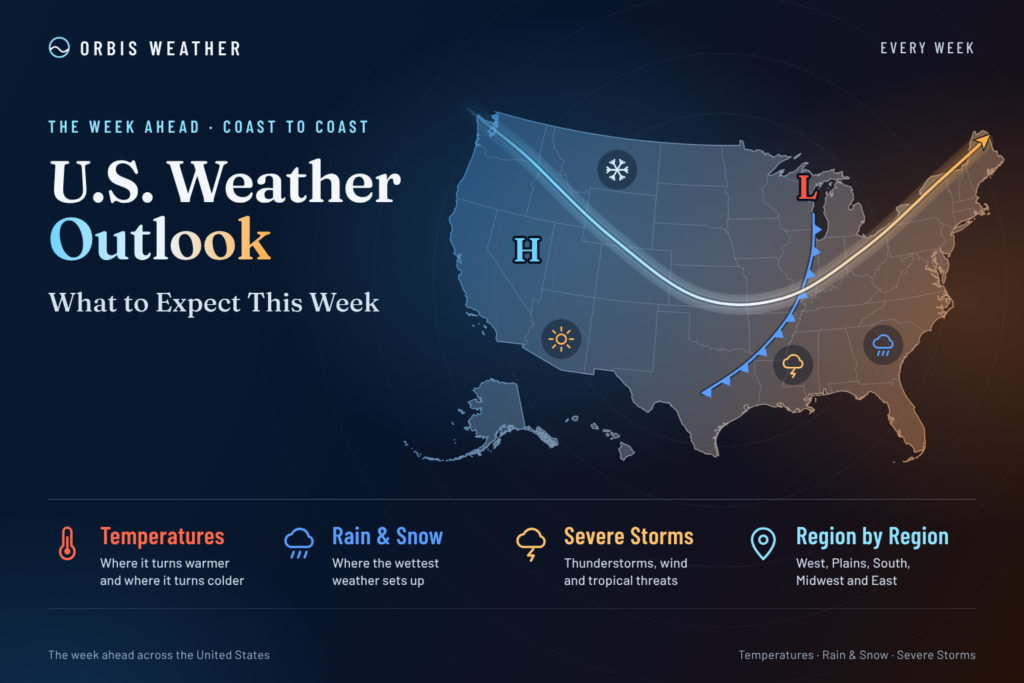
Most of the country stays dry and quiet this week under a large high, while storms focus on the Pacific Northwest and South Texas.
- South Texas: Gulf moisture brings heavy rain Sunday into Monday, with a WPC Slight Risk of excessive rainfall.
- Pacific Northwest: A strong cold front Saturday night brings wind and rain, followed by repeated Pacific moisture plumes all week.
- Southern California: Offshore winds and fire danger peak Saturday, then a warm, dry spell runs into midweek with high tides at the coast.
- Northeast and Great Lakes: Cold rain and some high-elevation wet snow end by Sunday, then a cooler, showery pattern returns late week.
- Severe storms: The Storm Prediction Center forecasts no severe thunderstorms Saturday or Sunday.
Local National Weather Service offices issue the official watches and warnings for each area.
The big picture
A large high over the middle of the country keeps fair weather for most areas through Monday. An upper low over the Great Lakes pulls Canadian air into the East, which runs cooler than normal from the Northeast to the Deep South. From Tuesday on, the Weather Prediction Center expects “an active Pacific storm track” with deep troughing in the northeast Pacific. That sends repeated atmospheric-river moisture plumes into the Pacific Northwest and California. A separate southern-stream trough brings showers and storms from the southern Plains to the Gulf Coast and Southeast through midweek.
Day by day
The weekend is quiet in the middle of the country; the West turns busier from Tuesday.
Day | East | Central states | West |
|---|---|---|---|
Sat, Nov 7 | Cold rain from the lower Great Lakes to New England; gusty northwest winds in the Mid-Atlantic | Morning frost and freeze in Kansas and Missouri; rain from southern New Mexico into West Texas early | Wind and Red Flag warnings near Los Angeles; strong cold front in western Washington at night |
Sun, Nov 8 | Wet snow may mix in on New England high ground in the morning; Maine clears at night | Heavy rain and non-severe storms in South Texas | Hot inland in Southern California; showers and lower snow levels in the Northwest |
Mon, Nov 9 | Clipper rain for the lower Great Lakes and upstate New York early; dry cold front in the Mid-Atlantic | Texas rain trends down; mild and dry in the Midwest | Next warm front reaches the Northwest late |
Tue, Nov 10 | Brief warm-up in the Mid-Atlantic | Showers and storms from the southern Plains to the Gulf Coast | Moisture plume over western Washington; warm in Southern California |
Wed, Nov 11 | Southern showers spread into the Southeast | Mild and dry in the central Plains | Lower-confidence day in the Northwest; Southern California still above normal |
Thu, Nov 12 | Showers return to the Mid-Atlantic as low pressure moves up the coast | Cooler air arrives in the Plains and Midwest | More widespread Northwest rain; onshore flow cools Southern California |
Fri, Nov 13 | Showers in the Mid-Atlantic; colder interiors may see mixed precipitation | Possible lake-effect precipitation near the Great Lakes | New moisture surge toward California and the Intermountain West; Southwest showers and storms |
Region by region
Northeast and Mid-Atlantic. Drier, cooler air arrives this weekend after Friday’s front. New York City has lows in the 40s to around 50 Saturday and Sunday nights and highs near 60 Sunday. The Baltimore–Washington office expects northwest gusts of 20 to 30 mph, seasonable weekend temperatures and showers again Thursday and Friday.
Southeast. The region runs cooler than normal this weekend. Showers and thunderstorms from the southern stream spread toward the Gulf Coast and Southeast through midweek.
Midwest and Great Lakes. A dry warming trend runs into early next week. Chicago may see near- or slightly-below-freezing lows Sunday and Monday mornings, then highs in the low to mid 60s Monday and Tuesday. Kansas City expects cooler air from Thursday, with any rain staying to the east.
Plains. The northern High Plains stay dry and much milder than normal, with gusty west-southwest winds. In Texas, rain from southern New Mexico moves into West Texas Saturday, then heavier rain falls over South Texas Sunday into Monday (see Hazards).
Rockies and Great Basin. The weekend is dry under the high. Late in the week a new moisture surge reaches the Intermountain West, with mountain snow possible as each cold front passes.
Southwest and California. Los Angeles coasts and valleys reach the mid 80s to around 90 this weekend, with highs in the 80s Tuesday and Wednesday, about 5 to 10 degrees above normal. Onshore flow brings highs in the 70s by Friday. Showers and storms are possible over the Southwest and Four Corners late in the week.
Pacific Northwest. Western Washington peaks in the 60s Saturday before a cold front brings rain Saturday night and highs in the 50s Sunday. Another warm front arrives late Monday, with a steady moisture plume Tuesday and wider rain from Thursday. Seattle’s office says river flooding is not expected through the next seven days.
Alaska. The Climate Prediction Center favors above-normal temperatures over the eastern mainland and Southeast Alaska for November 12 to 16.
Hawaii. A tropical disturbance southeast of the Big Island is forecast to pass well south of the islands (see Tropics).
Hazards this week
South Texas rain and Pacific Northwest wind are the main hazards; no severe thunderstorms are forecast this weekend.
Hazard | Where | When | What the forecasters say |
|---|---|---|---|
Flooding rain | South-central and South Texas | Sun 6 a.m. CST to Mon 6 a.m. CST | WPC Slight Risk (level 2 of 4). Areal averages of 2 to 3 inches, local totals of 4 to 8 inches. WPC says the area “will likely need adjustment.” A Marginal Risk covers South, south-central and West Texas Saturday. |
Severe storms | Texas, New England | Sat and Sun | SPC: no severe thunderstorm areas forecast either day. Scattered to numerous non-severe storms are possible in southern, central and southwest Texas Sunday. |
High wind | Western Washington | Sat afternoon into early Sun (PST) | High Wind Watch; 50 to 75% chance of gusts over 58 mph in the watch area. Gusts of 30 to 45 mph elsewhere. A Storm Warning covers coastal waters 10 a.m. Sat to 10 a.m. Sun PST. |
Wind and fire weather | Los Angeles and Ventura counties | Sat (PST) | Wind Advisory 2 a.m. to 2 p.m.; Red Flag Warning 2 a.m. to 6 p.m. No further wind or fire products expected after Saturday. |
Coastal flooding and surf | Southern California; Washington coast | Through Tue (SoCal); Sun (WA) | Coastal Flood Advisories for Orange and San Diego county coasts until noon Tuesday and for parts of the Los Angeles office’s coast until 10 p.m. Monday (PST). High tides of 7.2 to 7.6 feet peak Sunday and Monday. Washington seas build to 20 to 28 feet Sunday, with a High Surf Advisory 4 a.m. to 10 p.m. PST. |
Mountain snow | Washington Cascades | Sat night to Sun | Snow levels fall from above 7,000 feet to 4,000 to 5,000 feet by Sunday morning. Washington Pass has about a 50% chance of 4 inches or more; WPC expects minor impacts. |
Frost and freeze | Kansas and Missouri; Chicago area; Mid-Atlantic | Sat morning; Sun–Mon mornings; late nights | Kansas City’s Frost Advisory and Freeze Warning ran until 8 a.m. CST Saturday, with another frosty night in Missouri Saturday night. Frost or near-freezing readings are possible in the Baltimore–Washington area. |
Nationally, fire activity is light. The National Interagency Fire Center reported Preparedness Level 1 on November 6, with 57 new fires covering 347 acres the previous day.
Tropics
No tropical cyclone threatens the United States. In the Atlantic, the National Hurricane Center gives a non-tropical low south-southeast of Bermuda a 10% chance of formation over seven days (outlook issued 1 a.m. EST Saturday). In the Pacific, a disturbance several hundred miles southeast of the Big Island has a 90% chance of becoming a tropical cyclone. It is forecast to move west-northwest to west at 10 to 15 mph, “passing well south of the Hawaiian Islands” (outlook issued 10 a.m. PST Friday). Each new outlook replaces these figures.
Beyond the week
The Climate Prediction Center expects a warm middle of the country and a wet West Coast into mid-November. Its outlooks were issued at 3 p.m. EST Friday, November 6.
Outlook | Valid | Confidence | Temperature | Precipitation |
|---|---|---|---|---|
6 to 10 day | Nov 12–16 | Above average, 4 out of 5 | Above normal West and Central, with 80–90% chances in the northern Plains; near to below normal in the eastern third | Above normal along most of the West Coast (70–80% south of San Francisco Bay), southern Plains and Florida; below normal in the central and interior East |
8 to 14 day | Nov 14–20 | Near average, 3 out of 5 | Above normal across most of the Lower 48; near normal on the East Coast and in northern and central California | Above normal from the West to the Mississippi River and along the Gulf Coast to Florida; below normal from the Great Lakes to the Atlantic coastal plain |
Hawaii is favored to be warmer than normal in both periods.
What could change
- Where the Texas rain sets up (Sunday to Monday). WPC calls uncertainty high, with models split between the Gulf coast, farther inland and northeast Mexico.
- Western moisture plumes (Tuesday to Saturday). WPC says “uncertainty remains concerning the timing, orientation and magnitude of individual moisture plumes.”
- Pacific Northwest midweek (Wednesday). Seattle’s office says uncertainty increases as a ridge builds inland and a trough sits offshore.
- Late-week cold (Thursday and Friday). Chicago’s office rates how cold the air gets as “an item of relatively low confidence.”
- A Southern California storm (Friday onward). The Los Angeles office sees a possible system between November 13 and 17, ranging from minimal rain to a significant storm.
About this outlook
This outlook summarizes forecasts from the National Weather Service: the Weather Prediction Center, Storm Prediction Center, Climate Prediction Center, National Hurricane Center and local forecast offices. Day 1 is Saturday, November 7, and day 7 is Friday, November 13. Forecast detail drops after the first three days, and local conditions can differ from regional summaries.
Glossary
- Atmospheric river: a long, narrow band of moisture that can bring heavy rain and mountain snow.
- Excessive rainfall risk: WPC’s four-level scale (Marginal, Slight, Moderate, High) for the chance of rain heavy enough to cause flash flooding.
- Clipper: a fast-moving low that drops southeast from Canada.
- Offshore winds: winds blowing from land toward the sea, which dry and warm the coast.
- Snow level: the elevation above which precipitation falls mainly as snow.
Frequently asked questions
Will there be severe storms this weekend? The Storm Prediction Center forecasts no severe thunderstorms anywhere in the country Saturday or Sunday. Texas could see non-severe storms Sunday.
Where is flooding most likely? South-central and South Texas, from Sunday morning into Monday morning. WPC rates the risk Slight, level 2 of 4, and says the area may shift.
How hot will Southern California get? Inland coastal areas and western valleys around San Diego reach the upper 80s to around 90 on Sunday, the warmest day. Forecasters expect cooling late in the week as onshore flow returns.
Is a hurricane headed for the United States? No. The only system with a high chance of forming is in the central Pacific and is forecast to pass well south of Hawaii.
Will it snow this week? Mainly in the mountains. The Washington Cascades may pick up a few inches Saturday night into Sunday, and higher New England terrain may see wet snow mixed with rain.
Sources
Weather Prediction Center
- Short Range Forecast Discussion, 3:00 a.m. EST Sat, Nov 7, 2026
- Extended Forecast Discussion, 2:31 a.m. EST Sat, Nov 7, 2026
- Excessive Rainfall Discussion, 3:25 p.m. EST Fri, Nov 6, 2026
- Heavy Snow and Icing Discussion, 1:48 a.m. EST Sat, Nov 7, 2026
Storm Prediction Center
- Day 1 Convective Outlook, 11:59 p.m. CST Fri, Nov 6, 2026
- Day 2 Convective Outlook, 12:45 a.m. CST Sat, Nov 7, 2026
Climate Prediction Center
- 6–10 and 8–14 Day Outlook Discussion, 3:00 p.m. EST Fri, Nov 6, 2026
National Hurricane Center
- Atlantic Tropical Weather Outlook, 1:00 a.m. EST Sat, Nov 7, 2026
- Eastern Pacific Tropical Weather Outlook, 10:00 a.m. PST Fri, Nov 6, 2026
- Central Pacific Tropical Weather Outlook, 2:00 a.m. HST Fri, Nov 6, 2026
Local forecast offices (Area Forecast Discussions)
- New York, 10:09 a.m. EST Fri, Nov 6
- Baltimore/Washington, 1:52 p.m. EST Fri, Nov 6
- Chicago, 5:46 a.m. CST Sat, Nov 7
- Kansas City, 5:16 a.m. CST Sat, Nov 7
- Los Angeles, 2:07 a.m. PST Sat, Nov 7
- San Diego, 4:27 a.m. PST Fri, Nov 6
- Seattle, 4:26 p.m. PST Fri, Nov 6
Fire
- National Interagency Fire Center Situation Report, 7:30 a.m. MDT Fri, Nov 6, 2026
Sources & Methodology
Weekly Global Weather Watch is compiled by Orbis Weather using information from official national and international meteorological agencies, including NOAA, the National Weather Service, National Hurricane Center, Weather Prediction Center, Climate Prediction Center, World Meteorological Organization and relevant national weather agencies worldwide.
Orbis Weather reviews these official observations, forecasts, warnings and outlooks to identify the most significant global weather patterns and hazards for the week ahead. Forecast conditions can change as new observations and model guidance become available.
About the Author
Paul Harrison — Founder & Publisher, Orbis Weather
Paul Harrison founded Orbis Weather in 2026 to make global weather and natural-hazard information easier to find, follow and understand. His coverage includes tropical cyclones, severe weather, extreme temperatures, earthquakes, volcanoes, wildfires, flooding and significant natural disasters worldwide.
View all articles by Paul Harrison → | Editorial Standards →
Global Weather Tracker Hub
Explore weather maps, tropical systems, storms and natural hazards around the world.
No matching trackers found.