
South America Weather & Natural Hazards Today
By Paul Harrison | Founder & Publisher, Orbis Weather

- Europe Weather & Natural Hazards Today — Saturday, November 7, 2026 7:10 PM
- Southeast Asia Weather & Natural Hazards Today: Saturday, November 7, 2026 7:01 PM
- Indonesia Volcanoes and Live Eruptions This Week: Saturday, November 7, 2026 6:51 PM
- Africa Weather & Natural Hazards Today — Saturday, November 7, 2026 5:36 PM
- Northeast Monsoon 2026/2027 Begins, With Heavy Rain, Floods and Rough Seas Possible Until March 2027 4:39 PM
- Middle East Weather & Natural Hazards Today – Saturday, November 7, 2026 4:17 PM
- Europe’s Hot Spots This Week Nov 6, 2026 2:51 PM
- Australian Region Tropical Weather Update — Saturday, November 7, 2026 11:23 AM
- Southwest Indian Ocean Tropical Weather Update – November 7, 2026 11:13 AM
- Australia, New Zealand & Oceania Weather & Natural Hazards Today Saturday, November 7, 2026 11:05 AM
- More than 80 rescued as catastrophic flood hits Fannin County, Georgia 8:57 AM
- North America Weather & Natural Hazards Today: East Coast Flood Threat, Canadian Storms and Pacific Weather Systems 8:39 AM
- Central America Weather & Natural Hazards Today: Heavy Rain, Flash Flooding and Tropical Development Threaten the Region 8:30 AM
- South America Weather & Natural Hazards Today — November 6, 2026 8:21 AM
- Daily Earthquakes, Storms, Fires & Floods Report — November 6, 2026 8:12 AM
- Global Natural Disasters This Week — November 6, 2026 8:03 AM
- Tropical Atlantic Daily Report: Friday, November 6, 2026 7:49 AM
- Eastern & Central Pacific Tropical Weather Update: Friday, November 6, 2026 7:39 AM
- WESTERN PACIFIC Tropical Weather Update: New Cyclone Threat Developing Near Guam as In-Fa Moves Away 7:25 AM





South America Weather & Natural Hazards Today — November 6, 2026
Storms Build Across Brazil as Colombia Monitors Flooding and Landslide Threats, While Argentina and Paraguay Face Changing Weather Conditions
By Paul Harrison | Founder & Publisher, Orbis Weather
Published: Friday, November 6, 2026
Region: South America
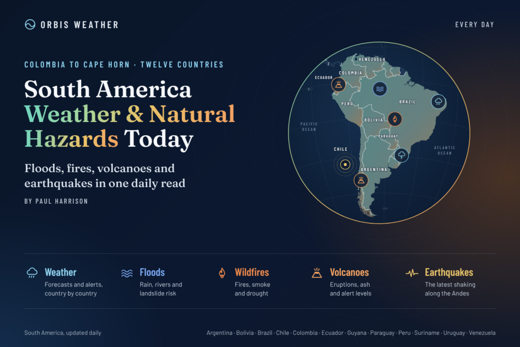
Coverage: Brazil, Argentina, Colombia, Peru, Chile, Ecuador, Bolivia, Paraguay, Uruguay, Venezuela, Guyana and Suriname.
South America Weather Overview
South America enters the first weekend of November with contrasting weather conditions, including developing thunderstorms, tropical rainfall, persistent flooding concerns and dry, hot weather across parts of the continent.
The most significant forecast development is an evolving weather system affecting southern Brazil and neighboring countries. Brazil’s National Institute of Meteorology (INMET) expects an area of low pressure to intensify around northern Argentina, Paraguay and Bolivia on Friday, increasing the potential for stronger rainfall and thunderstorms across southern Brazil on Saturday.
Meanwhile, Colombia continues its daily monitoring of rainfall, river conditions and landslide hazards. Across the Amazon Basin, tropical showers remain an important weather concern, while northeastern Brazil faces unusually dry conditions and elevated afternoon heat.
This report distinguishes between officially forecast weather, ongoing hazard monitoring and broader seasonal risks. Conditions can change quickly, particularly in mountainous regions and areas already affected by flooding.
Today’s Main Weather and Natural Hazard Concerns
Region | Main concern | Outlook |
|---|---|---|
Southern Brazil | Thunderstorms and heavy rainfall | Increasing into Saturday |
Central Brazil | Thunderstorms and localized flooding | Unsettled |
Colombia | Flooding and landslide monitoring | Ongoing |
Northern Argentina and Paraguay | Developing low-pressure system | Conditions changing |
Bolivia | Rainfall and storm development | Monitor locally |
Peru and Ecuador | Andean and tropical rainfall hazards | Regional monitoring |
Chile | Mountain weather and seismic exposure | Regional monitoring |
Northeastern Brazil | Heat and low humidity | Official alerts in effect |
The table represents a mixture of confirmed forecasts and general monitoring priorities, not a uniform list of active emergency warnings.
Brazil: Heavy Rain and Thunderstorms Threaten Several Regions
Brazil is one of South America’s main weather areas to watch today, with increasing atmospheric instability expected across central and southern portions of the country.
Southern Brazil: Storms Expected to Intensify
According to INMET’s November 5 forecast for November 6–7, showers and isolated thunderstorms are expected across northern and western Paraná on Friday.
Rain and thunderstorms are also forecast to spread into western Santa Catarina and northwestern Rio Grande do Sul later in the day.
By Saturday, the developing low-pressure system and advancing frontal boundary are expected to increase the potential for stronger storms, particularly across northern portions of southern Brazil.
Potential hazards include intense downpours, lightning, gusty winds and localized flooding where rainfall becomes concentrated.
Southeastern Brazil: Rain and Temperature Changes
São Paulo, Minas Gerais, Rio de Janeiro and Espírito Santo face varying levels of unsettled weather.
INMET has identified areas of potential thunderstorm activity across São Paulo, Minas Gerais and portions of Rio de Janeiro and Espírito Santo.
Forecast temperatures for Friday include:
São Paulo: 21°C (70°F) maximum.
Rio de Janeiro: 28°C (82°F) maximum.
Belo Horizonte: 34°C (93°F) maximum.
A marine cold front is helping lower temperatures around eastern São Paulo, while warmer conditions persist farther inland.
Central and Northern Brazil
Thunderstorms are expected in Goiás, Mato Grosso do Sul and portions of Mato Grosso, with further instability extending into Saturday.
Across the Amazon region, showers and isolated thunderstorms are possible in Amazonas, Acre, Rondônia and Tocantins.
In contrast, northeastern Brazil faces hot, dry weather. INMET has issued orange and yellow low-humidity warnings covering portions of Ceará, Rio Grande do Norte, Paraíba, Pernambuco, Piauí, Bahia and neighboring areas.
Teresina could reach 40°C (104°F), increasing the importance of hydration and heat precautions.
Source: INMET official November 6–7 forecast.
Colombia: Flooding, Heavy Rain and Landslide Monitoring Continue
Colombia remains an important natural-hazard monitoring area following significant flooding reported earlier this week.
Heavy rainfall can produce several overlapping hazards, including overflowing rivers, saturated hillsides, flash flooding and disruption to roads serving mountainous communities.
Colombia’s Institute of Hydrology, Meteorology and Environmental Studies (IDEAM) published its November 5 daily hydrometeorological report, covering rainfall, river alerts, marine conditions, landslide threats and vegetation-fire monitoring.
IDEAM also published its November 5 landslide-risk bulletin, which assesses the probability of slope failures using observed and forecast rainfall.
These bulletins provide the official basis for evaluating local hazards. The existence of national monitoring does not mean every department is under an active warning.
Areas Requiring Particular Attention
Communities in the Andean highlands, Pacific drainage basins and flood-prone river valleys should pay close attention to local alerts.
Steep slopes can become unstable following prolonged rainfall, while rivers may remain elevated even after heavy rain ends.
Residents should avoid flooded roads, monitor river conditions and follow instructions from municipal emergency management agencies.
For the latest municipal-level information, consult IDEAM’s official weather and hazard bulletins.
Ecuador: Heavy Rain and Thunderstorm Warnings Through Saturday
Ecuador is facing a significant rainfall threat, with the country’s National Institute of Meteorology and Hydrology (INAMHI) issuing Weather Alert No. 86 for November 4–7.
The alert covers heavy to very heavy rainfall and scattered thunderstorms, particularly across coastal provinces.
Areas of Greatest Concern
Esmeraldas, Santo Domingo, Manabí, Los Ríos, Guayas and El Oro are among the areas identified for potentially intense rainfall.
The warning also highlights the possibility of river rises, localized flooding, fallen trees and difficult driving conditions.
Pichincha province is included in the wider warning area, although rainfall intensity will vary considerably by location.
The alert is scheduled to remain in effect until 10 a.m. local time on Saturday, November 7, unless updated.
Residents of flood-prone communities should monitor nearby waterways and avoid driving through submerged streets.
Peru: Heavy to Extreme Rainfall Forecast Along Northern Coast
Peru faces another notable weather threat this weekend, with the National Meteorology and Hydrology Service (SENAMHI) forecasting significant rainfall through Sunday, November 8.
Tumbes and Piura at Risk
Heavy to extreme rainfall is forecast for parts of the northern coast, particularly Tumbes, with moderate to heavy rainfall possible in inland Piura.
For Friday, November 6, rainfall totals approaching 100 mm (3.9 inches) in a day are forecast for parts of the northern coastal region.
Rain is also expected across sections of the Andes, accompanied by thunderstorms and wind gusts approaching 40 km/h (25 mph).
Hail is possible in northern mountain areas above approximately 2,800 meters (9,186 feet).
Flash Flood and Landslide Concerns
Peru’s National Civil Defense Institute (INDECI) is urging local authorities to prepare evacuation routes and review emergency arrangements.
Heavy rainfall in mountainous terrain can trigger huaicos, the locally used term for destructive flows of mud, rocks and debris.
These hazards can develop rapidly in steep valleys and may threaten roads, bridges and settlements.
The strongest rainfall is not expected everywhere. Conditions will vary substantially between the coast, highlands and Amazonian regions.
Official information: SENAMHI Peru.
Argentina: Thunderstorm, Strong Wind and Zonda Alerts
Argentina is facing several weather hazards on Friday, November 6, including thunderstorms, strong winds and potentially hazardous downslope winds near the Andes.
Argentina’s National Meteorological Service (SMN) has issued yellow-level warnings across multiple provinces.
Thunderstorms Across Central Argentina
Parts of Buenos Aires province, La Pampa and San Luis are forecast to experience isolated thunderstorms, some potentially strong.
Rainfall totals of approximately 15–40 mm (0.6–1.6 inches) are possible in affected areas, with locally higher amounts.
Thunderstorms may produce frequent lightning, hail, heavy downpours and gusty winds.
Strong Winds Across Western Argentina
Wind warnings also cover portions of Córdoba, Mendoza, San Juan, La Rioja, Catamarca and neighboring provinces.
In mountain areas, winds may reach 45–70 km/h (28–43 mph), with gusts potentially exceeding 110 km/h (68 mph).
Strong Zonda winds, which descend from the Andes and can become warm, dry and gusty, are an additional concern in susceptible areas.
These conditions can create difficult travel, reduce visibility through blowing dust and increase the risk of falling branches or unsecured objects.
Paraná River Flooding: Continued Monitoring
The Paraná River basin remains an important longer-term flood-monitoring concern following reports of serious flooding in northeastern Argentina earlier this week.
Communities in Corrientes, Chaco and Misiones should continue monitoring official river-level information.
River flooding may persist after rainfall has ended because water from upstream tributaries takes time to move through the basin.
Current November 6 river gauges were not independently verified for this report, so no claim is made that previously reported evacuation thresholds remain exceeded today.
Official source: Argentina National Meteorological Service.
Paraguay and Bolivia: Developing Low-Pressure System
A developing low-pressure area near northern Argentina, Paraguay and Bolivia is expected to contribute to increased atmospheric instability across the region.
The system is forecast to interact with a frontal boundary, supporting stronger rainfall and thunderstorms across southern Brazil during Saturday.
For Paraguay and Bolivia, the main concern is whether organized thunderstorms develop locally as the circulation strengthens.
Potential impacts include brief heavy rain, lightning, gusty winds and reduced visibility.
The precise locations and intensity of storms in Paraguay and Bolivia require confirmation from their national meteorological services.
Residents should follow local forecasts rather than assuming that Brazil’s storm warnings automatically apply across international borders.
Chile: Andean Weather, Wind and Seismic Hazards
Chile’s distinctive geography creates several weather and natural-hazard challenges, ranging from dry northern deserts to the mountain ranges and storm-prone southern regions.
Weather Conditions
During November, changing frontal systems can bring rain and wind to southern Chile, while the Andes may experience rapid temperature changes and difficult mountain conditions.
Travelers crossing high mountain passes should monitor forecasts for wind, precipitation and visibility.
No specific nationwide severe-weather warning for Chile on November 6 was independently verified in the sources reviewed.
Earthquake and Volcanic Monitoring
Chile lies along the boundary where the Nazca Plate descends beneath the South American Plate, making it one of the world’s most seismically active countries.
Earthquakes and volcanic activity are separate geological hazards and cannot be predicted from ordinary weather conditions.
For verified activity, consult the National Seismological Center and Chile’s volcanic monitoring network.
Venezuela, Guyana and Suriname: Tropical Rainfall Monitoring
Northern South America remains subject to tropical moisture, showers and thunderstorms, although conditions can differ considerably between coastal areas and inland rainforest regions.
Venezuela
Venezuela’s mountainous northern terrain and major river systems create localized flood and landslide vulnerabilities during periods of persistent rainfall.
Mountain roads and communities near steep slopes warrant particular attention when heavy rain develops.
Guyana and Suriname
Both countries have low-lying coastal areas where intense rainfall can cause temporary drainage problems and localized flooding.
Inland regions may experience thunderstorms, particularly where daytime heating combines with tropical moisture.
Specific November 6 rainfall warnings for these three countries were not independently verified for this edition.
Residents should consult national weather services for current local alerts.
Uruguay: Monitoring Changing Southern Weather
Uruguay lies near the northern edge of the Southern Hemisphere’s midlatitude weather systems, where frontal boundaries can bring rapid changes in wind, rainfall and temperature.
With atmospheric instability developing farther north around Paraguay and Argentina, regional weather patterns should be monitored into the weekend.
However, the development of this system does not establish that Uruguay itself will experience severe thunderstorms.
No specific active national severe-weather alert for Uruguay was independently verified for this report.
Official updates are available through Uruguay’s Meteorological Institute (INUMET).
South America Earthquake and Volcano Monitoring
South America experiences some of the world’s most significant geological hazards, particularly along its western Pacific margin.
The Andean region is part of the Pacific Ring of Fire, where tectonic plate interactions generate earthquakes and support volcanic activity.
Earthquake Risk
The main seismic monitoring areas include Chile, Peru, Ecuador and Colombia.
Earthquake risk also extends into portions of Argentina, Bolivia and Venezuela.
Earthquakes cannot currently be predicted with reliable dates, times or magnitudes. This report does not claim that a significant earthquake is imminent.
Volcanic Activity
Volcanic monitoring remains important in the Andes, where active and potentially active volcanoes can threaten nearby communities through ashfall, volcanic gases, lahars and other hazards.
Volcanic ash can also disrupt aviation operations, sometimes far from the eruption site.
No new eruption or major earthquake is declared in this edition without a verified event bulletin.
Readers can consult the USGS real-time earthquake map and Smithsonian Global Volcanism Program for independently maintained monitoring information.
South America Weather Outlook: November 7–9, 2026
The following outlook combines verified near-term forecasts with broader monitoring considerations. It is not a uniform three-day forecast for every South American country.
Date | Expected developments |
|---|---|
Saturday, November 7 | Stronger storm potential in southern Brazil; Ecuador’s current heavy-rain warning continues into the morning |
Sunday, November 8 | Heavy-rain threat remains a concern in northern Peru through the forecast warning period |
Monday, November 9 | Updated forecasts needed to determine whether southern Brazil’s storm system and regional rainfall hazards persist |
The next several days will be particularly important for communities already dealing with saturated ground or elevated river levels.
Even when rainfall begins to ease, floodwaters can continue moving downstream and landslide risks may remain elevated.
Why November Is an Important Weather Month in South America
November marks a seasonal transition across much of the continent.
In tropical regions, increasing atmospheric moisture and daytime heating can support thunderstorms and heavy rainfall.
Across central Brazil, the wet season is becoming established, while southern Brazil, Paraguay, Uruguay and northern Argentina can experience active frontal systems.
In the Andes, the combination of steep terrain, localized heavy rain and unstable slopes can produce dangerous flash floods and landslides.
The Role of El Niño
El Niño can influence South American rainfall patterns by changing tropical Pacific Ocean temperatures and atmospheric circulation.
Its effects vary considerably by location and season.
Parts of northeastern Argentina and the Paraná basin can experience wetter-than-normal conditions during certain El Niño events, while other regions may experience different rainfall responses.
However, El Niño does not directly explain every flood, storm or temperature extreme. Individual events must be evaluated using observations, forecasts and regional atmospheric conditions.
Seasonal outlooks also cannot determine precisely when or where a particular storm will occur.
Weather and Natural Hazard Safety Advice
People living or traveling in areas exposed to severe weather should take practical precautions.
Flooding: Never drive or walk through fast-moving floodwater. Roads and bridges may be damaged beneath the surface.
Thunderstorms: Move indoors when thunder is heard. Avoid isolated trees, exposed ridges and open water.
Landslides: Watch for new ground cracks, leaning trees, unusual rumbling sounds and sudden changes in stream flow.
Strong winds: Secure loose outdoor objects and avoid damaged power lines.
Extreme heat: Drink water regularly, reduce strenuous activity during peak afternoon heat and check on vulnerable people.
Earthquakes: Drop, cover and hold on during shaking. Follow local evacuation guidance after a major event.
Volcanic ash: Follow civil defense instructions and avoid unnecessary exposure to airborne ash.
Emergency warnings from national and local authorities always take priority over regional weather summaries.
Official South America Weather and Natural Hazard Sources
Orbis Weather uses national meteorological and geological agencies as primary references wherever possible.
Country | Official agency |
|---|---|
Brazil | |
Argentina | |
Colombia | |
Peru | |
Ecuador | |
Chile | |
Bolivia | |
Paraguay | |
Uruguay | |
Venezuela | |
Guyana | |
Suriname | National meteorological and disaster management authorities |
Additional geological monitoring references include the USGS, Smithsonian Global Volcanism Program and national civil protection agencies.
Orbis Weather Editorial Methodology
This report has been prepared as an original regional weather and natural-hazards summary for Orbis Weather.
The November 6 edition incorporates official forecasts and hazard bulletins published November 5–6, 2026, together with contemporaneous reporting on national meteorological warnings.
Our reporting approach:
Weather forecasts are distinguished from observed events, active warnings and general environmental risks.
Official alerts are attributed to their issuing agencies where verified. Areas without confirmed active warnings are described as monitoring regions rather than declared emergencies.
Temperatures are presented in Celsius and Fahrenheit, with rainfall and wind measurements converted where useful.
Weather conditions and warning levels may change after publication. Orbis Weather does not operate its own meteorological observation network or issue official emergency warnings.
For corrections or additional information, readers should use the contact information published on Orbis Weather.
Final Outlook: A Stormy Weekend for Parts of South America
South America’s weather picture on November 6 is dominated by several developing and ongoing concerns.
Southern Brazil faces an increasing thunderstorm threat as a low-pressure system develops near Paraguay, Bolivia and northern Argentina. Central Brazil is also experiencing unsettled conditions, while northeastern Brazil continues to face heat and low humidity.
Ecuador and northern Peru face significant rainfall warnings, including the possibility of flooding and landslides.
Argentina is dealing with a separate combination of thunderstorms, strong winds and mountain-related wind hazards.
Colombia remains an important area for flood and landslide monitoring, particularly where previous rainfall has left communities vulnerable.
The key message for the weekend is that heavy rainfall, strong winds and flooding risks are not confined to one part of South America. Residents should monitor official forecasts and be prepared for rapidly changing conditions.
Orbis Weather will continue following significant weather developments, tropical systems, earthquakes, volcanic activity and other natural hazards affecting the continent.
About the Author
Paul Harrison — Founder & Publisher, Orbis Weather
Paul Harrison founded Orbis Weather in 2026 to make global weather and natural-hazard information easier to find, follow and understand. His coverage includes tropical cyclones, severe weather, extreme temperatures, earthquakes, volcanoes, wildfires, flooding and significant natural disasters worldwide.
View all articles by Paul Harrison → | Editorial Standards →
Global Weather Tracker Hub
Explore weather maps, tropical systems, storms and natural hazards around the world.
No matching trackers found.