
🌍 Australia, New Zealand & Oceania Weather & Natural Hazards Today
By Paul Harrison | Founder & Publisher, Orbis Weather

- Europe Weather & Natural Hazards Today — Saturday, November 7, 2026 7:10 PM
- Southeast Asia Weather & Natural Hazards Today: Saturday, November 7, 2026 7:01 PM
- Indonesia Volcanoes and Live Eruptions This Week: Saturday, November 7, 2026 6:51 PM
- Africa Weather & Natural Hazards Today — Saturday, November 7, 2026 5:36 PM
- Northeast Monsoon 2026/2027 Begins, With Heavy Rain, Floods and Rough Seas Possible Until March 2027 4:39 PM
- Middle East Weather & Natural Hazards Today – Saturday, November 7, 2026 4:17 PM
- Europe’s Hot Spots This Week Nov 6, 2026 2:51 PM
- Australian Region Tropical Weather Update — Saturday, November 7, 2026 11:23 AM
- Southwest Indian Ocean Tropical Weather Update – November 7, 2026 11:13 AM
- Australia, New Zealand & Oceania Weather & Natural Hazards Today Saturday, November 7, 2026 11:05 AM
- More than 80 rescued as catastrophic flood hits Fannin County, Georgia 8:57 AM
- North America Weather & Natural Hazards Today: East Coast Flood Threat, Canadian Storms and Pacific Weather Systems 8:39 AM
- Central America Weather & Natural Hazards Today: Heavy Rain, Flash Flooding and Tropical Development Threaten the Region 8:30 AM
- South America Weather & Natural Hazards Today — November 6, 2026 8:21 AM
- Daily Earthquakes, Storms, Fires & Floods Report — November 6, 2026 8:12 AM
- Global Natural Disasters This Week — November 6, 2026 8:03 AM
- Tropical Atlantic Daily Report: Friday, November 6, 2026 7:49 AM
- Eastern & Central Pacific Tropical Weather Update: Friday, November 6, 2026 7:39 AM
- WESTERN PACIFIC Tropical Weather Update: New Cyclone Threat Developing Near Guam as In-Fa Moves Away 7:25 AM





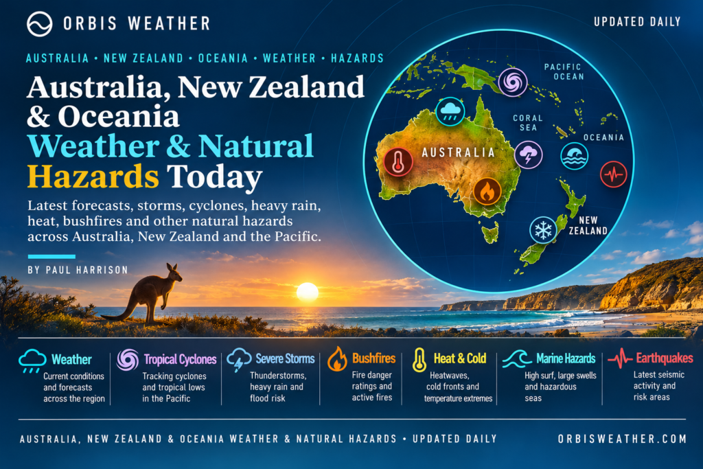
🌏 Australia, New Zealand & Oceania Weather & Natural Hazards Today
Saturday, November 7, 2026
By Paul Harrison | Orbis Weather
Regional weather intelligence covering Australia, New Zealand, Papua New Guinea, Fiji, Vanuatu, the Solomon Islands, New Caledonia, Samoa, Tonga and the wider South Pacific.
🌦️ Regional Weather Overview — Storms, Extreme Heat and Flooding Threats
Australia, New Zealand and the Pacific Islands enter Saturday, November 7, with a contrasting mix of severe weather hazards, including dangerous heatwaves, thunderstorms, localized flooding and the early stages of the South Pacific tropical cyclone season.
The two most significant confirmed weather concerns are extreme heat across northern Australia and severe thunderstorm potential across New Zealand’s North Island.
Parts of northern Australia face temperatures exceeding 40°C (104°F), while New Zealand’s MetService has issued thunderstorm watches covering extensive areas of the North Island, where intense rainfall could produce flash flooding and hazardous driving conditions.
Across the tropical Pacific, cyclone monitoring continues, although the latest available official advisories from Fiji and Vanuatu do not identify an active cyclone threat in their respective monitoring areas.
🚨 Today’s regional hazard summary
Region | Principal hazard | Outlook |
|---|---|---|
🇦🇺 Northern Australia | Extreme heat and heatwave conditions | High concern |
🇦🇺 Eastern Australia | Thunderstorms and localized heavy rain | Monitor |
🇳🇿 New Zealand North Island | Severe thunderstorms and flash flooding | Elevated concern |
🇳🇿 New Zealand South Island | Changeable spring weather | Monitor |
🇫🇯 Fiji and South Pacific | Tropical disturbances and heavy rainfall potential | Seasonal monitoring |
🇻🇺 Vanuatu | Tropical cyclone development | Low potential |
🇵🇬 Papua New Guinea | Heavy tropical rain, earthquakes and volcanoes | Ongoing monitoring |
🌊 Pacific coastal communities | Rough seas and coastal flooding potential | Check local advisories |
These categories are Orbis Weather editorial assessments, not official warning classifications. Conditions and official alerts vary significantly between locations.
🇦🇺 Australia Weather & Natural Hazards Today
🔥 Northern Territory — Severe to Extreme Heatwave
Northern Australia remains a major focus for dangerous heat.
Official Bureau of Meteorology warnings relayed by a live Australian warning service identify severe to extreme heatwave conditions affecting the Tiwi District, with maximum temperatures reaching the mid-30s to low-40s Celsius and overnight temperatures remaining unusually warm.
That represents daytime temperatures of approximately 95–106°F, with limited nighttime cooling.
The heatwave is expected to persist through the weekend and potentially into the middle of next week.
Main hazards:
Heat exhaustion and heatstroke, particularly among vulnerable residents.
Increased physical stress during outdoor work and exercise.
Warm nights limiting recovery from daytime heat.
Potential additional fire-weather concerns wherever strong winds and dry vegetation coincide.
Residents should reduce strenuous outdoor activity during the hottest hours, remain hydrated and check official heat-health advice.
🌡️ Western Australia — Kimberley Extreme Heat
The Kimberley is another significant heatwave hotspot.
Bureau of Meteorology warning information indicates maximum temperatures in the low to mid-40s Celsius, approximately 104–113°F, with overnight minimum temperatures in the mid to high 20s Celsius.
Severe to extreme heatwave conditions are expected to continue over the weekend before potentially easing early next week.
Travelers crossing remote parts of Western Australia should carry additional drinking water, monitor vehicle conditions and avoid unnecessary exposure during extreme afternoon temperatures.
In the Pilbara and inland districts, isolated thunderstorms can also develop during the warmer months. Any active thunderstorm warnings should be checked directly with the Bureau.
⛈️ Queensland — Heatwave Conditions Across Northern Districts
Queensland is experiencing another period of significant heat stress, particularly across northern and inland districts.
Official heatwave information identifies affected areas including the Peninsula, Gulf Country, Northern Goldfields and Upper Flinders, North Tropical Coast and Tablelands, Herbert and Lower Burdekin, and Central Coast and Whitsundays districts.
Inland temperatures could reach the high 30s to low 40s Celsius, approximately 99–106°F.
Locations specifically identified in warning information include Aurukun, Kowanyama, Pormpuraaw and Weipa.
High humidity can increase the impact of hot conditions, particularly near the tropical coast.
Thunderstorm risk: Afternoon thunderstorms are a recurring November hazard across tropical Queensland. Lightning, sudden heavy rain and localized flooding should be monitored, but an active severe thunderstorm warning has not been independently confirmed for every district.
🌦️ New South Wales — Spring Showers and Thunderstorm Monitoring
New South Wales remains in its spring storm season, when warm inland air can interact with changing weather systems.
The main hazards to monitor include thunderstorms, brief heavy downpours, damaging wind gusts and isolated hail.
Sydney, Newcastle, the Hunter region and inland communities should monitor local forecasts for changing conditions.
For coastal areas, beachgoers and boat operators should also check swell, wind and marine warnings before entering the water.
Forecast confidence: A statewide severe thunderstorm outbreak for Saturday has not been verified in the available official information. Any warnings should be assessed by location rather than assumed to apply across New South Wales.
🌬️ Victoria — Cooler Air and Showery Conditions
Victoria faces cooler spring conditions across several districts.
Available Saturday forecast information for Geelong indicates a high chance of showers, with southwesterly winds potentially reaching 25–35 km/h (16–22 mph) during part of the day.
The temperature range is approximately 8–15°C (46–59°F), with small hail possible in the Geelong and Surf Coast forecast district.
For Melbourne and surrounding regions, residents should remain prepared for rapidly changing spring conditions.
Outdoor activities may be affected by showers, gusty winds and cooler temperatures.
🌤️ South Australia — Changeable Spring Weather
South Australia is transitioning through its typical late-spring pattern of warmer inland conditions and cooler southern coastal weather.
Adelaide and the southeastern districts should monitor approaching frontal systems, which can bring changes in wind direction, cooler air and showers.
In northern and inland areas, heat and dry vegetation remain important considerations for bushfire preparedness.
No specific statewide severe-weather emergency has been established from the information reviewed for this report.
🌧️ Tasmania — Showers, Wind and Cool Conditions
Tasmania’s exposed coastal and highland areas remain vulnerable to rapid changes in spring weather.
Potential hazards include strong winds, showers, reduced visibility and cold conditions at elevation.
Motorists traveling through mountain districts should check forecasts before departure, while marine operators should consult official coastal wind and swell warnings.
🇳🇿 New Zealand Weather & Natural Hazards Today
⛈️ North Island — Severe Thunderstorm Watches and Flash Flood Risk
New Zealand faces one of the region’s clearest confirmed severe-weather threats for Saturday.
MetService information available Friday evening identifies severe thunderstorm watches affecting much of the North Island.
The northern watch covers areas including Northland, Auckland, the Coromandel Peninsula, Waikato, Bay of Plenty, Rotorua, Taupō and Taranaki.
Thunderstorms could produce localized rainfall rates of 25–40 mm per hour (approximately 1–1.6 inches per hour), or potentially more in some areas.
The northern thunderstorm risk is concentrated from around midnight Friday through Saturday morning.
A separate watch extends the concern into southern North Island districts, including Manawatū, Tararua, Kapiti-Horowhenua, Wairarapa and Wellington, from approximately midday through early Saturday evening.
🚨 What makes these storms dangerous?
Intense rainfall over short periods can overwhelm urban drainage systems and cause rapid rises in smaller waterways.
Potential impacts include:
Flash flooding in low-lying communities.
Surface flooding on roads and motorways.
Landslips on steep terrain.
Reduced visibility during heavy downpours.
Hazardous driving conditions around streams, valleys and flood-prone crossings.
A severe thunderstorm watch means conditions are favorable for severe thunderstorms; it does not mean every community within the watch area will experience severe weather.
Residents should monitor MetService for any escalation to localized severe thunderstorm warnings.
🌧️ Auckland, Hamilton and Tauranga
Auckland and the upper North Island should be particularly alert during the overnight and morning period.
Hamilton, Tauranga and surrounding districts also face potential thunderstorms and localized heavy rain.
The main concern is the intensity of individual downpours rather than a guarantee of widespread flooding.
🌬️ Wellington and the Lower North Island
Wellington and surrounding districts face a later period of thunderstorm concern on Saturday.
The potential for intense rainfall makes local drainage, hillside stability and road conditions important considerations.
Travelers should allow additional time and avoid driving through floodwater.
🏔️ South Island — Changeable Conditions
The South Island remains subject to variable spring weather, particularly in alpine and exposed coastal areas.
Mountain travelers should remain prepared for cold temperatures, sudden wind changes, rain and reduced visibility.
No comparable island-wide severe thunderstorm watch for the South Island was identified in the warning information reviewed for this edition.
🔭 New Zealand Outlook — Sunday to Tuesday
MetService’s extended outlook indicates the main trough should move eastward on Sunday, November 8, with a weak ridge developing.
Further unsettled conditions may return early next week as additional troughs approach from the Tasman Sea.
Rainfall concerns could increase again in parts of the northern North Island on Monday and Tuesday, although confidence in warning-level rainfall remains limited.
🌀 South Pacific Tropical Cyclone Outlook
🇫🇯 Fiji — No Significant Tropical Disturbance Identified
The Fiji Meteorological Service’s Regional Specialized Meteorological Centre in Nadi reports no significant tropical disturbance analyzed or forecast across its monitored region, extending from the equator to 25°S and 160°E to 120°W.
The bulletin was issued November 5 at 22:15 UTC, corresponding to November 6 in Fiji.
This is encouraging as the South Pacific approaches the more active portion of its cyclone season.
However, the absence of a significant tropical disturbance does not eliminate the possibility of heavy showers, thunderstorms or localized flooding from ordinary tropical weather systems.
Residents of Suva, Nadi, Lautoka and surrounding islands should continue monitoring local rainfall and marine advisories.
🇻🇺 Vanuatu — Tropical Cyclone Development Potential Remains Low
The Vanuatu Meteorology and Geo-Hazards Department’s November 6 outlook reports:
No existing tropical cyclones within its area of responsibility.
Low potential for tropical low or cyclone development over the following five days.
Low cyclone likelihood for Saturday through Wednesday.
The agency defines its low category as a 10–30% probability.
Although tropical cyclone development is currently assessed as unlikely, Vanuatu remains exposed to heavy rainfall, localized flooding and geological hazards.
🇸🇧 Solomon Islands — Heavy Rain and Coastal Hazards
The Solomon Islands remain within a tropical environment where thunderstorms and periods of intense rainfall can develop quickly.
Communities around Honiara, Guadalcanal and the western islands should monitor local forecasts for heavy showers, lightning and possible flash flooding.
Mountainous terrain increases the potential for landslides following prolonged rainfall.
No specific nationwide severe-weather warning has been verified for Saturday in the sources reviewed.
🇳🇨 New Caledonia — Tropical Weather Monitoring
New Caledonia is entering the Southern Hemisphere’s warmer and wetter season.
Nouméa and surrounding coastal communities should monitor rainfall, thunderstorm development and marine conditions.
Heavy showers can cause localized flooding, particularly in areas with steep terrain or inadequate drainage.
A significant tropical cyclone threat has not been established for New Caledonia in the information reviewed for this report.
🇼🇸 Samoa and 🇹🇴 Tonga — Rainfall and Marine Conditions
Samoa and Tonga remain vulnerable to tropical downpours, thunderstorms, strong coastal winds and dangerous seas during the warmer months.
The most important considerations for island communities include local flood alerts, swell forecasts and any newly developing tropical disturbances.
For Saturday, specific rainfall totals, wave heights and active warnings have not been independently verified.
Residents and maritime operators should consult their national meteorological services for the latest local conditions.
🇵🇬 Papua New Guinea — Weather and Geological Hazards
🌧️ Tropical Rainfall and Flash Flooding
Papua New Guinea’s tropical climate and mountainous terrain create significant exposure to rainfall-related hazards.
Areas including Port Moresby, Lae, Madang and the Highlands can experience rapidly changing conditions, particularly where thunderstorms develop over steep terrain.
Heavy rain can trigger flash flooding, river rises and landslides, while remote road networks may become difficult to access.
These are ongoing regional vulnerabilities rather than confirmation of widespread flooding on Saturday.
🌎 Earthquake Recorded Near Lae
The United States Geological Survey recorded a magnitude 4.6 earthquake approximately 96 km (60 miles) north-northwest of Lae on November 6 at 00:02 UTC.
The reported depth was approximately 97.8 km (61 miles).
This is a confirmed seismic event, although no major damage or tsunami impact has been established from the information reviewed.
Papua New Guinea lies along an active tectonic boundary, where earthquakes and volcanic activity are recurring natural hazards.
🌋 Earthquakes, Volcanoes and Tsunami Monitoring
🌎 Recent Pacific Earthquake Activity
Seismic monitoring has identified several earthquakes across the southwestern Pacific during November 5–6.
Location | Magnitude | Reported depth |
|---|---|---|
Fiji Islands region | 6.1 | 530 km |
Papua New Guinea region | 4.8 | 111 km |
Vanuatu Islands | 4.8 | 68 km |
Vanuatu Islands | 4.5 | 242 km |
Values from the GFZ GEOFON earthquake catalogue; preliminary magnitudes and depths can differ between seismic agencies.
🌊 Why earthquake depth matters
The magnitude 6.1 earthquake in the Fiji Islands region occurred at a considerable depth of approximately 530 km (329 miles).
Deep earthquakes can be detected across large areas but generally present a different surface-impact profile from shallow earthquakes of similar magnitude.
A deep earthquake does not automatically generate a tsunami. Tsunami generation is generally associated with significant displacement of the seafloor, most commonly during shallower undersea earthquakes.
No tsunami warning is being claimed for these events in this report. Readers should use the Pacific Tsunami Warning Center and national emergency agencies for authoritative tsunami information.
🌋 Volcano Monitoring
Papua New Guinea and Vanuatu contain some of the most geologically active volcanic areas in the southwest Pacific.
Volcanoes requiring ongoing monitoring include:
Mount Ulawun and Manam in Papua New Guinea.
Mount Yasur and Ambrym in Vanuatu.
Other active volcanic systems along the Melanesian island arc.
Potential hazards include volcanic ash, gas emissions, explosions and aviation disruption.
An active eruption or ash advisory for Saturday has not been independently confirmed for these volcanoes. Their inclusion reflects their geological importance, not a declaration of new eruptive activity.
🔥 Australia Bushfire and Heat Risk
Australia’s approaching summer brings increasing attention to bushfire conditions.
Extreme heat is already a significant concern across parts of Western Australia, the Northern Territory and Queensland.
However, heatwave warnings and bushfire warnings are not interchangeable.
Bushfire danger depends on several interacting factors, including temperature, relative humidity, wind speed, vegetation dryness and existing fire activity.
During the coming days, the principal fire-weather monitoring priorities are northern and inland Australia, where persistent heat could combine with dry fuels and stronger winds.
Residents should consult their state fire and emergency agencies for official fire danger ratings, active incidents and evacuation instructions.
🌊 Marine, Coastal and Ocean Hazards
Marine conditions remain an important consideration across Australia, New Zealand and the Pacific Islands.
Australian coastlines
Strong winds, changing swell and thunderstorms can create dangerous conditions for recreational boaters and swimmers.
Exposed coastlines may experience rapidly changing surf conditions, even when nearby inland weather appears relatively settled.
New Zealand coastal waters
The unsettled weather pattern affecting the North Island may also produce locally difficult marine conditions.
Boaters should consult MetService marine forecasts, particularly where thunderstorms or frontal systems are approaching.
Pacific Islands
Small island communities are especially vulnerable to high surf, coastal inundation and interruptions to maritime transport.
The absence of a tropical cyclone does not guarantee safe sea conditions.
Local marine warnings should always take priority over broad regional summaries.
📅 Regional Weather and Natural Hazards Outlook — November 7–11
Date | Main areas to monitor | Primary concern |
|---|---|---|
Sat, Nov 7 | Northern Australia, New Zealand North Island | Extreme heat, severe thunderstorms |
Sun, Nov 8 | Northern Australia, New Zealand | Persistent heat, easing NZ trough |
Mon, Nov 9 | Kimberley, Northern Territory, northern NZ | Heatwave conditions, possible renewed rain |
Tue, Nov 10 | Northern Australia, New Zealand North Island | Continued heat, approaching NZ trough |
Wed, Nov 11 | Northern Australia, South Pacific | Heatwave monitoring, tropical development potential |
This is a regional planning outlook, not a location-specific five-day forecast. The greatest forecast confidence applies to the documented heatwave warnings and New Zealand’s near-term thunderstorm outlook. Longer-range conditions are subject to change.
🛡️ Safety and Preparedness
Residents and travelers across the region should take practical precautions appropriate to their local hazards.
During extreme heat: Stay hydrated, limit strenuous outdoor activity, check on vulnerable neighbors and never leave children or animals inside parked vehicles.
During severe thunderstorms: Move indoors, avoid exposed locations and do not drive through floodwater.
During heavy rainfall: Monitor river conditions, avoid flooded roads and remain alert to landslides in mountainous terrain.
During earthquakes: Drop, Cover and Hold On. In coastal areas, follow local tsunami evacuation guidance if strong or prolonged shaking occurs.
During volcanic activity: Follow local exclusion zones and official aviation or ashfall advisories.
🔗 Official Weather and Natural Hazard Sources
Orbis Weather recommends the following agencies for official forecasts, observations and warnings.
Agency | Coverage |
|---|---|
Australia weather, heatwaves, severe storms and tropical cyclones | |
New Zealand forecasts, warnings and marine conditions | |
Fiji and South Pacific tropical cyclone monitoring | |
Vanuatu weather, cyclone and geological hazards | |
Papua New Guinea weather information | |
Earthquake detection and seismic information | |
International earthquake monitoring | |
Tsunami alerts and bulletins | |
New Zealand earthquakes and volcanic activity | |
American Pacific territories, including Guam and the Northern Mariana Islands |
📰 Orbis Weather Editorial Methodology and Data Transparency
Prepared by Paul Harrison | Orbis Weather
This report combines available official meteorological warnings, published forecasts, earthquake monitoring data and regional hazard assessments to provide a consolidated overview of weather and natural hazards across Australia, New Zealand and Oceania.
How this report is prepared
Official national meteorological agencies are prioritized for severe-weather information. Earthquake information is sourced from recognized seismic monitoring organizations, while tropical cyclone assessments are based on advisories from responsible regional warning centers.
The report distinguishes between:
Confirmed observations: Events or measurements documented by recognized monitoring agencies.
Official warnings and watches: Alerts issued by responsible authorities.
Forecast risks: Potential future conditions supported by published forecasts.
Seasonal hazards: Recurring regional risks that are not necessarily active at publication time.
A seasonal risk should never be interpreted as an active emergency warning.
Forecast limitations
Weather forecasts can change rapidly, particularly in tropical environments and mountainous regions.
The geographic size of Oceania also means that a regional report cannot represent conditions at every island, town or coastal location.
Temperature values are provided in Celsius and Fahrenheit where relevant. Rainfall and earthquake measurements are converted or rounded for readability.
Some official advisories may be updated after this article is prepared. Where current warnings could not be independently verified, this report avoids claiming that they are active.
Corrections and updates
Orbis Weather aims to correct material factual errors promptly and to distinguish updated information from earlier forecasts.
Readers should consult official emergency agencies when decisions involve personal safety, evacuation, marine travel or severe weather.
Reporting period: Saturday, November 7, 2026, local date across Australia, New Zealand and the South Pacific.
Information cutoff: November 6, 2026, approximately 16:00 UTC. Saturday forecasts are forward-looking where the local date had not yet begun at the reporting cutoff.
🌏 Final Outlook — What Matters Most Today?
Three developments deserve particular attention as the region moves into the weekend.
First, northern Australia’s heatwave remains a serious health concern. Parts of Western Australia, the Northern Territory and Queensland are experiencing or expecting exceptionally high temperatures, with some districts facing conditions exceeding 40°C (104°F).
Second, New Zealand’s North Island faces a significant thunderstorm and localized flash-flooding threat. MetService watches identify intense rainfall as the main danger, especially during Saturday morning in northern districts and later in the day farther south.
Third, the South Pacific cyclone season requires continued monitoring, even though the latest available Fiji and Vanuatu outlooks do not identify an immediate significant cyclone threat.
Meanwhile, earthquakes recorded around Papua New Guinea, Vanuatu and Fiji demonstrate the continuing geological activity of the southwest Pacific.
For Orbis Weather, the priority remains clear: distinguish confirmed hazards from developing threats, monitor official warning agencies and provide readers with practical information as conditions evolve.
Orbis Weather — Tracking Our Changing Planet.
By Paul Harrison | Orbis Weather
Editorial note: This report provides general weather and natural hazard information. It does not replace official warnings, emergency instructions or location-specific forecasts.
About the Author
Paul Harrison — Founder & Publisher, Orbis Weather
Paul Harrison founded Orbis Weather in 2026 to make global weather and natural-hazard information easier to find, follow and understand. His coverage includes tropical cyclones, severe weather, extreme temperatures, earthquakes, volcanoes, wildfires, flooding and significant natural disasters worldwide.
View all articles by Paul Harrison → | Editorial Standards →
Global Weather Tracker Hub
Explore weather maps, tropical systems, storms and natural hazards around the world.
No matching trackers found.