
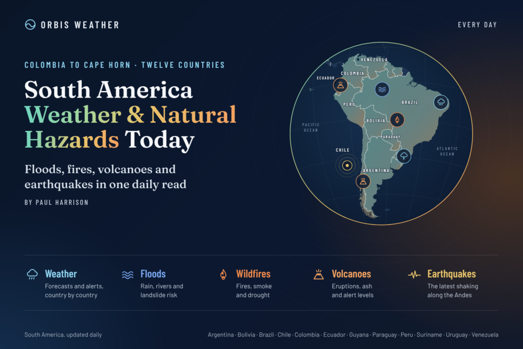
South America Weather & Natural Hazards Today
By Paul Harrison | Founder & Publisher, Orbis Weather

- Deadly Floods Hit Iraq as Powerful Thunderstorms Sweep Across the Region 8:58 AM
- North America Weather & Natural Hazards Today — November 9, 2026 8:23 AM
- Central America Weather & Natural Hazards Today – November 9, 2026 8:14 AM
- South America Weather & Natural Hazards Today — Monday, November 9, 2026 8:06 AM
- Daily Earthquakes, Storms, Fires & Floods Report — November 9, 2026 7:47 AM
- Weekly Global Weather Watch: Weekly Analysis, November 9, 2026 7:29 AM
- Tropical Atlantic Daily Report: Monday, November 9, 2026 6:59 AM
- Eastern & Central Pacific Tropical Weather Update: Monday, November 9, 2026 6:51 AM
- WESTERN PACIFIC Tropical Weather Update – November 9, 2026 6:17 AM





South America Weather & Natural Hazards Today — Monday, November 9, 2026
Heavy Rain Threatens Peru, Flood Alerts Intensify in Chile, and Thunderstorm Warnings Cover Large Parts of Brazil
By Paul Harrison | Founder & Publisher, Orbis Weather
Published: Monday, November 9, 2026
Region: South America
Coverage: Brazil, Argentina, Chile, Peru, Colombia, Ecuador, Bolivia, Paraguay, Uruguay, Venezuela, Guyana, Suriname and French Guiana.
South America Weather Overview
South America begins the new week facing a mixture of severe thunderstorms, flooding, mountain hazards and ongoing recovery from destructive storms.
The most significant developments for Monday, November 9, include heavy rainfall warnings in Peru, flooding and thunderstorm alerts in Chile, and a broad storm warning across central and southeastern Brazil.
In Peru, the national meteorological service SENAMHI has issued warnings covering November 9–11, including potentially intense rainfall along the northern coast and in the Andes. In Chile, authorities are responding to river flooding in Coquimbo while another weather system threatens central regions. Brazil’s INMET has issued a November 9 thunderstorm warning covering numerous inland and southeastern districts.
These developments follow a turbulent period across the continent, including damaging storms in southern Brazil and flooding concerns in Colombia.
Today’s Orbis Weather report examines the principal weather threats, country-by-country conditions, flood risks, geological hazards and the outlook through Wednesday, November 11.
Today’s Main Weather and Natural Hazard Alerts
Country / Region | Primary concern | Current assessment |
|---|---|---|
🇵🇪 Peru | Heavy rain, flash floods, landslides | Official rainfall warnings |
🇨🇱 Chile | River flooding, thunderstorms | Red alerts in parts of Coquimbo |
🇧🇷 Brazil | Thunderstorms, wind, hail | INMET yellow-level warning |
🇨🇴 Colombia | Flooding, landslides | Ongoing flood monitoring |
🇻🇪 Venezuela | Flooding, river conditions | GDACS flood report |
🇦🇷 Argentina | Thunderstorms, river conditions | Regional monitoring |
🇪🇨 Ecuador | Rainfall, landslide susceptibility | Seasonal monitoring |
🇧🇴 Bolivia | Thunderstorms, mountain rainfall | Regional monitoring |
🇵🇾 Paraguay | River levels, thunderstorms | Monitoring |
🇺🇾 Uruguay | Rainfall, river flooding | Monitoring |
🇬🇾 Guyana, 🇸🇷 Suriname and French Guiana | Tropical rainfall, drought conditions | Regional monitoring |
Important: These assessments are not uniform official alert classifications. Confirm current warning status with the relevant national weather or civil defense agency.
🇵🇪 Peru: Heavy Rainfall Warnings for November 9–11
Peru faces one of South America’s more significant officially documented rainfall threats today.
According to reporting based on SENAMHI meteorological notice No. 462, rainfall from Monday through Wednesday could range from light to heavy in the Andean highlands, with strong to extreme rainfall forecast along the northern coast.
Northern Peru is particularly vulnerable to flooding because intense rain can rapidly overwhelm normally dry drainage channels.
In Tumbes, heavy rain on November 7 triggered flows through several ravines in the Casitas district, damaging a local road and interrupting traffic near Cañaveral.
Reported rainfall also reached 44.2 mm (1.74 inches) at Huásimo in Tumbes.
Separately, SENAMHI notice No. 461 identified strong winds exceeding 55 km/h (34 mph) across parts of the central and southern Peruvian Amazon.
Areas requiring attention
Tumbes and Piura: Intense coastal rainfall, flash flooding and overflowing drainage channels.
Andean highlands: Heavy rain, unstable slopes and possible landslides.
Cusco, Huánuco, Junín, Madre de Dios, Puno and Ucayali: Strong-wind concerns in areas covered by the Amazon warning.
Mountain communities should pay particular attention to road conditions, especially where steep slopes, saturated ground and narrow river valleys increase the consequences of heavy rainfall.
Travelers should check SENAMHI notices and local civil defense information before using mountain roads.
🇨🇱 Chile: Red Flood Alerts and Thunderstorms in Central Regions
Chile is experiencing two distinct weather threats: river flooding in the north-central Coquimbo Region and approaching thunderstorms farther south.
Reports dated November 9 indicate that Chile’s disaster agency SENAPRED declared red alerts for Monte Patria and Río Hurtado because of overflowing rivers and streams. Salamanca was placed under a yellow alert.
The flooding is associated with snowmelt and increased runoff from mountain catchments.
Meanwhile, Chile’s meteorological service warned of thunderstorms and periods of rain from Monday afternoon into early Tuesday across Valparaíso, the Metropolitan Region, O’Higgins and Maule.
The approaching system is described as a cut-off low, a weather pattern capable of producing localized heavy precipitation and thunderstorms.
Main hazards
Coquimbo Region: Flooding and dangerous river conditions, especially around Monte Patria and Río Hurtado.
Santiago and central Chile: Thunderstorms, localized heavy rain and potentially difficult travel conditions.
Andean foothills: Rapid changes in stream levels, slippery roads and localized runoff.
Flooding from mountain snowmelt can continue even where rainfall is limited at lower elevations.
Residents should avoid river crossings and follow instructions from SENAPRED.
🇧🇷 Brazil: Widespread Thunderstorm Warning
Brazil remains a major weather concern following destructive storms earlier in November.
For Monday, November 9, the National Institute of Meteorology (INMET) has published a yellow-level potential dangerthunderstorm warning across a large area of central and southeastern Brazil.
The official warning lists the following possible conditions:
Weather hazard | Forecast potential |
|---|---|
Rainfall intensity | 20–30 mm per hour (0.8–1.2 inches) |
Daily rainfall | Up to 50 mm (2 inches) |
Wind gusts | 40–60 km/h (25–37 mph) |
Hail | Possible |
Secondary impacts | Local flooding, fallen branches, crop damage, isolated power interruptions |
Affected areas include portions of Goiás, Minas Gerais, Espírito Santo, Bahia, Tocantins, Mato Grosso and the Federal District, among other districts listed in the warning.
The notice runs from 12:00 a.m. through 11:59 p.m. local Brazilian time on November 9.
Southern Brazil: Storm recovery continues
Paraná, Santa Catarina and Rio Grande do Sul have experienced destructive weather during the first part of November.
Damaging thunderstorms, hail and strong winds have affected communities, while heavy rainfall has increased concerns about localized flooding and damaged infrastructure.
The most important considerations for recovering communities include downed power lines, weakened trees, damaged roofs, blocked drainage and the potential for additional rain to complicate repairs.
Rio de Janeiro: Aftermath of November 7 storm
A powerful storm affected Rio de Janeiro and surrounding coastal communities on Saturday, November 7.
Reported impacts included wind gusts exceeding 80 km/h (50 mph), neighborhood flooding, damage to electrical infrastructure and temporary disruption on the Rio–Niterói Bridge.
The immediate priority is recovery and monitoring for further hazards, rather than assuming the November 7 storm conditions remain in force today.
Amazon Basin and central Brazil
November marks the approach of the Southern Hemisphere summer, when increasing heat and atmospheric moisture support thunderstorms across much of central Brazil and the Amazon Basin.
Storms can produce intense rainfall over relatively small areas, meaning one community may experience flooding while another nearby receives much less rain.
Official alerts should be consulted before treating any seasonal risk as a confirmed local threat.
🇨🇴 Colombia: Hundreds of Municipalities Face Landslide Risk
Colombia is experiencing widespread rainfall-related hazards, with official monitoring highlighting a significant threat of landslides and flooding.
According to a November 9 report based on Colombia’s Institute of Hydrology, Meteorology and Environmental Studies (IDEAM), 584 municipalities face potential landslide threats, while 213 hydrological subzones are under flood-related alerts.
The Pacific region experienced thunderstorms during the early hours of Monday, although other areas began the day relatively dry.
Rainfall is expected to develop or continue in parts of Chocó, Antioquia, Risaralda, Boyacá, Santander, Cauca, Valle del Cauca and Nariño.
The Amazon region could also experience scattered rain, particularly around Caquetá and Putumayo.
Bogotá forecast
Bogotá is expected to experience predominantly dry conditions with partly cloudy skies and a forecast maximum of approximately 21°C (70°F).
However, conditions elsewhere in the Colombian Andes can differ considerably because of elevation and localized rainfall.
Flood and landslide concerns
The principal dangers include rapidly rising streams, unstable hillsides, debris flows and transportation disruption.
Residents living near steep slopes or riverbanks should monitor IDEAM and local emergency management alerts.
🇦🇷 Argentina: Strong Winds, Mountain Snow and Rainfall Warnings
Argentina’s National Meteorological Service (SMN) has issued yellow-level warnings for Monday, November 9, covering portions of eight provinces.
The primary threats are strong winds, mountain snowfall and rain in southern Patagonia.
Wind warnings
Affected areas include parts of Córdoba, Catamarca, La Rioja, San Luis, La Pampa, Santa Cruz and Tierra del Fuego.
Forecast winds could reach 40–80 km/h (25–50 mph), with gusts potentially exceeding 90 km/h (56 mph).
Snow in Mendoza
Northwestern Mendoza faces snowfall of approximately 5–15 cm (2–6 inches), with locally higher accumulations possible.
Mountain travel may be affected by snow, ice and poor visibility.
Rain in Santa Cruz
Southwestern Santa Cruz could receive 10–30 mm (0.4–1.2 inches) of precipitation, with higher amounts in elevated terrain and a mixture of rain and snow possible.
Buenos Aires, meanwhile, is forecast to enjoy largely clear conditions, with temperatures around 14–25°C (57–77°F).
🇵🇾 Paraguay: Monitoring After Recent Severe Thunderstorms
Paraguay experienced significant thunderstorm activity over the weekend.
On November 7, the Directorate of Meteorology and Hydrology warned of strong thunderstorms, gusty winds and possible hail affecting Asunción and eight departments in eastern Paraguay.
Affected areas included Central, Cordillera, Guairá, Caaguazú, Caazapá, Itapúa, Paraguarí and Alto Paraná.
Conditions were expected to improve in many areas from Sunday, although scattered rainfall remained possible in the Chaco and northern eastern region.
For November 9, residents should check updated forecasts rather than assume Saturday’s warnings remain active.
River levels, drainage conditions and additional thunderstorm development remain important monitoring considerations.
🇺🇾 Uruguay: River Conditions and Changing Spring Weather
Uruguay’s weather is influenced by frontal systems crossing southern South America, with the potential for alternating warm conditions, showers and thunderstorms during spring.
Recent unsettled conditions across the wider Río de la Plata basin make river levels and localized drainage important considerations.
However, a specific nationwide severe weather warning for Uruguay on November 9 was not independently confirmed for this report.
Residents should consult the Uruguayan Meteorological Institute (INUMET) for local rainfall forecasts, wind warnings and thunderstorm alerts.
🇪🇨 Ecuador: Rainfall Concerns and Galápagos Flood Recovery
Ecuador remains vulnerable to heavy tropical rainfall, particularly along the Pacific coast and western Andean slopes.
The Galápagos Islands have also experienced significant flooding.
Heavy rainfall on October 31 affected Santa Cruz Island, prompting emergency response measures.
Reporting on November 8 described the activation of a $2 million emergency fund to assist with the consequences of the flooding, including an initial allocation of $500,000 for priority needs.
Ecuadorian authorities have also mobilized humanitarian assistance to the affected islands.
On the mainland, the principal hazards to monitor include intense downpours, flash flooding and landslides in mountainous areas.
The National Institute of Meteorology and Hydrology (INAMHI) provides official warnings and forecasts.
🇧🇴 Bolivia: Rainy-Season Hazards Developing
Bolivia is approaching the wetter part of its annual weather cycle.
Thunderstorms can develop across the eastern lowlands, while intense rainfall in the Andes may produce rapid runoff into narrow valleys.
Important areas to monitor include La Paz, Cochabamba, Santa Cruz and the Amazonian departments of Beni and Pando.
Potential seasonal hazards include flash flooding, river rises, landslides and lightning.
These are general seasonal risks, not confirmation of active November 9 warnings.
Bolivia’s National Meteorology and Hydrology Service (SENAMHI) should be consulted for current local alerts.
🇻🇪 Venezuela: Flood Monitoring Continues
Venezuela appears in the Global Disaster Alert and Coordination System’s November 9 flood reporting.
The GDACS feed retrieved early Monday included a green-level flood report for Venezuela.
A green classification generally indicates a lower assessed humanitarian impact than higher-level GDACS alerts. It does not mean individual communities are free from danger.
River conditions, local rainfall and access to remote communities remain important considerations.
No specific nationwide rainfall total or evacuation figure was independently verified for this report.
🇬🇾 Guyana, 🇸🇷 Suriname and French Guiana: Tropical Rainfall and Drought Monitoring
Northern South America’s tropical climate can produce sharp contrasts between intense local rainfall and longer-term rainfall deficits.
GDACS drought monitoring published November 9 includes parts of Guyana, Suriname and French Guiana within a wider multinational assessment.
Drought monitoring should not be confused with a same-day weather warning. It describes longer-term conditions rather than whether rain will occur today.
Communities should monitor local rainfall, river levels and water-resource guidance.
South America Earthquake and Volcano Monitoring
South America lies along one of the world’s most active tectonic boundaries.
The Nazca Plate subducts beneath the South American Plate, creating significant earthquake and volcanic hazards along the western margin of the continent.
Earthquake monitoring
Region | Principal geological hazard |
|---|---|
Chile | Large earthquakes and possible tsunamis |
Peru | Earthquakes, coastal tsunami hazards |
Ecuador | Earthquakes and volcanic activity |
Colombia | Earthquakes and active volcanoes |
Bolivia | Deep and intermediate-depth earthquakes |
Argentina | Earthquakes along western mountain regions |
Earthquake verification: A complete, validated list of earthquakes recorded during the previous 24 hours was not available for this report. No claim is made that the continent experienced no significant earthquakes.
For verified earthquake magnitudes, depths and locations, consult the USGS Earthquake Hazards Program.
Volcano monitoring
Important volcanic systems requiring ongoing observation include Sabancaya in Peru, Puracé in Colombia, and active volcanic complexes along the Chilean Andes.
Volcanic hazards may include ash emissions, volcanic gases, aviation disruption and lahars, depending on the individual volcano and its current activity.
This report does not independently establish new eruptions or changes in alert level on November 9.
Current conditions should be verified through Peru’s IGP, Colombia’s Geological Service, Chile’s SERNAGEOMIN and the Smithsonian Global Volcanism Program.
Wildfires, Drought and Air Quality
Wildfire susceptibility varies considerably across South America.
Hot, dry and windy weather can increase fire danger in grassland, forest and agricultural regions. Conversely, persistent rainfall may reduce immediate fire risk while increasing flood and landslide hazards.
The November 9 GDACS monitoring feed identifies ongoing drought assessments involving Brazil and portions of northern South America.
Drought conditions can increase pressure on water supplies, agriculture and vegetation.
However, no verified continent-wide count of active wildfires or current air-quality measurements was available for inclusion today.
Residents should use national environmental agencies and satellite-based fire monitoring systems for the latest observations.
El Niño: Why South America’s Weather Could Become More Extreme
El Niño is an important influence on South America’s seasonal weather patterns.
The phenomenon involves unusually warm sea-surface temperatures across the central and eastern equatorial Pacific, affecting atmospheric circulation and rainfall patterns worldwide.
Its effects are not uniform across South America.
In some circumstances, El Niño increases the likelihood of heavy rainfall in coastal Ecuador and Peru and parts of southeastern South America. Other regions may experience increased drought susceptibility.
Recent reporting describes a strengthening El Niño episode expected to influence the 2026–2027 season.
However, El Niño does not directly explain every flood, thunderstorm or weather emergency.
Local atmospheric conditions, terrain, moisture and individual weather systems remain essential to understanding specific events.
South America Weather Outlook: November 9–11, 2026
Date | Regions to watch | Main hazards |
|---|---|---|
Monday, Nov. 9 | Peru, Chile, Brazil, Colombia, Argentina | Heavy rain, flooding, thunderstorms, strong winds and mountain snow |
Tuesday, Nov. 10 | Peru, central Chile, Colombia | Continuing rainfall warnings, river levels and landslide susceptibility |
Wednesday, Nov. 11 | Peru and wider Andean region | Rainfall monitoring and mountain travel conditions |
The Peru rainfall warning extends through November 11, while Chile’s central-region thunderstorm threat extends into early Tuesday.
Elsewhere, the table identifies monitoring priorities rather than confirmed daily severe-weather forecasts. Updated national bulletins will be necessary to assess conditions as the week progresses.
Weather and Natural Hazard Safety
Across South America, the most important precautions depend on local conditions.
Flooding: Never drive or walk through fast-moving floodwater.
Landslides: Avoid unstable slopes, especially after prolonged rainfall.
Thunderstorms: Move indoors when lightning or thunder is present.
Strong winds: Secure outdoor objects and avoid damaged trees and electrical infrastructure.
Mountain snow: Check road conditions and carry appropriate emergency supplies.
Earthquakes: Drop, cover and hold on during shaking.
Tsunamis: After strong or prolonged coastal earthquake shaking, move to higher ground without waiting for an official warning.
Volcanic ash: Follow evacuation instructions and use appropriate respiratory protection when advised.
Emergency instructions from local authorities always take priority over regional weather reporting.
Official Weather and Natural Hazard Sources
Orbis Weather uses national meteorological agencies, geological monitoring organizations and established international hazard information systems.
Organization | Coverage | Official website |
|---|---|---|
INMET | Brazil weather warnings | |
SENAMHI Peru | Peru weather and rainfall | |
SENAPRED | Chile disaster alerts | |
IDEAM | Colombia weather and hydrology | |
SMN Argentina | Argentina forecasts and warnings | |
INUMET | Uruguay weather | |
USGS | Earthquake monitoring | |
GDACS | International disaster monitoring | |
Smithsonian GVP | Global volcano monitoring | |
WMO | Global climate and weather |
Additional reporting consulted
Today’s report also incorporates dated reporting from El Comercio Perú, Semana, La Nación, ABC Color, Viajando Chile and Clarín where relevant, distinguishing those reports from direct official bulletins.
Orbis Weather Editorial Methodology
Orbis Weather produces independently written regional weather and natural hazard reports to help readers understand important environmental developments.
Our editorial approach includes:
Source verification: Prioritizing national meteorological agencies, geological services, disaster authorities and recognized international monitoring organizations.
Clear distinctions: Separating confirmed events, official warnings, forecasts, seasonal risks and unverified developments.
Geographic context: Explaining how weather and natural hazards differ across countries, regions and landscapes.
Original analysis: Providing explanations of weather patterns, flood susceptibility, geographical exposure and potential consequences rather than simply reproducing agency bulletins.
Corrections and updates: Revising information when new official data becomes available or earlier reporting is corrected.
Transparency: Identifying when complete observations, current measurements or official confirmations are unavailable.
This report was prepared using information available on the morning of November 9, 2026, Eastern Standard Time. Publication timing and local time zones may affect the status of individual warnings.
Final Outlook: Flooding and Severe Weather Lead South America’s Hazards
South America’s weather concerns for Monday, November 9, are concentrated in several distinct regions.
Peru faces officially forecast heavy rainfall, with particular concern for the northern coast and Andean highlands.
Chile is responding to serious river flooding in Coquimbo while thunderstorms threaten central regions.
Brazil remains vulnerable to damaging thunderstorms, including hail, strong winds and localized flooding.
Colombia continues to monitor widespread landslide and flood threats, while Argentina faces strong winds, mountain snow and rainfall warnings across several provinces.
The broader picture illustrates the variety of natural hazards affecting South America as the Southern Hemisphere moves toward summer.
Orbis Weather will continue tracking significant developments across the continent, with emphasis on official warnings, verified impacts and practical information for residents and travelers.
About the Author
Paul Harrison — Founder & Publisher, Orbis Weather
Paul Harrison founded Orbis Weather in 2026 to make global weather and natural-hazard information easier to find, follow and understand. His coverage includes tropical cyclones, severe weather, extreme temperatures, earthquakes, volcanoes, wildfires, flooding and significant natural disasters worldwide.
View all articles by Paul Harrison → | Editorial Standards →
Global Weather Tracker Hub
Explore weather maps, tropical systems, storms and natural hazards around the world.
No matching trackers found.