
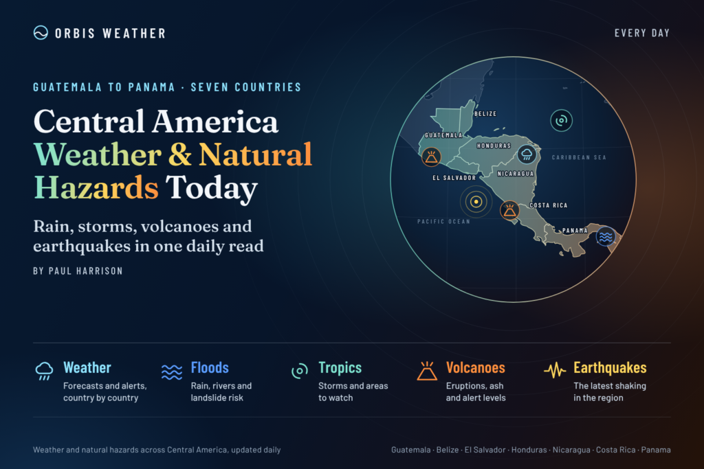
Central America Weather & Natural Hazards Today
By Paul Harrison | Founder & Publisher, Orbis Weather

- Deadly Floods Hit Iraq as Powerful Thunderstorms Sweep Across the Region 8:58 AM
- North America Weather & Natural Hazards Today — November 9, 2026 8:23 AM
- Central America Weather & Natural Hazards Today – November 9, 2026 8:14 AM
- South America Weather & Natural Hazards Today — Monday, November 9, 2026 8:06 AM
- Daily Earthquakes, Storms, Fires & Floods Report — November 9, 2026 7:47 AM
- Weekly Global Weather Watch: Weekly Analysis, November 9, 2026 7:29 AM
- Tropical Atlantic Daily Report: Monday, November 9, 2026 6:59 AM
- Eastern & Central Pacific Tropical Weather Update: Monday, November 9, 2026 6:51 AM
- WESTERN PACIFIC Tropical Weather Update – November 9, 2026 6:17 AM





Central America Weather & Natural Hazards Today – November 9, 2026
Orbis Weather | Daily Regional Weather & Natural Hazards Report
By Paul Harrison | Orbis Weather
Monday, November 9, 2026
Heavy Rain, Pacific Low Pressure and Flooding Concerns Across Central America
Central America begins the new week with unsettled weather, as a developing area of low pressure over the eastern Pacific contributes to heavy rainfall, thunderstorms and concerns about flash flooding and landslides.
The greatest immediate concerns are concentrated along parts of the Pacific side of the region, particularly Costa Rica, Nicaragua, El Salvador and southern Honduras. Mountainous communities, riverside settlements and locations with saturated soils face additional hazards.
The U.S. National Hurricane Center (NHC) has been monitoring a low-pressure disturbance offshore of Nicaragua and El Salvador. Although its prospects for tropical cyclone development have diminished, the system remains capable of producing heavy rainfall.
Meanwhile, Costa Rica’s national meteorological institute has issued updates concerning low pressure near Guanacaste, and Honduran authorities have warned of possible flooding and landslides during November 8–9.
This report covers Belize, Guatemala, Honduras, El Salvador, Nicaragua, Costa Rica and Panama, with particular attention to rainfall, flooding, landslides, tropical activity, earthquakes, volcanic hazards and marine conditions.
Today’s Main Weather and Hazard Headlines
🌧️ Heavy rainfall: Pacific-facing areas of Central America face the most significant immediate rainfall concerns.
⚠️ Flooding: Rapid rises in streams and rivers are possible where persistent thunderstorms develop.
⛰️ Landslides: Steep terrain and saturated slopes require particular attention.
🌀 Tropical disturbance: A low-pressure system offshore of Nicaragua and El Salvador has a low probability of becoming a tropical cyclone.
🌊 Marine conditions: Showers, thunderstorms and locally hazardous conditions remain possible near the Pacific disturbance.
🌋 Volcanoes and earthquakes: Central America’s active tectonic and volcanic zones require continued monitoring, independently of the current weather.
1. Tropical Weather Outlook – Caribbean Sea and Eastern Pacific
Eastern Pacific: Low Pressure Offshore of Central America
The National Hurricane Center’s late November 8 outlook identified disturbance EP96, more than 100 miles offshore of Nicaragua and El Salvador.
Satellite-derived wind observations indicated a defined circulation, with winds around 30–35 mph (48–56 km/h) near the center. However, associated thunderstorms had become less organized.
The NHC estimated the probability of tropical cyclone formation at:
Forecast period | Development probability |
|---|---|
Next 48 hours | 20% – Low |
Next 7 days | 20% – Low |
Environmental conditions were expected to become less favorable as the disturbance moved westward or west-southwestward, away from Central America.
Despite the declining development prospects, the NHC warned that periods of heavy rain could affect portions of Central America over the following day or so.
Important: A disturbance does not need to become a named tropical storm to produce dangerous flooding.
Caribbean Sea and Atlantic Basin
The NHC’s November 9 outlook indicated no active Atlantic tropical cyclones and no tropical cyclone formation expected across the Atlantic basin, including the Caribbean Sea and Gulf of Mexico, during the next seven days.
This does not eliminate the possibility of ordinary tropical showers, localized flooding or hazardous marine weather.
2. Country-by-Country Weather and Natural Hazards
🇧🇿 Belize – Localized Rainfall and Coastal Weather Monitoring
Belize’s immediate weather concerns include the potential for localized heavy showers, thunderstorms and drainage problems, particularly if rain becomes concentrated over low-lying areas.
Areas to monitor: Belize City, Belmopan, Orange Walk, Corozal, Dangriga and Punta Gorda.
Flood-prone neighborhoods and roads with inadequate drainage can become hazardous during intense tropical downpours. Coastal communities should also monitor local marine forecasts for thunderstorm activity and changing wind conditions.
No specific nationwide flood warning for November 9 was independently verified for this report.
Outlook: Monitor local rainfall forecasts and official Belize meteorological bulletins. The Pacific disturbance discussed above is not forecast to make landfall in Belize.
🇬🇹 Guatemala – Mountain Rainfall and Landslide Awareness
Guatemala’s mountainous terrain makes localized intense rainfall particularly hazardous.
Areas to monitor: Guatemala City, Escuintla, Retalhuleu, Quetzaltenango, Alta Verapaz and the Pacific coastal departments.
The main potential hazards include flash flooding in steep valleys, slope instability and disruption to mountain roads.
Rainfall associated with the broader eastern Pacific disturbance may affect portions of Central America, although specific November 9 rainfall totals for Guatemala have not been verified.
Outlook: Residents should follow INSIVUMEH bulletins and avoid assuming that a lack of tropical storm classification means flooding is impossible.
🇭🇳 Honduras – Official Warning for Rain and Landslides
Honduras is one of the countries with a confirmed weather-related warning relevant to today’s report.
On November 8, Honduran authorities reported that the national emergency management agency, COPECO, had issued a preventive warning covering the following 48 hours.
The warning highlighted rainfall across eastern, central, southern and southwestern Honduras.
El Paraíso, Choluteca and Valle were identified as departments of particular concern.
Possible impacts include rising streams, river flooding and landslides.
Areas to monitor: Choluteca, Valle, El Paraíso and surrounding river basins.
Outlook: Flooding and landslide precautions are particularly important in the warned areas. Residents should follow any subsequent changes to COPECO’s alert levels.
🇸🇻 El Salvador – Pacific Rainfall and Thunderstorm Risk
El Salvador lies close to the eastern Pacific disturbance being monitored by the NHC.
Areas to monitor: San Salvador, La Libertad, La Paz, Usulután, San Miguel and coastal communities.
The disturbance could contribute to periods of heavy rainfall, with localized flash flooding possible where thunderstorms persist.
Steep terrain and urban drainage systems may increase the impact of concentrated rainfall.
Outlook: The principal concern is rainfall rather than a confirmed tropical storm landfall. Residents should consult El Salvador’s Ministerio de Medio Ambiente y Recursos Naturales (MARN) for current warnings.
🇳🇮 Nicaragua – Offshore Low Pressure Remains the Main Concern
Nicaragua is particularly relevant to today’s tropical weather situation because the NHC has identified low pressure offshore of the country’s Pacific coast.
Areas to monitor: Managua, León, Chinandega, Rivas, Granada and Pacific coastal communities.
The disturbance has shown signs of weakening organization, but rainfall remains a concern.
Potential impacts include localized flash flooding, rapidly rising waterways, reduced visibility during heavy rain and hazardous conditions for small boats near thunderstorms.
Outlook: Monitor the eastern Pacific disturbance and rainfall warnings issued by INETER. The system’s expected movement away from land does not rule out rain-related impacts.
🇨🇷 Costa Rica – Low Pressure Near Guanacaste
Costa Rica has one of the clearest documented meteorological concerns in the region today.
The Instituto Meteorológico Nacional (IMN) issued a November 9 meteorological report at 4:00 a.m. concerning a low-pressure system offshore of Guanacaste.
The institute identified atmospheric instability associated with the system and continued monitoring of the country’s weather conditions.
Areas to monitor: Guanacaste, Puntarenas, the Nicoya Peninsula, the Central Pacific region and vulnerable mountain communities.
Possible hazards include heavy showers, thunderstorms, flash flooding and landslides where rainfall becomes persistent.
Outlook: Follow the latest IMN reports and National Emergency Commission announcements. Conditions may vary significantly between the Pacific coast, Central Valley and Caribbean side of the country.
🇵🇦 Panama – Rainfall and Flood Monitoring
Panama remains vulnerable to localized heavy tropical rainfall, particularly in areas where thunderstorms develop repeatedly.
Areas to monitor: Panama City, Colón, Chiriquí, Veraguas, Bocas del Toro and Darién.
Potential hazards include urban flash flooding, rising streams, landslides and dangerous conditions near thunderstorms.
However, a specific nationwide November 9 rainfall emergency or severe-weather warning has not been independently verified for this report.
Outlook: Residents should monitor forecasts from Panama’s Instituto de Meteorología e Hidrología and alerts issued by SINAPROC.
3. Regional Rainfall and Flooding Outlook
The most important weather hazard across Central America today is the potential for heavy rainfall and its consequences.
Flooding can occur even when a tropical disturbance remains weak or moves away from the coastline.
Areas Requiring Particular Attention
Country or region | Main concern | Assessment |
|---|---|---|
Southern Honduras | Heavy rain, rising waterways, landslides | Official preventive warning |
Pacific Nicaragua | Rain associated with offshore low pressure | NHC rainfall concern |
El Salvador | Rainfall associated with Pacific disturbance | NHC rainfall concern |
Northern Pacific Costa Rica | Low-pressure-related rainfall | Official meteorological reports |
Pacific Guatemala | Localized heavy rain and landslides | Potential hazard; local alert unverified |
Belize | Localized flooding during heavy showers | General precaution |
Panama | Thunderstorms and localized flooding | General precaution |
These are qualitative assessments, not official numerical risk categories. They do not imply that every listed area is experiencing flooding.
Why Heavy Rain Is Particularly Dangerous
Central America’s geography can amplify the effects of intense rainfall.
Mountain ranges rise sharply from the Pacific and Caribbean coastal plains. When moist air is forced upward, it cools and can produce substantial rainfall.
In steep terrain, water can flow rapidly into narrow valleys and river channels.
Where soils are already saturated, additional rainfall can trigger slope failures or landslides.
Urban areas face different challenges. Drainage systems can become overwhelmed, causing roads and low-lying neighborhoods to flood within a short period.
Safety advice: Never attempt to drive through floodwater. Water depth, road damage and current strength can be difficult to judge.
4. Earthquake Activity and Seismic Hazards
Central America lies along one of the world’s most active tectonic boundaries.
The Cocos Plate is being forced beneath portions of the Caribbean Plate and Panama region, generating earthquakes and supporting volcanic activity along much of the Pacific margin.
Earthquake hazards are particularly important in Guatemala, El Salvador, Nicaragua, Costa Rica and Panama.
Earthquake Monitoring Status
A complete, independently verified earthquake catalog for November 9 was not available during preparation of this report.
Consequently, no specific earthquake magnitudes, depths, locations or casualty figures are being presented as confirmed events.
Readers can consult the U.S. Geological Survey’s live earthquake monitoring system for the latest reported seismic activity.
Official resource: USGS Latest Earthquakes
Earthquake Safety
If strong shaking occurs, drop to the ground, take cover beneath sturdy furniture where possible, and hold on until the shaking stops.
In coastal areas, strong or prolonged earthquake shaking may indicate a tsunami threat. Residents should follow local evacuation procedures and move to higher ground when appropriate.
5. Volcanic Activity Across Central America
Central America’s volcanic arc extends from Guatemala through El Salvador, Nicaragua and Costa Rica into western Panama.
Several volcanoes require routine monitoring because their activity can change without direct connection to regional weather conditions.
Country | Volcanoes to monitor |
|---|---|
Guatemala | Fuego, Pacaya, Santiaguito |
El Salvador | San Miguel, Santa Ana |
Nicaragua | Masaya, Telica, San Cristóbal |
Costa Rica | Poás, Rincón de la Vieja, Turrialba |
Panama | Barú |
These are volcanoes of monitoring interest, not a list of confirmed eruptions today.
Volcanic Ash and Aviation
Volcanic ash can affect aircraft operations, visibility, roads, agriculture and respiratory health.
Heavy rainfall can also mobilize loose volcanic material, potentially producing dangerous mudflows known as lahars.
November 9 status: No new eruption, aviation ash advisory or volcano-specific emergency has been independently confirmed for inclusion in this report.
Official geological agencies and volcanic ash advisory centers should be consulted for current activity.
6. Marine and Coastal Conditions
Pacific Coast
The eastern Pacific disturbance remains the principal marine-weather feature of interest near Central America.
The NHC’s November 8 outlook identified winds of approximately 30–35 mph near the disturbance’s circulation. These winds were associated with the offshore system and should not be interpreted as a forecast for every coastal location.
Potential hazards near active thunderstorms include gusty winds, reduced visibility, lightning and locally rough seas.
Small vessels operating near Nicaragua, El Salvador and Costa Rica should monitor official marine forecasts before departure.
Caribbean Coast
The Caribbean side of Central America remains exposed to localized showers, thunderstorms and changing coastal conditions.
However, no active Atlantic tropical cyclone was reported in the NHC’s November 9 outlook.
Specific wave heights, swell periods and coastal wind speeds have not been independently verified for this report.
Boaters should use current marine forecasts rather than relying on a regional overview for navigation decisions.
7. Costa Rica Weather: What Changes on Monday?
Costa Rica’s official national forecast provides an important indication of how conditions may evolve.
According to the IMN forecast for Monday, November 9, the low-pressure system is expected to move westward, gradually retreating from the country and reducing its influence.
Rain may continue along northern Pacific coastal areas during the early morning and morning.
Elsewhere, generally partly cloudy conditions are expected, although isolated afternoon showers may develop over mountainous areas and spread toward parts of the Central Valley, Northern Zone and Central Pacific.
Trade winds are also expected to strengthen beginning Monday afternoon.
This suggests that conditions could gradually improve in some areas, but it does not eliminate local flooding hazards or the possibility of further showers.
8. Weather Outlook for the Next 24–48 Hours
Monday, November 9
The primary focus remains on the Pacific low-pressure disturbance and associated rainfall.
Southern Honduras faces a documented preventive warning, while Costa Rica continues monitoring the low-pressure system near Guanacaste.
Nicaragua and El Salvador should monitor rainfall associated with the offshore disturbance.
Tuesday, November 10
The NHC expects the disturbance to move generally westward or west-southwestward, with environmental conditions becoming less favorable for tropical development.
As the circulation moves away, its direct influence on parts of Central America may diminish.
Nevertheless, lingering moisture, local thunderstorms and runoff from previous rainfall may prolong flooding concerns.
This is a regional outlook rather than a verified city-by-city forecast for Tuesday.
9. Travel, Roads and Outdoor Activities
Travelers across Central America should remain alert to rapidly changing conditions.
Mountain highways can be particularly vulnerable to landslides and falling debris during heavy rain.
Flooded bridges and river crossings can become dangerous even when rainfall has stopped locally.
Visitors planning hiking, rafting, boating or coastal excursions should check forecasts and official restrictions before departing.
For aviation, thunderstorms may produce temporary operational disruptions, while volcanic ash remains a separate hazard requiring specialist monitoring.
No specific airport closures or flight cancellations have been verified for this report.
10. Public Safety Recommendations
Residents and visitors in affected areas should take practical precautions:
⚠️ Follow official warnings issued by national meteorological and emergency management agencies.
🌧️ Avoid flooded roads, rivers and low-water crossings.
⛰️ Remain alert for landslides, particularly near steep slopes and mountain roads.
🌊 Monitor marine warnings before boating or fishing.
📱 Keep mobile devices charged and emergency contact information accessible.
🏠 Prepare for temporary travel disruption or localized power interruptions where severe weather develops.
🚨 Follow evacuation instructions immediately if issued by local authorities.
11. Official Weather and Natural Hazard Sources
Orbis Weather uses official meteorological, geological and emergency management information to support its regional reporting.
The following agencies provide authoritative updates.
Agency | Coverage | Official website |
|---|---|---|
NOAA National Hurricane Center | Tropical Atlantic and eastern Pacific | |
Belize National Meteorological Service | Belize weather | |
INSIVUMEH | Guatemala weather, earthquakes and volcanoes | |
COPECO | Honduras emergency alerts | |
MARN | El Salvador environmental and hazard monitoring | |
INETER | Nicaragua weather, geology and hazards | |
IMN | Costa Rica weather | |
SINAPROC | Panama civil protection | |
USGS | Global earthquake monitoring | |
Smithsonian Global Volcanism Program | Global volcanic activity |
12. How Orbis Weather Prepares This Report
Orbis Weather combines official weather bulletins, tropical cyclone outlooks, scientific monitoring resources and regional hazard information to produce accessible daily reporting.
Our editorial approach distinguishes between three categories of information:
Confirmed observations and warnings: Information directly supported by an official agency or an identifiable published report.
Forecast conditions: Expected developments based on meteorological guidance, which may change as new observations become available.
General hazard awareness: Established geographical or seasonal risks that do not necessarily indicate an active emergency.
We do not treat the absence of a verified warning as proof that conditions are safe.
Where reliable current measurements or event confirmations are unavailable, we identify that limitation rather than inventing rainfall totals, earthquake magnitudes, wind speeds or emergency declarations.
Weather forecasts and emergency warnings may change after publication.
13. Final Outlook – Central America, November 9, 2026
Central America’s most important weather story today is the eastern Pacific low-pressure system and its associated rainfall.
Although tropical cyclone development appears increasingly unlikely, the potential for heavy rain remains important.
Southern Honduras faces documented rainfall and landslide concerns, while Costa Rica continues to monitor atmospheric instability associated with low pressure near Guanacaste.
Nicaragua and El Salvador should also remain attentive to rainfall from the offshore disturbance.
The broader Atlantic and Caribbean tropical outlook remains relatively quiet, with no tropical cyclone development expected over the next seven days.
For the next 24–48 hours, flooding, landslides and locally hazardous thunderstorms deserve more attention than the prospect of a named tropical storm.
Residents and travelers should continue checking official forecasts, particularly in mountainous and flood-prone communities.
About Orbis Weather
Orbis Weather provides independent reporting on global weather, tropical cyclones, earthquakes, volcanic activity, flooding, wildfires and other natural hazards.
Our goal is to make complex weather and environmental information understandable, accessible and useful to readers around the world.
Reports are written and edited for public information and are not substitutes for official emergency instructions.
Written by Paul Harrison
Orbis Weather – Global Weather, Tropical Storms & Natural Hazards
About the Author
Paul Harrison — Founder & Publisher, Orbis Weather
Paul Harrison founded Orbis Weather in 2026 to make global weather and natural-hazard information easier to find, follow and understand. His coverage includes tropical cyclones, severe weather, extreme temperatures, earthquakes, volcanoes, wildfires, flooding and significant natural disasters worldwide.
View all articles by Paul Harrison → | Editorial Standards →
Global Weather Tracker Hub
Explore weather maps, tropical systems, storms and natural hazards around the world.
No matching trackers found.