Tropical Atlantic Daily Report: Saturday, November 7, 2026
By Paul Harrison, Orbis Weather
This report is current to 6:47 a.m. EST (11:47 UTC) on Saturday, November 7, 2026. It uses the National Hurricane Center (NHC) Atlantic Tropical Weather Outlook issued at 1:00 a.m. EST (0600 UTC) and the Tropical Weather Discussion labeled 1215 UTC, both on November 7. Times are given in Eastern Standard Time (EST) and UTC.
At a glance
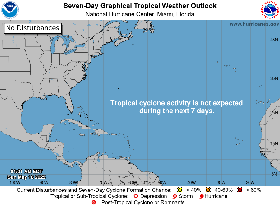
The Atlantic basin is quiet this Saturday: there are no tropical cyclones, and the one system NHC is watching has a low chance of becoming one.
- No tropical storms, hurricanes or potential tropical cyclones are active, and no storm threatens land.
- A non-tropical low, Invest AL94, lies several hundred miles south-southeast of Bermuda. NHC rates its formation chance as low over both 48 hours and 7 days.
- NHC says gale-force winds are likely over parts of the central subtropical Atlantic through the weekend, a marine hazard rather than a land threat.
- The 2026 season remains well below the 1991-2020 average on named storms, hurricanes and major hurricanes, with 23 days left before it ends on November 30.
The National Hurricane Center and national weather services issue the official forecasts and warnings. Follow any evacuation order immediately.
Active storms
There are no active tropical or subtropical cyclones or potential tropical cyclones in the Atlantic, the Caribbean Sea or the Gulf of Mexico, according to NHC’s 1:00 a.m. EST outlook.
Disturbances to watch
NHC is monitoring one area, a non-tropical low over the open Atlantic, and gives it a low chance of development.
Area | Location | 48-hour chance | 7-day chance | NHC outlook issued |
|---|
Western and Central Atlantic (Invest AL94) | Several hundred miles south-southeast of Bermuda | Low, 10% | Low, 10% | 1:00 a.m. EST (0600 UTC) Nov 7 |
NHC says the low is producing “disorganized showers and thunderstorms” and “could still acquire some subtropical characteristics through tonight before upper-level winds increase on Sunday.” It expects the low to move generally eastward and be absorbed by a new non-tropical low to its east early next week.
The Tropical Weather Discussion places the 1002 mb low near 25.5N 62.5W, under a gale warning, with heavy showers north of 20N between 46W and 61W. It lists no tropical waves this morning. A cold front stretches from St. Petersburg, Florida, to the northwestern Gulf of Mexico, with moderate north-northeast winds and seas up to 3 ft [0.9 m]. In the Caribbean, a broad 1008 mb low lies over the waters off Nicaragua, with winds moderate or weaker.
Season so far
The 2026 Atlantic season is running well behind normal, with only one hurricane so far.
Measure | 2026 to date | 1991-2020 average, full season |
|---|
Named storms | 10 | 14 |
Hurricanes | 1 | 7 |
Major hurricanes (Category 3 or higher) | 1 | 3 |
The 2026 counts come from NHC’s season list, current as of 15 UTC on November 5. The averages come from NHC climatology. NHC’s list rates the season 3 named storms, 5 hurricanes and 2 major hurricanes below normal, with accumulated cyclone energy 83% below normal. The lone hurricane, Isaias, peaked at 105 kt [120 mph, 195 km/h] during October 6-10. The latest named storm, Subtropical Storm Josephine, lasted October 21-22.
ENSO: the Climate Prediction Center’s October 8 discussion keeps an El Niño Advisory in effect and says “El Niño continues to strengthen, with a strong-to-very strong El Niño likely through January-March 2027.”
What to watch next
The key question for the next 36 hours is whether AL94 gains subtropical traits before upper-level winds strengthen on Sunday.
- Today and tonight: NHC’s next Atlantic Tropical Weather Outlooks will update AL94’s formation chances.
- Through the weekend: gale warnings for the central subtropical Atlantic, in the High Seas Forecasts issued by the National Weather Service.
- Early next week: NHC expects AL94 to be absorbed by a new non-tropical low to its east; the Tropical Weather Discussion says the lows will merge over the eastern waters late in the weekend.
- Thursday, November 12: the Climate Prediction Center’s next ENSO Diagnostic Discussion.
- Monday, November 30: the official end of the Atlantic hurricane season, per NHC.
About this report
This report draws on NHC’s Atlantic Tropical Weather Outlook (1:00 a.m. EST, 0600 UTC, November 7), the Tropical Weather Discussion (labeled 1215 UTC, November 7), NHC’s 2026 season list (as of November 5), NHC climatology and the Climate Prediction Center’s October 8 ENSO discussion. Times are EST, the zone NHC uses for Atlantic outlooks this time of year, with UTC alongside. Figures can change with each new NHC product, so the latest NHC release takes precedence.
Glossary
- Invest: an area of weather NHC is investigating for possible development, given a number such as AL94.
- Non-tropical low: a low-pressure system that draws energy from temperature contrasts, not from warm ocean water like a tropical cyclone.
- Subtropical cyclone: a hybrid system with both tropical and non-tropical features; one with winds of 39 mph [63 km/h] or more gets a name.
- Major hurricane: a hurricane of Category 3 or higher on the Saffir-Simpson scale, with winds of at least 111 mph [179 km/h].
- ENSO: the El Niño-Southern Oscillation, the cycle of warming and cooling in the tropical Pacific that influences weather worldwide.
Frequently asked questions
Are there any hurricanes or tropical storms in the Atlantic today? No. NHC’s 1:00 a.m. EST outlook lists no tropical or subtropical cyclones in the Atlantic, the Caribbean Sea or the Gulf of Mexico. No land area faces a tropical threat.
Will the low near Bermuda become a named storm? NHC rates the chance as low. The low could briefly take on subtropical features through tonight, but NHC expects upper-level winds to increase on Sunday and the system to be absorbed by another low early next week.
Is the low dangerous even if it does not develop? NHC says gale-force winds are likely over parts of the central subtropical Atlantic through the weekend. That is mainly a hazard for ships and mariners on the open ocean.
Is the hurricane season over? Not officially. NHC defines the season as June 1 to November 30, and notes that storms sometimes form outside those dates. 2026 has produced fewer storms and hurricanes than average.
Sources
- NHC Atlantic Tropical Weather Outlook — issued 1:00 a.m. EST (0600 UTC), November 7, 2026
- NHC Atlantic Tropical Weather Discussion — labeled 1215 UTC, November 7, 2026
- National Hurricane Center home page — last updated 14:50 UTC, November 6, 2026
- NHC Tropical Cyclone Reports, 2026 Atlantic season — summary as of 15 UTC, November 5, 2026
- NHC Tropical Cyclone Climatology — 1991-2020 averages, accessed November 7, 2026
- CPC ENSO Diagnostic Discussion — issued October 8, 2026