
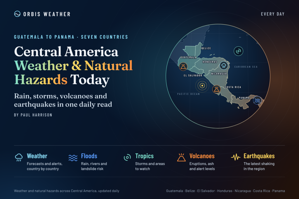
Central America Weather & Natural Hazards Today
By Paul Harrison | Founder & Publisher, Orbis Weather

- Europe Weather & Natural Hazards Today — Saturday, November 7, 2026 7:10 PM
- Southeast Asia Weather & Natural Hazards Today: Saturday, November 7, 2026 7:01 PM
- Indonesia Volcanoes and Live Eruptions This Week: Saturday, November 7, 2026 6:51 PM
- Africa Weather & Natural Hazards Today — Saturday, November 7, 2026 5:36 PM
- Northeast Monsoon 2026/2027 Begins, With Heavy Rain, Floods and Rough Seas Possible Until March 2027 4:39 PM
- Middle East Weather & Natural Hazards Today – Saturday, November 7, 2026 4:17 PM
- Europe’s Hot Spots This Week Nov 6, 2026 2:51 PM
- Australian Region Tropical Weather Update — Saturday, November 7, 2026 11:23 AM
- Southwest Indian Ocean Tropical Weather Update – November 7, 2026 11:13 AM
- Australia, New Zealand & Oceania Weather & Natural Hazards Today Saturday, November 7, 2026 11:05 AM
- More than 80 rescued as catastrophic flood hits Fannin County, Georgia 8:57 AM
- North America Weather & Natural Hazards Today: East Coast Flood Threat, Canadian Storms and Pacific Weather Systems 8:39 AM
- Central America Weather & Natural Hazards Today: Heavy Rain, Flash Flooding and Tropical Development Threaten the Region 8:30 AM
- South America Weather & Natural Hazards Today — November 6, 2026 8:21 AM
- Daily Earthquakes, Storms, Fires & Floods Report — November 6, 2026 8:12 AM
- Global Natural Disasters This Week — November 6, 2026 8:03 AM
- Tropical Atlantic Daily Report: Friday, November 6, 2026 7:49 AM
- Eastern & Central Pacific Tropical Weather Update: Friday, November 6, 2026 7:39 AM
- WESTERN PACIFIC Tropical Weather Update: New Cyclone Threat Developing Near Guam as In-Fa Moves Away 7:25 AM





Central America Weather & Natural Hazards Today: Heavy Rain, Flash Flooding and Tropical Development Threaten the Region
Friday, November 6, 2026 | Orbis Weather
By Paul Harrison | Orbis Weather
CENTRAL AMERICA — A developing area of low pressure off Central America’s Pacific coast is raising concerns about heavy rainfall, flash flooding and potentially dangerous landslides across parts of the region as the weekend approaches.
Nicaragua and Costa Rica are at the center of the most significant rainfall concerns, while Panama is also experiencing unsettled weather and localized flooding risks.
The National Hurricane Center (NHC) reports that a broad low-pressure system offshore of Nicaragua has a medium chance of developing into a tropical depression over the weekend. Regardless of whether the system becomes a named storm, persistent tropical moisture could produce dangerous conditions in vulnerable communities.
The NHC’s November 6 Tropical Weather Discussion specifically highlights the possibility of life-threatening flash flooding and landslides across Central America over the next several days.
Today’s Main Weather Headlines
Nicaragua: Heavy tropical rainfall and thunderstorms present an elevated flash-flood and landslide threat.
Costa Rica: Persistent Pacific moisture, heavy showers and possible flooding are the principal concerns.
Panama: Rain and thunderstorms continue to affect parts of the country, with particular concern in western districts and areas with saturated soil.
Honduras, El Salvador and Guatemala: Localized thunderstorms and flooding remain hazards to monitor, although today’s strongest confirmed regional rainfall signal is farther south.
Belize: Residents should monitor local forecasts for changing showers and thunderstorms, particularly along the Caribbean coast.
Eastern Pacific: A low-pressure disturbance offshore of Nicaragua could develop into a tropical depression this weekend.
These are regional risk assessments, not declarations that every country is under an official weather warning.
1. Tropical Development: Low Pressure Offshore Nicaragua
The most important developing weather story today is the broad area of low pressure over the eastern Pacific near Central America.
According to the National Hurricane Center’s 10:05 UTC Tropical Weather Discussion on November 6, the disturbance is generating disorganized showers and thunderstorms.
A tropical depression could form during the weekend as the system drifts slowly offshore. However, upper-level winds are expected to become less favorable for additional development after the weekend.
The NHC assigns the system a medium probability of tropical cyclone formation over both the next 48 hours and the next seven days.
Why this matters: Tropical cyclone classification is not required for a disturbance to produce damaging floods. A slowly moving low-pressure system can draw large amounts of moisture over the same mountainous areas for several days, increasing the risk of rapidly rising rivers and unstable hillsides.
At the time of the referenced NHC update, no tropical cyclone was active in the eastern Pacific. The developing low should not be described as an established tropical storm.
2. Nicaragua: Heavy Rainfall and Landslide Threat
Nicaragua faces one of the region’s more significant rainfall threats through the weekend.
Tropical moisture associated with the eastern Pacific disturbance is helping generate widespread showers and thunderstorms across parts of Central America, with Nicaragua specifically highlighted by the NHC for some of the heaviest precipitation.
Potential impacts include:
Rapid flooding in low-lying neighborhoods and poorly drained urban areas.
Sudden rises in smaller rivers, streams and drainage channels.
Landslides along steep slopes and mountain roads.
Localized transportation disruptions during intense downpours.
Reduced visibility and hazardous driving conditions.
Communities in western and southern Nicaragua should pay particular attention to updated rainfall forecasts and local emergency information.
Orbis Weather assessment: Rainfall accumulation and terrain vulnerability are more immediate concerns than tropical-storm-strength winds. Specific rainfall totals and affected municipalities require confirmation from updated national forecasts.
3. Costa Rica: Pacific Rainfall and Unstable Conditions
Costa Rica’s National Meteorological Institute (IMN) forecasts unsettled conditions for Friday and the weekend as a low-pressure system associated with the Intertropical Convergence Zone remains near the Pacific coast of Central America.
The IMN expects rain beginning early Friday along the Pacific coast, particularly in the Northern Pacific region.
In the Central Valley, scattered afternoon showers may persist into the evening, with patches of fog also possible.
The institute issued several meteorological notices on November 5 concerning rainfall in the Northern Zone, Caribbean areas and the developing Pacific low-pressure disturbance.
Areas requiring attention
Northern Pacific: Periods of rainfall may affect roads, agricultural areas and low-lying communities.
Central Valley: Afternoon showers, evening rainfall and fog could affect travel around mountainous routes.
Northern Zone: Additional rainfall may increase the likelihood of localized flooding where drainage systems or waterways are already under pressure.
Pacific-facing mountains: Steep terrain can increase landslide risk during prolonged or intense rainfall.
Residents should follow IMN notices and guidance from Costa Rica’s National Emergency Commission (CNE), particularly if traveling through mountainous regions.
4. Panama: Thunderstorms and Saturated Ground
Unsettled conditions are also affecting Panama, with the western part of the country requiring particular attention.
Weather information attributed to Panama’s Institute of Meteorology and Hydrology (IMHPA) indicates that showers and thunderstorms affected both Caribbean and Pacific areas on November 5.
Rainfall was expected to remain possible on Friday in the Tierras Altas district of Chiriquí and parts of Bocas del Toro.
Authorities also urged continued precautions in the Azuero region because unstable, saturated ground can increase landslide risk.
Potential hazards include localized flooding, slippery mountain roads, lightning and falling debris along steep roadways.
Travelers should avoid crossing flooded roads and monitor official notices from SINAPROC, Panama’s national civil protection agency.
5. Guatemala: Cooler Highlands and Isolated Rain
Guatemala is experiencing a seasonal transition as the rainy season gradually gives way to cooler conditions, particularly across western and mountainous areas.
On November 5, Guatemala’s meteorological authority, INSIVUMEH, reported a minimum temperature of 3.4°C (38.1°F) in Quetzaltenango and 10.4°C (50.7°F) in Huehuetenango.
Isolated afternoon rainfall was also expected in the Pacific foothills and southern western regions, while fog affected some areas.
The country’s November climate outlook indicates that rainfall could remain substantial in northern districts, especially the Northern Transversal Strip, despite the seasonal transition.
INSIVUMEH also anticipates the possible influence of two cold fronts during November. These could bring cooler temperatures, locally increased winds and additional rainfall.
Residents in high-elevation communities should prepare for chilly early mornings, while people traveling through mountain passes should watch for fog and reduced visibility.
6. Honduras and El Salvador: Monitoring the Pacific Disturbance
Honduras and El Salvador are geographically close to the developing eastern Pacific weather system, making changes in its position and moisture circulation important to monitor.
However, the NHC’s latest regional discussion identifies Nicaragua and Costa Rica, rather than Honduras and El Salvador, as the main areas of concern for the heaviest precipitation.
Localized thunderstorms remain possible, especially in mountainous areas, but no specific nationwide flooding emergency for either country was verified in the sources reviewed for this report.
The most important hazards to watch are sudden heavy downpours, localized flash flooding, lightning and landslides where soils become saturated.
Residents should consult their respective national meteorological and civil protection services for municipality-level warnings.
7. Belize: Caribbean Weather Monitoring
Belize remains outside the main area of heavy Pacific rainfall highlighted in today’s NHC discussion.
Nevertheless, its tropical climate means brief heavy showers, thunderstorms and coastal weather changes remain possible.
The principal concerns to monitor include localized urban flooding during intense rainfall, lightning and changes in Caribbean marine conditions.
No new nationwide severe-weather emergency for Belize was independently verified for this edition.
The National Meteorological Service of Belize remains the appropriate source for current district forecasts, marine conditions and official warnings.
8. Marine Weather: Eastern Pacific and Caribbean Sea
Marine conditions are an important part of today’s developing weather story.
The NHC reports numerous showers and isolated thunderstorms across the eastern Pacific offshore waters from Nicaragua toward Panama.
Satellite-based wind observations indicated moderate to fresh winds in the affected offshore region, with seas generally reaching 4–7 feet (1.2–2.1 meters).
The NHC also expects periods of stronger winds near the Gulf of Papagayo and Gulf of Panama during the forecast period.
Fishing vessels, ferry operators and recreational boaters should be alert to thunderstorms, lightning, locally reduced visibility and sudden wind changes.
The Caribbean side of Central America is not the focus of the developing Pacific disturbance, but mariners should continue checking local coastal forecasts.
9. Earthquakes and Volcanoes: Regional Monitoring
Central America lies along an active tectonic boundary where the Cocos Plate interacts with the Caribbean Plate and neighboring crustal blocks.
Earthquakes are therefore a persistent natural hazard across Guatemala, El Salvador, Nicaragua, Costa Rica and Panama.
Earthquake activity
For this November 6 edition, no comprehensive live earthquake catalog was verified. Consequently, this report does not claim that no significant earthquakes have occurred.
Readers can review recent earthquake locations, magnitudes and depths through the USGS Earthquake Map.
Volcanic activity
Several volcanoes across Central America require ongoing scientific monitoring, including Fuego and Santiaguito in Guatemala, Santa Ana in El Salvador, Masaya in Nicaragua, and Poás and Turrialba in Costa Rica.
Their inclusion here does not indicate that a new eruption occurred today.
Volcanic hazards can include ashfall, gas emissions, restricted visibility and lahars, which are volcanic mudflows that may occur during heavy rainfall.
Guatemala’s INSIVUMEH continues its volcano surveillance program, while national geological and emergency agencies monitor volcanoes elsewhere in the region.
For international updates, consult the Smithsonian Global Volcanism Program.
10. Flooding and Landslides: Why the Weekend Matters
The combination of tropical moisture, repeated thunderstorms and mountainous terrain makes flooding and landslides the most important natural hazards across parts of Central America over the next several days.
The eastern Pacific disturbance may remain near the region long enough to produce repeated periods of heavy rainfall.
Even where rainfall is not continuous, several thunderstorms affecting the same watershed can cause rivers and streams to rise rapidly.
Three factors are particularly important:
Rainfall intensity: Short periods of torrential rain can overwhelm urban drainage systems and trigger flash floods.
Soil saturation: Repeated rainfall reduces the ability of the ground to absorb additional water, increasing runoff and slope instability.
Mountainous terrain: Steep slopes and narrow valleys can concentrate water rapidly, making landslides and sudden river rises especially dangerous.
The NHC’s explicit warning about potentially life-threatening flash flooding and landslides should be taken seriously, particularly across Nicaragua and Costa Rica.
11. Central America Weather Outlook: November 6–9, 2026
Period | Expected development | Main concern |
|---|---|---|
Friday, Nov. 6 | Tropical moisture and widespread showers across parts of southern Central America | Heavy rain and localized flooding |
Saturday, Nov. 7 | Offshore low-pressure system may organize further | Flash flooding, landslides and possible tropical development |
Sunday, Nov. 8 | Disturbance may remain near the Pacific coast | Continued heavy rainfall |
Monday, Nov. 9 | Upper-level conditions may become less favorable for tropical development | Residual rainfall and saturated ground |
This is a regional outlook based on the November 6 NHC discussion, not a precise daily forecast for every location. The disturbance’s eventual track, organization and rainfall distribution remain uncertain.
12. Public Safety: What Residents Should Do
Residents in areas affected by persistent rainfall should follow several basic precautions.
Avoid driving or walking through floodwater. Water depth and road damage can be difficult to judge.
Stay away from unstable hillsides, particularly after repeated heavy downpours.
Monitor river levels and local civil protection alerts.
Keep mobile devices charged and have an emergency communication plan.
Move to safer ground immediately if authorities order an evacuation.
Mariners should check updated forecasts before departing and avoid thunderstorms.
Flooding can develop quickly, and local conditions may deteriorate before regional forecasts are updated.
13. Official Weather and Natural Hazard Sources
Orbis Weather recommends the following primary sources for current forecasts, alerts and scientific observations.
Agency | Information |
|---|---|
Tropical disturbances and cyclone forecasts | |
Costa Rica forecasts and meteorological warnings | |
Weather, earthquakes, volcanoes and hydrology | |
Weather and hydrometeorological information | |
Belize forecasts and warnings | |
Earthquake observations | |
Forecasts, marine discussions and weather guidance |
14. Orbis Weather Analysis: The Bigger Picture
Today’s weather pattern illustrates why tropical disturbances can become dangerous long before they develop into organized tropical storms.
The offshore Pacific low-pressure system is interacting with abundant tropical moisture and the Intertropical Convergence Zone, a region where converging winds help promote cloud development and thunderstorms.
For Nicaragua and Costa Rica, the immediate concern is the amount of rain that may fall over vulnerable terrain.
The most significant uncertainty is whether the offshore disturbance will organize into a tropical depression and how long its moisture circulation will remain positioned near Central America.
A stronger system is not necessarily required for greater flooding impacts. The duration and location of heavy rainfall can be more important than the storm’s maximum wind speed.
15. Final Outlook: Heavy Rain Remains the Priority
Central America enters the first weekend of November with a potentially significant rainfall event developing along its Pacific side.
Nicaragua and Costa Rica face the clearest heavy-rainfall threat, while western Panama must also contend with unsettled conditions and unstable ground.
The developing offshore low-pressure system will require close monitoring through Saturday and Sunday.
The key message from Orbis Weather is simple: flooding and landslides are the immediate threats, regardless of whether the disturbance becomes a tropical depression.
Residents and travelers should monitor official updates, especially in mountainous communities and areas susceptible to rapid flooding.
About the Author
Paul Harrison — Founder & Publisher, Orbis Weather
Paul Harrison founded Orbis Weather in 2026 to make global weather and natural-hazard information easier to find, follow and understand. His coverage includes tropical cyclones, severe weather, extreme temperatures, earthquakes, volcanoes, wildfires, flooding and significant natural disasters worldwide.
View all articles by Paul Harrison → | Editorial Standards →
Global Weather Tracker Hub
Explore weather maps, tropical systems, storms and natural hazards around the world.
No matching trackers found.