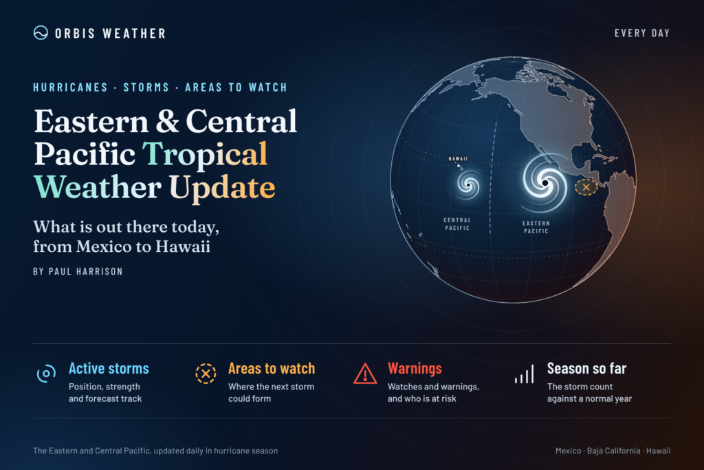
Eastern & Central Pacific Tropical Weather Update: Friday, November 6, 2026
By Paul Harrison, Orbis Weather
Current to 6:47 a.m. EST / 1:47 a.m. HST Friday, Nov. 6, 2026 (11:47 UTC). Based on the Central Pacific Hurricane Center (CPHC) Tropical Weather Outlook issued at 8 p.m. HST Thursday, Nov. 5, the National Hurricane Center (NHC) Eastern North Pacific Tropical Weather Outlook issued at 10 p.m. PST Thursday, Nov. 5 (both 0600 UTC Nov. 6), and the NHC Eastern Pacific Tropical Weather Discussion issued at 1605 UTC Thursday, Nov. 5.
At a glance
A tropical depression is expected to form on Friday from a low southeast of Hawaii, but it is forecast to pass well south of the islands.
- No active storms. NHC and CPHC list no tropical cyclones in either basin. No storm has watches, warnings or a forecast landfall, so no land is under a direct storm threat today.
- CP95 near Hawaii: CPHC gives the low a high, 90 percent chance of becoming a tropical cyclone within 48 hours and within 7 days.
- Low off Central America: NHC gives it a medium, 40 percent chance over both 48 hours and 7 days. NHC says it could bring areas of heavy rain to parts of Central America through the weekend.
- Season to date: NHC counts 20 named storms, 10 hurricanes and 8 major hurricanes in the eastern Pacific, all above the 1991-2020 normal.
The National Hurricane Center, the Central Pacific Hurricane Center and national weather services, including Mexico’s Servicio Meteorológico Nacional (SMN), issue the official forecasts and warnings. Follow any evacuation order immediately.
Active storms
There are no active tropical or subtropical cyclones or potential tropical cyclones in the eastern or central North Pacific. The NHC home page states “There are no tropical cyclones in the Eastern Pacific at this time” and “There are no tropical cyclones in the Central Pacific at this time.”
Disturbances to watch
Two areas are being monitored, and CP95 southeast of Hawaii is the more likely to develop.
Area | Basin | Location | 48-hour chance | 7-day chance | Outlook issued |
|---|
CP95 | Central Pacific (eastern portion) | Several hundred miles southeast of the Big Island of Hawaii | High, 90% | High, 90% | 8 p.m. HST Thu, Nov. 5 (CPHC) |
Broad low | Eastern Pacific | Offshore of Central America | Medium, 40% | Medium, 40% | 10 p.m. PST Thu, Nov. 5 (NHC) |
CP95: CPHC says showers and thunderstorms “continue to show signs of organization” and “a tropical depression is expected to develop on Friday.” The system is forecast to move west-northwestward to westward at 10 to 15 mph (16 to 24 km/h), “passing well south of the Hawaiian Islands.” NWS Honolulu showed no tropical watches or warnings; its map listed a High Surf Advisory and a Small Craft Advisory (map updated 8:10 a.m. HST Thursday).
Low off Central America: NHC says a tropical depression could still form over the weekend while the low drifts slowly offshore, and that “upper-level winds should prevent further development after the weekend.” NHC lowered the 7-day chance from 50 percent at 10 a.m. PST to 40 percent at 10 p.m. PST Thursday. NHC’s Thursday discussion expected Central America’s heaviest rain over Nicaragua and Costa Rica.
- Costa Rica: the national emergency commission (CNE) declared a nationwide green alert, “una fase informativa y preventiva” (an informational and preventive phase), La Nación and Infobae reported on Nov. 3. Infobae listed a tropical wave, a trough, the Intertropical Convergence Zone and coastal lows as causes. The national weather institute (IMN) expects rain with thunderstorms to continue over the weekend, Teletica reported on Nov. 5.
- El Salvador: Civil Protection director Luis Alonso Amaya said the low “representa una probabilidad de incidencia y no una afectación confirmada” (represents a chance of impact, not a confirmed impact), Diario El Salvadorreported on Nov. 5. The environment ministry (MARN) said the heaviest rain could come between the weekend and Monday, Nov. 9, Infobae reported the same day.
- Panama: the civil protection agency (SINAPROC) extended a rain prevention notice through 11:59 p.m. Thursday, Nov. 5, with forecast totals of up to 280 mm (about 11 inches) in parts of Chiriquí, Veraguas and Azuero, Infobae reported on Nov. 4. It attributed the rain to the monsoon trough and a low north of Panama.
The reports cited describe alerts and forecasts; none reports deaths or damage.
Wider pattern: NHC’s 1605 UTC Thursday discussion placed the monsoon trough from the Nicaragua-Costa Rica border through a 1008 mb low near 10N 91W and on to 05N 128W, with the ITCZ continuing to 09N 140W. It expected fresh to strong northerly gap winds in the Gulf of Tehuantepec Friday night, increasing Sunday night as a cold front enters the southwest Gulf of Mexico, “with gales possible Mon night.”
Season so far
The 2026 eastern Pacific season has produced more named storms, hurricanes and major hurricanes than a full average season.
Measure | Eastern Pacific 2026 | NHC difference from 1991-2020 normal | Full-season average, 1991-2020 | Central Pacific 2026 |
|---|
Named storms | 20 | +6 | 15 | 7 |
Hurricanes | 10 | +2 | 8 | 5 |
Major hurricanes | 8 | +4 | 4 | 3 |
Eastern Pacific counts and differences are from NHC’s 2026 season summary (as of 09 UTC Nov. 2); full-season averages are from NHC climatology. Central Pacific counts are from NHC’s central Pacific season page (as of 09 UTC Nov. 5) and include storms that crossed in from the east. Three named storms formed in the central Pacific itself: Hurricane Lala and Tropical Storms Moke and Olana, the latest on Oct. 25-26. The most recent eastern Pacific storm was Hurricane Vance, Oct. 21-29. NHC’s pages list no 2026 deaths in either basin. No CPHC or NOAA page consulted gives a 1991-2020 central Pacific average.
ENSO: NOAA’s Climate Prediction Center kept an El Niño Advisory in its Oct. 8 discussion: “El Niño continues to strengthen, with a strong-to-very strong El Niño likely through January-March 2027.”
What to watch next
- CP95 on Friday: CPHC expects a tropical depression to form. If it does, CPHC will begin advisories; its outlooks have been issued at 2 a.m., 2 p.m. and 8 p.m. HST.
- Low off Central America this weekend: NHC’s next outlooks (issued at 4 a.m., 10 a.m., 4 p.m. and 10 p.m. PST in its recent cycle) will update the formation odds and rain risk. National services such as Costa Rica’s IMN and CNE issue local alerts.
- Gulf of Tehuantepec gap winds: NHC’s Tropical Weather Discussion expects winds to strengthen Friday night and Sunday night, with gales possible Monday night.
- ENSO update: NOAA’s Climate Prediction Center schedules its next ENSO discussion for Nov. 12.
- Season end: NHC’s eastern Pacific season runs May 15 to Nov. 30.
About this report
This daily update covers the eastern North Pacific, east of 140°W, where the National Hurricane Center in Miami issues forecasts, and the central North Pacific, from 140°W to the International Date Line, covered by the Central Pacific Hurricane Center in Honolulu. It draws on NHC and CPHC outlooks and discussions, NHC season data, NOAA’s Climate Prediction Center, and national agencies as reported by news outlets. Times are given in the zone each product uses (HST, PST, EST) or UTC. Outlooks are updated several times a day, so the newest NHC or CPHC product always replaces the figures here. Orbis Weather covers the Atlantic in a separate daily report.
Glossary
- Tropical Weather Outlook: NHC and CPHC’s regular product giving each disturbance’s chance of becoming a tropical cyclone within 48 hours and 7 days.
- Invest (for example CP95): a numbered label forecasters give a disturbance they are watching closely; “CP” marks the central Pacific.
- Monsoon trough: a band of low pressure near the equator where winds converge and showers form.
- Gap winds (Tehuantepecers): strong northerly winds funneled through a mountain gap in southern Mexico onto the Gulf of Tehuantepec.
- Saffir-Simpson category: a 1-to-5 hurricane scale based on sustained wind speed; Category 3 and above is a major hurricane.
Frequently asked questions
Is Hawaii threatened by the system southeast of the Big Island? CPHC expects the low to move west-northwestward to westward, “passing well south of the Hawaiian Islands.” No tropical watches or warnings are in effect for Hawaii. Residents should still check the latest CPHC and NWS Honolulu products.
Will it get a name? CPHC expects a tropical depression to form on Friday. The outlook does not forecast its strength beyond that; CPHC advisories would carry an intensity forecast once a depression forms.
Is Central America at risk this weekend? NHC says the low offshore could bring areas of heavy rain to parts of Central America through the weekend, whether or not it develops. Costa Rica is under a nationwide preventive green alert, and El Salvador’s Civil Protection says impacts are possible but not confirmed.
Is the eastern Pacific season over? No. NHC’s season runs through Nov. 30, and this year has already exceeded the full-season averages for named storms, hurricanes and major hurricanes.
Sources
- NHC home page (last update 14:43 UTC Nov. 5, 2026)
- NHC Graphical Tropical Weather Outlook, eastern Pacific (embeds NHC Eastern North Pacific outlook, 10 p.m. PST Nov. 5, and CPHC Central North Pacific outlook, 8 p.m. HST Nov. 5)
- NHC Graphical Tropical Weather Outlook, central Pacific (outlooks of 2 p.m. HST and 4 p.m. PST Nov. 5)
- NHC Eastern North Pacific Tropical Weather Outlook (10 a.m. PST Nov. 5)
- CPHC Central North Pacific Tropical Weather Outlook (2 a.m. HST Nov. 5)
- NHC Eastern Pacific Tropical Weather Discussion (1605 UTC Nov. 5)
- NWS Honolulu (map updated 8:10 a.m. HST Nov. 5)
- NHC 2026 eastern Pacific season (as of 09 UTC Nov. 2)
- NHC 2026 central Pacific season (as of 09 UTC Nov. 5)
- NHC climatology (1991-2020 averages)
- NOAA CPC ENSO Diagnostic Discussion (Oct. 8, 2026)
- La Nación: CNE declara alerta verde en todo Costa Rica (Nov. 3, 2026)
- Infobae: Costa Rica declara alerta verde en todo el país (Nov. 3, 2026)
- Teletica: sistema de baja presión impactará el Pacífico Central (Nov. 5, 2026)
- Diario El Salvador: Protección Civil prevé lluvias (Nov. 5, 2026)
- Infobae: la baja presión en el Pacífico mantiene en alerta a El Salvador (Nov. 5, 2026)
- Infobae: Panamá enfrenta nuevas jornadas de mal tiempo (Nov. 4, 2026)