
Second Historic Flood Hits Four Corners Region as Rivers Surge and Communities Face New Evacuations
By Paul Harrison | Founder & Publisher, Orbis Weather

- Middle East Weather & Natural Hazards Today – Wednesday, November 4, 2026 3:54 PM
- Europe’s Cold Spots This Week Nov 3, 2026 2:51 PM
- Australia, New Zealand & Oceania Weather & Natural Hazards Today — Wednesday, November 4, 2026 11:26 AM
- Eastern Australia Weather Update: Dangerous Storms, Giant Hail and Destructive Winds 10:26 AM
- Mount Semeru Erupts in Indonesia, Sending Dangerous Pyroclastic Flow Down Its Slopes 8:34 AM
- South America Weather & Natural Hazards Today — November 3, 2026 8:09 AM
- Central America Weather & Natural Hazards Today: Heavy Rain, Flooding and Landslide Concerns Continue Across the Region 8:00 AM
- North America Weather & Natural Hazards Today — November 3, 2026 7:50 AM
- Weekly Tropical Storm Tracker: Tuesday, November 3, 2026 7:39 AM
- Daily Earthquakes, Storms, Fires & Floods Report November 3, 2026 7:30 AM
- Tropical Atlantic Daily Report: Tuesday, November 3, 2026 7:11 AM
- Eastern & Central Pacific Tropical Weather Update: Tuesday, November 3, 2026 7:02 AM
- Western Pacific Tropical Weather Nov 3 6:51 AM





Second Historic Flood Hits Four Corners Region as Rivers Surge and Communities Face New Evacuations
Orbis Weather | November 2, 2026 | By Paul Harrison
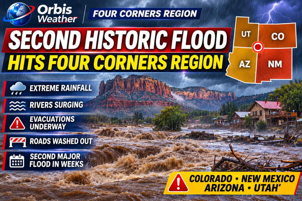
A second major flooding disaster in less than two weeks is striking the Four Corners region of the United States, bringing dangerous river rises, mandatory evacuations, washed-out roads and fears of catastrophic damage across Colorado, New Mexico, Arizona and Utah.
Communities still recovering from October’s destructive flooding have been hit by another powerful Pacific storm system, bringing exceptionally heavy rainfall to already saturated ground.
In southwestern Colorado, officials warned that the San Juan River near Pagosa Springs could approach or exceed levels associated with the devastating flood of 1911. The threat prompted evacuations and major road closures.
Colorado Faces Historic River Flooding
Pagosa Springs has emerged as one of the most seriously threatened communities.
The Archuleta County Sheriff’s Office warned that the San Juan River could rise above 20 feet (6.1 meters), compared with approximately 17.8 feet (5.4 meters) during the historic 1911 flood.
Authorities urged residents in vulnerable areas to evacuate, while flooding disrupted highways and access to the mountain community.
The latest emergency follows severe flooding in late October that damaged roads, homes and infrastructure across southwestern Colorado.
New Mexico Issues Evacuation Alerts
In San Juan County, New Mexico, emergency officials issued evacuation alerts for people within half a mile of the Animas, La Plata and San Juan rivers.
The communities around Farmington and Bloomfield have been particularly concerned about rising water levels.
Officials warned that debris, sediment and changes to river channels caused by the previous flood could make the latest flooding even more destructive.
The National Weather Service also reported significant rainfall in the Chuska Mountains and Farmington area during the latest storm.
Arizona and Utah Also Affected
The flooding emergency extends beyond Colorado and New Mexico.
Arizona communities, including Sedona, Camp Verde and parts of Gila County, experienced evacuations as rivers and normally dry washes filled rapidly.
In Utah, saturated ground and additional rainfall created renewed concerns about flash flooding, particularly near vulnerable desert communities, national parks and backcountry roads.
Across the Southwest, rescue teams have responded to flooded vehicles, stranded residents and rapidly rising water.
Why Is the Four Corners Region Flooding Again?
The latest flooding is associated with unusually moisture-rich Pacific weather systems, including an atmospheric river transporting moisture into the southwestern United States.
Several factors have increased the severity of the flooding:
-
Saturated ground: Previous storms have reduced the ability of soil to absorb additional rainfall.
-
Mountain runoff: Heavy precipitation over elevated terrain feeds rivers and streams downstream.
-
Steep terrain: Water can move rapidly through narrow canyons and drainage channels.
-
Repeated storms: Communities have had little opportunity to recover between major rainfall events.
The ongoing El Niño pattern and unusually warm Pacific waters have also contributed to the broader atmospheric conditions supporting exceptional rainfall across the region.
What Happens Next?
As of November 2, flooding remains a serious concern in affected communities, even where the heaviest rainfall has eased.
Rivers can continue rising after rain ends because water from mountain watersheds takes time to reach downstream locations.
Residents should remain alert for changing river forecasts, road closures, damaged bridges and possible contamination of floodwaters.
Official information is available from the National Weather Service and NOAA National Water Prediction Service.
Orbis Weather Analysis
The second major flood illustrates how repeated extreme rainfall can turn a single natural disaster into a prolonged regional emergency.
The greatest danger is not necessarily confined to the areas receiving the heaviest rain. Downstream communities may face rising rivers hours after storms have moved away.
For the Four Corners region, the immediate priorities remain protecting lives, monitoring river levels and restoring access to communities isolated by flood damage.
Orbis Weather will continue following developments across the American Southwest as the flooding emergency unfolds
About the Author
Paul Harrison — Founder & Publisher, Orbis Weather
Paul Harrison founded Orbis Weather in 2026 to make global weather and natural-hazard information easier to find, follow and understand. His coverage includes tropical cyclones, severe weather, extreme temperatures, earthquakes, volcanoes, wildfires, flooding and significant natural disasters worldwide.
View all articles by Paul Harrison → | Editorial Standards →
Global Weather Tracker Hub
Explore weather maps, tropical systems, storms and natural hazards around the world.
No matching trackers found.