
Mount Semeru Erupts in Indonesia, Sending Dangerous Pyroclastic Flow Down Its Slopes
By Paul Harrison | Founder & Publisher, Orbis Weather

- Europe’s Cold Spots This Week Nov 3, 2026 2:51 PM
- Australia, New Zealand & Oceania Weather & Natural Hazards Today — Wednesday, November 4, 2026 11:26 AM
- Eastern Australia Weather Update: Dangerous Storms, Giant Hail and Destructive Winds 10:26 AM
- Mount Semeru Erupts in Indonesia, Sending Dangerous Pyroclastic Flow Down Its Slopes 8:34 AM
- South America Weather & Natural Hazards Today — November 3, 2026 8:09 AM
- Central America Weather & Natural Hazards Today: Heavy Rain, Flooding and Landslide Concerns Continue Across the Region 8:00 AM
- North America Weather & Natural Hazards Today — November 3, 2026 7:50 AM
- Weekly Tropical Storm Tracker: Tuesday, November 3, 2026 7:39 AM
- Daily Earthquakes, Storms, Fires & Floods Report November 3, 2026 7:30 AM
- Tropical Atlantic Daily Report: Tuesday, November 3, 2026 7:11 AM
- Eastern & Central Pacific Tropical Weather Update: Tuesday, November 3, 2026 7:02 AM
- Western Pacific Tropical Weather Nov 3 6:51 AM





Mount Semeru Erupts in Indonesia, Sending Dangerous Pyroclastic Flow Down Its Slopes
ORBIS WEATHER | VOLCANO & NATURAL HAZARDS NEWS
November 3, 2026 | By Paul Harrison
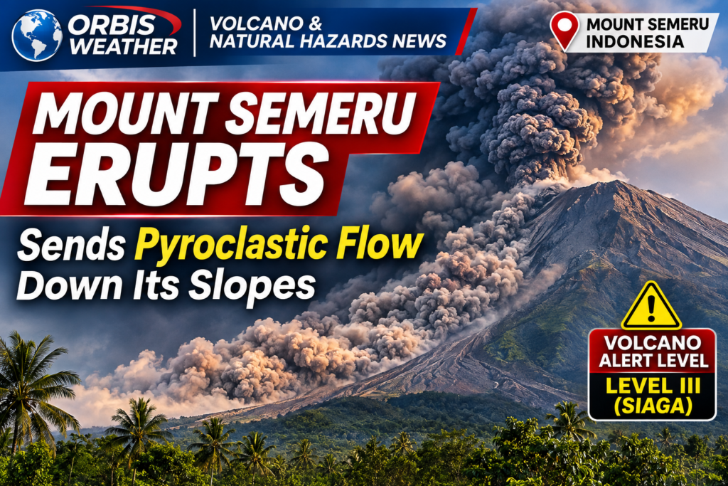
Indonesia’s Mount Semeru, one of the country’s most active volcanoes, has reportedly erupted again, sending a dangerous pyroclastic flow down its slopes on the island of Java.
A pyroclastic flow is a fast-moving avalanche of superheated volcanic gas, ash and rock fragments. Unlike an ordinary ash cloud, it travels along the ground and can be deadly to anyone caught in its path.
The reported activity highlights the continuing volcanic hazards facing communities around Mount Semeru, particularly settlements and river valleys that lie below the volcano.
🌋 Eruption Recorded on November 3
According to Indonesia’s ANTARA news agency, Mount Semeru erupted at approximately 12:06 p.m. Western Indonesia Time on Tuesday, November 3.
Volcano monitoring officer Agastya Rajendra reported that the eruption was accompanied by a pyroclastic flow. However, thick fog obscured the volcano, preventing observers from determining how far the flow traveled.
Seismic instruments recorded a maximum amplitude of 22 millimeters, with the eruption lasting approximately four minutes and 44 seconds.
Monitoring reports documented four eruptions between 12:34 a.m. and 12:52 p.m. local time.
⚠️ Alert Level III Remains in Effect
Mount Semeru remains at Level III (Siaga), the second-highest level in Indonesia’s four-stage volcanic alert system.
Authorities have issued specific restrictions:
-
No activity within 5 kilometers (3.1 miles) of the summit.
-
Avoid the southeastern Besuk Kobokan sector within 13 kilometers (8.1 miles) of the summit.
-
Beyond that distance, remain at least 500 meters (1,640 feet) from the Besuk Kobokan riverbanks because pyroclastic flows and volcanic mudflows could potentially extend as far as 17 kilometers (10.6 miles) from the summit.
Residents must also remain alert around the Besuk Bang, Besuk Kembar and Besuk Sat river systems.
🌧️ Heavy Rain Could Trigger Additional Hazards
The eruption is not the only concern.
Rainfall over volcanic slopes can mobilize loose ash, rock and sediment, creating dangerous volcanic mudflows known as lahars.
These flows can travel through river channels, damaging roads, bridges and buildings.
Communities downstream of Mount Semeru should remain especially vigilant during periods of heavy rainfall, even when explosive volcanic activity temporarily decreases.
🌏 Why Mount Semeru Is So Active
Mount Semeru rises approximately 3,676 meters (12,060 feet) above sea level and is the highest mountain on the Indonesian island of Java.
The volcano forms part of Indonesia’s volcanically active region along the Pacific Ring of Fire.
Here, tectonic processes involving the Indo-Australian and Sunda plates generate magma that feeds numerous volcanoes across the Indonesian archipelago.
Semeru has a long history of eruptions, including dangerous pyroclastic flows and lahars that have affected communities on its lower slopes.
📡 What Happens Next?
Scientists will continue monitoring seismic activity, volcanic emissions, lava movement and potential pyroclastic flows.
The key concerns are whether additional eruptions occur, whether pyroclastic flows reach populated areas and whether rainfall increases the risk of lahars.
At the time of the reports reviewed, the distance traveled by the November 3 pyroclastic flow had not been established. No verified casualty or evacuation figures were available in those reports.
For official updates, consult MAGMA Indonesia and Indonesia’s volcanic monitoring agency, PVMBG.
Orbis Weather | Editorial Note
This report is based on November 3, 2026, eruption observations and Indonesian volcanic monitoring information reported by ANTARA and PVMBG-based sources. Volcanic conditions can change rapidly. Hazard boundaries and evacuation instructions issued by Indonesian authorities take precedence over this article.
Sources: ANTARA News, November 3, 2026 · Semeru monitoring and PVMBG reports
Orbis Weather — Tracking Earth’s Weather, Volcanoes and Natural Hazards.
About the Author
Paul Harrison — Founder & Publisher, Orbis Weather
Paul Harrison founded Orbis Weather in 2026 to make global weather and natural-hazard information easier to find, follow and understand. His coverage includes tropical cyclones, severe weather, extreme temperatures, earthquakes, volcanoes, wildfires, flooding and significant natural disasters worldwide.
View all articles by Paul Harrison → | Editorial Standards →
Global Weather Tracker Hub
Explore weather maps, tropical systems, storms and natural hazards around the world.
No matching trackers found.