
Violent Storms, Heavy Rain Forecast for Thailand from November 5 Through 9
By Paul Harrison | Founder & Publisher, Orbis Weather

- Violent Storms, Heavy Rain Forecast for Thailand from November 5 Through 9 10:11 PM
- South America Flood Emergency: Colombia and Argentina Face Deadly Disasters as Rivers Overflow 9:57 PM
- Malaysia Flood Alert: Johor Identifies 337 Flood Hotspots as Northeast Monsoon Begins 9:33 PM
- Europe Weather & Natural Hazards Today — Wednesday, November 4, 2026 7:14 PM
- Southeast Asia Weather & Natural Hazards Today: Wednesday, November 4, 2026 7:05 PM
- Singapore Lightning & Thunderstorms This Week — Wednesday, November 4, 2026 6:57 PM
- Africa Weather & Natural Hazards Today — Wednesday, November 4, 2026 6:44 PM
- Middle East Weather & Natural Hazards Today – Wednesday, November 4, 2026 3:54 PM
- Europe’s Cold Spots This Week Nov 3, 2026 2:51 PM
- Australia, New Zealand & Oceania Weather & Natural Hazards Today — Wednesday, November 4, 2026 11:26 AM
- Eastern Australia Weather Update: Dangerous Storms, Giant Hail and Destructive Winds 10:26 AM
- Mount Semeru Erupts in Indonesia, Sending Dangerous Pyroclastic Flow Down Its Slopes 8:34 AM
- South America Weather & Natural Hazards Today — November 3, 2026 8:09 AM
- Central America Weather & Natural Hazards Today: Heavy Rain, Flooding and Landslide Concerns Continue Across the Region 8:00 AM
- North America Weather & Natural Hazards Today — November 3, 2026 7:50 AM
- Weekly Tropical Storm Tracker: Tuesday, November 3, 2026 7:39 AM
- Daily Earthquakes, Storms, Fires & Floods Report November 3, 2026 7:30 AM
- Tropical Atlantic Daily Report: Tuesday, November 3, 2026 7:11 AM
- Eastern & Central Pacific Tropical Weather Update: Tuesday, November 3, 2026 7:02 AM
- Western Pacific Tropical Weather Nov 3 6:51 AM





Violent Storms, Heavy Rain Forecast for Thailand from November 5 Through 9
· @Paul
By Paul Harrison, Orbis Weather
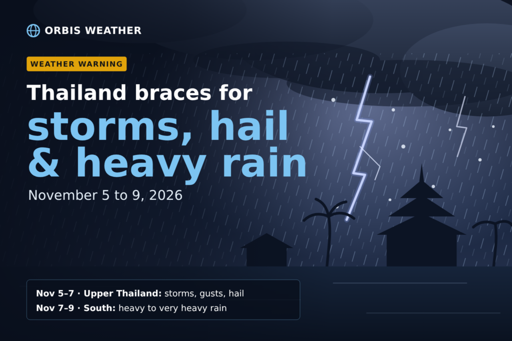
Thailand faces five days of unsettled weather from Thursday, November 5, to Monday, November 9. The Thai Meteorological Department (TMD) forecasts thunderstorms, strong gusty winds, hail and heavy rain across upper Thailand from November 5 to 7, followed by heavy to very heavy rain in the South from November 7 to 9.
TMD has issued a series of advisories on the event since November 1. Its fourth, issued at 5 a.m. on Tuesday, November 3, named the provinces at risk each day. A fifth advisory carrying the same warnings was reported by PPTV on Tuesday evening. The Department of Disaster Prevention and Mitigation (DDPM) has put Bangkok and 61 provinces on alert in response.
Key facts
|
|
|---|---|
Upper Thailand | November 5–7: thunderstorms, strong gusts, hail, isolated heavy rain |
South | November 7–9: heavy rain in many areas, very heavy in some |
Cause | High-pressure system (cold air mass) from China |
Seas | Waves above 2 metres in thunderstorm areas, Gulf of Thailand and Andaman Sea |
Hotlines | TMD 1182; DDPM 1784 |
Day by day: where the storms and rain fall
TMD gives November 5 to 7 as the storm period for upper Thailand as a whole, starting in the Northeast before spreading to the other regions, so not every area will see storms on every day. The heaviest rain then shifts to the South over the weekend.
Provinces at risk of heavy rain, day by day
TMD’s fourth advisory listed the following provinces for heavy rain. Very heavy rain is forecast only in the South, on November 8 and 9.
Date | Heavy rain | Very heavy rain |
|---|---|---|
Thu Nov 5 | North: Nan, Phrae, Uttaradit, Sukhothai, Kamphaeng Phet, Phitsanulok, Phichit, Phetchabun. Northeast: Loei, Nong Bua Lamphu, Udon Thani, Nong Khai, Bueng Kan, Sakon Nakhon, Khon Kaen, Chaiyaphum, Nakhon Ratchasima, Buri Ram. Central: Nakhon Sawan, Lop Buri, Saraburi. East: Nakhon Nayok, Prachin Buri. South: Chumphon, Surat Thani, Nakhon Si Thammarat, Songkhla, Pattani, Narathiwat | None listed |
Fri Nov 6 | North: Chiang Mai, Chiang Rai, Lamphun, Lampang, Phayao, Nan, Phrae, Sukhothai, Tak, Kamphaeng Phet. Central: Nakhon Sawan, Uthai Thani, Chai Nat, Sing Buri, Ang Thong, Phra Nakhon Si Ayutthaya, Suphan Buri, Kanchanaburi, Ratchaburi, Nakhon Pathom, Samut Sakhon, Samut Songkhram, Bangkok and its metropolitan area. South: Phetchaburi, Prachuap Khiri Khan, Surat Thani, Nakhon Si Thammarat, Phatthalung, Songkhla, Pattani, Yala, Narathiwat | None listed |
Sat Nov 7 | South: Chumphon, Surat Thani, Nakhon Si Thammarat, Phatthalung, Songkhla, Pattani, Yala, Narathiwat, Krabi, Trang, Satun | None listed |
Sun Nov 8 | East: Chon Buri, Rayong. South: Phetchaburi, Prachuap Khiri Khan, Surat Thani, Chumphon, Phatthalung, Pattani, Yala, Narathiwat, Trang, Satun | Nakhon Si Thammarat, Songkhla |
Mon Nov 9 | South: Phetchaburi, Prachuap Khiri Khan, Chumphon, Yala, Ranong, Phang Nga, Phuket, Krabi, Trang, Satun | Surat Thani, Nakhon Si Thammarat, Phatthalung, Songkhla, Pattani, Narathiwat |
The lists come from the November 3 advisory as reported by Nation Thailand and Siam Rath; later advisories may change them.
Why the weather is turning
TMD attributes the change to a high-pressure system, or cold air mass, from China that is expected to extend over upper Thailand and the South China Sea. As that cooler, drier air pushes south, it meets the warm, humid air still over Thailand, and the boundary between them can set off thunderstorms. The same system strengthens the easterly winds over Thailand and the Gulf of Thailand, which carry moisture onto the southern peninsula and feed the heavier rain there from November 7.
TMD expects the storms to start in the Northeast and then spread to the North, the Central region including Bangkok, and the East. In the northeastern highlands, Phu Kradueng National Park in Loei recorded a low of 17.0°C on Tuesday, Nation Thailand reported.
Rough seas in the Gulf and Andaman Sea
Waves may rise above 2 metres in areas of thunderstorms in both the Gulf of Thailand and the Andaman Sea, TMD said. Its advice, as reported by Siam Rath: “ชาวเรือทั้งสองฝั่ง ควรเดินเรือด้วยความระมัดระวัง และหลีกเลี่ยงบริเวณที่มีฝนฟ้าคะนอง” (boat operators on both coasts should sail with caution and avoid areas with thunderstorms).
Outside storms, TMD’s daily forecast for November 3–4 put waves at about 1 metre off both southern coasts and below 1 metre along the eastern seaboard. Fishermen, ferry passengers and island visitors on the Andaman and Gulf coasts should check the latest forecast before sailing, particularly from November 7, when the heaviest rain reaches the South.
How authorities are preparing, and what residents should do
DDPM director-general Nirat Pongsitthaworn said the department had prepared after assessing TMD’s forecasts, Nation Thailand reported on November 3. DDPM has put 47 provinces in the North, Northeast, Central region and East, plus Bangkok, on a storm watch for November 5 to 7. All 14 southern provinces are on a flood watch for November 5 to 9. DDPM warned that “heavy to very heavy rain could trigger flash floods, rapid runoff, mudslides and localised flooding.”
TMD’s advice to the public:
- During thunderstorms: avoid open areas, standing under large trees and being near billboards that are not securely built. The original reads “หลีกเลี่ยงการอยู่ในที่โล่งแจ้ง ใต้ต้นไม้ใหญ่ และป้ายโฆษณาที่ไม่แข็งแรง” (avoid open areas, under big trees and weak billboards), as reported by PPTV.
- In the South: watch for rain building up over several days, which “อาจทำให้เกิดน้ำท่วมฉับพลันและน้ำป่าไหลหลาก” (may cause flash floods and runoff from the hills), especially in foothills near waterways and in low-lying areas.
- In flood-prone areas: prepare for more rain and keep watching water levels, Siam Rath reported.
- Contacts: TMD’s 24-hour line is 1182 (or 0-2399-4012-13); DDPM’s hotline is 1784.
Travellers heading to provinces on the heavy-rain lists, including national parks in the North and Northeast, should check forecasts before setting out, Nation Thailand advised.
About this article
This article summarizes advisories from the Thai Meteorological Department and the Department of Disaster Prevention and Mitigation, as reported by Thai news outlets. It is not an official warning. TMD updates its advisories twice a day, so readers in Thailand should check the latest version on the TMD website or call 1182. Thai quotes are given in the original with an English translation.
Frequently asked questions
Will Bangkok be affected? Yes. TMD expects thunderstorms and gusty winds in the Central region, including Bangkok and its surroundings, during November 5 to 7, and lists Bangkok and its metropolitan area for heavy rain on November 6.
When is the worst rain expected in the South? Rain in the South builds from November 7, and TMD forecasts very heavy rain in some provinces on November 8 and 9. Nakhon Si Thammarat and Songkhla are listed for very heavy rain on both days.
Why is hail possible in Thailand? Hail forms in strong thunderstorms with powerful updrafts. TMD has included hail in its warnings since its third advisory, issued on November 2.
Is it safe to travel by boat during this period? TMD advises boat operators to sail with caution and avoid thunderstorm areas, where waves may exceed 2 metres. Travellers should check the latest advisory and local operators’ notices before sailing.
Sources
- Thai PBS World: Violent storms, heavy rain forecast for Thailand from November 5 through 9 (Nov 3, 2026)
- Thai Meteorological Department: weather warnings
- Thairath English: TMD Announcement No. 1 (Nov 1, 2026)
- Nation Thailand: Hail risk in upper Thailand as South faces very heavy rain (Nov 2, 2026)
- Nation Thailand: TMD issues five-day rain and hail alert for November 5–9 (Nov 3, 2026)
- Nation Thailand: Phu Kradueng records 17°C as Loei faces November 5 rain risk (Nov 3, 2026)
- Nation Thailand: Bangkok and 61 provinces on alert for storms and flash floods (Nov 3, 2026)
- Siam Rath: TMD advisory No. 4 (Nov 3, 2026, in Thai)
- PPTV: TMD advisory No. 5 (Nov 3, 2026, in Thai)
About the Author
Paul Harrison — Founder & Publisher, Orbis Weather
Paul Harrison founded Orbis Weather in 2026 to make global weather and natural-hazard information easier to find, follow and understand. His coverage includes tropical cyclones, severe weather, extreme temperatures, earthquakes, volcanoes, wildfires, flooding and significant natural disasters worldwide.
View all articles by Paul Harrison → | Editorial Standards →
Global Weather Tracker Hub
Explore weather maps, tropical systems, storms and natural hazards around the world.
No matching trackers found.