
Malaysia Flood Alert: Johor Identifies 337 Flood Hotspots as Northeast Monsoon Begins
By Paul Harrison | Founder & Publisher, Orbis Weather

- Violent Storms, Heavy Rain Forecast for Thailand from November 5 Through 9 10:11 PM
- South America Flood Emergency: Colombia and Argentina Face Deadly Disasters as Rivers Overflow 9:57 PM
- Malaysia Flood Alert: Johor Identifies 337 Flood Hotspots as Northeast Monsoon Begins 9:33 PM
- Europe Weather & Natural Hazards Today — Wednesday, November 4, 2026 7:14 PM
- Southeast Asia Weather & Natural Hazards Today: Wednesday, November 4, 2026 7:05 PM
- Singapore Lightning & Thunderstorms This Week — Wednesday, November 4, 2026 6:57 PM
- Africa Weather & Natural Hazards Today — Wednesday, November 4, 2026 6:44 PM
- Middle East Weather & Natural Hazards Today – Wednesday, November 4, 2026 3:54 PM
- Europe’s Cold Spots This Week Nov 3, 2026 2:51 PM
- Australia, New Zealand & Oceania Weather & Natural Hazards Today — Wednesday, November 4, 2026 11:26 AM
- Eastern Australia Weather Update: Dangerous Storms, Giant Hail and Destructive Winds 10:26 AM
- Mount Semeru Erupts in Indonesia, Sending Dangerous Pyroclastic Flow Down Its Slopes 8:34 AM
- South America Weather & Natural Hazards Today — November 3, 2026 8:09 AM
- Central America Weather & Natural Hazards Today: Heavy Rain, Flooding and Landslide Concerns Continue Across the Region 8:00 AM
- North America Weather & Natural Hazards Today — November 3, 2026 7:50 AM
- Weekly Tropical Storm Tracker: Tuesday, November 3, 2026 7:39 AM
- Daily Earthquakes, Storms, Fires & Floods Report November 3, 2026 7:30 AM
- Tropical Atlantic Daily Report: Tuesday, November 3, 2026 7:11 AM
- Eastern & Central Pacific Tropical Weather Update: Tuesday, November 3, 2026 7:02 AM
- Western Pacific Tropical Weather Nov 3 6:51 AM





Malaysia Flood Alert: Johor Identifies 337 Flood Hotspots as Northeast Monsoon Begins
· @Paul
By Paul Harrison, Orbis Weather
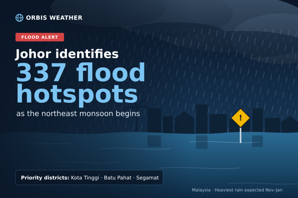
Johor has identified 337 flood hotspots across its 10 districts ahead of the northeast monsoon rains expected from November to January. Kota Tinggi, Batu Pahat and Segamat will get priority, and the state is seeking RM20 million to RM30 million in emergency funds for immediate maintenance work.
The figures were given on Tuesday, November 3, by Mohamad Fazli Mohamad Salleh, who chairs the Johor state committee for public works, transport, infrastructure and communications. He spoke to reporters after visiting a flood wall and drainage project on Sungai Rinting in Pasir Gudang, according to Malay Mail, Utusan Malaysia and RTM.
Key facts
|
|
|
|---|---|
|
Announced by |
Mohamad Fazli Mohamad Salleh, Johor public works, transport, infrastructure and communications committee chairman |
|
When and where |
Tuesday, November 3, 2026, at the Sungai Rinting project, Pasir Gudang |
|
Priority districts |
Kota Tinggi, Batu Pahat, Segamat |
|
Monsoon season |
Began October 27, expected to last until March 2027 (MetMalaysia) |
|
Main flood risk period |
November to January |
Where the hotspots are
The district figures come from the Department of Irrigation and Drainage (DID), Malay Mail reported. Utusan Malaysia reported that Kota Tinggi’s hotspots are residential and village areas, and that Batu Pahat’s include locations along Sungai Simpang Kiri and Sungai Batu Pahat.
How Johor is preparing
Mohamad Fazli said the state would deal first with work that can be done straight away, such as maintenance, because embankments and flood walls take longer to build. “Priority will be given to tasks that can be executed immediately,” he said, as quoted by Malay Mail. Utusan Malaysia quoted him as saying the state would set priorities “mengikut merit serta ‘priority’ kawasan” (according to merit and the priority of each area), favouring places that directly affect residents and main roads over plantation land.
The measures he listed include:
- Emergency funding: an application for RM20 million to RM30 million to cover November and December. Malay Mail said the state was preparing the application, RTM described it as an application received, and Utusan Malaysia reported a figure of up to RM30 million.
- Roads: Utusan Malaysia reported that the Public Works Department (JKR) expects 30 road alignments in Kota Tinggi to be affected, including seven locations on the Kota Tinggi–Mersing route. Malay Mail described 30 high-risk road locations, 21 on federal roads and 9 on state roads, without naming a district. Malay Mail also reported 21 high-risk locations covering 6.5 km in Batu Pahat and 16 in Segamat, split evenly between federal and state roads.
- Batu Pahat works: RM11.79 million for road pavement maintenance, RM3.20 million for other road works and RM1.92 million under the MARRIS road allocation for drainage-related work. The state has also set up mobile pumps at the Parit Botak sluice gate and planned alternative routes via the FT024 federal road and the PLUS Highway.
- Maintenance and readiness: mapping hotspots, cleaning and dredging drains, getting machinery ready, public outreach, and use of the eBencana disaster reporting system.
- Longer-term schemes: Phase 1 of the Sungai Johor Flood Mitigation Plan, the Sungai Pemandi Flood Mitigation Plan, flood alleviation in Kampung Sungai Kapal Lama in Pengerang, flood mitigation schemes for Bandar Batu Pahat and Sungai Batu Pahat, and coastal embankment upgrades.
The Sungai Rinting project he visited is worth RM3.4 million and will benefit about 300 residents along the river, RTM reported.
What the monsoon could bring
The Malaysian Meteorological Department (MetMalaysia) said on October 23 that the 2026/2027 northeast monsoon would begin on October 27 and continue until March. Its director-general, Dr Mohd Hisham Mohd Anip, said three to five episodes of continuous heavy rain were expected from November to January, which “could lead to flooding in low-lying areas and locations near rivers.” He also warned of rough seas in the South China Sea.
Utusan Malaysia, reporting Tuesday’s briefing, said MetMalaysia expects above-normal rainfall from late December to January. From January to March, MetMalaysia expects rain to ease, particularly in the northern Peninsula and Sabah, and has warned of a risk of more extreme heat linked to what it called the ongoing “Super El Niño”.
The northeast monsoon, known in Malay as musim tengkujuh, is Malaysia’s main wet season.
Storms already hitting the Peninsula
The announcement came a day after heavy rain caused flash floods across the Klang Valley on Monday, November 2. Free Malaysia Today reported that the worst-hit area was Kampung Melayu Subang in Selangor, where the river reached 18.77 metres against a danger level of 17.4 metres. About 92 homes were flooded and three people were moved to a relief centre; no deaths were reported.
On Tuesday afternoon, MetMalaysia issued thunderstorm warnings for 10 states, valid until 8 p.m. In Johor they covered Batu Pahat, Muar, Tangkak and Kluang, according to Malay Mail. MetMalaysia issues these warnings when rain is expected to exceed 20 mm an hour, and each is valid for up to six hours.
What residents should do
Deputy Prime Minister Datuk Seri Ahmad Zahid Hamidi urged the public on October 27 to stay vigilant as the monsoon began, warning that the rain “could increase the risk of flooding, particularly in areas near rivers and low-lying areas.” He told people to “never attempt to cross floodwaters,” adding: “Safety for yourself and your family must come first.”
- Check MetMalaysia’s warnings before travelling, especially in the afternoon and evening, when its recent thunderstorm alerts have applied.
- People living in or near the hotspots, particularly along rivers in Muar, Batu Pahat and Kota Tinggi, should know their nearest relief centre and how they would leave.
- Report flooding through the eBencana disaster reporting system, which the Johor government named among its preparations.
- Drivers should avoid flooded roads and use alternative routes where authorities have set them, such as those planned around Batu Pahat.
About this article
This article summarizes statements by the Johor state government and MetMalaysia as reported by Malaysian news outlets. It is not an official warning. Readers in Malaysia should follow MetMalaysia, the Department of Irrigation and Drainage and their local authorities. The reports differed on some details, such as the road figures and the status of the funding request, and both versions are given above.
Frequently asked questions
What is a flood hotspot? It is a location that the authorities have marked as likely to flood, usually because of past flooding, low ground or nearness to a river. Johor’s list covers residential areas, villages and road locations that will get priority for maintenance and monitoring.
Which Johor district has the most hotspots? Muar has the most, followed by Johor Bahru and Batu Pahat. The state has nonetheless named Kota Tinggi, Batu Pahat and Segamat as its priority districts.
How long will the flood season last? MetMalaysia expects the northeast monsoon to run until March 2027. The heaviest rain is forecast for November to January, after which rain is expected to ease.
How can I get flood warnings in Malaysia? MetMalaysia issues thunderstorm and heavy-rain warnings on its website and through the media. Floods can be reported through the eBencana system, which Johor has included in its preparations.
Sources
- Malay Mail: Johor identifies 337 flood hotspots as state braces for northeast monsoon (Nov 3, 2026)
- Utusan Malaysia: 337 lokasi ‘hotspot’ banjir di Johor dikesan susulan Monsun Timur Laut (Nov 3, 2026)
- Berita RTM: Banjir: 337 lokasi ‘hotspot’ dikenal pasti di Johor (Nov 3, 2026)
- Malay Mail: North-east monsoon begins Oct 27, MetMalaysia warns (Oct 23, 2026)
- Malay Mail: Zahid urges public to stay alert as northeast monsoon begins (Oct 27, 2026)
- Free Malaysia Today: Flash floods batter Klang Valley (Nov 2, 2026)
- Malay Mail: MetMalaysia warns of torrential evening rain across 10 states (Nov 3, 2026)
About the Author
Paul Harrison — Founder & Publisher, Orbis Weather
Paul Harrison founded Orbis Weather in 2026 to make global weather and natural-hazard information easier to find, follow and understand. His coverage includes tropical cyclones, severe weather, extreme temperatures, earthquakes, volcanoes, wildfires, flooding and significant natural disasters worldwide.
View all articles by Paul Harrison → | Editorial Standards →
Global Weather Tracker Hub
Explore weather maps, tropical systems, storms and natural hazards around the world.
No matching trackers found.