
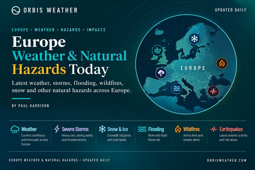
🌍 Europe Weather & Natural Hazards Today
By Paul Harrison | Founder & Publisher, Orbis Weather

- Malaysia Flood Alert: Johor Identifies 337 Flood Hotspots as Northeast Monsoon Begins 9:33 PM
- Europe Weather & Natural Hazards Today — Wednesday, November 4, 2026 7:14 PM
- Southeast Asia Weather & Natural Hazards Today: Wednesday, November 4, 2026 7:05 PM
- Singapore Lightning & Thunderstorms This Week — Wednesday, November 4, 2026 6:57 PM
- Africa Weather & Natural Hazards Today — Wednesday, November 4, 2026 6:44 PM
- Middle East Weather & Natural Hazards Today – Wednesday, November 4, 2026 3:54 PM
- Europe’s Cold Spots This Week Nov 3, 2026 2:51 PM
- Australia, New Zealand & Oceania Weather & Natural Hazards Today — Wednesday, November 4, 2026 11:26 AM
- Eastern Australia Weather Update: Dangerous Storms, Giant Hail and Destructive Winds 10:26 AM
- Mount Semeru Erupts in Indonesia, Sending Dangerous Pyroclastic Flow Down Its Slopes 8:34 AM
- South America Weather & Natural Hazards Today — November 3, 2026 8:09 AM
- Central America Weather & Natural Hazards Today: Heavy Rain, Flooding and Landslide Concerns Continue Across the Region 8:00 AM
- North America Weather & Natural Hazards Today — November 3, 2026 7:50 AM
- Weekly Tropical Storm Tracker: Tuesday, November 3, 2026 7:39 AM
- Daily Earthquakes, Storms, Fires & Floods Report November 3, 2026 7:30 AM
- Tropical Atlantic Daily Report: Tuesday, November 3, 2026 7:11 AM
- Eastern & Central Pacific Tropical Weather Update: Tuesday, November 3, 2026 7:02 AM
- Western Pacific Tropical Weather Nov 3 6:51 AM





🌍 Europe Weather & Natural Hazards Today — Wednesday, November 4, 2026
ORBIS WEATHER | EUROPE DAILY REPORT
By Paul Harrison | Founder & Publisher, Orbis Weather
Published: Wednesday, November 4, 2026 — European local date
Coverage: United Kingdom, Ireland, Western Europe, Central Europe, Scandinavia, Mediterranean Europe, Eastern Europe and the Balkans
Reporting focus: Severe storms, flooding, damaging winds, thunderstorms, temperature extremes, snow, earthquakes, volcanoes and other natural hazards.
🌦️ Europe Weather Overview — November 4, 2026
Europe begins Wednesday with a sharp contrast in weather conditions, as unsettled conditions continue around the Mediterranean and southeastern Europe while high pressure brings generally quieter weather to the United Kingdom and parts of western Europe.
The main weather story is the continuing threat of heavy rainfall, thunderstorms and localized flooding across sections of southeastern Europe and the Mediterranean.
Greece remains an important monitoring area following the severe weather that affected the country earlier in the week. Rain and thunderstorm warnings extend into the early hours of Wednesday for parts of Thrace, the northeastern Aegean islands and the Dodecanese.
Meanwhile, southern France and Corsica face rain-related and thunderstorm warnings, with the potential for localized flooding where heavier downpours develop.
Farther north, Germany faces overnight frost in several regions, while the United Kingdom is expected to remain largely dry under persistent high pressure, although fog and chilly mornings may cause travel difficulties.
The broader European weather pattern also raises an interesting question about the approaching winter. Meteorologists are monitoring possible disruption to the stratospheric polar vortex, although this does not mean an immediate severe cold outbreak is expected.
Forecast context: UK Met Office, European weather-warning information and November 2 reporting on atmospheric developments.
🚨 Europe’s Main Weather Hazards Today
Hazard | Areas to monitor | Primary concern |
|---|---|---|
🌧️ Heavy rainfall | Greece, southern France, Corsica | Localized flooding |
⛈️ Thunderstorms | Eastern Greece, southern France, Mediterranean | Lightning and intense downpours |
💨 Strong winds | Adriatic and Mediterranean coastal areas | Marine disruption |
🧊 Frost | Germany and parts of Central Europe | Slippery roads |
🌫️ Fog | United Kingdom, inland western Europe | Reduced visibility |
🌊 Coastal hazards | Mediterranean and Adriatic | Rough seas and changing conditions |
🌍 Earthquakes | Greece, Italy, Balkans, Iceland | Ongoing seismic monitoring |
🌋 Volcanoes | Iceland, Italy | Volcanic activity monitoring |
The table combines identified weather-warning areas with standing natural-hazard monitoring priorities. It does not mean every listed hazard is currently active.
🇬🇷 Greece — Heavy Rain and Thunderstorms Remain a Concern
Greece remains one of Europe’s most important weather-monitoring areas following the unsettled conditions of the previous two days.
Storm Agneta brought significant severe-weather concerns to western Greece earlier in the week, including heavy rainfall, thunderstorms and flash-flood potential.
Attention now extends toward eastern and northeastern areas, where rain and thunderstorm warnings have been listed into Wednesday morning.
Areas requiring attention
Thrace: Rain and thunderstorm warnings into early Wednesday.
Northeastern Aegean islands: Additional rainfall and possible thunderstorms.
Dodecanese: Showers and thunderstorms could affect local travel and marine activities.
Western Greece: Monitoring continues for residual flooding, saturated ground and storm-related damage.
Mountainous terrain and narrow river valleys can increase flash-flood danger when intense rainfall occurs.
Residents should remain alert to rapidly rising water, particularly near streams, underpasses and low-lying roads.
Wednesday outlook: The greatest concern is localized rainfall and thunderstorm activity rather than a confirmed nationwide severe-weather emergency. Warning levels and expiration times should be checked against the latest Hellenic National Meteorological Service bulletins.
🇫🇷 France — Southern Rainfall, Thunderstorms and Flood Monitoring
Parts of southern France and Corsica face an unsettled Wednesday, with weather-warning information identifying both rainfall-related flooding concerns and thunderstorms.
Areas listed include Gard, Hérault, Bouches-du-Rhône, Haute-Corse and Corse-du-Sud.
These warnings cover a period extending through Wednesday, November 4.
Main hazards
🌧️ Heavy showers may cause temporary surface-water accumulation.
⛈️ Thunderstorms could produce lightning and brief intense rainfall.
🚗 Motorists should be cautious around flooded underpasses and low-lying roads.
🌊 Coastal conditions may become locally hazardous during stronger showers and gusts.
Southern France is particularly vulnerable to intense autumn rainfall when moist Mediterranean air interacts with cooler atmospheric conditions and nearby mountainous terrain.
Wednesday outlook: Localized flooding is the main risk to monitor, but the available warning information does not establish that widespread destructive flooding is occurring.
🇮🇹 Italy — Mediterranean Instability and Changing Coastal Conditions
Italy enters Wednesday following an unsettled start to the week.
A deep Mediterranean low-pressure system was forecast to produce significant rainfall and strong winds across central and southern Italy on Monday before progressing eastward toward Greece.
The effects of this earlier system provide important context for Wednesday’s weather, although its previous rainfall forecast should not be treated as a confirmed November 4 observation.
Regional monitoring
Southern Italy: Watch for lingering showers, isolated thunderstorms and wet roads.
Sardinia: Changing wind and marine conditions deserve attention.
Liguria: Wind-warning developments remain an important consideration along the northwestern coast.
Northern Italy and the Alps: Colder overnight conditions may produce frost in sheltered valleys and icy patches at higher elevations.
Sicily: Monitor local forecasts for Mediterranean showers and coastal winds.
Italy’s complex terrain can produce substantial differences in weather over short distances, particularly between Alpine communities, inland valleys and Mediterranean coastal regions.
Wednesday outlook: Local rainfall, coastal winds and mountain conditions are the main monitoring priorities. No nationwide severe-weather emergency is established by the information reviewed.
🇬🇧 United Kingdom — High Pressure, Fog and Chilly Mornings
The United Kingdom is experiencing a comparatively quiet weather pattern.
According to the UK Met Office, high pressure is expected to dominate from Wednesday through Friday, November 6.
This should bring mainly dry and settled weather across much of the country.
However, settled autumn weather does not necessarily mean uninterrupted sunshine.
What to expect
🌤️ Predominantly dry conditions across much of England and Wales.
🌫️ Overnight and morning fog, potentially slow to clear.
🌡️ Temperatures near or slightly below seasonal averages.
🧊 Localized overnight frost.
🌦️ Occasional cloud and light rain possible in northern and northwestern areas.
Fog may become one of the more important travel hazards, especially on rural roads and around major transport routes during the morning commute.
Looking ahead
The Met Office indicates that Atlantic weather systems may become more influential during the second week of November.
That could eventually bring a return to more frequent rainfall and stronger winds, particularly across western and northern areas.
Wednesday outlook: Generally settled, with fog and localized frost the principal concerns.
🇮🇪 Ireland — Atlantic Weather and Coastal Monitoring
Ireland sits close to the Atlantic storm track, making changes in pressure systems particularly important during November.
For Wednesday, attention should focus on regional cloud cover, coastal wind conditions and the possibility of weak weather fronts affecting Atlantic-facing areas.
Western counties, including Galway, Mayo, Clare and Donegal, are especially exposed when stronger Atlantic winds develop.
However, no specific nationwide Irish severe-weather warning has been independently established for this report.
Residents and travelers should consult Met Éireann for updated local forecasts, particularly before marine activities or longer journeys.
🇩🇪 Germany — Frost and Early-Winter Travel Concerns
Germany faces chilly overnight and early-morning conditions, with official frost warnings listed for several western and central districts.
Affected areas in the reviewed warning information include parts of North Rhine-Westphalia, Hesse and Rhineland-Palatinate.
Main concerns
🧊 Frost may develop on exposed surfaces and parked vehicles.
🚗 Bridges and untreated rural roads can become slippery when surface temperatures fall sufficiently.
🌫️ Localized fog could reduce visibility.
🏔️ Higher elevations may experience colder conditions than surrounding lowlands.
Frost does not necessarily mean widespread snow or freezing rain, and neither should be assumed without additional forecast evidence.
Wednesday outlook: Frost and localized visibility problems are the primary verified concerns in the available warning information.
🇪🇸 Spain and Portugal — Autumn Rainfall and Flash-Flood Awareness
The Iberian Peninsula remains an important region for monitoring autumn rainfall.
Eastern Spain is particularly vulnerable to intense Mediterranean rainstorms when moist air interacts with slow-moving upper-level disturbances.
Such systems can occasionally produce very heavy rainfall over relatively small areas.
Areas to monitor
Eastern Spain: Localized heavy showers and thunderstorms where instability develops.
Mediterranean coastal regions: Surface flooding and drainage problems during intense rainfall.
Northern Spain: Changing Atlantic weather conditions.
Portugal: Atlantic-facing coastal and marine conditions.
Warnings for parts of Spain were reported on November 3, but those alerts should not automatically be assumed to remain in effect throughout November 4.
Wednesday outlook: Monitor AEMET and IPMA for updated warnings. A major nationwide flood emergency has not been verified for either country in the information reviewed.
🇭🇷 🇸🇮 🇲🇪 Adriatic and Balkan Region — Wind and Coastal Hazards
The Adriatic coastline is another area where weather conditions deserve attention.
Wind warnings affected sections of Croatia and Montenegro in the preceding reporting period, while nearby Slovenia also experienced wind-related concerns.
Strong regional winds, including the bora, can develop rapidly along the eastern Adriatic coast.
Potential impacts
💨 Strong gusts on exposed roads and bridges.
🌊 Rough seas and hazardous small-boat conditions.
⛴️ Possible ferry and coastal transport disruption.
🏔️ Rapidly changing conditions in mountainous areas.
These are monitoring priorities rather than a claim that all previously issued warnings remain active on Wednesday.
Travelers should consult national meteorological agencies and ferry operators before departure.
🇸🇪 🇳🇴 🇫🇮 Scandinavia — Colder Weather and Increasing Winter Hazards
Northern Europe continues its seasonal transition toward winter.
Across Norway, Sweden and Finland, the combination of shorter daylight hours, colder overnight temperatures and increasingly frequent wintry conditions makes road and mountain safety especially important.
Regional outlook
Norway: Mountain snow, icy roads and coastal wind conditions remain important seasonal hazards.
Sweden: Frost and freezing conditions become increasingly relevant across northern and inland areas.
Finland: Snow and ice monitoring is important, particularly in northern districts.
Denmark: Coastal winds, fog and wet roads are typical hazards to monitor during November.
No specific November 4 snowfall accumulation or countrywide winter-storm warning has been verified for these countries in the information reviewed.
Local forecasts remain essential because conditions can vary considerably between coastal areas and inland highlands.
🇵🇱 🇨🇿 🇦🇹 Central Europe — Frost, Fog and Mountain Weather
Poland, the Czech Republic, Austria, Slovakia, Hungary and Switzerland are entering the period when overnight frost and mountain weather become increasingly important.
Across lower elevations, fog and low cloud can develop during periods of light winds and stable atmospheric conditions.
Higher elevations in the Alps and Carpathians require additional caution because weather can change rapidly.
Main hazards to monitor
🧊 Overnight frost and localized icy surfaces.
🌫️ Valley fog and reduced visibility.
🏔️ Snow and freezing conditions at higher elevations.
🚗 Hazardous mountain passes where wintry precipitation occurs.
🌧️ Localized rainfall and river-level changes.
These are regional seasonal concerns, not confirmed active severe-weather alerts across every country.
Travelers crossing Alpine routes should check local road conditions, especially during overnight and early-morning hours.
🌍 Earthquake Activity — Europe’s Seismic Zones
Earthquake monitoring remains an important part of Orbis Weather’s European natural-hazards coverage.
Europe experiences seismic activity throughout the year, particularly around the Mediterranean, the Balkans and Iceland.
Region | Primary seismic concern |
|---|---|
🇬🇷 Greece | Aegean tectonic activity |
🇮🇹 Italy | Apennine and southern Italian fault systems |
🇹🇷 Western Turkey | Active fault systems and Aegean earthquakes |
🇷🇴 Romania | Vrancea intermediate-depth earthquakes |
🇮🇸 Iceland | Tectonic and volcanic seismic activity |
🇦🇱 Albania and Balkans | Regional fault systems |
Is there a major earthquake emergency today?
No major European earthquake emergency has been independently verified for November 4 in the sources reviewed for this report.
This does not establish that no earthquakes have occurred. Smaller earthquakes happen frequently, and event catalogs are updated throughout the day.
Readers can check the European-Mediterranean Seismological Centre and USGS earthquake monitoring map for recent earthquake locations, magnitudes and depths.
🌋 Volcano Monitoring — Iceland, Italy and the Mediterranean
Europe contains several active volcanic systems that require ongoing scientific monitoring.
🇮🇸 Iceland
Iceland’s position along the Mid-Atlantic Ridge makes it one of Europe’s most geologically active countries.
Important monitoring areas include the Reykjanes Peninsula and Iceland’s major volcanic systems.
Scientists monitor earthquake swarms, ground deformation, gas emissions and other indicators of possible volcanic unrest.
🇮🇹 Italy
Italy’s principal volcanic monitoring areas include:
Mount Etna: Sicily’s active stratovolcano.
Stromboli: An active volcanic island north of Sicily.
Campi Flegrei: A volcanic caldera near Naples.
Mount Vesuvius: A closely monitored volcanic system near Naples.
Current volcanic status
No new European volcanic eruption or evacuation order has been independently confirmed for November 4 through the sources reviewed for this article.
For authoritative activity updates, consult the Italian National Institute of Geophysics and Volcanology and Icelandic Meteorological Office.
🔥 Wildfires and Smoke — Southern Europe
Although Europe’s peak summer wildfire season has ended, vegetation fires can still occur during autumn, particularly when dry conditions combine with strong winds.
Southern Spain, Portugal, Greece, Italy and the Balkans remain relevant monitoring regions.
The most important factors include vegetation dryness, wind speed, humidity and local ignition sources.
Wednesday assessment: No specific major new wildfire incident or evacuation has been independently verified for this report.
For satellite-based fire information, readers can consult the European Forest Fire Information System.
Satellite detections should not automatically be interpreted as confirmed uncontrolled wildfires.
❄️ Winter Watch — Could Europe’s Weather Turn Colder?
One of the more interesting atmospheric developments concerns the Northern Hemisphere’s stratospheric polar vortex.
Forecast models suggest the polar vortex could experience an unusually early weakening during November.
This matters because significant disruptions to the polar vortex can sometimes influence the position of the jet stream and the movement of cold air across the Northern Hemisphere.
However, the relationship is complicated.
A weakened polar vortex does not automatically produce a major European cold wave.
Current reporting indicates that severe cold across Europe is not considered likely during the next two to three weeks, although the possibility of altered atmospheric circulation later in the season deserves monitoring.
Orbis Weather assessment: This is a developing longer-range weather story, not an immediate blizzard or extreme-cold warning.
📅 Europe Weather Outlook — November 4–6, 2026
Date | Main developments to monitor |
|---|---|
Wednesday, Nov. 4 | Rain and thunderstorms in parts of Greece and southern France; German frost; UK fog |
Thursday, Nov. 5 | Mediterranean rainfall developments, coastal winds and continued monitoring of northern European temperatures |
Friday, Nov. 6 | High pressure likely to continue influencing the UK; reassess Mediterranean storms and Atlantic weather patterns |
This outlook identifies supported forecast trends and monitoring priorities. It is not a verified city-by-city forecast for all of Europe.
🚦 Regional Natural Hazards Summary
Editorial monitoring priorities for November 4 — not official Meteoalarm warning levels.
Region | Monitoring priority | Main concern |
|---|---|---|
Greece and Aegean | Elevated | Rain and thunderstorms |
Southern France and Corsica | Elevated | Heavy showers and localized flooding |
Southern Italy | Watch | Unsettled Mediterranean conditions |
Adriatic coast | Watch | Wind and marine hazards |
Germany | Elevated locally | Overnight frost |
United Kingdom | Routine | Fog and localized frost |
Iberian Peninsula | Watch | Rainfall and flash-flood potential |
Scandinavia | Seasonal watch | Cold, snow and ice |
Iceland | Ongoing monitoring | Seismic and volcanic activity |
Elevated indicates an identified weather concern in the reviewed information. It does not imply a red or orange official warning.
🛡️ Weather Safety — Advice for European Residents and Travelers
🌧️ Heavy rainfall and flooding
Never drive through floodwater. Avoid fast-flowing streams, low-water crossings and underground parking areas during intense rainfall.
⛈️ Thunderstorms
Move indoors when thunder is heard. Avoid exposed hillsides, open water and isolated trees.
💨 Strong winds
Secure outdoor objects, avoid exposed coastal areas and check ferry schedules before traveling.
🧊 Frost and ice
Allow additional travel time during cold mornings, especially on bridges, rural roads and mountain routes.
🌍 Earthquakes
During shaking, drop, cover and hold on. Follow local emergency guidance afterward.
🌋 Volcanic hazards
Respect exclusion zones and follow official volcanic monitoring and civil protection instructions.
🔎 Official Weather and Natural Hazard Sources
Orbis Weather uses authoritative meteorological and scientific organizations to help readers understand weather risks and natural hazards.
Organization | Information provided |
|---|---|
European severe-weather warnings | |
European and global forecast modeling | |
UK forecasts and weather warnings | |
French weather forecasts and alerts | |
Spanish weather forecasts and warnings | |
German weather forecasts and warnings | |
Greek weather information | |
European and Mediterranean earthquakes | |
Italian earthquakes and volcanoes | |
European environmental and satellite monitoring |
These organizations provide information with different publication schedules. Official warnings should always be checked directly for the latest changes.
📰 Final Outlook — Europe Weather & Natural Hazards Today
Europe’s weather picture on Wednesday, November 4, is dominated by contrasting conditions.
Southern and southeastern Europe remain the primary areas of concern, particularly Greece and southern France, where rainfall and thunderstorm warnings require attention.
Italy and the Adriatic region continue to warrant monitoring for changing Mediterranean weather, while Germany faces localized frost.
The United Kingdom is experiencing a comparatively quiet spell, with high pressure bringing predominantly dry conditions but also increasing the potential for fog and chilly mornings.
Across northern Europe, the transition toward winter continues, while meteorologists monitor atmospheric developments that could eventually influence Europe’s weather later in the season.
For now, the most immediate practical concerns are heavy rain, localized flooding, thunderstorms, coastal winds, frost and reduced visibility.
Orbis Weather will continue following significant European developments involving severe storms, flooding, winter weather, earthquakes, volcanoes, wildfires and other natural hazards.
About the Author
Paul Harrison — Founder & Publisher, Orbis Weather
Paul Harrison founded Orbis Weather in 2026 to make global weather and natural-hazard information easier to find, follow and understand. His coverage includes tropical cyclones, severe weather, extreme temperatures, earthquakes, volcanoes, wildfires, flooding and significant natural disasters worldwide.
View all articles by Paul Harrison → | Editorial Standards →
Global Weather Tracker Hub
Explore weather maps, tropical systems, storms and natural hazards around the world.
No matching trackers found.