
🌏 Southeast Asia Weather & Natural Hazards Today:

- Malaysia Flood Alert: Johor Identifies 337 Flood Hotspots as Northeast Monsoon Begins 9:33 PM
- Europe Weather & Natural Hazards Today — Wednesday, November 4, 2026 7:14 PM
- Southeast Asia Weather & Natural Hazards Today: Wednesday, November 4, 2026 7:05 PM
- Singapore Lightning & Thunderstorms This Week — Wednesday, November 4, 2026 6:57 PM
- Africa Weather & Natural Hazards Today — Wednesday, November 4, 2026 6:44 PM
- Middle East Weather & Natural Hazards Today – Wednesday, November 4, 2026 3:54 PM
- Europe’s Cold Spots This Week Nov 3, 2026 2:51 PM
- Australia, New Zealand & Oceania Weather & Natural Hazards Today — Wednesday, November 4, 2026 11:26 AM
- Eastern Australia Weather Update: Dangerous Storms, Giant Hail and Destructive Winds 10:26 AM
- Mount Semeru Erupts in Indonesia, Sending Dangerous Pyroclastic Flow Down Its Slopes 8:34 AM
- South America Weather & Natural Hazards Today — November 3, 2026 8:09 AM
- Central America Weather & Natural Hazards Today: Heavy Rain, Flooding and Landslide Concerns Continue Across the Region 8:00 AM
- North America Weather & Natural Hazards Today — November 3, 2026 7:50 AM
- Weekly Tropical Storm Tracker: Tuesday, November 3, 2026 7:39 AM
- Daily Earthquakes, Storms, Fires & Floods Report November 3, 2026 7:30 AM
- Tropical Atlantic Daily Report: Tuesday, November 3, 2026 7:11 AM
- Eastern & Central Pacific Tropical Weather Update: Tuesday, November 3, 2026 7:02 AM
- Western Pacific Tropical Weather Nov 3 6:51 AM




Southeast Asia Weather & Natural Hazards Today: Wednesday, November 4, 2026
· @Paul
By Paul Harrison, Orbis Weather
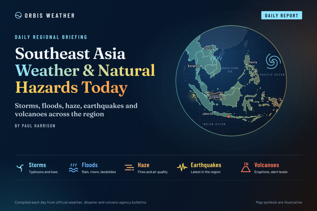
No tropical cyclone threatens Southeast Asia this Wednesday. The main hazards are afternoon thunderstorms and flash-flood risk in Malaysia after flooding in the Klang Valley, heavy-rain alerts in parts of Indonesia, and a flood watch for southern Thailand that starts on Thursday. Typhoon In-fa is far to the northeast over the Pacific south of Japan and forecast to move away, and Cyclone Murasu came ashore in India, outside the region.
Mount Semeru in East Java erupted again on Tuesday, and Mayon in the Philippines is at Alert Level 3. Singapore’s air quality is in the Moderate range, and showers are expected to keep smoke haze down. This report is current to 7:00 a.m. Wednesday, November 4 in Bangkok, Hanoi and Jakarta (UTC+7), 8:00 a.m. in Manila, Singapore and Kuala Lumpur (UTC+8), and 7:00 p.m. Tuesday, November 3 US Eastern time.
Key facts
Hazard | Where | Latest |
|---|---|---|
Thunderstorms, flash floods | Peninsular Malaysia, Sabah, Sarawak | MetMalaysia evening thunderstorm warnings on Tuesday; Klang Valley flash floods on Monday |
Storm and flood watch | Upper Thailand; all 14 southern provinces | Department of Disaster Prevention and Mitigation (DDPM) alert for November 5 to 9 |
Heavy rain | North Sumatra, Bangka Belitung (Indonesia) | BMKG “Siaga” (alert) level for heavy to very heavy rain, November 3 to 5 |
Volcanic eruption | Semeru, East Java | Eruptions on Tuesday, one with a pyroclastic flow |
Volcanic unrest | Mayon, Philippines | Minor explosive lava activity; 6 km danger zone closed |
Smoke haze | Singapore, southern ASEAN | Haze lingering; showers expected to limit it |
Tropical cyclones
Neither active storm threatens Southeast Asia, and no other depression or low-pressure area was listed in the western Pacific, South China Sea, Bay of Bengal or Andaman Sea.
Storm | Latest position | Strength | Movement | Agency |
|---|---|---|---|---|
Typhoon In-fa (30W) | 23.5°N 138.8°E at 11 p.m. Tuesday Manila time, over the Pacific south of Japan | Typhoon (JMA); 130 km/h (70 knots) sustained winds, gusts 157 km/h (JTWC, 8 a.m. Monday Manila time) | JMA forecasts a track north to 26.3°N 138.5°E by Wednesday night, then a turn northeast into the open Pacific | Japan Meteorological Agency (JMA); US Joint Typhoon Warning Center (JTWC) |
Cyclone Murasu (04B) | Inland over south coastal Andhra Pradesh, India: 15.7°N 80.2°E, about 30 km north-northeast of Ongole, at 8:30 a.m. India time (10:00 a.m. Bangkok time) Tuesday | Severe cyclonic storm at landfall, winds 95–105 km/h, gusts 115 km/h; forecast to weaken to a deep depression by Tuesday midnight India time | North-northwest at 8 km/h | India Meteorological Department (IMD) |
Floods and heavy rain
Malaysia
Heavy rain on Monday, November 2, caused flash floods across the Klang Valley around Kuala Lumpur. Free Malaysia Today reported that the worst-hit area was Kampung Melayu Subang, where the river reached 18.77 metres against a danger level of 17.4 metres. About 92 homes were flooded, and the Selangor fire and rescue department moved three people to a relief centre. No deaths were reported.
On Tuesday at 4:10 p.m. Malaysia time, MetMalaysia issued thunderstorm warnings valid to 8:00 p.m. for 10 states. They included five Selangor districts, among them Petaling and Klang. MetMalaysia issues these alerts when rain is expected to exceed 20 mm an hour. In late October it forecast three to five episodes of continuous heavy rain between November and January during the northeast monsoon.
Thailand
DDPM has put Bangkok and 61 provinces on alert for November 5 to 9, citing the Thai Meteorological Department (TMD). A new high-pressure system, or cold air mass, from China is expected to spread over upper Thailand and the South China Sea. That will bring thundershowers and gusty winds to 47 northern, northeastern, central and eastern provinces plus Bangkok from November 5 to 7. All 14 southern provinces are under a flood watch for November 5 to 9, with rain intensifying from November 7. DDPM warned that “heavy to very heavy rain could trigger flash floods, rapid runoff, mudslides and localised flooding.”
Country-by-country weather today
Country | Main weather today | Hazard to watch |
|---|---|---|
Philippines | PAGASA’s latest forecast (November 3): the northeast monsoon, or amihan, brings cloudy skies and isolated light rain to Ilocos, the Cordillera and Cagayan Valley; elsewhere, including Metro Manila, partly cloudy with isolated showers or thunderstorms | High heat index: 42°C in Cavite City on Tuesday led to class suspensions |
Vietnam | Northern Vietnam is between two cold-air surges; the national forecast centre expects daytime sunshine and highs of 28–32°C after the first, weak surge | Stronger cold surge and showers, locally heavy, from November 5 to 7 |
Thailand | Bangkok: scattered thundershowers with gusty winds and isolated heavy rain; 24–26°C low, 33–35°C high (TMD) | Storms from Thursday; southern flood watch |
Malaysia | Afternoon and evening thunderstorms are the pattern, after MetMalaysia warnings on Monday and Tuesday | Flash floods in low-lying Klang Valley areas |
Singapore | Moderate to heavy thundery showers in the afternoon on most days, highs of 33–35°C (Meteorological Service Singapore outlook for the first half of November) | Lingering smoke haze |
Indonesia | BMKG expects moderate to heavy rain across much of Sumatra, Java, Bali, Nusa Tenggara Barat, Kalimantan, Sulawesi, Maluku and Papua; in West Kalimantan, Landak regency is flagged for Wednesday | Strong winds in Banten and West Java (BMKG, November 3 to 5) |
Earthquakes
The strongest earthquakes the US Geological Survey (USGS) recorded in Southeast Asia in the 48 hours to Wednesday morning were moderate, and most were deep, more than 90 km below the surface.
Magnitude | Location | Local time | Depth |
|---|---|---|---|
4.8 | 85 km south of Gorontalo, Indonesia | 11:37 p.m. Tue Nov 3 (WITA, UTC+8) | 137 km |
4.5 | 31 km east of Mawlaik, Myanmar | 11:53 a.m. Tue Nov 3 (Myanmar time, UTC+6:30) | 116 km |
4.7 | 113 km southwest of Basco, Philippines | 4:42 p.m. Mon Nov 2 (Philippine time, UTC+8) | 35 km |
5.1 | 19 km west-northwest of Tomohon, Indonesia | 4:13 p.m. Mon Nov 2 (WITA, UTC+8) | 197 km |
5.1 | Banda Sea, Indonesia | 9:53 a.m. Mon Nov 2 (WIT, UTC+9) | 94 km |
Tsunami status: USGS flagged none of these events for tsunami potential.
Volcanoes
Volcano | Country | Alert level | Latest activity |
|---|---|---|---|
Mayon | Philippines | 3 of 5 (magmatic unrest) | Minor Strombolian activity (small explosive bursts of lava); plume 1,600 m above the crater; 11 volcanic earthquakes; sulfur dioxide 1,894 tonnes a day |
Kanlaon | Philippines | 2 of 5 (increased unrest) | 16 volcanic earthquakes; sulfur dioxide 1,532 tonnes a day; 150 m plume. No entry within 4 km; sudden steam-driven eruptions possible |
Taal | Philippines | 1 of 5 (low-level unrest) | 30 volcanic earthquakes; 500 m plume; sulfur dioxide 273 tonnes a day |
Bulusan | Philippines | 1 of 5 (low-level unrest) | 3 volcanic earthquakes; weak plume |
Semeru | Indonesia (East Java) | Level III of IV (Siaga) | Four eruptions on Tuesday between 12:34 a.m. and 12:52 p.m. WIB, one with a pyroclastic flow (a fast avalanche of hot gas and rock) hidden by fog. Exclusion zone 5 km around the summit, 13 km to the southeast |
Philippine figures are from PHIVOLCS 24-hour bulletins issued at midnight Wednesday, Manila time; Semeru details are from Indonesia’s Center for Volcanology and Geological Hazard Mitigation (PVMBG) via Antara.
Haze, fires and air quality
Singapore’s National Environment Agency (NEA) expects the smoke haze situation to improve with the start of the inter-monsoon period. The ASEAN Specialised Meteorological Centre (ASMC) has downgraded the southern ASEAN region to Alert Level 2 and reports few to isolated hotspots, although it has observed moderate to dense smoke over southern Sumatra, central Kalimantan, Sulawesi and southern Papua. In Singapore, the 24-hour Pollutant Standards Index (PSI) was 63–81 (Moderate) at 6 p.m. Tuesday, and NEA forecasts 51–80 (Moderate) for Wednesday, with showers expected to keep the haze down. Between October 16 and 28, Singapore’s air quality reached “Unhealthy” on seven days and “Very Unhealthy” on three.
What to watch over the next few days
- Southern Thailand, November 5 to 9: heaviest rain expected from November 7, with flash-flood and mudslide risk.
- Cold air from China, November 5 to 7: a stronger surge into northern Vietnam, with overnight lows of 21–24°C and below 21°C in some mountain areas, plus storms over upper Thailand.
- Malaysia’s northeast monsoon: further thunderstorm warnings would raise the flash-flood risk again in flood-hit Selangor districts such as Petaling and Klang.
- Semeru: further eruptions and lahars (volcanic mudflows) during heavy rain along the Besuk Kobokan valley, where PVMBG warns of risk up to 17 km from the summit.
- Typhoon In-fa: JMA expects it to turn northeast into the open Pacific by Thursday.
About this article
This report summarizes official bulletins and news reports from national weather, disaster and geological agencies. It is not an official warning: readers should follow their national meteorological agency and local authorities. Wind speeds are converted from knots (1 knot = 1.852 km/h) and rounded; earthquake times are converted from UTC to local time. Each agency’s figures carry the time they were issued, and conditions can change quickly after publication.
Frequently asked questions
Is a typhoon heading for the Philippines or Vietnam? No. Typhoon In-fa is south of Japan and forecast by JMA to curve northeast into the open Pacific. No other tropical depression or low-pressure area was listed over the western Pacific or South China Sea.
Why is Thailand expecting storms when a cold air mass is arriving? When high pressure from China pushes cold, dry air south, it meets warm, humid air over Thailand. The clash can set off thunderstorms and gusty winds, while northeast winds push moisture onto the southern peninsula.
What does Semeru’s Level III (Siaga) status mean? It is the second-highest level on Indonesia’s four-step scale. PVMBG keeps the public out of set danger zones around the summit and along the Besuk Kobokan river valley, where pyroclastic flows and lahars travel.
Is Singapore’s air safe today? NEA forecasts the 24-hour PSI to stay in the Moderate band (51 to 100) on Wednesday. NEA says the health impact of haze depends on a person’s health status, the PSI level, and the length and intensity of outdoor activity, and advises using its daily forecast to plan.
Sources
- JTWC Western Pacific significant tropical weather advisory
- JTWC Indian Ocean significant tropical weather advisory
- JMA active tropical cyclones and Typhoon In-fa forecast track
- ETV Bharat: Cyclone Murasu weakens after Andhra landfall (Nov 3)
- Philstar: Rain or shine, mixed weather expected across Philippines (Nov 3)
- DTiNews: Northern Vietnam braces for two consecutive cold air surges (Oct 31)
- Nation Thailand: Bangkok and 61 provinces on alert for storms and flash floods (Nov 3)
- Nation Thailand: DDPM warns of Phuket flood risks (Oct 26)
- Thai Meteorological Department: weather forecast
- Malay Mail: MetMalaysia warns of torrential evening rain across 10 states (Nov 3)
- Free Malaysia Today: Flash floods batter Klang Valley (Nov 2)
- Bernama: MetMalaysia warns of flood risk during 2026/2027 northeast monsoon (Oct 23)
- AsiaOne: Singapore weather outlook, first half of November (Oct 29)
- NEA: Haze situation update (Nov 3)
- ASEAN Specialised Meteorological Centre
- Akurat: BMKG weather warnings for November 4
- Pontianak Info: BMKG West Kalimantan warning, November 3–5
- USGS earthquake catalogue query
- PHIVOLCS 24-hour bulletins: Mayon, Kanlaon, Taal, Bulusan
- Antara: Semeru erupts with pyroclastic flow (Nov 3)
About the Author
Paul Harrison — Founder & Publisher, Orbis Weather
Paul Harrison founded Orbis Weather in 2026 to make global weather and natural-hazard information easier to find, follow and understand. His coverage includes tropical cyclones, severe weather, extreme temperatures, earthquakes, volcanoes, wildfires, flooding and significant natural disasters worldwide.
View all articles by Paul Harrison → | Editorial Standards →
Global Weather Tracker Hub
Explore weather maps, tropical systems, storms and natural hazards around the world.
No matching trackers found.
The Southeast Asia Weather & Natural Hazards Today briefing from Orbis Weather tracks the most important weather and natural-hazard developments across Singapore, Indonesia, the Philippines, Malaysia, Thailand, Vietnam, Myanmar and the wider Southeast Asia region.
Updated regularly, the briefing covers tropical weather, earthquakes, volcanic activity, monsoon flooding, severe thunderstorms, wildfire smoke, haze and other significant hazards. Conditions can change rapidly, so readers should follow official national authorities for warnings, evacuations and emergency information.