
By Paul Harrison | Founder & Publisher, Orbis Weather
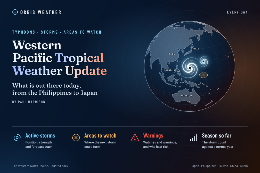






WESTERN PACIFIC Tropical Weather Update: Typhoon Cempaka Strengthens as Philippines and Japan Monitor Its Track
Orbis Weather | Sunday, November 8, 2026
By Paul Harrison | Orbis Weather
TYPHOON CEMPAKA IS NOW THE MAIN TROPICAL THREAT IN THE WESTERN PACIFIC, strengthening over the Philippine Sea as forecasters monitor its movement toward the northwest and an anticipated change in direction during the coming days.
The storm has intensified into a typhoon, with sustained winds reaching approximately 75 mph (120 km/h). Although Cempaka remains well offshore, its development is attracting attention across the Philippines, Japan and the wider western North Pacific.
The latest forecasts suggest the system will remain over open water rather than make a direct landfall in the Philippines. However, changing steering winds, possible further intensification and hazardous marine conditions make continued monitoring important.
National Weather Service+1
1. Western Pacific Tropical Cyclone Activity
Based on the JTWC Significant Tropical Weather Advisory issued November 8, 2026, at 06:00 UTC.
System | Classification | Status |
|---|---|---|
Cempaka (31W) | Typhoon | Active |
Other tropical cyclones | None reported | No active systems |
Additional tropical disturbances | None reported | No development areas identified |
Subtropical systems | None reported | No active systems |
The Joint Typhoon Warning Center (JTWC) identifies Cempaka as the only active tropical cyclone in the western North Pacific in its November 8 basin-wide advisory. No additional tropical disturbances or subtropical systems were listed.
This does not guarantee that new disturbances will not form. Tropical weather conditions can change rapidly, particularly during November, when warm ocean waters can still support powerful typhoons.
TropicalInfo+1
2. Typhoon Cempaka (31W): Latest Position and Strength
According to the National Weather Service in Guam, the following conditions were reported at 1:00 p.m. Chamorro Standard Time on Sunday, November 8 (03:00 UTC):
Measurement | Latest reported value |
|---|---|
Storm name | Cempaka |
International designation | 31W |
Classification | Typhoon |
Center position | 21.6°N, 138.1°E |
Maximum sustained winds | 75 mph (120 km/h) |
Movement | West at 14 mph (23 km/h) |
Distance from Guam | Approximately 710 miles northwest |
Distance from Saipan | Approximately 670 miles northwest |
Typhoon-force wind radius | Up to 10 miles from center |
Tropical-storm-force wind radius | Up to 115 miles north of center |
Cempaka strengthened from a tropical storm into a typhoon as it moved away from the Northern Mariana Islands.
Forecasters expect the system to turn northwestward and slow during Monday, with additional strengthening possible in the near term.
The National Weather Service reported no tropical cyclone watches or warnings in effect for Guam and the Northern Mariana Islands in this advisory.
National Weather Service
3. Philippines: Will Cempaka Enter the Philippine Area of Responsibility?
The Philippine Atmospheric, Geophysical and Astronomical Services Administration (PAGASA) reports that Cempaka remains outside the Philippine Area of Responsibility (PAR).
In its November 8 afternoon assessment, PAGASA placed the typhoon approximately 1,600 kilometers east of extreme northern Luzon, with sustained winds of 120 km/h and gusts reaching 150 km/h.
PAGASA forecasts that Cempaka could enter the PAR on Monday morning, November 9, when it would receive the local name Samuel.
The anticipated track then takes the storm north-northeastward, potentially allowing it to leave the PAR by Monday evening or early Tuesday.
Importantly, the current forecast does not indicate a direct impact on Philippine land areas.
However, the northeast monsoon is expected to produce moderate to rough seas along portions of northern and central Luzon. Very rough conditions may develop along northern Luzon coastlines from Tuesday, with a gale warning potentially required.
Residents and maritime operators should distinguish between the effects of the northeast monsoon and the direct effects of Cempaka.
origin.pagasa.dost.gov.ph+1
4. Japan and the Ryukyu Islands: What to Watch
Cempaka’s position south of Japan and its anticipated northward turn make the waters of the western North Pacific an important area to monitor.
The latest available forecasts do not establish a direct landfall threat to mainland Japan or the Ryukyu Islands.
Nevertheless, the following developments deserve attention:
Changes in the forecast track as Cempaka approaches its anticipated turn.
Potential strengthening before the storm encounters less favorable atmospheric conditions.
Increasing swell and hazardous seas along portions of the storm’s offshore track.
Any changes in official marine advisories affecting shipping routes and island communities.
The Japan Meteorological Agency (JMA) remains an essential source for updated tropical cyclone forecasts and marine warnings.
At this stage, it would be premature to suggest that Cempaka will strike Japan.
5. Guam and the Northern Mariana Islands
Cempaka has continued moving away from Guam, Saipan and the northern islands of the Commonwealth of the Northern Mariana Islands.
The November 8 Guam advisory confirms that no tropical cyclone watches or warnings were in effect.
Although the storm’s center is moving farther away, mariners should continue checking local coastal forecasts for any remaining swell or hazardous marine conditions.
Residents should rely on the National Weather Service Guam for localized information rather than interpreting the storm’s distance alone as a guarantee of safe conditions.
National Weather Service
6. Other Tropical Weather Across the Western Pacific
While Cempaka is the only active tropical cyclone identified in the latest JTWC advisory, several other atmospheric features are producing showers and thunderstorms across the tropical western Pacific.
Micronesia and the Near-Equatorial Trough
The National Weather Service Guam identifies a near-equatorial trough extending across portions of Micronesia, including an area of low pressure near Kosrae.
This feature is associated with scattered to numerous showers in some locations.
The trough is expected to weaken somewhat as a strengthening ridge disrupts its circulation.
Palau and Yap
A separate trade-wind trough east of Palau and Yap is generating scattered to numerous showers and isolated thunderstorms.
The disturbance is expected to move westward over the coming days.
Neither feature was classified as a tropical cyclone or listed as a tropical development area in the JTWC’s November 8 advisory.
Nevertheless, localized heavy rainfall, lightning and rapidly changing marine conditions remain possible near stronger thunderstorms.
National Weather Service+1
7. Regional Tropical Weather Outlook: November 8–11
Region | Outlook | Primary concern |
|---|---|---|
Philippine Sea | Active typhoon | Cempaka’s track and intensity |
Northern Philippines | Northeast monsoon | Rough seas and localized heavy rain |
Southern Japan | Monitor Cempaka | Offshore track and marine conditions |
Guam and Northern Marianas | Cempaka moving away | Remaining marine hazards |
Palau and Yap | Trade-wind trough | Showers and thunderstorms |
Kosrae and nearby waters | Near-equatorial trough | Locally heavy showers |
South China Sea | Monitor local forecasts | Monsoon winds and sea conditions |
This regional assessment combines the latest available tropical cyclone advisories and weather discussions. It is not a prediction that every listed region will experience dangerous conditions.
8. Why November Typhoons Can Still Be Dangerous
Although the western North Pacific’s most active tropical cyclone period generally occurs between May and October, typhoons can develop during any month of the year.
November storms may encounter changing atmospheric conditions as stronger weather systems move across East Asia.
Several factors can influence their development:
Ocean temperatures: Warm waters provide energy that can sustain tropical cyclones and sometimes support rapid intensification.
Vertical wind shear: Strong differences in wind speed or direction with altitude can disrupt the organization of a tropical cyclone.
Steering currents: Subtropical high-pressure systems and approaching troughs can determine whether a typhoon moves westward toward land or curves north and northeast over the ocean.
Dry air: The intrusion of dry air into a cyclone’s circulation can weaken thunderstorm activity and reduce its intensity.
Ocean swell: Large waves generated by powerful storms can travel far beyond their immediate wind fields, potentially affecting coastlines even when a cyclone remains offshore.
November remains an important month for tropical cyclone monitoring, particularly across the Philippine Sea and western Pacific shipping corridors.
9. What Happens Next? The 72-Hour Outlook
Forecast period: Sunday, November 8, through Wednesday, November 11, 2026.
Sunday, November 8
Cempaka is expected to continue moving over the Philippine Sea, with additional strengthening possible. Its immediate threat remains concentrated over open waters.
Monday, November 9
The storm may briefly enter the Philippine Area of Responsibility, receiving the local name Samuel. A change toward a more northerly or northeasterly track is anticipated.
Tuesday, November 10
Forecasters will be watching whether Cempaka follows the predicted recurving path and how its intensity changes. The northeast monsoon may also produce increasingly hazardous seas along northern Luzon.
Wednesday, November 11
The storm’s location, intensity and possible effects on marine routes will depend on how quickly it turns and how it interacts with the surrounding atmospheric environment.
A specific Wednesday position or intensity cannot be confirmed from the advisories reviewed for this report.
The forecast remains subject to change.
National Weather Service+1
10. Safety Advice for Residents and Mariners
People living or traveling across the western Pacific should continue monitoring official weather information, especially where tropical cyclones, monsoon surges or strong thunderstorms could affect transportation and marine activities.
Mariners: Review official marine forecasts and avoid hazardous seas near tropical cyclone circulation.
Coastal communities: Pay attention to high-surf advisories and locally issued warnings.
Residents in flood-prone areas: Monitor rainfall alerts and avoid driving or walking through floodwater.
Travelers: Check airline and ferry updates where adverse weather may affect operations.
Island communities: Follow national meteorological agencies and emergency management authorities for locally applicable instructions.
A typhoon does not have to make landfall to create dangerous conditions at sea.
11. Orbis Weather Assessment
The western Pacific’s main tropical weather story on November 8 is the strengthening of Typhoon Cempaka.
The storm has developed into a typhoon over the Philippine Sea, and forecasters anticipate further changes in both its strength and direction.
For the Philippines, the current forecast is relatively favorable because the storm is expected to remain well offshore. However, northern coastal waters may become increasingly hazardous under the influence of the northeast monsoon.
For Japan, attention should remain focused on Cempaka’s anticipated recurvature and its eventual passage through the open western North Pacific.
Elsewhere, trade-wind disturbances across Micronesia continue to produce showers and thunderstorms, but the JTWC has not identified additional tropical cyclones or development areas in its latest basin-wide advisory.
The key question over the next 24–48 hours is whether Cempaka follows its forecast turn away from the Philippines while continuing to strengthen.
Orbis Weather will continue following official tropical cyclone information as the situation develops.
12. Frequently Asked Questions
Is there an active typhoon in the Western Pacific?
Yes. Typhoon Cempaka (31W) is active as of November 8, 2026, with sustained winds reported near 75 mph (120 km/h).
Will Typhoon Cempaka hit the Philippines?
Current forecasts do not indicate a direct landfall. PAGASA expects the storm to remain over the Philippine Sea and turn away from Philippine land areas.
What will Cempaka be called in the Philippines?
If Cempaka enters the Philippine Area of Responsibility as forecast, PAGASA will assign it the local name Samuel.
Is Guam under a typhoon warning?
No. The National Weather Service Guam’s November 8 afternoon advisory reported no tropical cyclone watches or warnings.
Are any other tropical cyclones active in the western North Pacific?
The JTWC’s November 8, 06:00 UTC advisory listed Cempaka as the only active tropical cyclone and identified no additional tropical disturbances.
When does the Western Pacific typhoon season end?
Unlike the Atlantic hurricane season, the western North Pacific has no fixed official end date. Tropical cyclones can form throughout the year, although activity typically peaks from late spring through autumn.
13. Official Sources and Further Information
This report draws on official meteorological bulletins and publicly available tropical cyclone analyses.
Joint Typhoon Warning Center (JTWC) — Tropical cyclone warnings, storm positions and forecast discussions.
Japan Meteorological Agency (JMA) — Regional tropical cyclone monitoring and forecasts.
PAGASA — Philippine tropical cyclone bulletins, weather forecasts and marine warnings.
National Weather Service Guam — Tropical cyclone advisories and regional weather discussions.
NOAA Satellite Services — Satellite observations of atmospheric conditions.
Specific source bulletins used include the JTWC Significant Tropical Weather Advisory of November 8 at 06:00 UTC, the NWS Guam Cempaka Advisory Number 8, and PAGASA’s November 8 afternoon weather assessment.
Editorial Methodology and Data Transparency
Prepared by Paul Harrison for Orbis Weather.
About the Author
Paul Harrison — Founder & Publisher, Orbis Weather
Paul Harrison founded Orbis Weather in 2026 to make global weather and natural-hazard information easier to find, follow and understand. His coverage includes tropical cyclones, severe weather, extreme temperatures, earthquakes, volcanoes, wildfires, flooding and significant natural disasters worldwide.
View all articles by Paul Harrison → | Editorial Standards →
🌀 Western Pacific Basin
Live typhoon tracking, tropical cyclone activity, satellite imagery, weather, sea-surface temperatures and waves across the Western North Pacific, including Japan, the Philippines, Taiwan, Guam and Micronesia.
⚠️ Western Pacific Tropics Right Now
Live basin status🌀 Western Pacific Storm Tracker
Live tropical cyclones · click a storm for track/cone🌀 Western Pacific Storm Tracker
Live tropical cyclones across the Western Pacific. Drag to pan, Ctrl/⌘+scroll to zoom, and click a storm to show its track and cone.