
🌀 Southwest Indian Ocean Tropical Weather Update
By Paul Harrison | Founder & Publisher, Orbis Weather
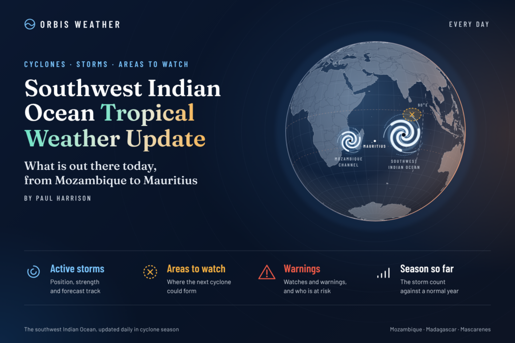






Southwest Indian Ocean Tropical Weather Update – Monday, November 9, 2026
By Paul Harrison | Orbis Weather
Coverage: Madagascar, Mozambique Channel, Mauritius, Réunion, Mayotte, Comoros, Seychelles and the surrounding Southwest Indian Ocean.
Forecast period: November 9–14, 2026
Latest verified information: November 8, 2026, using Météo-France La Réunion tropical cyclone bulletins and regional monitoring reports. This article is dated November 9 for readers in the Southwest Indian Ocean; conditions may change as new bulletins are issued.
Tropical Depression 02 Weakens Near Madagascar, but Heavy Rain Remains a Concern
The Southwest Indian Ocean tropical cyclone season is delivering an early reminder that a weakening tropical system can still produce hazardous weather.
Tropical Depression 02-20262027, which developed north of the Mascarene Islands, is expected to weaken and dissipate as it approaches the northern tip of Madagascar on Monday, November 9.
Although the system is losing its tropical organization, its remaining moisture could produce heavy rainfall across northern Madagascar, followed by unsettled weather in the Comoros and Mayotte during the early part of the week.
Météo-France La Réunion reports that the depression is no longer expected to strengthen into a named tropical storm. The main concern has shifted from damaging cyclone winds to locally heavy rainfall, thunderstorms and possible flooding.
Current Tropical Cyclone Status
Tropical Depression 02-20262027
| Classification | Tropical depression |
| Maximum sustained winds | 55 km/h (34 mph) |
| Estimated peak gusts | 75 km/h (47 mph) |
| Central pressure | 1,010 hPa |
| Last verified position | 12.8°S, 51.3°E |
| Movement | Northwest at 19 km/h (12 mph) |
| Expected evolution | Weakening and dissipation |
The forecast places the weakening system near 11.5°S, 49.1°E at 10:00 a.m. Réunion time on November 9, close to northern Madagascar.
No additional active tropical systems were anticipated during the following five days in the referenced Météo-France bulletin. That forecast remains subject to revision.
Madagascar: Northern Provinces Face the Greatest Rainfall Threat
Northern Madagascar is the primary area of concern as the remnants of Tropical Depression 02 move toward the island.
The Antsiranana region, particularly its eastern areas, could experience substantial rainfall through Tuesday morning.
The principal hazards include:
Heavy downpours capable of producing localized flash flooding.
Rising water levels in streams and smaller rivers.
Dangerous travel conditions on poorly drained roads.
Possible landslides on saturated or unstable slopes.
Thunderstorms and periods of reduced visibility.
The cyclone center is forecast to pass near Cape d’Ambre at Madagascar’s northern extremity. However, the heaviest rainfall does not necessarily occur directly beneath the center of a weakening tropical depression.
Residents in northern Madagascar should monitor updates from the country’s meteorological and disaster-management authorities, especially where flooding has occurred previously.
The European Commission and United Nations-supported Global Disaster Alert and Coordination System classified the event as a low-level, green humanitarian impact alert. This classification does not eliminate the possibility of significant localized flooding.
Mayotte and Comoros: Unsettled Weather Expected Early This Week
The remnants of Tropical Depression 02 are expected to move into the northern Mozambique Channel as a much weaker circulation.
For Mayotte, Météo-France identified the potential for showers and thunderstorms between Monday and Wednesday, November 9–11.
Rainfall intensity remains uncertain, and localized heavier downpours are possible.
The Comoros archipelago should also monitor the system’s remaining moisture, particularly where slow-moving thunderstorms develop.
The main concerns are short-duration heavy rainfall, reduced visibility, localized flooding and potentially difficult conditions for small boats.
This is primarily a rainfall-monitoring situation rather than an anticipated direct strike from an organized tropical cyclone.
Réunion: No Direct Cyclone Impact Expected
Réunion is not expected to experience a direct impact from Tropical Depression 02.
Météo-France reported no cyclone alert for Réunion in its November 8 bulletin.
The island’s weather is instead being influenced by its normal trade-wind regime, with occasional showers over windward areas and higher terrain.
For Monday, November 9, the forecast indicated generally favorable morning conditions in many areas, with clouds developing over the slopes later in the day.
Residents and visitors should continue to follow ordinary local weather forecasts, particularly for mountain activities and marine travel.
The absence of a cyclone alert does not mean all weather-related hazards are absent.
Mauritius and Rodrigues: Monitoring Continues
Mauritius and Rodrigues are not identified as direct impact areas for Tropical Depression 02 in the latest verified cyclone outlook.
The weakening circulation is tracking well to the northwest of the main Mascarene Islands, with its remaining moisture expected to affect areas closer to northern Madagascar and the Comoros.
For Mauritius and Rodrigues, attention should remain focused on routine local weather conditions, trade winds, marine forecasts and any newly developing tropical disturbances.
No direct cyclone impact is indicated for either island from this system. However, that assessment should not be interpreted as a comprehensive verification of every local marine or weather warning.
Mozambique Channel: Weakening System Moves Toward Northern Waters
The northern Mozambique Channel is expected to become the final area influenced by the remnants of Tropical Depression 02.
As the circulation weakens, the system should lose its organized tropical characteristics. Nevertheless, moisture associated with the low-pressure area could support scattered thunderstorms and locally heavy rain.
The greatest immediate concern is around Mayotte, the Comoros and waters adjacent to northern Madagascar.
For mainland Mozambique, the available cyclone bulletin does not identify a direct tropical cyclone landfall threat from this system.
Mariners operating in the northern Mozambique Channel should monitor forecasts for thunderstorms, gusty winds and reduced visibility, even after the depression is officially declared dissipated.
Seychelles and the Open Southwest Indian Ocean
The Seychelles are outside the forecast center track of Tropical Depression 02.
No separate organized tropical system was identified for the Seychelles region in the reviewed five-day basin outlook.
Nevertheless, the equatorial and tropical Indian Ocean can experience localized heavy showers and thunderstorms independently of named tropical cyclones.
Boaters, fishing vessels and inter-island operators should continue monitoring regional marine forecasts.
The broader Southwest Indian Ocean remains under routine tropical cyclone surveillance as the 2026–2027 season develops.
Five-Day Tropical Outlook: November 9–14
The following outlook summarizes the anticipated evolution of Tropical Depression 02 and the wider basin. It is based on the November 8 cyclone bulletin, rather than a newly issued November 9 forecast.
Date | Expected tropical weather |
|---|---|
Mon, Nov 9 | Depression 02 weakens near northern Madagascar; heavy rain remains possible |
Tue, Nov 10 | Residual moisture may bring rain and thunderstorms to northern Madagascar, Comoros and Mayotte |
Wed, Nov 11 | Showers and thunderstorms may persist around Mayotte as the remnants disperse |
Thu, Nov 12 | No additional organized tropical system indicated in the reviewed outlook |
Fri–Sat, Nov 13–14 | Continued monitoring; no new system identified in the reviewed five-day forecast |
The final day extends beyond the five-day outlook’s precise coverage, so it should not be interpreted as a confirmed absence of cyclone development.
Forecast confidence: Higher confidence in the weakening of Depression 02; lower confidence in the precise location, duration and intensity of rainfall associated with its remnants.
2026–2027 Cyclone Season: El Niño Favors Below-Normal Activity
The World Meteorological Organization released its seasonal outlook on November 5, indicating that the Southwest Indian Ocean could experience a quieter-than-average cyclone season.
The outlook, developed through Météo-France La Réunion, assigns a 70% probability to below-normal cyclone activity.
2026–2027 SEASONAL FORECAST
6–10
Named tropical storms expected3–5
Expected to reach tropical cyclone intensity70%
Probability of below-normal activity10
Average seasonal named stormsThe anticipated quieter season is associated with a strong El Niño event and changes in atmospheric circulation that may make conditions less favorable for tropical cyclone development.
However, seasonal forecasts describe the expected number of storms, not the severity of any individual event.
Even one cyclone making landfall near a populated coastline can produce major damage.
Regional rainfall expectations
The WMO outlook also highlights significant regional rainfall differences for November 2026 through January 2027.
Above-normal rainfall is favored in northern Madagascar, the Comoros, parts of Seychelles and Tanzania.
Southern and central Mozambique, along with portions of western Madagascar, may experience below-normal rainfall.
Near-normal rainfall is expected across the Mascarene Islands during November through January, with wetter conditions possible later in the season.
These are seasonal probabilities rather than forecasts for individual days.
Why Weakening Tropical Depressions Can Still Be Dangerous
Tropical cyclone intensity is primarily determined by wind speed. However, the most serious consequences of a tropical weather system are not always associated with its strongest winds.
A weakening tropical depression can continue transporting large amounts of moisture across vulnerable terrain.
Northern Madagascar is particularly susceptible to this problem because mountainous terrain can enhance rainfall when moisture-laden winds are forced upward.
This process, known as orographic lifting, can increase rainfall intensity even when a tropical system’s circulation is weakening.
Three factors deserve particular attention during the coming days: how slowly thunderstorms move, whether rain repeatedly falls over the same location, and how saturated the ground becomes.
Flash flooding can develop rapidly, especially in mountainous communities and areas with limited drainage.
For this reason, the expected dissipation of Depression 02 should not be interpreted as an immediate end to the rainfall threat.
Marine and Coastal Safety Outlook
Marine conditions around a weakening tropical system can remain hazardous after its winds begin decreasing.
Fishing vessels, coastal transport operators and recreational boaters should be particularly cautious in the waters surrounding northern Madagascar and the Comoros.
Potential hazards include isolated thunderstorms, sudden gusts, reduced visibility and locally rough seas.
The exact wave heights and wind conditions at any particular location should be obtained from an official marine forecast. This report does not assign unverified wave heights or specific small-craft warning levels.
Travelers planning coastal activities should also monitor rainfall forecasts, particularly where roads and access routes cross rivers or low-lying terrain.
What Orbis Weather Is Watching Next
The main developments to monitor over the next 24–72 hours are whether Depression 02 fully dissipates, how much rainfall develops over northern Madagascar, and whether its remaining moisture produces thunderstorms around Mayotte and the Comoros.
Beyond the immediate system, the wider basin will continue to be monitored for new areas of disturbed weather.
The early-season activity illustrates that tropical cyclone development can occur before the season reaches its climatological peak.
Although the 2026–2027 seasonal forecast favors below-normal activity, individual disturbances can still develop quickly and require close attention.
Southwest Indian Ocean Tropical Weather Summary
As Monday, November 9, begins across the Southwest Indian Ocean, Tropical Depression 02 is expected to be in its final stages.
The system is forecast to weaken near northern Madagascar, with no direct cyclone impact expected for Réunion.
The primary remaining concern is heavy rainfall affecting northern Madagascar, followed by possible unsettled conditions in Mayotte and the Comoros through the early part of the week.
No additional organized tropical system was anticipated in the latest verified five-day outlook.
For communities around the Southwest Indian Ocean, the message is straightforward: the cyclone may be fading, but the rainfall deserves continued attention
About the Author
Paul Harrison — Founder & Publisher, Orbis Weather
Paul Harrison founded Orbis Weather in 2026 to make global weather and natural-hazard information easier to find, follow and understand. His coverage includes tropical cyclones, severe weather, extreme temperatures, earthquakes, volcanoes, wildfires, flooding and significant natural disasters worldwide.
View all articles by Paul Harrison → | Editorial Standards →
Global Weather Tracker Hub
Explore weather maps, tropical systems, storms and natural hazards around the world.
No matching trackers found.