
Singapore Lightning & Thunderstorm Tracker – Live Storms
By Paul Harrison | Founder & Publisher, Orbis Weather

- Europe Weather & Natural Hazards Today — Wednesday, November 11, 2026 7:14 PM
- Southeast Asia Weather & Natural Hazards Today: Wednesday, November 11, 2026 7:04 PM
- Singapore Lightning & Thunderstorms This Week — Wednesday, November 11, 2026 6:56 PM
- Africa Weather & Natural Hazards Today — Wednesday, November 11, 2026 5:48 PM
- Middle East Weather & Natural Hazards Today – Wednesday, November 11, 2026 3:58 PM
- Europe’s Cold Spots This Week Nov 10, 2026 3:16 PM
- Fog turns morning commute into deadly pileups on Bulgaria highway 1:06 PM
- Australian Region Tropical Weather Update — Wednesday, November 11, 2026 12:06 PM
- Southwest Indian Ocean Tropical Weather Update – Wednesday, November 11, 2026 11:58 AM
- Australia, New Zealand & Oceania Weather & Natural Hazards Today — Wednesday, November 11, 2026 11:09 AM
- North America Weather & Natural Hazards Today — November 10, 2026 10:43 AM
- Central America Weather & Natural Hazards Today – Tuesday, November 10, 2026 10:35 AM
- South America Weather & Natural Hazards Today – November 10, 2026 10:27 AM
- Daily Earthquakes, Storms, Fires & Floods Report — November 10, 2026 10:15 AM
- Weekly Tropical Storm Tracker: Tuesday, November 10, 2026 10:07 AM
- Tropical Atlantic Daily Report: Tuesday, November 10, 2026 9:56 AM
- Eastern & Central Pacific Tropical Weather Update: Tuesday, November 10, 2026 9:49 AM
- WESTERN PACIFIC Tropical Weather Update – November 10, 2026 9:42 AM




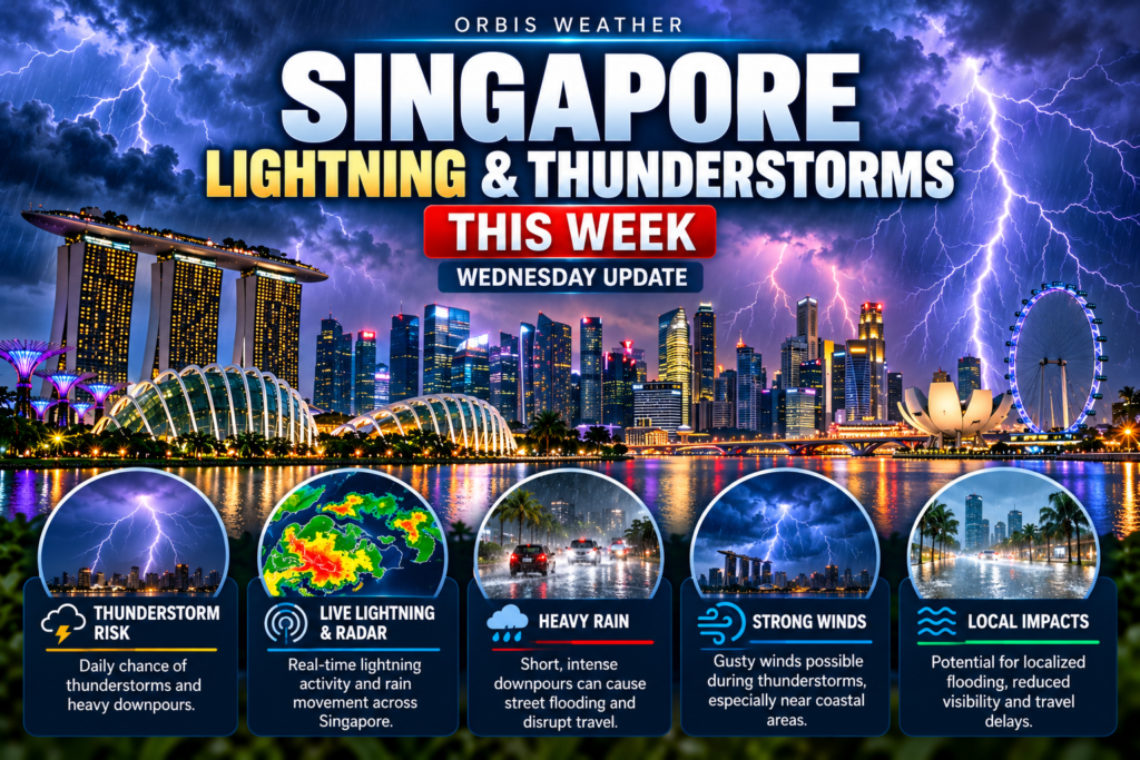
Singapore Lightning & Thunderstorms This Week — Wednesday, November 11, 2026
By Paul Harrison, Orbis Weather ·
At a glance
- Thundery showers are forecast on all five days, Wednesday to Sunday, mostly in the afternoon.
- Thursday and Friday storms may start earlier, in the late morning.
- Highs near 33°C (91°F), lows near 24°C (75°F), with light winds.
- Singapore remains in the inter-monsoon period, when lightning tends to be more intense. A brief flash flood hit West Coast Road on Tuesday.
- The Meteorological Service Singapore (MSS) and the National Environment Agency (NEA) issue the official forecasts and warnings.
Day by day
Every day from Wednesday to Sunday carries thundery showers, mostly in the afternoon, with highs near 33°C (91°F) and light winds.
Day | Forecast | High / low | Wind |
|---|---|---|---|
Wed 11 Nov | Thundery showers over many areas in the afternoon | 33°C / 24°C (91°F / 75°F) | Variable, 5-15 km/h (3-9 mph) |
Thu 12 Nov | Late morning and early afternoon thundery showers | 33°C / 24°C (91°F / 75°F) | SW, 5-15 km/h (3-9 mph) |
Fri 13 Nov | Late morning and early afternoon thundery showers | 33°C / 24°C (91°F / 75°F) | SW, 5-15 km/h (3-9 mph) |
Sat 14 Nov | Afternoon thundery showers | 33°C / 24°C (91°F / 75°F) | Variable, 5-15 km/h (3-9 mph) |
Sun 15 Nov | Afternoon thundery showers | 33°C / 24°C (91°F / 75°F) | NNE, 5-15 km/h (3-9 mph) |
Wednesday is from the MSS 24-hour forecast issued on the evening of Tuesday 10 November. Thursday to Sunday are from the MSS 4-day outlook issued at 5.30 am on Wednesday 11 November. Wednesday’s relative humidity is forecast at 60% to 95%.
Thursday and Friday are the days to watch earlier than usual: storms may start in the late morning rather than mid-afternoon.
The MSS fortnightly outlook for 29 October to 15 November expects moderate to heavy thundery showers over parts of the island on most afternoons, extending into the evening on a few days. It forecasts rainfall for 1-15 November slightly above the long-term average over most of the island, and daily highs of 33-35°C (91-95°F).
The past week. Heavy Rain Warnings were issued on 9 and 10 November. On 10 November PUB reported a flash flood at the junction of West Coast Road and West Coast Way, which subsided by 3 pm (AsiaOne). Somerset Road logged 66.2 mm (2.6 in) of rain that day, as of 5 pm, per the MSS home page.
Why storms happen now
Singapore is in the inter-monsoon period, when winds are light and variable and thundery showers form readily in the afternoon heat. MSS says thundery showers and lightning tend to be more intense now than in either monsoon season, and expects the Northeast Monsoon to set in towards the end of November or early December 2026.
November is one of the stormiest months of the year at Changi. December is wetter but has fewer thunderstorm days.
1991-2020 average, Changi | November | December |
|---|---|---|
Rainfall | 252.3 mm (9.9 in) | 331.9 mm (13.1 in) |
Rain days | 19 | 19 |
Thunderstorm days | 19 | 14 |
Lightning days | 22 | 16 |
Mean daily max / min | 31.2°C / 24.6°C (88°F / 76°F) | 30.5°C / 24.3°C (87°F / 76°F) |
Source: MSS Climate of Singapore and MSS Monsoon Update (updated 29 October 2026).
Lightning in Singapore
Lightning is routine in Singapore: NEA’s Changi Climate Station observes it on about 176 days a year, or one day in two, according to a written parliamentary reply by the Minister for Sustainability and the Environment. This week the main risk window is late morning to early afternoon on Thursday and Friday, and the afternoon on Wednesday, Saturday and Sunday. A few storms may carry on into the evening. NEA’s detection system tracks both cloud-to-ground strikes and lightning inside storm clouds, and feeds real-time alerts to the myENV app.
Staying safe and checking warnings
The safest place in a thunderstorm is inside a building or a car, and the safest habit is to check alerts before heading out.
- Outdoors: take shelter in a house, large building or car, and stay inside for at least 30 minutes after the last thunder. Keep away from isolated tall objects such as trees and poles, and from metal fences and rails (NEA advice, as reported by Mothership).
- No shelter nearby: head for the lowest ground and crouch down as low as possible. Stay off bicycles and motorcycles.
- Indoors: do not touch electric switches or appliances if you are wet or standing in water (PUB).
- If someone is struck: if there is no response, get someone to call 995 for an ambulance and another to fetch an AED. If the person is not breathing, begin CPR (SCDF).
- Flash floods: avoid flooded areas and turn back to higher ground. Do not walk through moving water above ankle height, or drive through water above kerb height (PUB).
Tool | What it gives |
|---|---|
myENV app (NEA) | Lightning alerts when lightning or thundery showers are detected or forecast within 6 km (3.7 mi) of a chosen location in the next two hours |
Current warnings, the 2-hour nowcast, rain radar and the 24-hour forecast | |
Daily forecast, temperatures and winds, updated twice a day | |
MSS Heavy Rain Warnings by SMS, and water level alerts from 210 canal and drain sensors at 50%, 75%, 90% and 100% full |
Frequently asked questions
What time of day are storms most likely this week? Mostly in the afternoon. On Thursday and Friday, MSS expects showers to start in the late morning and run into the early afternoon. A few storms may last into the evening.
Will the lightning alert warn me if the storm is not overhead? Yes. The myENV alert covers a 6 km radius around a chosen location, so it can trigger before the storm arrives. It is based on detected strikes and on forecasts of thundery showers.
When does the Northeast Monsoon start? MSS expects it to set in progressively towards the end of November or early December 2026. Winds will then strengthen and blow mainly from the northwest or northeast.
Is the haze still a concern? It has eased. MSS says inter-monsoon winds make smoke haze less likely to reach Singapore. A 5 November MSS notice announced the end of mask distribution and the closure of haze shelters.
How hot will it get? Highs near 33°C are forecast each day. MSS notes the daily maximum could still reach around 35°C (95°F) on a few days this month.
About this report
This report covers Wednesday 11 to Sunday 15 November 2026. Wednesday’s forecast is the MSS 24-hour forecast issued on the evening of Tuesday 10 November; Thursday to Sunday come from the MSS 4-day outlook issued at 5.30 am on 11 November. Forecasts change through the week, and thunderstorms are local, so conditions vary across the island. Check the MSS portal or myENV on the day.
Term | Meaning |
|---|---|
MSS | Meteorological Service Singapore, the national weather service under NEA |
Inter-monsoon | The transition between monsoons, with light, variable winds and frequent afternoon storms |
Heavy Rain Warning | An MSS alert that heavy rain is expected to affect Singapore |
Nowcast | A forecast for the next two hours, by area |
Flash flood | A sudden, short-lived flood, usually after intense rain overwhelms drains |
Sources
- MSS 24-hour forecast
- MSS 4-day outlook
- MSS home page: warnings, nowcast, daily records and notices
- MSS fortnightly outlook, 29 October to 15 November 2026
- MSS monsoon update, 29 October 2026
- MSS Climate of Singapore
- MSE written reply to PQ on lightning alert system, 4 August 2026
- PUB SMS alerts
- PUB flood safety tips
- SCDF CPR
- SCDF Emergency Medical Services
- Mothership, How to avoid getting struck by lightning in S’pore, 22 November 2017
- AsiaOne, flash flood at West Coast Road, 10 November 2026
- AsiaOne, thundery showers and PUB flash flood alerts, 9 November 2026
- AsiaOne, heavy thundery showers expected, 6 November 2026
Next 6 Hours
Storm Safety Snapshot
Official & Related Sources
Global Weather Tracker Hub
Explore weather maps, tropical systems, storms and natural hazards around the world.
No matching trackers found.
⚡ Singapore Lightning & Thunderstorm Tracker – Live Storms
Monitor thunderstorms, heavy rain and lightning risk across Singapore with the Orbis Weather Singapore Lightning & Thunderstorm Tracker.
Singapore’s tropical climate creates favorable conditions for thunderstorms throughout the year. Warm temperatures, abundant moisture and strong atmospheric instability can allow storms to develop rapidly, sometimes bringing intense rainfall, frequent lightning and gusty winds within a short period.
The Orbis Weather tracker provides a quick look at current rain, thunderstorm potential, wind and conditions expected during the next several hours.
For official Singapore weather warnings and lightning information, always follow the Meteorological Service Singapore and other appropriate Singapore authorities.
⚡ Why Singapore Gets So Much Lightning
Singapore’s location close to the equator creates an environment highly favorable for thunderstorm development.
Temperatures remain warm throughout the year, while surrounding tropical waters supply large amounts of moisture to the atmosphere.
When warm, humid air rises, it cools and condenses into towering clouds.
If atmospheric conditions are sufficiently unstable, these clouds can develop into powerful cumulonimbus thunderstorms capable of producing torrential rain, strong winds and frequent lightning.
⛈️ How Thunderstorms Form
A thunderstorm generally requires three basic ingredients: moisture, unstable air and a mechanism that causes air to rise.
Singapore regularly has abundant atmospheric moisture.
Strong tropical sunshine heats the surface, encouraging warm air to rise. Sea breezes, regional wind boundaries and other atmospheric features can provide additional lift.
As rising air cools, water vapor condenses and clouds grow vertically.
Strong thunderstorms can eventually extend many kilometres into the atmosphere.
Inside these clouds, powerful updrafts and downdrafts move water droplets and ice particles through the storm.
Electrical charges can separate within the cloud, eventually producing lightning.
🌧️ Why Singapore Thunderstorms Can Produce Intense Rain
Tropical air can contain enormous quantities of water vapor.
When thunderstorms develop, this moisture can condense rapidly and produce very heavy rainfall.
A storm does not necessarily need to last for hours to create problems.
A short but extremely intense tropical downpour can overwhelm drainage systems, produce temporary road flooding and reduce visibility.
This is why rainfall intensity can sometimes be as important as total daily rainfall.
⚡ What Causes Lightning?
Lightning is an enormous electrical discharge.
Inside a thunderstorm, collisions between ice particles, water droplets and other particles help separate electrical charges.
When the difference in electrical charge becomes large enough, electricity rapidly travels between regions of the cloud, between separate clouds or between the cloud and ground.
The resulting electrical discharge heats the surrounding air extremely rapidly.
That sudden heating causes the air to expand explosively, producing the sound we hear as thunder.
🌩️ Cloud-to-Ground vs. In-Cloud Lightning
Not every lightning flash reaches the ground.
A large amount of lightning occurs entirely within clouds or between clouds.
Cloud-to-ground lightning occurs when an electrical discharge connects the storm with Earth’s surface.
Both types can indicate an active thunderstorm.
A storm producing frequent in-cloud lightning can still pose a serious threat because cloud-to-ground strikes may develop at any time.
👂 If You Can Hear Thunder, Lightning Is Close Enough to Matter
Thunder provides a simple warning that lightning is occurring nearby.
Lightning can strike outside the area experiencing the heaviest rain.
That means waiting until rain reaches your exact location before seeking shelter can be dangerous.
If thunder is audible, move to a substantial enclosed building or other appropriate shelter.
Beaches, open fields, exposed coastal areas and isolated trees are poor places to remain during a thunderstorm.
🏝️ Lightning at Singapore Beaches
Singapore’s beaches and coastal areas can become particularly exposed during thunderstorms.
Open beaches provide relatively little protection from lightning.
Swimming should also be avoided when thunderstorms are nearby.
People visiting Sentosa, East Coast Park and other coastal recreation areas should monitor developing weather before and during outdoor activities.
A storm may develop or approach rapidly even when conditions were sunny earlier.
🏗️ Lightning and Outdoor Work
Singapore has extensive construction, port, aviation and outdoor commercial activity.
Workers operating cranes, scaffolding or exposed equipment can face additional risks during thunderstorms.
Outdoor operations should follow appropriate workplace lightning procedures and official safety requirements.
The Orbis Weather tracker can provide general awareness of developing conditions but should not replace professional workplace lightning-warning systems.
🌬️ Thunderstorm Wind Gusts
Lightning and rain are not the only hazards produced by Singapore thunderstorms.
Strong downdrafts can develop when rain-cooled air descends rapidly from a storm and spreads outward near the surface.
These winds can produce sudden powerful gusts.
Loose outdoor objects, temporary structures, tree branches and marine activities can all be affected.
Conditions may deteriorate rapidly as a strong thunderstorm approaches.
💨 What Is a Downburst?
A downburst occurs when a concentrated column of rapidly descending air reaches the surface and spreads outward.
Downbursts can produce damaging straight-line winds.
Smaller, concentrated events are often called microbursts.
Although they are different from tornadoes, powerful downburst winds can still cause damage and create serious aviation hazards.
Heavy tropical thunderstorms are capable of producing these sudden wind events.
🌧️ Thunderstorms and Flash Flooding
Intense thunderstorms can produce large amounts of rainfall in a short period.
When rainfall exceeds the ability of drainage systems to remove water, localized flash flooding can occur.
Roads and low-lying areas may become flooded rapidly.
Never assume floodwater covering a road is shallow enough to drive through safely.
Singapore’s official authorities should always be consulted when heavy-rain or flood warnings are issued.
🌬️ What Is a Sumatra Squall?
One of the most interesting thunderstorm phenomena affecting Singapore is the Sumatra squall.
These organized lines of thunderstorms generally develop over or near Sumatra and move eastward across the Strait of Malacca toward Peninsular Malaysia and Singapore.
They can bring sudden heavy rainfall, frequent lightning and strong gusty winds.
Sumatra squalls can occur during the night or morning, making them different from thunderstorms produced mainly by afternoon heating.
Because they can affect a large area, they are important for aviation, marine operations and outdoor activities.
🌦️ Afternoon Thunderstorms
Many Singapore thunderstorms develop during the afternoon.
Strong daytime heating makes the lower atmosphere increasingly unstable.
Local sea breezes can then interact with winds over the island, helping air converge and rise.
Thunderstorms can develop rapidly once these boundaries interact.
This explains why a hot, relatively sunny morning can sometimes transition into a stormy afternoon.
🌙 Can Singapore Get Thunderstorms at Night?
Yes.
Although daytime heating is an important trigger for many thunderstorms, storms can occur at virtually any hour.
Regional weather systems, Sumatra squalls, monsoon conditions and existing thunderstorm complexes can bring overnight or early-morning storms.
This is another reason not to assume thunderstorms are exclusively an afternoon hazard.
🌧️ Singapore’s Monsoons and Thunderstorms
Singapore experiences two primary monsoon regimes: the Northeast Monsoon and Southwest Monsoon.
The transition periods between them are known as inter-monsoon periods.
Thunderstorm behavior can change with these seasonal wind patterns.
Inter-monsoon periods often feature relatively light winds and strong local heating, creating favorable conditions for afternoon thunderstorms.
The Southwest Monsoon can also produce Sumatra squalls, while the Northeast Monsoon can bring longer periods of widespread rain during monsoon surges.
🌊 Thunderstorms and Marine Conditions
Singapore is surrounded by busy coastal waters.
Thunderstorms can produce lightning, sudden wind shifts, heavy rain and sharply reduced visibility.
These conditions can be dangerous for small boats, kayaks, paddleboards and other recreational watercraft.
Marine conditions can change considerably faster than expected when a strong thunderstorm approaches.
Check current weather and official marine information before heading onto the water.
✈️ Thunderstorms and Changi Airport
Thunderstorms can also affect aviation.
Lightning near an airport can interrupt some ground operations, while heavy rainfall can reduce visibility.
Strong thunderstorm winds can affect aircraft approaches and departures.
Thunderstorms along flight routes may require aircraft to deviate around hazardous weather.
Individual flight status should always be checked directly with the airline or airport.
📡 Weather Radar and Thunderstorms
Weather radar is one of the most useful tools for tracking thunderstorms.
Radar sends energy into the atmosphere and measures signals reflected by precipitation.
This allows meteorologists to identify where rain is occurring and how storms are moving.
Areas of stronger radar returns can indicate heavier precipitation.
Radar does not, however, show every thunderstorm hazard directly.
Lightning observations, wind measurements, satellite imagery and surface observations provide additional information.
⚡ Lightning Tracker vs. Weather Radar
Lightning data and radar complement each other.
Radar primarily shows precipitation and storm structure.
Lightning detection shows electrical activity.
A thunderstorm can produce substantial lightning even when the heaviest rainfall is somewhere else.
Likewise, heavy tropical rain does not always contain large amounts of lightning.
Using both types of information provides a more complete understanding of storm activity.
☔ What Does Rain Chance Mean?
Rain probability estimates the likelihood of measurable precipitation for a particular location and time period.
It does not mean that rain will occur continuously for that percentage of the day.
A 60% rain probability, for example, should not be interpreted as meaning it will rain for 60% of the time.
In tropical climates such as Singapore, thunderstorms can also be highly localized.
One part of the island may experience heavy rain while another remains relatively dry.
📍 Is There a Thunderstorm Near Singapore Right Now?
The Orbis Weather Singapore Lightning & Thunderstorm Tracker provides a quick overview of current precipitation, thunderstorm potential, wind and the next several hours of forecast conditions.
Because tropical storms can develop quickly, conditions should be checked again if you’re planning outdoor activities later in the day.
For official warnings and detailed Singapore observations, use information from the Meteorological Service Singapore.
📊 Understanding the Next 6 Hours
Short-range forecasts can be especially useful for Singapore because of the rapidly changing nature of tropical weather.
The Orbis Weather dashboard displays expected conditions over the next several hours to help visitors identify periods when rain or thunderstorm potential may increase.
Forecasts are not guarantees.
The exact location and timing of individual thunderstorms can be difficult to predict because convective storms can form, strengthen and dissipate rapidly.
🇸🇬 Singapore Lightning Safety
When thunderstorms approach, the safest option is generally to move inside a substantial enclosed building.
Avoid exposed beaches, open fields and isolated trees.
People on the water should return to appropriate shelter before a thunderstorm reaches their location whenever possible.
Do not depend solely on visible rainfall to determine lightning risk.
Lightning can occur beyond the main rain shaft.
🛰️ Where Does Orbis Weather Get Its Storm Data?
The current Orbis Weather Singapore Lightning & Thunderstorm Tracker uses Open-Meteo weather and forecast fields as a live storm indicator.
The Meteorological Service Singapore remains the authoritative source for official Singapore weather observations, forecasts and warnings.
Orbis Weather organizes weather information into a convenient dashboard for general situational awareness but does not issue official Singapore thunderstorm or lightning warnings.
⚡ Monitor Singapore Thunderstorms
Singapore’s tropical environment means thunderstorms can develop quickly throughout the year.
Monitoring rain, lightning potential, wind and short-range forecasts can help residents and visitors better understand changing conditions.
Use the Orbis Weather Singapore Lightning & Thunderstorm Tracker for quick situational awareness and explore the Singapore Weather & Natural Hazards, Singapore Monsoon & Flood Tracker, Singapore Haze & Air Quality Tracker and Southeast Asia Natural Hazards pages for a broader view of conditions across the region.
Important Thunderstorm & Lightning Disclaimer
The Orbis Weather Singapore Lightning & Thunderstorm Tracker is provided for general information, education and situational awareness.
The current browser-based tracker uses Open-Meteo weather information as a storm indicator. It should not be interpreted as an official lightning-detection or warning system. The page itself currently identifies Meteorological Service Singapore as the official reference.
Thunderstorms can develop rapidly, and lightning can occur outside areas of heavy rainfall.
Do not use this tracker alone for life-safety decisions.
Follow Meteorological Service Singapore and Singapore authorities for official warnings and emergency information.