Eastern & Central Pacific Tropical Weather Update: Tropical Storm Vance and Depression Olana Remain Active
Orbis Weather | Tuesday, October 27, 2026
By Paul Harrison | Orbis Weather
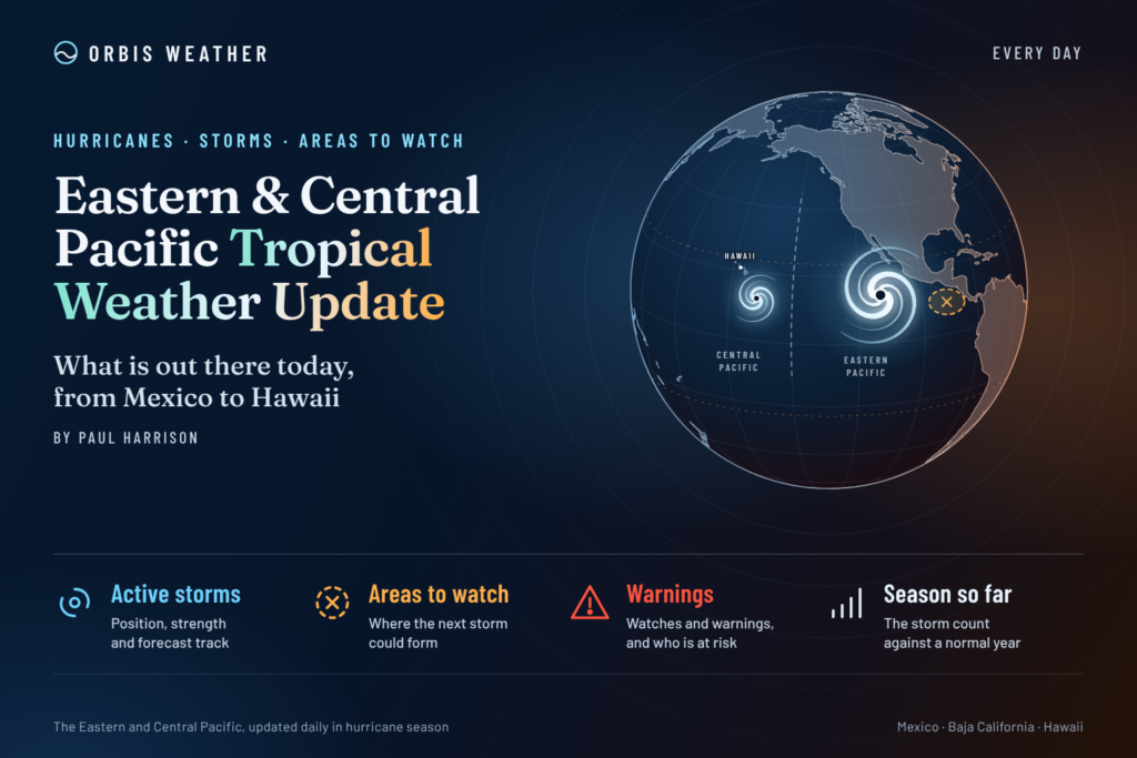
🌪️ Two tropical systems remain the focus of attention across the eastern and central Pacific, with Tropical Storm Vance spinning off Mexico’s Pacific coast and Tropical Depression Olana weakening in the remote central Pacific.
The latest verified National Hurricane Center (NHC) outlook, issued Monday, October 26, identifies both systems as active. However, forecasters are not expecting any additional tropical cyclones to develop across the eastern and central North Pacific during the following seven days.
That distinction is important. Although the prospects for new storm formation are low, existing tropical systems can still produce dangerous marine conditions, including strong winds, large waves and hazardous seas.
This Orbis Weather report examines the two active systems, their potential development, possible coastal and marine impacts, and the wider outlook as the 2026 Pacific hurricane season approaches its final month.
Verification note: The latest official bulletins retrieved for this report are dated October 26. Storm positions and intensities below are from those bulletins, not confirmed October 27 observations.
🌪️ Eastern Pacific: Tropical Storm Vance
Active tropical storm
Latest verified position: October 26
Tropical Storm Vance continues to be monitored off the Pacific coast of Mexico, with its center located several hundred miles south-southwest of Manzanillo.
According to the NHC advisory issued at 2:00 p.m. Mountain Standard Time on October 26, Vance was moving westward while maintaining tropical-storm intensity.
Vance — latest verified storm statistics
Maximum sustained winds
65 mph
105 km/hMovement
West
6 mph (10 km/h)Central pressure
997 mb
Position
15.4°N, 106.1°W
Source: National Hurricane Center, October 26, 2026, 2:00 p.m. MST. These values may have changed.
🌀 What happens next to Vance?
Vance’s westward movement was carrying the system over the eastern Pacific, away from its earlier position near Mexico.
Several environmental factors will influence its future intensity:
Sea-surface temperatures: Warm ocean water provides energy that can sustain tropical convection.
Vertical wind shear: Strong winds at different atmospheric levels can disrupt a storm’s circulation and weaken its thunderstorms.
Atmospheric moisture: Dry air entering the circulation can limit the development of organized thunderstorms.
Ocean heat content: The depth of warm water matters because storms can churn cooler water toward the surface.
A tropical storm with sustained winds of 65 mph is below the 74 mph threshold required for hurricane classification, but it remains capable of producing hazardous conditions at sea.
Vance’s latest forecast track, intensity changes and any coastal alerts should be checked against subsequent NHC advisories rather than inferred from its earlier westward movement.
🌊 Possible impacts along Mexico’s Pacific coast
Even when the center of a tropical storm remains offshore, swells generated by its circulation may travel considerable distances.
Potential marine concerns include rough seas, increased surf, dangerous rip currents and deteriorating conditions for smaller vessels.
The extent of these hazards depends on the storm’s size, strength, direction of travel and distance from the coast.
Coastal residents, fishing operators and mariners should consult Mexican weather authorities and official marine forecasts for location-specific warnings.
🌴 Central Pacific: Tropical Depression Olana
Weakening system
Latest verified position: October 26
Farther west, Tropical Depression Olana was located several hundred miles west-southwest of Johnston Atoll.
The National Hurricane Center reported that Olana had weakened to a tropical depression and was expected to lose its remaining tropical characteristics, potentially becoming a remnant low.
The October 26 advisory placed Olana in the remote central Pacific, well away from the main Hawaiian Islands.
Olana — latest verified storm statistics
Maximum sustained winds
35 mph
55 km/hMovement
Southeast
3 mph (5 km/h)Central pressure
1007 mb
Position
13.6°N, 176.6°W
Source: National Hurricane Center, October 26, 2026, 11:00 a.m. HST.
🌧️ Why is Olana weakening?
Tropical cyclones depend on an organized circulation and sustained thunderstorm activity near their centers.
When that structure deteriorates, a tropical storm can weaken into a tropical depression and eventually a remnant low.
Olana’s weakening trend indicates that its tropical circulation was becoming less organized as of the latest verified advisory.
However, a weakening tropical cyclone does not immediately become harmless.
Residual thunderstorms, gusty winds and rough seas may persist near its circulation even after it loses tropical cyclone status.
🏝️ Is Hawaii at risk?
Olana’s reported location was far west-southwest of Johnston Atoll and remote from the main Hawaiian Islands.
The verified outlook did not identify a new developing tropical disturbance threatening Hawaii.
Nevertheless, Hawaiian waters can experience significant swells generated by distant weather systems. Beachgoers and mariners should monitor local surf forecasts, high-surf advisories and marine warnings.
A weakening storm near the International Date Line should not automatically be interpreted as an approaching threat to Hawaii.
🔴 Latest October 27 update: Vance weakens, Olana becomes post-tropical
More recent NHC information confirms two significant developments overnight.
Tropical Storm Vance has weakened to 45 mph (75 km/h) as of 2:00 a.m. MST Tuesday, October 27. The storm was centered near 15.9°N, 106.9°W, moving northwest at 8 mph (13 km/h), with a minimum central pressure of 1002 millibars.
Meanwhile, Olana has officially become a post-tropical remnant low. The NHC issued its final advisory at 5:00 p.m. HST Monday, October 26.
At that time, Olana had sustained winds of approximately 30 mph (45 km/h), and its center was near 13.0°N, 175.9°W.
These developments indicate that both systems have weakened, although Vance remains an active tropical storm.
📅 Seven-day tropical development outlook: October 27 – November 2
The NHC’s latest available tropical outlook indicates that no additional tropical cyclone formation is expected across the eastern or central North Pacific during the next seven days.
Region | Outlook | Primary concern |
|---|
Eastern Pacific | No new development expected | Tropical Storm Vance |
Offshore Mexico | Monitor Vance | Marine conditions and surf |
Central Pacific | No new development expected | Residual effects of Olana |
Hawaiian region | No new development indicated | Local marine and surf conditions |
This forecast does not mean that all storm-related hazards have ended. Vance remains active, and the remnants of Olana may continue to influence local ocean conditions.
Forecast confidence generally decreases with time, particularly when considering changes in storm structure and environmental conditions.
🌡️ El Niño and the 2026 Pacific hurricane season
One of the important influences on this year’s tropical weather patterns has been the development of El Niño conditions.
El Niño involves unusually warm sea-surface temperatures across parts of the equatorial Pacific, accompanied by changes in atmospheric circulation.
These changes can influence tropical cyclone development, particularly in the central Pacific.
NOAA’s 2026 seasonal outlook predicted:
A 70% probability of an above-normal central Pacific hurricane season.
A 20% probability of a near-normal season.
A 10% probability of a below-normal season.
Between 5 and 13 tropical cyclones across the central Pacific during the season.
These were preseason probabilities, not a count of storms observed through October.
Although El Niño can favor increased tropical cyclone activity in parts of the Pacific, it does not guarantee that any individual disturbance will become a tropical storm or hurricane.
Individual systems still depend on atmospheric moisture, wind shear, ocean temperatures and other environmental factors.
🌀 Why tropical activity can continue into November
The eastern Pacific hurricane season officially runs from May 15 through November 30, while the central Pacific season runs from June 1 through November 30.
Although activity generally declines during autumn, tropical storms can still develop late in the season when oceanic and atmospheric conditions remain favorable.
Late-season systems may behave differently from storms during the peak summer months because of changes in upper-level winds, ocean temperatures and large-scale weather patterns.
For that reason, forecasters continue monitoring tropical disturbances until the official end of the season.
🚢 Marine safety: What residents and travelers should know
Tropical storms can produce hazardous ocean conditions far beyond their immediate centers.
For people living along Mexico’s Pacific coast, traveling to Hawaii or operating vessels in the Pacific, several precautions remain important.
🌊 Beach safety: Check surf conditions and rip-current warnings before entering the water.
🚤 Boating: Review marine forecasts, particularly near active or recently dissipated tropical systems.
🏝️ Island travel: Monitor official forecasts for changes in weather, surf and local advisories.
🛰️ Storm tracking: Use official NHC forecast tracks rather than relying exclusively on individual computer-model projections.
⚠️ Emergency alerts: Follow warnings and instructions from local authorities.
📡 Official tropical weather sources
Orbis Weather uses publicly available meteorological information and official government forecasting products to provide accessible tropical weather coverage.
Primary reference sources for this report include:
📝 Orbis Weather editorial methodology and forecast disclaimer
How this report is prepared
This report combines official tropical cyclone advisories, publicly available weather observations and meteorological explanations.
Storm positions, maximum sustained winds, atmospheric pressures and movement are attributed to official National Hurricane Center products. Where possible, the advisory date and time are identified so readers can distinguish observations from forecasts.
Forecast uncertainty
Tropical weather forecasts are subject to change. A predicted storm track does not guarantee an exact path, and hazardous weather can occur outside a forecast cone.
Seven-day tropical development outlooks describe the potential for new tropical cyclones to form. They are not forecasts of all possible rain, wind, wave or flooding hazards.
Corrections and updates
Orbis Weather aims to correct material factual errors promptly. When significant new official information becomes available, articles may be updated to reflect changes in storm status, intensity, location and expected impacts.
Public safety
Orbis Weather is an independent weather information publisher and is not an official government warning service. Readers should always follow instructions issued by the National Hurricane Center, National Weather Service and relevant local emergency management agencies.
🌎 Final outlook: A weakening Pacific, but monitoring continues
The eastern and central Pacific remain under tropical weather surveillance as October draws to a close.
Tropical Storm Vance has weakened significantly but remains active off Mexico, while Olana has lost its tropical cyclone classification and become a remnant low.
The absence of expected new tropical development during the coming week is encouraging, but the Pacific hurricane season is not yet over.
Orbis Weather will continue monitoring tropical disturbances, official advisories and changing marine conditions throughout the eastern and central Pacific.
By Paul Harrison | Orbis Weather