
🌍 Australia, New Zealand & Oceania Weather & Natural Hazards Today
By Paul Harrison | Founder & Publisher, Orbis Weather
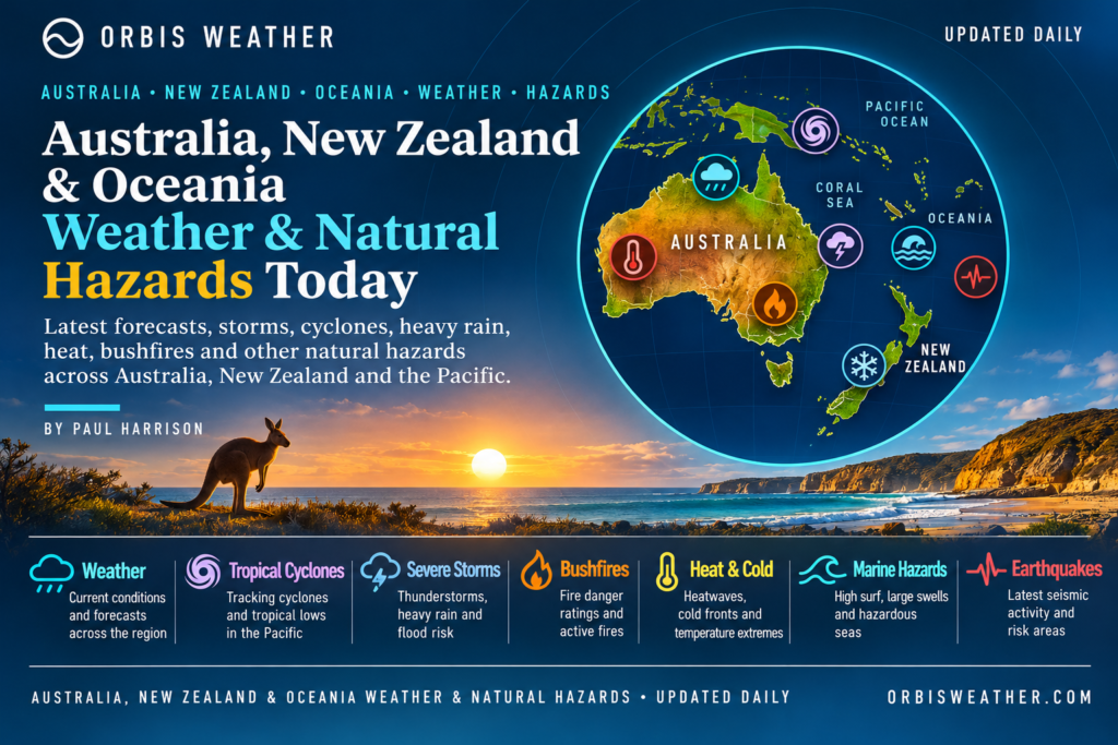






🌏 Australia, New Zealand & Oceania Weather & Natural Hazards Today
Monday, November 9, 2026
By Paul Harrison | Founder & Publisher, Orbis Weather
Independent weather reporting covering Australia, New Zealand, Papua New Guinea, Fiji, Vanuatu, the Solomon Islands, New Caledonia, Samoa, Tonga and the wider South Pacific.
🌦️ Regional Weather Overview — Queensland Storms, New Zealand Rain and South Pacific Cyclone Monitoring
Australia, New Zealand and the Pacific Islands begin Monday, November 9, with contrasting weather conditions, ranging from lingering thunderstorm concerns in eastern Australia to approaching rain-bearing systems around New Zealand and the continuing seasonal threat of tropical rainfall across Oceania.
In Australia, southeast Queensland has experienced a turbulent opening to November, with severe thunderstorms, hail and heavy downpours affecting communities. Conditions remain changeable, although the latest regional forecasts suggest a quieter Monday in some previously affected districts.
Across New Zealand, an approaching weather front is expected to bring increasing cloud and rain to parts of the country, with northern districts and the South Island’s western ranges among the areas worth monitoring.
Farther north, the South Pacific tropical cyclone season is underway. Fiji’s regional tropical cyclone centre reported no significant tropical disturbance in its November 7 assessment, but continued surveillance remains essential as ocean temperatures, tropical moisture and seasonal atmospheric conditions evolve.
🚨 Regional Natural Hazard Summary — November 9
|
Region |
Primary concern |
Outlook |
|---|---|---|
|
🇦🇺 Queensland |
Thunderstorms, hail and localized flooding |
Monitor |
|
🇦🇺 New South Wales |
Coastal showers and changing temperatures |
Generally lower risk |
|
🇦🇺 Northern Australia |
Heat, humidity and developing wet-season storms |
Seasonal risk |
|
🇳🇿 North Island |
Approaching front and localized heavy rain |
Monitor |
|
🇳🇿 South Island |
Western rainfall and mountain weather |
Monitor |
|
🇵🇬 Papua New Guinea |
Heavy tropical showers, landslides and earthquakes |
Seasonal and geological risk |
|
🇫🇯 Fiji |
Tropical rainfall and cyclone surveillance |
Monitor |
|
🇻🇺 Vanuatu |
Tropical weather, earthquakes and volcanoes |
Ongoing hazards |
|
🌊 Wider South Pacific |
Cyclones, coastal swells and seismic activity |
Continued surveillance |
These are regional monitoring priorities, not declarations of active warnings. Official agencies determine warning status.
🇦🇺 Australia Weather & Natural Hazards Today
⛈️ Queensland — Thunderstorm Risk After a Stormy Start to November
Southeast Queensland has experienced several rounds of severe thunderstorms during early November, including hail-producing storms that affected populated areas.
The Australian Bureau of Meteorology’s Sunday evening forecast for the Wide Bay and Burnett region identified the possibility of severe thunderstorms near the coast, with damaging winds and large hail.
For Monday, November 9, the same forecast indicates partly cloudy conditions, with showers possible in northern districts and daytime temperatures approaching 30°C (86°F) in parts of the region.
The immediate concern is localized storm development rather than a uniform severe-weather event across Queensland.
Residents should remain alert for rapidly changing conditions, particularly when travelling through areas affected by recent heavy rain.
🌤️ New South Wales — Cooler Conditions and Coastal Showers
New South Wales is expected to experience a mixture of sunshine, cloud and isolated showers on Monday.
The Bureau of Meteorology’s November 9 city forecasts include:
|
Location |
Forecast low |
Forecast high |
Conditions |
|---|---|---|---|
|
Sydney |
12°C (54°F) |
21°C (70°F) |
Possible early shower |
|
Newcastle |
11°C (52°F) |
20°C (68°F) |
Shower or two |
|
Wollongong |
11°C (52°F) |
19°C (66°F) |
Possible early shower |
|
Wagga Wagga |
4°C (39°F) |
24°C (75°F) |
Sunny |
|
Coffs Harbour |
13°C (55°F) |
22°C (72°F) |
Mostly sunny |
The difference between cooler inland mornings and milder afternoons is characteristic of spring weather across southeastern Australia.
Drivers in areas experiencing early showers should watch for reduced visibility and wet roads.
☀️ Northern Territory — Heat and Wet-Season Preparation
The Northern Territory is entering the period when increasing tropical moisture and daytime heating can support thunderstorms.
Darwin, the Top End and inland tropical communities should monitor the potential for:
-
High daytime temperatures and humidity.
-
Afternoon thunderstorms and lightning.
-
Localized heavy rainfall.
-
Rapidly changing conditions on remote roads.
These are seasonal hazards rather than confirmed November 9 warnings.
🌦️ Western Australia — Contrasting Northern and Southern Conditions
Western Australia spans several climate zones, producing substantial differences between the tropical north and temperate southwest.
The Kimberley and Pilbara face increasing seasonal heat and potential thunderstorm activity, while Perth and surrounding southwest districts experience more variable spring temperatures and coastal winds.
Bushfire awareness remains important wherever dry vegetation, strong winds and elevated temperatures coincide.
🌬️ Victoria, South Australia and Tasmania
Southern Australia continues through its changeable spring period, when weather fronts and shifting winds can produce significant day-to-day temperature differences.
Melbourne, Adelaide, Hobart and surrounding districts should monitor updated forecasts for wind changes, showers and temperature fluctuations.
In exposed coastal areas, wind conditions may be more important than rainfall totals for boating and outdoor activities.
No specific severe-weather warning is asserted for these states without a verified current agency bulletin.
🇳🇿 New Zealand Weather & Natural Hazards Today
🌧️ North Island — Another Weather System Approaches
New Zealand begins Monday with attention turning toward another frontal system approaching from the Tasman Sea.
MetService guidance issued November 4 identified a front expected to move toward the northwestern North Island later on Monday, November 9.
That outlook assigned low confidence to warning-level rainfall in northern and eastern Northland. Low confidence represents a possibility, not confirmation that warning thresholds will be reached.
Auckland, Northland and Waikato
Northern communities should watch for increasing cloud, showers and potentially heavier rain as the system approaches.
Rainfall intensity and the position of the front will determine whether localized drainage problems or stream rises develop.
Wellington and Central North Island
Changing cloud cover and the possibility of showers remain the principal weather considerations.
Travellers should monitor updated wind and road forecasts, particularly across exposed hills and coastal routes.
🏔️ South Island — Western Rainfall and Alpine Conditions
MetService’s published short-range forecast indicates rain becoming heavier around the Westland ranges, with additional unsettled conditions affecting Fiordland.
Western mountain catchments can experience significant rainfall even when eastern towns remain comparatively sheltered.
For the Southern Alps, changing wind, cloud and precipitation can create difficult conditions for hikers and backcountry travellers.
🌋 Earthquake and Volcanic Monitoring
New Zealand lies along the boundary between the Australian and Pacific tectonic plates.
Earthquakes remain an ongoing natural hazard, particularly around the North Island, Cook Strait and parts of the South Island.
GeoNet provides authoritative information about earthquake locations, magnitudes and volcanic activity.
No new major earthquake or volcanic eruption is claimed in this report without a verified event bulletin.
🌴 Papua New Guinea & Pacific Islands Weather
🇵🇬 Papua New Guinea — Tropical Rainfall and Landslide Awareness
Papua New Guinea remains exposed to tropical downpours, thunderstorms and localized flooding throughout much of the year.
Port Moresby, Lae, Madang and the Highlands can experience substantially different conditions because of the country’s mountainous terrain.
The main hazards to monitor include intense rainfall, flash flooding, landslides and lightning.
Papua New Guinea also lies within an active tectonic region, making earthquake and tsunami preparedness particularly important.
No specific November 9 earthquake, landslide or flood emergency has been independently confirmed for this report.
🇫🇯 Fiji — Tropical Cyclone Season Underway
Fiji and surrounding island groups are entering their summer tropical cyclone season.
The Fiji Meteorological Service’s tropical disturbance summary issued November 7 at 22:43 UTC reported no significant tropical disturbance analysed or forecast within its monitoring area, extending from the equator to 25°S and from 160°E to 120°W.
That assessment is encouraging, but it does not guarantee that conditions will remain quiet throughout the coming week.
Even without a named cyclone, localized tropical thunderstorms can produce heavy rainfall, flooding and dangerous lightning.
Communities across Viti Levu, Vanua Levu and smaller islands should continue monitoring official forecasts.
🇻🇺 Vanuatu — Rainfall, Volcanoes and Earthquakes
Vanuatu faces several overlapping natural hazards because of its tropical location and active volcanic and tectonic environment.
The principal concerns include heavy tropical rainfall, landslides, earthquakes, volcanic activity and tsunami exposure.
Active volcanic systems, including Yasur and Ambrym, require continued monitoring through the Vanuatu Meteorology and Geo-Hazards Department.
Volcanic alert levels can change independently of weather conditions.
Residents and visitors should respect official exclusion zones and avoid relying on older volcanic status reports.
🇸🇧 Solomon Islands — Tropical Showers and Seismic Risk
The Solomon Islands experience tropical rainfall throughout the year, with localized heavy downpours capable of disrupting roads, coastal settlements and inter-island transport.
The islands also sit near active tectonic plate boundaries.
Strong earthquakes can occur offshore or beneath populated islands, sometimes creating tsunami threats.
No specific new tsunami warning is confirmed for November 9 in the information reviewed.
🇳🇨 New Caledonia — Trade Winds and Coastal Conditions
New Caledonia’s weather is influenced by tropical moisture, trade winds and changing atmospheric systems over the Coral Sea.
Nouméa, the Loyalty Islands and exposed coastal areas should monitor local forecasts for showers, wind changes and marine conditions.
Reef passages and open-water routes can become hazardous when strong winds combine with swell.
🇼🇸 Samoa and 🇹🇴 Tonga — Tropical Rainfall and Cyclone Preparedness
Samoa and Tonga are entering a season when tropical disturbances can develop across the southwest Pacific.
Heavy showers, thunderstorms and coastal swells remain important hazards even in the absence of a named cyclone.
For Tonga, earthquake and tsunami preparedness is particularly important because of its proximity to the Tonga Trench.
Communities should maintain emergency supplies and follow local meteorological and disaster-management agencies.
🌀 South Pacific Tropical Cyclone Outlook
The southwest Pacific cyclone season normally extends from November through April.
As noted earlier, RSMC Nadi’s November 7 bulletin identified no significant tropical disturbance within its designated monitoring region.
That is the latest specific disturbance assessment independently verified for this article, not a claim of a newly issued November 9 all-clear.
The main areas requiring continued surveillance are the Coral Sea, waters around Vanuatu and Fiji, and the wider southwest Pacific.
🌡️ El Niño and the Developing Summer Season
The Australian Bureau of Meteorology’s November 3 Tropical Climate Update identified strong El Niño and a positive Indian Ocean Dipole as active climate influences.
Its outlook for November 8–21 indicates above-average rainfall is likely across much of northern Western Australia and the Northern Territory, extending into northwestern Queensland, while parts of far northern Queensland may experience below-average rainfall.
The Bureau also expects generally warmer-than-average temperatures, particularly overnight.
These climate patterns influence seasonal probabilities but do not establish the track or intensity of an individual tropical cyclone.
🔥 Queensland Heatwave Warning — November 8–11
An important development for Monday is the heatwave warning issued by the Australian Bureau of Meteorology at 1:48 p.m. Queensland time on Sunday, November 8.
The warning covers parts of northern Queensland, including the Peninsula, Gulf Country, Northern Goldfields and Upper Flinders, North Tropical Coast and Tablelands, Herbert and Lower Burdekin, and Central Coast and Whitsundays districts.
Inland and western Cape York locations may experience maximum temperatures in the high 30s to low 40s Celsius, approximately 37–43°C (99–109°F), with warm overnight conditions.
Communities identified as potentially affected include Weipa, Aurukun, Croydon, Kowanyama and Pormpuraaw.
The warning is valid through Wednesday, November 11, subject to updates.
Heat safety: Avoid strenuous outdoor activity during the hottest periods, drink water regularly, check on vulnerable residents and seek air-conditioned shelter when necessary.
🌊 Marine Weather and Coastal Hazards
Marine conditions deserve particular attention across Australia and Oceania because fishing, tourism and inter-island transport depend heavily on safe sea conditions.
For southeast Queensland, the Bureau’s November 8 marine forecast indicated that a trough and southeasterly wind change would move northward, followed by a weak ridge.
For Gold Coast waters on Monday, November 9, the forecast included:
-
Southerly winds of 15–20 knots, locally reaching 25 knots offshore early.
-
Seas initially around 2 metres, easing during the morning.
-
Southerly swell of 1–1.5 metres inshore and 2–3 metres offshore.
These figures apply specifically to Gold Coast waters and should not be used for other Australian or Pacific coastlines.
Across the wider region, mariners should check local wind, swell, tide and warning information before departure.
🌋 Earthquakes, Volcanoes and Tsunami Monitoring
Australia, New Zealand and Oceania include some of the world’s most active earthquake and volcanic regions.
The Pacific Ring of Fire extends through Papua New Guinea, the Solomon Islands, Vanuatu, Tonga and New Zealand.
|
Hazard |
Main monitoring areas |
Official source |
|---|---|---|
|
Earthquakes |
New Zealand, PNG, Vanuatu, Tonga |
GeoNet, USGS |
|
Volcanoes |
Vanuatu, PNG, New Zealand |
National geological agencies |
|
Tsunamis |
Pacific coastal communities |
PTWC, national agencies |
|
Landslides |
PNG Highlands, Vanuatu, New Zealand |
Local emergency authorities |
|
Tropical cyclones |
Coral Sea and southwest Pacific |
BoM, RSMC Nadi |
This is a geographical hazard overview, not a list of newly confirmed November 9 incidents.
For any strong or prolonged coastal earthquake, residents should follow local tsunami evacuation guidance immediately rather than waiting for a news report.
📅 Regional Weather Outlook — November 9–13, 2026
|
Date |
Areas to monitor |
Main concern |
|---|---|---|
|
Mon, Nov 9 |
Northern Queensland |
Heatwave conditions |
|
Tue, Nov 10 |
Northern Australia |
Tropical moisture and rainfall |
|
Wed, Nov 11 |
Queensland, New Zealand |
Heatwave updates, changing fronts |
|
Thu, Nov 12 |
Fiji, Vanuatu, Coral Sea |
Tropical cyclone surveillance |
|
Fri, Nov 13 |
Wider Oceania |
Rainfall, marine and seismic hazards |
The table combines verified short-range concerns with longer-range monitoring priorities. It is not a detailed five-day forecast for every location.
🛡️ Weather and Natural Hazard Safety
Extreme heat: Stay hydrated, limit exposure during peak afternoon heat and check on older residents and young children.
Thunderstorms: Move indoors when thunder is heard. Avoid open fields, exposed beaches and isolated trees.
Flooding: Never drive through floodwater. Water depth, road damage and currents can be difficult to judge.
Tropical cyclones: Follow official warnings, secure loose objects and maintain emergency supplies.
Earthquakes: Drop, Cover and Hold On. In coastal areas, strong or prolonged shaking may require immediate evacuation to higher ground.
Volcanoes: Follow exclusion zones and official advice concerning ashfall, volcanic gases and aviation restrictions.
Marine conditions: Check local forecasts and carry appropriate communications and safety equipment.
🔎 Official Weather and Natural Hazard Sources
Orbis Weather uses national meteorological and geological agencies as its primary sources wherever possible.
|
Agency |
Official information |
|---|---|
|
Australian Bureau of Meteorology |
|
|
MetService New Zealand |
|
|
Fiji Meteorological Service |
|
|
Vanuatu Meteorology and Geo-Hazards Department |
|
|
GeoNet New Zealand |
|
|
US Geological Survey |
|
|
Pacific Tsunami Warning Center |
|
|
World Meteorological Organization |
📝 Orbis Weather Editorial Methodology and Reporting Standards
This report combines official meteorological forecasts, published severe-weather information, tropical cyclone assessments and geological hazard monitoring.
Orbis Weather distinguishes between:
-
Confirmed warnings: Officially issued alerts with identifiable locations and validity periods.
-
Forecast risks: Weather hazards supported by current forecasts but not necessarily meeting warning criteria.
-
Seasonal hazards: Conditions typical of a region or time of year that do not constitute an active emergency.
-
Unverified events: Claims that are excluded until sufficient reliable evidence becomes available.
Weather conditions, forecasts and warning statuses can change rapidly. Where a current agency bulletin could not be independently verified, this report does not present the hazard as an active warning.
Reporting Period
Regional reporting date: Monday, November 9, 2026.
Preparation date: Sunday, November 8, 2026, U.S. Eastern Standard Time.
The report uses Monday’s local calendar date for Australia, New Zealand and Oceania. Because Pacific time zones vary, some islands reach Monday earlier than others.
The latest independently verified source information includes November 8 Australian forecasts, the November 7 Fiji tropical disturbance assessment, and earlier published New Zealand forecast guidance. These sources have different issue times and should not be interpreted as simultaneous observations.
Corrections and Updates
Orbis Weather aims to correct material factual errors promptly and update information when newer official data becomes available. Readers should consult the original issuing agency for operational warnings and emergency instructions.
🌏 Final Outlook — November 9, 2026
Northern Queensland’s heatwave is among the clearest officially documented hazards affecting the region as Monday begins, while recent severe thunderstorms underline the changeable nature of Australia’s spring weather.
New Zealand faces another period of unsettled conditions as frontal systems move across the Tasman Sea, with rainfall and mountain weather requiring attention.
Across Fiji, Vanuatu, Papua New Guinea and the wider Pacific, the developing tropical cyclone season remains a major monitoring priority, even without a significant disturbance identified in the latest verified RSMC Nadi summary.
The key message for Monday: monitor Queensland’s heat, follow changing New Zealand forecasts and maintain tropical cyclone awareness across the southwest Pacific.
Orbis Weather — Independent weather reporting and natural hazard analysis.
By Paul Harrison | Founder & Publisher, Orbis Weather
About the Author
Paul Harrison — Founder & Publisher, Orbis Weather
Paul Harrison founded Orbis Weather in 2026 to make global weather and natural-hazard information easier to find, follow and understand. His coverage includes tropical cyclones, severe weather, extreme temperatures, earthquakes, volcanoes, wildfires, flooding and significant natural disasters worldwide.
View all articles by Paul Harrison → | Editorial Standards →
Global Weather Tracker Hub
Explore weather maps, tropical systems, storms and natural hazards around the world.
No matching trackers found.