
South America Weather & Natural Hazards Today
By Paul Harrison | Founder & Publisher, Orbis Weather
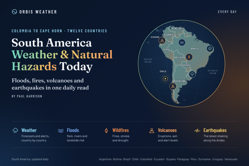






South America Weather & Natural Hazards Today — Sunday, November 8, 2026
Severe Storms and Flooding Remain Major Concerns Across Brazil, Colombia and the Southern Cone as El Niño Influences South America’s Weather
By Paul Harrison | Founder & Publisher, Orbis Weather
Published: Sunday, November 8, 2026
Region: South America
Coverage: Brazil, Argentina, Colombia, Peru, Chile, Ecuador, Bolivia, Paraguay, Uruguay, Venezuela, Guyana and Suriname.
South America Weather Overview
South America enters Sunday, November 8, with a complicated weather picture. Recent severe thunderstorms and flooding have affected parts of Brazil, river levels remain a concern in the Southern Cone, and tropical rainfall continues to create potential hazards across northern South America.
Three developments deserve particular attention:
Brazil: Recent damaging storms, heavy rainfall and flooding have left communities vulnerable to further disruption, particularly where the ground is already saturated.
Colombia: Flooding, river conditions and landslide susceptibility remain important monitoring priorities. The national weather agency has published updated hydrometeorological bulletins for November 8.
Argentina, Paraguay and Uruguay: Recent river flooding and unsettled weather highlight the need for continued monitoring of rainfall and downstream water levels.
The developing 2026–2027 El Niño is also influencing the continent’s broader seasonal outlook, with increased rainfall potential in parts of southeastern South America and possible rainfall deficits elsewhere.
Latin Times+2
This report separates recently documented weather events, official monitoring information and seasonal hazard potential. Not every region discussed is under an active weather warning.
Today’s Main Weather and Natural Hazard Concerns
Country or region | Main concern | Assessment |
|---|---|---|
Southern Brazil | Storm damage, heavy rain and flooding | Recent impacts; monitor new alerts |
Southeastern Brazil | Thunderstorms and localized flooding | Reported storm impacts |
Colombia | Flooding, rising rivers and landslides | Official monitoring ongoing |
Northern Argentina | River flooding and thunderstorms | Continued monitoring |
Paraguay | Paraná River levels and storms | Flood concern |
Uruguay | Flooding and heavy rainfall | Recent impacts |
Peru | Heavy rainfall and mountain hazards | Local forecast monitoring |
Ecuador | Tropical downpours and flooding | Recent flooding |
Bolivia | Thunderstorms and seasonal rainfall | Regional monitoring |
Chile | Mountain weather and seismic hazards | Routine monitoring |
Venezuela and the Guianas | Tropical rain and thunderstorms | Seasonal hazard potential |
Assessment describes the nature of each concern, not an official warning classification. Current alert levels must be checked with the relevant national agency.
Brazil: Storm Damage and Flooding Remain Major Concerns
Brazil remains one of the most important countries to monitor following a period of severe weather across its southern states.
Earlier in November, thunderstorms brought damaging winds, hail and flooding to communities in Santa Catarina and Rio Grande do Sul. Reports documented damage to homes, displacement and emergency rescue operations.
The combination of saturated ground, damaged infrastructure and additional rainfall can prolong the effects of severe weather long after the strongest thunderstorms have passed.
November 5+1
Southern Brazil
The main areas requiring continued monitoring include Paraná, Santa Catarina and Rio Grande do Sul.
Potential hazards associated with further storm development include intense rainfall, flash flooding, strong wind gusts, hail and river-level rises.
Communities recovering from earlier storms should pay particular attention to drainage systems, damaged buildings and road closures.
Southeastern Brazil
A storm-related incident report dated November 8 describes destruction and flooding in Rio de Janeiro state. The report is based on an initial news account and should be treated as preliminary until corroborated by local civil defense authorities.
8 November 2026
Residents should consult Brazil’s National Institute of Meteorology (INMET) and local civil defense services for the latest warnings.
Central and Northern Brazil
Across central Brazil and parts of the Amazon Basin, seasonal rainfall patterns are becoming increasingly important as the Southern Hemisphere approaches summer.
Afternoon thunderstorms can develop rapidly, producing intense but localized rainfall.
Meanwhile, unusually warm or dry conditions may increase heat stress and vegetation-fire susceptibility in locations experiencing rainfall deficits.
These are regional seasonal considerations rather than confirmation of active heat or wildfire warnings today.
Latest Update: Destructive Storm Hits Rio de Janeiro
A powerful storm struck Rio de Janeiro and surrounding areas on Saturday, November 7, bringing heavy rain, damaging winds and widespread disruption.
According to Agência Brasil and CNN Brasil:
Wind gusts exceeded 80 km/h (50 mph) in Rio de Janeiro.
Flooding affected several neighborhoods, including parts of the city’s northern and southwestern districts.
High-voltage electricity towers were brought down in the metropolitan area.
Part of a house collapsed in Arraial do Cabo, while beachfront kiosks were damaged in Cabo Frio.
The Rio–Niterói Bridge experienced a temporary traffic interruption.
Civil defense authorities issued an extreme alert during the storm.
For Sunday, November 8, Rio de Janeiro’s forecast calls for continued unsettled conditions, with rain easing during the day and winds gradually weakening. Temperatures are forecast between 17°C and 27°C (63°F–81°F).
Agência Brasil+1
Residents should remain cautious around fallen trees, damaged power infrastructure and flooded roads.
Argentina: Strong Winds Threaten Patagonia
Argentina has a more clearly defined official weather warning for Sunday.
The National Meteorological Service (SMN) has issued yellow-level wind alerts affecting southern Santa Cruz and Tierra del Fuego.
Westerly winds are expected at 40–60 km/h (25–37 mph), with gusts potentially reaching 90 km/h (56 mph).
Such conditions can create difficult driving conditions, particularly for high-sided vehicles and travelers on exposed roads.
Argentina’s national alert feed also identifies areas of rain and snow, including forecasts of 5–15 cm (2–6 inches) of snow in affected locations. Exact locations and warning periods should be checked against the latest SMN map.
LA NACION+1
Buenos Aires Weather
Buenos Aires is expected to experience much quieter conditions.
Sunday’s forecast includes mostly clear skies, with temperatures ranging from approximately 9°C to 22°C (48°F–72°F).
A warming trend is expected early in the coming week.
LA NACION
Colombia: Flooding and Landslide Monitoring Continues
Colombia remains an important area for monitoring rainfall-related hazards.
The Institute of Hydrology, Meteorology and Environmental Studies (IDEAM) published updated hydrometeorological bulletins for Sunday, November 8, covering current conditions, alerts and forecasts.
Ideam+1
Colombia’s mountainous geography makes some communities especially vulnerable to landslides when rainfall saturates hillsides.
River flooding can also continue after the heaviest rain has stopped, particularly where upstream water levels remain elevated.
Areas requiring continued attention include the Pacific region, Andean mountain communities and flood-prone river valleys.
Residents should consult IDEAM’s latest municipal-level alerts rather than assuming that the entire country faces the same risk.
Peru and Ecuador: Rainfall and Mountain Hazards
Peru and Ecuador face a combination of tropical rainfall, steep mountain terrain and localized flooding vulnerabilities.
Peru
Northern Peru experienced heavy rainfall warnings earlier in the week, including alerts extending into the November 8 period.
The country’s varied geography means conditions can differ dramatically between the Pacific coast, Andes and Amazon Basin.
Important hazards to monitor include flash flooding, landslides, river rises and disruption to mountain roads.
The current warning status should be confirmed with Peru’s National Meteorology and Hydrology Service, SENAMHI, because earlier warning periods may have expired.
Ecuador
Ecuador experienced flooding earlier in November, including incidents affecting Guayaquil and the Galápagos Islands.
An earlier multiday heavy-rainfall warning was scheduled to end on November 7. Its previous validity should not be interpreted as confirmation of an active warning on November 8.
Nov 4, 2026+1
Further heavy downpours could create additional difficulties in communities where drainage systems or infrastructure remain damaged.
INAMHI and Ecuador’s national risk-management authorities should be consulted for updated warnings and emergency information.
Paraguay and Uruguay: River Flooding Remains a Concern
Paraguay and Uruguay have experienced significant weather-related disruption in recent weeks.
Heavy rainfall and elevated river levels have affected communities along the Paraná and Uruguay river systems.
Earlier flooding led to evacuations and disruption in several border areas, including communities near the Paraná River.
The continuing concern is that river flooding may persist or worsen downstream even after local rainfall decreases.
Latin Times
However, earlier evacuations and flood reports should not automatically be treated as newly occurring incidents on November 8.
Residents should monitor local river gauges, national meteorological bulletins and civil defense announcements.
Bolivia, Venezuela, Guyana and Suriname
Across Bolivia and northern South America, tropical moisture and seasonal thunderstorms remain important weather considerations.
In Bolivia, thunderstorms may affect lowland communities while mountainous areas face localized runoff and slope-instability hazards.
Venezuela, Guyana and Suriname can experience heavy tropical showers capable of producing localized flooding, particularly in urban drainage areas and communities near rivers.
No specific nationwide emergency warning for these countries has been independently verified for this report.
Chile: Mountain Weather and Geological Monitoring
Chile’s weather varies significantly from the extremely dry northern desert to the cooler, wetter southern regions.
Travelers crossing the Andes should monitor mountain forecasts, particularly where strong winds, snow or rapidly changing visibility could affect roads and high-altitude routes.
Chile also lies along an active tectonic boundary and is exposed to earthquakes, volcanic activity and tsunamis.
These are persistent geological hazards, not evidence of a newly confirmed major earthquake or volcanic eruption today.
For current information, readers should consult Chile’s National Seismological Center, SERNAGEOMIN and SENAPRED.
El Niño: What It Means for South America
The developing 2026–2027 El Niño is a major consideration for South America’s seasonal weather outlook.
El Niño occurs when unusually warm sea-surface temperatures develop across the central and eastern equatorial Pacific Ocean, influencing atmospheric circulation and rainfall patterns around the world.
Its effects vary considerably across South America.
Region | Potential seasonal influence |
|---|---|
Southern Brazil | Increased rainfall likelihood |
Uruguay and northeastern Argentina | Wetter conditions and increased flood potential |
Paraguay | Changes in rainfall and river flows |
Central and northern Brazil | Increased risk of rainfall deficits |
Coastal Ecuador and northern Peru | Potential for unusually heavy seasonal rainfall |
Northern South America | Changes in tropical rainfall distribution |
Andean highlands | Regional differences in precipitation and drought risk |
Seasonal outlooks indicate that El Niño could favor wetter conditions in southeastern South America while increasing the likelihood of hot and dry conditions in parts of central Brazil.
The Climate Brink+2
Importantly, El Niño does not mean every location will experience extreme weather. Individual storms, floods and droughts depend on shorter-term atmospheric conditions, local geography and other climate influences.
South America Earthquake and Volcano Monitoring
South America is one of the world’s most geologically active regions.
The Nazca Plate subducts beneath the South American Plate along much of the continent’s western margin, producing frequent earthquakes and supporting volcanic activity in the Andes.
Earthquake Monitoring
The most earthquake-prone areas include Chile, Peru, Ecuador and Colombia.
Earthquakes can occur without warning, and significant offshore events may create tsunami hazards.
No claim of a new major earthquake on November 8 is made in this report because a complete real-time seismic event review has not been independently verified.
Readers can check the USGS real-time earthquake map for the latest recorded activity.
Volcano Monitoring
Active volcanic systems across the Andes require continuous monitoring.
Important monitoring regions include southern Colombia, Ecuador, southern Peru and Chile.
Volcanic hazards can include ashfall, volcanic gases, lahars and disruption to aviation.
The Smithsonian Global Volcanism Program provides information about volcanic systems and documented activity worldwide.
Current eruption alerts should always be verified with the responsible national geological agency.
South America Weather Outlook: November 9–11, 2026
The following is a regional monitoring outlook, not a verified country-by-country numerical forecast.
Date | Main areas to monitor | Key considerations |
|---|---|---|
Monday, Nov. 9 | Brazil, Colombia, Argentina | Storm recovery, river levels and changing forecasts |
Tuesday, Nov. 10 | Paraguay, Uruguay, Amazon Basin | Rainfall developments and flood monitoring |
Wednesday, Nov. 11 | Andes, northern South America, southern Brazil | Mountain hazards, tropical rainfall and renewed storm potential |
Forecast confidence is highest for the documented short-term warnings discussed earlier in this report. Conditions for November 10–11 require updated national forecasts.
Weather and Natural Hazard Safety Advice
Residents and travelers across South America should take precautions appropriate to local conditions.
Flooding: Never drive through floodwater. Roads and bridges may be damaged beneath the surface.
Thunderstorms: Seek shelter indoors when thunder is heard and avoid exposed areas.
Landslides: Watch for cracks in the ground, leaning trees, unusual rumbling and sudden changes in stream flow.
Strong winds: Secure loose objects, avoid damaged power lines and use caution on exposed roads.
Heat: Stay hydrated and limit strenuous outdoor activity during periods of extreme heat.
Earthquakes: Drop, cover and hold on during shaking. Follow official tsunami evacuation instructions where applicable.
Volcanic ash: Follow local health and civil defense guidance, especially for people with respiratory vulnerabilities.
Official warnings and evacuation instructions always take priority over general regional reports.
Official Weather and Natural Hazard Sources
Orbis Weather prioritizes national meteorological, hydrological and geological agencies for regional weather coverage.
Country | Official agency |
|---|---|
Brazil | |
Argentina | |
Colombia | |
Peru | |
Ecuador | |
Chile | |
Bolivia | |
Paraguay | |
Uruguay | |
Venezuela | |
Guyana | |
Suriname | National meteorological and disaster-management authorities |
Additional reporting sources for this edition include Agência Brasil, CNN Brasil and La Nación.
Orbis Weather Editorial Methodology
This report has been prepared as an independently written regional weather and natural hazards summary for Orbis Weather.
How Information Is Selected
The report combines published national weather bulletins, documented weather incidents, hydrological monitoring, seasonal climate research and geological hazard information.
Official meteorological and emergency-management agencies are prioritized over secondary news reports wherever practical.
Forecasts Versus Observed Events
Observed events are distinguished from forecast hazards. Seasonal weather tendencies are not presented as guaranteed daily conditions.
Where an alert’s validity period has ended, it is treated as historical unless a newer warning has been confirmed.
Limitations
South America covers a vast geographical area with highly variable weather and terrain. A continent-wide report cannot replace local forecasts or emergency warnings.
Not all national alert systems were independently verified in real time for this edition. The absence of a reported warning does not establish that conditions are safe.
Weather conditions, warning levels, river heights and emergency information may change after publication.
Corrections and Updates
Orbis Weather aims to distinguish verified facts from developing information. Material factual errors should be corrected when identified, with significant changes clearly explained.
Final Outlook: South America Faces Contrasting Weather Threats
South America’s most significant documented weather developments entering Sunday, November 8, include destructive storms in Rio de Janeiro, recent severe-weather damage across southern Brazil and strong-wind warnings in southern Argentina.
Colombia, Paraguay, Uruguay and other flood-sensitive regions remain important monitoring areas because rainfall and river conditions can continue creating hazards after storms have moved away.
Meanwhile, the developing El Niño adds another layer of uncertainty to the coming months, with the potential for wetter conditions in southeastern South America and drier weather in other regions.
The key message for November 8 is that recent storm damage, ongoing flood vulnerability and new local warnings all deserve attention — but the risks are not uniform across the continent.
Orbis Weather will continue following the changing weather patterns, tropical rainfall, flooding, earthquakes, volcanic activity and other natural hazards affecting South America.
About the Author
Paul Harrison — Founder & Publisher, Orbis Weather
Paul Harrison founded Orbis Weather in 2026 to make global weather and natural-hazard information easier to find, follow and understand. His coverage includes tropical cyclones, severe weather, extreme temperatures, earthquakes, volcanoes, wildfires, flooding and significant natural disasters worldwide.
View all articles by Paul Harrison → | Editorial Standards →
Global Weather Tracker Hub
Explore weather maps, tropical systems, storms and natural hazards around the world.
No matching trackers found.