Tropical Atlantic Daily Report: Tuesday, November 3, 2026
By Paul Harrison, Orbis Weather
Current to 6:47 a.m. EST (11:47 UTC), Tuesday, November 3, 2026. Uses the NHC Tropical Weather Outlook issued at 1:00 a.m. EST (06:00 UTC) and the Tropical Weather Discussion issued at 0615 UTC.
At a glance
The Atlantic basin is quiet, with no active tropical cyclones and one low-chance area to watch near the Bahamas.
- Active storms: none in the Atlantic, Caribbean Sea or Gulf of Mexico, according to the National Hurricane Center (NHC).
- Threat to land: no tropical watches or warnings are in effect, so this report has no storms-threatening-land section today.
- Disturbance: a low is expected to form a few hundred miles northeast of the Bahamas. NHC gives it a low 10% chance of development in 48 hours and 30% in 7 days.
- Non-tropical hazard: NHC has a gale warning for the western Atlantic north of about 27N from Wednesday into Friday, with seas up to about 16 ft (4.9 m).
- Season to date: 10 named storms, 1 hurricane and 1 major hurricane, all below the 1991-2020 average for this date.
The National Hurricane Center and national weather services issue the official forecasts and warnings. If authorities order an evacuation, follow it immediately.
Active storms
There are no tropical or subtropical cyclones and no potential tropical cyclones in the Atlantic basin, according to the NHC home page updated at 08:20 UTC. The Eastern and Central Pacific are also quiet.
Disturbances to watch
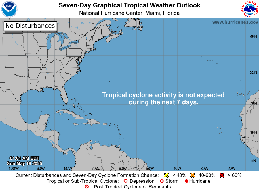
One area is on NHC’s outlook, and its chances are low.
Area | Location | 48-hour chance | 7-day chance | NHC outlook issued |
|---|
Western Atlantic | Expected to form along a weakening front a few hundred miles northeast of the Bahamas | Low, 10% | Low, 30% | 1:00 a.m. EST Nov 3 |
NHC says the low is expected to form “in a day or so” and “could acquire some subtropical characteristics late this week while it drifts over the western Atlantic.” It adds that chances “should end by the weekend” as the system moves east or northeast “into unfavorable environmental conditions.”
The Tropical Weather Discussion lists no tropical waves today. It expects broad low pressure southwest of Bermuda, near 27N to 28N, from Tuesday night through Wednesday. Gale-force winds are likely north of 29N from Wednesday afternoon through Thursday evening.
Closer to land, an upper-level low over the southeast Gulf of Mexico is producing scattered showers and thunderstorms over the Straits of Florida. A cold front is forecast to reach the Texas coast late Tuesday afternoon and move over the northwest Gulf of Mexico Tuesday night. An upper trough is supporting scattered showers and thunderstorms over the northwest Caribbean.
Season so far
The 2026 Atlantic season is running well below the 1991-2020 average to this date on every count.
Measure | 2026 to date | 1991-2020 average to this date | Full-season average |
|---|
Named storms | 10 | 13 | 14 |
Hurricanes | 1 | 6 | 7 |
Major hurricanes | 1 | 3 | 3 |
Accumulated cyclone energy (ACE) | 19.7 | NHC lists 2026 as 83% below normal | — |
Sources: the NHC 2026 season summary “as of 03 UTC 2 November 2026” (2026 counts, and the departure from normal used for the to-date averages) and the NHC climatology page (full-season averages). The only hurricane so far was Isaias, a major hurricane on Oct. 6-10 with peak winds of 105 knots (about 120 mph [195 km/h]). The most recent named system was Subtropical Storm Josephine on Oct. 21-22.
NOAA’s Climate Prediction Center, in its Oct. 8 discussion, keeps an El Niño Advisory in effect and says “a strong-to-very strong El Niño” is likely through January-March 2027.
What to watch next
The main item is whether the low northeast of the Bahamas forms and gains subtropical traits late this week.
- Today and Wednesday: NHC’s next Tropical Weather Outlooks will show whether the low forms near the weakening front, as NHC expects “in a day or so.”
- Wednesday to Friday: NHC’s marine forecasts and the Tropical Weather Discussion track the gale north of about 27N in the western Atlantic.
- Late this week: NHC outlooks will say whether the low acquires subtropical characteristics before conditions turn unfavorable by the weekend.
- Tuesday night onward: the National Weather Service covers the cold front crossing the Texas coast and the northwest Gulf of Mexico.
- Nov. 12: NOAA’s Climate Prediction Center is scheduled to issue its next ENSO discussion.
About this report
This report summarizes official products from the National Hurricane Center and NOAA’s Climate Prediction Center. NHC outlook times are given in Eastern Standard Time (EST), as NHC issues them; the Tropical Weather Discussion uses UTC. Figures can change with each new product, and the latest NHC issuance always takes precedence over this summary.
Glossary
- Formation chance: NHC’s probability that a disturbance becomes a tropical or subtropical cyclone within 48 hours or 7 days.
- Subtropical cyclone: a low-pressure system with a mix of tropical and non-tropical traits, often forming near old fronts.
- Major hurricane: a hurricane of Category 3, 4 or 5 on the Saffir-Simpson Hurricane Wind Scale.
- Accumulated cyclone energy (ACE): a measure of a season’s combined storm strength and duration.
- Gale warning: a marine warning for sustained gale-force winds over open water, issued separately from tropical storm warnings.
Frequently asked questions
Is any storm threatening land today? No. NHC reports no tropical cyclones in the Atlantic basin, and no tropical watches or warnings are in effect.
Could the low near the Bahamas become a named storm? It is possible but unlikely in the short term. NHC gives it a 10% chance in 48 hours and 30% over 7 days, and says it may become subtropical late this week before conditions turn unfavorable.
Will the western Atlantic be rough this week? Yes, for mariners. NHC expects strong to gale-force winds and rough to very rough seas north of about 27N from Wednesday through Friday, with seas peaking near 16 ft (4.9 m).
How does 2026 compare with an average season? It is well below average. NHC’s season summary shows 10 named storms and 1 hurricane, against averages of 13 and 6 by this date, and seasonal ACE 83% below normal.
Sources
- National Hurricane Center home page, last updated 08:20 UTC Nov. 3, 2026
- NHC Atlantic Tropical Weather Outlook, issued 1:00 a.m. EST Nov. 3, 2026
- NHC Atlantic Tropical Weather Discussion, issued 0615 UTC Nov. 3, 2026
- NHC 2026 Atlantic season summary, as of 03 UTC Nov. 2, 2026
- NHC tropical cyclone climatology, 1991-2020 averages
- NOAA CPC ENSO diagnostic discussion, issued Oct. 8, 2026