
🇺🇸 U.S. Weather Outlook: What to Expect This Week
By Paul Harrison | Founder & Publisher, Orbis Weather




U.S. Weather Outlook (Next 7 Days): October 24–30, 2026
By Paul Harrison, Orbis Weather
This outlook covers Saturday, October 24, through Friday, October 30, 2026. It was written Saturday morning, October 24, at about 7:30 a.m. EDT, from National Weather Service products issued over the previous day.
At a glance
The week’s main weather is heavy rain on the southern High Plains this weekend and a wet, windy, coastal-flood-prone stretch on Florida’s east coast. Much of the central and eastern U.S. stays dry and warmer than average, and the Weather Prediction Center says weather across the lower 48 “does not appear widely hazardous next week.”
- Southern High Plains and Rockies: flash flooding possible Saturday and Sunday from New Mexico and West Texas into southeast Colorado and western Kansas.
- Florida east coast: heavy rain Sunday and Monday, gusty northeast winds, high surf and moderate to possibly major coastal flooding with King Tides.
- East and Midwest: dry, with frost early in the weekend in the Northeast, then warmth spreading east.
- Pacific Northwest and northern Rockies: rounds of rain and mountain snow through the week.
- Hawaii: a heavy rain and flash flood risk Tuesday into Wednesday.
Local National Weather Service offices issue the official watches and warnings for each area.
The big picture
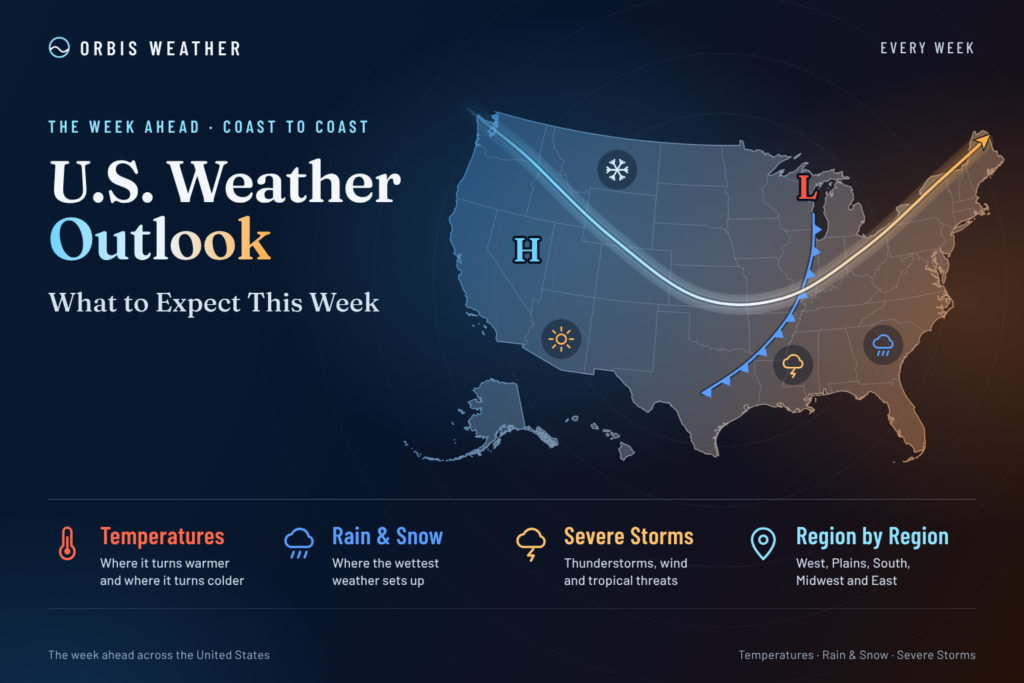
Two features run the weekend: a slow upper-level low over the Southwest and a strong high over the East. The upper low stays nearly still through Sunday morning, pulling moisture from the Gulf of California into the Southwest and southern High Plains, then lifts toward the central Rockies. The eastern high pushes northeast winds onto Florida, where a broad low along a stalled boundary to the south keeps the onshore flow going. Next week, an upper ridge lets warmer-than-average air spread over much of the eastern half of the country. Troughs bring repeated rain and mountain snow to the Northwest and northern Rockies, while the western U.S. runs near to slightly below average.
Day by day
The wettest days are the weekend in the southern High Plains and Sunday to Monday in Florida; the rest of the week is mostly quiet.
Day | East | Central states | West |
|---|---|---|---|
Sat, Oct 24 | Frost advisory in parts of NY and CT until 9 a.m. EDT; dry. Showers along Florida’s east coast. | Heavy rain and storms from New Mexico and West Texas into southeast Colorado and western Kansas. Cold front in Denver; highs in the low 50s. | Upper low over Southern California. Rain reaches the Washington coast in the evening. |
Sun, Oct 25 | Heavy rain on Florida’s east coast; northeast gusts to 40 mph. Northeast dry. | Heavy rain continues on the central and southern High Plains. Isolated hail in New Mexico and far West Texas. | Light rain in western Washington. Warm and dry in Southern California. |
Mon, Oct 26 | Coastal flooding on Florida’s east coast. A dry cold front crosses the Northeast at night. | Lesser flash flood risk in the southern Plains. About 60°F near Lake Michigan. | Low moves onshore in northwest Oregon. Tides above 7.5 feet possible in San Diego. |
Tue, Oct 27 | Warmer than average air spreads east. Florida rain chances ease. | Rain in the northern Plains and Upper Midwest, possibly mixed with snow. Gusts of 30 to 40 mph in northeast New Mexico. | Rain and higher-elevation snow in the Northwest and northern Rockies. Southern California begins cooling. |
Wed, Oct 28 | Mild and mostly dry. | Mostly dry in the Texas Panhandle. | Wetter trend in western Washington. |
Thu, Oct 29 | Near-normal temperatures in Florida. | Rounds of rain and storms possible in the south-central U.S. | Southern California coast and valleys in the upper 60s to mid 70s; slight chance of showers. |
Fri, Oct 30 | Dry in the New York area. | Rain may increase in the southern Plains. Modest cooling near Chicago. | Unsettled in western Washington, with highs in the low to mid 50s. |
Region by region
Northeast and Mid-Atlantic. The region stays dry through much of the week under high pressure. The New York office expects lows of 25 to 30°F well inland and in the Long Island Pine Barrens early Saturday, similar readings late Saturday night, and patchy frost possible again Sunday night.
Southeast. Florida’s east coast gets the region’s weather. Melbourne forecasts rain chances of 60 to 80 percent Saturday night through Monday, with highs in the upper 70s to low 80s. Miami says the most likely total through Monday is 1 to 1.5 inches, with a less likely scenario of 3 to 4 inches.
Midwest and Great Lakes. It is dry and warm. Chicago expects highs in the lower to mid 70s Saturday, Sunday as the warmest day, and above-average temperatures through about Wednesday or Thursday. Highs in the 70s reach as far north as the Mid-Mississippi and Ohio Valleys next week.
Plains. The southern High Plains are wet this weekend. Amarillo expects 1 to 2 inches in the western Texas Panhandle and 0.1 to 1 inch farther east, with more rain possible late in the week. Shortwaves bring rain to the northern Plains next week, and snow “could mix in at times” even at lower elevations.
Rockies and Great Basin. Albuquerque forecasts another 0.5 to 3 inches along and east of the central mountain chain through Sunday night, with “a few inches” of snow on the highest Sangre de Cristo peaks. Denver sees highs in the 60s to near 70°F most days next week. The northern Rockies and Great Basin get multiple rounds of rain and higher-elevation snow.
Southwest and California. Southern California turns dry and warm. San Diego expects Sunday highs in the mid 70s to lower 80s on the coast and valleys and the mid 80s in the lower deserts, then cooling Tuesday through Thursday.
Pacific Northwest. Seattle expects highs in the mid to upper 50s through Monday and rain mainly on the coast and Olympics at first. Conditions stay “generally unsettled into Friday.”
Alaska. WPC expects powerful storms with heavy rain, mountain snow, high winds and coastal flooding threats for western Alaska and the Aleutians, while Southeast Alaska stays dry.
Hawaii. Moisture deepens from Tuesday, with precipitable water above 2.5 inches and heavy rain and thunderstorms on most islands through at least Thursday.
Hazards this week
Flash flooding in the southern High Plains and coastal flooding in Florida are the main hazards; severe weather potential is limited.
Hazard | Where | When | What the forecasters say |
|---|---|---|---|
Flooding rain | New Mexico, West Texas, southeast Colorado, western Kansas | Sat–Mon | WPC Slight Risk Saturday and Sunday, Marginal Monday in the southern Plains. A Flood Watch covers much of New Mexico, including Albuquerque and Santa Fe, from 6 a.m. MDT Saturday through late Saturday night. WPC’s Friday discussion gave 1 to 3 inches from northeastern New Mexico to western Kansas Sunday. |
Flooding rain | Florida east coast | Sun–Tue | WPC Slight Risk Sunday, Marginal Monday. Melbourne keeps a Marginal Risk on Tuesday. |
Severe storms | Southwest and southern Rockies; New Mexico and far West Texas | Sat; Sun | SPC Slight Risk Saturday, with lightning, damaging gusts, hail and a few tornadoes possible. SPC Marginal Risk Sunday, mainly for hail. For Tuesday to Saturday, SPC says severe potential “appears low.” |
Wind, surf, coastal flooding | East-central and Southeast Florida coast | Sat–Mon, coastal flooding possibly longer | Coastal Flood Warning from 2 a.m. EDT Sunday to 8 p.m. EDT Monday on the east-central coast. Breakers of 7 to 12 feet. Miami says major flooding is possible with King Tides, and moderate flooding may last through the week. |
Coastal flooding | Southern California coast | Sat–Wed | Tides running 1.4 to 1.6 feet above predictions. Minor to moderate flooding from Saturday; “Locally significant impacts expected from Monday to Wednesday.” |
Frost | Interior New York and Connecticut, eastern Long Island | Sat and Sun mornings | Frost Advisory until 9 a.m. EDT Saturday; frost possible again Sunday morning. |
Heavy rain, flash flooding | Hawaii | Tue–Wed | WPC says “confidence is increasing in a heavy rainfall and flash flood risk”; timing and amounts remain uncertain. |
Storms, coastal flooding | Western Alaska and Aleutians | Weekend through next week | High winds, heavy rain and snow, and coastal flooding threats on the west and southwest coasts. |
Wildfire | National | As of Oct 23 | National Preparedness Level 1, with 105 new fires reported on Oct 22. |
Tropics
No tropical system threatens the United States. The Atlantic has no tropical cyclones as of the 2 a.m. EDT Saturday outlook. In the eastern Pacific, Hurricane Vance (Advisory 12, 3 a.m. CST Saturday) was about 365 miles south-southwest of Acapulco, Mexico, with 110 mph winds, moving north-northwest at 7 mph and expected to weaken. No coastal watches or warnings are in effect. Near the Date Line, a broad low has a 20 percent chance of forming over seven days. Newer advisories replace these figures.
Beyond the week
The Climate Prediction Center favors a warm East and a wet southern and central U.S. into early November. These outlooks were issued at 3 p.m. EDT Thursday, October 22.
Outlook | Temperature | Precipitation | Confidence |
|---|---|---|---|
6–10 day (Oct 28–Nov 1) | Above normal for most of the East except parts of Maine, and for the Southwest and central and southern Rockies. Below normal in the Pacific Northwest and much of Montana. | Above normal from California across the central and southern Rockies, the Great Plains, the Midwest and the Southeast. Near to below normal in the Northeast. | Above average, 4 out of 5 |
8–14 day (Oct 30–Nov 5) | Above normal for the eastern half of the country and most of the Great Plains. Near normal for most of the West. | Above normal for most of the country, over 50 percent likely in much of California, the Southwest and the southern Plains. Not favored near the Canadian border from Washington to northern Minnesota or in the Northeast. | About average, 3 out of 5 |
What could change
Forecasters name five specific uncertainties this week.
- Florida rain totals, Sunday and Monday: WPC noted “Low confidence on these details at this lead time,” and Miami says a possible closed low off the Carolina coast could track south along Florida.
- Southern Plains late in the week: WPC says “into later next week amounts may increase, depending on how the pattern evolves.”
- Hawaii, Tuesday and Wednesday: global models are “very aggressive” with heavy rain over the central islands, but ensembles do not lock in that amount.
- Colorado, Sunday and Monday: Denver calls the precipitation forecast uncertain, with heavier amounts possible in the central and northern mountains.
- Western Washington, Monday: the day is drier if the low tracks into Oregon, with light showers otherwise.
About this outlook
This outlook summarizes forecasts from the National Weather Service: the Weather Prediction Center, Storm Prediction Center, Climate Prediction Center, National Hurricane Center and local forecast offices. Day 1 is Saturday, October 24, and day 7 is Friday, October 30. Forecasts change, and details beyond three or four days are less certain. Local offices issue the official watches and warnings.
Glossary
- Upper-level low: a pocket of low pressure high in the atmosphere that can stall and produce days of showers and storms.
- Excessive Rainfall Outlook risk levels: WPC’s four-level scale (Marginal, Slight, Moderate, High) for the chance that rain exceeds flash flood guidance.
- Precipitable water: the total water vapor in a column of air, a measure of how much rain a storm could produce.
- King Tides: the highest astronomical tides of the year, which raise coastal flood risk.
- Shortwave: a small disturbance in the upper-level winds that can trigger rain or snow as it passes.
Frequently asked questions
Where is flash flooding most likely this weekend? In New Mexico, West Texas, southeast Colorado and western Kansas, under WPC Slight Risks on Saturday and Sunday. Urban areas, roads, small streams, narrow canyons and burn scars are the most vulnerable, according to WPC.
How bad will coastal flooding be in Florida? Melbourne expects minor to moderate flooding along the whole east-central coast through Monday evening. Miami expects moderate flooding with each high tide and says major flooding is possible with King Tides.
Will the East stay warm? Yes, for most of the week. WPC expects warmer-than-average temperatures across much of the eastern half of the country, and CPC favors above-normal temperatures there into early November.
Is a hurricane headed for the U.S.? No. The Atlantic is quiet, and Hurricane Vance in the eastern Pacific has no U.S. watches or warnings and is forecast to weaken.
Is there severe weather next week? Very little is expected. SPC says severe potential appears low from Tuesday through Saturday, with deep moisture confined to Texas and the Gulf Coast.
Sources & Methodology
Weekly Global Weather Watch is compiled by Orbis Weather using information from official national and international meteorological agencies, including NOAA, the National Weather Service, National Hurricane Center, Weather Prediction Center, Climate Prediction Center, World Meteorological Organization and relevant national weather agencies worldwide.
Orbis Weather reviews these official observations, forecasts, warnings and outlooks to identify the most significant global weather patterns and hazards for the week ahead. Forecast conditions can change as new observations and model guidance become available.
About the Author
Paul Harrison — Founder & Publisher, Orbis Weather
Paul Harrison founded Orbis Weather in 2026 to make global weather and natural-hazard information easier to find, follow and understand. His coverage includes tropical cyclones, severe weather, extreme temperatures, earthquakes, volcanoes, wildfires, flooding and significant natural disasters worldwide.
View all articles by Paul Harrison → | Editorial Standards →
Global Weather Tracker Hub
Explore weather maps, tropical systems, storms and natural hazards around the world.
No matching trackers found.