
Local Tide Chart – High & Low Tides Near You
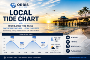
ORBIS Tide Chart
Asks your browser for permission to use your location, reverse-geocodes it (BigDataCloud) to find the nearest NOAA tide station, and pulls that station's predictions (NOAA CO-OPS). If location access is denied, no nearby station is found, or the request times out, it falls back to Naples, FL. For situational awareness only — not a substitute for official tide tables or marine warnings.
💧 Water Temperature & Local Forecast 💧
Local Water Temp & Surf Conditions
Share your location and we'll pull water temperature, wind and the local forecast from the nearest NOAA/NWS sources to you.
Local Forecast
Local Tide Chart – High & Low Tides Near You
Check local high and low tide times, water temperature, wind and coastal weather with the Orbis Weather Local Tide Chart.
The interactive tide tool uses your location to find a nearby NOAA tide station and display available tide predictions for your area. You can also check local water temperature, wind conditions and the latest National Weather Service forecast.
Whether you’re planning a day of fishing, boating, kayaking, paddleboarding, shelling or simply heading to the beach, understanding the tides can help you choose the best time to be near the water.
🌊 How the Orbis Weather Tide Chart Works
The Orbis Weather Local Tide Chart uses tide predictions from NOAA’s Center for Operational Oceanographic Products and Services, commonly known as NOAA CO-OPS.
When you allow location access, the tool uses your approximate device location to identify a nearby NOAA tide station.
The chart then displays available predicted high and low tide times for that station.
Because tides vary from one location to another, the nearest NOAA station provides a much more useful reference than a generic regional tide forecast.
📈 What Is High Tide?
High tide occurs when the ocean reaches a local maximum water level during the tidal cycle.
After reaching high tide, water levels generally begin falling toward the next low tide.
The exact height and timing of high tide vary by location.
Coastline shape, water depth, bays, inlets, islands and other geographic features can significantly affect local tides.
This is why two beaches relatively close to each other can experience high tide at different times.
📉 What Is Low Tide?
Low tide occurs when the local water level reaches a minimum point in the tidal cycle.
Low tide can expose beaches, sandbars, rocks, tidal flats and other coastal features that may be underwater during high tide.
For beachgoers, shell collectors and people exploring tidal areas, low tide can create very different conditions from high tide.
Boaters should be particularly aware of low tides in shallow channels, marinas and coastal waterways where reduced water depth can become important.
🌙 What Causes Ocean Tides?
Ocean tides are primarily caused by the gravitational pull of the Moon and, to a lesser extent, the Sun.
As Earth rotates, different parts of the planet move through areas of higher and lower ocean water.
The result is the repeating rise and fall in sea level that we experience as tides.
However, actual tide timing and height are much more complicated than simply following the position of the Moon.
The shape of coastlines, ocean basins, bays, channels and the seafloor all influence local tides.
☀️ What Are Spring Tides?
Spring tides occur around the new moon and full moon when the gravitational influences of the Sun, Moon and Earth are more closely aligned.
During these periods, the difference between high and low tide can become greater than usual.
High tides may be higher, while low tides may be lower.
Despite the name, spring tides have nothing to do with the spring season.
They occur throughout the year.
🌓 What Are Neap Tides?
Neap tides generally occur around the first-quarter and third-quarter phases of the Moon.
During these periods, the gravitational influences of the Sun and Moon partially counteract each other.
The difference between high and low tide is usually smaller.
This produces a more moderate tidal range compared with spring tides.
⏰ Why Do Tide Times Change Every Day?
High and low tides do not normally occur at exactly the same clock time every day.
The Moon moves in its orbit around Earth while Earth rotates.
As a result, the timing of the tidal cycle shifts from one day to the next.
Local geography further modifies these patterns.
Rather than assuming tomorrow’s tide will occur at the same time as today’s, check the current tide prediction for your location.
🌊 Why Tide Heights Matter
The time of high or low tide is only part of the information contained in a tide prediction.
Predicted tide height can also be important.
A particularly high astronomical tide may bring water farther onto beaches and into low-lying coastal areas.
A very low tide can expose additional shoreline or reduce water depth in shallow waterways.
Boaters, anglers and coastal property owners may therefore want to consider both tide timing and predicted water level.
🏖️ Best Tide for the Beach
There is no single tide that is best for every beach activity.
Low tide may expose more beach and can create excellent conditions for walking, shelling and exploring tidal areas.
High tide can reduce the amount of exposed beach and may bring deeper water closer to shore.
Local conditions matter greatly.
Some beaches change dramatically between high and low tide, while others experience relatively modest differences.
Weather, waves and currents should always be considered along with the tide.
🐚 Best Tide for Shelling
Shelling is often popular around lower tides because more of the beach and tidal zone may become exposed.
Conditions can sometimes be especially interesting after storms or periods of stronger wave activity that move shells onto the shoreline.
However, tide predictions alone cannot guarantee good shelling conditions.
Beach shape, currents, waves, recent weather and local regulations can all affect what you find.
🎣 Tides and Fishing
Tides can strongly influence coastal fishing.
Moving water transports baitfish, nutrients and other food through passes, inlets, estuaries and coastal waterways.
Many anglers therefore pay close attention to periods surrounding incoming and outgoing tides.
The best tide depends on the species, location, season and fishing technique.
Rather than assuming high or low tide is always best, experienced anglers often focus on periods when water is actively moving.
🚤 Tides and Boating
Tide information can be especially important for boaters operating in shallow coastal waters.
Water depth in channels, marinas, passes and near sandbars can change significantly between high and low tide.
A route that provides adequate depth at high tide may become much shallower several hours later.
Tide predictions should be used as one component of boating preparation alongside official nautical charts, observed water levels, marine forecasts and local knowledge.
The Orbis Weather tide tool is not intended for navigation.
🛶 Kayaking and Paddleboarding
Kayakers and paddleboarders can also benefit from checking tides before heading onto coastal waterways.
Tidal currents can become strong in passes, channels and narrow waterways.
An outgoing tide may make returning against the current more difficult, while an incoming tide can change water depth and access to shallow areas.
Wind is equally important for paddlers.
That is why the Orbis Weather page provides local wind and forecast information alongside tide predictions.
🌡️ Local Water Temperature
Water temperature affects swimming comfort, fishing conditions and marine ecosystems.
The Orbis Weather tool searches for nearby reporting information from NOAA sources when available.
Water temperatures can vary considerably over short distances, particularly near bays, rivers, inlets and shallow coastal waters.
A station measurement should therefore be treated as representative of conditions near that reporting location rather than the exact temperature at every nearby beach.
💨 Wind and Coastal Conditions
Wind can dramatically change conditions on the water.
Even when tides are favorable, strong winds can create rough conditions for small boats, kayaks and paddleboards.
Wind direction also matters.
Onshore winds can increase wave action along beaches, while offshore winds can push small floating objects and inexperienced paddlers away from shore.
Always consider wind and marine conditions along with the tide before heading onto the water.
🌊 Tide Predictions vs. Actual Water Levels
A tide prediction estimates the astronomical tide expected from the gravitational influences of the Moon and Sun combined with known local tidal patterns.
Actual water levels can be different.
Wind, atmospheric pressure, storms, river flow and ocean conditions can push water above or below predicted levels.
This difference becomes especially important during hurricanes, tropical storms, nor’easters and other significant coastal storms.
A tide chart should therefore never be treated as a storm-surge forecast.
🌀 Hurricanes, Storm Surge and High Tide
Tropical storms and hurricanes can produce storm surge when strong winds push ocean water toward the coast.
If significant storm surge occurs near the time of high tide, total water levels can become even higher.
However, storm surge is a separate phenomenon from the normal astronomical tide.
During a hurricane or tropical storm, follow official storm-surge forecasts and evacuation instructions from the National Hurricane Center and local authorities.
Do not attempt to estimate hurricane flood risk from a normal tide chart alone.
🌧️ Weather Can Change Coastal Water Levels
Tropical systems are not the only weather events capable of changing water levels.
Persistent onshore winds can push water toward the coast.
Offshore winds can sometimes reduce water levels.
Low atmospheric pressure can also contribute to higher water levels, while river discharge can affect conditions in estuaries and tidal rivers.
This is why observed water levels do not always exactly match tide predictions.
🌕 What Are King Tides?
“King tide” is an informal term commonly used for some of the highest predicted astronomical tides of the year.
They typically occur when gravitational and orbital conditions combine to produce unusually high tides.
King tides can cause temporary flooding in particularly low-lying coastal areas, especially when combined with onshore winds or other weather conditions.
They can also provide communities with a glimpse of which locations are particularly vulnerable to elevated coastal water levels.
📍 Tide Times Near Me
The Orbis Weather Local Tide Chart is designed to make finding nearby tide information simple.
Allow location access and the tool attempts to identify a nearby NOAA tide station automatically.
If location access is unavailable, the tool may use a fallback location.
Always check the station name displayed by the tracker before relying on the prediction.
A tide station farther from your actual location may experience high and low tides at different times.
🗺️ Why Tide Times Vary by Location
Tides do not move along an entire coastline simultaneously.
Ocean water must move through complex coastlines, bays, estuaries, channels and inlets.
These geographic features can delay or amplify the tidal cycle.
For example, a tide at an ocean-facing beach can occur at a substantially different time from a location farther inside a bay or tidal river.
For the most useful prediction, select a NOAA station reasonably close to the location you intend to visit.
📡 Where Does Orbis Weather Get Tide Data?
Orbis Weather uses tide predictions from NOAA CO-OPS — the Center for Operational Oceanographic Products and Services.
Local weather information is obtained from NOAA and the National Weather Service.
These are established U.S. government sources for tide, water-level, marine and weather observations.
Orbis Weather organizes the information into an easy-to-use local coastal planning tool.
🏝️ Plan Your Day on the Coast
Tides influence beaches, boating, fishing, kayaking, paddleboarding, shelling and many other coastal activities.
Checking the tide before leaving home can help you better understand the conditions you may encounter.
Use the Orbis Weather Local Tide Chart to check high and low tide times, water temperature, wind and the local weather forecast.
For a broader picture of coastal weather, also explore the Orbis Weather Local Weather Map, Atlantic Hurricane Tracker, Gulf Hurricane Tracker and Live Lightning Map.
Important Tide & Marine Safety Disclaimer
The Orbis Weather Local Tide Chart is provided for general information, recreation planning and situational awareness.
Tide predictions represent expected astronomical tides. Actual water levels can differ because of wind, atmospheric pressure, storms, river flow and other environmental conditions.
Water temperature and weather observations may come from reporting stations some distance from your exact location.
Do not use the Orbis Weather Tide Chart for navigation or emergency marine decisions.
For navigation, hazardous marine conditions, coastal flooding, storm surge and other safety-critical information, consult official NOAA/National Weather Service products, official tide and water-level observations and appropriate nautical resources.