
Landslide Hotspots: Most Landslide-Prone Places on Earth
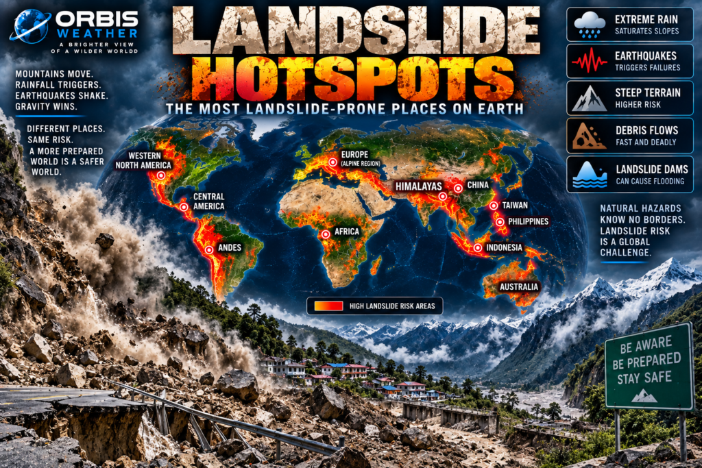

⛰️ Landslide Hotspots: The Most Landslide-Prone Places on Earth
Mountains can appear permanent.
But sometimes an entire mountainside moves.
Heavy rain saturates the soil. An earthquake shakes an unstable slope. A tropical cyclone dumps extraordinary amounts of water over steep terrain. Wildfire removes vegetation that once helped hold soil in place.
Then gravity takes over.
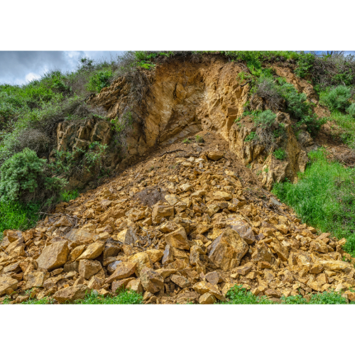
Rock, mud, trees and debris begin moving downhill.
Some landslides creep forward slowly over months or years.
Others accelerate within seconds, becoming violent avalanches of rock and earth capable of destroying almost everything in their path.
According to the U.S. Geological Survey, landslides can range from movements of only inches per year to events traveling tens of miles per hour. Some can move faster than a person can run.
Around the world, landslide danger is concentrated where three ingredients frequently come together:
⛰️ Steep terrain + 🌧️ intense precipitation + 🌎 unstable geology.
And nowhere is that combination more dramatic than across the great mountain systems of South and Southeast Asia.
From Nepal and northern India through Bhutan, Pakistan, southern China, Taiwan, the Philippines and Indonesia, some of Earth’s most landslide-prone landscapes rise above densely populated valleys.
Welcome to Earth’s Landslide Hotspots.
🏔️ The Himalayas — Earth’s Great Landslide Zone
The Himalayas are among the youngest and most geologically active major mountain ranges on Earth.
They exist because the Indian tectonic plate continues pushing into the Eurasian Plate.
That collision creates extraordinary mountains.
It also creates unstable slopes.
Then the monsoon arrives.
Every year, enormous amounts of rainfall fall across portions of the Himalayan region.
Water infiltrates soil and fractured rock.
Rivers erode the bottom of slopes.
Road construction cuts into mountainsides.
Earthquakes periodically shake the landscape.
Eventually, some slopes fail.
The World Bank describes the Hindu Kush–Himalayan region as particularly vulnerable to landslides and earthquakes.
Few regions combine so many landslide triggers within such enormous mountainous terrain.
🇳🇵 Nepal — Where Mountains, Monsoons and Earthquakes Meet
Nepal represents one of the clearest examples of extreme landslide exposure.
The country contains some of Earth’s steepest terrain.
The geology of the Himalayas is young and fractured.
Every summer, monsoon rainfall saturates hillsides.
Earthquakes add another major trigger.
The World Bank identifies Nepal’s combination of complex terrain, young Himalayan geology, high seismic activity and annual monsoon rainfall as a particularly difficult landslide-risk environment.
Many communities sit within narrow valleys or on steep hillsides.
Roads wind along mountain slopes.
Rivers cut deep valleys through the landscape.
When landslides occur, they don’t simply threaten houses.
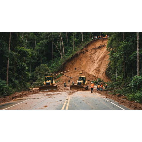
They can cut roads and isolate entire communities.
🌧️ Nepal’s Monsoon Landslides
Rain is one of the most important landslide triggers on Earth.
As water enters soil, it increases the weight of the slope.
Water pressure within the ground can also reduce the forces holding soil and rock together.
Eventually, gravity wins.
During Nepal’s monsoon season, prolonged rainfall can destabilize thousands of slopes.
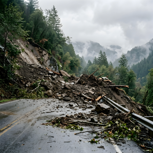
A road that was open in the morning may be buried by afternoon.
Mountain communities may become inaccessible.
Rivers can become filled with debris.
And sometimes landslides block entire rivers.
That can create another dangerous hazard.
🌊 Landslide Dams — When Mountains Block Rivers
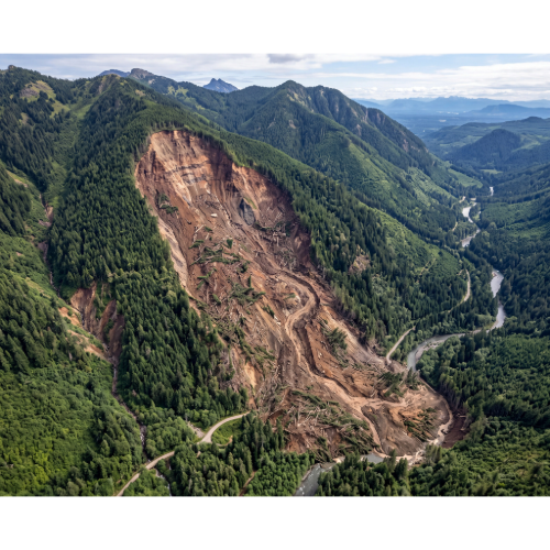
A large landslide can fall directly into a river valley.
Enough rock and debris may completely block the river.
Water then begins accumulating behind the landslide.
A temporary lake forms.
These landslide dams can be extremely dangerous.
Some remain stable.
Others eventually fail.
If the natural dam suddenly collapses, enormous quantities of stored water can surge downstream.
A landslide can therefore trigger a chain reaction:
⛰️ Landslide → 🌊 blocked river → 🏞️ temporary lake → 💥 dam failure → 🌊 flash flood
This type of cascading disaster is especially important in mountainous regions such as the Himalayas.
🇮🇳 India — Himalayan Landslides and Monsoon Rain
Northern and northeastern India contain another enormous landslide environment.
Mountain states including:
🇮🇳 Uttarakhand
🇮🇳 Himachal Pradesh
🇮🇳 Sikkim
🇮🇳 Arunachal Pradesh
experience recurring slope failures.
The combination of steep Himalayan terrain and intense monsoon rainfall creates widespread susceptibility.
Road construction, development and changes to natural drainage can further destabilize slopes in some locations.
India also faces landslide hazards in other mountainous areas, including portions of the Western Ghats.
Extreme rainfall can trigger hundreds of slope failures across a region during a single major weather event.
🇵🇰 Pakistan — Mountains Under Pressure
Northern Pakistan contains some of Earth’s most spectacular mountain terrain.
The Himalayas, Karakoram and Hindu Kush converge across the broader region.
But this landscape is also geologically active.
Earthquakes can trigger thousands of landslides.
Heavy monsoon rainfall can trigger additional failures.
Mountain roads can become blocked.
Entire valleys can be isolated.
Glacial lakes and steep river valleys add additional hazards.
In these environments, landslides frequently become part of larger disasters involving earthquakes, floods or extreme rainfall.
🇧🇹 Bhutan — A Mountain Nation
Bhutan is another Himalayan country where steep terrain dominates the landscape.
Roads frequently follow narrow valleys and cut across steep mountain slopes.
Heavy monsoon rainfall can trigger rockfalls, landslides and debris flows.
Transportation infrastructure can be particularly vulnerable.
This is one reason landslide risk isn’t measured only by fatalities.
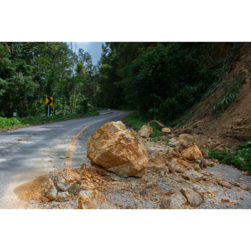
A relatively small landslide can have enormous consequences if it blocks the only major road into a remote community.
🇨🇳 China — Mountains, Earthquakes and Extreme Rain
China contains some of the world’s most landslide-prone terrain.
The mountainous southwest is particularly important.
Provinces including Sichuan and Yunnan contain:
⛰️ Steep mountains
🌎 Active faults
🌧️ Heavy rainfall
🏞️ Deep river valleys
Large earthquakes can trigger extraordinary numbers of landslides.
The 2008 Wenchuan earthquake in Sichuan triggered widespread slope failures across the mountainous landscape.
Some blocked rivers and created dangerous temporary lakes.
China demonstrates how earthquakes and landslides can combine into a single cascading disaster.
🇹🇼 Taiwan — Typhoons Meet Mountains
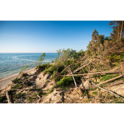
Taiwan may be one of the clearest examples of weather-driven landslide danger.
The island contains extremely steep mountains.
It also lies in an active tectonic zone.
Then typhoons arrive from the western Pacific.
A single tropical cyclone can dump extraordinary quantities of rain across Taiwan’s mountains.
That water rushes into steep valleys.
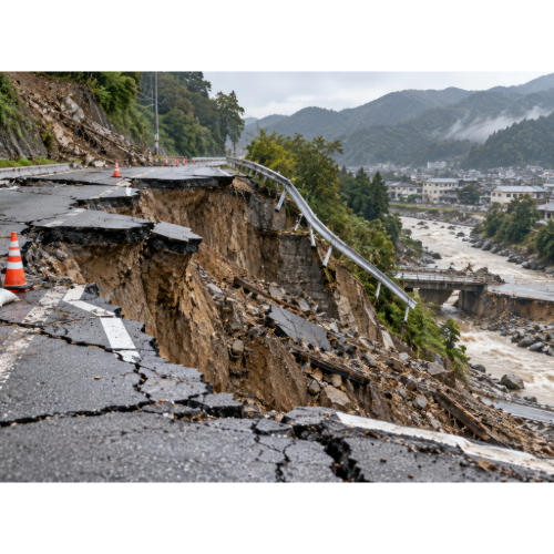
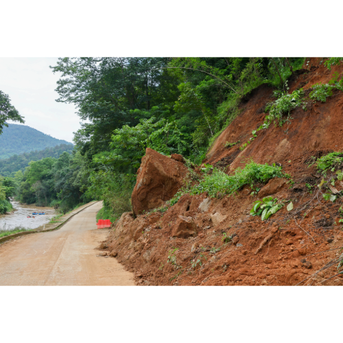
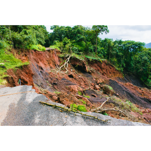
Slopes collapse.
Rivers fill with sediment.
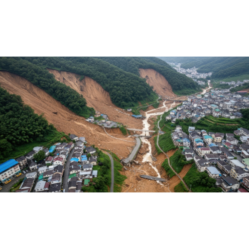
Debris flows race downstream.
The combination of typhoons + earthquakes + steep terrain makes Taiwan one of Earth’s major landslide hotspots.
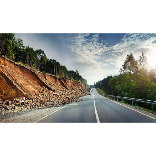
🇵🇭 Philippines — Tropical Rain on Steep Islands
The Philippines faces a similar combination.
Mountainous islands.
Active faults.
Volcanoes.
Typhoons.
Torrential tropical rainfall.
When a powerful tropical cyclone crosses the Philippines, rainfall can become as dangerous as wind.
Mountain slopes may collapse.
Roads disappear beneath debris.
Communities along hillsides and river valleys can become isolated.
Volcanic terrain can add another hazard.
Loose ash and volcanic material can mix with rainfall and produce fast-moving debris flows.
🇮🇩 Indonesia — Volcanoes, Earthquakes and Tropical Rain
Indonesia combines nearly every major landslide trigger.
🌧️ Torrential tropical rainfall
🌋 Volcanoes
🌎 Earthquakes
⛰️ Steep terrain
🌲 Land-use change
🛣️ Mountain development
The country contains thousands of mountainous islands where communities often live close to steep slopes.
Heavy rain can trigger landslides during the wet season.
Volcanic slopes can be especially unstable.
Earthquakes can trigger rockfalls and massive slope failures.
Indonesia therefore sits at the intersection of several Orbis Weather danger-zone categories:
Earthquakes. Volcanoes. Tsunamis. Floods. Landslides.
Few countries experience such a diverse collection of natural hazards.
🌎 Central America — Volcanoes, Mountains and Tropical Storms
Another major landslide corridor stretches through Central America.
Countries including:
🇬🇹 Guatemala
🇸🇻 El Salvador
🇭🇳 Honduras
🇳🇮 Nicaragua
🇨🇷 Costa Rica
contain steep mountains and volcanic terrain.
Tropical storms and hurricanes can produce extreme rainfall.
That rain can trigger thousands of landslides.
Some may be small.
Others can bury roads, destroy homes or overwhelm entire communities.
NASA’s landslide-monitoring work has specifically focused on rainfall-triggered landslide hazards in parts of Central America.
🌎 The Andes — South America’s Landslide Corridor
The Andes stretch thousands of miles along western South America.
This enormous mountain chain contains numerous landslide hotspots.
Important regions include:
🇨🇴 Colombia
🇪🇨 Ecuador
🇵🇪 Peru
🇧🇴 Bolivia
Steep terrain combines with earthquakes and intense rainfall.
Mountain roads frequently cross unstable slopes.
Cities have expanded onto hillsides.
During extreme rainfall, landslides and debris flows can sweep into populated valleys.
🇨🇴 Colombia — Mountains and Tropical Rain
Colombia contains three major branches of the Andes.
Many cities and towns occupy mountainous terrain.
Heavy tropical rainfall can destabilize slopes.
Roads wind across mountainsides.
River valleys cut through steep landscapes.
When intense rain persists, the combination can become dangerous.
Some Colombian disasters have involved enormous debris flows carrying mud, boulders, trees and water through communities.
🇵🇪 Peru — Earthquakes and Mountain Avalanches
Peru contains one of history’s most dramatic examples of an earthquake-triggered landslide.
On May 31, 1970, a major earthquake struck off Peru.
The shaking destabilized a massive section of rock and ice on Mount Huascarán.
An enormous debris avalanche raced downhill.
The city of Yungay was overwhelmed.
USGS historical analysis notes that the avalanche was responsible for a substantial portion of the fatalities associated with the earthquake.
The disaster demonstrates how a landslide can transform an earthquake into something even more destructive.
🇧🇷 Brazil — Landslides Above Dense Cities
Brazil doesn’t have Himalayan mountains.
But portions of southeastern Brazil contain steep hillsides exposed to intense tropical rainfall.
Cities have expanded onto slopes.
Some communities contain densely packed homes built on or beneath unstable terrain.
When extreme rainfall occurs, saturated slopes can collapse.
This creates an especially dangerous combination:
steep terrain + extreme rainfall + dense population.
Urban landslides demonstrate that mountain height isn’t the only factor determining risk.
Exposure matters just as much.
🇺🇸 Western United States — America’s Landslide Zone
Landslides occur across the United States.
USGS says every U.S. state and territory experiences them.
Major susceptible regions include:
⛰️ Pacific Coast Ranges
⛰️ Rocky Mountains
⛰️ Appalachian Mountains
🏔️ Alaska
🌋 Hawaii
USGS notes that steep slopes containing weak or fractured materials are particularly susceptible.
California, Washington, Oregon and Alaska contain some of the country’s most significant landslide environments.
🇺🇸 California — Rain, Fire and Debris Flows
California has a particularly complicated landslide problem.
Steep coastal and mountain terrain creates natural susceptibility.
Winter storms can bring intense rainfall.
Earthquakes can destabilize slopes.
And wildfire creates another major problem.
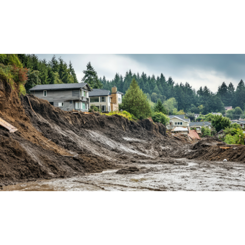
After vegetation burns, slopes may become dramatically more vulnerable to debris flows.
Heavy rain falling over a recently burned landscape can rapidly mobilize ash, soil, rocks and burned vegetation.
A wildfire disaster can therefore create a landslide disaster months later.
USGS actively produces post-fire debris-flow hazard assessments across the western United States.
🌧️ Rain — Earth’s Great Landslide Trigger
Globally, heavy rainfall is one of the most important landslide triggers.
Rainwater infiltrates the ground.
Soil becomes heavier.
Water pressure increases.
Friction can decrease.
Eventually, the slope loses stability.
USGS notes that prolonged or heavy rainfall produces the most frequent and widespread damaging landslides in the United States.
Many are shallow but move rapidly, and some transform into fast-moving debris flows.
This same fundamental process occurs around the world.
🌎 Earthquakes — When the Mountain Starts Moving
Earthquakes provide another powerful trigger.
Strong shaking can instantly destabilize thousands of slopes.
Rockfalls begin.
Mountain ridges collapse.
Old landslides reactivate.
USGS research shows that earthquake-triggered ground failure can contribute substantially to earthquake losses.
The danger is especially great where major faults cross steep mountain terrain.
That is why earthquake hotspots and landslide hotspots often overlap.
🔥 Wildfires Can Create Future Landslide Zones
Wildfires remove vegetation.
Roots that helped stabilize soil can be damaged.
The ground surface changes.
Then rain arrives.
On steep burned slopes, intense rainfall can create destructive debris flows.
This means a wildfire’s danger may continue long after the flames are extinguished.
California frequently demonstrates this phenomenon, but post-fire debris flows can occur in other mountainous fire-prone regions as well.
Fire changes the landscape. Rain exposes the weakness. Gravity does the rest.
🌋 Volcanoes and Landslides
Volcanoes create another form of unstable mountain.
Eruptions can fracture rock.
Hydrothermal activity can weaken volcanic material.
Earthquakes beneath volcanoes can destabilize slopes.
Entire sections of a volcanic mountain can collapse.
Rainfall can then mobilize loose volcanic ash and debris.
Some volcanic landslides can transition into lahars — destructive mixtures of water, mud and volcanic debris.
Volcanoes are therefore both eruption hazards and potential landslide hazards.
🌊 What Is a Debris Flow?
A debris flow is one of the most dangerous forms of rapid slope failure.
Imagine a fast-moving mixture of:
💧 Water
🪨 Rocks
🌳 Trees
🟫 Mud
🏚️ Debris
moving downhill through a canyon or stream channel.
USGS describes debris flows as rapidly moving slurries of water, soil and rock that can develop from rainfall-triggered landslides.
They can move with tremendous force.
Large boulders may be carried downstream.
Cars can be swept away.
Buildings can be destroyed.
And because debris flows often follow channels, valleys and canyon bottoms can be especially dangerous.
🛣️ Roads Can Destabilize Mountains
Mountain roads are essential.
But constructing them can change a slope.
Road cuts remove material supporting hillsides.
Drainage patterns can change.
Water may become concentrated in unstable areas.
Loose excavated material may be deposited downslope.
The World Bank notes that road construction in mountainous areas can be an important contributor to landslide and erosion problems when not properly managed.
Engineering therefore plays an important role in reducing landslide risk.
🌳 Vegetation Matters
Plant roots can help stabilize shallow soils.
Healthy vegetation can also affect how rainfall reaches and moves through the ground.
USGS notes that mature native vegetation with strong root systems may reduce landslide susceptibility on some slopes.
Removing vegetation doesn’t guarantee a landslide.
But deforestation, wildfire and land disturbance can change slope stability.
Again, landslides rarely have only one cause.
Multiple factors usually interact.
🛰️ Watching Landslides From Space
Landslides can be surprisingly difficult to monitor globally.
Many happen in remote mountains.
Clouds may obscure satellite views.
Small events may never appear in news reports.
NASA developed the Global Landslide Catalog to collect reports of rainfall-triggered landslides worldwide.
NASA also operates the Landslide Hazard Assessment for Situational Awareness — LHASA — model.
The system combines information including:
🌧️ Satellite rainfall
⛰️ Slope
🪨 Geology
🛣️ Roads
🌎 Faults
🌲 Forest loss
to identify locations where landslides may be more likely.
Satellite technology is making it increasingly possible to watch landslide conditions on a global scale.
⚠️ Warning Signs of a Landslide
Some landslides happen with little warning.
Others provide clues.
Potential warning signs can include:
⚠️ New cracks appearing in the ground
🌳 Trees suddenly leaning
🚧 Roads or driveways deforming
🏠 Foundations separating
💧 New water seepage from a slope
🪨 Increasing rockfall
🚪 Doors or windows suddenly becoming difficult to close
USGS warns that landslides are difficult to predict and some occur without obvious warning.
During extreme rainfall in steep terrain, situational awareness is especially important.
🌎 Earth’s Major Landslide Hotspots
Some of the world’s most important landslide-prone regions include:
🏔️ Himalayas — Earth’s premier combination of extreme relief, monsoon rainfall and active tectonics.
🇳🇵 Nepal — Steep terrain, earthquakes and annual monsoon rainfall.
🇮🇳 Northern India — Himalayan and monsoon landslide exposure.
🇵🇰 Northern Pakistan — High mountains, earthquakes and intense rainfall.
🇧🇹 Bhutan — Steep Himalayan terrain and monsoon precipitation.
🇨🇳 Southwestern China — Mountains, earthquakes and heavy rainfall.
🇹🇼 Taiwan — Typhoons, earthquakes and extremely steep terrain.
🇵🇭 Philippines — Tropical cyclones, earthquakes and mountainous islands.
🇮🇩 Indonesia — Tropical rainfall, volcanoes and earthquakes.
🌎 Central America — Volcanic mountains plus hurricanes and tropical rainfall.
🏔️ Andes — Earthquakes, steep terrain and intense rainfall from Colombia to Peru.
🇧🇷 Southeastern Brazil — Extreme rainfall and densely populated hillsides.
🇺🇸 Western United States — Rainfall, earthquakes, wildfire and steep mountain terrain.
🇺🇸 Alaska — Mountains, earthquakes, glaciers and unstable slopes.
🌍 Where Are Earth’s Greatest Landslide Hotspots?
There is no single Landslide Capital of the World.
Landslides depend heavily on terrain, rainfall, earthquakes, geology, land use and population exposure.
But NASA’s Global Landslide Catalog has identified an important global pattern:
South and Southeast Asia contain the highest reported concentrations of rainfall-triggered and fatal landslides.
Within that enormous region, the Himalayas stand out.
The mountains are steep.
The geology is young.
Earthquakes are common.
Monsoon rainfall can be extreme.
Millions of people live within mountain valleys and on hillsides.
Roads cross unstable slopes.
Rivers continuously erode mountains from below.
That combination creates one of Earth’s most powerful landslide environments.
But landslides are not exclusively an Asian hazard.
The Andes experience them.
Central America experiences them.
California experiences them.
Brazil experiences them.
Alaska experiences them.
Almost anywhere steep terrain meets unstable material and a powerful trigger, a landslide can occur.
And unlike hurricanes, landslides don’t need an ocean.
Unlike earthquakes, they don’t require a major fault.
Unlike volcanoes, they don’t require magma.
Sometimes all that is necessary is a mountain, enough rain—
and gravity.
❓ Landslide Hotspots — Frequently Asked Questions
Where do most landslides occur?
Landslides occur worldwide, but mountainous regions with steep slopes, heavy rainfall and active tectonics experience particularly high susceptibility.
What is the world’s biggest landslide hotspot?
There is no official single hotspot, but South and Southeast Asia — particularly the Himalayan region — stand out strongly in global landslide records.
What causes most landslides?
Major triggers include intense or prolonged rainfall, earthquakes, volcanic activity, erosion and human alteration of slopes.
Why does Nepal have so many landslides?
Nepal combines steep Himalayan terrain, young and fractured geology, earthquakes and intense annual monsoon rainfall.
Can hurricanes and typhoons cause landslides?
Yes. Tropical cyclones can produce extreme rainfall over mountains, triggering widespread landslides and debris flows.
Can earthquakes cause landslides?
Yes. Strong earthquake shaking can destabilize slopes and trigger thousands of landslides across mountainous regions.
Can wildfires cause landslides?
Wildfire can increase susceptibility to debris flows by removing vegetation and changing soil and slope conditions. Heavy rain over a burn scar can then mobilize debris.
What is a debris flow?
A debris flow is a fast-moving mixture of water, soil, rock and other material traveling downslope or through channels.
Can landslides block rivers?
Yes. Large landslides can create natural dams. If those dams fail, they can produce dangerous downstream flooding.
Can scientists predict landslides?
Scientists can identify susceptible terrain and monitor rainfall, soil conditions and slope movement, but determining exactly when an individual landslide will occur remains difficult.
Where can I follow landslides and other natural hazards?
Follow Orbis Weather global natural-hazard coverage for major landslides, earthquakes, floods, tropical cyclones, volcanoes and other developing disasters.