Wildfire Hotspots: The Most Fire-Prone Places on Earth

🔥 Wildfire Hotspots: The Most Fire-Prone Places on Earth
Somewhere on Earth, something is burning.
A lightning strike ignites a remote boreal forest in Canada.
Dry winds push flames through chaparral in California.
A summer heatwave turns Mediterranean vegetation into fuel.
Bushfires race across Australia.
Fires spread through Siberian forests.
Smoke from burning vegetation in South America rises high enough to be detected from space.
Fire is a natural part of many ecosystems.
But when extreme heat, drought, dry vegetation and powerful winds come together, an ordinary wildfire can become an extraordinary natural disaster.
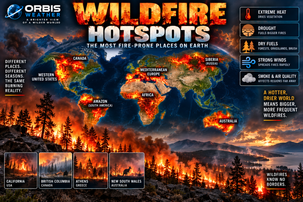
Around the world, several regions repeatedly stand out as major Wildfire Hotspots.
Among the most important are:
🔥 Western United States
🔥 Canada and Alaska
🔥 Mediterranean Europe
🔥 Australia
🔥 Siberia and northern Russia
🔥 Amazon and Cerrado regions of South America
🔥 Southern and central Africa
And wildfire patterns are changing.
NASA research shows that extreme wildfire events have become more frequent, larger and more intense globally over recent decades, particularly in northern and temperate forests.
Welcome to Earth’s Wildfire Hotspots.
🔥 What Creates a Wildfire Hotspot?
A landscape doesn’t become wildfire-prone because of one factor.
Several ingredients usually combine.
🌡️ Heat
🌵 Drought
🌲 Dry vegetation
💨 Strong winds
⚡ Lightning
🔥 Human ignition
🏔️ Terrain
When vegetation loses moisture, grass, leaves, branches and trees become fuel.
Strong winds can then rapidly push a fire across the landscape.
Steep slopes can accelerate fire spread.
Lightning can ignite fires in remote areas.
Humans can accidentally — or intentionally — provide another ignition source.
But every wildfire hotspot behaves differently.
A California chaparral fire is not the same as a Canadian boreal forest fire.
An Australian bushfire is different from agricultural burning in Africa.
Understanding global fire requires understanding the landscape.
🇺🇸 Western United States — America’s Wildfire Hotspot
Few places have become more closely associated with destructive wildfire than the western United States.
California receives much of the attention, but wildfire danger extends across:
🇺🇸 Oregon
🇺🇸 Washington
🇺🇸 Idaho
🇺🇸 Montana
🇺🇸 Nevada
🇺🇸 Arizona
🇺🇸 New Mexico
🇺🇸 Colorado
and other western states.
The region contains forests, grasslands, deserts and shrublands adapted to very different fire environments.
Hot summers can dry vegetation.
Mountain snowpack eventually disappears.
Long periods without rain allow fuels to become increasingly combustible.
Then winds arrive.
Under extreme conditions, fires can spread extraordinarily quickly.
🇺🇸 California — Where Fire Meets Millions of People
California’s wildfire problem is especially complicated.
The state contains enormous variations in climate, vegetation and terrain.
Northern California contains extensive forests.
Southern California contains large areas of chaparral and shrubland.
Mountain ranges surround densely populated valleys and coastal communities.
Millions of homes have been built near wildland vegetation.
This boundary between human development and natural vegetation is known as the wildland-urban interface, or WUI.
When wildfire reaches these communities, a vegetation fire can become an urban disaster.
Homes themselves can become fuel.
Wind-blown embers may ignite structures well ahead of the main fire front.
Entire neighborhoods can become threatened.
💨 Wind — The Wildfire Accelerator
Wind can transform a dangerous fire into an extreme one.
Strong winds supply oxygen to flames.
They push fire rapidly through vegetation.
They bend flames toward unburned fuel.
And they carry burning embers ahead of the fire.
Those embers can ignite new fires far from the original flame front.
California is famous for powerful dry wind events including Santa Ana winds in Southern California and Diablo-type winds farther north.
Similar wind-driven wildfire events occur elsewhere around the world.
When vegetation is exceptionally dry, wind can turn a spark into a rapidly moving emergency.
🇨🇦 Canada — The Boreal Fire Giant
Canada contains one of Earth’s largest areas of boreal forest.
Fire is naturally part of this ecosystem.
Lightning frequently ignites remote forests during summer.
Many fires burn far from cities.
But Canadian fires can become enormous.
NASA’s satellite observations show that boreal forests across northern North America are among the regions experiencing some of the largest increases in extreme fire behavior.
The extraordinary Canadian wildfire season of 2023 demonstrated how far the effects can travel.
Smoke spread across vast portions of North America and crossed the Atlantic.
Wildfire is therefore not simply a local hazard.
Smoke can become a continental or even intercontinental event.
🇺🇸 Alaska — Fire in the Far North
Alaska contains another enormous boreal fire environment.
Long summer days can dry vegetation.
Lightning can ignite remote forests.
Some fires burn for long periods because reaching them is difficult.
Increasing fire activity across northern forests is particularly important because boreal landscapes contain enormous stores of carbon.
When these forests — and in some places organic soils — burn, large amounts of carbon and smoke can enter the atmosphere.
Wildfire is increasingly becoming an Arctic story as well as a temperate one.
🇷🇺 Siberia — Fires Across the World’s Largest Forests
Across the Arctic lies another enormous wildfire region:
Siberia.
Russia contains vast boreal forests stretching thousands of miles across northern Eurasia.
Summer heat and lightning can ignite fires across remote landscapes.
Some burn extremely far from major population centers.
Satellite observations are essential for monitoring these fires because ground-based observation across such enormous territory is difficult.
NASA’s global fire research identifies the boreal forests of both Russia and northern North America as regions experiencing substantial increases in extreme wildfire activity.
❄️ Wildfires in the Arctic
Wildfire once seemed like an unlikely Arctic hazard.
That perception is changing.
WMO and NASA have documented significant fires at high northern latitudes.
Vegetation may be sparse compared with forests farther south, but grasses, shrubs, peat and other organic material can burn.
Arctic fires can also produce another unusual phenomenon:
holdover or “zombie” fires.
In some environments, fire can smolder beneath the surface in organic soils and potentially survive cold periods before becoming visible again.
The far north is increasingly important in the global wildfire story.
🌊 The Mediterranean — Europe’s Great Fire Zone
Southern Europe experiences some of Earth’s most recognizable wildfire conditions.
Hot summers.
Long dry periods.
Dense vegetation.
Mountainous terrain.
Strong winds.
Together they create an enormous seasonal fire environment surrounding the Mediterranean.
Major wildfire countries include:
🇪🇸 Spain
🇵🇹 Portugal
🇫🇷 France
🇮🇹 Italy
🇬🇷 Greece
🇹🇷 Turkey
🇭🇷 Croatia
and others.
Recent years have brought destructive fires from the Iberian Peninsula to Greece and Turkey.
WMO’s European State of the Climate report found that 2025 produced Europe’s largest annual burned area in the record used by the report.
The Mediterranean remains one of Earth’s major wildfire danger zones.
🇬🇷 Greece — Heat, Wind and Mountain Fire
Greece frequently experiences dangerous summer fire conditions.
Vegetation becomes extremely dry during prolonged hot weather.
Strong winds can then accelerate flames through mountainous terrain and toward coastal communities.
Islands can also experience serious fires.
Evacuation can become complicated when roads are limited and large numbers of tourists are present during peak summer.
Greek wildfires demonstrate why wildfire preparedness isn’t simply about extinguishing flames.
It also requires evacuation planning.
🇵🇹 Portugal and 🇪🇸 Spain — The Iberian Fire Zone
The Iberian Peninsula experiences another important Mediterranean fire regime.
Heatwaves and drought can create extremely dry vegetation across Portugal and Spain.
Mountainous terrain complicates firefighting.
Wind can produce rapid changes in fire direction.
Rural population changes and vegetation management can also affect the amount and arrangement of combustible fuel.
Wildfire here is a landscape problem as much as a weather problem.
🇦🇺 Australia — Bushfire Country
Few countries have a deeper relationship with fire than Australia.
Fire is naturally embedded within many Australian ecosystems.
Numerous plant species have evolved alongside recurring fire.
But extreme bushfires can become catastrophic.
Australia’s combination of:
🌡️ Extreme heat
🌵 Drought
🌾 Dry grass
🌿 Flammable vegetation
💨 Strong winds
⚡ Lightning
creates some extraordinary fire environments.
NASA’s Global Fire Atlas found that many of the world’s largest and fastest-spreading individual fires occur in sparsely populated grasslands in Australia, Africa and Central Asia.
One fire recorded in Australia’s Northern Territory in 2007 burned roughly 40,000 square kilometers, according to NASA’s summary of the Global Fire Atlas.
That is an astonishing scale.
🇦🇺 Australia’s Black Summer
The 2019–2020 Black Summer became one of the defining wildfire disasters of modern Australia.
Fires burned across several states.
Communities were destroyed.
Wildlife habitat was devastated.
Smoke spread enormous distances.
Some fires generated towering thunderstorms known as pyrocumulonimbus clouds.
These are thunderstorms created or intensified by the heat of a fire itself.
A wildfire can essentially begin influencing its own weather.
⛈️ When Wildfires Create Thunderstorms
Extremely intense fires release tremendous heat.
Hot air rises rapidly.
If atmospheric conditions are favorable, enormous smoke columns can develop into thunderstorm-like clouds called pyrocumulonimbus, or pyroCb.
These storms can produce:
⚡ Lightning
💨 Powerful winds
🌧️ Precipitation
🔥 New fire ignitions
They can also transport smoke high into the atmosphere.
This is one of the most dramatic examples of interaction between wildfire and weather.
The fire isn’t merely responding to the atmosphere.
It is changing it.
🇧🇷 Brazil — Amazon and Cerrado Fire
South America contains another major global fire region.
Brazil experiences widespread seasonal burning across the Amazon and Cerrado.
But this fire environment differs significantly from the boreal forests of Canada or Siberia.
Many fires in tropical South America are associated with human activity, including land clearing and agricultural practices.
NASA’s satellite record shows intense seasonal fire activity across parts of South America, particularly during the dry season.
The Cerrado — a vast tropical savanna — naturally has a relationship with fire.
The humid Amazon rainforest is different.
Large-scale burning there can contribute to forest degradation and ecosystem change.
🌍 Africa — Earth’s Fire Continent
Look at global satellite fire maps and Africa immediately stands out.
NASA has described Africa as the planet’s “fire continent.”
During some parts of the year, enormous numbers of satellite-detected fires occur across the continent.
But there is an important distinction.
Many African fires are not catastrophic forest wildfires.
A large share involves:
🌾 Agricultural burning
🌿 Savanna fires
🐄 Land management
🔥 Seasonal grass burning
NASA reported that on an average August day in its long-term MODIS observations, roughly 70% of actively burning fires detected globally occurred in Africa.
That doesn’t mean Africa suffers 70% of the world’s destructive wildfire disasters.
It demonstrates why fire detections and wildfire disasters are not the same thing.
Context matters.
🔥 Not Every Fire Is a Disaster
Fire is not inherently bad.
Many ecosystems evolved with it.
Some forests need periodic fire to clear undergrowth.
Certain plants depend on heat or smoke to reproduce.
Grasslands and savannas have experienced natural and human-managed burning for thousands of years.
Indigenous communities around the world have also used carefully managed fire to shape landscapes.
The problem comes when fire becomes too frequent, too intense, occurs in the wrong ecosystem or collides with vulnerable communities.
Wildfire management therefore isn’t simply about eliminating fire.
In many landscapes, that would be impossible — and ecologically harmful.
🌲 The Fuel Problem
Wildfires need something to burn.
That sounds obvious, but fuel is one of the most important parts of wildfire science.
Fuel can include:
🌲 Trees
🌿 Shrubs
🍂 Dead leaves
🪵 Fallen branches
🌾 Grass
🌱 Organic soils
When vegetation grows and then dries, fuel accumulates.
In some forests, decades of aggressive fire suppression have allowed combustible material to build up.
NASA notes that historical suppression of wildfire has contributed to fuel accumulation in portions of western U.S. forests.
This creates a difficult challenge.
Stopping every small fire can sometimes contribute to conditions that allow future fires to become much larger.
🌡️ Heat, Drought and Fire Weather
Wildfire depends strongly on weather.
Hot temperatures remove moisture from vegetation.
Drought dries landscapes over longer periods.
Low humidity accelerates drying.
Strong winds increase fire spread.
NASA reports that fire seasons in several parts of the world are becoming longer.
Parts of the western United States, Mexico, Brazil and East Africa now experience fire seasons more than a month longer than they did roughly 35 years earlier.
NASA also reports that human-caused climate change has been a major driver of increasing fire weather in the American West.
But climate isn’t the only factor.
Ignitions, vegetation management, land use, development and firefighting practices all influence wildfire outcomes.
🏘️ The Wildland-Urban Interface
One of the greatest wildfire challenges isn’t happening deep in wilderness.
It’s happening where wilderness meets neighborhoods.
This is the wildland-urban interface.
As communities expand into forests, grasslands and shrublands, more homes become exposed to wildfire.
A fire that once burned through mostly uninhabited vegetation can now threaten thousands of structures.
Road networks can become evacuation bottlenecks.
Power lines can be damaged.
Emergency services can become overwhelmed.
Wildfire risk is therefore partly about where fires occur.
But it is also about where we build.
💨 Wildfire Smoke — The Disaster Beyond the Flames
You don’t need to live beside a wildfire to experience its effects.
Smoke can travel hundreds or thousands of miles.
Fine particles can reduce air quality far from the fire itself.
Large wildfire seasons in Canada, Siberia and the western United States have repeatedly demonstrated how smoke can spread across continents.
NASA notes that wildfire smoke can travel thousands of miles and affect millions of people.
A remote fire can therefore become an urban air-quality emergency far downwind.
🛰️ Watching Wildfires From Space
Satellites have revolutionized wildfire monitoring.
NASA instruments aboard satellites can detect thermal anomalies associated with active fires.
One of the most important systems is FIRMS — the Fire Information for Resource Management System.
FIRMS uses satellite observations to provide near-real-time information about active fires and thermal hotspots around the world.
Satellite imagery can also reveal:
🔥 Active fire fronts
💨 Smoke plumes
⬛ Burn scars
🌡️ Thermal hotspots
🌎 Regional fire patterns
These observations are especially valuable in remote areas where fires may otherwise go undetected.
🔥 Earth’s Major Wildfire Hotspots
Some of the world’s most important wildfire regions include:
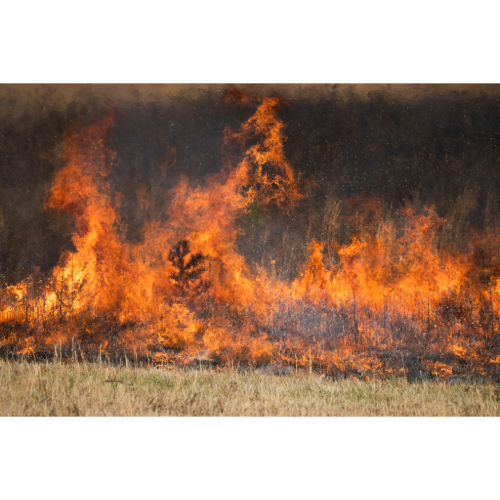
🇺🇸 Western United States — Forest, grassland and chaparral fires combined with extensive development.
🇨🇦 Canada — Enormous boreal forests and lightning-driven summer fires.
🇺🇸 Alaska — Remote boreal fires and increasing northern fire activity.
🇷🇺 Siberia — Vast forests, extreme summer heat and remote wildfire activity.
🌊 Mediterranean Europe — Heat, drought, vegetation and strong winds.
🇦🇺 Australia — Bushfires across forests, grasslands and savannas.
🇧🇷 Brazil — Seasonal Amazon and Cerrado fire activity, much of it influenced by human land use.
🌍 Africa — Earth’s greatest concentration of seasonal satellite fire detections, dominated in many areas by savanna and agricultural burning.
🌎 Central Asia — Large grassland and steppe fires.
❄️ Arctic — An emerging area of concern as extreme northern fire activity increases.
🌎 Where Are Earth’s Greatest Wildfire Hotspots?
There is no single Wildfire Capital of the World.
That’s because fire means very different things in different environments.
Africa has enormous numbers of seasonal fire detections.
Australia can experience gigantic grassland and bushfires.
Canada and Siberia contain vast boreal forests capable of supporting enormous fires.
California combines severe fire weather with millions of people living close to combustible landscapes.
Mediterranean Europe experiences intense summer fire conditions.
South America experiences extensive seasonal burning associated with both natural landscapes and human land use.
NASA’s research nevertheless reveals an important modern trend.
Extreme wildfire activity has more than doubled globally over approximately the past two decades.
The strongest increases have occurred in some northern and temperate forests — particularly the western United States and the boreal forests of northern North America and Russia.
At the same time, global satellite data show that total burned area can move in the opposite direction because burning in many grasslands and savannas has declined.
That apparent contradiction reveals something important.
There is no single global wildfire story.
Some landscapes are burning less.
Some forests are experiencing more extreme fires.
Some regions burn naturally.
Others are dominated by human ignitions.
Some fires restore ecosystems.
Others destroy communities.
But when extreme heat, drought, wind and abundant dry fuel align, almost any fire-prone landscape can become dangerous.
The world’s Wildfire Hotspots may be separated by oceans.
But they share the same fundamental ingredients: fuel, weather and ignition.
And when all three come together, the landscape can change in hours.
❓ Wildfire Hotspots — Frequently Asked Questions
Where are the world’s biggest wildfire hotspots?
Major wildfire regions include the western United States, Canada, Alaska, Siberia, Mediterranean Europe, Australia, South America and parts of Africa.
Which continent has the most fires?
Satellite observations detect exceptionally large numbers of seasonal fires across Africa, although many are agricultural or savanna fires rather than destructive forest wildfires.
Does California have the most wildfires in the world?
No. California is one of the world’s most prominent destructive wildfire regions because of its population, vegetation, terrain and weather, but global fire activity is much broader.
Why does Canada have so many forest fires?
Canada contains enormous boreal forests where summer heat, dry vegetation and lightning can create widespread wildfire activity.
Why is Australia so fire-prone?
Australia combines fire-adapted vegetation with extreme heat, drought, dry grasslands, lightning and periods of strong wind.
Why is the Mediterranean wildfire-prone?
Mediterranean summers are often hot and dry, allowing vegetation to become highly combustible. Strong winds and mountainous terrain can make fires more difficult to control.
Are all wildfires bad?
No. Fire is a natural and necessary ecological process in many forests, grasslands and savannas. Problems arise when fire becomes unusually intense, frequent or threatens people and infrastructure.
Can wildfires create their own weather?
Extremely intense fires can generate pyrocumulonimbus clouds, which can produce strong winds, lightning and thunderstorm-like conditions.
Can wildfire smoke travel thousands of miles?
Yes. Large smoke plumes can travel across countries, continents and even oceans.
How are wildfires detected from space?
Satellites detect heat signatures, smoke and burned areas. NASA’s FIRMS system provides near-real-time global active-fire information.
Where can I track active wildfires?
Use the Orbis Weather Live U.S. Wildfire Tracker and global hazard coverage to follow major wildfires, smoke and developing fire emergencies.