
Southeast Asia Natural Hazards – Live Regional Tracker

- Europe Weather & Natural Hazards Today – Sunday, November 15, 2026 7:41 PM
- Africa Weather & Natural Hazards Today — Sunday, November 15, 2026 7:34 PM
- Middle East Weather & Natural Hazards Today – November 15, 2026 7:26 PM
- Southeast Asia Natural Hazards This Week: Sunday, November 15, 2026 7:18 PM
- Southeast Asia Weather & Natural Hazards Today: Sunday, November 15, 2026 7:07 PM
- Earth’s Hot Spots This Week November 14, 2026 3:26 PM
- Australia, New Zealand & Oceania Weather & Natural Hazards Today — Sunday, November 15, 2026 11:06 AM
- North America Weather & Natural Hazards Today – November 14, 2026 10:45 AM
- Central America Weather & Natural Hazards Today – Saturday, November 14, 2026 10:36 AM
- South America Weather & Natural Hazards Today – November 14, 2026 10:26 AM
- WESTERN PACIFIC Tropical Weather Update – November 14, 2026 10:19 AM
- U.S. Weather Outlook (Next 7 Days): Nov. 14–20, 2026 9:28 AM
- Australian Region Tropical Weather Update: Saturday, November 14, 2026 9:13 AM
- Daily Earthquakes, Storms, Fires & Floods Report — November 14, 2026 8:50 AM
- Southwest Indian Ocean Tropical Weather Update: Saturday, November 14, 2026 8:40 AM




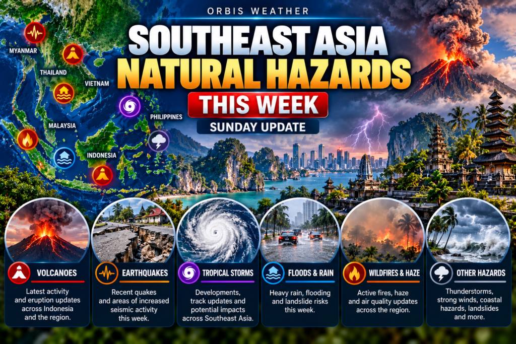
Southeast Asia Natural Hazards This Week: Sunday, November 15, 2026
By Paul Harrison, Orbis Weather ·
Heavy rain was the main hazard across Southeast Asia this week. It brought more than 500 mm of rain to parts of central Vietnam, flood alerts to southern Thailand, and floods in Selangor in Malaysia and Aceh and North Sumatra in Indonesia. In the Philippines, a new lava dome was confirmed at Mayon Volcano, which remains at Alert Level 3. None of the reports cited here gave deaths from this week’s floods.
No tropical cyclone threatens Southeast Asia. Forecasters were tracking one disturbance in the Bay of Bengal and gave it a low chance of developing within 24 hours. This report covers Monday, November 9, to Sunday morning, November 15, 2026. It is current to 05:55 on Sunday in Bangkok, Hanoi and Jakarta (UTC+7), 06:55 on Sunday in Manila, Singapore and Kuala Lumpur (UTC+8), and 17:55 on Saturday, November 14, US Eastern time.
Key facts
Hazard | Where | Latest figure | Source, date reported |
|---|---|---|---|
Heavy rain | Quang Ngai, Vietnam | 545.2 mm in 24 hours at Tra Thanh | Tuoi Tre News, Nov 11 |
Flood alert | Southern Thailand | 16 provinces on alert for Nov 9–13 | DDPM via The Nation, Nov 9 |
Floods | Selangor, Malaysia | 1,498 people in 7 relief centres | JKM via Media Selangor, Nov 14 |
Floods | Langkat, North Sumatra, Indonesia | 3,155 people affected, 336 in shelters | BNPB via Okezone, Nov 13 |
Volcano | Mayon, Philippines | Alert Level 3; new lava dome confirmed Nov 13 | PHIVOLCS via Philstar, Nov 14 |
Volcanoes | Anak Krakatau, Merapi, Semeru, Indonesia | All three at Level III (Siaga) | PVMBG via CNBC Indonesia, Nov 11 |
Earthquakes | Banda Sea and Tanimbar, Indonesia | Strongest: two magnitude 5.4 events | USGS catalog, Nov 15 |
Tropical cyclones | Bay of Bengal | Invest 92B only; low development chance in 24 hours | JTWC, Nov 14 |
Conflicting figures: a Bernama report on Nov 13 gave 1,373 evacuees in Selangor, but its per-centre figures add up to 1,240.
Floods and heavy rain
Central Vietnam had the heaviest rain of the week, while southern Thailand spent five days under flood alerts. Floods also displaced people in Malaysia and Indonesia.
Vietnam
Rain from November 9 to 11 topped 500 mm in several places, with nearly 553 mm at Tra Giap in Da Nang, VnExpress International reported on November 11. On November 10 alone, Tra Thanh in Quang Ngai recorded 320 mm and Bach Ma Peak in Hue 288.2 mm, according to the National Centre for Hydro-Meteorological Forecasting (NCHMF), reported by DTiNews.
In Da Nang, the Truong River overflowed into about 20 homes in Tra My Commune, with water more than 1 m deep in many houses (Tuoi Tre News, November 11). In Quang Ngai, flooding cut off nearly 500 households in Phuoc Giang Commune, and about 125 households were moved out of landslide-risk areas (SGGP, November 12). Landslides blocked several national highways, including more than 10,000 cubic metres of earth on National Highway 9C in Quang Tri. SGGP said advance warnings and evacuations meant no one died in a landslide at Tra My. The NCHMF forecast rain to ease from November 12, leaving scattered showers from November 15.
Thailand
The Department of Disaster Prevention and Mitigation (DDPM) put 16 provinces, 14 of them in the south, on flood alert for November 9 to 13. The Nation reported that a cold air mass from China strengthened the northeast monsoon over the Gulf of Thailand. DDPM sent mobile phone flood alerts to Phatthalung on November 10, and to Koh Samui (Surat Thani) and Tha Sala (Nakhon Si Thammarat) on November 12, citing “continuous heavy rain.”
The highest rainfall reported by November 10 was 72.5 mm at Pak Phanang, Nakhon Si Thammarat. The Royal Irrigation Department prepared ten large mobile pumps for Songkhla. With waves forecast at 2 to 3 m in the lower Gulf, small boats were told to stay ashore. The reports gave no casualty or household figures.
Malaysia
Flood evacuees in Selangor rose through the week, all in Kuala Selangor district by November 14. The count reached 1,498 people from 402 families at 8am on November 14, up from 1,248 the previous morning, according to Department of Social Welfare (JKM) figures reported by Media Selangor and Bernama. In Hilir Perak, numbers fell to 265 people from 74 families. On November 13, the Malaysian Meteorological Department issued thunderstorm and heavy rain warnings for parts of Terengganu, Pahang, Johor, Sabah and Sarawak.
Indonesia
In Langkat, North Sumatra, an overflowing river flooded hamlets in Sekoci village, Besitang district, to depths of 70 cm to 2.5 m. The National Disaster Management Agency (BNPB) reported hundreds of houses, five schools and 193.4 hectares of farmland affected (Okezone, November 13). In Gayo Lues, Aceh, flooding from about 01:00 WIB (UTC+7) on November 12 put 40 cm of water in homes, and a suspension bridge collapsed; no deaths were reported (detikSumut, November 12). In South Jakarta, a landslide on November 10 at about 14:10 WIB affected five houses and 45 people (Antara, November 10).
Tropical cyclones
No tropical cyclone threatens Southeast Asia. The Joint Typhoon Warning Center (JTWC) listed no cyclones or disturbances in the western North Pacific, including the South China Sea, at 21:00 Singapore time on November 14. The Japan Meteorological Agency (JMA) listed no active systems. PAGASA reported no tropical cyclone inside the Philippine Area of Responsibility.
System | Position | Strength (JTWC estimate) | Agency and time | Outlook |
|---|---|---|---|---|
Invest 92B, Bay of Bengal | 9.1°N 86.2°E, about 770 km southwest of Port Blair | Winds 43–52 km/h (23–28 knots), pressure about 1008 hPa | JTWC, 02:00 Nov 15 Singapore time | Gradual development over 48 hours while moving northwest; low chance of a significant cyclone within 24 hours |
Invest 96S, eastern Indian Ocean | 1.2°S 91.0°E, about 1,440 km south-southwest of Port Blair | Winds 43–52 km/h (23–28 knots), pressure about 1009 hPa | JTWC, 02:00 Nov 15 Singapore time | Tracking generally east; models disagree on development; low chance within 24 hours |
JTWC wind figures are one-minute average sustained winds.
Haze, fires and air quality
There was no haze episode this week. The ASEAN Specialised Meteorological Centre (ASMC) alert stood at Level 0, “End of Dry Season for the Southern ASEAN Region,” on its page last updated November 11. Singapore’s National Environment Agency issued its final haze update of the season on November 7, with the 24-hour PSI at 51 to 55, in the Moderate range. In Indonesia, BMKG Pekanbaru counted 90 hotspots across Sumatra on November 13, 40 of them in South Sumatra. ASMC warned that strong El Niño conditions persist and that the northern ASEAN region may see more haze toward the end of the year.
Earthquakes
No earthquake of magnitude 5.5 or greater struck the region this week. The strongest were two magnitude 5.4 events in eastern Indonesia, both at a shallow depth of 10 km, according to the US Geological Survey (USGS). The first struck the Banda Sea, 160 km east of Masohi in Maluku, on Monday evening. The second struck near the Tanimbar Islands on Tuesday morning.
USGS magnitude | Local time | Location | Depth |
|---|---|---|---|
5.2 | Sat Nov 14, 09:59 WIB (UTC+7) | Off the west coast of northern Sumatra | 10 km |
5.1 | Wed Nov 11, 20:32 WIT (UTC+9) | Tanimbar Islands, Maluku | 15 km |
5.1 | Wed Nov 11, 00:51 WIT (UTC+9) | 139 km east-southeast of Labuha, North Maluku | 10 km |
5.0 | Tue Nov 10, 17:34 WIT (UTC+9) | 58 km northeast of Fef, Southwest Papua | 35 km |
5.4 | Tue Nov 10, 10:53 WIT (UTC+9) | Tanimbar Islands, Maluku | 10 km |
5.4 | Mon Nov 9, 18:48 WIT (UTC+9) | Banda Sea, 160 km east of Masohi, Maluku | 10 km |
The USGS listed 24 events of magnitude 4.5 or greater in the search area: 19 in Indonesia, four in and near Mindanao in the Philippines, and one in southern China.
Volcanoes
Mayon in the Philippines was the main volcano story this week. PHIVOLCS staff confirmed a new lava dome in its crater on the morning of November 13, after satellite images showed the crater floor swelling on November 2 to 4 (Philstar, November 14). PHIVOLCS warned Guinobatan, Daraga and Camalig of pyroclastic density currents, rockfalls, lava flows and ashfall.
Volcano | Country | Alert level | This week’s activity | Keep-out zone |
|---|---|---|---|---|
Mayon | Philippines | 3 (scale 0–5) | One minor Strombolian eruption at 14:05 on Nov 13; 206 rockfall events and 63 pyroclastic density currents in 24 hours; sulfur dioxide 526 tonnes a day (PHIVOLCS via Philstar, Nov 14) | 6 km Permanent Danger Zone |
Kanlaon | Philippines | 2 (scale 0–5) | Ash plume 600 m high from 21:30 to 21:32 on Nov 14; 15, 4, 8 and 1 volcanic earthquakes on Nov 11–14; edifice still inflating (PHIVOLCS via GMA, Nov 15) | 4 km Permanent Danger Zone |
Anak Krakatau | Indonesia | Level III, Siaga (of IV) | Status confirmed Nov 11; no activity figures given (PVMBG via CNBC Indonesia) | 5 km radius |
Merapi | Indonesia | Level III, Siaga (of IV) | Status confirmed Nov 11; lahar warning for river channels in heavy rain | 3 km radius |
Semeru | Indonesia | Level III, Siaga (of IV) | Status confirmed Nov 11; lahar warning for river valleys | 5 km radius; 13 km along Besuk Kobokan to the southeast |
Philippine times are Philippine Standard Time (UTC+8). Hiking trails on Anak Krakatau, Merapi and Semeru are closed, CNBC Indonesia reported.
Country by country
Country | Main hazard this week | What to watch |
|---|---|---|
Philippines | Mayon lava dome at Alert Level 3; Kanlaon ash emissions | PAGASA warned of flash floods and landslides from easterly rains in Eastern Visayas, Caraga, Davao and Bicol (Nov 12) |
Vietnam | Floods and landslides in the central provinces, Nov 9–12 | Reservoir releases kept flood and landslide risk high in Khanh Hoa (SGGP, Nov 12) |
Thailand | Flood alerts in 16 provinces, Nov 9–13 | Heavy to very heavy rain in the south, Nov 18–22 |
Malaysia | Floods in Selangor and Perak | Evacuee numbers in Kuala Selangor |
Singapore | Haze season over; last 24-hour PSI Moderate (Nov 7) | Showers expected to keep haze suppressed (NEA) |
Indonesia | Floods in Langkat and Gayo Lues; three volcanoes at Siaga | Hotspots in South Sumatra and Bangka Belitung |
Myanmar | Minor flood listed by GDACS from Nov 10; 50 displaced, no deaths (updated Nov 12) | Isolated hotspots noted by ASMC |
What to watch in the week ahead
Date | Where | What forecasters say |
|---|---|---|
Sun Nov 15 | Southern Thailand | Isolated heavy rain on both coasts; waves 1–2 m on the east coast, above 2 m in thundershowers (TMD via The Nation) |
From Sun Nov 15 | Central Vietnam | Rain eases to scattered showers (NCHMF via SGGP) |
Sun Nov 15 to Tue Nov 17 | Bay of Bengal | Invest 92B forecast to develop gradually over 48 hours while moving northwest (JTWC) |
Wed Nov 18 to Sun Nov 22 | Southern Thailand | Heavy to very heavy rain; lower Gulf waves about 2 m, above 3 m in thundershowers; flash flood risk near foothills (TMD via The Nation) |
Ongoing | Mayon, Albay, Philippines | Alert Level 3 with pyroclastic density currents and rockfalls (PHIVOLCS) |
National weather services and disaster agencies issue the official warnings. Follow them for decisions about safety and travel.
About this article
This article summarises official bulletins and news reports. It is not an official warning. Wind speeds are converted from knots (1 knot = 1.852 km/h) and distances from nautical miles (1 nautical mile = 1.852 km). Times are local and name the zone: WIB is UTC+7 and WIT is UTC+9 in Indonesia. Earthquakes come from the USGS catalog for magnitude 4.5 and above between 12°S and 29°N and 91°E and 142°E, starting November 8 UTC. National agencies may give different magnitudes, and casualty and evacuee counts change as reports are updated.
Glossary
- Invest: a weather disturbance that forecasters are investigating for possible cyclone development.
- PSI: Singapore’s Pollutant Standards Index, the air quality measure reported by the National Environment Agency.
- Alert level: PHIVOLCS uses levels 0 to 5; Indonesia’s PVMBG uses levels I to IV, with III called Siaga.
- Pyroclastic density current: a fast flow of hot gas, ash and rock down a volcano’s slopes.
- Lahar: a mudflow of volcanic material, often set off by heavy rain.
Frequently asked questions
Is a typhoon heading for Southeast Asia? No. JTWC, JMA and PAGASA reported no tropical cyclone in the western Pacific or South China Sea on November 14. The only nearby disturbance, Invest 92B in the Bay of Bengal, was moving northwest with a low chance of becoming a significant cyclone within 24 hours.
Why has it rained so much in southern Thailand and central Vietnam? The Nation, citing Thai forecasters, said a cold air mass from China strengthened the northeast monsoon over the Gulf of Thailand. Vietnamese forecasters also tracked a cold air mass spreading south while heavy rain fell in the central provinces.
Is the haze over? For now, yes. ASMC’s alert is at Level 0 and Singapore ended its haze updates on November 7. ASMC says strong El Niño conditions continue and more haze is possible in the northern ASEAN region toward the end of the year.
Is it safe to go near Mayon Volcano? No one should enter the 6 km Permanent Danger Zone, PHIVOLCS says. Alert Level 3 remains in force, and the agency has warned nearby towns of pyroclastic density currents, rockfalls, lava flows and ashfall.
Were this week’s earthquakes dangerous? None reached magnitude 5.5, according to the USGS. The two strongest, both magnitude 5.4, struck the Banda Sea and the Tanimbar Islands area in eastern Indonesia.
Sources
Floods and heavy rain
- Floods sever roads, swallow excavators, inundate hundreds of homes in central Vietnam, VnExpress International, Nov 11, 2026
- Heavy rain forces evacuations, floods homes and roads in central Vietnam, Tuoi Tre News, Nov 11, 2026
- Heavy rain in central Vietnam to ease from November 12, DTiNews, Nov 11, 2026
- Central region races to recover from flooding, landslides, SGGP, Nov 12, 2026
- DDPM puts 16 Thai provinces on flood alert for 9–13 November, The Nation, Nov 9, 2026
- DDPM issues Phatthalung flood alert as 9 provinces face heavy rain through Nov 13, The Nation, Nov 10, 2026
- RID prepares ten large pumps for Songkhla amid southern flood alert, The Nation, Nov 11, 2026
- Flood alerts issued for parts of Surat Thani and Nakhon Si Thammarat, The Nation, Nov 12, 2026
- Heavy rain and flash flood risks persist across southern Thailand, The Nation, Nov 12, 2026
- TMD expects five days of heavy southern rain on November 18–22, The Nation, Nov 13–14, 2026
- Thailand weather today, 14 November, Thaiger, Nov 14, 2026
- Mangsa banjir di Selangor meningkat, Perak berkurang setakat 4 petang, Bernama, Nov 13, 2026
- Mangsa banjir Selangor meningkat, 1,498 orang berlindung di tujuh PPS, Media Selangor, Nov 14, 2026
- Banjir hingga karhutla terjang sejumlah wilayah: di Langkat, ribuan warga terdampak, Okezone, Nov 13, 2026
- Banjir dan longsor terjang Gayo Lues, jembatan gantung putus, detikSumut, Nov 12, 2026
- Lima rumah dengan 45 jiwa terdampak tanah longsor di Bangka Jaksel, Antara, Nov 10, 2026
- Easterlies bring rain to Eastern Visayas, Bicol, Davao, Caraga, GMA News, Nov 12, 2026
- GDACS alerts feed, accessed Nov 15, 2026
Tropical cyclones
- JTWC Significant Tropical Weather Advisory, western and South Pacific, 1300 UTC Nov 14, 2026
- JTWC Significant Tropical Weather Advisory, Indian Ocean, 1800 UTC Nov 14, 2026
- JMA tropical cyclone data, accessed Nov 15, 2026
- PAGASA Tropical Cyclone Bulletin, accessed Nov 15, 2026
Haze, fires and air quality
- ASEAN Specialised Meteorological Centre, page updated Nov 11, 2026
- Haze Situation Update (7 November 2026), NEA, Nov 7, 2026
- BMKG deteksi 90 titik panas di Sumatera, Riauin, Nov 13, 2026
Earthquakes
- USGS earthquake catalog search, M4.5+, Nov 8–15, 2026, accessed Nov 15, 2026
Volcanoes
- Bagong lava dome sa Mayon, namataan, Pilipino Star Ngayon, Nov 14, 2026
- PHIVOLCS: Alert Level 3 prevails over Mayon Volcano, CGTN, Nov 3, 2026
- LOOK: Kanlaon Volcano emits 600-meter ash plume, GMA News, Nov 15, 2026
- Tiga gunung api berstatus Siaga, masyarakat diminta waspada, CNBC Indonesia, Nov 11, 2026
🌏 Latest M4.0+ Earthquakes • 24 Hours
🗺️ Country Hazard Guide
🔗 Orbis Asia-Pacific Trackers
🏛️ Regional Official Sources
Global Weather Tracker Hub
Explore weather maps, tropical systems, storms and natural hazards around the world.
No matching trackers found.
🌏 Southeast Asia Natural Hazards – Live Regional Tracker
Monitor earthquakes, volcanoes, tropical cyclones, floods, severe storms, wildfire smoke and other major hazards with the Orbis Weather Southeast Asia Natural Hazards regional tracker.
Southeast Asia is one of the world’s most geographically and geologically diverse regions. Hundreds of millions of people live among active tectonic plate boundaries, tropical seas, major river systems, mountainous terrain and some of the world’s most active volcanoes.
Indonesia and the Philippines experience frequent earthquakes and volcanic activity. Tropical cyclones can affect the Philippines, Vietnam and surrounding countries. Seasonal monsoons bring heavy rainfall and flooding, while vegetation and peat fires can sometimes produce widespread transboundary haze.
The Orbis Weather dashboard brings these hazards together to provide a convenient regional overview.
🌏 Why Southeast Asia Experiences So Many Natural Hazards
Southeast Asia sits at the intersection of several major natural systems.
To the east and south, powerful tectonic forces associated with the Pacific Ring of Fire create frequent earthquakes and volcanic eruptions.
Above the region, warm tropical oceans provide enormous amounts of atmospheric moisture and energy.
Seasonal monsoon circulations bring periods of intense rainfall, while tropical cyclones regularly develop over the Western Pacific and South China Sea.
Mountainous terrain can amplify rainfall and increase landslide risk.
Together, these factors make Southeast Asia particularly vulnerable to multiple types of natural hazards.
🌎 Earthquakes Across Southeast Asia
Earthquakes are among the region’s most significant hazards.
Indonesia and the Philippines are particularly active because both countries are located near complex tectonic plate boundaries.
Myanmar also has important active fault systems, while earthquakes in and around Southeast Asia can occasionally be felt in countries with lower local seismic activity, including Singapore and Malaysia.
The Orbis Weather regional dashboard monitors significant earthquakes to provide a quick overview of recent seismic activity.
For more detailed information, visitors can use the dedicated Southeast Asia Earthquake Tracker.
🇮🇩 Why Indonesia Has So Many Earthquakes
Indonesia lies along several interacting tectonic boundaries.
In many locations, one tectonic plate is being forced beneath another through a process known as subduction.
Stress can accumulate along these plate boundaries for years, decades or centuries before being suddenly released as an earthquake.
Indonesia’s long chain of islands means seismic hazards extend across a huge geographic area, from Sumatra and Java to Sulawesi, Maluku and Papua.
Some powerful offshore earthquakes can also generate tsunamis.
🇵🇭 Earthquake Risk in the Philippines
The Philippines is another highly active earthquake region.
Numerous faults, trenches and tectonic boundaries surround and cross the archipelago.
Earthquakes can occur beneath the islands or offshore.
Because many communities are located close to the coast, strong offshore earthquakes may require rapid tsunami evaluation by official authorities.
🌋 Volcanoes Across Southeast Asia
Southeast Asia contains one of the greatest concentrations of active volcanoes on Earth.
Indonesia has more than 100 Holocene volcanic systems catalogued by global scientific databases, while the Philippines also contains numerous active volcanoes.
Volcanic hazards can include lava flows, ashfall, pyroclastic flows, lahars, volcanic gases and, in unusual circumstances, tsunamis.
The Orbis Weather regional dashboard provides broad volcano awareness, while the Indonesia Volcano Trackerprovides more detailed information about Indonesian volcanic systems.
🌋 Why Indonesia Has So Many Volcanoes
Many Indonesian volcanoes exist because of subduction.
As one tectonic plate descends beneath another, geological processes can generate magma.
That magma may eventually rise toward the surface and feed volcanic systems.
This process has produced the long chains of volcanoes visible across Sumatra, Java and other Indonesian islands.
Some of these volcanoes are located close to densely populated communities, making monitoring especially important.
🌋 Volcanic Ash and Aviation
Volcanic eruptions can affect areas far beyond the volcano itself.
Fine volcanic ash can rise high into the atmosphere and be transported considerable distances by wind.
Airborne volcanic ash is particularly dangerous to aircraft.
Flights may therefore be rerouted or airports temporarily disrupted when significant ash clouds enter aviation corridors.
Travelers flying through Indonesia or other volcanic parts of Southeast Asia should check directly with airlines when major eruptions occur.
🌀 Tropical Cyclones Across Southeast Asia
The Western Pacific is the world’s most active tropical-cyclone basin.
Tropical depressions, tropical storms and typhoons can affect large portions of Southeast Asia.
The Philippines is particularly exposed because many Western Pacific cyclones approach or cross the country before continuing toward the South China Sea.
Vietnam, southern China and other areas surrounding the South China Sea can then experience additional impacts.
🇵🇭 Why the Philippines Gets So Many Typhoons
The Philippines lies directly beside the warm tropical waters of the Western Pacific.
Tropical cyclones developing farther east can travel westward toward the archipelago.
Some systems intensify significantly before reaching the Philippines.
Hazards can include destructive winds, extreme rainfall, flash flooding, landslides, dangerous waves and coastal storm surge.
The effects can continue even after a storm moves inland or away from the country.
🇻🇳 Tropical Cyclones and Vietnam
Vietnam frequently experiences tropical storms and typhoons moving across the South China Sea.
Heavy rainfall can become one of the greatest hazards, particularly when tropical moisture interacts with mountainous terrain.
Flooding and landslides can occur well inland from the coastline.
A weakening tropical cyclone can therefore remain dangerous long after its strongest winds have diminished.
🌧️ Southeast Asia’s Monsoon Seasons
Monsoons are large seasonal changes in regional wind patterns.
They strongly influence rainfall across Southeast Asia.
Different parts of the region experience different monsoon timing and effects, but periods of persistent or extremely heavy rainfall can affect countries including Thailand, Vietnam, Malaysia, Singapore, Myanmar, Cambodia, Laos, Indonesia and the Philippines.
Monsoon rainfall is essential for water supplies and agriculture, but excessive rainfall can create major flood hazards.
🌊 Flooding Across Southeast Asia
Flooding is one of the region’s most widespread natural hazards.
Different types of flooding can occur.
Flash flooding can develop rapidly following intense thunderstorms.
River flooding may develop more slowly after prolonged heavy rainfall across a watershed.
Coastal flooding can occur during storm surge, exceptionally high tides or other elevated sea-level events.
Urban flooding can occur when intense rainfall exceeds the capacity of drainage systems.
🏔️ Landslides and Mountainous Terrain
Heavy rainfall can destabilize steep slopes.
This makes landslides a significant secondary hazard in mountainous parts of Southeast Asia.
The Philippines, Indonesia, Vietnam, Myanmar, Thailand, Laos and Malaysia all contain areas where steep terrain and intense rainfall can combine to create dangerous conditions.
Earthquakes can also trigger landslides by suddenly destabilizing slopes.
🌊 Tsunami Risk in Southeast Asia
Several parts of Southeast Asia face tsunami risk because major active tectonic boundaries lie beneath surrounding seas.
Large, shallow undersea earthquakes can sometimes displace the seafloor and generate tsunami waves.
However, not every strong offshore earthquake produces a tsunami.
Magnitude, depth, fault movement and the amount of vertical seafloor displacement all matter.
Whenever an official tsunami warning is issued, coastal residents should follow national and local evacuation instructions immediately.
🌊 The 2004 Indian Ocean Tsunami
The December 2004 Sumatra-Andaman earthquake and Indian Ocean tsunami demonstrated the extraordinary destructive potential of the region’s tectonic systems.
A massive undersea earthquake off northern Sumatra generated tsunami waves that affected coastlines around the Indian Ocean.
The disaster led to major improvements in regional tsunami monitoring, warning systems and public awareness.
It remains an important reminder that powerful regional earthquakes can create hazards extending far beyond the earthquake epicenter.
🌫️ Wildfire Smoke and Transboundary Haze
Natural hazards in Southeast Asia are not limited to earthquakes and storms.
Vegetation and peat fires can produce enormous quantities of smoke.
During some periods, winds can transport this smoke across national borders.
Indonesia, Malaysia, Singapore and other nearby countries can experience degraded air quality during significant regional haze episodes.
This phenomenon is commonly known as transboundary haze.
🔥 Peat Fires and Regional Smoke
Peatlands contain large amounts of partially decomposed organic material.
When peat dries sufficiently, it can burn.
Peat fires can be particularly difficult to extinguish because burning may continue beneath the surface.
These fires can produce large quantities of fine-particle pollution and smoke.
Weather conditions, rainfall and wind direction then determine where that smoke travels.
🌫️ Singapore and Regional Haze
Singapore is not usually the source of major regional vegetation-fire smoke, but its air quality can be influenced by fires elsewhere in Southeast Asia.
When winds transport smoke toward Singapore, concentrations of fine particulate matter such as PM2.5 can increase.
The Singapore Haze & Air Quality Tracker provides a more detailed look at Singapore’s pollution conditions.
Official Singapore PSI and public-health guidance should always be obtained from the National Environment Agency.
⛈️ Severe Thunderstorms
Tropical thunderstorms are common across Southeast Asia.
These storms can produce torrential rain, frequent lightning and strong wind gusts.
Some thunderstorms can generate damaging straight-line winds or localized flash flooding.
Because tropical convection can develop quickly, weather conditions may deteriorate within a relatively short period.
⚡ Lightning
The warm and humid tropical atmosphere supports frequent thunderstorm activity across much of Southeast Asia.
Lightning is therefore an important everyday weather hazard.
People working outdoors, boating, swimming, hiking or participating in other exposed activities should pay attention to developing thunderstorms.
Lightning can occur beyond the area experiencing the heaviest rainfall.
☀️ Extreme Heat
Heat is another important regional hazard.
High temperatures combined with tropical humidity can create dangerous heat stress.
Urban areas can experience additional warming through the urban heat-island effect.
Outdoor workers, older adults and people participating in strenuous outdoor activities can be particularly vulnerable during periods of extreme heat.
🇮🇩 Indonesia Natural Hazards
Indonesia faces one of the broadest combinations of hazards in Southeast Asia.
Major hazards include:
Earthquakes • Volcanoes • Tsunamis • Floods • Landslides • Tropical rainfall • Wildfire smoke • Haze
Its enormous geographic size and complicated tectonic environment make Indonesia particularly important for regional hazard monitoring.
🇵🇭 Philippines Natural Hazards
The Philippines is especially vulnerable to:
Typhoons • Earthquakes • Volcanoes • Floods • Landslides • Storm surge
The combination of Western Pacific tropical cyclones and active tectonic boundaries makes the Philippines one of the region’s most hazard-exposed countries.
🇻🇳 Vietnam Natural Hazards
Vietnam’s major hazards include:
Typhoons • Tropical storms • Flooding • Landslides • Extreme heat
Storms moving across the South China Sea can produce significant coastal and inland impacts.
🇹🇭 Thailand Natural Hazards
Thailand can experience:
Monsoon flooding • Severe thunderstorms • Heat • Drought • Regional haze
Flooding along major river systems can become particularly important during prolonged periods of monsoon rainfall.
🇲🇾 Malaysia Natural Hazards
Malaysia’s major environmental hazards include:
Monsoon flooding • Thunderstorms • Landslides • Haze • Heat
Peninsular Malaysia can also be affected by smoke transported from regional vegetation and peat fires.
🇸🇬 Singapore Natural Hazards
Singapore has relatively low earthquake and tropical-cyclone risk compared with some neighboring countries, but it still experiences several significant environmental hazards.
These include:
Thunderstorms • Lightning • Flash flooding • Haze • Heat
Powerful distant earthquakes may also occasionally be felt in Singapore.
🇲🇲 Myanmar Natural Hazards
Myanmar faces several major hazards:
Earthquakes • Tropical cyclones • Flooding • Landslides • Extreme heat
The Sagaing Fault creates significant earthquake risk, while cyclones from the Bay of Bengal can produce destructive wind, rainfall and storm surge.
🇰🇭 Cambodia Natural Hazards
Cambodia is particularly exposed to:
Flooding • Drought • Extreme heat • Severe thunderstorms
Seasonal changes in the Mekong River and Tonlé Sap system are important components of the country’s hydrology.
🇱🇦 Laos Natural Hazards
Laos faces hazards including:
Flooding • Landslides • Severe thunderstorms • Extreme heat
Its mountainous terrain can increase vulnerability to landslides during periods of intense rainfall.
🇧🇳 Brunei Natural Hazards
Brunei can experience:
Heavy rainfall • Flooding • Thunderstorms • Haze
Regional smoke can also affect air quality when atmospheric conditions transport pollution across northern Borneo.
🛰️ How Orbis Weather Monitors Southeast Asia
The Orbis Weather Southeast Asia Natural Hazards dashboard combines several types of regional information.
Recent earthquake activity is obtained from the USGS Earthquake Catalog.
Regional volcano information should be verified through national observatories such as Indonesia’s PVMBG/MAGMA.
Tropical cyclone information should be checked with the appropriate national meteorological agencies and official regional warning centers.
Regional haze and hotspot information can be monitored through the ASEAN Specialised Meteorological Centre.
The AHA Centre also provides regional disaster-monitoring information for ASEAN.
⚠️ Understanding the Orbis Regional Hazard Activity Level
The automatic Orbis activity level displayed by the current browser dashboard is based primarily on live regional earthquake magnitude and activity.
It is not an official ASEAN all-hazards warning level.
This distinction is important.
A low Orbis activity level does not mean that every country in Southeast Asia is free from floods, typhoons, volcanic activity, haze or other hazards.
Always examine the individual hazard sections and consult national authorities when significant conditions are developing.
🌏 Why Regional Hazard Monitoring Matters
Natural hazards do not respect national borders.
Smoke can cross from one country into another.
Tropical cyclones can affect several countries during a single journey.
Major earthquakes can be felt hundreds of kilometres from their epicenters.
Tsunamis can cross entire ocean basins.
Flood-producing monsoon systems can affect multiple countries simultaneously.
Looking at Southeast Asia as an interconnected region therefore provides valuable context that individual country reports may not always show.
📍 Is There a Natural Disaster in Southeast Asia Right Now?
The Orbis Weather Southeast Asia Natural Hazards dashboard provides a quick overview of significant regional conditions.
Check the earthquake panel for recent seismic activity and use the country hazard guide to understand which hazards are most relevant in different parts of Southeast Asia.
For current events, continue to the dedicated Orbis trackers and official national authorities.
The Southeast Asia Weather & Natural Hazards Today briefing provides another useful source for current regional developments.
🌏 Monitor Southeast Asia’s Natural Hazards
Southeast Asia contains some of Earth’s most active geological and meteorological environments.
Earthquakes shake Indonesia, the Philippines and Myanmar. Volcanoes rise along major tectonic arcs. Typhoons cross the Western Pacific. Monsoons bring heavy rain and flooding, while regional fires can send smoke across international borders.
The Orbis Weather Southeast Asia Natural Hazards dashboard brings these threats together in one regional overview.
Use it as a starting point, then explore the dedicated Southeast Asia Earthquake Tracker, Indonesia Volcano Tracker, Singapore Weather & Natural Hazards, Singapore Haze & Air Quality Tracker, Singapore Lightning & Thunderstorm Tracker and Singapore Monsoon & Flood Tracker for more detailed monitoring.
⚠️ Important Natural Hazards Disclaimer
The Orbis Weather Southeast Asia Natural Hazards dashboard is provided for general information, education and situational awareness.
The automatic Orbis regional activity indicator is not an official ASEAN warning system and currently reflects regional earthquake magnitude and activity rather than every natural hazard occurring across Southeast Asia.
Earthquake locations and magnitudes can be revised. Tropical cyclone forecasts can change. Volcanic activity can escalate rapidly. Flooding and severe thunderstorms can develop locally even when broader regional conditions appear quiet.
For official warnings, evacuation orders, tsunami information, volcanic exclusion zones, tropical-cyclone warnings and emergency instructions, follow the appropriate national and local authorities.
Do not use Orbis Weather alone for emergency or life-safety decisions.