
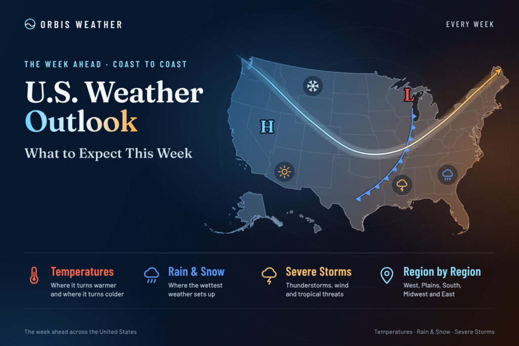
🇺🇸 U.S. Weather Outlook: What to Expect This Week

- Middle East Weather & Natural Hazards Today – November 15, 2026 7:26 PM
- Southeast Asia Natural Hazards This Week: Sunday, November 15, 2026 7:18 PM
- Southeast Asia Weather & Natural Hazards Today: Sunday, November 15, 2026 7:07 PM
- Earth’s Hot Spots This Week November 14, 2026 3:26 PM
- Australia, New Zealand & Oceania Weather & Natural Hazards Today — Sunday, November 15, 2026 11:06 AM
- North America Weather & Natural Hazards Today – November 14, 2026 10:45 AM
- Central America Weather & Natural Hazards Today – Saturday, November 14, 2026 10:36 AM
- South America Weather & Natural Hazards Today – November 14, 2026 10:26 AM
- WESTERN PACIFIC Tropical Weather Update – November 14, 2026 10:19 AM
- U.S. Weather Outlook (Next 7 Days): Nov. 14–20, 2026 9:28 AM
- Australian Region Tropical Weather Update: Saturday, November 14, 2026 9:13 AM
- Daily Earthquakes, Storms, Fires & Floods Report — November 14, 2026 8:50 AM
- Southwest Indian Ocean Tropical Weather Update: Saturday, November 14, 2026 8:40 AM





U.S. Weather Outlook (Next 7 Days): Nov. 14–20, 2026
By Paul Harrison, Orbis Weather
At a glance
A stormy West and a chilly East define the week of Saturday, Nov. 14, through Friday, Nov. 20, 2026. This outlook was written Saturday at 9:30 a.m. EST.
- West: Back-to-back Pacific storms bring rain to California and the Northwest and heavy mountain snow from the Sierra Nevada to the Rockies, with another system due midweek.
- South-central states: Heavy rain moves from the Southern Plains on Saturday to the Lower Mississippi Valley on Sunday, with isolated flash flooding possible.
- East: Below-normal temperatures and frost or freeze into early next week, then a gradual warm-up late in the week.
- Coasts: High surf and coastal flooding along the California coast this weekend.
- Tropics: No tropical cyclones are active, and none are expected to form in the next seven days.
Local National Weather Service offices issue the official watches and warnings for each area.
The big picture
An amplified jet stream sets the pattern: a trough of cold air aloft over the East early in the week and repeated troughs pushing into the West. Two atmospheric rivers, long plumes of Pacific moisture, reach the West Coast on Saturday and Sunday. Weather Prediction Center forecasters expect an upper ridge over the north-central states to spread east late in the week, ending the eastern chill. Rain and mountain snow from the West could spread into the central states by mid to late week, though forecasters say the timing of an upper low entering the West is still unsettled.
Day by day
The West stays active all week, while the East turns from cold and breezy to dry and milder.
Day | East | Central states | West |
|---|---|---|---|
Sat., Nov. 14 | Cold and breezy; lake-effect snow showers in the Great Lakes and northern New England | Heavy rain on the Southern Plains; small hail possible in Texas | Heavy snow in the Utah and Colorado mountains; Northwest front arrives in the evening |
Sun., Nov. 15 | Dry, cold morning; first freeze for much of eastern North Carolina | Rain shifts to the Lower Mississippi Valley; isolated strong storms on the Texas Coastal Plain | Second atmospheric river reaches California; Sierra snow begins late |
Mon., Nov. 16 | Cold mornings continue | Cooler air spreads into Texas | Heavy Sierra and Cascade snow; snow levels falling behind a cold front |
Tue., Nov. 17 | Frost or freeze possible in the Southeast and Mid-Atlantic | Rain along the Gulf Coast and Florida, heaviest offshore | Strong front: rain in valleys, snow in the Great Basin and Rockies |
Wed., Nov. 18 | Gradual warming | Rain and snow may reach the northern Plains | Heavy rain possible in California; strong Sierra ridge winds |
Thu., Nov. 19 | Milder; rain lingers on Florida’s east coast | Rain and snow may spread into the central U.S. | Upper low moves into the West; snow levels drop near Reno |
Fri., Nov. 20 | Dry and milder | Snow possible on the north side of a low; warm north-central states | Coldest morning of the week in western Nevada; dry in western Washington |
Region by region
Northeast and Mid-Atlantic: New York City highs reach only the upper 40s Saturday, climbing to the lower 60s by Thursday and Friday with an extended dry spell. Boston-area lows stay in the 20s and low 30s through the week.
Southeast: Inland eastern North Carolina expects lows in the upper 20s to low 30s Sunday morning under a Freeze Warning, amid ongoing drought. Rain spreads along the Gulf Coast and Florida early next week, lingering on Florida’s east coast into midweek.
Midwest and Great Lakes: Much of the region could see its first freeze of the season this weekend, and lake-effect showers end after Saturday. Widespread highs in the 50s are forecast for the north-central U.S. next week.
Plains: Rain spreads across south-central Texas Saturday and Sunday, and Monday highs there stay below 60 except in the southern Rio Grande Plains. Forecasters note that highs in the 50s in parts of Texas “are more typical of January.”
Rockies and Great Basin: Heavy snow falls Saturday in the Wasatch, Uintas, San Juans and Sangre de Cristos, with up to 12 inches locally in the San Juans. Around Reno, lows drop into the teens and 20s Saturday, and the coldest air of the week arrives Thursday night into Friday.
Southwest and California: Rain ends in Southern California Saturday afternoon. The Sacramento Valley expects 0.25 to 1 inch Sunday into Monday, with 0.75 to 1.75 inches in higher terrain.
Pacific Northwest: Western Washington gets another 1 to 3 inches of rain on the coast and 0.50 to 1 inch inland through the weekend, most of it Saturday night. Highs reach the lower 50s Sunday and Monday, then a blocking pattern keeps the area dry through Friday.
Alaska: A rapidly deepening North Pacific low brings high winds to the Aleutians Tuesday and Wednesday, with north to northeast winds of 50 to 55 knots (about 58 to 63 mph) behind it.
Hawaii: Gustier trade winds arrive late this weekend, and the best chance of statewide rain comes Tuesday and Wednesday, with the heaviest windward and mountain showers on the Big Island.
Hazards this week
Mountain snow and coastal surf are the week’s main hazards; severe weather is limited.
Hazard | Where | When | What forecasters say |
|---|---|---|---|
Heavy snow | Wasatch, Uintas, San Juans, Sangre de Cristos | Saturday | 50% to 80% chance of at least 6 inches above 7,000 to 9,000 feet |
Heavy snow | Sierra Nevada, northern California ranges, parts of the Cascades | Late Sunday into Monday | Snowfall rates of 1 inch per hour or more; over 70% chance of at least 6 inches |
Heavy snow | Sierra to central and northern Nevada, Idaho, western Montana | Monday into Tuesday | Difficult travel expected |
Lake-effect snow | Adirondacks and Green Mountains | Saturday | Chance of 4 inches or more as high as 30% to 50% |
Flooding rain | Southern Plains, then Lower Mississippi Valley | Saturday, then Sunday | Isolated flash flooding possible |
Flooding rain | California | Wednesday | WPC Marginal Risk of excessive rainfall |
Severe storms | Texas Coastal Plain | Sunday | SPC Marginal Risk; isolated strong to severe storms possible |
Wind | Grays Harbor and northern Washington coast, San Juan County | 4 p.m. Saturday to 4 a.m. Sunday PST | Wind Advisory |
Wind | Sierra ridges in the Reno forecast area | Sunday night; Wednesday | Gusts of 50 to 65 mph Sunday night, about 70 mph or more Wednesday |
Frost and freeze | Southeast and Mid-Atlantic | Early next week | Frost and freeze hazards expected |
High surf and coastal flooding | Central and Southern California coast | Saturday into Sunday | Breakers up to 35 feet on the Bay Area coast; Coastal Flood Warning for Los Angeles-area coastal zones Saturday |
Coastal flooding | Back bays of New Jersey and Delaware | Until 4 p.m. EST Saturday | Coastal Flood Advisory |
Fire | Nationwide | This week | National Preparedness Level 1; 92 new fires on Friday |
The National Interagency Fire Center’s Saturday report lists five uncontained large fires, including the 2,378-acre Range 47 fire near Hattiesburg, Miss.
Tropics
No tropical cyclones are active in the Atlantic, eastern Pacific or central Pacific. The National Hurricane Center’s outlooks issued Saturday at 7 a.m. EST (Atlantic) and 4 a.m. PST (eastern Pacific) and the Central Pacific outlook at 2 a.m. HST all say formation is not expected in the next seven days. Newer outlooks replace these.
Beyond the week
The Climate Prediction Center favors a mild East and a cool, wet West heading into Thanksgiving week. Its outlooks were issued Friday, Nov. 13, at 3 p.m. EST, with confidence rated above normal, 4 out of 5, for both periods.
Period | Temperature | Precipitation |
|---|---|---|
6 to 10 days (Nov. 19–23) | Above normal for most areas east of the Rockies, over 80% likely near the Great Lakes; below normal for most of the West | Above normal from California through the Rockies, Plains and Mississippi Valley; below normal in the Northeast and parts of the Northwest |
8 to 14 days (Nov. 21–27) | Above normal for most of the East, over 60% likely in the Great Lakes, Northeast and Mid-Atlantic; near to below normal in the Great Basin, Four Corners and Southern Plains | Above normal for much of California and the Plains and Mississippi Valley, over 50% likely from southern Texas into Florida; below normal in the Pacific Northwest and northern Rockies |
Alaska leans warmer than normal in both periods. Hawaii leans drier than normal, which forecasters tie to the winter El Niño signal.
What could change
The biggest open question is the midweek storm in the West.
- Western upper low, Wednesday to Friday: WPC says guidance “still struggles” with the placement and timing of an upper low entering the West, which affects California rain and Sierra snow totals.
- Sierra cold front, Sunday into Monday: Forecasters note “a bit of uncertainty” in the front’s timing, which controls when snow levels fall.
- Southern California rain, Sunday night to Monday: The Los Angeles office says the number of forecast solutions with no rain has increased.
- Northern Plains rain and snow, midweek: WPC says the details are uncertain for rain and snow reaching the northern Plains.
- Storm track, Nov. 21–27: The Climate Prediction Center cites elevated uncertainty in the path of any storm leading into Thanksgiving.
About this outlook
This outlook summarizes forecasts from NOAA’s Weather Prediction Center, Storm Prediction Center, Climate Prediction Center and National Hurricane Center, plus local National Weather Service forecast discussions and the National Interagency Fire Center. Day 1 is Saturday, Nov. 14, and day 7 is Friday, Nov. 20. Forecasts beyond three days carry more uncertainty, and local conditions can differ from regional summaries.
Glossary
- Atmospheric river: A long, narrow band of moisture that can bring heavy rain and mountain snow.
- Trough and ridge: A dip in the jet stream that brings cooler, unsettled weather, and a bulge that brings warmer, drier weather.
- Snow level: The elevation above which precipitation falls mainly as snow.
- Lake-effect snow: Snow that forms when cold air crosses warmer lake water.
- Blocking pattern: A stalled high and low pressure arrangement that holds weather in place for days.
Frequently asked questions
Will there be travel trouble in the Sierra Nevada? Yes. The Weather Prediction Center expects difficult travel as heavy snow falls late Sunday into Tuesday, and Carson Pass has a 75% to 95% chance of up to 6 inches of new snow. More snow is expected Wednesday and Thursday.
When does the cold in the East end? Late in the week. Forecasters expect a ridge to spread east, bringing gradually warmer and dry weather to the Northeast.
Is severe weather expected? Very little. The only organized risk this week is an SPC Marginal Risk for the Texas Coastal Plain on Sunday.
Is any tropical storm threatening the U.S.? No. No tropical cyclones are active, and none are expected to form in the Atlantic or Pacific in the next seven days.
What does Thanksgiving week look like? Early signals favor above-normal temperatures in the East and wetter-than-normal weather from California through the Plains. The storm track that week is still uncertain.
Sources
National centers
- WPC Short Range Forecast Discussion, 3:12 p.m. EST Fri., Nov. 13
- WPC Extended Forecast Discussion, 1:51 a.m. EST Sat., Nov. 14
- WPC Heavy Snow and Icing Discussion, 1:48 a.m. EST Sat., Nov. 14
- WPC Alaska Extended Discussion, 6:41 p.m. EST Fri., Nov. 13
- WPC Hawaii Extended Discussion, 3:58 a.m. EST Sat., Nov. 14
- SPC Day 1 Convective Outlook, 11:15 p.m. CST Fri., Nov. 13
- SPC Day 3 Convective Outlook, 1:32 p.m. CST Fri., Nov. 13
- CPC 6–10 and 8–14 Day Outlook Discussion, 3 p.m. EST Fri., Nov. 13
- National Hurricane Center Atlantic outlook, 7 a.m. EST, and eastern Pacific outlook, 4 a.m. PST, Sat., Nov. 14
- Central Pacific Tropical Weather Outlook, 2 a.m. HST Sat., Nov. 14
- NIFC Incident Management Situation Report, 7:30 a.m. MDT Sat., Nov. 14
Local National Weather Service forecast discussions
- New York, 3:41 a.m. EST Sat., Nov. 14
- Boston, 6:15 a.m. EST Fri., Nov. 13
- Newport/Morehead City, N.C., 6:03 a.m. EST Sat., Nov. 14
- Austin/San Antonio, 7:23 a.m. CST Sat., Nov. 14
- Reno, 12:42 a.m. PST Sat., Nov. 14
- Sacramento, 2:28 a.m. PST Fri., Nov. 13
- San Francisco Bay Area, 3:53 p.m. PST Fri., Nov. 13
- Los Angeles, 4:47 p.m. PST Fri., Nov. 13
- San Diego, 4:55 p.m. PST Fri., Nov. 13
- Seattle, 3:51 p.m. PST Fri., Nov. 13
- Mount Holly, N.J., 6:16 a.m. EST Sat., Nov. 14
- Honolulu, 3:33 a.m. HST Sat., Nov. 14
Sources & Methodology
Weekly Global Weather Watch is compiled by Orbis Weather using information from official national and international meteorological agencies, including NOAA, the National Weather Service, National Hurricane Center, Weather Prediction Center, Climate Prediction Center, World Meteorological Organization and relevant national weather agencies worldwide.
Orbis Weather reviews these official observations, forecasts, warnings and outlooks to identify the most significant global weather patterns and hazards for the week ahead. Forecast conditions can change as new observations and model guidance become available.
About the Author
Paul Harrison — Founder & Publisher, Orbis Weather
Paul Harrison founded Orbis Weather in 2026 to make global weather and natural-hazard information easier to find, follow and understand. His coverage includes tropical cyclones, severe weather, extreme temperatures, earthquakes, volcanoes, wildfires, flooding and significant natural disasters worldwide.
View all articles by Paul Harrison → | Editorial Standards →
Global Weather Tracker Hub
Explore weather maps, tropical systems, storms and natural hazards around the world.
No matching trackers found.